Published on and written by Cyril Jarnias
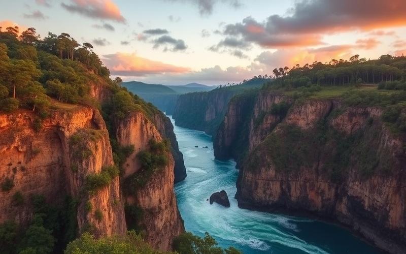
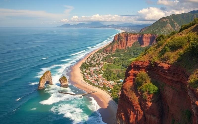
Nestled in the heart of Central America, El Salvador stands out for its unique and diverse terrain, alternating between majestic volcanic mountain ranges and vast welcoming plains.
This smallest country in the region offers a fascinating geographical cocktail where every corner holds natural treasures, from idyllic beaches to the slopes of active volcanoes.
Its tropical climate, marked by dry and rainy seasons, shapes a landscape of remarkable biodiversity, ranging from lush forests to coastal formations shaped by the Pacific.
Exploring El Salvador means immersing yourself in a territory where nature and culture intertwine, where every peak and valley tells a story rich with emotion.
General Geography and Country Location
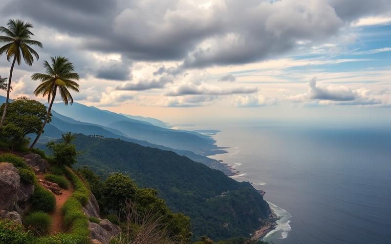
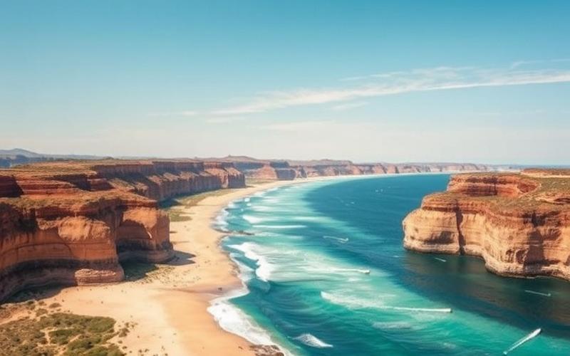
El Salvador is located in Central America, bordered to the northeast by Honduras, to the northwest by Guatemala, and to the south by the Pacific Ocean. This country has only one maritime coastline, on the Pacific, unlike most other Central American countries.
| Area | Population (recent estimate) | Capital | Other Major Cities |
| 21,040 km² | 5.6 million | San Salvador | Santa Ana, San Miguel, Soyapango |
Geographical Position
Located between 13°50′ N and 88°55′ W. The country shares a land border of 342 km with Honduras and 203 km with Guatemala.
Main Cities
- San Salvador (capital and largest city)
- Santa Ana
- San Miguel
- Soyapango
Topography
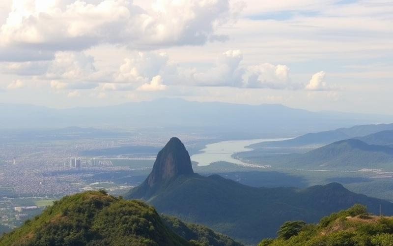
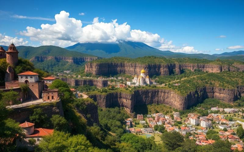
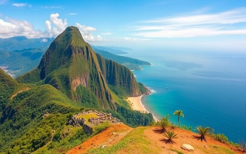
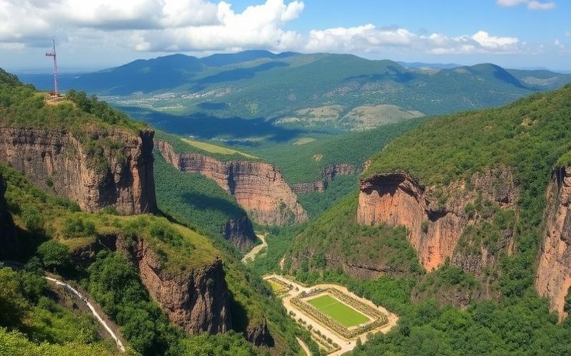
85% of the territory is occupied by two parallel mountain ranges and a central plateau.
- Sierra Madre (north): runs along the border with Honduras and is home to the highest point, Cerro El Pital (2,730 m).
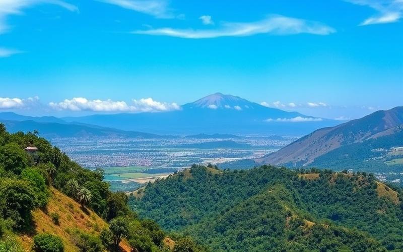
- Volcanic Range (south): about twenty volcanoes, the highest being Santa Ana (2,365 m), followed by San Vicente (2,182 m) and San Salvador (1,943 m).
- Between the volcanoes, alluvial basins and eroded hills.
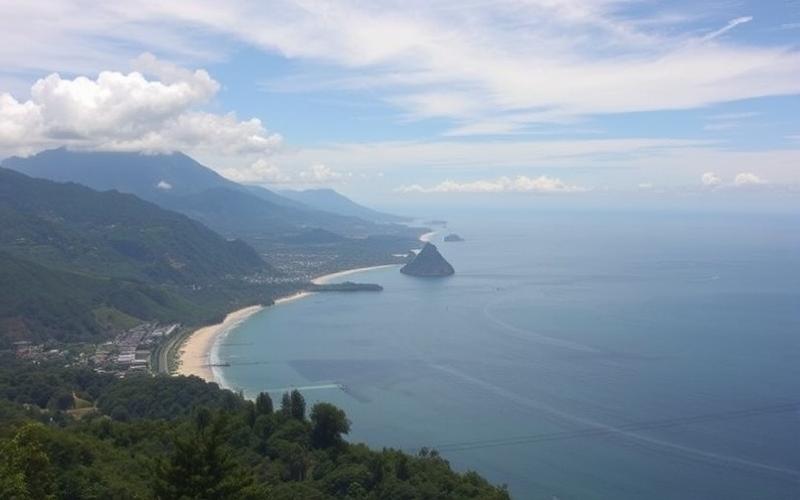
- Coastal Plains: narrow strip to the south, along the Pacific Ocean, known as the “Pacific Lowlands.”
Climate
Tropical, with two main seasons:
- Rainy season: from May to October, characterized by heavy rainfall, promoting crop growth.
- Dry season: from November to April, a period favorable for harvesting and certain specific crops.
Temperatures vary little, but altitude moderates the heat in mountainous regions.
Influence on Agriculture and Economy
Volcanic soils are very fertile, particularly suited for growing coffee, which is a major economic resource. The coastal plains are used for growing sugarcane, cotton, and livestock. Climatic conditions, combined with topography, allow for agricultural diversification but make the country vulnerable to extreme phenomena (droughts, floods, volcanic eruptions).
El Salvador is thus characterized by a contrasting geography, a high population density, and an economy where agriculture, supported by the fertility of volcanic lands and the tropical climate, plays a central role.
Good to Know:
El Salvador, covering an area of 21,041 km², benefits from its strategic position between Honduras, Guatemala, and the Pacific Ocean, with San Salvador as its capital; its varied topography notably influences agriculture, although the tropical climate is marked by dry and rainy seasons.
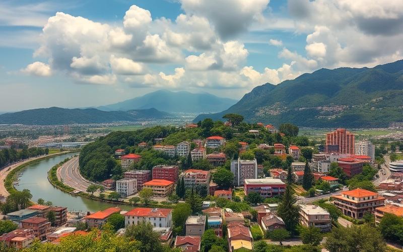
Main Geographical Regions
| Region | Geographical Features | Climatic Features | Economic and Ecological Importance | Cultural and Daily Influence | Notable Cities/Sites | Major Environmental Impacts |
|---|---|---|---|---|---|---|
| Pacific Coastal Plain | Narrow strip (max. 22 km) between volcanoes and Pacific, low altitude, beaches, mangroves, lagoons | Hot and humid tropical climate, abundant rainfall in rainy season, stable temperatures | Fishing, beach tourism, agriculture (cotton, sugarcane, tropical fruits), mangrove ecosystems essential for biodiversity | Lifestyle oriented towards the sea (fishing, surfing), festivals and traditions linked to the sea and nature | La Libertad, Costa del Sol, Usulután, Jiquilisco (mangrove area) | Coastal erosion, pollution, loss of mangrove habitats, vulnerability to hurricanes and rising sea levels |
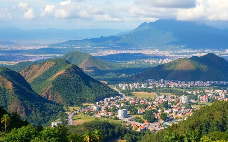
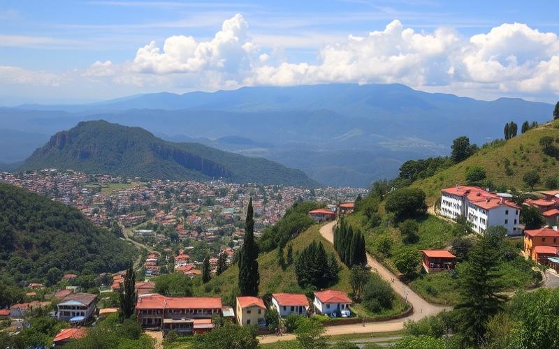
| Volcanic Ranges | Over 20 volcanoes distributed in 5 groups, fertile volcanic lands, spectacular landscapes | Temperate climate on slopes, microclimates due to altitude, high volcanic and seismic risks | Intensive agriculture (coffee, corn), some of the most fertile lands in the country, volcanic tourism, nature reserves | Omnipresent coffee culture (coffee plantations, festivals), influence on architecture (villages built on slopes), agricultural traditions | Izalco, Santa Ana, San Miguel (Chaparrastique), Cerro Verde National Park | Risk of eruptions, landslides, deforestation for agriculture, soil erosion |
| Inland Highlands | Central plateau (avg. alt. 600 m), fertile valleys, hills, framed by mountain ranges | More temperate climate, less humid, marked seasonal variations, occasional snow on peaks (El Pital) | High population density, diversified agriculture, main cities and economic centers, conservation areas | Urban life (San Salvador, Santa Ana), city culture, markets, festivals, culinary diversity | San Salvador (capital), Santa Ana, Suchitoto, El Pital (highest point) | Urbanization, deforestation, urban pollution, erosion, pressure on water resources |
Pacific Coastal Plain
- Geography: Narrow coastal strip along the Pacific, characterized by long beaches, mangroves, and coastal lagoons.
- Climate: Tropical, hot and humid, conducive to fishing and growing tropical products.
- Economy/Ecology: Agriculture and fishing dominate. Mangroves play a key role in protecting biodiversity and populations from storms.
- Culture/Daily Life: The sea shapes the lifestyle, from cuisine to local festivals.
- Cities/Sites: La Libertad, Costa del Sol, Jiquilisco.
- Environmental Issues: Mangrove degradation, coastal erosion, pollution.
Volcanic Ranges
- Geography: String of active or dormant volcanoes, very fertile volcanic lands, landscapes marked by cones and craters.
- Climate: Temperate, frequent risks of volcanic and seismic activity.
- Economy/Ecology: Coffee cultivation, rich agricultural lands, tourism related to volcanoes and natural parks.
- Culture/Daily Life: Strong rural identity, agricultural traditions, festivals linked to coffee harvest.
- Cities/Sites: Izalco, Santa Ana, San Miguel, Cerro Verde.
- Environmental Issues: Risk of eruptions, deforestation, soil erosion.
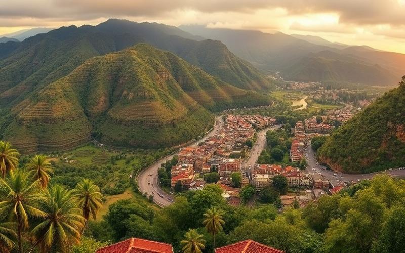
Inland Highlands
- Geography: Central plateau surrounded by mountains, fertile valleys, moderate altitude.
- Climate: More temperate than the coast, seasonal variations, occasional snow on peaks.
- Economy/Ecology: Urban and economic heart of the country, diversified agriculture, conservation areas.
- Culture/Daily Life: Urban life, cultural diversity, city festivals, markets.
- Cities/Sites: San Salvador, Santa Ana, Suchitoto, El Pital.
- Environmental Issues: Urbanization, deforestation, pollution, water pressure.
Each region shapes the identity, economy, and daily life of Salvadorans, creating a mosaic of unique landscapes, cultures, and ecological challenges.
Good to Know:
The volcanic ranges, home to cities like Santa Ana, offer unique biodiversity essential for ecotourism and agriculture, while the inland highlands influence the economy through coffee cultivation; the Pacific coastal plains, with cities such as La Libertad, are crucial for fishing and beach tourism but threatened by erosion.
Main Cities and the Largest Metropolis
Main Cities of El Salvador: Characteristics, Importance, and Location
| City | Population (latest census) | Department | Area (km²) | Geographical Location | Economic and Cultural Role |
|---|---|---|---|---|---|
| San Salvador | 415,346 (city), 1.5 million (metro) | San Salvador | ~72 | Central-west of the country, central zone | Capital; administrative, economic, cultural heart; university, financial, and commercial center; numerous historical sites and museums |
| Soyapango | 261,122 | San Salvador | ~29 | Eastern agglomeration of San Salvador | Major industrial center, urban workforce |
| Santa Ana | 204,340 | Santa Ana | ~400 | West, western zone | Economic center of the west, rich colonial heritage, cultural tourism and access to coffee zone |
| San Miguel | 158,136 | San Miguel | ~593 | East, eastern zone | Economic and commercial center of the east, festivals, proximity to Chaparrastique volcano |
| Mejicanos | 140,751 | San Salvador | ~21 | North of the agglomeration | Residential and industrial city |
| Santa Tecla | 108,840 | La Libertad | ~112 | Southwest of San Salvador | Dynamic city, residential neighborhoods, modern shopping centers |
| Apopa | 131,286 | San Salvador | ~51 | North of the agglomeration | Industrial zone, road junction |
| Delgado | 112,161 | San Salvador | ~22 | East of San Salvador | Residential and industrial city |
| Ilopango | 103,862 | San Salvador | ~34 | Southeast, near Lake Ilopango | Access to the lake, nautical activities, residential area |
| Sonsonate | 49,129 | Sonsonate | ~225 | Southwest, near the Pacific | Transit city, agricultural center, access to the coast |
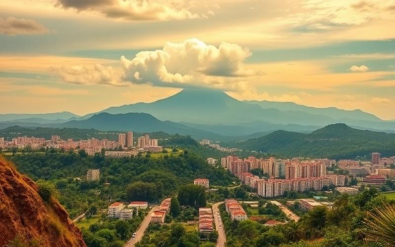
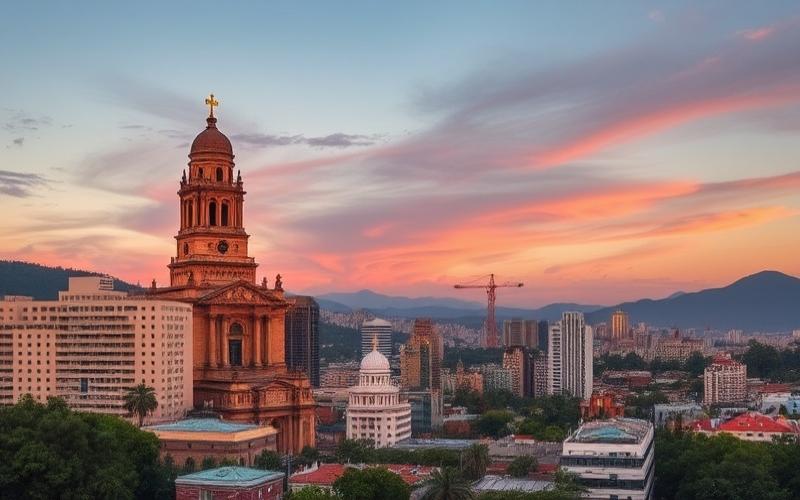
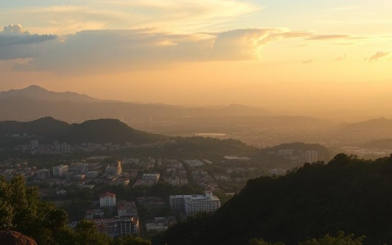
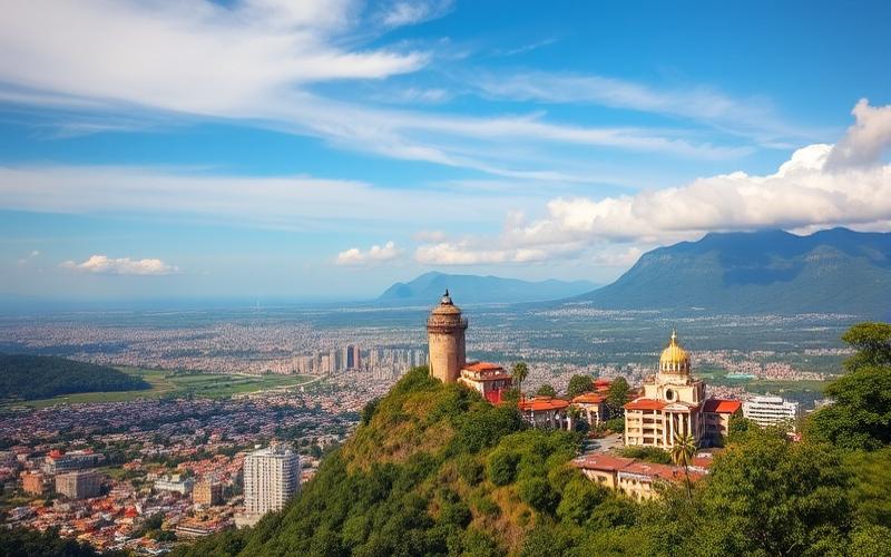
San Salvador
The most populous city and capital of El Salvador, San Salvador is the political, economic, and cultural center of the country. The metropolitan area has over 1.5 million inhabitants. Located in a valley surrounded by volcanoes, it benefits from a strategic position in the central-west, facilitating access to other regions.
Infrastructure
- Dense road network, main bus station of the country
- International airport nearby (Comalapa)
- Presence of large shopping centers (Metrocentro, the largest in Central America)
- Universities, convention centers, modern hospitals
Population
- City: about 415,000 inhabitants
- Metropolitan area: over 1.5 million
Tourist and Historical Assets
- Metropolitan Cathedral (pilgrimage site, tomb of Archbishop Romero)
- National Palace, theaters, museums (art museum, anthropology museum)
- Plaza del Salvador del Mundo (national symbol)
- Lively neighborhoods, artisan markets, renowned street food
- Cerro Los Planes de Renderos: panoramic view of the city
- Proximity to natural and archaeological sites (El Boquerón National Park, Joya de Cerén UNESCO World Heritage Site)
Other Major Cities and Their Roles
- Santa Ana: second largest city in the country, industrial and commercial hub, remarkable colonial historic center, proximity to archaeological sites and Santa Ana volcano
- San Miguel: capital of the eastern region, known for its festivals (Carnival of San Miguel), economic base for agriculture and livestock, service center
- Soyapango: large industrial city, integrated into the San Salvador metropolitan area, strong economic activity
Good to Know:
San Salvador, the capital, has about 1.7 million inhabitants and is the economic center with its industrial and commercial zones, while Santa Ana and San Miguel are notable cultural and historical hubs.
Borders and Neighboring Countries
El Salvador is located in Central America, between the Tropic of Cancer and the equator, in the northern hemisphere. With an area of 21,040 km², it is the smallest country in Central America.
Geographical Location
El Salvador occupies the western part of the Central American isthmus. It is bordered to the south and southwest by the Pacific Ocean, giving it an exclusively Pacific maritime coastline—it is the only Central American country without access to the Caribbean Sea.
Neighboring Countries and Land Borders
| Neighboring Country | Direction | Approximate Border Length |
|---|---|---|
| Guatemala | Northwest | 203 km |
| Honduras | Northeast | Between 342 km (official sources) and 391 km (some estimates) |
The only two countries with which El Salvador shares a land border are therefore Guatemala (to the northwest) and Honduras (to the northeast).
The border with Honduras is significantly longer than that with Guatemala.
Maritime Border
To the south, El Salvador has a coastline on the Pacific Ocean of approximately 307 kilometers. This coastline is marked by beaches, natural bays, and important port areas like Acajutla or La Unión. The Gulf of Fonseca, located in the southeastern part of the country, forms a maritime space shared with Nicaragua—although El Salvador does not share a direct land border with the latter.
Border Agreements and Historical Disputes
A historical border dispute opposed El Salvador and Honduras over an area of 440 km². This dispute was settled by the International Court of Justice in 1992 and definitively resolved by a bilateral agreement in 2006:
- El Salvador obtained about 150 km².
- Honduras received about 290 km².
Inhabitants of the disputed territories benefited from dual Salvadoran-Honduran nationality.
Geographical Regions Near the Borders
Here are some notable natural elements near the national boundaries:
- Mountains: Mountain ranges cross the border areas; notably the Cinquera mountains at the limit of the Chalatenango department (Honduran border), as well as several active or extinct volcanoes near the capital San Salvador.
- Rivers: Several rivers naturally serve as boundaries between El Salvador and its neighbors. For example, the Lempa River originates in Guatemala before entering Salvadoran territory.
- National Parks: Regions near the borders host several protected areas.
- Montecristo Trifinio National Park (straddling El Salvador, Guatemala, and Honduras)
- Cerro Cacahuatique Forest Reserve
- The humid tropical forests of the western department of Ahuachapán
- The isolated beaches around the Gulf of Fonseca also constitute an ecological highlight
Major road axis: The Pan-American Highway crosses the entire country from west to east via San Miguel to then reach Tegucigalpa or Managua via Choluteca on the Honduran side; it also connects directly to Ciudad Pedro Alvarado on the Guatemalan side, thus allowing international and local travelers easy access to these neighboring destinations as well as inland via secondary roads that descend to the Pacific coastline where not only commercial ports but also popular beach resorts are located, such as those around Sonsonate or Usulután, depending on its precise geographical position on this relatively narrow coastal strip compared to other Central American nations that have access to both the Atlantic/Caribbean and Pacific coasts simultaneously, whereas here the only possible option remains South/Southwest facing the large Indian Ocean/Southeast Asian Pacific basin, etc…
In summary, the unique geographical situation, the varied physical characteristics combining rugged terrain, fertile valleys, sandy coastlines, wetlands, deep gulf, means that each border sector presents its own interest both for curious visitors and scientists interested in exceptional biodiversity despite the modest size of the national territory, which is generally densely populated, especially the urban center around the capital San Salvador, which concentrates the main administrative, cultural, and economic activities, while rural provinces remain mostly agricultural, oriented towards exports of coffee, sugar, cotton, tropical fruits, etc…
Good to Know:
El Salvador, located in Central America, shares land borders with Honduras for about 256 km and Guatemala for 203 km, and has a maritime border with the Pacific Ocean to the south. Near these borders are points of interest like the Sierra Madre mountains and several national parks, and the country historically resolved a territorial dispute with Honduras through an agreement in 1992.
Disclaimer: The information provided on this website is for informational purposes only and does not constitute financial, legal, or professional advice. We encourage you to consult qualified experts before making any investment, real estate, or expatriation decisions. Although we strive to maintain up-to-date and accurate information, we do not guarantee the completeness, accuracy, or timeliness of the proposed content. As investment and expatriation involve risks, we disclaim any liability for potential losses or damages arising from the use of this site. Your use of this site confirms your acceptance of these terms and your understanding of the associated risks.
Cyril Jarnias is an independent expert in international wealth management with over 20 years of experience. As an expatriate himself, he is dedicated to helping individuals and business leaders build, protect, and pass on their wealth with complete peace of mind.
On his website, cyriljarnias.com, he shares his expertise on international real estate, offshore company formation, and expatriation.
Thanks to his expertise, he offers sound advice to optimize his clients' wealth management. Cyril Jarnias is also recognized for his appearances in many prestigious media outlets such as BFM Business, les Français de l’étranger, Le Figaro, Les Echos, and Mieux vivre votre argent, where he shares his knowledge and know-how in wealth management.