Published on and written by Cyril Jarnias
Sandwiched between China and Japan, clinging to the eastern edge of the Asian continent, the geography of South Korea is that of a territory that is at once compact, rugged, densely populated, and powerfully transformed by development. In just over a century, this small country, barely larger than Portugal, has transformed from a deforested, poor, rural peninsula into one of the world’s most advanced urban and industrial economies. Yet, this meteoric trajectory only makes sense in light of its physical geography, the distribution of its population, and the highly intensive use of its land and water.
A Peninsula Country: Location, Borders, and Dimensions
South Korea’s geography is first understood by its position. The country occupies the southern half of the Korean Peninsula, between 33° and 39° north latitude and 124° to 131° east longitude. It lies entirely on the Eurasian Plate, in direct contact with major regional powers, which has long made Korea a strategic corridor between mainland China and the Japanese archipelago.
Length in kilometers of the Demilitarized Zone (DMZ) separating North and South Korea.
On the other three sides, South Korea’s geography is maritime. To the west, the country faces the Yellow Sea, called Sohae (“West Sea”), known for its dramatic tides. To the south, it opens onto the Korea Strait and the East China Sea. To the east, it faces the Sea of Japan, which Seoul refers to as Donghae (“East Sea”). The southern coast is about 200 km from the Japanese islands of Kyūshū and Honshū, while China’s Shandong Peninsula is less than 200 km to the west.
The land area of South Korea is approximately 100,000 km² (between 99,720 and 100,410 km² depending on the source), supplemented by about 290 km² of water. This represents 45% of the total area of the Korean Peninsula. The country is comparable in size to Indiana or Portugal and is slightly smaller than England. Despite this modest area, the territory is home to over 51 million inhabitants, making it a very densely populated country.
To situate the country on the world stage, the following table provides some area benchmarks:
| Territory | Approximate Area (km²) |
|---|---|
| Entire Korean Peninsula | ≈ 223,170 |
| South Korea | ≈ 100,000 |
| United Kingdom (reference) | ≈ 242,000 |
| State of Minnesota (USA) | ≈ 225,000 |
| Portugal | ≈ 92,000 |
This size ratio illustrates a fundamental tension: a rather small space, inserted into a densely populated region of East Asia, but carrying strong geopolitical and economic stakes.
Topography: A Mountainous Backbone, Rare but Decisive Plains
The most striking feature of South Korea’s geography is the dominance of mountainous terrain. Between 70% and 75% of the territory consists of mountains and hills. In other words, less than one-third of the country offers true plains or lowlands.
The peninsula is generally higher in the east and north, and lower in the west and south. This asymmetry structures hydrology, land use, and population distribution.
The Major Ranges: Taebaek and Sobaek
Two major mountain systems structure South Korea’s geography.
The Taebaek Range (Taebaek-sanmaek) runs along the eastern coast for over 500 km, forming a north-south backbone. With an average altitude around 1,000 m, it rises directly from the sea on the eastern side, where mountains often plunge quite abruptly into the water. Mount Seorak (Seoraksan, 1,708 m) is one of its iconic peaks, along with Mount Taebaek (1,567 m) or Mount Odae (1,563 m).
The Sobaek Range (Sobaek-sanmaek), which extends about 350 km southwest from the eastern highlands, forms the backbone of south-central South Korea. Its highest point is Mount Jiri (Jirisan), whose Cheonwangbong peak reaches 1,915 m, making it the highest peak on the country’s mainland. This range is part of a very mountainous landscape, with the country boasting nearly 7,800 named mountains and many summits exceeding 1,500 m in altitude.
Off the mainland, South Korea’s geography is dominated by Mount Halla (Hallasan) on Jeju Island, an extinct volcano of 1,950 m which is the country’s highest point. Jeju and Ulleungdo are in fact of volcanic origin, a sign of an active geological past, although the peninsula is now considered relatively stable, with no active volcanism and moderate seismicity.
Counted but Vital Plains
Facing this mountainous mass, plains are rare and concentrated in certain well-defined zones: around major rivers, in deltas, and along the western and southern coasts. The contrast is particularly marked between the east, with its rectilinear coasts and steep mountains, and the west, where valleys open onto accumulated lowlands.
The main plains are located:
– around the Han River (Han-gang) in the Seoul and Gyeonggi region;
– on the Pyeongtaek coast;
– in the Geum River basin;
– in the vast Nakdong River basin in the southeast;
– on the Yeongsan plains and especially on the great Honam plain (Mangyeong and Gimje) in the southwest.
These alluvial plains, formed by river sediment deposits, are the country’s agricultural heartland. Areas near rivers are mostly converted into rice paddies, while hills host forests and urban areas. High-altitude plateaus, around 1,000 m, are sometimes used for market gardening or pastures.
It thus becomes clear that topographic constraints—few flat lands, surrounded by relief—are at the heart of South Korea’s geography and condition both agriculture and urbanization.
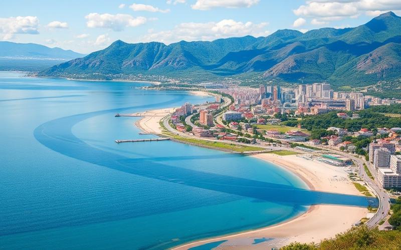
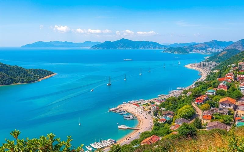
Coasts, Islands, and Wetlands: A Rugged Coastline
With approximately 2,400 km of coastline for South Korea alone (and over 8,600 km for the entire peninsula), the coastline is particularly extensive relative to the area. It is not a simple continuous border: the southern and western façade forms a puzzle of capes, bays, estuaries, and archipelagos.
Western Coastline: Extreme Tides and Mudflats
To the west, facing the Yellow Sea, the South Korean coast is deeply indented. Tides here reach spectacular amplitudes, up to 9 m at Incheon. This dynamic leads to the formation of vast intertidal mudflats: about 1,833 km² of wetlands of the slikke and schorre type have been recorded, placing South Korea among the world’s major countries for coastal marshes.
The intertidal zones, crucial habitats for migratory birds, are threatened by development such as land reclamation. The Saemangeum Dam (34 km long) is an example, having transformed hundreds of km² of mudflats into agricultural or industrial zones, with major impacts on ecosystems and sediment dynamics.
Southern and Eastern Coasts: Rias, Archipelagos, and Cliffs
The southern coast also has a ria morphology, with numerous drowned estuaries, deep bays, and a myriad of islands. The Dadohaehaesang Marine National Park, in the southwest, brings together over a thousand islets in a mosaic of sea channels, rocks, and coastal forests. The southwest of South Korea (Jeollanam-do) is thus one of the most maritime sectors of the country, both for fishing, aquaculture, tourism, and ferry transport.
To the east, the coastline, facing the Sea of Japan / East Sea, is much more rectilinear. Mountains plunge almost directly into the sea. The rivers that flow into it remain short, steep, and fast-flowing. A few islands punctuate this arc, notably Ulleungdo and the Dokdo / Takeshima rocks (Liancourt Rocks), at the heart of a sovereignty dispute with Japan.
Geographic description of the east coast of the Korean Peninsula
Archipelagos and Major Islands
There are approximately 3,500 islands under South Korean jurisdiction, mainly off the southern and western coasts. The largest is Jeju (1,825 km²), itself an autonomous province with a central volcano, a milder climate, and a major tourist role. Other important islands include Ganghwa (at the mouth of the Han), Jindo, Wando, Hongdo, Heuksando, and Yeongjongdo, connected to the mainland by the bridge leading to Incheon Airport.
The following table summarizes some key elements of the coastline:
| Coastal Element | Main Characteristic |
|---|---|
| Coastline length (South) | ≈ 2,413 km |
| West / South coast type | Highly indented, ria, strong tides, mudflats |
| East coast type | Rather rectilinear, mountains plunging into sea |
| Number of islands (order of magnitude) | ≈ 3,500 (majority west and south) |
| Largest island | Jeju (1,825 km²) |
| Extent of mudflats | ≈ 1,833 km² |
This insular and estuarine geography has facilitated the development of fishing, shellfish farming, major ports (Busan, Incheon, Ulsan, Gwangyang), and intensive ferry lines, but it also complicates the protection of coastal habitats.
Climate: A Monsoon Country with Four Distinct Seasons
South Korea’s geography lies within the East Asian monsoon belt. The climate is both humid continental and humid subtropical depending on the region, with very marked seasonal contrasts.
Dry, Cold Winter and Hot, Humid Summer
Winter, from late November to mid-March, is dominated by the Siberian High. Cold, dry air sweeps over the peninsula, bringing sub-zero temperatures to most of the territory. In Seoul, the January average fluctuates between –5 and –2.5 °C. In northeastern provinces like Gangwon, and at higher altitudes, frosts are even more severe, with minimums that can drop to –20 °C. Snow is frequent there, especially in the Taebaek and Seorak ranges, which has led to the development of over twenty ski resorts, such as YongPyong or Muju Deogyusan.
The south and the coast enjoy milder winters: Busan</strong averages around 2 to 3 °C in January, Jeju around 6 to 7 °C. But the air remains generally dry, with little precipitation.
National temperature record in South Korea, reached in Hongcheon during a 2018 heatwave.
Two transitional seasons, spring (March-May) and autumn (September-November), are often described as the most pleasant, offering moderate temperatures, clearer skies, and spectacular vegetation: blossoms in spring, glowing forests in autumn.
Rainfall Pattern: Summer Monsoon, Typhoons, and Extreme Events
South Korea generally receives over 1,000 mm of rain per year, sometimes up to 1,700-1,800 mm on the southern coasts and Jeju. But this rainfall is extremely concentrated in time: about two-thirds of the precipitation falls between June and September, during the jangma, the summer rainy season.
The period of 30 to 35 days, typically from late June to late July, corresponds to the rainy season (Baiu). It is characterized by a quasi-stationary front between the cold, humid air from the Sea of Okhotsk and the warm, humid air from the North Pacific. This generates sometimes torrential rains over several days, interspersed with lulls. A second, shorter phase of precipitation often occurs in late summer or early autumn (Shūrin).
The country is also exposed to 1 to 3 typhoons per year, most often in August and September. Less affected than Japan or Taiwan, it nevertheless experiences violent winds and heavy rainfall that cause flash floods, landslides, and damage in both rural and urban areas. The southern coastal provinces and Jeju are particularly vulnerable. Major floods have struck the country several times, such as during a typhoon in 1984 which killed nearly 190 and left 200,000 homeless.
Weather phenomena and trends observed by authorities, linked to climate change.
Increase in average temperature, sometimes exceeding 2 °C above normal in some recent years.
Trend towards more intense but sometimes more erratic monsoon rains, with increasing year-to-year variability.
Increase in events such as severe droughts, prolonged heatwaves, wildfires, and localized torrential rains.
Yellow Dust and Air Pollution
Another feature of South Korea’s geography: the recurrence, in spring, of yellow dust (Hwangsa) episodes. Masses of mineral particles rise from the deserts of China and Mongolia (Taklamakan, Gobi, Ordos), ascend to high altitudes (3,000 to 5,000 m), and are transported by westerly winds to the peninsula in two to three days. Seoul and the western part of the country can thus experience 3 to 6 days per year of heavily dust-laden air, sometimes combined with regional industrial pollution.
These phenomena, added to local emissions, explain concerning levels of air pollution in major metropolitan areas, now a central issue in urban and environmental policies.
Hydrology: Short Rivers, Vital Basins, and Tight Water Management
Given the high eastern relief and the general slope towards the west and south, most of the major rivers in South Korea originate in the Taebaek range and flow towards the Yellow Sea or the Korea Strait.
The Main River Basins
Five systems dominate:
– the Han (Han-gang), which flows through Seoul and empties to the west;
– the Geum (Geum-gang), in the central-west;
– the Nakdong (Nakdong-gang), the longest river in the country, flowing towards the Korea Strait;
– the Yeongsan (Yeongsan-gang), in the southwest;
– the Seomjin (Seomjin-gang), often considered the “fifth major river,” flowing south.
These five basins cover nearly two-thirds of the national territory. In contrast, rivers flowing east (into the Sea of Japan / East Sea) are short, entrenched, and fast-flowing.
The “high east, low west” configuration results in fertile alluvial plains downstream of the western and southern rivers, promoting the development of rice paddies, cities, and industrial zones. However, these regions are also exposed to significant seasonal variations in river flow, with frequent flood risks in summer.
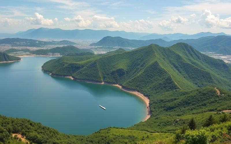
Water Resources: Seasonal Abundance, Structural Scarcity
On an annual scale, South Korea has about 69.7 km³ of renewable water resources. The average surface water runoff is estimated at over 60 km³, supplemented by about 13 km³ of groundwater resources (of which a large part, 10.7 km³, feeds the base flow of rivers). Per capita, this gives about 2,546 m³ of renewable water per inhabitant per year, roughly one-sixth of the global average, placing the country in the category of water-stressed states.
Nearly 37% of annual resources correspond to summer floodwaters that are difficult to store. In practice, it is estimated that about 57% of total water (76 billion m³) is actually available for use, with the rest lost to evapotranspiration.
To smooth out this seasonality and secure water usage, South Korea’s geography has been covered with infrastructure. There are:
Total storage capacity of dams in Algeria, representing nearly a quarter of the country’s renewable water resources.
The first major multipurpose dam, on the Soyang River, was commissioned in the 1970s; since then, such facilities have become widespread on the four main basins.
Water Policies and Controversies
The water issue has become central throughout urbanization and industrialization. Total water use multiplied more than sixfold between the 1960s and 1990s, from about 5.1 to 33 billion m³, before stabilizing.
This figure represents the volume of water in billions of m³ that South Korea’s Four Major Rivers Restoration Project aimed to secure for supply.
While it improved some indicators (bike paths, reclamation of recreational spaces along rivers), the project is heavily criticized for its ecological impacts: transforming free-flowing rivers into successions of artificial lakes, algae proliferation, destruction of wetlands, disruption of fish migration and habitats of many species.
The control of freshwater is all the more strategic as South Korea’s geography also relies heavily on alternative solutions: reuse of treated wastewater (notably for industrial cooling or river flow augmentation), seawater desalination on islands, rainwater storage, bank filtration, etc. These tools complement a highly efficient water supply network, with a drinking water service rate of about 96.5%.
Land Use: A Territory Under High Pressure
In a country where mountains dominate, the issue of land use is vital. South Korea’s geography must accommodate on a restricted space giant cities, industrial zones, dense transport axes, rice paddies, orchards, forests, and protected natural areas.
Available data show a largely stable overall structure in recent decades:
| Land Use (order of magnitude) | Share of National Area |
|---|---|
| Forests | ≈ 64% |
| Arable land | ≈ 15% |
| Permanent crops (orchards, plantations) | ≈ 2% |
| Permanent pasture | < 1% |
| Other (urban, industrial, infrastructure…) | ≈ 18% |
This means that agriculture in the broad sense (including vineyards, orchards, meadows) occupies roughly 17 to 18% of the territory. In 2022, agricultural area is estimated at about 1.7 million hectares, nearly 17% of South Korea. Per capita, arable land availability is extremely low: around 0.03 hectare, compared to 0.5 ha in the United States or 0.3 ha in France.
A Scarce and Heavily Regulated Agrarian Capital
This scarcity has shaped a heavily regulated land tenure system. In 1949, a major land reform abolished large estates and redistributed land to cultivators, with a ceiling of 3 hectares per farmer. Subsequently, a series of laws—the Land Reform Act, Agricultural Land Protection Act, Basic Agricultural Land Act, Agricultural Development Region Act—sought to prevent speculation, protect the best rice paddies, and support a family farming model.
Between 2011 and 2019, the cultivated agricultural area in France declined by 29%.
Simultaneously, South Korea’s geography has seen an increase in the share of rented agricultural land rather than owned: over half of the area is believed to be farmed under lease, with a majority of farm households becoming tenants rather than owners.
Forest cover rate in South Korea in the mid-1950s, after devastation caused by logging and war.
Urban and Industrial Land: Concrete’s Grip
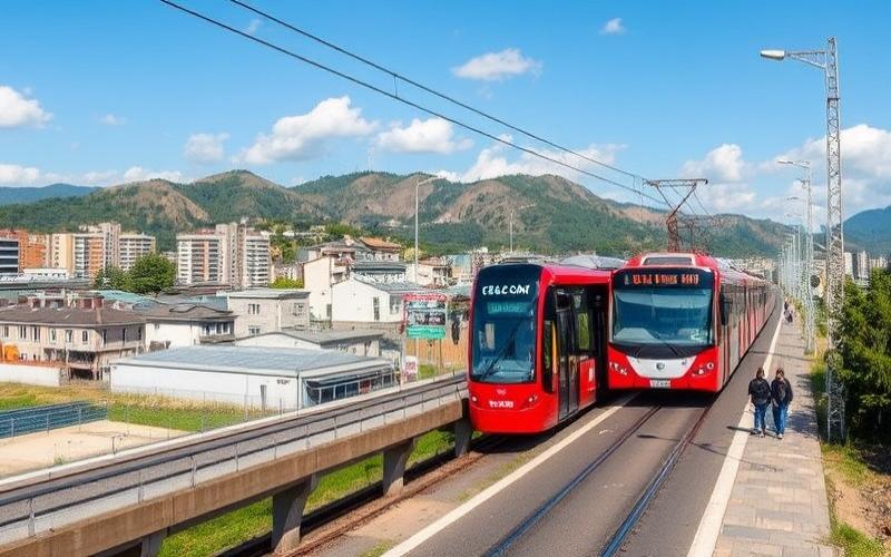
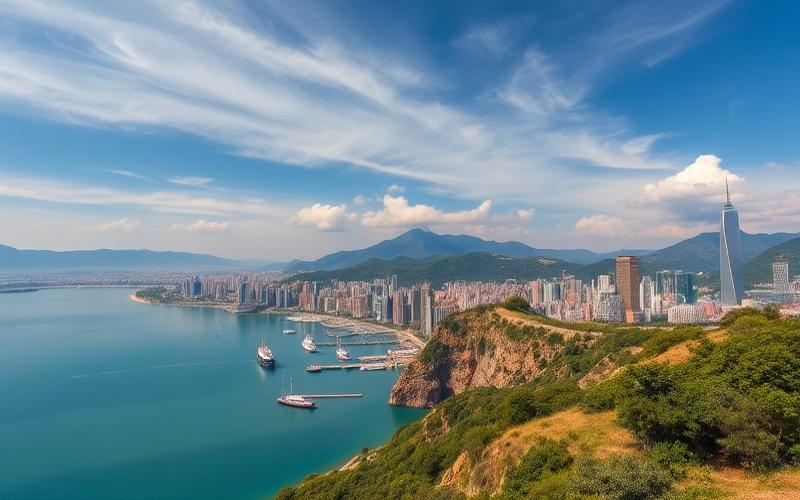
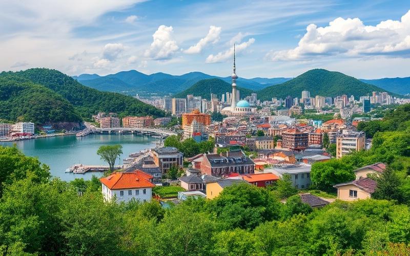
The industrial and urban energy of South Korea’s geography is visible in the rapid progression of built-up areas. In places, the countryside is literally surrounded by linear cities, warehouse zones, and industrial parks linked by highways and high-speed rail lines. The coastal plains and river valleys of the southeast (Busan, Ulsan, Pohang) and northwest (Seoul, Incheon, Gyeonggi) concentrate most of the logistical and manufacturing hubs.
Land use monitoring tools, like the three-level national mapping (7 major cover types, broken down into 22 then 41 categories down to the local level), now allow for fine measurement of these changes and planning of uses—agricultural, residential, industrial, or conservation—in each province.
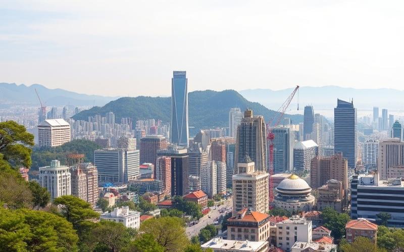
Population and Urbanization: Extreme Densities and Megacities
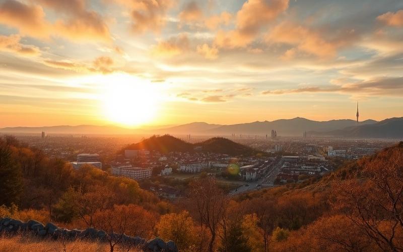
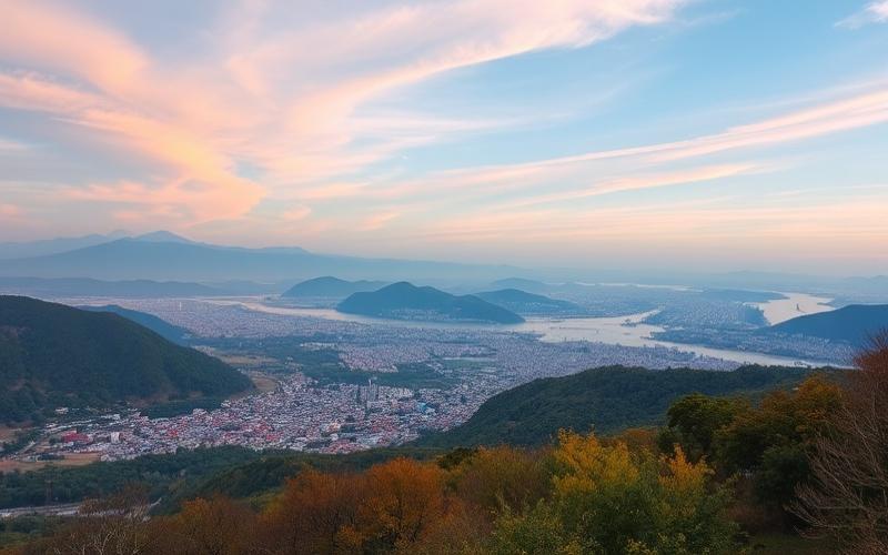
In a predominantly mountainous country, the population logically concentrates in the available lowlands. This physical constraint, combined with the post-war demographic boom and rapid industrialization, has given South Korea some of the world’s highest population density indicators.
National Density and Regional Distribution
With approximately 52 to 53 million inhabitants for just over 100,000 km², density is around 530 inhabitants/km², compared to less than 400 in 1980. That is about 16 times the average density of the United States in the late 1980s, and roughly four times that of metropolitan France today.
However, this average masks significant contrasts:
– the plains regions around Seoul and Busan far exceed this average density;
– Gyeonggi-do, the province surrounding Seoul, is the most densely populated;
– conversely, Gangwon-do, the mountainous northeastern province, is the least dense, with vast, sparsely inhabited forested areas.
Major metropolitan areas concentrate most of the inhabitants. The capital region (Seoul, Incheon, Gyeonggi) alone accounts for nearly half of the national population, making it one of the world’s most massive metropolitan areas.
Urban Explosion and Megacities
The urban transition has been extremely rapid. At Liberation in 1945, less than 15% of Koreans lived in cities. Forty years later, in 1985, this rate exceeded 65%, and today it is around 80-82%. South Korea is therefore a largely urban country.
A few figures illustrate the transformation discussed in the article.
– Seoul had 990,000 inhabitants in the 1940s, 1.45 million by the late 1940s, over 9.6 million today, and over 25 million in the wider metropolitan area;
– Busan grew from 330,000 inhabitants before the war to over one million in the 1950s and over 3.3 million currently;
– other cities—Daegu, Incheon, Gwangju, Daejeon, Ulsan, Suwon, Seongnam, Goyang, Changwon—have reached or are approaching the one million inhabitant threshold.
The following table gives an idea of the orders of magnitude for some major cities:
| City (province-level administration) | Approximate Population (city proper) |
|---|---|
| Seoul (Special City) | ≈ 9.6–10 million |
| Busan (Metropolitan City) | ≈ 3.3–3.7 million |
| Incheon (Metropolitan City) | ≈ 3 million |
| Daegu (Metropolitan City) | ≈ 2.4–2.6 million |
| Daejeon, Gwangju, Ulsan | ≈ 1.1–1.5 million each |
This urbanization has relied on a specific administrative hierarchy: Special Cities (Teukbyeolsi), Metropolitan Cities (Gwangyeoksi), Cities (Si), Rural Counties (Gun), etc. Classification criteria include the level of urbanization and population thresholds. The largest municipalities enjoy quasi-provincial powers, reflecting the weight of these megacities in the country’s political structure.
Aging, Density, and Territorial Pressures
Demographic evolution also structures South Korea’s geography. The country, which experienced very strong population growth until the 1980s, with a fertility rate above 6 children per woman in the 1950s, now faces one of the world’s lowest fertility rates (around 0.7 child per woman). The population peaked around 2021 (about 51.8 million) and has begun to decline, against a backdrop of rapid aging: over 20% of residents are now over 65.
Spatially, this translates into: the dimensions and organization of spaces will influence social interactions and individual behaviors.
– maintenance of high urban densities, but with stabilization or even a decline in numbers in some city centers;
– an intensification of demographic decline in the countryside and small towns, where young people leave and the age structure is increasingly unbalanced;
– a phenomenon of return to the countryside (kwichon), with urban dwellers (often young) selected by public policies to be encouraged to settle in rural areas, fueling new agricultural, tourism, or semi-rural living projects.
Pressure on peri-urban land, however, remains very strong, fueled by both the search for affordable housing and the logic of industrial and logistical development along major transport axes.
Administrative Organization and Major Regional Groups
South Korea’s geography is divided into nine provinces (do), six metropolitan cities, one special city (Seoul) and one special autonomous city (Sejong). To this is added the special autonomous province of Jeju. Each province has a particular geographic profile, blending topography, climate, economy, and heritage.
Some examples illustrate the regional diversity:
Presentation of the main geographic, economic, and tourist characteristics of South Korean provinces.
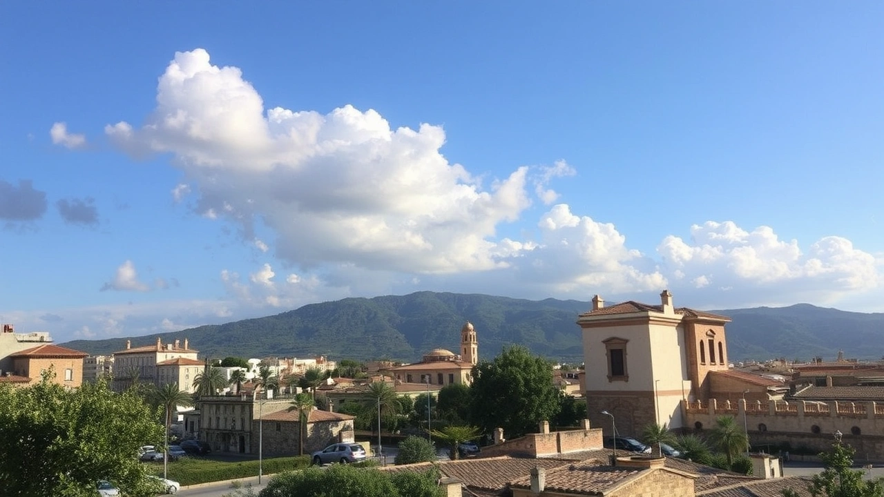
Very mountainous northeastern province with a cold climate, known for its national parks (Seoraksan, Odaesan, Taebaeksan) and ski resorts. Low population density and vast forests.
Densely populated belt surrounding Seoul, hub of urban growth with new towns and technology hubs (Suwon, Yongin). Includes proximity national parks like Bukhansan.
Major agricultural granary of the southwest, characterized by river plains (Yeongsan, Tamjin, Seomjin). Dominated by rice farming, horticulture, fishing, and a string of coastal islands.
Highly industrialized southeastern region, centered on the Nakdong Valley, major ports (Busan, Ulsan, Pohang), and a mountainous hinterland rich in national parks (Jirisan, Gayasan, Gyeongju).
Large volcanic island to the southwest, with a subtropical climate. Combines agriculture (citrus, vegetables), coastal tourism, and hiking (Hallasan, Jeju Olle trail).
Each of these regions combines in its own way topography, climate, water use, agriculture, industries, and cities. The provincial mosaic allows a very concrete reading of how South Korea’s geography unfolds, from the hyper-dense capital center to the nearly empty forested areas of the northeast, from the archipelagos of the southern sea to the volcanic plateaus of Jeju.
Protected Areas: National Parks, DMZ, and Reforestation
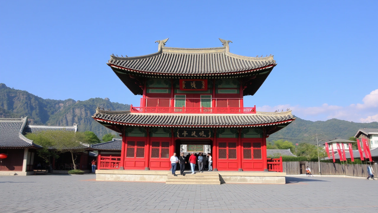
Despite enormous pressure on space, South Korea’s geography has established a significant network of protected areas. Twenty-three national parks cover about 6.6% of the territory, all managed by the Korea National Park Service (KNPS) except for Hallasan, locally administered by Jeju. Seventeen of these parks are mountainous (Jirisan, Seoraksan, Deogyusan, Naejangsan…), four are marine or coastal (Dadohaehaesang, Hallyeohaesang, Taeanhaean, Byeonsan-bando), and one is historical (Gyeongju).
This framework protects both emblematic landscapes, biodiversity, and water resources. Measures to limit visitation (quotas, ban on night climbing, ecological rest zones) have been implemented to curb the effects of mass tourism.
Paradoxically, the DMZ—this zone of military tension—has also become a biodiversity refuge. The near-total ban on access and construction since 1953 has allowed the maintenance or return of species extinct elsewhere, in a strip of land running from sea to sea.
Finally, reforestation programs have transformed the appearance of the hills. South Korea’s geography, once described as denuded, is now dominated by secondary forests—sometimes monotonous, sometimes more diverse—which play an essential role in water regulation, landslide prevention, and carbon sequestration.
A Geography at the Heart of Development Choices
Underlyingly, South Korea’s geography illuminates the major orientations of its development.
The mountainous terrain concentrated urbanization in river basins, fostering the emergence of large megacities. The scarcity of agricultural land made their conversion crucial, generating complex land legislation. The seasonality of rains and typhoons necessitated major hydraulic works, a source of environmental debates. Finally, the high population density spurred ambitious policies in housing, transportation, smart cities, and urban regeneration.
South Korea cannot expand. It can only transform itself, redevelop, densify, convert. In this context, South Korea’s geography is not a mere backdrop: it is a structuring constraint, but also a lever. The mountains that limited agriculture yesterday have become a tourist and ecological asset; rivers long used as mere industrial outlets are now the object of restoration plans and recreational enhancement; rural areas, threatened by depopulation, are becoming laboratories for new forms of agriculture, including high-tech (smart farms, data-driven greenhouse cultivation).
On a limited territory, all public policies (urbanization, transport, energy, food, environment) are articulated around a precise analysis of space. This analysis integrates population distribution, soil typology, climate vulnerabilities, water capacities, and ecological corridors, making geography a key factor for the country’s future.
Disclaimer: The information provided on this website is for informational purposes only and does not constitute financial, legal, or professional advice. We encourage you to consult qualified experts before making any investment, real estate, or expatriation decisions. Although we strive to maintain up-to-date and accurate information, we do not guarantee the completeness, accuracy, or timeliness of the proposed content. As investment and expatriation involve risks, we disclaim any liability for potential losses or damages arising from the use of this site. Your use of this site confirms your acceptance of these terms and your understanding of the associated risks.
Cyril Jarnias is an independent expert in international wealth management with over 20 years of experience. As an expatriate himself, he is dedicated to helping individuals and business leaders build, protect, and pass on their wealth with complete peace of mind.
On his website, cyriljarnias.com, he shares his expertise on international real estate, offshore company formation, and expatriation.
Thanks to his expertise, he offers sound advice to optimize his clients' wealth management. Cyril Jarnias is also recognized for his appearances in many prestigious media outlets such as BFM Business, les Français de l’étranger, Le Figaro, Les Echos, and Mieux vivre votre argent, where he shares his knowledge and know-how in wealth management.