Published on and written by Cyril Jarnias
Wedged between the mountain and the sea, almost entirely built up, the territory of the Principality appears minuscule on a map. Yet, the geography of Monaco packs a remarkable density of terrain, micro-neighborhoods, interlocking borders, ports, infrastructure, and even… territorial sea. Understanding this 2.08 km² country requires looking at both the cliff, the marine horizon, the land reclaimed from the Mediterranean, and the urban fabric pushed to the extreme.
A City-State on the French Riviera
The geography of Monaco is first set within a very precise backdrop: the northern shore of the Mediterranean, in the heart of the French Riviera. The territory is backed by the French department of the Alpes-Maritimes and overlooked in the distance by the first Alpine foothills. Technically, it is a micro-city-state in Western Europe, a semi-enclave bordered by France to the north, east, and west, and by the sea to the south.
The center of Monaco is located about 13 km northeast of Nice and about fifteen kilometers from the Italian border. The Italian region of Liguria and the town of Ventimiglia are only a few kilometers to the east. The Principality lies at the heart of a cross-border Franco-Italian living area, where movement between the two countries is very fluid.
The official geographical coordinates (around 43°44′ north latitude and 7°25′ east longitude) place the Principality squarely in a Mediterranean climate, in a time zone centered on Europe (CET/CEST). The proximity of the sea and the surrounding terrain make it a coastal site wedged between cliff and shoreline, which has determined how the country has been built.
A Tiny State, but an Extended Regional Footprint
With an area of 2.08 km² since the opening of the new Portier (Anse du Portier) neighborhood in 2024, the Principality remains the world’s second smallest sovereign state, just behind Vatican City. It is, however, by far the most densely populated country on the planet, with over 38,000 inhabitants crowded onto a strip of land where the width varies from 349 to 1,700 meters.
The territory in question is smaller than Central Park in New York and represents only a few times the area of the Mall in Washington. This extreme smallness leads to a compression of all elements: housing, stadiums, gardens, roads, schools, ports, a heliport, and institutions.
However, Monaco’s presence extends far beyond these 2.08 km². The country shares a continuous urban area of about 55,000 inhabitants with the neighboring French communes of Beausoleil, Cap-d’Ail, and Roquebrune-Cap-Martin. From the heights of these towns, the Principality appears as the ultra-dense heart of a larger cross-border urban area, where one crosses the border around a bend or on a staircase.
A Territory Compressed Between Cliff and Mediterranean
Topography plays a key role in the geography of Monaco. Officially, the highest point in the territory is at 164.4 meters above sea level, at the entrance to the Patio Palace residence on Chemin des Révoires, in the Jardin Exotique neighborhood, directly adjacent to the French border. At the other extreme, the lowest point is obviously the level of the Mediterranean.
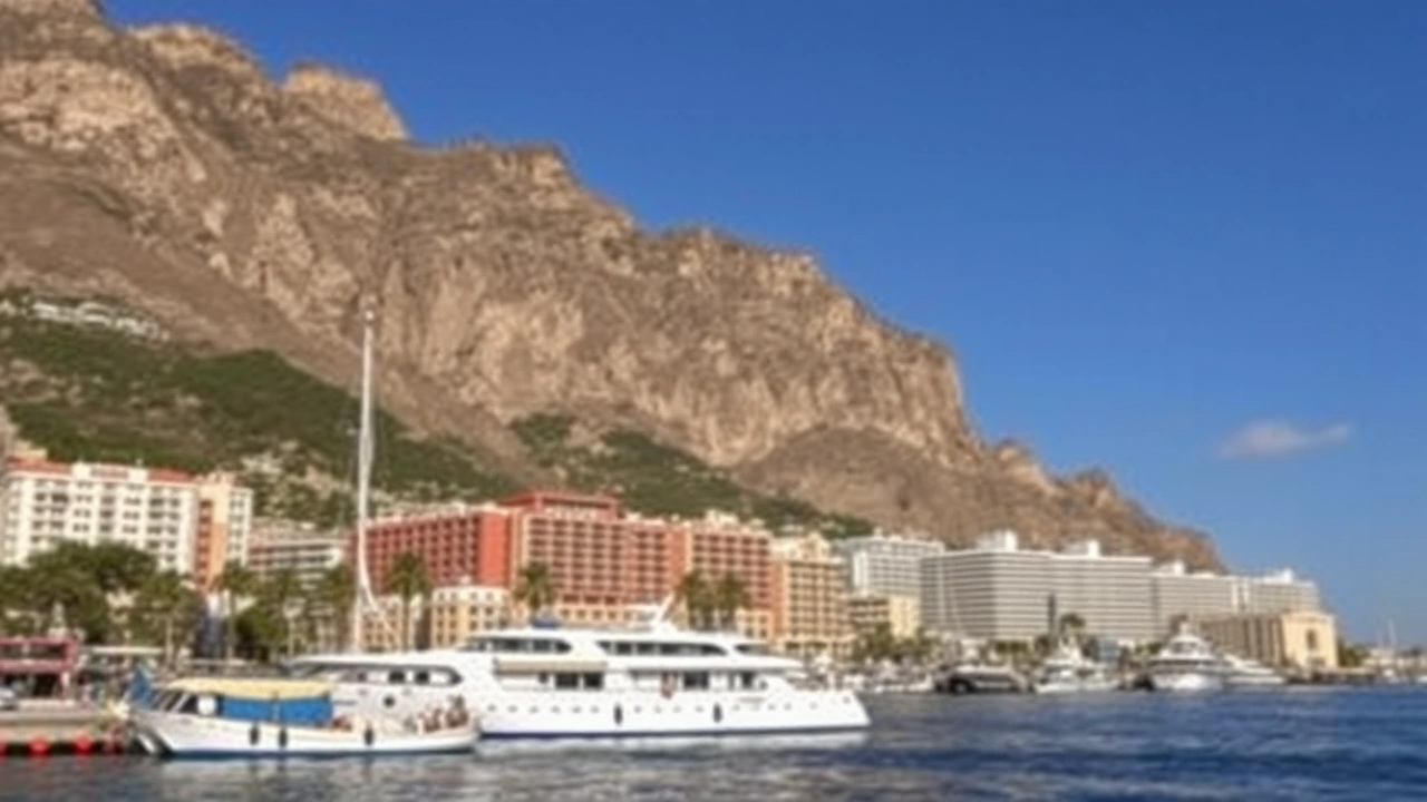
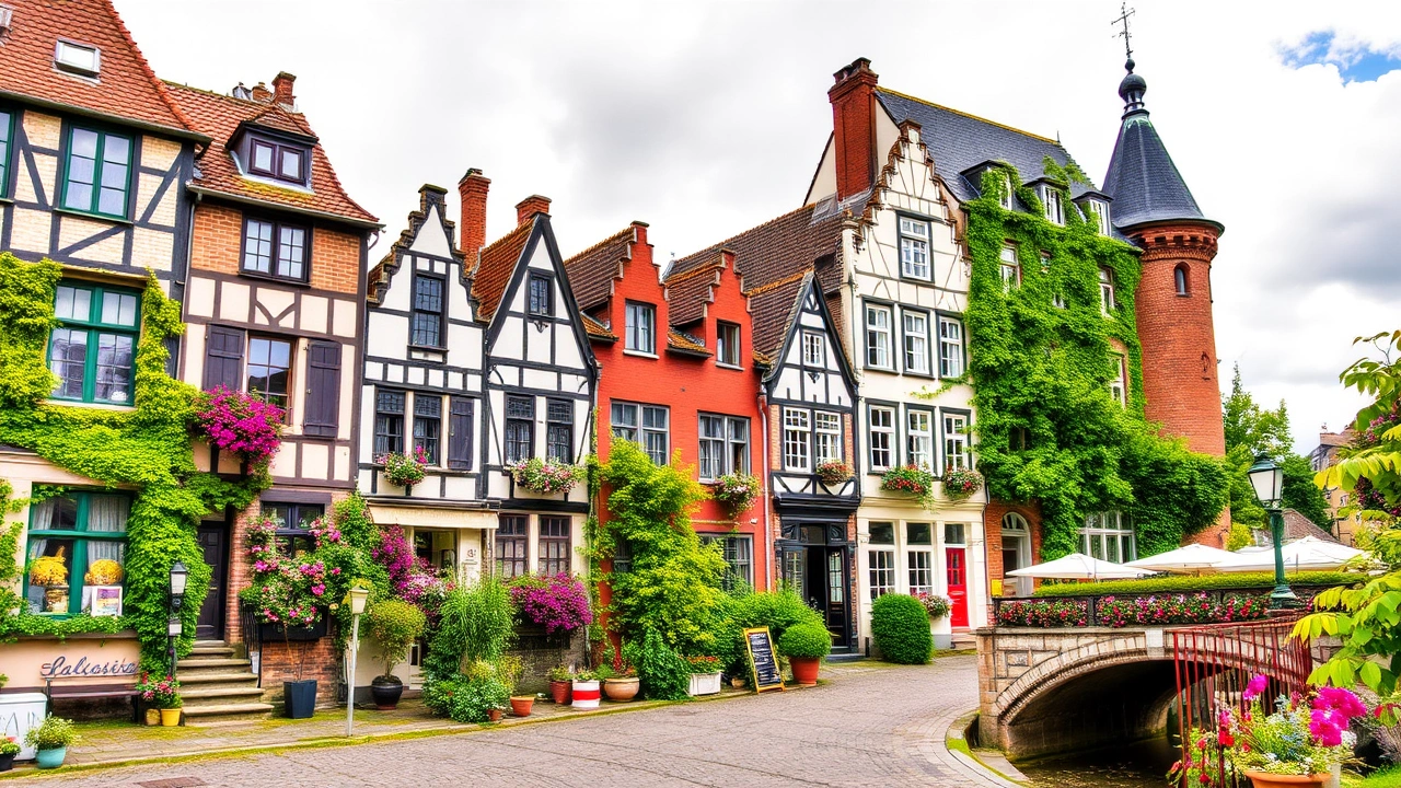
The Monegasque landscape is marked by slopes, rocky spurs, and steep-sided valleys. Its most famous feature is the Rock of Monaco-Ville, a limestone promontory jutting into the sea and overlooking the port. This cliff is composed of karstified Jurassic limestone, housing caves like the Observatory Cave, open to the public since 1946.
Short Valleys, Tiny Watercourses
On a continental scale, the Principality’s “rivers” resemble streams. The longest watercourse, Saint-Jean stream, is only about 190 meters long. The largest inland body of water, Fontvieille Lake, does not exceed 0.5 hectares.
This near absence of natural hydrography is directly linked to the size of the territory and the extensive urbanization. Every valley has been occupied by roads, buildings, or public facilities. Watercourses are channeled, underground, or reduced to occasional surface runoff during rain events.
An Extremely Short Coastal Strip
The Principality has one of the shortest shorelines in the world for a coastal state: only 3.83 km of frontage on the Mediterranean. This is, according to official figures, the shortest coastline for a non-landlocked country.
The table below summarizes some essential orders of magnitude:
| Geographical Indicator | Approximate Value |
|---|---|
| Total Area | 2.08 km² (208 hectares) |
| Land Border Length | 5.47 km (with France) |
| Coastline Length | 3.83 km |
| Minimum Width of the Country | 349 m |
| Maximum Width | 1,700 m |
| Highest Point | 164.4 m (Chemin des Révoires) |
| Lowest Point | 0 m (Mediterranean) |
This narrow strip of land follows the shape of the coastline, with a largely artificial coastline: dredged ports, floating breakwaters, developed beaches, concrete esplanades, islets reclaimed from the sea. The geography of Monaco is thus as much a product of geology as of coastal engineering.
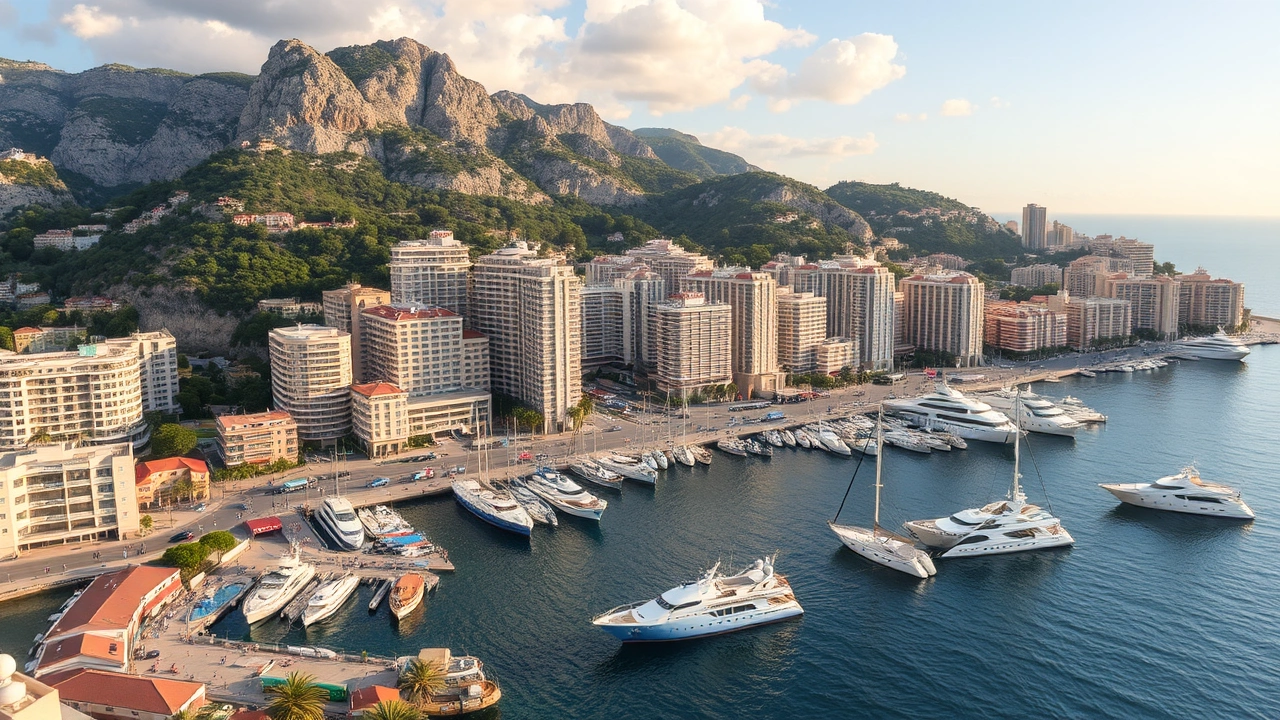
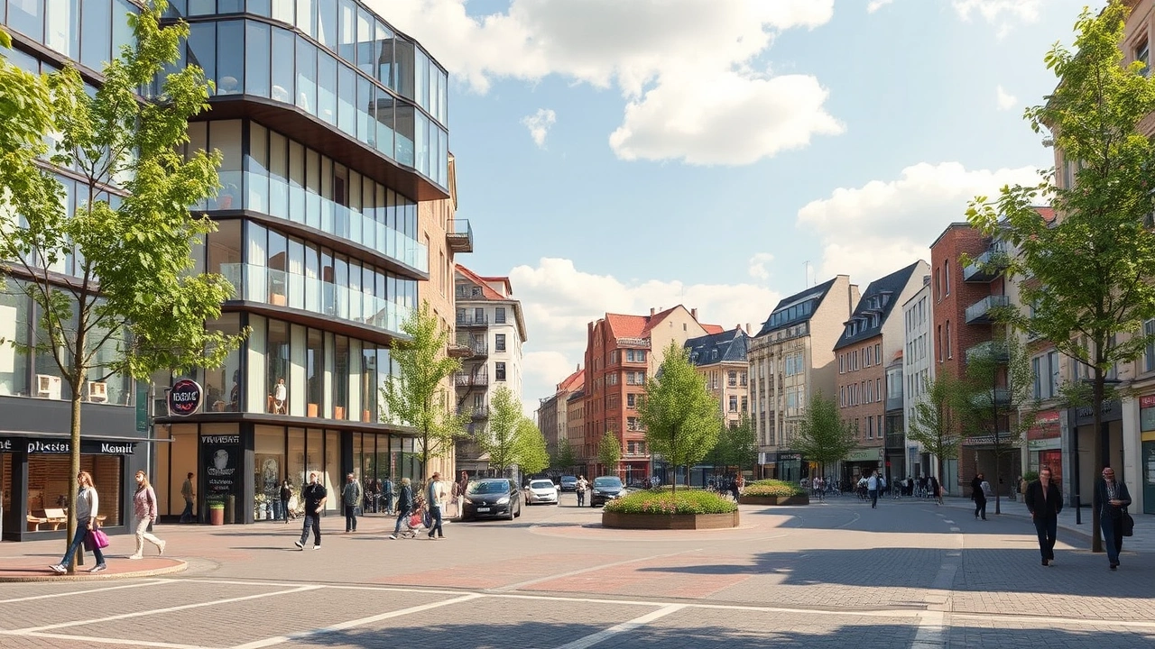
An Almost Entirely Urban State
Almost the entire territory is occupied by buildings, infrastructure, or public spaces. The numbers are clear: about 99% of the surface is classified as urban area or “other uses,” and barely 1% is permanent cropland. There is no longer any significant commercial agriculture; the only officially mentioned “natural resource” is fishing.
This pressure on space explains several emblematic phenomena of Monaco’s geography.
Height in meters of the Odéon Tower, which dominates Monaco’s skyline.
Second, underground development: parking lots, roads, technical galleries, the railway station, logistics centers, cultural facilities like the Grimaldi Forum are partially or completely buried. This hidden network helps free up space on the surface for housing, green spaces, and activity areas.
Finally, an urban planning approach of “rebuilding the city upon itself”: many older complexes have been demolished to be replaced by taller and denser buildings. In this context, every real estate project is also an act of geography, redesigning the skyline, wind flow, sunlight, or sea views.
Internal Division: Traditional Quarters and Modern Wards
Officially, the Principality comprises only one municipality: the Commune of Monaco. There is no legal distinction between the city and the state. But for urban planning and statistics, the territory is divided into a mosaic of traditional quarters, administrative “wards,” and reserved sectors.
Historically, four main quarters are distinguished: Monaco-Ville, La Condamine, Monte Carlo, and Fontvieille. Moneghetti is often considered a fifth. Based on these entities, a finer division into “wards” was established by sovereign ordinance, then revised in 2013.
Official Space Distribution
Data from “Monaco in Figures 2025” details the distribution of the territory into reserved sectors and wards. The following table summarizes this breakdown:
| Sectors / Wards | Area (hectares) | Share of Territory |
|---|---|---|
| Monaco-Ville (reserved sector) | 19.6 | 9.4 % |
| Ravin de Sainte-Dévote (reserved) | 2.3 | 1.1 % |
| Monte-Carlo | 43.7 | 21.0 % |
| Fontvieille | 33.0 | 15.8 % |
| La Condamine | 29.6 | 14.2 % |
| Larvotto | 27.5 | 13.2 % |
| Jardin Exotique | 23.5 | 11.3 % |
| La Rousse | 17.7 | 8.5 % |
| Les Moneghetti | 11.5 | 5.5 % |
| Total | 208.4 | 100 % |
For statistical purposes, these wards are further subdivided into 178 blocks, a granularity that illustrates the care taken by the authorities to precisely track land use in such a confined space.
The Major Geographical Areas
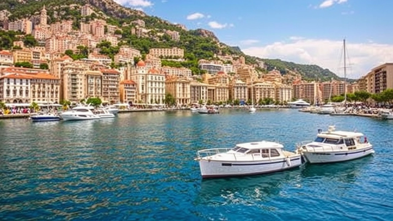
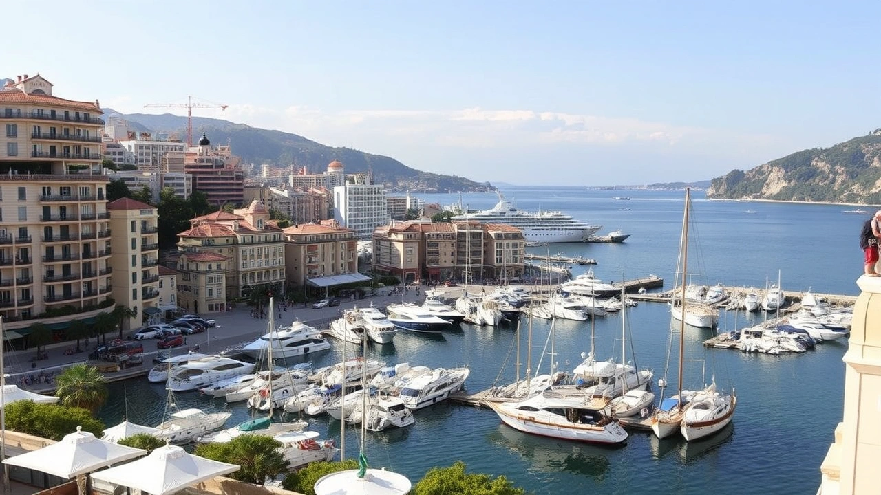
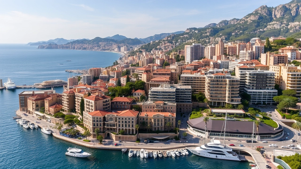
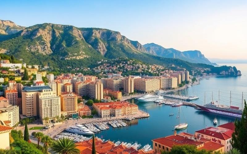
Monaco-Ville, perched on its rock, constitutes the historic and political core: the Prince’s Palace, cathedral, museums, medieval alleyways. The La Condamine quarter spreads out at the foot of this promontory, around Port Hercule, with a flatter and denser urban fabric dominated by commercial and port activity.
Monte Carlo concentrates the postcard image of Monaco with its casino, luxury hotels, the Carré d’Or, and its high-end boutiques. It is the most densely populated quarter in the collective imagination. However, administratively, the most populous ward is Larvotto, located along the beach of the same name.
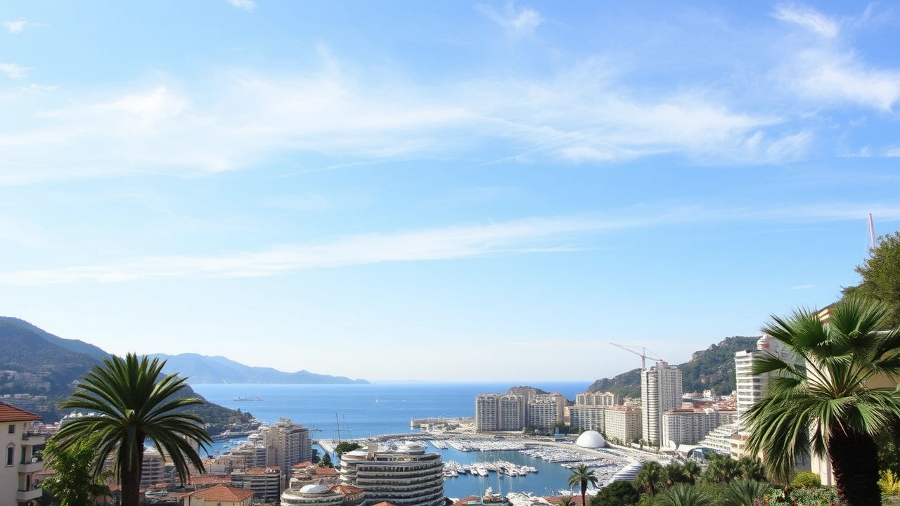
Fontvieille, finally, stretches across land reclaimed from the sea, at the foot of the cliffs, featuring the Stade Louis-II, a shopping center, a secondary port, and a mixed residential and business zone. Higher up, on the slopes rising towards France, the neighborhoods of Jardin Exotique, Les Moneghetti, or La Rousse act as an urban balcony, offering panoramic views over the entire territory and the sea.
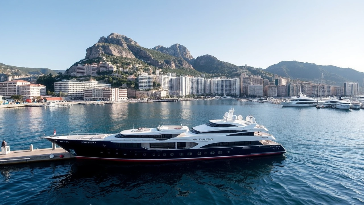
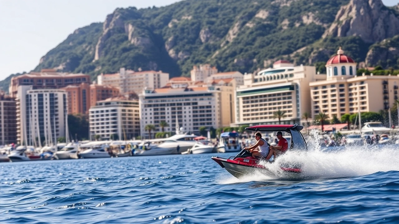
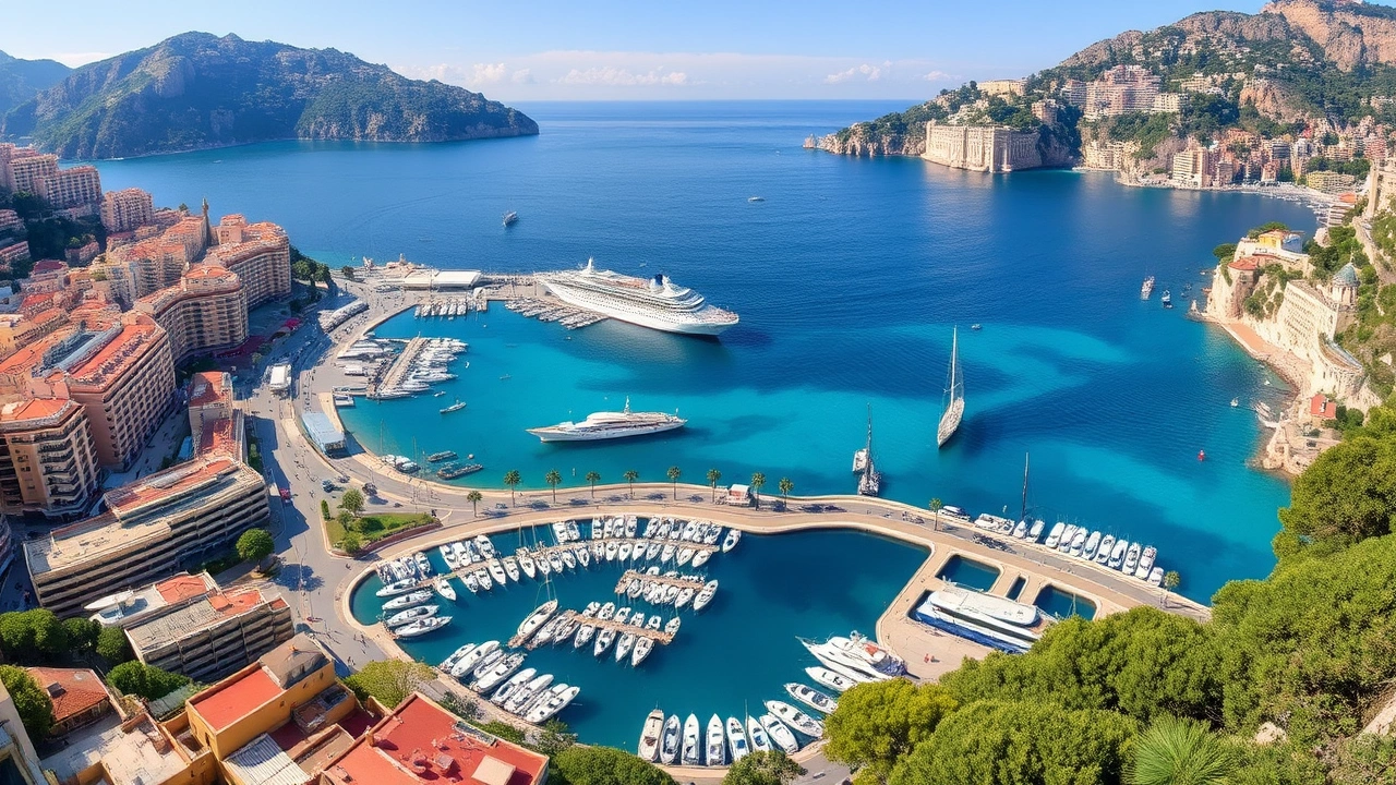
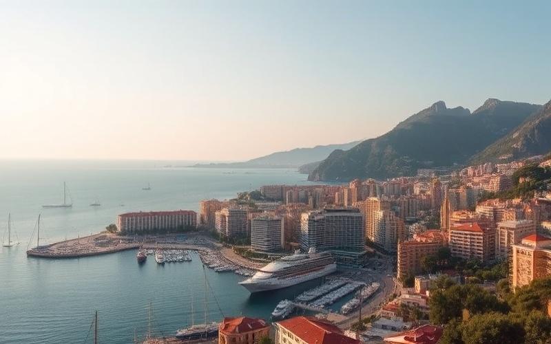
A Fully Developed Coastline: Ports, Beaches, and Breakwaters
Despite the small size of its shoreline, the Principality has two deep-water ports and a very popular urban beach, not to mention the immediate proximity of the French port of Cap-d’Ail.
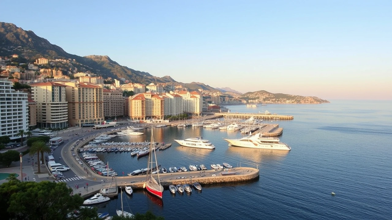
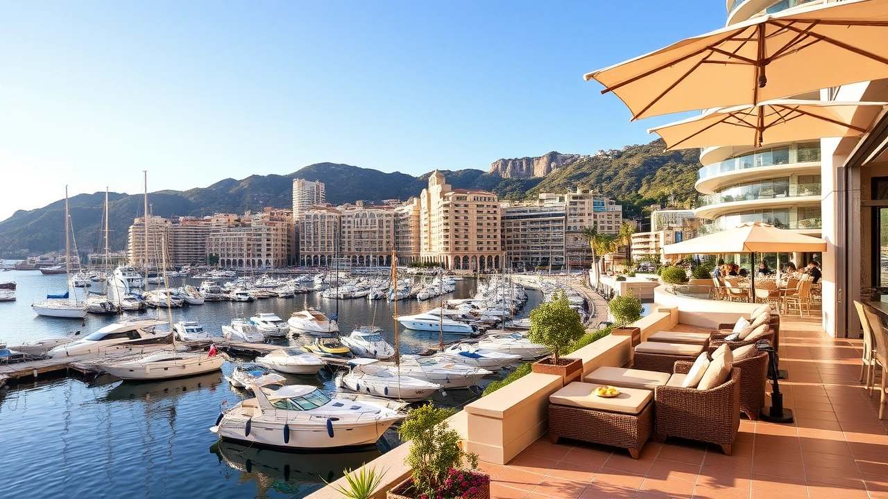
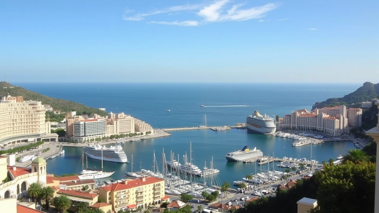
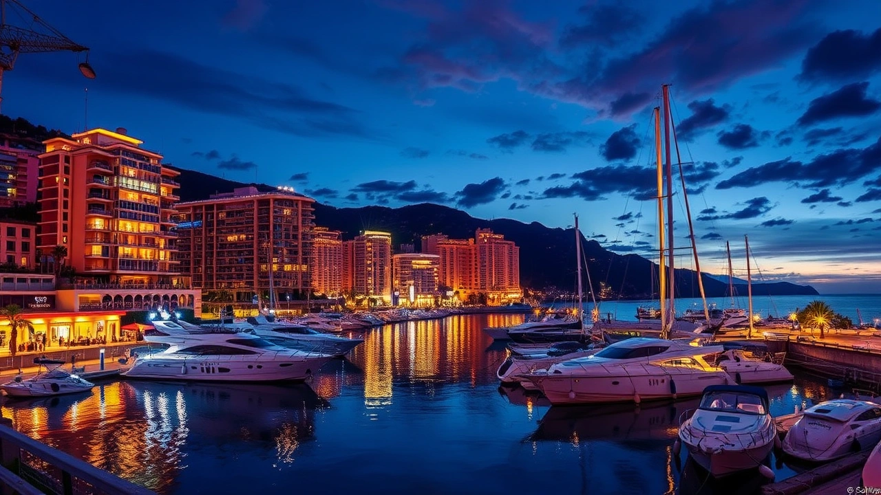
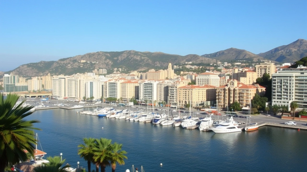
Port Hercule, located at the foot of La Condamine and the Rock, is the historic and main port of Monaco. It has undergone significant transformations and expansions over the decades. Notably, a semi-floating breakwater and an additional platform were built in the early 2000s. These developments now allow for the accommodation of large cruise ships and a marina for very large yachts. This port extension, along with protective structures, has altered the coastline and contributes to the constant reshaping of the waterfront.
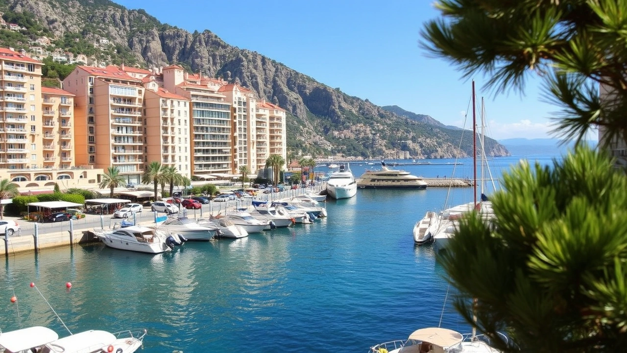
Port Fontvieille serves as a second port, more sheltered, integrated into the coastal area entirely reclaimed from the sea southwest of the Rock. It mainly hosts smaller pleasure boats in a highly urbanized environment where industrial sheds stand alongside residences and parks.
Larvotto Beach is the main bathing beach in Monaco. It is fully developed and protected by breakwaters. Recently, its esplanade was reorganized and coastal maintenance work was carried out. This coastal area is artificial, with imported sand, breakwaters, jetties, and constructions on a platform.
The geography of Monaco, seen from the sea, is thus dominated by breakwaters, quays, and terraced buildings. The original rocky coastline now appears only in fragments, notably at the base of the Rock or in a few remaining coves.
Gaining Space from the Sea: Geography Under Construction
For a state enclosed between a fixed border and a constrained coastline, the only room for maneuver is to push back the shoreline. Since the end of the 19th century, the Principality has made reclaiming land from the Mediterranean a major territorial development strategy.
The first embankments were made in La Condamine, then especially in Fontvieille, where over 20 hectares were gained in the 1960s-1970s. This operation radically transformed the country’s relationship with the sea, creating a large platform for industrial, residential, and sports use.
In the following decades, Larvotto was equipped with an artificial beach and Port Hercule was in turn enlarged by massive maritime structures. Each time, the country’s area increased by a few hectares, in proportions that are modest but crucial on the scale of such a tiny territory.
Portier (Mareterra): A New Neighborhood on 6 Hectares
The latest major stage of this expanding geography is the Portier neighborhood, also called Mareterra or Anse du Portier. This new piece of the city was developed on 6 hectares of land reclaimed from the sea, between Monte-Carlo and Larvotto, and officially opened in 2024.
Each concrete caisson of the maritime belt weighs approximately 10,000 tonnes.
On this foundation, the Principality has built an eco-neighborhood mixing very high-end residences, waterfront villas, offices, shops, a coastal promenade, a public park, and a small marina. About 1,000 new residents are expected in this area, administratively integrated into the Larvotto ward. The project illustrates how much the geography of Monaco is no longer just “endured,” but largely “manufactured.”
Towards Other Extensions, Notably in Fontvieille
The Monegasque authorities have also approved a project to extend Fontvieille by approximately 0.08 km², again through land reclamation. This new advance onto the sea will represent only a handful of hectares, but on the scale of the Principality, every fraction of a square kilometer is strategic.
These projects face a double limit. On one side, environmental concerns related to the potential destruction of Posidonia seagrass meadows, protected marine habitats, or the increase in anthropogenic pressures on an already saturated coastal strip. On the other side, the legal constraints of the territorial sea, defined by an agreement with France that governs the possible extension of the Monegasque maritime domain.
A Tiny Sea… But a Multiplied Maritime Space
The Principality’s extremely short maritime frontage does not prevent it from having a maritime zone much larger than its land territory. Agreements concluded with France have allowed for the delimitation of a territorial sea and an exclusive economic zone that stretches far out to sea in the shape of a corridor.
Available estimates indicate a maritime expanse of about 290 km² under Monegasque jurisdiction, nearly 140 times the country’s land surface area. This corridor stretches about a hundred nautical miles south of the coast, in a strip roughly 2 nautical miles wide, flanked on either side by French waters.
The Principality, although small in land area, possesses a significant maritime space granting it rights of exploration, fishing, and environmental protection. It has thus established itself as a hub for marine research and conservation, hosting one of the world’s first marine protected areas, the Oceanographic Institute, and marine laboratories of the International Atomic Energy Agency.
The geography of Monaco is therefore not limited to its roads and buildings: it includes an invisible but strategic slice of the Mediterranean, within which preservation policies and control over fishing activities are deployed.
A Mediterranean Climate Tempered by the Sea
If there is one area where the Principality’s small size has no importance, it is certainly the climate. The geography of Monaco affords it a typically Mediterranean microclimate, but particularly mild, classified as “Csa” in the Köppen nomenclature (hot-summer Mediterranean) with nuances close to a humid subtropical climate under maritime influence.
Summers are generally hot, sunny, and dry, but without excess: temperatures above 30°C remain relatively rare, with sea breezes tempering the atmosphere. Summer nights are very mild, with average minimums often above 20°C in high summer.
Winter is remarkably mild for such a northern latitude: averages for January and February hover around 10°C, frosts are exceptional, and snow appears only once or twice a decade. The snowfall observed in late February 2018 in Monaco and Monte-Carlo is precisely one of these rare climatic curiosities.
Annual rainfall amounts to about 740 mm, spread over just over 60 rainy days per year.
Regarding sunshine, the figures are around 2,575 hours per year, a very high level on a European scale. The following table, based on climate averages provided by Météo-France, summarizes some characteristic parameters:
| Climate Parameter | Approximate Average Value |
|---|---|
| Annual Mean Temperature | 16.4 °C |
| Heat Record | 34.5 °C |
| Cold Record | -5.2 °C |
| Annual Precipitation | 743.6 mm |
| Rainy Days (≥ 1 mm) per Year | 62.4 days |
| Average Relative Humidity | 74.9 % |
| Annual Sunshine | 2,574.7 hours |
| Sea Temperature (February) | 13.0 °C |
| Sea Temperature (August) | 23.6 °C |
This mild and sunny climate, combined with a landscape where buildings seem to cling to cliffs overlooking the sea, has greatly contributed to making the Principality a tourist destination for affluent travelers since the late 19th century. Here, the geography of Monaco directly serves the territory’s economic model.
An Urban Mosaic Interlocked with Neighboring France
On paper, the Principality’s boundaries cover only 2.08 km². On the ground, the separation with neighboring French towns is almost imperceptible. Some buildings have an entrance on the Monaco side and another on the French side; streets change countries mid-bend; entire neighborhoods share the same slopes, the same views, and sometimes the same technical networks.
Estimated number of daily cross-border workers coming from France and Italy to work in Monaco.
The geography of Monaco must therefore also be read as a node within an urban fabric that extends beyond it. The main access routes – Moyenne Corniche road, A8 motorway, Marseille-Ventimiglia railway lines, heliport links with Nice airport – connect the Principality to a larger coastal and mountainous hinterland, of which it constitutes the densest economic pole.
Transport, Networks, and Mobility in a Constrained Space
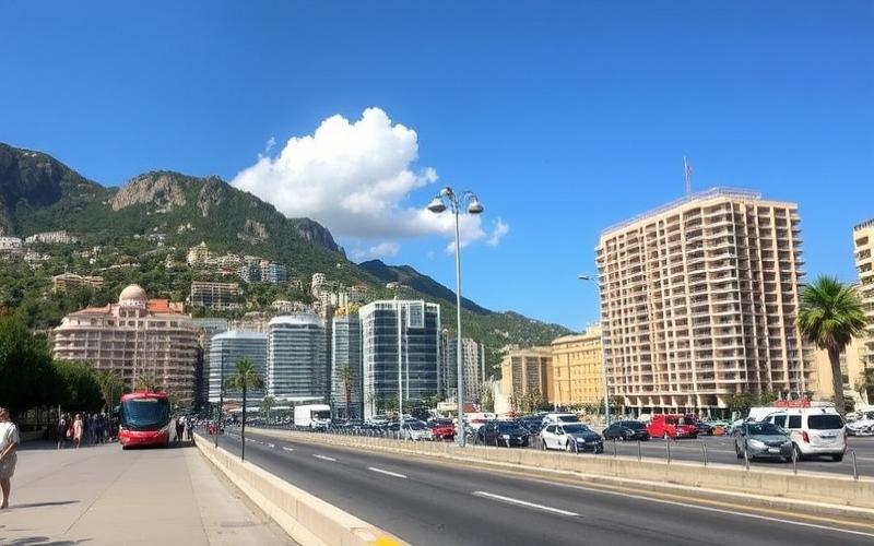
The confined territory imposes a particular organization of transport. The road network, about 77 km long, is superimposed on several levels, with tunnels, viaducts, and ramps exploiting every nook of the topography. Many stretches are so narrow that they serve, once a year, as a temporary circuit for the Formula 1 Grand Prix, making the city a unique setting for motor racing.
This is the only railway station in the Principality, located on the Marseille–Ventimiglia line. Inaugurated in 1999, it is partially underground, having replaced and buried the old line. This project freed up several hectares on the surface for new urban developments.
The bus network of the Compagnie des Autobus de Monaco covers all neighborhoods, while a dense network of public elevators, escalators, and pedestrian walkways helps overcome the significant elevation changes. Walking, although sometimes athletic, remains a central mode of transport, encouraged by the proliferation of dedicated pathways.
Finally, the Fontvieille Heliport connects the Principality to Nice Côte d’Azur Airport in a few minutes. In a country where airplanes cannot land for lack of space, the vertical air solution has become a key element of the functional geography.
A Marine Territory at the Heart of Conservation Policies
If land is scarce and expensive, the sea has become the other major field of action for the Principality. Beyond port and leisure activities, the geography of Monaco includes a network of marine protected areas, scientific research zones, and facilities dedicated to the study of the marine environment.
Monaco is home to one of the world’s earliest protected marine habitats, near the Larvotto reserve. The Rock also hosts the Oceanographic Institute and the International Atomic Energy Agency’s laboratories dedicated to the marine environment, a unique structure within the United Nations system.
This positioning is explained both by the country’s scientific history and by a geographic reality: a reduced but intensely pressured maritime frontage (urbanization, nautical traffic, discharges), backed by a much larger maritime space under national jurisdiction, and located in a particularly fragile Mediterranean ecosystem.
Sea extension operations, like Portier, have moreover been conditioned on ecological compensation measures: relocation of protected species like pen shells or Posidonia seagrass meadows, creation of artificial reefs, close monitoring of water quality and turbidity during construction.
Demographics and Density: Human Geography at the Extreme
With about 38,000 inhabitants on 2.08 km², the population density far exceeds 18,000 inhabitants per km², making it the most densely populated country in the world. Some sources cite even higher densities depending on calculation methods. To this resident population are added tens of thousands of commuters every day, further increasing the pressure on space.
Less than a quarter of residents are Monegasque nationals. The majority of the population comes from a multitude of countries, with a strong presence of French, Italian, and British nationals. This diversity is reflected in the languages spoken (mainly French, but also Italian, Monegasque, and English) and contributes to the country’s cultural mosaic.
This extreme human geography is reflected in the real estate price map: amounts reaching, or even exceeding, 100,000 euros per square meter have been recorded in the most prestigious sectors, placing Monaco at the summit of global real estate markets. It is estimated that about a third of residents are millionaires, a proportion unmatched elsewhere.
The organization of the territory, between historic quarters, land reclaimed from the sea, and densely built slopes, contributes to structuring a spatial segregation that is essentially economic. The most sought-after coastal sectors – Monte-Carlo, Larvotto, Portier – concentrate the most expensive buildings and villas, while the higher parts offer compromises between exceptional views and high density.
A State, a City, a Landscape: An Inseparably Political Geography
Finally, the geography of Monaco cannot be separated from its political status. As a unitary city-state, where the city and the state are one, every planning choice has strong political implications. The decision to gain land from the sea, to reconfigure a neighborhood, to pedestrianize a street, or to build a tower is directly part of an overall strategy for the survival and competitiveness of a territory without a hinterland.
France ensures the defense of Monaco, partially controls its airspace, and cooperates on customs, traffic, and the environment. Land borders are open without formalities, while precise treaties govern the sharing of maritime competencies and the functioning of the customs union.
The Principality, a member of the Council of Europe but not of the European Union, is legally distinct from its large neighbor, while being deeply intertwined with its transport networks, economic systems, and urban fabric. This constant balancing act between political independence and geographical integration is an integral part of how the territory is constructed.
Conclusion: A Laboratory of Urban Geography in the Mediterranean
In just over two square kilometers, the geography of Monaco brings together a condensed set of contemporary issues: management of an ultra-coveted coastal space, vertical densification, conquest of new land from the sea, preservation of marine ecosystems, integration into a cross-border urban area, adaptation to Mediterranean climate risks.
A country without countryside, without a major river, or its own mountain, the Principality has transformed its rugged topography into a resource, exploiting every meter of cliff, every crevice, every possibility for reclamation. It has extended its horizon by appropriating a maritime corridor disproportionate to its land territory, while cultivating an image as a major player in ocean protection.
At a time when many coastal metropolises are seeking solutions to reconcile urban growth, climate risks, and land pressure, the Monegasque case appears both as a singularity – due to its size, wealth, and status – and as an extreme laboratory of urban geography on the shores of the Mediterranean.
A French business executive, around 50 years old, with a financial portfolio already well-structured in Europe, wanted to diversify part of his capital into high-end residential real estate in Monaco to seek secure rental income and exposure to a highly sought-after market. Allocated budget: 1.5 to 2.5 million euros, without using credit.
After analyzing several neighborhoods (Carré d’Or, Fontvieille, La Rousse), the chosen strategy was to target a 2–3 room apartment in an upscale residence, combining reasonable but stable rental yield (3–4% gross – the higher the yield, the higher the risk) and strong potential for capital preservation and appreciation in the medium to long term, for an overall cost (acquisition + notary fees + possible refurbishments) of around 2 million euros. The mission included: neighborhood selection, connection with a local network (real estate agent, notary, private banker, international tax advisor), choice of holding structure (direct, Monegasque entity, or foreign company), and definition of an international wealth diversification plan integrating this Monegasque asset.
Planning to move abroad? Contact us for custom offers.
Disclaimer: The information provided on this website is for informational purposes only and does not constitute financial, legal, or professional advice. We encourage you to consult qualified experts before making any investment, real estate, or expatriation decisions. Although we strive to maintain up-to-date and accurate information, we do not guarantee the completeness, accuracy, or timeliness of the proposed content. As investment and expatriation involve risks, we disclaim any liability for potential losses or damages arising from the use of this site. Your use of this site confirms your acceptance of these terms and your understanding of the associated risks.
Cyril Jarnias is an independent expert in international wealth management with over 20 years of experience. As an expatriate himself, he is dedicated to helping individuals and business leaders build, protect, and pass on their wealth with complete peace of mind.
On his website, cyriljarnias.com, he shares his expertise on international real estate, offshore company formation, and expatriation.
Thanks to his expertise, he offers sound advice to optimize his clients' wealth management. Cyril Jarnias is also recognized for his appearances in many prestigious media outlets such as BFM Business, les Français de l’étranger, Le Figaro, Les Echos, and Mieux vivre votre argent, where he shares his knowledge and know-how in wealth management.