Published on and written by Cyril Jarnias
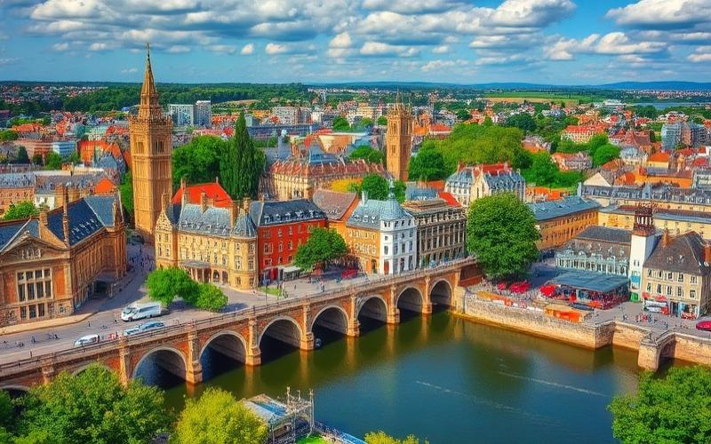
It’s hard to talk about the United Kingdom without mentioning rain, changing skies, and rugged coastlines. But reducing the geography of the United Kingdom to a few weather clichés would mean missing a far more complex territory: an archipelago shaped by glaciation, surrounded by strategic seas, divided into four nations with highly contrasting landscapes, and home to a largely urban population where 70% of the land remains dedicated to agriculture.
This article provides an overview of the geography of the United Kingdom, covering its topography, climate, natural environments, land use, agriculture, natural resources, and human organization of the territory.
An Island State at Europe’s Doorstep
The United Kingdom is an island state located off the northwestern coast of continental Europe. Its coordinates are around 54° north latitude and 2°30′ west longitude, but the entire territory actually stretches between 49° and 59° N for the mainland part, and almost 61° N with the Shetland Islands. From east to west, it extends between 8° West and 2° East.
This is the distance in kilometers separating the United Kingdom from France at the Strait of Dover.
The United Kingdom occupies most of the British Isles archipelago, including:
– the island of Great Britain (where England, Scotland, and Wales are located);
– the northeastern part of the island of Ireland, corresponding to Northern Ireland;
– more than a thousand smaller islands, of which about a hundred are inhabited.
The four constituent nations cover a total of approximately 244,000 km², making it the 7th largest island country in the world. The distribution of area illustrates the dominant weight of England:
| Nation | Area (km², order of magnitude) | Share of total country |
|---|---|---|
| England | ≈ 130,462 | just over 50% |
| Scotland | ≈ 78,800 | about one third |
| Wales | ≈ 20,780 | ≈ 8% |
| Northern Ireland | ≈ 14,330 | ≈ 6% |
| Total United Kingdom | ≈ 244,000 | 100% |
The island nature is such that no point in the territory is more than 113 to 125 kilometers from tidal waters. The village of Coton in the Elms, in Derbyshire, is classified as the point farthest from the coastline.
A Highly Contrasted Topography: Mountains in the North and West, Plains in the South and East
The physical geography of the United Kingdom is often summarized by an imaginary line, the Tees–Exe line, which roughly connects the estuary of the Tees in northeastern England to the estuary of the Exe in the southwest. North and west of this line, mountainous terrain and plateaus dominate, while the south and east present gentler landscapes of hills and plains.
Major Topographic Regions
England is generally a land of low hills and plains, but its northwestern quarter and part of the southwest are distinctly more rugged. You can find:
– the Lake District in Cumbria, which concentrates the highest peaks in England;
– the Pennines, sometimes nicknamed “the backbone of England”;
– the moors of Dartmoor and Exmoor in the southwest;
– the North York Moors and several secondary ranges (Shropshire Hills, Cotswolds, Chilterns, etc.).
Scotland is by far the most mountainous of the UK nations. A major fault, the Highland Boundary Fault, separates:
The geography of Scotland divides into two main regions: to the north and west, the Highlands, dominated by the country’s highest massifs like the Grampians, Cairngorms, and Cuillin; to the south and east, the lower-lying Lowlands, which notably include the industrial plains of the Central Lowlands, bordered by the Southern Uplands.
Wales is also largely mountainous, especially in the north and center, with iconic ranges like Snowdonia (Eryri), the Brecon Beacons (Bannau Brycheiniog), or the Cambrian Mountains. Southern Wales has less pronounced terrain, more suitable for urbanization and industry.
Northern Ireland is dominated by hills and medium-sized mountains. The Mourne Mountains form its main range, complemented by the Antrim Plateau and the Sperrin Mountains.
Peaks and Extreme Points
The highest points of each nation show the altitudinal contrast within the United Kingdom:
| Nation | Main Peak | Elevation (meters) |
|---|---|---|
| Scotland | Ben Nevis | 1,345 m |
| Wales | Snowdon (Yr Wyddfa) | 1,085 m |
| England | Scafell Pike | 978 m |
| Northern Ireland | Slieve Donard | 852 m |
All of the ten highest peaks in the country are located in Scotland, highlighting the mountainous character of the northern part of the archipelago. At the opposite end of the spectrum, the lowest point is in the Fens of East Anglia, a low-lying plain where some plots reach about 4 meters below sea level.
A Complex Geology Shaped by Glaciation
The current topography of the United Kingdom results from hundreds of millions of years of geological history. Very ancient rocks, like the Lewisian gneiss of northwestern Scotland, date back more than 2.7 billion years. Over the ages, the territory was successively attached to different continents (Laurentia, Gondwana, Avalonia), before being integrated into the supercontinent Pangaea.
The bedrock was structured by several orogenic episodes (Caledonian and Variscan mountain chains). The Cretaceous deposited thick layers of chalk, visible in the White Cliffs of Dover. Active volcanism 63 to 52 million years ago formed the Antrim Plateau and the Giant’s Causeway.
Quaternary glaciations, particularly the Anglian and Devensian periods, then profoundly reshaped the landscape: U-shaped valleys, fjords, deep lochs, moraine deposits, and erratic boulders still mark the territory. Post-glacial isostatic rebound continues today, with a gradual uplift of Scotland and a relative subsidence of the south and east of England, on the order of a millimeter per year (more around London).
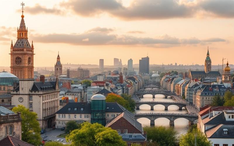
A Country of Rivers, Lakes, and a Very Indented Coastline
The geography of the United Kingdom is inseparable from its dense hydrographic network and its extremely sinuous coastline, whose length, depending on the measurement method used, exceeds 12,400 kilometers.
Rivers and Streams: A Tight Network
About twenty major rivers irrigate the archipelago, providing natural drainage, water resources, historic transportation routes, and the location of major ports.
The longest river in the country is the Severn, approximately 354 kilometers long. It rises in Wales, flows through western England, and empties into the Severn Estuary, which opens onto the Bristol Channel. England’s iconic river, the Thames, runs 346 kilometers from the Cotswold Hills to its estuary in the heart of London, before reaching the North Sea.
Each nation has its reference river:
| Nation | Longest River (entirely within) | Approximate Length |
|---|---|---|
| England | Thames | 346 km |
| Scotland | Tay | 188 km |
| Wales | Usk | 126 km |
| Northern Ireland | Bann | 122 km |
Other major river systems, like the Trent, the Great Ouse, the Wye, or the Clyde, gave birth to major industrial ports: Liverpool on the Mersey, Bristol on the Severn, Newcastle upon Tyne on the Tyne, or Glasgow on the Clyde. The country also developed an extensive canal network, particularly dense in England, which played a central role during the Industrial Revolution.
Lakes and Lochs: Vast Inland Bodies of Water
Lakes (or lochs in Scotland) are numerous, but their distribution is very uneven. Northern Ireland is home to the largest surface body of water, Lough Neagh, covering nearly 382 km². In Scotland, Loch Lomond dominates by area (just over 71 km²), while Loch Ness holds the volume record. Loch Morar is the deepest, with over 300 meters of water.
Presentation of the main natural lakes and artificial reservoirs in England and Wales.
The largest natural lake in England, located in the Lake District, with an area of 14.7 km².
Another major lake in the Lake District in England, renowned for its natural beauty.
A famous natural lake in the Lake District in England, appreciated for its landscapes.
A vast artificial reservoir in England, complementing the network of bodies of water.
The largest natural lake in Wales, with an area of about 4.8 km².
A Fractal Coastline, Between Cliffs, Estuaries, and Bays
The coastline of the United Kingdom is notoriously complex. By one estimate, the coast measures about 12,429 kilometers, but the “coastline paradox” causes this figure to vary depending on the scale of measurement used. The coast has a high fractal dimension, which concretely means an extremely “indented” outline, rich in peninsulas, bays, estuaries, and islets.
Among the major coastal indentations, one can cite bays, gulfs, and rias, which are deep incursions of the sea into the land.
– the Bristol Channel and Cardigan Bay to the west;
– Lyme Bay and the Solent on the south coast;
– the estuaries of the Thames, Humber, Mersey, Clyde, Forth, or Tay;
– the Scottish firths (Firth of Forth, Firth of Clyde, Moray Firth, etc.);
– The Wash, a vast fan-shaped estuary on the east coast of England.
Spectacular cliffs punctuate the coastline, notably the White Cliffs of Dover or the Seven Sisters in Sussex. The Jurassic Coast, between Exmouth (Devon) and Swanage (Dorset), is a UNESCO World Heritage Site for its geological and fossil richness.
The United Kingdom claims a territorial sea of 12 nautical miles and an exclusive economic zone (EEZ) of 200 nautical miles. The EEZ associated with the European archipelago reaches about 774,000 km², but if overseas territories and Crown dependencies are included, the country’s total maritime zones exceed 6.8 million km², the fifth largest maritime area in the world.
An Archipelago of Islands: From Great Britain to the Scottish Archipelagos
The geography of the United Kingdom is first and foremost that of a country of islands. The number of islands attached to the territory is estimated at over a thousand, of which about 130 are inhabited.
The main island is of course Great Britain, which comprises England, Scotland, and Wales. But Scotland, in particular, has a constellation of archipelagos: Inner and Outer Hebrides (Lewis and Harris, Skye, Mull, Uists…), Orkney, and Shetland. The island of Lewis and Harris, at over 2,180 km², is the largest Scottish island.
In Wales, the island of Anglesey (Ynys Môn) stands off the northwestern coast with about 710 km². In England, the Isle of Wight, in the English Channel, is the largest (≈ 380 km²), followed by the Isle of Sheppey in the Medway Estuary. In Northern Ireland, Rathlin Island is the main inhabited island, with about 16 km².
Geography of the British Isles
The Channel Islands (Jersey, Guernsey, Alderney, Sark) and the Isle of Man are not part of the United Kingdom as such, although they are closely linked politically as Crown dependencies.
A Temperate Oceanic Climate, but with Great Nuance
The United Kingdom shares with much of northwestern Europe a temperate oceanic climate, classified as Cfb in the Köppen system. The proximity of the Atlantic Ocean and the North Atlantic Drift (an extension of the Gulf Stream) play an essential moderating role: without this warm current, winters would on average be about ten degrees colder.
Contrasted Seasons, Often Changeable Weather
The climate is characterized by rather cool temperatures, frequent precipitation, and often cloudy skies. The weather can change several times in the same day due to the polar jet stream and successive Atlantic depressions.
The seasons have marked features:
– Spring: still a cool and fairly calm period, with averages varying greatly from the mountainous north (average temperatures sometimes negative or close to 0 °C) to southern England (around 9 to 10 °C). Snow is still possible in March, especially on high ground.
– Summer: the warmest and sunniest season. Temperatures in southern England typically hover around 18 to 25 °C. Summer thunderstorms, especially in the south, east, and center of England, can be severe, particularly during “Spanish plume” situations (influx of warm Iberian air).
– Autumn: often unsettled, with frequent Atlantic disturbances. The coastlines of southern England enjoy the mildest autumns, while mountainous and northern regions cool down quickly.
– Winter: overall cool, wet, windy, and often overcast. Temperatures rarely drop below –10 °C at night or exceed 15 °C during the day. Heavy snowfall is mostly confined to the Scottish Highlands, the Pennines, and the Welsh mountains.
Extremes are nonetheless very real: the highest temperature recorded reached 40.3 °C at Coningsby in Lincolnshire, while several Scottish locations have observed lows of –27.2 °C. These records illustrate the country’s increased vulnerability to climate warming.
Marked Regional Nuances
While the general pattern pits a warmer south and a wetter west against a cooler and drier north and east, the differences are clear between the four nations of the United Kingdom.
This is the minimum annual precipitation threshold in millimeters in some parts of Essex, England, one of the driest regions of the archipelago.
Wales benefits on average from higher annual temperatures than Northern Ireland and Scotland, but is distinguished above all by its humidity: the west and upland areas like Snowdonia can receive between 3,000 and 5,000 mm of rain per year, compared to less than 1,000 mm on some coastal stretches. Sunshine is intermediate: less than in England but more generous than in Scotland or Northern Ireland. The southwestern Welsh coast, around Tenby, exceeds 1,700 hours of annual sunshine, while mountain peaks fall below 1,200 hours.
Scotland is the coolest region of the UK. Its climate varies: temperate oceanic in the Lowlands, and subpolar to subarctic (tundra type) in the mountains and the Shetlands. Winters are mild with an average just above 0°C, and summers are cool with highs around 17°C. Precipitation, more abundant than elsewhere, is particularly frequent from late autumn to early spring.
Northern Ireland sits between Scotland and Wales in terms of temperatures, with winters generally milder than Scotland’s and significant but slightly lower precipitation than Wales. It receives more sunshine than Scotland, but remains overall less sunny than the rest of Great Britain.
A simple pattern summarizes the regional logic well: the western facades (Northern Ireland, western Wales, western England and Scotland) are the mildest, wettest, and windiest, while the eastern and southeastern regions are drier, less windy, with greater temperature ranges. Southern England is least exposed to polar influences, but can occasionally experience heatwaves of continental origin.
Land Use Dominated by Agriculture
Despite a high level of urbanization—about 83 to 85% of the population lives in cities—the geography of the United Kingdom remains largely rural in its land use. Nearly 70 to 75% of the land area is considered suitable for agriculture, and about 70% of the total area is actually used for agricultural purposes.
Agricultural Land Use
The concept of Utilised Agricultural Area (UAA) groups different categories of agricultural land: arable and horticultural land, fallow land, temporary and permanent grassland, grazing land, land dedicated to outdoor pigs, excluding woodland. In 2022, this utilized area represented about 18.1 million hectares, or nearly three-quarters of the surface area of the United Kingdom (about 24.9 million hectares of land).
This is the percentage of the UAA considered cultivable, equivalent to about one quarter of the country’s total area.
Some of this land is of modest quality, particularly in mountainous and moorland areas. England and Wales use an agricultural land classification system from Grade 1 (excellent) to Grade 5 (very poor). Grades 1, 2, and 3a, classed as “best and most versatile,” are better protected from urbanization. Scotland has its own seven-class system and Northern Ireland uses a scheme similar to that of England and Wales.
This is the percentage of agricultural land in Scotland classified as Less Favoured Areas, often upland moors specialized in livestock farming.
Growing Land Pressure
For two decades, total agricultural area has tended to decline, by about 64,000 acres per year, in favor of urbanization, expansion of woodland, and other non-agricultural uses. At the same time, woodland area is expanding (about 3.24 million hectares of forests) and urbanization covers about 1.85 million hectares.
The distribution of land uses for England, the most populous of the nations, illustrates this fragile balance between agriculture, forest, and city well:
| Type of Land Use (England) | Approximate Share of Area |
|---|---|
| Crops and Fallow | ≈ 30% |
| Grassland and Grazing | ≈ 36% |
| Other Agricultural Land | ≈ 5% |
| Forests and Woodland | ≈ 8% |
| Urban Development | ≈ 21% |
In this context, competition between food production, nature conservation, housing, and transport infrastructure is particularly strong in the south and east of the country, where the land is most fertile and the cities most dynamic.
A Powerful Agriculture, Structured by East-West Contrasts
The agricultural geography of the United Kingdom is largely dictated by climate and topography. The drier eastern regions are better suited for arable farming, while the wetter western regions lend themselves more to livestock farming.
Arable in the East, Livestock in the West
In the east and south of England, characterized by large, flat, open fields, cereals dominate. Wheat alone occupies more than half (about 57%) of the cereal area, and, during the growing season, nearly three-quarters of arable land is sown with cereals (wheat, barley, oats). The country thus produces between 14 and 15 million tonnes of wheat each year, placing it among the world’s major producers (13th producer in 2021). Annual barley production reaches about 6.5 million tonnes.
Other important crops complete this picture: potatoes, sugar beets, oilseed rape, peas, beans, and a wide range of fruits and vegetables. A small fraction of arable land (just over 2% in 2020) is dedicated to energy crops (e.g., for bioenergy).
Over 33 million sheep graze on the territory, from about 41,000 farms.
Milk is produced mostly in the western half of the country: dairy farms (about 17,000) are particularly concentrated in southwestern England, Wales, and western Scotland. The average size of dairy herds is around a hundred cows, with regional variations.
The total cattle herd approaches 9.6 million head, the pig herd around 5.2 million, and poultry exceeds 180 to 190 million head.
An Intensive but Minor Sector in the Economy
British agriculture is highly mechanized and intensive by European standards. Yet, its direct contribution to national wealth remains limited, around 0.5% of gross value added. In value terms, annual agricultural production amounts to a little over ten billion pounds sterling, with a predominant share from livestock (about 62% of the value, driven by milk, beef, and other animal products) and the rest from crops (cereals, vegetables, flowers, etc.).
The total farming income for England in 2024 was £5.3 billion.
The landholding structure is very diverse: there are about 190,000 to 216,000 agricultural holdings, often of modest size. The average farm size is around 81 hectares for the UK, a bit more in England (87 hectares). Nearly half of the holdings cover less than 20 hectares. Just over 70% of farms are mostly owned by their operator, the rest being leased to tenant farmers. In England, 54% of holdings are fully owned, 31% are mixed tenure, 14% are fully rented.
Agriculture employs about 1% of the UK workforce, or up to 480,000 people.
A Country Largely Dependent on Food Imports
Despite this agricultural intensity, the United Kingdom is not self-sufficient. It supplies between 54% and 60% of its own food consumption by volume. It is generally self-sufficient for lamb and milk, and nearly so for poultry, eggs, and cereals, but heavily dependent on imports for products like rice, some vegetables (e.g., greenhouse tomatoes), and exotic fruits. Most agricultural trade is with other Western European countries.
This food dependency fits into a historical context where food security has been a major concern, as evidenced by post-war policies (Agriculture Act 1947) and, more recently, debates around the European Common Agricultural Policy, which formerly funded UK farmers to the tune of over £3 billion per year in direct payments.
A Heavily Urbanized and Polarized Human Geography
The United Kingdom has about 70 million inhabitants in the mid-2020s, making it one of the most populous countries in Europe. With an average density of about 260 to 280 inhabitants per km², it is also one of the most densely populated, particularly in England, where density exceeds 430 inhabitants per km².
A Population Concentrated in the South and East
England accounts for more than 80% of the total population—over 56 million people—while it represents just over half of the area. Scotland has about 5.5 million inhabitants, Wales just over 3.1 million, and Northern Ireland nearly 1.9 million.
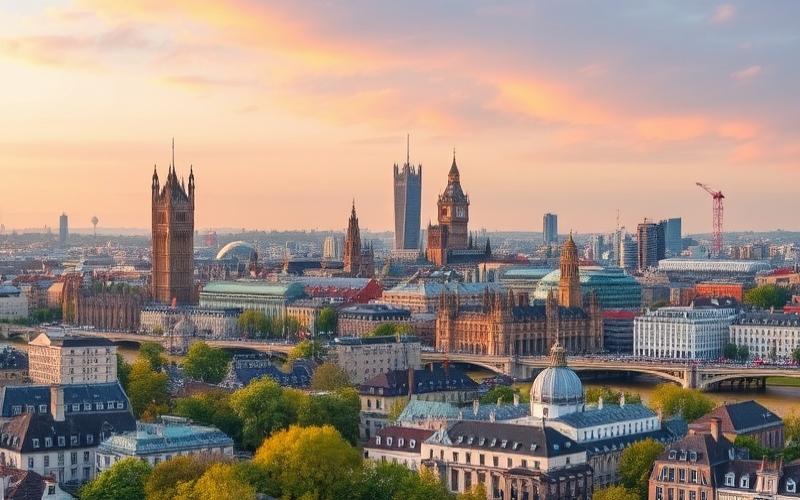
The population is overwhelmingly urban: nearly 85% of inhabitants live in urban areas, and some densely populated corridors, like London and southeastern England, concentrate a disproportionate share of the population and national wealth. Greater London alone has nearly 9.8 million inhabitants, and metropolises like Manchester, Birmingham, Leeds, Glasgow, Liverpool, or Bristol structure a highly developed urban network.
A Complex Administrative Mesh
The administrative geography of the United Kingdom is very intricate. Politically, the country is a unitary state, but composed of four nations with varying degrees of autonomy. England, which does not have its own parliament, is divided into nine large regions for statistics and some administrative purposes (North East, North West, Yorkshire and the Humber, East Midlands, West Midlands, East of England, South East, South West, plus London).
The UK has a complex, nested administrative structure. The entire territory is covered by several layers: counties, boroughs, district councils, communities, and civil parishes. Finer subdivisions exist with ITL2 and ITL3 levels, which roughly correspond to counties and districts. Scotland, Wales, and Northern Ireland each have their own local divisions, such as council areas or principal areas.
A Transportation Network at the Scale of the Archipelago
The physical geography, marked by topography and seas, has influenced the development of a transportation network that combines roads, railways, ports, and airports.
The British road network extends over 420,000 kilometers, including motorways and major roads.
The national rail network, the oldest in the world, represents about 10,000 miles of track in Great Britain, complemented by some 300 kilometers in Northern Ireland. Five main trunk lines with relatively high speed (up to 200 km/h) radiate from London, and a modern high-speed line, High Speed 1, connects the capital to the Channel Tunnel. A vast plan for modernizing and developing rail infrastructure is underway, although some projects, like extensions of the HS2 high-speed line to northern England, have been reassessed.
The airports of London, notably Heathrow, play a global hub role, while major ports like Felixstowe, Southampton, or the Port of London structure maritime traffic, both freight and passenger (ferry lines to Ireland, France, Belgium, the Netherlands, etc.).
Natural Resources and Environmental Challenges
The geography of the United Kingdom is not limited to its landscapes and climate; it also encompasses the distribution of natural resources and the environmental pressures on soils, waters, and biodiversity.
Subsoil Resources and Energy
The subsoil holds a significant variety of mineral resources: coal, oil, natural gas, iron, tin, gold, rock salt, potash, clays (china clay, ball clay), gypsum, limestone, chalk, silica sands, etc. Historically, coal and iron ore provided the material basis for the Industrial Revolution and the massive industrialization of England, Wales, and Scotland.
Today, most hydrocarbons come from the North Sea continental shelf, although oil and gas production has passed its peak and the UK has become a net energy importer again. Significant gas and oil fields also exist in the Irish Sea and along the east coast. Europe’s largest onshore oil field, Wytch Farm, is located in southern England.
Tidal stream power could meet up to 11% of the country’s electricity demand by 2050.
Soil, Water, and Biodiversity
British soils, relatively young as they result from the last glaciation, generally contain between 2 and 5% organic matter. Their acidity varies greatly depending on the terrain: very acidic sandy moors (pH 3.5–5.0), mountain peatlands, calcareous brown soils which are much more basic (pH up to 8.0). Soil quality is, however, threatened by compaction, erosion, and pollution. It is estimated that about 10 million acres of agricultural soil are at high risk of compaction and 5 million acres at risk of erosion, with an annual loss on the order of 3 million tonnes of soil, just from the agricultural sector.
This is the percentage of English agricultural land classified as a Nitrate Vulnerable Zone, imposing constraints on spreading practices.
Biodiversity is severely depleted. An international study ranked the United Kingdom among the most nature-depleted countries, placing it beyond 180th place out of over 200 countries. Ancient deforestation, agricultural intensification, urbanization, and pollution have reduced many species populations. In response, vast areas are protected: national parks, Special Areas of Conservation, Special Protection Areas for birds, Sites of Special Scientific Interest, protected coastal areas, etc. The official goal is now to protect 30% of the country’s land and seas for nature by 2030.
A Territory Shaped by History, Between Land and Sea
The geography of the United Kingdom is not fixed. Since the introduction of agriculture to the British Isles about seven millennia ago, landscapes and land use have been reshaped by human practices. Medieval monasteries, whose vast estates were confiscated during the Dissolution of the Monasteries in the 16th century, left lasting marks on the landholding structure. The system of strip fields with common pastures has barely survived, except in a few rare villages like Laxton in Nottinghamshire.
England’s population nearly tripled between 1750 and 1850, illustrating the population explosion of the era.
Today, the geographical challenges are different but just as structuring: adaptation to climate change, reduction of greenhouse gas emissions (a large portion of which still comes from agriculture, particularly nitrous oxide and methane).
In this composite landscape, the geography of the United Kingdom appears as a subtle balance between sea and land, dense urban areas and vast countryside, cereal plains and mountain ranges, glacial heritage and intense human modification. It is this mix that makes this archipelago a geographical object both complex and fascinating.
Disclaimer: The information provided on this website is for informational purposes only and does not constitute financial, legal, or professional advice. We encourage you to consult qualified experts before making any investment, real estate, or expatriation decisions. Although we strive to maintain up-to-date and accurate information, we do not guarantee the completeness, accuracy, or timeliness of the proposed content. As investment and expatriation involve risks, we disclaim any liability for potential losses or damages arising from the use of this site. Your use of this site confirms your acceptance of these terms and your understanding of the associated risks.
Cyril Jarnias is an independent expert in international wealth management with over 20 years of experience. As an expatriate himself, he is dedicated to helping individuals and business leaders build, protect, and pass on their wealth with complete peace of mind.
On his website, cyriljarnias.com, he shares his expertise on international real estate, offshore company formation, and expatriation.
Thanks to his expertise, he offers sound advice to optimize his clients' wealth management. Cyril Jarnias is also recognized for his appearances in many prestigious media outlets such as BFM Business, les Français de l’étranger, Le Figaro, Les Echos, and Mieux vivre votre argent, where he shares his knowledge and know-how in wealth management.