
 Published on and written by Cyril Jarnias
Situated at the southernmost edge of the Caribbean, the Republic of Trinidad and Tobago occupies a unique geographical position at the junction of the Caribbean basin and the South American continent. This small island nation, often presented as just another Caribbean archipelago, is distinguished by its physical, geological, and biological proximity to Venezuela, of which it is in fact a natural extension. Understanding the geography of Trinidad and Tobago, therefore, means reading a map where Atlantic influences, South American heritage, mountainous terrain, coastal plains, mangroves, coral reefs, and industrial zones related to oil and gas all overlap.
The national territory is mainly comprised of the two islands of Trinidad and Tobago, supplemented by numerous small coastal islands. With a modest land area of 5,128 km², the country, however, controls a vast exclusive economic zone, fifteen times larger. This strategic maritime space includes shipping lanes, fishing areas, undersea hydrocarbon deposits, and coral reefs vulnerable to climate change.
An archipelago south of the Caribbean, at the gates of Venezuela
The geography of Trinidad and Tobago begins with its location: the archipelago lies in the southeastern part of the Lesser Antilles, on the border between the Caribbean Sea and the North Atlantic Ocean. Located between approximately 10° and 11° north latitude and 60° to 62° west longitude, the country is the southernmost of the Caribbean island states. It lies only 11 km off the northeast coast of Venezuela, separated from it by the Gulf of Paria and two narrow channels, the “Dragon’s Mouth” to the northwest and the “Serpent’s Mouth” to the southwest.
Distance in kilometers separating Trinidad and Tobago from Grenada, illustrating the density of the regional neighborhood.
A geological extension of South America
From a geological point of view, the uniqueness is clear: Trinidad rests on the South American continental shelf and was historically attached to the mainland. The island’s terrain extends the Venezuelan coastal ranges, while the sedimentary formations in the south hold significant deposits of oil and natural gas.
Trinidad and Tobago are part of an ancient island arc related to the Caribbean Plate and not the current volcanic arc of the Lesser Antilles, which explains the absence of recent volcanism on these islands.
A small territory, two main islands and a myriad of islets
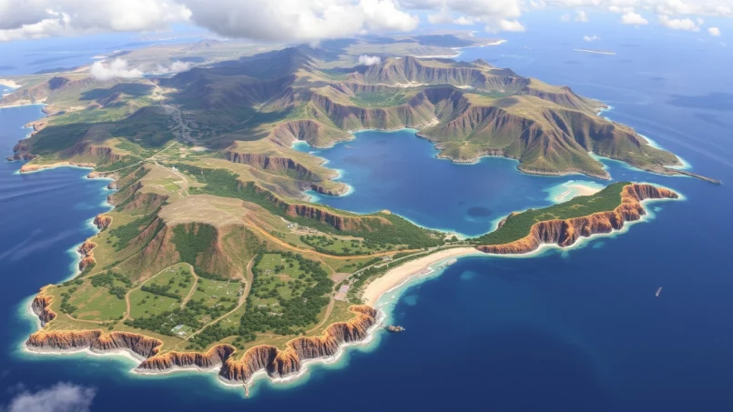
The country’s land territory covers 5,128 km². Trinidad accounts for about 93% of this area with 4,768 km², Tobago for 5.8% with about 300 km², the rest being made up of small islands like Chacachacare, Monos, Huevos, Gaspar Grande (Gasparee), Little Tobago, and Saint Giles Island.
Trinidad, the larger island, is roughly rectangular in shape, about 80 km long and 59 km wide. Tobago, more slender and oriented northeast–southwest, measures nearly 41 km long with a maximum width of about 12 km. The two islands are separated by a sea passage about 37 km wide, where several islets partially enclose the Gulf of Paria on the Trinidad side.
The table below summarizes the key dimensions of the main islands.
| Island | Area (km²) | Share of National Area | Average Length (km) | Maximum Width (km) |
|---|---|---|---|---|
| Trinidad | 4,768 | ~93 % | ~80 | ~59 |
| Tobago | ~300 | ~5.8 % | ~41 | ~12 |
| Little Tobago | 1.2 | < 0.1 % | Small satellite island | — |
| National Total | 5,128 | 100 % | — | — |
Little Tobago, sometimes nicknamed “Bird of Paradise Island,” is a striking example of an insular micro-relief: a star-shaped hill with steep slopes, located about one kilometer off the northeast coast of Tobago.
Trinidad’s Terrain: Three Ranges, Plains, and Swamps
The internal geography of Trinidad is structured by three major terrain groups arranged roughly from west to east: the Northern Range in the north, the Central Range in the center, and the Southern Range in the south, supplemented by a few isolated hills like the Montserrat Hills. These ranges, inherited from South American tectonics, also dictate the flow of rivers and the location of settlements and agriculture.
The Northern Range: Mountainous Backbone
In northern Trinidad, the Northern Range forms a barrier of hills and mountains parallel to the coast. It peaks at El Cerro del Aripo (or Mount Aripo) at 940 meters, the highest point in the country, followed very closely by El Tucuche (936 m). The average altitude of the range is around 460 m, but it features steep slopes, with numerous ravines, waterfalls, and deeply incised valleys, like the Maracas Valley.
Annual precipitation exceeding 3,000 mm on the windward slopes, supporting dense forest and rich biodiversity.
Central and Southern Ranges: Hills and Agricultural Plains
Further south, the Central Range crosses the island diagonally from southwest to northeast. Its altitude is more modest: the highest point, Mount Tamana, reaches about 308 m. It is a belt of folds and thrusts made of younger sedimentary rocks (Cretaceous and Eocene), bordered by Miocene formations on its flanks. At the foot of this range, fertile alluvial plains develop, notably the Caroni Plain between the Northern Range and the Central Range.
The Southern Range and the Trinity Hills, in southern Trinidad, form an area of hills generally under 300 m in altitude. Composed of Miocene sandstones, shales, and clays uplifted during the Pleistocene, this region is crucial for hydrocarbons: the adjacent sedimentary basins contain the island’s main oil and gas deposits. Geological phenomena such as mud volcanoes are also observed here, with Devil’s Woodyard being an example.
Between these ranges lie plains and alluvial valleys, particularly the Caroni Plain, the historic heart of the sugar industry, and the central plains where soils, a mix of fine sands and heavy clays, offer good agricultural potential when well-drained.
Swamps, Reservoirs, and Coastlines
The coastal lowlands host vast wetlands. In the northwest, the Caroni Swamp extends between the Northern Range and the Gulf of Paria coast, forming a labyrinth of mangroves, channels, and mudflats. To the east, the Nariva Swamp occupies a broad coastal basin open to the Atlantic. These two swamps play a major role in biodiversity (water birds, manatees, fish) but also in coastal protection against erosion and storms.
Overview of the main reservoirs and rivers of the island of Trinidad, essential for drinking water supply and irrigation.
The Hollis, Navet, and Caroni dams are developed for drinking water supply to urban areas and agricultural irrigation.
The Ortoire (about 50 km) in the southeast and the Caroni (about 40 km) in the northwest are the longest, draining the southern and central parts of the island.
Trinidad’s rivers are numerous but short, flowing directly from the highlands to the sea.
Along the coasts, diversity is equally marked: long, straight beaches pounded by Atlantic waves to the east (Manzanilla Beach), more sheltered coves in the Gulf of Paria to the west, cliffs, and remote coves to the north. In the southwest, a completely unique site attracts attention: Pitch Lake, the world’s largest natural deposit of asphalt, a vast expanse of semi-solid bitumen exposed at the surface.
Tobago: A Mountain Ridge and Coral Reefs
While Trinidad concentrates most of the population and industrial activity, Tobago has a more compact geography, dominated by a single mountainous massif, the Main Ridge, paired with a coral platform in the southwest. This simple organization explains the stark contrast between a very wooded, humid eastern half and a drier, more urbanized southwestern half open to beach tourism.
The Main Ridge and Pigeon Peak
The Main Ridge runs across Tobago from northeast to southwest for nearly 30 km. This mountain ridge peaks at Pigeon Peak, the highest point on the island at about 550 m in altitude. The slopes feature deep, fertile valleys, largely occupied by forest and a few rural villages. Rivers there are short, descending rapidly to the sea.
Tobago’s forest reserve is one of the oldest protected reserves in the Western Hemisphere. This long-standing protection has helped maintain significant forest cover and diverse fauna, including forest birds, bats, and reptiles and amphibians typical of humid tropical ecosystems. However, the island’s species richness is slightly lower than Trinidad’s, due to its smaller size and greater geographical isolation from the South American mainland.
The Coral Platform and Southwest Beaches
At the southwestern tip of Tobago, the geography changes abruptly: the Main Ridge slopes down to a low coral platform, on which lies the island’s main town, Scarborough, as well as major tourist areas such as Pigeon Point or Store Bay. The coastline here is marked by white sand beaches, turquoise lagoons, seagrass beds, and coral reefs, among which the famous Buccoo Reef.
These reefs play a protective barrier role against swells and storms, while harboring exceptional marine biodiversity (corals, reef fish, sea turtles). However, they are weakened by warming waters, ocean acidification, land-based pollution, and poorly managed tourism practices.
The following table illustrates some contrasting physical characteristics between Trinidad and Tobago.
| Characteristic | Trinidad | Tobago |
|---|---|---|
| Dominant Terrain | Three ranges (Northern, Central, Southern) | Single Main Ridge |
| Highest Point | El Cerro del Aripo – 940 m | Pigeon Peak – 550 m |
| Main Wetlands | Caroni Swamp, Nariva Swamp | Some coastal marshes, more limited |
| Coral Reefs | Present, but less iconic | Buccoo Reef, Little Tobago reefs, etc. |
| Coastal Plains | Extensive, especially in center and south | Main plain in southwest |
| Geological Origin | Extension of the Venezuelan coast | Segment of an ancient island arc |
Tropical Maritime Climate: Two Seasons and a “Little Dry Season”
The climate of Trinidad and Tobago is of a tropical maritime type, essentially rhythm by the alternation of a dry season and a wet season, under the influence of the northeast trade winds and the seasonal movement of the Intertropical Convergence Zone. The country’s very southern position largely spares it from the direct path of the most powerful hurricanes, although Tobago has already suffered destructive episodes.
A Year Divided into Dry and Rainy Seasons
Across the archipelago, two main periods are clearly distinguished:
– a dry season that generally extends from January to May;
– a rainy season from June to December.
During the dry season, conditions are dominated by relatively dry maritime air, moderate to strong winds, hot days, and cooler nights. Precipitation occurs mainly in the form of late-afternoon convective showers. In some interior regions of Trinidad, drought can be felt, especially in case of prolonged rainfall deficit.
In the wet season, the atmosphere becomes more humid and unstable, with weak surface winds and frequent rains due to equatorial disturbances like tropical waves or low-level convergence. The rainy season generally extends from June to December, but peaks of intensity vary geographically: the Piarco region, near Port of Spain, experiences its maximum rainfall in August, while Tobago records its peak in November.
A phenomenon locally called “Little Dry Season” or “Petit Careme” is also observed: a short period of relative rainfall calm that often occurs between mid-September and mid-October, right in the middle of the wet season, and which in some ways resembles a mini dry season.
High but Little-Varying Temperatures
In this tropical context, temperatures remain generally high throughout the year. Annual averages hover around 26°C, with limited seasonal variation. In Trinidad, the average daily temperature varies approximately from 25°C in February to 29°C in April. The hottest months are generally April, May, and September–October, with average highs around 32–33°C. The warmest nights often occur in May–June (in Trinidad) and May–September (in Tobago).
Extreme minimum temperature ever recorded in Trinidad and Tobago (in degrees Celsius).
The day/night contrast is often more marked than the seasonal variation, with hot days giving way to more pleasant evenings, especially in the dry season.
Contrasted Rainfall and Influence of Terrain
Average annual precipitation varies considerably by location. Trinidad receives on average about 2,100 mm of rain per year, but the Northern Range can record up to 3,800 mm on its windward slopes. The west and some central plains are drier, receiving more between 1,700 and 2,000 mm.
Tobago is slightly wetter on average, around 2,500 mm, but again the distribution is uneven: the slopes of the Main Ridge capture much of the precipitation, while the southwestern plain is drier, which has implications for water management and tourism pressures.
This is the record for monthly rainfall, measured at Piarco in October 1988 (in millimeters).
Hurricanes, Storms, and Climate Change
Even though the country lies south of the main Atlantic cyclone tracks, it is not immune to storms. Tobago was hard hit by Hurricane Flora in 1963, which caused loss of life and destroyed a significant portion of crops and infrastructure. More modest tropical storms, like Alma (1974) or Bret (1993), have also affected Trinidad.
To these meteorological risks are now added the effects of climate change: a gradual rise in air and sea temperatures, sea-level rise (estimated between 1 and 4 mm/year depending on Trinidad’s coasts), projected intensification of extreme rainfall, potential lengthening of the dry season, and more pronounced drought episodes. These trends particularly threaten low-lying coastal areas, mangroves, coral reefs (bleaching), and freshwater supply.
A Biodiversity with a South American Imprint
The geography of Trinidad and Tobago is not limited to its terrain and climate: it is also reflected in an exceptionally rich biodiversity, more closely related to that of neighboring Venezuela than to most other Caribbean islands. This richness stems from the ancient land connection with the continent and the diversity of habitats present in a relatively small territory.
Forests, Savannas, Mangroves, and Reefs
Approximately 40% of the territory is still forested, a notable level for a small, densely populated, and highly industrialized state. Several major types of terrestrial and coastal ecosystems are distinguished:
– humid lowland and montane forests (Northern Range, Main Ridge in Tobago);
– dry forests and xeric shrublands (especially on exposed slopes or poorer soils);
– natural savannas, remnants of ancient open landscapes;
– coastal mangroves, notably in the Caroni and Nariva swamps;
– karst ecosystems, areas of limestone rock with caves and sinkholes;
– anthropogenic environments: agricultural land, plantations, fallow land, urban areas, and retaining dams.
Trinidad and Tobago count approximately 3,300 species of vascular plants, of which 59 are endemic. Nearly 350 tree species coexist, adapted to different environments like ridges or plains. One species, the manchineel, is particularly toxic and can grow on beaches, requiring increased vigilance from residents and visitors.
Coastal areas complement this picture with coral reefs, seagrass beds, sandy and rocky seabeds, harboring a varied marine fauna: more than 950 species of fish, sea urchins, starfish, manta rays, dolphins, occasionally whale sharks, but also invasive species like the lionfish (Pterois), which threatens the ecological balance of reefs.
Terrestrial Fauna: Birds, Mammals, Reptiles, and Amphibians
Faunistically, Trinidad and Tobago is a haven for ornithologists. Approximately 472 species of birds have been identified, including two endemics. The country has at least 17 species of hummingbirds, from the tiny tufted coquette to more common garden species. The scarlet ibis, which gathers in spectacular flocks at dusk in the Caroni Swamp, is one of the national symbols. In Tobago, the cocrico, a galliform bird, is also emblematic.
The Caroni and Nariva swamps are crucial wetlands for biodiversity. They harbor a great variety of birds like herons, egrets, terns, and migratory species. The Nariva Swamp is also the habitat of threatened mammals, notably the Antillean manatee, a critically endangered species on a regional scale.
Among mammals, about a hundred species are recorded: the ocelot (a spotted small cat), the collared peccary (quenk), the red-rumped agouti, the lowland paca (lappe), the red brocket deer, the neotropical otter, several monkeys (white-faced capuchin, red howler monkey), and some 70 species of bats. The latter group illustrates well the biogeographic link with South America.
Reptiles are also well represented: five species of sea turtles nest on the beaches, including the leatherback, which comes to lay eggs in large numbers on some Trinidad sites, like Matura Beach. Also found are the green anaconda, the boa constrictor, the spectacled caiman, as well as at least 47 species of snakes, of which only four are highly venomous, and only on the island of Trinidad.
Regarding amphibians, remarkable species like the golden tree frog or the Trinidad poison frog inhabit the misty forests of the Northern Range. Overall, the country is home to around 30 species of amphibians.
The table below provides an overview of known biological diversity.
| Biological Group | Approximate Number of Species | Notable Particularities |
|---|---|---|
| Vascular Plants | ~3,300 | 59 endemic, ~350 tree species |
| Birds | ~472 | 2 endemic, 17 hummingbird species, scarlet ibis |
| Mammals | ~100 | Ocelot, manatee, monkeys, 70 bat species |
| Reptiles | ~90 | 5 sea turtles, anaconda, caiman, iguanas |
| Amphibians | ~30 | Golden tree frog, Trinidad poison frog |
| Freshwater Fish | ~50 | Short but varied river fauna |
| Marine Fish | ≥950 | High reef and pelagic diversity |
Human Pressures and Deforestation
Despite this richness, the nature of Trinidad and Tobago is under pressure. Land use changes constitute a major factor in the erosion of biodiversity. Between 1990 and 2010, the country is estimated to have lost about 6.2% of its forest cover, or nearly 15,000 hectares. The share of land with more than 30% tree cover is thus thought to have decreased compared to the 74% estimated in 1990. The loss of primary forest is estimated at over 27% over certain periods.
Deforestation is primarily caused by agricultural expansion (for local or export crops like cocoa and palm oil), urbanization, road infrastructure development, and illegal logging. Dry forests and savannas, sometimes underestimated, are particularly affected by these phenomena.
In coastal areas, industrialization has left a marked imprint, notably in the Gulf of Paria and around petrochemical complexes. The construction of terminals, wharves, and basins, combined with pollution and land reclamation, has destroyed or severely degraded mangroves. Coastal swamps sometimes serve as dumps, accumulating plastics, hydrocarbons, and other contaminants.
Marine threats are no less: overfishing, destructive practices, land-based pollution (agricultural runoff, sewage), industrial discharges, warming and ocean acidification are undermining coral reefs and seagrass beds, which are crucial for fishing, shoreline protection, and tourism.
Human Settlement, Cities, and Coastlines
The human geography of the country is largely structured by the distribution of terrain and the presence of low coastal areas. Approximately 70% of the population lives in the coastal zone, which also concentrates nearly 81% of economic activity. Major cities and main industrial centers are located on coastal plains or plateaus near the sea, which accentuates their vulnerability to sea-level rise, coastal erosion, and flooding.
Main Urban Areas and Administrative Structures
The country’s political and economic center, Port of Spain, is located on the northwest coast of Trinidad, on the edge of the Gulf of Paria and at the foot of the Northern Range. It is the capital and main commercial port, surrounded by densely populated suburbs and neighborhoods that extend along the east–west corridor.
Further south, still on the west coast of Trinidad, San Fernando is another major port city, linked to the history of the oil industry and the distribution of petroleum products. Chaguanas, in the center of the island, has become the largest urban area by population, marked by strong urban and commercial growth. Other important centers like Arima, Tunapuna–Piarco, or Couva structure the urban network.
The main island of Trinidad is divided into 14 local government entities (cities, boroughs, and regions). The island of Tobago, for its part, has its own local government, the Tobago House of Assembly, composed of 15 electoral districts. Its main town, Scarborough, located on the south coast, concentrates administrative activities and a large part of maritime traffic.
A Predominantly “Trinidadian” People
Approximately 1.4 to 1.5 million people live in Trinidad and Tobago, the vast majority (about 96%) on the island of Trinidad and only 4% in Tobago. The country has a pronounced urban demographic profile: more than half the population lives in urban or suburban areas, often in the form of linear villages along main roads.
This strong demographic concentration in coastal corridors and alluvial plains poses major planning challenges: flood risk, landslides in sloped areas, pressure on mangroves and beaches, water and sanitation needs.
Natural Resources and Economic Geography
The geography of Trinidad and Tobago is also that of a subsoil exceptionally rich in hydrocarbons, a natural asphalt lake, aggregate quarries, forests producing timber, and a sea rich in fishery resources. This abundance has shaped an economic model very different from that of most Caribbean islands.
An Oil and Gas Subsoil
The south of Trinidad is traversed by a vast oil belt that extends offshore, into the Gulf of Paria and towards the Atlantic. The Miocene and Pliocene sediments of the southern plains cover significant reserves of crude oil and natural gas. Cumulative oil production has already exceeded three billion barrels, and proven crude reserves are estimated at about 0.7 billion barrels. Natural gas reserves, meanwhile, are measured in hundreds of billions of cubic meters.
This wealth has allowed Trinidad and Tobago to become, over time, the leading producer of oil and natural gas in the Caribbean, and a major exporter of liquefied natural gas (LNG), ammonia, and methanol. Large industrial facilities – liquefaction complexes, petrochemical plants, steel mills – occupy the coastline, notably at Point Lisas, Point Fortin, Pointe-à-Pierre, or Brighton.
Pitch Lake, in southwestern Trinidad, is a case apart: this natural asphalt lake, the largest in the world, has been exploited since the 19th century and remains both a geological curiosity and an industrial resource.
Agriculture, Fishing, and Services
Despite the overwhelming importance of hydrocarbons in GDP and exports (up to 80% of export revenues in some years), the country’s economic geography also includes agricultural and fishery activities, albeit of more limited weight. The fertile plains of the Caroni Plain and central Trinidad host crops of sugarcane (in decline), cocoa, coffee, rice, citrus, and various vegetables. The share of agriculture in GDP remains low, but it represents a strategic issue in a context of economic diversification and food security.
Fishing, a vital activity for many coastal communities, is directly dependent on the health of marine ecosystems. Coral reefs, mangroves, and seagrass beds play a crucial role as breeding and nursery grounds for many fish and crustacean species. Preserving these natural habitats is therefore essential to ensure the sustainability of fishery resources and the livelihoods of families that depend on them.
Tobago, for its part, relies more on tourism and services, taking advantage of its beaches, Buccoo Reef, its mountainous forests, and its image as a more tranquil island than Trinidad. The warm climate, beach landscapes, and proximity to major source markets (North America, Europe) make it a popular destination, even though tourism there remains less massive than in other Caribbean islands.
Geography and Climate Change: Between Vulnerability and Adaptation
The geographical configuration of Trinidad and Tobago – high concentration of human and economic activity in coastal zones, dependence on coastal and marine resources, importance of industrial infrastructure by the sea – makes the country particularly sensitive to the effects of climate change.
Coastal and Marine Threats
Sea-level rise, already measurable on Trinidad’s coasts (on the order of 1 to 4 mm/year depending on the sector), accentuates beach erosion, causes saline intrusion into aquifers, and increases the risk of flooding in low-lying coastal plains, where cities, refineries, port terminals, and power plants are nonetheless located.
Storms and cyclones, even when they do not strike directly, can generate storm surges that inundate coastlines, damage mangroves, and weaken infrastructure. Furthermore, the increase in sea surface temperature leads to coral bleaching events, which threaten reefs like Buccoo, with cascading consequences for fishing and tourism.
Coastal water pollution is a structural problem, caused by plastic waste, hydrocarbons, industrial effluents, and sewage. These pressures, combined with the impacts of climate change, severely compromise the resilience of ecosystems.
Pressure on Water, Agriculture, and Health
Inland, changes in precipitation patterns – more intense downpours, but also longer dry periods – can destabilize the water cycle. Reservoirs and rivers are subject to more extreme alternations of floods and low flows, complicating the management of drinking water and irrigation. Agriculture, already marginal in the economy, is on the front line facing climate hazards: pest attacks favored by heat, increased water stress, drier soils.
Episodes of extreme heat and increased concentrations of Saharan dust in the atmosphere – frequent between May and July – also have health consequences, particularly for vulnerable people (respiratory illnesses, heat stroke, etc.).
Adaptation and Transition Policies
Aware of this vulnerability, the country has adopted a series of national policies: a development strategy called Vision 2030, a National Climate Change Policy, a carbon emissions reduction strategy, a nationally determined contribution (NDC) under the Paris Agreement, and above all a first National Adaptation Plan published in 2023, which also serves as the first adaptation communication to the UNFCCC.
Greenhouse gas emission reduction target by 2030 relative to a business-as-usual scenario for industry, electricity, and transport (percentage).
In the energy sector, targets have been announced to increase the share of renewable energy, notably solar, even if achievements remain modest compared to the predominance of natural gas in electricity generation. Pilot projects for rooftop photovoltaic panels and charging infrastructure for electric vehicles, however, testify to a desire for diversification.
A Geography in Tension Between Nature, Industry, and Sea
The geography of Trinidad and Tobago is one of a delicate balance between a lush tropical nature, a subsoil exceptionally rich in hydrocarbons, densely populated coasts, and a vast, strategic maritime space. On a Caribbean scale, few states combine so many contrasts: forested mountains reminiscent of the Andes, ancient sugar-growing alluvial plains, coastal swamps that are bird sanctuaries, coral reefs prized by divers, industrial ports weighing heavily in global energy trade.
This archipelago benefits from a crossroads position, ecological diversity, and mineral wealth. However, it is highly vulnerable to climate change and human pressure. Its future will depend on land-use planning, ecosystem protection, economic diversification, and adaptation choices made in the coming decades.
Disclaimer: The information provided on this website is for informational purposes only and does not constitute financial, legal, or professional advice. We encourage you to consult qualified experts before making any investment, real estate, or expatriation decisions. Although we strive to maintain up-to-date and accurate information, we do not guarantee the completeness, accuracy, or timeliness of the proposed content. As investment and expatriation involve risks, we disclaim any liability for potential losses or damages arising from the use of this site. Your use of this site confirms your acceptance of these terms and your understanding of the associated risks.

Cyril Jarnias is an independent expert in international wealth management with over 20 years of experience. As an expatriate himself, he is dedicated to helping individuals and business leaders build, protect, and pass on their wealth with complete peace of mind.
On his website, cyriljarnias.com, he shares his expertise on international real estate, offshore company formation, and expatriation.
Thanks to his expertise, he offers sound advice to optimize his clients' wealth management. Cyril Jarnias is also recognized for his appearances in many prestigious media outlets such as BFM Business, les Français de l’étranger, Le Figaro, Les Echos, and Mieux vivre votre argent, where he shares his knowledge and know-how in wealth management.





