
 Published on and written by Cyril Jarnias
Located in Southeast Asia, Vietnam stretches along the South China Sea, offering a diverse landscape that ranges from spectacular northern mountains to picturesque southern beaches.
This country, rich in history, combines natural splendor with a unique cultural heritage, from the enchanting Sapa Valley with its terraced rice fields to the dynamic and fertile Mekong Delta.
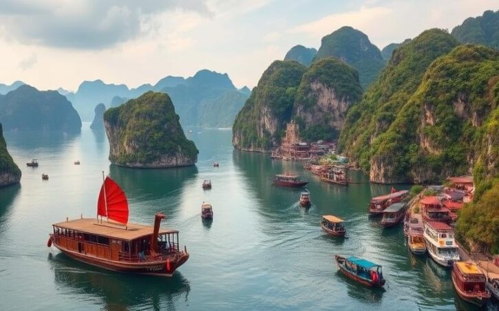
Dominated by the legendary Red River and the impressive karst formations of Ha Long Bay, Vietnam enchants with its stunning geographical contrasts and remarkable biodiversity, making it a true treasure for lovers of breathtaking landscapes and varied ecosystems.
Geographical Location of Vietnam
Vietnam is located east of the Indochinese Peninsula, in the heart of Southeast Asia, between latitudes 8°30′ and 23°22′ north and longitudes 102°10′ and 109°30′ east.
Land Borders
- China to the north
- Laos to the west
- Cambodia to the southwest
Maritime Border
Over 3,200 km of coastline borders the South China Sea (also called the “East Sea”), the Gulf of Tonkin to the north, and the Gulf of Thailand to the south.
The country stretches approximately 1,650 km from north to south, and its width varies from 600 km in the north to just 50 km in the center, giving the territory a particularly pronounced elongated “S” shape.
| Geographical Element | Characteristics |
|---|---|
| Area | 331,698 km² |
| N-S Length | 1,650 km |
| Min/Max Width | 50 km / 600 km |
| Coastline Length | approx. 3,260 km |
| Highest Point | Mount Fansipan (3,143 m) |
| Main Regions | North (Tonkin), Central (Annam), South (Cochinchina) |
The Major Deltas
Two major deltas structure the territory and play a major role:
Red River Delta (North)
Around Hanoi, it is densely populated, very fertile, and constitutes a historical and cultural cradle of the country.
Mekong Delta (South)
Around Ho Chi Minh City, it is one of Vietnam’s main agricultural regions, particularly for rice cultivation and aquaculture.
Other Major Geographical Features
Relief
The country is composed of two-thirds mountains and plateaus (notably the Annamite Range in the center and the Central Highlands), while plains are concentrated around the deltas.
Islands and Archipelagos
Vietnam controls numerous islets, including the disputed Paracel (Hoàng Sa) and Spratly (Trường Sa) archipelagos.
Climate and Geographical Influences
Vietnam is subject to a tropical monsoon climate, with abundant rainfall, strong winds, and frequent typhoons.
The elongated topography creates significant climatic variations between the north, center, and south, influencing agriculture, biodiversity, and regional lifestyles.
Key Strategic Cities
| City | Geographical and Strategic Role |
|---|---|
| Hanoi | Political capital, located in the heart of the Red River Delta, historical and cultural center of the north |
| Ho Chi Minh City | Economic capital, located in the Mekong Delta, nerve center of the south and the national economy |
| Haiphong | Main seaport in the north |
| Da Nang | Central city, crossroads between north and south, access to the sea |
These cities are located in or near the major deltas and key communication axes, reinforcing their importance in Vietnam’s economy, culture, and logistics.
Good to know:
Located in Southeast Asia, Vietnam shares its land borders with China to the north, Laos and Cambodia to the west, and has a vast coastline along the South China Sea to the east, which promotes maritime trade. The country’s elongated shape, stretching from north to south, includes key regions like the fertile Mekong and Red River deltas, which are essential for agriculture; Hanoi in the north and Ho Chi Minh City in the south are major economic and cultural hubs.
Summary
Vietnam, a Southeast Asian country with a long, “S”-shaped form, stretches 1,650 km from north to south between China, Laos, Cambodia, and the South China Sea. Its geography, dominated by two major deltas (Red River in the north, Mekong in the south), a long coastline, and mountains covering two-thirds of the territory, profoundly influences its climate (tropical monsoon), economy (agriculture, fishing, ports), and culture (regional diversity, importance of Hanoi and Ho Chi Minh City).
The Main Regions of Vietnam
Vietnam is structured into eight main regions that play a crucial role in its economic, social, and cultural organization. This regional division facilitates administrative management, development planning, and the promotion of local identities, while fostering national cohesion. The regions are: Northwest, Northeast, Red River Delta, North Central Coast, South Central Coast, Central Highlands, Southeast, and Mekong Delta.
| Region | Area (km²) | Population (2015) | Main Provinces |
|---|---|---|---|
| Northwest | 44,301 | 4,446,800 | Lao Cai, Son La, Dien Bien |
| Northeast | 50,684 | 8,568,200 | Ha Giang, Cao Bang, Quang Ninh |
| Red River Delta | 14,957 | 19,714,300 | Hanoi, Haiphong, Nam Dinh |
| North Central Coast | 51,456 | 10,472,900 | Thanh Hoa, Nghe An, Hue |
| South Central Coast | 44,377 | 9,185,000 | Da Nang, Nha Trang |
| Central Highlands | 54,641 | 5,607,900 | Gia Lai, Dak Lak, Lam Dong |
| Southeast | 23,591 | 16,127,800 | Ho Chi Minh City, Bien Hoa |
| Mekong Delta | 40,576 | 17,590,400 | Can Tho, My Tho, Soc Trang |
Descriptions and Geographical Characteristics of the Regions
- Northwest: Mountainous region, known for its high peaks (Mount Fansipan, 3,143 m), temperate to cool climate, dense forests, and terraced rice fields. Low density, strong presence of ethnic minorities. Sapa and Dien Bien Phu are major tourist hubs.
- Northeast: Rugged terrain, mountains and valleys, humid subtropical climate. Varied ecosystems, caves (Ba Be), forests. Ha Giang attracts for its karst landscapes, Quang Ninh for Ha Long Bay.
- Red River Delta: Fertile plain, humid subtropical climate. Historical and cultural cradle, high density. Hanoi, political and intellectual capital, Haiphong, industrial port. Sites: Perfume Pagoda, ancient imperial city of Hoa Lu.
- North Central Coast: Narrow coastal strip, mountainous relief to the west, tropical climate with typhoon season. Cities like Hue (World Heritage), Thanh Hoa, and Vinh. Beaches, lagoons, and historical sites (imperial citadel, tombs).
- South Central Coast: Coastal, alternating plains and mountains. Tropical climate, renowned beaches (Nha Trang, Da Nang), seaside resorts. Da Nang, economic and technological hub, Hoi An, historic city.
- Central Highlands: Volcanic plateaus, temperate climate, forests, coffee plantations. Mixed population with ethnic minorities. Dalat, tourist city with a cool climate, and Buon Ma Thuot, coffee capital.
- Southeast: Plain, tropical climate, high urbanization. Ho Chi Minh City, the country’s economic and financial center, Ba Ria-Vung Tau, oil port. Attractive for industry, finance, and services.
- Mekong Delta: Alluvial plain, canal network, tropical climate. “Rice bowl” of Vietnam, large rural population. Can Tho, logistics and commercial center. Natural sites: flooded forests, floating markets, islands.
Main Cities and Their Roles
- Hanoi: Capital, political, cultural, and educational center.
- Ho Chi Minh City: Economic metropolis, industrial, financial, and cultural hub.
- Da Nang: Port city, technological innovation, beach tourism.
- Can Tho: Center of the Mekong Delta, logistics and agriculture.
- Hue: Historical capital, World Heritage site.
- Haiphong: Major industrial port.
Major Tourist Attractions by Region
- Northwest: Sapa, Fansipan, ethnic villages
- Northeast: Ha Long Bay, Ha Giang Loop
- Red River Delta: Perfume Pagoda, Hanoi Old Quarter
- North Central Coast: Hue Citadel, Thuan An beaches
- South Central Coast: Nha Trang beaches, Hoi An Ancient Town
- Central Highlands: Tuyen Lam Lake, coffee plantations in Buon Ma Thuot
- Southeast: Saigon Colonial District, Cu Chi Tunnels
- Mekong Delta: Cai Rang Floating Markets, Tra Su Bird Sanctuary
Economic and Cultural Interactions
Interregional exchanges are intense: agricultural products from the Mekong Delta to urban centers, worker flows from rural regions to Ho Chi Minh City and Hanoi.
Festivals, culinary practices, and crafts circulate and strengthen national identity.
Transport infrastructure (roads, railways, ports) connects the regions, promoting integration.
Challenges and Opportunities of Regional Development
Challenges
- Economic inequalities between coastal/urban regions and mountainous/rural areas
- Rapid urbanization, pressure on urban services
- Environmental degradation: soil erosion, river pollution, rising sea levels in the Mekong Delta
- Vulnerability to natural disasters (typhoons, floods)
Opportunities
- Investments in infrastructure (roads, ports, energy)
- Promotion of tourism and sustainable agriculture
- Development of renewable energy in rural areas
- Government policies: poverty reduction programs, investment incentives in disadvantaged regions
Recent Statistics
- Urbanization rate: over 38% in 2025
- National economic growth: +6.5% in 2024, with the Southeast and Mekong Delta as main drivers
- Agricultural exports: the Mekong Delta accounts for over 50% of national rice production
Stakes for National Unity
Regional integration, the circulation of goods and people, and the promotion of cultural diversity remain essential levers for Vietnam’s cohesion and development.
Good to know:
Vietnam is divided into 8 major regions, each with unique geographical characteristics like the mountains of the Northwest or the fertile Mekong Delta, influencing their economic and cultural roles. Policies aim to reduce regional disparities, balancing urbanization with ecosystem preservation, notably through projects in the Red River Delta and the Central Highlands.
Major Vietnamese Cities
Hanoi, Ho Chi Minh City, Da Nang, and Hai Phong are the main urban centers of Vietnam, each with distinct geographical, economic, and cultural characteristics.
| City | Population (2024) | Area (km²) | GDP per capita (USD) | Economic and Cultural Role |
|---|---|---|---|---|
| Hanoi | 8.7 million | 3,359 | 4,109 | Political capital, administrative and cultural center |
| Ho Chi Minh City | 9.4 million | 2,095 | 6,770 | Economic capital, industrial and financial hub |
| Da Nang | ≈1.2 million | 1,285 | ~4,400 | Seaport, industrial hub of Central Vietnam |
| Hai Phong | ≈2.1 million | 1,527 | ~3,800 | Main port in the north, industrial zone |
Hanoi
- Located in the north, on the banks of the Red River.
- Political and administrative center of the country, housing government institutions, universities, and national museums.
- Strong growth of the middle class, dynamism in real estate and services.
- Major tourist sites: Old Quarter, Ho Chi Minh Mausoleum, Hoan Kiem Lake, historical pagodas.
- Challenges: urban congestion, air pollution, pressure on infrastructure due to rapid urbanization.
Ho Chi Minh City
- Located in the south, on the Mekong Delta, a river, road, and air crossroads.
- Vietnam’s leading economic hub, accounting for about 16% of national GDP and driving industrialization.
- Key sectors: industry, finance, commerce, high technology (Saigon Hi-Tech Park).
- Cosmopolitan city, cultural diversity, vibrant nightlife, colonial monuments, markets, museums, modern towers.
- Massively attracts migrants and foreign investors, fostering innovation but increasing demographic pressure.
- Challenges: overpopulation, chronic traffic jams, air and water pollution, waste management, flood risks.
Da Nang
- Located on the central coast, between Hanoi and Ho Chi Minh City, near mountains and the sea.
- Third-largest city in the country, deep-water port, industrial, logistics, and tourism center.
- Strong growth driven by tourism (beaches, Marble Mountains, Dragon Bridge, proximity to Hoi An and Hue).
- Pioneer in smart cities, development of modern infrastructure.
- Challenges: rapid urbanization, sustainable coastal management, pressure on natural resources.
Hai Phong
- Major port in the north, on the Gulf of Tonkin.
- Second-largest port in the country, industrial and logistics platform, specialized in shipbuilding, automotive, and agri-food.
- Connected to Hanoi by highway and railway, key role in northern exports.
- Tourist attractions: colonial center, Du Hang Pagoda, Cat Ba Island (near Ha Long Bay).
- Challenges: industrial pollution, water sanitation, renewal of port infrastructure.
Common Challenges for Major Vietnamese Cities
- Rapid and sometimes unplanned urbanization, high population density.
- Increasing air and water pollution.
- Strained transport and housing infrastructure.
- Increased risks related to climate change (floods, sea-level rise).
- Need for sustainable urban planning and innovative solutions for the environment and quality of life.
Demographic and Economic Evolution
These urban centers are experiencing sustained population growth, fueled by rural exodus and economic dynamism. The national urbanization rate has exceeded 70% in some regions, compared to about 37% nationally twenty years ago. The rise of the middle class, openness to investment, and infrastructure development explain the dynamism of these metropolises.
Key takeaway: These cities concentrate most of the development but must address significant urban challenges to ensure balanced and sustainable growth.
Good to know:
Hanoi is Vietnam’s vibrant capital, harmoniously blending tradition and modernity, while Ho Chi Minh City, the country’s economic engine, experiences rapid growth with urban challenges like overpopulation.

Cyril Jarnias is an independent expert in international wealth management with over 20 years of experience. As an expatriate himself, he is dedicated to helping individuals and business leaders build, protect, and pass on their wealth with complete peace of mind.
On his website, cyriljarnias.com, he shares his expertise on international real estate, offshore company formation, and expatriation.
Thanks to his expertise, he offers sound advice to optimize his clients' wealth management. Cyril Jarnias is also recognized for his appearances in many prestigious media outlets such as BFM Business, les Français de l’étranger, Le Figaro, Les Echos, and Mieux vivre votre argent, where he shares his knowledge and know-how in wealth management.





