
 Published on and written by Cyril Jarnias
The country may not appear large on the map of Central America, but it packs an astonishing diversity of landscapes. From mountains blanketed in humid forests to the vast limestone plains of the north, from coastal savannas to the world’s second-largest barrier reef, Belize’s geography shapes its agriculture, population distribution, climate risks, and national economy.
Beyond its beaches and dive sites, the territory is characterized by the interweaving of its terrain, climate, soils, forests, rivers, and reefs. This diversity creates great ecological wealth but also makes the landscape extremely vulnerable to storms, floods, and human pressures.
A Small Country, a Great Variety of Environments
Belize occupies the southeastern part of the Yucatán Peninsula, on the Caribbean coast of Central America. The country is an elongated quadrilateral stretching north to south, approximately 280 to 290 km (174 to 180 miles) long with a maximum width of about one hundred kilometers. Its land area is around 22,800 to 22,960 km² (8,800 to 8,864 sq mi), to which are added lagoons, coastal wetlands, and over a thousand coral islets – the famous cayes.
Belize has a coastline of approximately 386 km (240 miles) along the Caribbean Sea.
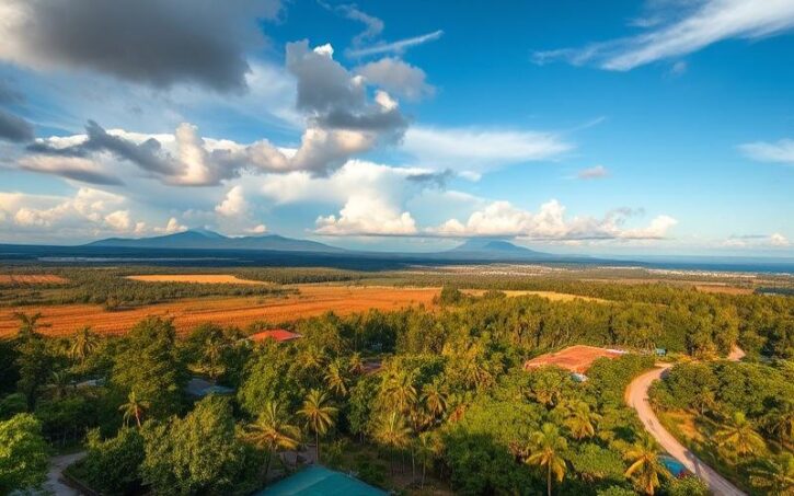
This location immediately creates two major physical regions. On one side, the low limestone lands of the north and the marshy coastal plains, traversed by slow rivers and bordered by mangroves. On the other, the Maya Mountains massif and its associated plateaus, which occupy the southern and central half of the country. Between these two blocks, a mosaic of forests, savannas, wetlands, and agricultural land completes the picture.
Terrain: From the Northern Lowlands to the Maya Mountains
The terrain of Belize is clearly divided into two major physiographic regions. This duality explains both the distribution of agricultural soils and the location of forests, villages, and roads.
The Plains and Lowlands of the North
The northern half is largely composed of low-lying plains, rarely exceeding 250 m (820 ft). This zone rests on the relatively stable tectonic platform of the Yucatán, made primarily of hard limestone. The landscape here remains generally flat, with large areas of marsh, grassy savannas, and sparse forests.
The northern coast and the area around Belize City are characterized by vast expanses of mangroves and coastal swamps. Moving inland from the sea, these wetlands give way to tropical pine savannas, then to broadleaf forests. The region is carved by many slow-flowing waterways, such as the New River which meanders toward Chetumal Bay, and by the 18 major river systems that drain the entire lowlands.
In these flat landscapes, flooding is a major risk. Approximately 62% of inhabited settlements are located in areas at high risk of flooding, often within the floodplains themselves. Nearly half the population lives at low elevations, highly exposed to tropical storms, storm surges, and rising water tables.
The Maya Mountains and the Highlands
The southern and central half of the country is dominated by the Maya Mountains, an ancient mountainous block extending eastward from the highlands of Guatemala. This massif forms a horst of Paleozoic rocks – granites, schists, quartzites – flanked by sedimentary basins. The peaks rise to around 1,100 m (3,600 ft), with the highest point, Doyle’s Delight, at 1,124 m (3,688 ft) in the Cockscomb Range. Victoria Peak, another iconic summit, reaches just over 1,120 m (3,675 ft).
The massif, which is 115 km (71 mi) long, has an asymmetrical relief: a sharp drop towards the coastal plain to the north and east, and a gradual decline to the west. This configuration strongly influences rainfall, river flow, and human settlement.
The Mountain Pine Ridge, a vast conifer plateau with acidic soils, represents one of the oldest exposed land surfaces in Central America. It is a region of hills, cliffs, and waterfalls, including the Thousand Foot Falls, considered the highest waterfall in Central America. Farther southeast, the Cockscomb Basin forms an isolated depression, covered in dense tropical rainforest, now a wildlife sanctuary.
Around the massif, limestone hills like the Yalbac Hills or the Manatee Hills extend the karst structure of the peninsula. Caves, sinkholes, underground rivers, and resurgences create a complex landscape where water sometimes disappears underground before reappearing downstream.
Water as the Guiding Thread of the Territory
Rivers, lagoons, swamps, aquifers, and coral reefs form a single system that structures the country’s geography. This hydrological architecture is at the heart of issues related to development, agriculture, and climate risks.
A Dense Network of Watersheds
The country has 35 major river basins or sub-basins and 21 major rivers. In total, 18 major drainage systems have been identified, grouped into six basin regions (north, northeast, central, southeast, southwest, south). Most originate in the Maya Mountains before flowing into the Caribbean Sea.
This is the percentage of Belize’s population that lives in the Belize River watershed, illustrating its historical role and vulnerability to flooding.
Other major waterways structure the territory. The Rio Hondo marks the northern border with Mexico. The Sarstoon River forms most of the southern border with Guatemala. The New River, the longest river entirely within the country, drains the eastern part of the Orange Walk District before reaching Chetumal Bay. Farther south, the Sibun, Sittee, North Stann Creek, and South Stann Creek rivers cascade down the slopes of the Maya Mountains toward the coastal plains of Stann Creek and Toledo.
Overall, the rivers of the north follow a meandering course through plains and swamps, while those in the south, with smaller basins and steeper slopes, reach the sea much more quickly. The total annual river flow is estimated at about 15 km³, representing a relatively abundant water endowment per capita, but one that is very unevenly distributed in time and space.
Lagoons, Wetlands, and Aquifers
The lowlands abound with stagnant or semi-permanent bodies of water. Twenty-nine inland lagoons have been recorded, the largest of which, the New River Lagoon, covers about 13.5 km² (5.2 sq mi). Swamps and mangroves extend over nearly 13.4% of the mainland territory, acting as natural filters but also as flood expansion zones.
Beneath the surface, aquifers play a strategic role. Their storage and infiltration capacity varies according to the geological nature of the subsoil. In the north, highly permeable limestone sediments promote significant infiltration and store large quantities of groundwater, although the resource is often poorly quantified there. In the south, some limestones have the same potential. Conversely, shale or slate-type rocks have lower permeability and storage capacity.
The quality of this groundwater is not uniform. Coastal areas and estuaries subject to tides show high chloride levels due to saltwater intrusion. In the north, the combination of a long dry season (three to four months) and high evaporation can also concentrate dissolved salts, particularly in some wells in the Corozal District, known for their hard, sulfate-rich waters.
Management, Uses, and Tensions over the Resource
The current uses of water reflect the country’s economic organization. In 2007, total consumption was estimated at nearly 579 million m³. Industrial uses take the lion’s share with about 73% of freshwater withdrawals, ahead of agriculture (more than 40% of total needs according to some 2005 calculations) and domestic use.
Although marginal (less than 1% of water withdrawals), irrigation is increasing for export crops like bananas, citrus, or papaya. Water comes from rivers, artificial reservoirs, or groundwater, and is distributed using techniques ranging from sprinklers to micro-irrigation.
Institutionally, several agencies share responsibilities, from the National Hydrological Service to the water utility authority, to specialized rural units. But overall coordination remains insufficient, and the lack of an integrated water policy or comprehensive monitoring of surface and groundwater quality limits the country’s ability to anticipate the rising trend in demand, pollution risks, and the effects of climate change.
Climate: A Humid Tropics Setting the Rhythm for Agricultural Seasons
Located in the tropical belt, Belize has a hot and humid climate, marked by the alternation of dry and rainy seasons. This pattern conditions agricultural productivity, aquifer recharge, forest dynamics, and exposure to natural disasters.
Seasons, Temperatures, and Humidity
The seasonal pattern is clear: a dry season from January to May, which can be subdivided into a cool, dry period (November-February) and then a hot, dry period (March-May), and a rainy season from June to November. In the middle of this wet period, a short meteorological respite – the “Little Dry” or “Mauga” – often occurs in August, except in the far south where the rainfall pattern remains more continuous.
Average annual relative humidity rate in Belize.
Abundant but Unevenly Distributed Rainfall
The north-south gradient is spectacular. Northern regions receive on average 1,300 to 1,500 mm (51 to 59 inches) of rain per year, with recorded values on the order of 50 to 60 inches (1,270 to 1,524 mm) in Corozal. Central areas, like Belize City, receive about 1,900 mm (75 inches), while the exposed slopes of the Maya Mountains in the south can receive up to 4,500 mm (177 inches) per year, as in some parts of the Toledo District or the Cockscomb Basin.
The country’s climatic gradient is accentuated by the Intertropical Convergence Zone, the orographic effect of the southern highlands, and wind patterns. The north is generally drier and more exposed to drought, while the south experiences heavy rains and saturated soils at the end of the wet season (November-December), disrupting agricultural work.
Rainfall statistics also show differentiated seasonal peaks: a single peak around July in the south, a double maximum (June and September) in central regions, and a more uniform distribution of rains from June to November in the north.
Hurricanes, Storms, and Climate Anomalies
The Caribbean coastline places the country in the direct path of Atlantic tropical waves, storms, and hurricanes. The official hurricane season runs from June to November, with a peak in tropical wave activity in June-July and a maximum frequency of storms and hurricanes in September-October. Historically, several episodes have left deep marks on the landscape and territorial organization, such as Hurricane Hattie which devastated Belize City in 1961 and led to the relocation of the capital inland to Belmopan.
The central and northern regions and the cayes are the most exposed to cyclones, unlike the south which is partially protected by the presence of Honduras. The main associated hazards are storm surges, river and coastal flooding, landslides, and soil salinization.
Added to this are large-scale oceanic and atmospheric oscillations, notably El Niño and the North Atlantic Oscillation, which disrupt some rain cycles and can trigger droughts in the north or intensify rains in the south. These effects are already being felt in agriculture, with a growing contrast between the northern districts (more frequently rain-deficient since the mid-2010s) and the southern districts.
Projections of warming of one to two degrees and precipitation variations on the order of ±10% suggest that key crops like corn, rice, or beans could see their yields decline by about 10% in the absence of adaptation. These trends reinforce the urgency of rethinking agricultural practices and water management at the watershed scale.
Forests, Ecoregions, and Biodiversity
Despite a measured decline in recent decades, Belize remains one of the most forested countries in Central America. This forest cover, combined with an extensive system of terrestrial and marine protected areas, makes it a key link in the Mesoamerican corridor.
A Still Dominant but Declining Forest Cover
According to the most recent estimates, approximately 56 to over 60% of the territory remains forested, representing between 1.27 and 1.65 million hectares (3.14 to 4.08 million acres). The figures differ depending on methodologies, but converge on a downward trend since the late 1980s, when forest cover reached nearly 76%. In some analyses, about 37% of forests are classified as primary, while other studies no longer record strictly primary forest in official statistics due to historical human disturbances.
In parallel, agricultural land and built-up areas account for only about 20% of the territory, meaning large blocks of forest remain, particularly in the Maya Mountains, Cockscomb, Chiquibul, Mountain Pine Ridge, and some portions of the northeast.
Ecoregions and Forest Types
The diversity of ecoregions reflects the north-south gradient and differences in soils and altitude. Notable distinctions include the Petén-Veracruz moist forests, rich in broadleaf species, now considered globally endangered and well represented in the center and south. At higher elevations, the characteristic pine forests of the Belizean pine forests ecoregion occupy well-drained acidic soils, notably in the Mountain Pine Ridge.
The region includes Yucatán moist forests, mangroves, and wooded swamps on the coasts, which protect against storms and serve as breeding grounds for marine life. Offshore, an interconnected ecosystem brings together seagrass beds, coral reefs, and vegetated cayes.
Iconic native species include mahogany, cedar, Santa Maria, ironwood, sapodilla, various oaks and pines, and palms like the palmetto. This plant wealth supports remarkable wildlife: over 150 species of mammals, about 540 bird species, 150 species of amphibians and reptiles, nearly 600 fish species, and over 3,400 species of vascular plants.
Protected Areas and Ecological Corridors
A significant portion of the territory is under protected status, with approximately 37% of the land and 13.6% of territorial waters classified as reserves, parks, or sanctuaries. In the Maya Mountains massif, no fewer than thirteen protected areas are interlinked, from the Chiquibul National Park to the Bladen Nature Reserve, including the Mountain Pine Ridge, Maya Mountain or Vaca forest reserves, and the Cockscomb Basin Wildlife Sanctuary, famous for harboring the highest known density of jaguars.
The green network of the Mesoamerican corridor, linking the Yucatán to Panama, is threatened by illegal activities (transboundary agricultural clearing, palm harvesting, hunting). These pressures, especially along the Guatemalan border, have already converted several thousand hectares, breaking the ecological continuity with the Selva Maya.
The Maritime Front: Reefs, Cayes, and the Barrier Reef
While the interior offers great diversity of forests and terrain, Belize’s maritime front is dominated by an exceptional reef system, which extends the Mesoamerican Barrier Reef to the south.
A Barrier Reef of Global Importance
The Belize Barrier Reef is often described as the longest barrier reef in the Western Hemisphere and the second largest in the world after Australia’s Great Barrier Reef. Depending on sources and segments measured, its length varies from 260 to over 320 km (162 to 199 miles), following the coast from the Mexican border to the vicinity of Honduras. It is an almost continuous fringe of reefs, lagoons, flats, and cayes, ranging from a few hundred meters off the coast in the north to nearly 40 km (25 miles) offshore in the south.
A significant part of this complex is inscribed as a UNESCO World Heritage Site under the Belize Barrier Reef Reserve System (BBRRS), which covers about 960 km² (371 sq mi) – roughly 12% of the reef in the broad sense. This system comprises seven marine protected areas: Bacalar Chico, the Blue Hole, Half Moon Caye, South Water Caye, Glover’s Reef, Laughing Bird Caye, and the Sapodilla Cayes.
The site was removed from UNESCO’s List of World Heritage in Danger in 2018, after being listed in 2009 due to threats from coastal development and oil exploration. Its removal followed significant progress in protection, including the establishment of a permanent moratorium on offshore oil exploration and a total ban on bottom trawling since 2010.
Atolls, Cayes, and the Great Blue Hole
The maritime front is not merely a simple barrier parallel to the coast. It encompasses nearly 450 cayes – small sand or mangrove islets – often protected by the reef, as well as three of the four coral atolls found in the entire Atlantic: Turneffe Atoll, Glover’s Reef, and Lighthouse Reef. These circular structures have developed over millennia on tectonic faults, forming rings of reefs surrounding deep lagoons.
One of the best-known sites is the Great Blue Hole, at the center of Lighthouse Reef. It is a vast, nearly circular marine cenote, about 300 m (984 ft) in diameter and 124 m (407 ft) deep, bordered by a ring of coral. Popularized in the 1970s by Jacques Cousteau’s expeditions, this sinkhole contains spectacular stalactites and unique pelagic fauna.
Several Belizean islands (cayes) illustrate the combination of natural and cultural heritage. Half Moon Caye is a natural monument and a sanctuary for seabirds, like red-footed boobies. Ambergris Caye, the largest island (about 40 km / 25 mi long), is home to San Pedro, a major tourist hub. Others like Caye Caulker, Tobacco Caye, South Water Caye, and the Silk Cayes form an archipelago highly prized by divers and sport fishers.
Marine Biodiversity and Human Pressures
The reef ecosystem is of extreme biological richness. Over 1,400 species of plants and animals have been recorded there, including more than 100 coral species (about 70 hard corals and around 30 soft corals), over 500 fish species, some 350 mollusk species, hundreds of invertebrates, and nearly 250 taxa of marine flora. Seagrass beds – primarily “turtle grass” (Thalassia testudinum) and “manatee grass” (Syringodium filiforme) – cover vast areas, serving as nurseries for countless species.
This is the world’s largest population of Caribbean manatees living in the reef’s waters.
This richness supports two economic pillars: nature-based tourism, a large portion of national visits being motivated by the reef, and fisheries, notably for lobster and conch, which contribute significantly to GDP. Estimates mention annual tourism revenues of about $80 million related to the reef and some $30 million from fishing.
But threats are multiplying: ocean warming and acidification lead to massive bleaching episodes (1995, 1997‑98, then 2023‑24) and the spread of diseases like stony coral tissue loss disease. More violent hurricanes, pollution from agricultural or urban sources, overfishing, mangrove destruction for tourist infrastructure, and boat anchoring on reefs exacerbate the degradation. An estimated 40% of the reef has been damaged since the late 1990s.
Faced with these challenges, the state, international NGOs, and financial partners have deployed an arsenal of measures: bans on certain destructive fishing practices, a moratorium on offshore oil, creation and expansion of reserves, but also new financing mechanisms, such as restructuring part of the public debt to generate dedicated funds for long-term marine conservation.
Administrative Geography and Major Regional Divisions
The country’s administrative divisions partly overlap with its major physiographic regions. Six districts make up the territory: Corozal and Orange Walk in the north, Belize and Cayo in the center, Stann Creek and Toledo in the south.
A Low-Density Administrative Grid
Belize is the least densely populated country in Central America, with a national population of a few hundred thousand spread over nearly 23,000 km² (8,880 sq mi). Densities vary strongly between districts. The Belize District, which encompasses Belize City and part of the most touristic cayes, is the most populous, with a density of nearly 29 inhabitants per km² (75 per sq mi). At the other extreme, the Toledo District, in the far south, has only about ten inhabitants per km² (26 per sq mi), over an area of more than 4,400 km² (1,700 sq mi).
The table below summarizes the area, population, and density of the districts, allowing visualization of the geographic footprint of major urban centers and more rural or forested areas.
| District | Area (km²) | Population (~2019) | Density (per km²) | District Capital |
|---|---|---|---|---|
| Belize | 4,310 | 124,096 | 28.8 | Belize City |
| Cayo | 5,200 | 99,118 | 19.1 | San Ignacio |
| Corozal | 1,860 | 45,310 | 24.4 | Corozal Town |
| Orange Walk | 4,600 | 52,550 | 11.3 | Orange Walk Town |
| Stann Creek | 2,550 | 48,162 | 18.9 | Dangriga |
| Toledo | 4,410 | 37,124 | 8.4 | Punta Gorda |
Between two-fifths and half of the population lives in urban areas. Belize City alone concentrates about one-fifth of the inhabitants, while the political capital, Belmopan, located in the Cayo District and built inland after Hurricane Hattie, hosts about one-eighth of the population.
The Three Major Regional Divisions
In many agricultural or environmental assessments, the districts are grouped into three major zones: north, center, and south. This division reflects very clear contrasts in terms of climate, soils, crops, and risks.
The Corozal and Orange Walk Districts, characterized by dry limestone plains and mechanized agriculture.
Dry limestone lowlands with broad plains suited to mechanized crops, notably concentrating sugarcane production.
Production centered around Orange Walk Town and in Mennonite communities (Little Belize, Shipyard, Blue Creek).
Proximity to the Mexican border and the Northern Highway, reinforcing the region’s agricultural and commercial vocation.
The central zone, formed by the Belize and Cayo Districts, combines the coastal front, the country’s administrative heart, and part of the Maya Mountains. Belize City, the main urban area, serves as a port and logistical hub, while Belmopan and San Ignacio structure the interior. Agriculture here is diversified, from the mechanized crops of Spanish Lookout to the mixed systems of small farms, on soils ranging from fertile alluvial valleys to the more acidic slopes of the mountain foothills.
The Stann Creek and Toledo Districts, in southern Belize, experience a very humid climate with heavy rainfall and dense forests. In Stann Creek, the coastal plains are devoted to banana and citrus plantations, vulnerable to hurricanes and requiring irrigation. In the Toledo hinterland, Maya communities practice traditional “milpa” agriculture, a shifting slash-and-burn cultivation system based on corn and beans, followed by fallow periods to regenerate the forest.
Agricultural Geography: An Underutilized Potential
Despite generally favorable natural conditions – warm climate, abundant water, vast areas still sparsely cultivated – Belize’s agricultural land remains modest in proportion to the national area.
Arable Land and Current Use
It is estimated that about 800,000 hectares (1.98 million acres), or nearly 38% of the territory, have potential for agriculture and livestock. Yet barely 9.7% of the land, approximately 78,000 hectares (193,000 acres), is actively used for agriculture. Half of this area is devoted to pasture, the rest occupied by permanent or annual crops. Relative to the country’s area, this means most of the available land remains forested or under natural cover.
The reasons for this underutilization are multiple: high costs of clearing and development (access to drinking water, electricity, construction of irrigation systems) in remote areas, concern about encroaching on protected areas, lack of secure markets for some produce, and weak modern equipment on most farms.
The Main Production Basins
The distribution of crops follows a very clear geography, structured by soil conditions, rainfall, and market access. The following table summarizes the regional placement of the major sectors.
| Agricultural Sector | Main Production Zones | Key Geographical Characteristics |
|---|---|---|
| Sugarcane | Orange Walk, Corozal, western Cayo | Northern lowlands, limestone soils, lower rainfall |
| Citrus (oranges, grapefruit) | Stann Creek, Toledo, expanding to Cayo | Humid southern coastal plains, partial irrigation needed |
| Banana | Stann Creek, Toledo | Very rainy coastal zones, alluvial soils, flood risk |
| Rice | Blue Creek (Orange Walk), Spanish Lookout (Cayo), Toledo | River valleys, lowlands, some small-scale irrigation |
| Grains (corn, sorghum) & Oilseeds (soy) | Mennonite communities (Little Belize, Shipyard, Blue Creek, Spanish Lookout) | Large mechanized farms, flat soils, seasonal climate |
| “Milpa” Systems | Toledo hinterland, Maya communities | Humid forests, varied soils, small-scale slash-and-burn agriculture |
Traditional exports concentrate on sugarcane, citrus (mainly oranges and grapefruit), and bananas, complemented by seafood (lobster, conch, shrimp, fish). Grains and legumes – corn, rice, sorghum, red and black beans, cowpeas – form the staple of domestic consumption, while some specialty crops like papaya, cacao, coffee, or hot peppers (including the famous habanero) play a niche role, often geared toward export or the tourist market.
A Sector with Three Faces
The social geography of agriculture reflects this diversity of systems. Three major sub-sectors can be distinguished. The first is that of export plantations, structured around sugar, bananas, citrus, and aquaculture, often linked to export chains to Europe or North America. This sub-sector is concentrated in the coastal zones of the north and south, near ports and main roads.
The second consists of family subsistence farms, oriented toward local markets, particularly prevalent in the Toledo and Cayo Districts. These farms are often run by Maya, Creole, Garifuna, or Mestizo communities and practice diversified cropping like corn, beans, tubers, vegetables, along with mixed livestock.
The third sub-sector consists of large-scale commercial estates, highly mechanized, often operated by Mennonite communities. These producers farm continuous blocks of arable land in the north (Little Belize, Shipyard, Blue Creek) and center (Spanish Lookout), with crops of grains, soy, rice, and intensive poultry or cattle ranching.
Irrigation, Climate Risks, and Diseases
While the climate seems favorable for agriculture, the realities on the ground are more complex. Dependence on rainfall, especially for sugarcane in the north (where up to two-thirds of plantations rely solely on rain) makes harvests very sensitive to hazards – repeated droughts or excessive rains. Citrus and bananas in the south rely more on irrigation systems but remain exposed to high winds and flooding during hurricanes.
Soils present specific challenges depending on the region. In the Maya Mountains, the siliceous soils of the slopes, highly acidic, require significant investment in correction and drainage to be cultivable. In the north, the unpredictable transition between fertile limestone soils and acidic or hydromorphic soils makes continuous expansion of large-scale crops difficult. It is therefore crucial to assess and adapt agricultural techniques to these local soil variations.
Added to these geographical constraints are sanitary and economic challenges: citrus diseases like “citrus greening”, epizootics in aquaculture, insect invasions on some legumes, fluctuations in global prices, not to mention recurrent flood damage to sugarcane in the plains of Orange Walk or Corozal, and storm damage to banana plantations and orchards in Stann Creek.
Projects like CRESAP, supported by international partners and satellite data, aim to strengthen agricultural resilience. A major challenge is reconciling the expansion of cultivated areas with the protection of forests and wetlands, notably in the Orange Walk District where tens of thousands of hectares of forest have been lost since the 2000s.
A Territory in Unstable Balance
Belize’s geography ultimately reads as a play of fragile balances. Between primary forests and agricultural clearings, between flood-prone lowlands and safer but less cultivable highlands, between coral reefs of priceless richness and growing pressures from the blue economy, the country must navigate a space that is both generous and vulnerable.
Despite a territory favorable to biodiversity and agriculture, the concentration of people in flood zones, the lack of modern infrastructure, deforestation, agricultural diseases, and global warming threaten this balance.
In this context, development choices – road routing, location of new plantations, watershed protection, mangrove management – will have lasting effects. The country has begun to equip itself with public policy tools, agricultural and hydrological information systems, and innovative financing mechanisms for conservation. But geography, with its physical constraints and assets, remains the inescapable backdrop for any development strategy in Belize.
Disclaimer: The information provided on this website is for informational purposes only and does not constitute financial, legal, or professional advice. We encourage you to consult qualified experts before making any investment, real estate, or expatriation decisions. Although we strive to maintain up-to-date and accurate information, we do not guarantee the completeness, accuracy, or timeliness of the proposed content. As investment and expatriation involve risks, we disclaim any liability for potential losses or damages arising from the use of this site. Your use of this site confirms your acceptance of these terms and your understanding of the associated risks.

Cyril Jarnias is an independent expert in international wealth management with over 20 years of experience. As an expatriate himself, he is dedicated to helping individuals and business leaders build, protect, and pass on their wealth with complete peace of mind.
On his website, cyriljarnias.com, he shares his expertise on international real estate, offshore company formation, and expatriation.
Thanks to his expertise, he offers sound advice to optimize his clients' wealth management. Cyril Jarnias is also recognized for his appearances in many prestigious media outlets such as BFM Business, les Français de l’étranger, Le Figaro, Les Echos, and Mieux vivre votre argent, where he shares his knowledge and know-how in wealth management.





