
 Published on and written by Cyril Jarnias
wp:paragraph –>
Belize makes investors dream: the second-largest barrier reef in the world, over a thousand islands, postcard beaches, a tourism boom, and booming real estate projects. But this idyllic setting comes with a much harsher reality: a level of climate and natural risk among the highest in the Caribbean, with direct repercussions on the value, costs, and safety of investments.
Before buying real estate in Belize (a beachfront villa, a building, or agricultural land), it is imperative to consider the real and measured risks: hurricanes, floods, coastal erosion, sea level rise, wildfires, and soil degradation.
This article provides a thorough overview of the main natural risks to account for before investing in Belize, drawing on the most recent data from technical studies, risk profiles, and economic analyses.
A highly vulnerable country: the general risk picture
Belize is a small, flat coastal state bordered by 386 km of coastline and over 1,060 islands (cayes). About 60% of the population lives in coastal areas, meaning over 200,000 people are directly exposed to marine hazards. Its economy relies heavily on coastal ecosystems: tourism accounts for up to 40% of GDP and 34% of jobs, while commercial fishing is worth about US$30 million per year.
This heavy concentration of economic and human assets along the coast, combined with a low-lying and poorly protected territory, makes Belize a “textbook case” of climate vulnerability: sea level rise, intensifying cyclones, repeated flooding, coral reef degradation, coastal erosion, droughts, wildfires, and localized landslides.
Textbook case of climate vulnerability
Past economic losses give an initial sense of scale: between 2000 and 2016, natural disasters caused approximately US$737 million in direct and indirect damages, averaging nearly US$46 million per year. And this only accounts for recorded events, without including slow erosion, siltation, beach loss, or declining tourism appeal.
For an investor, this context means two things: the risk of a disaster is not hypothetical, and its impact can be massive at both the asset level and the market level.
Hurricanes, storms, and floods: the number one risk
Belize lies right in the Atlantic hurricane belt. The official season runs from June to November, with peak intensity between August and October. No region of the country is completely safe, although the type of risk (storm surge, wind, river flooding) varies by location.
Modeling done for the country shows that hurricanes and tropical storms are by far the most costly hazard, ahead of earthquakes or landslides. For public and private buildings, damages from wind and cyclone-related flooding alone are estimated at an average of US$17.9 million per year, or just over 1% of GDP.
The example of Belize City: extreme vulnerability
Belize City, built on a low delta at the mouth of the Belize River, combines multiple disadvantages: very low elevation, waterlogged soils, internal canals and lagoons, and mangroves largely destroyed by urban development. Risk indicators there are among the highest in the region.
A multidimensional assessment exercise assigned scores (out of 10) to various parameters:
| Risk indicator in Belize City | Score (0–10) | Risk level |
|---|---|---|
| Total number of people affected by extreme events | 9.37 | Very high |
| Percentage of people living less than 5 m above sea level | 8.73 | Very high |
| Market losses related to extreme events | 7.93 | High |
| Percentage of the metropolitan area exposed to flooding | 7.17 | Moderate–high |
| Coastal erosion | 7.10 | Moderate–high |
| Level of waterfront development | 6.53 | Moderate–high |
Nearly 40% of the city’s surface area consists of wetlands, and a significant portion of residents live less than 5 meters above sea level. Several types of flooding combine here: high tide and storm surge (coastal flooding), river floods, urban runoff, backflow through drains, groundwater rise, and coastal erosion.
In areas like Faber’s Road Extension, homes are often built on former swamps or filled mangroves without adequate drainage and informally, which worsens exposure to risks.
For a real estate investor in Belize City, the message is clear: the location within the city, elevation, proximity to a canal or lagoon, local flood history, and the presence (or absence) of remnant mangroves are decisive parameters. They influence not only the risk of damage but also access to insurance, premium costs, and long-term valuation.
Hurricanes and storm surges: a risk amplified by sea level rise
Climate projections indicate that between 2040 and 2065, average sea level could rise by about 0.47 m in the region, with a high-end trajectory exceeding one meter by the end of the century. Even this moderate rise has a multiplying effect on storm surges: with unchanged topography, a Category 5 hurricane could generate a storm surge approaching 6 meters in some sectors of the Belizean coast, far beyond the current seawalls of Belize City, which peak at around one meter.
Nearly 700 km² of land are vulnerable to erosion and wave damage in the low-lying islands and cayes.
Inland flooding: rivers, agricultural plains, and roads
Beyond the coast, nearly all districts are expected to see an increase in the frequency and intensity of floods. The mechanisms differ by region:
In the Belize District, river overflows after heavy rain are a major risk. The Corozal and Orange Walk districts are particularly exposed to hurricane-related flooding. In the agricultural plains of the north, the combination of dry limestone soils, deforestation, and intense rainfall favors rapid runoff, carrying soil and inputs into rivers and lagoons.
Each flood endangers roads, bridges, water and transport networks, with immediate economic repercussions: difficulty in moving workers, interruption of tourism or industrial activities, delays on construction sites. The collapse of the Kendal Bridge during a tropical storm in 2008 showed the potential scale of these impacts: severing the north-south road link for months and requiring a multi-million-dollar reconstruction investment.
For an investor in infrastructure, logistics, or agribusiness, this riverine risk must be integrated into modeling of flows, maintenance costs, and redundancy needs (alternative bridges, backup routes, decentralized storage).
Sea level rise and coastal erosion: the silent threat
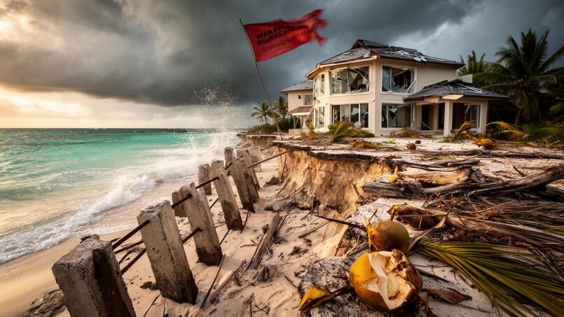
While hurricanes strike spectacularly, erosion and sea level rise constitute a more insidious risk, but at least as strategic for coastal assets. Studies conducted along Belize’s coastline conclude that the country—especially its cayes, atolls, and low coastal plains—is “very vulnerable” to the projected acceleration of sea level rise.
Beach loss, shoreline retreat, and infrastructure damage
The concrete consequences of this sea level rise are already being observed:
– shoreline retreat and disappearance of sandy beaches,
– temporary or permanent flooding of low-lying areas,
– weakening or collapse of buildings built too close to the sea,
– degradation of coastal freshwater aquifers by saltwater intrusion.
Belize’s coral reefs and mangroves prevent between US$231 and US$347 million in potential losses from erosion and storms each year.
Yet, in many coastal real estate projects, developers have historically razed all vegetation down to the high tide line—especially mangroves—to offer an “unobstructed view.” Besides being illegal, field observations show this often leads to an almost immediate loss of part of the land through erosion. For a property owner, this is a double cost: shrinking land base, structures needing rebuilding or raising, and increased wave exposure.
Macroeconomic impact on tourism and GDP
Tourism is particularly exposed to this coastal “nibbling” risk. Over 70% of visitors go to the cayes, and about 80% engage in reef-related activities (diving, snorkeling) or beach activities. A single study quantifying the effect of a one-meter sea level rise estimates the GDP loss could exceed 2%, or more than US$61 million, mainly through reduced tourism.
At the national level, the combined annual value of tourism, fisheries, and coastal protection associated with reefs and mangroves is estimated between US$395 and US$559 million. Yet investments in protecting these ecosystems remain far below their economic contribution. For a hotel, land, or long-term investor, not integrating this natural capital—and the risk of its degradation—into the equation means severely underestimating the risk.
Reef degradation, acidification, and tourism risks
The country’s reef system—especially the Belize Barrier Reef Reserve System, a UNESCO World Heritage site—is not just a scenic asset. It is a true natural infrastructure that:
– dissipates more than three-quarters of the energy of incoming waves from the open sea,
– is the main magnet for divers and snorkelers,
– hosts key species for fisheries (lobster, reef fish),
– supports thousands of jobs in tourism and fishing.
Tourists attracted by reefs and mangroves spent up to US$262 million in 2007.
Yet these reefs are under a cocktail of pressures:
– warming sea surface temperatures (correlated with mass bleaching episodes),
– ocean acidification from rising dissolved CO₂,
– land-based pollution (sewage, agricultural runoff, sediments),
– overfishing of certain key species (groupers, snappers),
– overtourism (destructive anchoring, trampling, overloaded boats).
The bleaching episodes of 1995 and 1998 dropped coral cover from 25–30% to about 11% on average across 140 studied reefs. Since then, thermal stress levels have only increased: the bleaching stress indicator rose from about 1.7 (1985–2014) to 3 during the 2014–2017 period, signaling more extreme and longer events.
Projections indicate recurrent severe thermal stress exceeding coral tolerance thresholds by the end of the century, with rising sea surface temperature and dissolved CO₂ identified by the IPCC as major threats.
Most Belizean reefs will experience recurrent thermal stress beyond coral species tolerance thresholds by 2100.
The increase in dissolved CO₂ concentration in the ocean is identified by the IPCC as a major threat to reefs in the 21st century.
For an investor betting on dive tourism, sport fishing, or seaside resort real estate, this reality raises a fundamental question: what will be the destination’s attractiveness if the reefs lose much of their biodiversity and wave-absorbing capacity? And how much will it cost to compensate for this loss (artificial reefs, replanting, reconfiguring the tourism offering)?
Wildfires and land degradation: an underestimated risk
Humid tropical Belize does not immediately bring to mind megafires. Yet the latest data show a rapid intensification of fire risk, especially in pine savannas and large interior forest blocks.
Between 2019 and 2022, over 5,090 fire alerts were recorded in the country, with about 97,260 acres of forest destroyed each year. Climate change is lengthening the dry season: the “fire season” now starts a month earlier than a decade ago, with hotter and longer drought periods.
Origin of fires: agriculture, poaching, and uncontrolled practices
The majority of fires are human-caused:
– escaped agricultural fires (milpa slash-and-burn, sugarcane burning),
– intentional burns to promote regrowth of grasses for game,
– arson linked to poaching,
– garbage burning and poorly controlled campfires.
Authorities now consider uncontrolled fire as the top threat to terrestrial protected areas. Rural communities are on the front line, with vulnerable wooden homes, crops, seasonal harvests like palm seeds, and local infrastructure such as roads and power lines regularly exposed.
Case study: the fire crisis in the Cayo District
A particularly well-documented episode occurred in the Cayo District during a heatwave where daytime temperatures neared and then exceeded 100 to 107 °F for several consecutive days. Satellite imagery (FIRMS system) recorded 80 to 117 fire hotspots per day, mainly linked to agricultural activities. Despite an emergency regulation banning open burning, the extreme heat reignited already controlled fires, turning them into wildfires.
The fires spread to the Vaca Forest Reserve and the outskirts of towns like Belmopan, San Ignacio, and Benque Viejo del Carmen, generating thick smoke and directly threatening populated areas and tourist sites. It took mobilizing forestry services, municipalities, private companies, and volunteers, along with bulldozers and water tankers, to contain the fire fronts.
For a land, agricultural, or ecotourism investor in these regions, this dynamic means:
– risk of direct destruction of crops, fences, buildings,
– long-term soil degradation (acidification, loss of humus),
– proliferation of pyrophilic and invasive plant species,
– landscape deterioration and reduced site attractiveness.
Forests, ecological corridors, and option value
Large-scale projects, such as the acquisition and protection of the Belize Maya Forest (about 240,000 acres) and the Rio Bravo Conservation and Management Area, aim to secure major forest blocks and wildlife corridors. They play an increasingly important role in fire risk management: patrols, firebreaks, prescribed burns, specialized equipment.
In the Belize Maya Forest, burned areas decreased from 1,022 acres in 2023 to 386 in 2024, and to zero in the first half of 2025 thanks to strengthened teams and equipment. However, in neighboring communities, fires are increasing due to forest conversion to pasture or crops.
For an investor, these protected areas can have a dual significance: on one hand, they reduce fire risk nearby and preserve ecological appeal; on the other, they may impose stronger regulatory constraints on land use. The long-term value of an asset near a well-managed forest corridor could, however, be more resilient than that of an isolated plot on the deforestation frontline.
Drought, erosion, and agriculture: a cocktail of risks for land
Nearly two-thirds of the national territory is classified as poor quality land (grades 4 and 5), highly prone to erosion when natural vegetation is removed. Agricultural development—often through clearing and burning—on these slopes and fragile soils leads to:
– increased runoff,
– reduced groundwater recharge,
– loss of soil fertility,
– siltation of rivers and lagoons,
– contribution to reef pollution from sediments and nutrients.
In the Toledo District, the shift from a traditional fallow period of 8 to 10 years to about 2 to 3 years has caused pronounced soil degradation and increased erosion. Faced with insufficient yields, farmers move to primary forests or steep slopes, worsening the problem.
Watershed analyses, such as that of the Rio Grande, show that the land cover types contributing most to erosion are precisely those resulting from deforestation: areas without forest cover, degraded lowland humid forests, and degraded submontane forests.
Average annual precipitation is decreasing by 120 mm per year due to climate change.
For an agricultural or agro-industrial investor, this translates into:
– greater uncertainty over yields,
– need to invest more in irrigation or soil conservation,
– risk of land degrading to the point of losing much of its productive value,
– exposure to criticism and regulations related to water and reef pollution.
In some extreme cases, erosion can even threaten the habitability of communities, as in Monkey River, where land loss linked to agriculture and coastal phenomena has forced residents to relocate.
Earthquakes and tsunamis: a less frequent but high-impact risk
Compared to neighboring Central American countries, Belize is less exposed to large earthquakes. Regional analyses conclude that it is the least exposed country to seismic hazards in the area. However, this does not mean no risk.
A magnitude 7.1 earthquake off the coast of Honduras in 2009 was strongly felt in Belize, triggering a tsunami warning for the Belizean coast, Guatemala, and Honduras. Although no significant wave hit the coast that day, the event highlighted several vulnerabilities:
The population is poorly prepared for seismic and tsunami risks. Additionally, warning dissemination is difficult during power outages, as in Placencia. Finally, many coastal towns are built at very low elevation, worsening the situation.
The tsunami risk is considered real: the coast, cayes, major tourist sites, and port areas are low-lying and densely occupied. A wave of 0.3 to 1 meter could already cause local damage, and stronger scenarios are not ruled out. Steps have been taken to improve preparedness (Tsunami Ready visit, training of weather and emergency management services, drills in villages like Placencia, Hopkins, or Gales Point), but residual risk remains.
Belize is adopting a new code based on the International Building Code 2021, including stricter structural provisions, replacing the 1985 Caribbean Uniform Building Code. For investors, it is essential to verify compliance with these standards and the actual quality of construction.
Insurance costs, construction resilience, and profitability
All these natural risks translate directly into the insurance world and, ultimately, into the profitability of an investment.
A tightening insurance market after storms
Belize has an “all perils” insurance system that typically covers fire, floods, hurricanes, sometimes earthquakes, along with liability and contents coverage. Major local companies (RF&G, Atlantic Insurance, Guardian General, etc.) reinsure with North American or European groups, bringing their products in line with international standards.
Annual premiums for real estate typically range between 1% and 3% of the insured value:
| Type of construction / location | Typical annual premium range |
|---|---|
| Concrete house inland | ~1% to 1.5% of value |
| Concrete house or condo in coastal area | ~1.5% to 2% |
| Wooden house (all contexts) | ~2% to 2.5%, or more |
| Highly exposed coastal properties | Up to 3% or more |
Wooden houses commonly cost two to three times more to insure than reinforced concrete structures. Deductibles for storm-related claims are higher than for fire: typically 2% to 5% of the sum insured. For a US$300,000 villa with a 3% cyclone deductible, the owner would have to pay the first US$9,000 of repairs out of pocket after a hurricane.
Estimated increase in insurance premiums in Belize over five years following Hurricane Lisa in 2022.
For an investor, this means: the need to make informed decisions to maximize returns while minimizing risks.
– plan for a substantial insurance budget (often several thousand dollars per year, potentially exceeding US$4,000 or $5,000 for a wooden house on an island),
– incorporate these recurring costs into the rental yield or resale model,
– be wary of properties that are difficult to insure or come with prohibitively high deductibles.
Construction quality: a major lever for resilience (and cost)
In practice, a property’s ability to withstand hazards will depend on:
For climate-resilient construction, several factors should be considered: choice of materials (reinforced concrete vs. wood, concrete roof vs. lightweight roof), elevation level with raised foundations to limit flood impact, compliance with anti-cyclone best practices including impact-resistant closures, tie-downs, and roof-to-wall connections, as well as location outside runoff zones and away from the tide line.
The construction sector is in transition: architects and engineers increasingly rely on international standards (IBC), but enforcement remains uneven and contractor licensing is not always required. There is no strict uniformity in the use of hurricane anchoring systems, for example.
Investing in a robust structure (concrete, modern standards, adequate elevation) certainly reduces the risk of serious damage but raises initial costs. Conversely, buying a locally styled wooden house by the sea may seem financially attractive, but it will expose you to high insurance premiums, repeated maintenance costs (termites, rust, salt), and a greater probability of damage during an extreme event.
A fragile economy facing climate shocks
Beyond individual properties, Belize’s vulnerability to natural hazards has significant macroeconomic implications. The country faces average annual losses on the order of US$29.5 million (or 1.69% of GDP) from hurricanes and floods, which the state must more or less absorb in the form of infrastructure repairs, emergency aid, and tax revenue shortfalls.
For rare but extreme events, the orders of magnitude are striking:
| Indicator | Hurricanes | Earthquakes |
|---|---|---|
| Average annual loss (AAL) | US$7.7M (0.45% GDP) | US$0.883M (0.05%) |
| Probable maximum loss (PML, 250-year period) | US$383M (22.6% GDP) | US$39M |
A once-in-a-century event could cause direct economic losses of at least US$565 million, or one-third of GDP. Reconstruction costs weighing on public finances tend to inflate debt, despite some innovative financing mechanisms (e.g., the Blue Bond, which restructured about US$550 million of external debt in exchange for marine conservation commitments).
For an investor, these macroeconomic vulnerabilities influence fiscal stability, the state’s ability to invest in protective infrastructure, the frequency and scale of debt-financed projects, and thus the overall business climate.
Governance, resilience plans, and persistent gaps
Belize has made notable progress institutionally and strategically: development of a National Climate Resilience Strategy, a National Climate Resilience Investment Plan (NCRIP), an Integrated Coastal Zone Management Plan, a permanent moratorium on offshore oil exploration, international commitments (NDCs, Blue Bond), and development of a specific resilience strategy for the Belize Barrier Reef.
However, several important gaps remain:
Lack of an integrated regulatory framework, weak institutional coordination, insufficient funding for marine protected areas often reduced to “paper parks,” and absence of a dedicated national disaster fund for frequent low- and medium-intensity events.
Recommendations from international institutions advocate a “layered risk” approach: budget reserves and credit lines for frequent but moderate events, parametric insurance for major disasters, and strengthening of data collection and planning.
For an investor, understanding this governance environment is important for judging the country’s ability to reduce risks over time. A state that clearly identifies its gaps and implements credible action plans paradoxically offers better visibility than a country where these issues are ignored.
What this means concretely for an investor in Belize
All this data may seem technical, but it translates into very concrete questions every investor should ask before committing.
The first concerns the precise location of the asset:
– Is it in a low coastal zone exposed to storm surges and erosion, or slightly inland and elevated?
– Is it in a floodplain or immediately adjacent to a canal, lagoon, or river?
– Are there mangroves or riparian forests still in place, or have they been destroyed?
– Does the land have a slope favorable for drainage, like some lots at Sandhill Village, or is it flat and poorly drained?
The second concerns the nature of the construction and the cost of protection:
– Is the building reinforced concrete or wood?
– Is the roof designed to withstand hurricane winds?
– Are openings protected (shutters, impact-resistant glazing)?
– Are there elevation or setback features from the sea?
The third concerns annual costs and financial reserves:
– What will be the realistic insurance cost, including post-Hurricane Lisa increases?
– What reserve funds should be set aside for unexpected storm or flood repairs (some advise up to 20% of the purchase price as a safety reserve)?
– Does the local rental market allow covering these costs without making the investment unprofitable?
Finally, the fourth concerns the long term:
Analyze whether the asset relies on vulnerable ecosystems (reefs, mangroves, beaches) whose future degradation would reduce its value. Check if the neighborhood benefits from public drainage, seawall reinforcement, or mangrove conservation plans, or if it is experiencing unregulated urbanization. Finally, assess whether projected climate trends (rising temperatures, declining precipitation, sea level rise) improve or worsen the long-term situation.
Seriously integrating these questions into due diligence is no longer an option in Belize; it is the condition for the postcard not to turn into a hefty bill.
—
Ultimately, investing in Belize remains perfectly possible—and potentially very attractive—provided you recognize that the country is on the front line of the climate crisis and natural risks. The interesting returns will likely come from assets that combine good location, resilient construction, integration of protective ecosystems (mangroves, reefs, forests), and alignment with national resilience and conservation policies.
In this country where nature is both the engine of the economy and the main source of risk, the best investment strategy is probably one that bets on nature as an ally rather than an adversary.
Do you have a wealth project or a question? Contact us now to speak with a wealth management expert.
Disclaimer: The information provided on this website is for informational purposes only and does not constitute financial, legal, or professional advice. We encourage you to consult qualified experts before making any investment, real estate, or expatriation decisions. Although we strive to maintain up-to-date and accurate information, we do not guarantee the completeness, accuracy, or timeliness of the proposed content. As investment and expatriation involve risks, we disclaim any liability for potential losses or damages arising from the use of this site. Your use of this site confirms your acceptance of these terms and your understanding of the associated risks.

Cyril Jarnias is an independent expert in international wealth management with over 20 years of experience. As an expatriate himself, he is dedicated to helping individuals and business leaders build, protect, and pass on their wealth with complete peace of mind.
On his website, cyriljarnias.com, he shares his expertise on international real estate, offshore company formation, and expatriation.
Thanks to his expertise, he offers sound advice to optimize his clients' wealth management. Cyril Jarnias is also recognized for his appearances in many prestigious media outlets such as BFM Business, les Français de l’étranger, Le Figaro, Les Echos, and Mieux vivre votre argent, where he shares his knowledge and know-how in wealth management.





