
 Published on and written by Cyril Jarnias
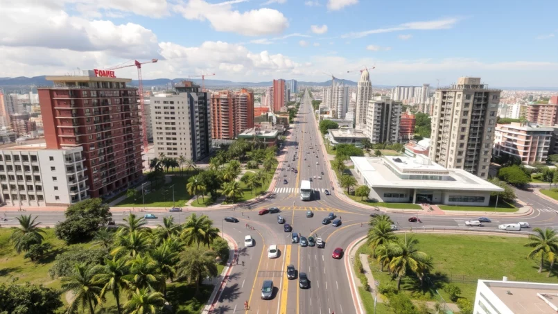
Behind its image as a peaceful country nestled between two giants, Uruguay is in fact preparing for a deep urban transformation. Between major transportation projects in Montevideo, a new smart city in Colonia, port modernization, massive housing programs, and climate adaptation strategies, the country is redesigning its cities for the coming decades. All this is built upon a political stability rare in the region, a relatively solid economy, and governance focused on long-term planning.
Urban development in Uruguay, centered on Montevideo, is now extending to the Atlantic coast, the country’s interior, and small and medium-sized cities. It revolves around a multisectoral approach integrating transportation, social housing, digital technology, climate, water, energy, logistics, and innovation.
A National Framework Driving Urban Transformation
To understand upcoming projects, one must first look at the institutional architecture and major strategies framing urban planning in the country. Uruguay has approximately 3.5 million inhabitants, over 96% of whom live in urban areas and more than 40% in the capital. Suffice to say, the urban issue is a national one.
The Ministry of Housing, Territorial Planning, and Environment (MVOTMA) leads housing and urban planning policy. It relies on major legislative and financial tools: the 1968 National Housing Law, the five-year housing plans (established in 1990), the Public Land Bank, and the National Housing and Urbanization Fund which finances the production and rehabilitation of housing.
Added to this legal foundation is a territorial planning framework consolidated in 2008 within the “Territorial Organization and Sustainable Development System,” which sets urban planning rules at the national and departmental levels. Furthermore, the 2009 law on political decentralization created 112 municipalities, giving cities a more active role in urban management.
Building on this foundation, the government has developed several structuring strategies for cities: a National Sustainable Cities Strategy carried out with the Office of Planning and Budget, a National Urban Land Access Strategy to limit land speculation, and, importantly, a series of National Climate Change Adaptation Plans explicitly targeting cities, infrastructure, and coastal areas.
The National Adaptation Plan for Cities and Infrastructure (NAP‑Cities) is particularly decisive for future projects: it outlines a path to 2050, divided into five-year action plans, with 41 detailed measures, potential funding sources, indicators, and a systematic approach to urban vulnerability (floods, heat waves, extreme winds, sea level rise, etc.). In other words, every major new urban project is supposed to be thought through this prism.
Housing: Addressing the Deficit Without Repeating Past Mistakes
The primary urban undertaking is housing. Uruguay has historically had a strong tradition of homeownership – about 60% of households own their homes – but the figures hide structural tensions. In 2006, over 5% of households lived in irregular settlements (often called “asentamientos”), a proportion that exploded in the 1995‑2005 decade in Montevideo, with a more than 37% increase in the number of slums after the economic crisis of the early 2000s.
Available data also show that nearly 28% of households are “occupants” in the broad sense, meaning without clear land tenure status (illegal occupation, borrowed housing, work arrangements). In Montevideo, the rate of illegal occupation is twice as high as in other cities. The consequence: the issue of the right to land and decent housing is at the heart of urban policies.
An Arsenal of Already Existing Housing Programs
Since the late 1960s, Uruguay has bet on housing cooperatives as a major lever. Today there are more than 2,000 cooperatives, mostly based on “mutual aid” (ayuda mutua), where members invest labor rather than capital, or on “prior savings” (ahorro previo) for the middle classes. In these models, the land and housing are collectively owned by the cooperative, which prevents speculation and stabilizes neighborhoods.
80% of the SIAV funds have been used in departments outside Montevideo, contributing to rebalancing the territory.
Other tools address specific needs: a Rental Guarantee Fund for households without guarantors but with low incomes, the CrediMat program (microcredits for construction materials, more oriented toward self-construction), and mechanisms to assist struggling debtors and cooperatives having difficulty paying their mortgage loans. In rural areas, the MEVIR agency continues to eliminate substandard housing through guided self-construction.
Programs for Integrating Informal Settlements
For informal neighborhoods, two major programs structure public action and are expected to become even more important in the coming years: the PIAI (Program for the Integration of Irregular Settlements) and the Neighborhood Improvement Program (PMB).
The Program for the Integration of Irregular Settlements (PIAI) in Uruguay, implemented with the support of the Inter-American Development Bank, aims to provide these precarious neighborhoods with basic infrastructure (drinking water, sewage, roads, electricity) and regularize the land tenure situation of residents. It addresses a dual problem: extreme social precarity (in some settlements in Montevideo, over 65% of adults have never had formal employment or standard schooling) and high exposure to climate risks.
The PMB, also financed by a major loan from the IDB ($100 million), adopts a more comprehensive approach, in four main stages: diagnosis, formulation of an improvement project, execution of works, and then transfer of ownership to residents. Within this framework, another loan of $70 million recently approved by the IDB plans to improve the living conditions of 7,642 households in 36 precarious settlements, with financing spread over 25 years. A pilot project in parallel plans to recover rundown public buildings in central Montevideo to transform them into affordable rental housing.
Over 1.3 billion recent dollars have been injected into the housing-inclusion sector by the state.
Montevideo: Transportation, Resilience, and Innovation at the Forefront
Montevideo concentrates both the main vulnerabilities and the majority of projects. The capital, home to about 1.8 million inhabitants in its metropolitan area and more than half of the country’s GDP, has launched a series of strategic plans since the 1990s, from its first development plan in 1994 to its 1998 Territorial Urban Planning Plan, and then to its Resilience Strategy in 2018.
This strategy, designed with the international network “100 Resilient Cities” of the Rockefeller Foundation, groups four main pillars and 40 to 45 concrete initiatives, including three highly structuring “resilience laboratories”: the transformation of the Pantanoso creek basin, the integrated development of the coastline, and a comprehensive risk management plan. These projects embrace urban planning, environment, social inclusion, and local governance simultaneously.
A Major Sustainable Mobility Project
The urban transportation sector is one of the most ambitious aspects of the upcoming transformation. Relying on a very dense urban population (96.1% of Uruguayans live in cities, half of them in the Montevideo metropolis), the government negotiated with the IDB a conditional credit line of $500 million specifically dedicated to the metropolis to modernize the transportation system.
A first tranche of $10 million funds studies and preparations for an electric Bus Rapid Transit project in Montevideo.
Avenida Italia already carries more than 360,000 passengers per day, nearly 70% via public transportation, making it an ideal corridor for a BRT. The stated goals are clear: reduce peak travel times by at least 10%, cut greenhouse gas emissions from bus travel by 30%, reduce operating costs for public transport operators, and improve road safety.
Another program, the “Montevideo Urban Transportation Program II,” funds the second phase of the urban mobility plan, with the creation of bus corridors, modern stations, terminals, and intelligent traffic management systems. Within this framework, 50 electric buses have already been acquired, with the support of the Renewable Energy Innovation Fund (REIF), which managed to turn an initial one million dollar allocation into $22 million in investments thanks to a 1 to 6 leveraging effect. These 50 buses avoid over 42,000 tons of CO₂ annually.
Sustainable mobility in Montevideo goes beyond buses, with tests of electric taxis and support for local start-ups developing cargo bikes and electric delivery vehicles. A 35 km tram-train project is under study, and two suburban railway lines could transport 38,000 passengers per day. A study funded by France is also assessing the feasibility of hydrogen trains.
Table – Main Urban and Metropolitan Transportation Projects
| Project | Type of Transport | Length / Corridor | Main Funding |
|---|---|---|---|
| BRT Avenida Italia / 8 de Octubre | Electric rapid bus | Key urban axis | IDB credit line ($500M) |
| Electric bus programs (50 units) | Urban bus | – | REIF Fund + local banks |
| Tram‑train Montevideo – El Pinar | Tram‑train (planned) | 35 km | Public-private partnership ($500M) |
| Suburban railway lines | Commuter train | 2 lines | Public/PPP funding |
| Exclusive bus lanes Avenida Italia | Dedicated bus lanes | Dense urban corridor | IDB + local contribution |
These massive transportation investments take place in a context where the sector already represents 41% of the country’s energy-related emissions. The National Urban Mobility Policy, developed with the technical support of the European Union via the EUROCLIMA+ program, aims to harmonize these projects with emission reduction goals and improved accessibility to urban centers.
Urban Recycling, Coastline, and Green Spaces
Montevideo is also working on another front: the reuse of vacant land and the reclamation of its coastline. A project to recover abandoned plots identified 25 properties for transformation. Some will be used to create the first housing cooperative on scattered lots, combining four plots to build 28 homes. Others will host autonomous housing for women with children who are victims of violence, or public spaces with controlled rents.
The transformation of the Pantanoso creek basin is designed as a pilot project to strengthen resilience in a vulnerable area, characterized by precarious housing and environmental degradation. The goal is to articulate several actions in an integrated manner: sanitation, flood risk management, creation of green spaces, and urban integration of informal neighborhoods.
On the coast, a sanitation plan has already connected 93% of residents to the sewage network and aims to reduce beach pollution, an essential element in a coastal city that received over a million tourists per year before the pandemic. A “Greener Montevideo Plan” is simultaneously deploying a series of actions: cleaning of watercourses, gradual replacement of horse-drawn carts with motorized tricycles for informal waste pickers, creation of fixed and mobile collection points, and a WhatsApp platform to report illegal dumping.
One of the most emblematic projects, however, is the new smart public lighting system: 70,000 connected LED streetlights linked by a LoRaWAN radio network covering 200 km². They promise a reduction of nearly 80% in lighting-related emissions, 40% energy savings, and up to an additional 30 to 40% in gains thanks to remote variation of light intensity. Again, the logic is twofold: reduce the energy bill and emissions, while improving the quality of public lighting and thus the perceived safety in the urban space.
+Colonia: The New City Aspiring to Be a Regional Laboratory
If Montevideo pilots the transformation of the existing, the +Colonia project, near Colonia del Sacramento, embodies the Uruguayan vision of a new smart city built almost from scratch. Presented as Latin America’s first planned smart city, this development was designed by the architecture firm Gómez Platero and unfolds on a site with seven kilometers of coastline and white sand beaches.
The ambition is to make +Colonia a true urban laboratory to test sustainable technologies in energy, connectivity, mobility, and sanitation. The National Research and Innovation Agency allocated $100,000 to sustainable urban planning studies conducted with the Fraunhofer IAO Institute (Germany), which is supporting the project.
A “15-Minute City” on the Shores of the Río de la Plata
The concept is directly inspired by the “15-minute city”: all essential functions – housing, work, commerce, education, health, leisure – must be accessible within a fifteen-minute walk or bike ride. Over half of the territory is reserved for green and recreational spaces, reflecting a move away from models of sprawling, car-dependent urbanization.
First phase of the project with two residential towers and five villas, designed for 700 to 1,000 inhabitants and an investment of about $80 million.
Apartments from $90,000 to $120,000 for small units, around $160,000 for a two-room unit, and $200,000 for a three-room unit. Price per m² between $2,000 and $3,000.
Loans covering up to 70% of the property value over 20 years, accessible even to non-residents, to attract foreign investors.
Table – Key Features of +Colonia
| Element | Indicative Data |
|---|---|
| Ultimate target population | 30,000 inhabitants (in 15–20 years) |
| Share of green spaces | > 50% of the territory |
| Coastline length | 7 km, white sand beaches |
| Size of first neighborhood | 700 to 1,000 residents (Distrito Génesis) |
| Distrito Génesis budget | $80 million US |
| Average price per m² | 2,000 – 3,000 US$/m² |
| Energy supply | UTE commitment to “green” supply |
Beyond urban design, +Colonia is conceived as a demonstrator of energy transition. The public company UTE has committed to making it the city with the highest proportion of clean energy in the region, which fits into a national context where the electrical grid already runs on 98% renewable sources.
The project is expected to double the population of the historic city of Colonia del Sacramento, a UNESCO World Heritage Site.
Medium-Sized Cities and Territories: Toward a Network of Uruguayan-Style “Smart Cities”
The urban challenge is not limited to major hubs. The Inter-American Development Bank is now financing a specific project (UR‑T1281) to strengthen the capacities of departmental governments to deploy smart urban services. The budget remains modest – $400,000 provided by a Korean poverty reduction fund – but the ambition is strategic: identify areas for digital progress, draw inspiration from Korean smart city experience, and design at least four pilot projects in medium-sized cities.
The envisaged projects cover varied areas like smart public lighting, waste collection, urban traffic management, heavy vehicle regulation in rural zones, online citizen participation, and public building energy efficiency. Concrete projects are already under study for the city of Rivera, on the Brazilian border, and for the Anglo neighborhood in Fray Bentos.
In parallel, the country seeks to homogenize its urban mobility policies: a National Urban Mobility Policy was developed with the support of GIZ (German cooperation) and funded by the European Commission, in line with climate goals and Uruguay’s commitments under the Paris Agreement. In 2024, this policy underwent public consultation as part of a National Sectoral Program.
In the interior, cities like Salto, Paysandú, or Rivera are already seeing rising demand for affordable housing, while coastal regions like Rocha are betting on more sustainable development via ecotourism and real estate projects better integrated with the environment.
Ports, Roads, Rails, Water: Urban Planning Connected to Major Infrastructure
Upcoming urban projects cannot be separated from the major infrastructure projects that are redrawing the country’s economic map. Uruguay devotes on average nearly 6% of its GDP to infrastructure investment, a high level regionally, and a significant portion of these investments has a direct impact on cities.
Ports and Logistics: Montevideo as a Regional Hub
The port of Montevideo, the gateway for over 70% of Uruguay’s foreign trade, is undergoing a major modernization phase. The concession for the Cuenca del Plata container terminal, operated by the Belgian group Katoen Natie, has been extended until 2080, in exchange for a $460 million investment program. The goal is to raise annual capacity to over 2 million TEUs (twenty-foot equivalent units), elevate the port to the region’s top sustainable terminal (with renewable electricity supply for ships at berth), and strengthen its role as a transshipment hub – already over half of containerized traffic today concerns the transit of Argentine and Brazilian goods.
The passenger terminal project under study represents an investment of about one billion dollars over a 30-year concession.
These port projects have structuring effects on Montevideo’s urban fabric: they lead to the redevelopment of port areas, stimulate the establishment of logistics zones and high-value-added industries, and justify the creation of new freight transport axes. A new rail connection to the port is thus underway, as an extension of the Central Railway project, which is rehabilitating and doubling 273 km of track between the port and Paso de los Toros, for an investment of about $1.1 billion.
Table – Key Figures on the Montevideo Logistics Axis
| Infrastructure | Capacity / Data |
|---|---|
| Port of Montevideo | > 1.3 M TEUs / year (target) |
| Port area | 140 hectares |
| Quay length | 5,140 m |
| Central Railway | 273 km of modernized tracks |
| Freight train speed | 80 km/h, 22.5 t per axle |
| Free zones & logistics parks | 7.5 M m² of warehouses (incl. 2.15 M in free zones) |
Beyond Montevideo, the port of Nueva Palmira, the country’s second largest, is expanding to accommodate more grains and wood pulp, while projects are under study for Fray Bentos or La Paloma. Together, these participate in making Uruguay a regional logistics hub, with a sector contributing about 5% to GDP and employing over 200,000 people.
Roads, Rail, and Water: A Backbone for Future Urban Projects
In the road sector, the country is often cited as having the densest network in Latin America, with nearly 8,900 km of national roads, the great majority of which are paved. Between 2012 and 2019, over 1,850 km were rehabilitated, exceeding set targets, and over 3,600 km are now under performance-based maintenance contracts. For the year 2023 alone, the Ministry of Transportation (MTOP) planned about $900 million in works, including a beltway connecting routes 1 and 5, the widening of route 5 to the north, and the completion of route 6.
This is the length in kilometers of the strategic railway line between Peñarol and José Pedro Varela that the Uruguayan state plans to reopen for agricultural exports.
Water and sanitation constitute another pillar of future urban developments. A national $500 million four-year plan envisions the construction of 54 new treatment plants, improvement of 40 existing facilities, extension of 3,472 km of sewage networks, and nearly 247,000 additional domestic connections. A water treatment plant powered by the Río de la Plata, with a budget of $289 million and connected by an 80 km pipeline, is to secure the water supply for Montevideo and neighboring departments, following a historic drought between 2022 and 2023 that caused over a billion in economic losses and strained drinking water distribution.
The Casupá dam, financed by an $80 million loan, aims to consolidate water security for nearly 60% of the population.
Climate, Coastline, and Adaptation: Building Cities in the Face of Rising Waters
With over 70% of its population living on the coast and a coastline of more than 700 km – including nearly 480 km on the Río de la Plata and 236 km on the Atlantic – Uruguay has no choice but to integrate climate at the heart of its urban strategy.
Climate projections by Uruguayan researchers indicate a temperature increase between 0.6°C and 1.1°C by 2030, then between 1°C and 2°C by 2050, with an expected increase in the frequency of extreme rainfall and violent winds. In the longer term, the most pessimistic scenario (RCP8.5) suggests a mean sea level rise of around 80 cm by the end of the century, while the level has already risen by about 11 cm in Montevideo, 2 to 3 cm of that in the last thirty years.
Integrated Coastal Planning
To cope, the country has developed a Coastal Zone Adaptation Plan (COASTAL‑NAP) that complements the NAP‑Cities. This plan builds on decades of work: initial coastal management schemes in the 1990s, the ECOPLATA program, a university master’s in integrated coastal zone management, the 2019 law on the coastal space, etc. It aims to integrate climate risks into coastal urban planning, through integrated coastal zone management (ICZM) and nature-based solutions (dune restoration, wetlands, etc.).
The findings are concerning: about 42% of the Río de la Plata shores and 32% of the Atlantic coast are affected by erosion. The flood risk in Montevideo’s coastal zone could be multiplied by six by 2100 in an extreme scenario. Average annual damages due to erosion are estimated today at $45.5 million, concentrated mainly in Montevideo and Maldonado. The most vulnerable natural habitats could see their impacted surface area increase by nearly 40% by the end of the century.
In this context, coastal urban projects, whether new residential areas, as around Punta del Este or Rocha, or high-end tourist complexes like some major tower and resort projects, must confront the requirements of the COASTAL‑NAP. Investments in hybrid infrastructure (seawalls + natural systems) are planned via the REACC COSTAS program, with an overall budget of nearly $14 million, which is also being deployed in cities along the Río Uruguay.
Indicators, Governance, and Green Financing
One of the most interesting aspects of the Uruguayan strategy is its systemic dimension. The NAP‑Cities is accompanied by a monitoring system composed of 25 indicators covering five dimensions – public spaces, infrastructure, social systems, governance, education – as well as a GIS (geographic information system) platform under development to map over 480 adaptation projects conducted across the country.
The government is exploring innovative financing instruments for climate projects: integration of climate criteria into the investment promotion law, creation of “green” credit lines via local banks (already mobilized for the REIF Fund and electric buses), and establishment of dedicated research funds for adaptation. This approach allows financing urban projects through advantageous financial structures, in exchange for high environmental performance.
Digital Innovation and “Smart City”: Urban Uruguay in a Connected Version
Another Uruguayan particularity: the urban transformation relies on an advanced digital infrastructure. The country ranks first in Latin America for e-government, open public data, and preparedness for artificial intelligence. The Agency for Digital Government (AGESIC), created in 2007, pilots a series of legislative and technical tools – digital identity, electronic signature, data protection, access to information, telemedicine, etc. – which permeate urban projects.
Montevideo was the first city in the region to adopt an open data policy back in 2010. Its ‘Montevideo Abierto’ portal publishes dozens of datasets, used by citizen applications like ‘Por mi Barrio’ to report problems in public space, or ‘Cómo ir’ for transportation information. The city complements this approach with the participatory platform ‘Montevideo Decide,’ which allows residents to propose projects, debate, and directly influence municipal actions, notably via calls for ideas for a more resilient and inclusive city.
At the national level, the new “Uruguay Innova (U+I)” program, intended as a state policy, seeks to organize the innovation ecosystem around four pillars: knowledge, innovation, internationalization, and regulatory framework. An innovation campus was inaugurated at the LATU technology park, hosting a Uruguayan innovation hub and international accelerators, among others. These initiatives pave the way for more ambitious “smart city” projects, like +Colonia or future lighting, waste management, and traffic systems in medium-sized cities.
Operators ANTEL, Movistar, and Claro are deploying 5G following an auction in the 3.5 GHz band. Licenses have also been granted to the Starlink and Kuiper satellite constellations. This technological environment fosters the development of IoT networks, illustrated by Montevideo’s 70,000 smart streetlights, and enables the emergence of new urban services (parking, roads, security, environmental monitoring).
What Uruguayan City for 2050?
Taken together, these projects compose a coherent image of a country trying to anticipate its urban changes rather than endure them. High urban density, the concentration of the population in Montevideo, historic dependence on the coastline, and recent climate shocks make this planning particularly urgent.
On the housing front, the combination of cooperatives, targeted subsidies, programs for integrating precarious neighborhoods, and public land tools suggests that Uruguay will continue to experiment with original solutions, avoiding reliance solely on the market. The bet is to reduce the quantitative and qualitative deficit while limiting speculation and promoting more restrained forms of urbanization.
Investments in electric and intelligent transportation (BRT, zero-emission buses, rail) aim to reduce car dependency and better serve the peripheries. Their effectiveness will be reinforced by controlled densification along transit axes, an approach inspired by ‘transit-oriented development’.
Port and logistics projects, for their part, risk accelerating the urbanization of certain sectors and attracting new populations to the areas influenced by major hubs. The capacity of cities to manage this dynamic, through rigorous territorial planning and requirements for social infrastructure (schools, healthcare, green spaces), will be decisive in avoiding increased fragmentation.
The NAP‑Cities and COASTAL‑NAP plans subject any major new project (like +Colonia, a waterfront development, or a large park) to long-term analyses. Facing rising waters threatening the coasts of Montevideo, Maldonado, Rocha, and the cities of the Río Uruguay, integrating nature-based solutions, warning systems, and resilient infrastructure has become a necessity.
The challenge will be to sustain this ambition over time, beyond political cycles, while ensuring that the benefits of these transformations – modern transportation, decent housing, quality public spaces, digital services – are not concentrated in a few privileged enclaves but permeate the entire urban territory. Judging by the emphasis placed on cooperatives, citizen participation, and programs targeting the most vulnerable neighborhoods, part of the answer is already taking shape in current policies.
Disclaimer: The information provided on this website is for informational purposes only and does not constitute financial, legal, or professional advice. We encourage you to consult qualified experts before making any investment, real estate, or expatriation decisions. Although we strive to maintain up-to-date and accurate information, we do not guarantee the completeness, accuracy, or timeliness of the proposed content. As investment and expatriation involve risks, we disclaim any liability for potential losses or damages arising from the use of this site. Your use of this site confirms your acceptance of these terms and your understanding of the associated risks.

Cyril Jarnias is an independent expert in international wealth management with over 20 years of experience. As an expatriate himself, he is dedicated to helping individuals and business leaders build, protect, and pass on their wealth with complete peace of mind.
On his website, cyriljarnias.com, he shares his expertise on international real estate, offshore company formation, and expatriation.
Thanks to his expertise, he offers sound advice to optimize his clients' wealth management. Cyril Jarnias is also recognized for his appearances in many prestigious media outlets such as BFM Business, les Français de l’étranger, Le Figaro, Les Echos, and Mieux vivre votre argent, where he shares his knowledge and know-how in wealth management.





