
 Published on and written by Cyril Jarnias
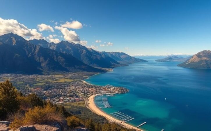
Sandwiched between the **Roaring Forties** and the **cold waters of the Southern Ocean**, Tasmania offers a concentrated dose of spectacular terrain, contrasting climates, and largely intact landscapes on the scale of a developed state. A main island of 64,519 km² surrounded by a myriad of islets – totaling 68,401 km² of emerged land – it is simultaneously the smallest and southernmost of Australia’s federated entities, and the only one not situated on the mainland.
Tasmania is located approximately 240 kilometers south of the Australian coast, across the Bass Strait.
A Singular Geographic Position in Southern Australia
Tasmania, or **Lutruwita** in palawa kani, lies directly in the path of the **violent westerly winds** nicknamed the “Roaring Forties.” These dominant flows shape the climate and rainfall distribution, as well as the coastal morphology, particularly on the western face, one of the most battered in Australia.
To the north, the island is separated from the Australian mainland by the Bass Strait, a shallow but dangerous stretch of water. To the south, the George V Antarctic Coast is about 2,500 km away. Its oceanic boundaries are defined by either the Southern Ocean, the Indian Ocean to the west, and the Tasman Sea to the east.
The land extremities highlight the island’s **north‑south orientation**: to the south, South East Cape at around 43°38′ S; to the north, **Woolnorth Point / Temdudheker** near Cape Grim / Kennaook around 40°38′ S. Between these two capes, a mosaic of plateaus, dolerite massifs, inland plains, rocky coasts, and sheltered bays forms a territory far more rugged than its size suggests.
A Mountainous Relief for the Smallest Australian State
Tasmania is the most **mountainous** of the Australian states and one of the most **rugged** islands in the world. Its backbone is formed by the Central Highlands, a vast elevated plateau occupying the central‑west, peaking at over 1,600 m and incised by escarpments, glacial cirques, and deep valleys.
Peaks and Plateaus
The highest point, **Mount Ossa**, reaches **1,617 m**. It belongs to a group of ranges – Pelion, Du Cane, Cradle–Bluff – where many peaks exceed **1,500 m**. To the east, the **Ben Lomond** massif rises to **1,573 m** at Legges Tor, overlooking a region that remains less tumultuous than the west.
Tasmania’s relief is marked by mountainous massifs, with dozens of summits exceeding 1,200 m. The central plateau, of doleritic nature, has an average elevation of 900 to 1,000 m. North of the Central Highlands, another plateau forms a system of hills extending towards the north coast. In contrast, the Midlands, in the central-east, constitute a relatively flat depression, crucial for agriculture and transport routes between major towns like Hobart and Launceston.
Contrasting Physical Regions
**Geographers** and **naturalists** distinguish several major **regions**:
Tasmania is structured into five distinct major geographical regions: the wild, rainy, and mining-oriented west coast and the West Coast Range; the central plateau (Central Plateau / Central Highlands), a realm of glacial lakes and highland moorlands; the Midlands, a dry corridor of pasture and crops between the western massifs and the escarpment of the Great Western Tiers; the east and northeast, dominated by lower plateaus, coastal granites (like at Freycinet), and alluvial plains; and the southeast, around Hobart, structured by the Derwent estuary and the trapezoidal relief of Mount Wellington (kunanyi), 1,269 m high.
Topography plays a direct role in the distribution of **climates**, **soils**, **forests**, and even **human settlement**. The main cities – Hobart, Launceston, Devonport, Burnie – are almost all nestled against estuaries or coastal plains.
Beneath the Surface: Geology of Exceptional Complexity
**Few territories of comparable size reveal such a complete geological record, spanning over 1.27 billion years up to Cenozoic volcanic formations.** Tasmania is, among other things, famous for its **vast Jurassic dolerite plateaus, its sharp Precambrian quartzites, its coastal granites, and its metalliferous volcanic belts.**
The Reign of Dolerite
Nowhere else in the world does **dolerite – or diabase** – cover such a **continuous area**. Approximately 30,000 km² of Tasmania are formed or capped by this Jurassic intrusive magma, injected into older sediments about 175 to 185 million years ago. This massive material contracts into columns and gives rise to spectacular cliffs, like the “Organ Pipes” on Mount Wellington or the coastal precipices of Cape Raoul and the Tasman Peninsula.
The center of the plateau and much of the southeast rest on this rock, which also forms the great escarpments of the Great Western Tiers, acting as ramparts above the Midlands.
Quartzites, Granites, and Volcanic Belts
The southwest and part of the west coast present a completely different face: that of **very ancient Precambrian quartzites**, metamorphosed and upturned into sharp ridges. Peaks like **Federation Peak or Frenchmans Cap** – the latter peaking at about 1,446 m – illustrate this landscape of white or pale gray rocky blades, difficult to access but spectacular.
On the eastern facade, another register prevails: **continental granites**. Freycinet National Park, with **the pink domes of The Hazards** and the famous curve of Wineglass Bay, is its icon. Further north, other granite outcrops mark the capes and islands of the Tasman Sea.
The northwest and west, however, host **ore-rich volcanic rocks**, grouped notably in the **Mount Read Volcanics**. This metalliferous bedrock has supported a long mining tradition (copper, zinc, lead, gold, tin, tungsten…), around centers like Mount Lyell, Rosebery, Zeehan, or Renison Bell.
Summary of some major geological assemblages associated with characteristic landscapes
Very ancient crystalline rocks, flattened by erosion. Landscapes of plains and low hills, often dotted with lakes.
Stacking of layers of sedimentary rock, generally horizontal. Landscapes of plains, structural plateaus, or cuestas.
Areas of high, rugged relief, resulting from tectonic plate collision. Presence of folds, faults, and thrust sheets.
Built by the accumulation of materials emitted by volcanoes. Landscapes of cones, domes, lava flows, and sometimes calderas.
Collapse grabens bounded by faults, associated with crustal thinning. Landscapes of elongated valleys and stepped terrain.
| Region / Dominant Bedrock | Main Rock or Group | Typical Landscape |
|---|---|---|
| Central Plateau & southeast | Jurassic dolerite | Tabulatory plateaus, columnar escarpments |
| Southwest & interior west | Precambrian quartzites | Sharp ridges, isolated peaks, saw-toothed crests |
| East & coastal northeast | Continental granites | Rounded domes, granite capes and peninsulas |
| Northwest & mining west | Volcanics (Mount Read Volcanics) | Rugged relief, incised valleys, metalliferous deposits |
| South & locally northwest | Limestones (Gordon Limestone, etc.) | Karst, caves, sinkholes |
Glaciations and Recent Shaping
Current landforms retain the marks of several glacial episodes, including those of the **Pleistocene**. A veritable **”ice cap”** about 65 km in diameter once covered the central plateau. U-shaped valleys, cirques, moraines, and string lakes bear witness to this, particularly in the Central Highlands and the West Coast Range.
The **lake landscapes** around **Cradle Mountain**, **Lake St Clair**, or the **Walls of Jerusalem** are the direct product of this modeling. Some dolerite summits – like **Cradle Mountain** – served as **nunataks**, protruding above the ice sheet.
Finally, recent history saw the **progressive isolation of the island** by rising sea levels at the end of the last glaciation. The land bridge connecting Tasmania to the mainland across the present-day Bass Strait first fragmented into archipelagos (including the Furneaux Group), then disappeared about **8,000 years ago**, cutting off land exchanges with Australia.
Coasts, Estuaries, and a Myriad of Islands
With **3,030 km of coastline** – **2,237 km around the main island** and **793 km for the islands** – Tasmania has the **fifth longest coastline in Australia**. This coastal fringe alternates immense beaches, cliffs, semi-enclosed bays, lagoons, and deep estuaries.
Shores Shaped by Wind and Waves
The **western facade**, fully exposed to Southern Ocean swells and westerly winds, lines up sandy bars and wave-battered cliffs. **Ocean Beach**, near Strahan, stretches for nearly 40 km. Further north, around Macquarie Harbour and the Pieman, the coasts are incised with fjords and swampy inlets.
The south, between South West Cape and South East Cape, is a succession of bays, havens, and low coasts with more moderate waves, but exposed to winter storms. To the east, the Tasman Sea brings a milder climate and more sunshine, giving rise to more hospitable shores: Wineglass Bay, Great Oyster Bay, the Bay of Fires, or the lagoons of Moulting Lagoon and Georges Bay.
Geographical Description of Tasmania
The **north**, facing the **Bass Strait**, is semi-sheltered from large swells but remains subject to **westerly winds**. The coast there combines beaches, modest cliffs, estuaries, and dunes.
Archipelagos and Major Islands
Around Tasmania, some **334 islands** are recorded, belonging to different groups (Furneaux, Hunter, Kent, Maatsuyker, Waterhouse, New Year, etc.). Most are **uninhabited** or occupied by small, isolated communities.
The table below presents **some of the largest islands attached to the state**, apart from the main island:
| Island | Approximate Area | Group / Location | Geographical Particularities |
|---|---|---|---|
| Flinders Island | ~1,359 km² (134,000 ha) | Furneaux Group, Bass Strait | Hilly relief, remnant of the continental bridge |
| King Island | ~1,091 km² (109,400 ha) | Bass Strait, northwest | Windy plains, exposed coasts, numerous reefs |
| Cape Barren Island | ~465 km² (46,500 ha) | Furneaux Group | Granitic hills, Aboriginal lands |
| Bruny Island | ~353 km² (35,300 ha) | D’Entrecasteaux Channel | Highly indented coast, 94 recorded beaches |
| Macquarie Island | ~124 km² (12,400 ha) | Southern Ocean, subantarctic | Isolated oceanic island, World Heritage site |
| Maria Island | ~101 km² (10,100 ha) | East coast | Limestone and sandstone plateau, fossiliferous cliffs |
| Robbins Island | ~99 km² (9,900 ha) | Northwest coast | Sandy plains, salt marshes |
| Clarke Island | ~82 km² (8,200 ha) | Furneaux Group | Low relief, pastures, surrounding rocky islets |
| Hunter Island | ~71 km² (7,100 ha) | Hunter Group, northwest | Rocky coasts, dunes, low visitation |
| Three Hummock Island | ~70 km² (7,000 ha) | Hunter Group | Rounded hills, mixed sand/rock coasts |
These islands constitute as many **variants of Tasmanian environments**: dunes and lagoons on King Island, granites and heathlands on Flinders, battered cliffs around the Maatsuykers, eroded plateaus on Maria Island.
An Island of Rivers, Lakes, and Waterfalls
Tasmania has about **150,000 km** of waterways and over **4,000 lakes** on the central plateau alone. Almost all major catchments originate in the wet highlands of the west and center, then converge towards the surrounding seas.
Major River Systems
**Four major systems** are distinguished by their length or flow:
The South Esk is Tasmania’s longest river with a length of 252 kilometers.
Many other rivers play an important regional role: **Arthur and Pieman** in the west, **Mersey**, **Forth**, and **Leven** in the northwest, **Henty** and **King** on the west coast, **Prosser**, **Swan**, and **Ansons** on the eastern facade.
The following table summarizes some **major rivers** and their **geographical context**:
| River | Approximate Length | Main Region Traversed | Mouth |
|---|---|---|---|
| South Esk | 252 km | Midlands / northeast | Tamar Estuary |
| Derwent | ~215 km | Central Highlands → southeast (Hobart) | Storm Bay / Tasman Sea |
| Arthur | 189 km | West / northwest | Tasman Sea / Bass Strait |
| Gordon | 186 km | Central Highlands, southwest, west | Macquarie Harbour |
| Huon | 169 km | Southwest, Huon Valley | D’Entrecasteaux Channel |
| Mersey | 158 km | Northwest | Bass Strait |
| Franklin | 129 km | Southwest / Gordon–Franklin Range | Gordon River |
| Leven | 99 km | Northwest | Bass Strait |
| North Esk | 97 km | Northeast | Confluence at Launceston (Tamar) |
| Pieman | 38 km | West | Tasman Sea |
Lakes, Dams, and Waterfalls
The concentration of high-altitude lakes is one of Tasmania’s most striking features. **Great Lake**, at **158 km²**, is the state’s largest freshwater lake. Thousands of smaller water bodies, natural or artificial, often connected to a vast hydroelectric network, are scattered around it.
This is the depth, in meters, of Australia’s deepest natural lake, Lake St Clair.
The combination of steep relief and abundant rainfall also gives rise to an **impressive density of waterfalls**. **Russell Falls**, in Mount Field National Park, at 58 m high, is the most famous figure, but dozens of others – like Nelson Falls, Montezuma Falls, or the Liffey Falls – punctuate the wet valleys of the west and center.
A Temperate Oceanic Climate, but Highly Contrasted
Unlike the rest of Australia, **Tasmania** enjoys a **generally cool and oceanic climate**, with four distinct seasons. Temperatures remain moderate, even in summer, but rainfall, cloud cover, and the frequency of snowfall vary strongly by region and altitude.
Rainfall Gradients from West to East
The **westerly winds** bring **Atlantic disturbances** that hit the western coast head-on. The mountain ranges act as a barrier, causing an orographic “wall” effect. Result: the western and southwestern slopes receive annual precipitation often exceeding **2,500 mm**, sometimes more than **3,000 mm**. Cradle Valley, in the mountainous northwest, receives about **2,690 mm** per year. At Butlers Gorge, on the central plateau at 665 m, an average of **1,705 mm** is measured.
This is the annual precipitation in millimeters at Ross, in the Midlands, Tasmania’s driest region.
The north coast shows intermediate values: **Launceston receives around 670 mm annually**, **Scottsdale nearly 990 mm**. King Island, in the Bass Strait, averages around 855 mm. The general pattern is thus a very marked gradient from the wet western mountains to the drier eastern plains.
Temperatures and Seasons
Summers (December to February) are generally **mild to pleasant**. On the coasts and lowlands, **average maxima range between 20 and 24 °C**. Hobart records a few peaks above 30 °C during brief heatwaves from the Australian desert, but these heatwaves remain temporary. The highest temperature recorded in the state, **42.2 °C**, was measured at Scamander on the east coast.
Record low temperature ever recorded on the Tasmanian central plateau.
The four seasons are well-defined: a **bright summer**, a **calm autumn with colorful foliage**, a **cold, wet winter with significant snowfall at altitude**, and an **unstable spring**, often windy, where snow episodes can last until October.
Snow, Sun, and Particular Phenomena
Snow falls almost every year above **1,000 m**, and the snowline can frequently lower towards **800 m**, sometimes 600 or even 400 m during polar air showers. Sea-level snow events, rare on an Australian scale, occur on average every five years, including in Hobart.
The number of sunshine hours varies greatly from region to region: some very cloudy southwestern sectors **cap under 1,500 annual hours** (about 4 hours of sun per day on average), while the surroundings of Launceston, in the northeast, **exceed 2,550 hours** (about 7 hours daily). Hobart enjoys about 2,400 hours of sunshine per year, nearly 6 hours per day.
Strong **UV** radiation from September to April nevertheless requires the same caution as elsewhere in Australia, despite lower temperatures. Finally, the combination of **drying foehn winds** and drought in the east increases fire risk in summer, particularly in the Midlands and bushland areas.
Soils, Agricultural Suitability, and Land Mapping
**Under a humid climate and ancient forests, many Tasmanian soils have undergone intense leaching.** They are often acidic, nutrient-poor, and poorly drained, particularly in western peatland and moorland sectors.
A Great Diversity of Soils
In the west and on some Bass Strait islands, one finds **severely depleted spodosols** and **sandy psamments**, sometimes described as “lateritic podzolic soils,” poorly suited to crops without heavy amendments.
In the north, alluvial soils and those derived from ancient basalt flows are very fertile. The red volcanic ferrosols of the northwest coast and the krasnozems support dairy farming, potato cultivation, and vegetables. The northeast also has fertile alluvial soils dedicated to fruit growing and market gardening.
The **Midlands** and the **lower Derwent** are remarkable for their relatively unleached soils, tending towards alkaline, often likened to “prairie soils” or “brown earths.” They support quality pastures for sheep and cattle farming, as well as cereal crops (wheat, barley) and oilseeds (canola).
In the southeast, around the Derwent and Huon, **deep, well-drained alluvium** enabled the development of significant **orcharding**, particularly apple cultivation. The “Apple Isle” reputation stems from this historical specialization, especially in the Huon Valley.
Land Capability Classification
To guide land use and preserve **agronomic capital**, Tasmania has developed a detailed “**Land Capability Classification**” system inspired by the U.S. Department of Agriculture (USDA) approach. This system classifies each potential agricultural parcel from 1 to 7, based on its permanent physical limitations (climate, slope, soil type, erosion risk, drainage, salinity, etc.), disregarding economic or social factors.
Classes 1 to 3 are considered prime agricultural land. These lands are suited to intensive cultivation.
| Class | Main Characteristics | Recommended Use |
|---|---|---|
| 1 | Very few or no constraints, wide range of crops possible | Diversified intensive crops |
| 2 | Slight limitations, crops possible 5 to 8 years out of 10 | Intensive crops and quality pastures |
| 3 | Moderate limitations, crops 3 to 5 years out of 10 | Rotations of crops / intensive pastures |
| 4 | Severe constraints, crops 1 to 2 years out of 10 | Dominant pasture, occasional crops |
| 5 | Unsuitable for broadacre crops | Pastures, exceptional forage |
| 6 | Very limited grazing, often best kept in natural vegetation | Conservation, marginal pastoral use |
| 7 | Extreme constraints, non-agricultural | Protection, natural heritage |
| E | Excluded areas (urban, non-private, non-agricultural surfaces) | – |
**Capability maps** are established at different scales: 1:100,000 for the regional level, 1:25,000 or 1:50,000 for districts, and up to **1:5,000** for farm-scale diagnostics. They serve as a basis for policies protecting **agricultural land**, regional planning schemes, and irrigation perimeter planning.
Forests, Natural Landscapes, and Biogeography
Tasmania is the **most forested Australian state**: approximately **54% of its surface area** was still covered by forests in 2018. It protects the most extensive temperate forest expanses in the Southern Hemisphere, with a continuum of environments ranging from the dry grasslands of the Midlands to the dense rainforests of the southwest.
Major Vegetation Formations
At low altitudes in drier regions (Midlands, east, lower Derwent), one encounters mosaics of **natural grasslands** and **open eucalyptus forests**, often converted to pasture or cultivation. As one approaches the wet slopes and intermediate altitudes, these formations give way to wet sclerophyll forests, where giant eucalyptus trees dominate a lush understory of tree ferns (Dicksonia antarctica), myrtle beech (Nothofagus cunninghamii), and endemic shrubs.
In the very wet regions of western and southwestern Tasmania, temperate rainforest is characterized by a dense cover of native conifers, Antarctic beech, mosses, and lichens, often without emergent eucalyptus. It houses emblematic and ancient species like the Huon pine (some clonal stands are estimated to be tens of thousands of years old), the King Billy pine, and the Tasmanian cedar.
Above about **800 to 1,000 m**, conditions become too harsh for these tall forests: alpine heathlands, highland grasslands, and “cushion plants” dominate, especially on the **dolerite plateaus**. Pencil pine (Athrotaxis cupressoides) groves form relics of ancient cold forests in sheltered pockets, for example at the Walls of Jerusalem.
On the **poor**, **waterlogged soils** of the west, “buttongrass” plains – a moorland of grasses and rosette plants – create vast **golden-brown** expanses, notably in the Southwest and the Tarkine region.
Bioregions and Protected Areas
The national biogeographic subdivision (IBRA) distinguishes **nine Tasmanian bioregions**: **Ben Lomond, Furneaux, King, Central Highlands, Northern Midlands, Northern Slopes, Southern Ranges, South East**, and **West**. Each combines specific substrates, climates, and ecological communities.
Nearly half of the territory is now under some form of protection.
The **Tarkine** (takayna), in the northwest, harbors **Australia’s largest contiguous temperate rainforest**, covering some 3,800 km², as well as a network of wild rivers, coastal dunes, and buttongrass plateaus.
Regional Organization and Human Geography
**Despite a modest population** – 557,571 inhabitants in 2021, about 573,000 in 2023 – Tasmania presents a **surprising human distribution** compared to the rest of the country. It is the most decentralized state: while Hobart remains the main urban center, only a minority of residents live there, the others dispersing into medium-sized towns and a fairly dense rural fabric.
Towns, Estuaries, and Agricultural Corridors
**Hobart**, the capital, is situated on the **Derwent** estuary, at the foot of **Mount Wellington**. About **40% of Tasmanians** live in the metropolitan area (**Greater Hobart**), which encompasses the local government areas of Hobart, Glenorchy, Clarence, and Kingborough.
Launceston is Tasmania’s second city. It is situated along the Tamar basin, at the confluence of the South Esk and North Esk rivers. The city overlooks a prosperous agricultural hinterland, notably the Tamar Valley, renowned for its vineyards.
On the north coast, **Devonport** and **Burnie** – to which can be added Ulverstone and Penguin – form a succession of small port towns linked to agriculture, industry, and maritime logistics to the mainland. Along this northern fringe, the red volcanic soils and moderate rainfall support intense dairy and vegetable production.
The Midlands, situated between Hobart and Launceston, are characterized by undulating landscapes devoted to livestock and cereal crops, dotted with historic towns such as Campbell Town, Oatlands, and Ross. To the west, the mining coast, with towns like Queenstown, Zeehan, and Rosebery, developed thanks to the deposits of the West Coast Range, in an environment long shaped by intensive industrial exploitation.
Population Density and Structure
With a density of about **7.8 inhabitants per km²**, Tasmania remains very sparsely populated on a global scale, and vast areas of the west and south are almost devoid of permanent settlement. The **population**, historically of predominantly British ancestry, is concentrated mainly in the southeast (Hobart and its region), the Tamar Valley, the north coast, and some fruit-growing valleys like the Huon.
The 29 Local Government Areas manage planning, roads, and urban services within a broader regional framework structured by **three major regions**: Northern, North West/Cradle Coast, and Southern Tasmania, each with regional land use strategies.
A Mosaic of Local Climates: From the Sunny Coast to the Subpolar Tundra
While the general climate is **temperate oceanic** (Köppen Cfb classification), the diversity of **altitudes** and **exposures** generates a wide range of micro‑climates.
Tasmania exhibits notable climatic diversity. The northeastern coast, like around Launceston, experiences a mild Mediterranean-type climate (Csb) with drier summers. At altitude, on the central plateau at Liawenee, the climate is subpolar oceanic (Cfc), sometimes approaching a cold-summer Mediterranean type (Csc). This relative severity is recognized by the National Construction Code (NCC), which classifies some local zones in thermal zones 7 and 8 for building insulation.
This climatic gradation is reflected in agricultural production: the **drier, sunnier east** is particularly suited to viticulture and specialized crops (olives, nuts, field vegetables), while the **wet west favors forestry, extensive livestock farming, and conservation**.
Wild Rivers and Environmental Challenges
Tasmania’s hydrography is not only **spectacular**; it is also at the heart of major **environmental debates**. The west and southwest harbor a high proportion of rivers that have remained relatively free of major development, a rarity on the Australian scale. Some, like the Franklin and Gordon, have been the focus of emblematic battles around hydroelectric dam projects.
Pressures on Waterways
In the more populated and agricultural regions of the east and north, **withdrawals for irrigation**, diffuse pollution from farming practices, and discharges from old mines have altered water quality and natural flows in several river systems. Episodes like the **partial drying of the South Esk** during recent droughts or algal blooms affecting drinking water intakes highlight the vulnerability of these resources to climatic variability and human uses.
An assessment of the river health monitoring program revealed that a notable proportion of monitored stations showed signs of degradation, particularly in recent years. This situation confronts environmental authorities and agricultural stakeholders with the challenge of balancing agricultural production, water supply, and preservation of aquatic ecosystems.
Climate Change and Projections
Climate modeling work, notably within the **”Climate Futures for Tasmania”** framework, converges towards continued **warming** and changes in precipitation patterns. Under a high-emissions scenario, mid-century projections anticipate an increase in average temperatures, an intensification of extreme rainfall, but also drier periods, particularly in some inland regions like the **Central Highlands**.
Climate trends, combined with strong interannual variability and phenomena like El Niño, La Niña, or the Indian Ocean Dipole, are expected to accentuate seasonal flow contrasts and increase fire risks in the already driest areas.
Tasmania: An Open-Air Geographical Laboratory
Ultimately, the geography of the country in Tasmania is that of a **compressed “small continent”**: steep mountains, glacial plateaus, agricultural plains, rainforests, quartzite “deserts,” archipelagos, and estuaries succeed one another across a territory that, elsewhere, would unfold over thousands of kilometers.
Tasmania’s insular isolation has preserved environments and species linked to Gondwana. Human society, concentrated, closely depends on the environment for its activities (agriculture, forestry, hydroelectricity, tourism). From mountains to beaches, through peatlands and valleys, each landscape illustrates a fragile balance between climate, geology, water, soils, and human activities.
For those interested in geography, Tasmania offers a **privileged field of observation**: one reads there both the **deep history of continents**, the current dynamics of mid-latitude climates, and contemporary trade-offs between conservation and development on an island where over 40% of the territory is already protected, but where economic and climatic pressures continue to grow.
Disclaimer: The information provided on this website is for informational purposes only and does not constitute financial, legal, or professional advice. We encourage you to consult qualified experts before making any investment, real estate, or expatriation decisions. Although we strive to maintain up-to-date and accurate information, we do not guarantee the completeness, accuracy, or timeliness of the proposed content. As investment and expatriation involve risks, we disclaim any liability for potential losses or damages arising from the use of this site. Your use of this site confirms your acceptance of these terms and your understanding of the associated risks.

Cyril Jarnias is an independent expert in international wealth management with over 20 years of experience. As an expatriate himself, he is dedicated to helping individuals and business leaders build, protect, and pass on their wealth with complete peace of mind.
On his website, cyriljarnias.com, he shares his expertise on international real estate, offshore company formation, and expatriation.
Thanks to his expertise, he offers sound advice to optimize his clients' wealth management. Cyril Jarnias is also recognized for his appearances in many prestigious media outlets such as BFM Business, les Français de l’étranger, Le Figaro, Les Echos, and Mieux vivre votre argent, where he shares his knowledge and know-how in wealth management.





