
 Published on and written by Cyril Jarnias
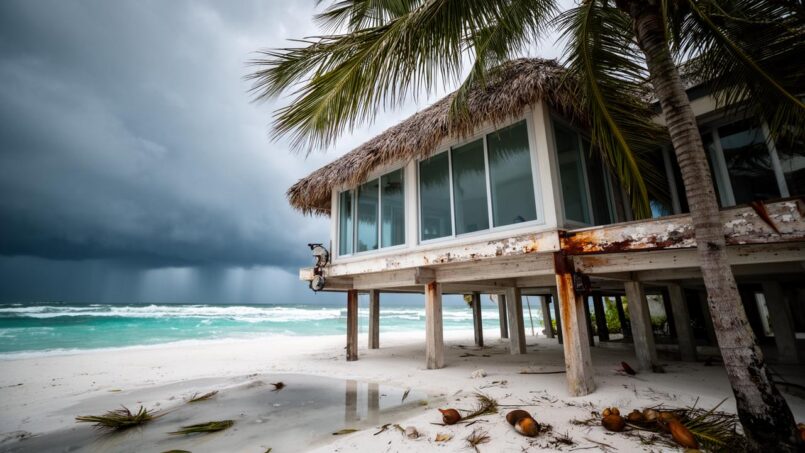
Belize is emerging in 2026 as one of the most dynamic real estate markets in the Caribbean, driven by a tourism boom, a new residency-by-investment program, and a very favorable tax system. But behind the postcard image, the reality is more complex: this low-lying coastal country, with its beaches, reefs, and mangroves, is also on the front line of climate change. Investing in real estate in Belize therefore means, consciously or not, playing on the edge between coastal appeal and rising climate risks.
In this article, we examine how climate change is reshaping real estate value, location, and design in Belize, drawing on official vulnerability studies, sea-level rise scenarios, and recent market trends.
A Booming Real Estate Market on a Vulnerable Coast
The main driver of Belize’s real estate remains tourism. More than 40% of the national economy depends on this sector, and the latest figures show that overnight arrivals now exceed pre-pandemic levels by nearly 10%. Three-quarters of visitors go to the cayes, and about 80% participate in reef-related activities such as diving or snorkeling. In other words, the country’s tourism—and therefore real estate—value rests directly on fragile coastal ecosystems.
Approximately 70% of Belize’s coastal tourism sector is physically vulnerable to the effects of climate change
The paradox is clear: while lodging demand is booming, the same areas that concentrate land value are those most threatened in the medium and long term by sea-level rise, reef degradation, or intensifying hurricanes.
An Economy Dependent on Coastal Ecosystems
Coral reefs, mangroves, and beaches form the backbone of Belizean tourism. Reefs attract divers, mangroves dampen waves and serve as fish nurseries, and beaches offer immediate seaside appeal. The associated ecosystem services have been quantified in several studies: reefs and mangroves prevent between 231 and 347 million dollars in coastal damages each year, mainly by safeguarding infrastructure and real estate from erosion and storm surge.
Mangroves and coral reefs represent up to $167 million per year in avoided damages along the coastline.
The natural protection provided by these ecosystems has a very concrete real estate dimension: it helps reduce the need for costly protective structures (dikes, seawalls, riprap), limits insurance premiums, and increases the “insurability” of coastal properties. But this protection is itself undermined by development pressures and climate change.
Sea-Level Rise, Erosion, Hurricanes: A Direct Threat to Property
Coordinated studies for the Belizean government provide a detailed mapping of the physical threats facing tourist areas. Four major climate factors have been identified as critical for coastal real estate: sea-level rise, increasing sea surface temperature, strengthening hurricane intensity, and rising air temperatures.
Sea-Level Rise: Loss of Beaches and Land
Belize has a long coastal plain, mostly below 20 m elevation, with vast areas below 10 m, and even large stretches of coastline between 0 and 5 m. This last interval is considered the most vulnerable to sea-level rise. Within a 3 km band from the shore—where a large portion of real estate development is concentrated—a significant fraction of this territory falls into that category.
A 1 m rise in sea level would cause a GDP loss of over 2% for Belize, more than US$61 million, mainly due to lower tourism revenues. This figure does not include beach loss, infrastructure degradation, land depreciation, or relocation costs.
A CARIBSAVE study cited in government work simulated the impact of different sea-level rise scenarios on three iconic sites: Caye Caulker, Rocky Point, and San Pedro (Ambergris Caye). The results are striking:
| Site | Beach loss with +1 m sea level | Beach loss with +2 m | Key real estate remarks |
|---|---|---|---|
| Caye Caulker | ≈ 96% of beach | 100% | Submersion of part of the island, including homes and hotels |
| Rocky Point | ≈ 90% of beach | 100% | Currently sparsely built but high tourism value |
| San Pedro (AC) | ≈ 45% of beach | 100% at +3 m | Heart of the hotel and beach condo market |
The example of Caye Caulker illustrates a possible tipping point: with a 1 m rise, a significant portion of the island—including homes and hotels—would simply be submerged. The real estate value accumulated on these narrow sand strips would be partially wiped out.
Accelerated Coastal Erosion: A Slow but Steady Nibbling
Beyond sea-level rise, coastal erosion is already underway. A diachronic analysis from 1969 to 2017 showed retreat rates of up to 2.6 m per year on some coastline stretches, representing more than 110 m of beach lost in 50 years. On average, the country loses about 15.8 hectares of land per year nationally, with a total area already affected of around 25 km².
These figures, modest as a percentage of the territory, are concentrated on the most expensive coastal fringe, including beachfront villas, hotel complexes, and a large share of premium land purchased by affluent Belizeans, expatriates, and foreign investors.
The example of certain villages like Monkey River, in the south, is often cited: since the mid-1980s, the community has lost entire stretches of shoreline, to the point where the viability of the village and its seaside homes is in question. The combination of several factors is already observable: sea-level rise, shoreline retreat, reduced sediment supply from rivers, and destruction of protective vegetation.
More Intense Hurricanes, More Frequent Flooding
Belize lies in a zone where North Atlantic tropical storms and hurricanes strike on average every two years. Climate data show an increase in event intensity over the past thirty years, correlated with warming surface waters. Projections indicate that, even if the overall frequency of cyclones does not necessarily increase, their maximum intensity should continue to grow.
The consequences for real estate are multiple
– Direct structural damage (ripped-off roofs, facades, weakened foundations);
– Flooding from river overflow (fluvial), extreme rainfall (pluvial), and storm surge (coastal);
– Erosion of waterfront land due to storm waves;
– Increased insurance costs, or even withdrawal of coverage for certain property types.
The cases of hurricanes Keith, Earl, Nana, and more recently Lisa show that hundreds, even thousands of homes can be destroyed or damaged in a single event, with a cumulative cost reaching several percentage points of GDP. A risk study estimated that a major disaster could generate more than $670 million in damages, nearly a quarter of the country’s GDP.
Belize City, Placencia, Ambergris Caye: High-Risk Tourist Hotspots
Vulnerability analyses commissioned by the authorities have classified different coastal regions according to their exposure to climate hazards. Unsurprisingly, the flagship beach tourism destinations appear among the most exposed.
Belize City: Economic Heart on Unstable Ground
Belize City combines multiple vulnerabilities. The city is built on a delta at the mouth of the Belize River, with large residential neighborhoods (Vista del Mar, Bella Vista, Belama, Fort George) erected on drained and filled marshlands, often only a few meters above current sea level.
Risk indicators developed in a CORVI-type assessment highlight:
| Indicator for Belize City | Risk score (0–10) | Real estate reading |
|---|---|---|
| People affected by extreme events | 9.37 | Very high human and economic vulnerability |
| Population living at < 5 m elevation | 8.73 | High concentration of assets in flood-prone areas |
| Share of metropolitan area subject to flooding | 7.17 | Large portion of the housing stock is exposed |
| Coastal erosion rate | 7.10 | Shoreline retreat affecting coastal properties |
| Level of shoreline development | 6.53 | High asset value along the waterfront |
| Low-income housing located in flood zones | 6.31 | High social and real estate exposure |
Authorities have already attempted to reduce these risks by building dikes and seawalls about one meter high, as well as pumping stations and canals. But projections indicate a sea-level rise of about 0.47 m between 2040 and 2065, which, combined with a Category 5 hurricane storm surge, could produce a surge of nearly 6 m. In that case, current defenses would be far from sufficient.
Rigid concrete or rock structures reflect wave energy, accelerating erosion of adjacent beaches and requiring further defensive works. This process gradually replaces natural defenses like mangroves and seagrasses, increasing the long-term vulnerability of properties.
Ambergris Caye, Caye Caulker, Lighthouse Reef: The Seaside Eldorado Under Pressure
Studies from the CARIBSAVE and CDKN-supported project showed that tourist hotspots like Ambergris Caye (San Pedro), Caye Caulker, Turneffe Atoll, Lighthouse Reef Atoll, and the Central-South region are among the most exposed to sea-level rise, rising sea surface temperature, and hurricanes.
Land value is skyrocketing on this island: average daily room rates over $270, rental condo demand exceeding supply, and major infrastructure projects to support luxury segment growth.
The average daily room rate now exceeds $270.
Demand for rental condos exceeds available supply on the island.
Road upgrades to Secret Beach and addition of a submarine power cable.
The paradox is again glaring: the more real estate investments pour into the front lines of the coast, the higher the value at risk from phenomena whose trajectory is, at best, contained but not reversed.
Placencia, Dangriga, Hopkins: Coastal Villages on the Front Line
The Placencia Peninsula has become, over the years, a major hub for retirees and investors seeking beachfront villas, small condos, or direct ocean-access land. The state has identified this region as one of the most vulnerable among marine communities, due to high exposure, high sensitivity, and still-limited adaptive capacity.
Projections show that even a modest sea-level rise (20 cm) already stresses linear infrastructure such as roads, protective dikes, and distribution networks, not to mention residential buildings sometimes built right at the waterline. The rapid expansion of subdivisions, often accompanied by clearing right up to the high-tide mark, locally worsens erosion.
From “All-Coast” to “Ridge-to-Reef”: How Climate is Reshaping Demand
Faced with these risk signals, the real estate market itself is beginning to incorporate variables once peripheral: elevation, exposure to prevailing winds, access to fresh water, agricultural potential. A dual dynamic is emerging: continued upscaling on the coast, coupled with a strategic diversification inland.
The Flight to Resilience: Climate, Migration, and New Buying Criteria
In 2026, observers now speak of a veritable “flight to resilience”: North American and European investors are actively seeking “climate-forward” jurisdictions—those rated for their resilience initiatives, low density, and long-term security potential. Belize, with its small population and vast, self-sufficient interior territories, is positioned as a direct beneficiary of this trend.
Keep a beachfront condo for rental profitability while acquiring a backup property (Plan B homestead) in the Cayo district or other highland areas. Selection criteria include elevation, presence of springs or rivers, soil fertility, and the ability to install solar and rainwater harvesting systems.
The Cayo District: A Laboratory for “Post-Coast” Real Estate
The Cayo district, in the west, is often described as the heart of the “Eco-Community” movement. Around San Ignacio and Santa Elena, the hills and riverbanks appeal to buyers seeking energy and food self-sufficiency, away from coastal storm lines. Communities like Carmelita Gardens or Chial Reserve capitalize on this desire for resilience: bioclimatic architecture, regenerative agriculture, solar microgrids, rainwater harvesting—all at elevations that greatly reduce the risk of marine flooding.
Cayo is expected to record real estate appreciation of up to 16% in 2026, surpassing coastal areas where expected increases are 6 to 9%.
Balancing Coastal and Inland Development
The government itself is beginning to incorporate this dimension into its policies, advocating for “balanced development of inland and coastal towns and villages” in housing strategies. This translates into recommendations to strengthen inland infrastructure (resilient roads and bridges, power grids, water), but also targeted adaptation projects in the most exposed coastal areas to delay or limit forced displacement.
For the investor, this spatial recomposition raises a simple question: bet exclusively on the waterfront, or spread assets between high short/medium-term profitability on the coast and safer long-term holdings inland? Climate now weighs as heavily as price curves in this equation.
Public Policies, Coastal Zoning, and New Building Standards
Recognizing the threat to its top economic sector, Belize has multiplied planning and adaptation initiatives in recent years.
Coastal Management Plans and Identification of Resilient Zones
In 2016, the government adopted an integrated coastal zone management policy, accompanied by subnational action plans. These documents rely on modeling tools like InVEST to identify coastline stretches where ecosystem conservation (mangroves, reefs, seagrasses) maximizes protection of property and people, and those that can, under conditions, accommodate additional tourism development.
The least vulnerable zones—in the north, north-central, and south—are identified as potential low-impact hotel development sites, subject to strict guidelines (building setbacks from the shore, use of “grey-green infrastructure,” limits on deforestation, etc.). This mapping allows decision-makers to steer investments toward the most “climate-compatible” areas, but developers must still be willing to follow these recommendations.
Setbacks, Mangroves, and “Grey-Green Infrastructure”
Belize has established a setback rule of 66 feet (about 20 m) from the shoreline for new construction, and has mangrove protection laws. In practice, enforcement is uneven, and many projects long continued to clear vegetation right to the waterline, often leading to almost immediate parcel erosion, then forcing the construction of retaining walls.
Coral reefs like those near Ambergris Caye provide up to 40% of wave dissipation function
The concept of “grey-green infrastructure” – combining protective structures (dikes, breakwaters) with restoration or creation of natural buffer zones – is increasingly promoted in workshops with tourism operators, in order to reconcile building protection with preserving the landscape amenities that give properties their value.
Building Standards, Drainage, and Resilient Housing
In the housing sector, several official reports emphasize the need to integrate climate resilience into housing policy. Recommendations cover a broad spectrum:
Plan integrated stormwater drainage systems in all cities, improve subdivision standards (fill, grading, outfalls), reinforce existing homes (frames, anchors, stilts), disseminate and enforce storm-resistant construction techniques, and establish housing insurance mechanisms linked to compliance with standards.
A recent project, supported by the Adaptation Fund, specifically targets strengthening disaster preparedness, early warning systems, and resilient housing, with a planned budget of about 50 million Belize dollars over five years. A substantial part of this program will be dedicated to building and renovating homes better able to withstand floods and hurricanes, through innovative financing solutions for vulnerable households.
For private investors, these regulatory and programmatic developments translate into rising design standards: accounting for extreme wind, raising floor levels, on-site stormwater management, and using appropriate materials and roof shapes. Properties that incorporate these elements will, over time, be easier to insure and resell.
Insurance, Cost of Risk, and Real Estate Returns
The issue of insurance vividly illustrates the climate impact on Belize real estate. While some markets like Florida are seeing premium spikes and coverage withdrawals, Belize remains, for now, an environment where natural disaster insurance is still accessible, provided certain criteria are met.
Storm deductibles for concrete buildings reach up to 5% of the insured capital.
These parameters create a clear hierarchy in asset quality from an insurance perspective:
| Type of construction / location | Typical annual premium (approx.) | Hurricane deductible | Investor takeaway |
|---|---|---|---|
| Concrete house in inland area | 1–1.5% of insured value | 2–3% | Moderate risk, good insurance conditions |
| Concrete house in coastal area | 1.5–2% | 3–5% | High risk but insurable |
| Wooden house in coastal area | 2–2.5% | ≈ 7% | Very high risk, high cost, volatility |
The incentive effect is immediate: concrete projects designed to hurricane-resistant standards, in slightly setback or elevated coastal areas, benefit from a much more attractive risk profile. Conversely, wooden residences placed a few meters from the sea, in a low-lying area, combine high insurance cost, high deductible, and increased likelihood of claims.
For vacation rental investors, climate differences influence net yield through occupancy potential, daily rate, but also insurance cost and post-storm repair expenses.
Toward “Climate-Smart” Real Estate in Belize
All the elements described—physical vulnerability, policy responses, insurance developments, and demand shifts—point to the same conclusion: in Belize, quality real estate is now, explicitly or not, “climate-smart” real estate.
Concretely, this means several things for the various stakeholders.
For Public Decision-Makers
Vulnerability studies have identified zones where adaptation efforts should be concentrated and where new development should be directed. They underscore the importance of :
– Integrating adaptation strategies into urban and tourism planning (appropriate zoning, revision of the Tourism Master Plan, strengthening the Coastal Zone Management Act);
– Preserving and restoring key ecosystems (mangroves, reefs, riparian forests) to maintain their role in protecting real estate assets;
– Strengthening building and subdivision standards in all exposed areas;
– Developing a national disaster and climate risk financing strategy, combining public budgets, insurance, regional mechanisms, and concessional financing.
For Promoters and Developers
Studies show that projects that account for climate from the design stage are more likely to benefit from political support, better reception from local communities, and a long-term competitive advantage. The use of “grey-green” infrastructure, compliance with coastal setback standards, stilt construction, use of naturalized vegetation for bank stabilization, and implementation of autonomous systems (solar, water harvesting) become commercial as well as technical arguments.
Green certification (EDGE, LEED, Green Globe) is gaining ground in Belize, notably at resorts on Ambergris Caye, improving their eco-friendly image and facilitating access to certain financing.
For Private Buyers and Investors
In the short term, the highest returns are still found on the coast, in micro-markets with strong rental demand like San Pedro or Placencia. But reading the climate risks calls for going beyond simple gross yield logic.
A balanced real estate portfolio in Belize today increasingly resembles a combination of three components:
Three asset categories aligned with climate adaptation and long-term value
Designed with high resilience standards (concrete, thoughtful siting, natural protection), realistically insured, and targeting international tourism clientele.
Located in Cayo, the Corozal highlands, or the South, leveraging elevation, fresh water access, and agro-ecological production to secure value.
Indirect participation in eco-resorts, regenerative communities, or ecosystem-based tourism infrastructure aligned with national policies.
The rise of climate as a structuring market factor also means that criteria once considered “technical”—sea-level rise projections, flood maps, reef condition, mangrove cover, risk indices—are now an integral part of real estate due diligence in Belize.
In the end, the climate impact on Belize real estate is not just a list of threats. It is redrawing the maps of value, shifting attention from the coast to the hills, imposing new construction practices, and highlighting the central role of ecosystems as “natural insurance.” In a country where the beauty of the cayes and reefs has long been seen only as a tourism asset, climate change reminds us that this beauty is also—and perhaps most importantly—a protective capital that must be preserved if real estate in Belize is to remain a sustainable investment.
An estate project or a question? Contact us now to speak with a wealth management expert.
Disclaimer: The information provided on this website is for informational purposes only and does not constitute financial, legal, or professional advice. We encourage you to consult qualified experts before making any investment, real estate, or expatriation decisions. Although we strive to maintain up-to-date and accurate information, we do not guarantee the completeness, accuracy, or timeliness of the proposed content. As investment and expatriation involve risks, we disclaim any liability for potential losses or damages arising from the use of this site. Your use of this site confirms your acceptance of these terms and your understanding of the associated risks.

Cyril Jarnias is an independent expert in international wealth management with over 20 years of experience. As an expatriate himself, he is dedicated to helping individuals and business leaders build, protect, and pass on their wealth with complete peace of mind.
On his website, cyriljarnias.com, he shares his expertise on international real estate, offshore company formation, and expatriation.
Thanks to his expertise, he offers sound advice to optimize his clients' wealth management. Cyril Jarnias is also recognized for his appearances in many prestigious media outlets such as BFM Business, les Français de l’étranger, Le Figaro, Les Echos, and Mieux vivre votre argent, where he shares his knowledge and know-how in wealth management.





