
 Published on and written by Cyril Jarnias
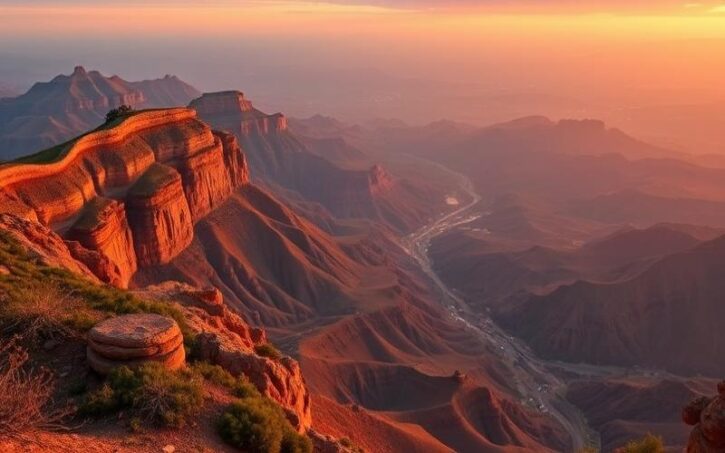
Located along the southwestern coast of South America, Chile offers a striking contrast between its diverse landscapes and rich natural heritage. This fascinating country, renowned for its remarkable geographical diversity, stretches over 4,300 kilometers in length while rarely exceeding 200 kilometers in width.
From the arid and mysterious Atacama Desert in the north to the vast icy expanse of Patagonia in the south, Chile is a true paradise for nature lovers and adventurers seeking unexplored territories.
Furthermore, its unique geography influences not only its varied climate but also the local culture and economy, making it a singular and captivating place to discover.
Location and Borders of Chile
Chile is located on the west coast of South America, forming a long, narrow strip of land between the Pacific Ocean to the west and the Andes Mountains to the east. The country’s approximate geographic coordinates range from 17°S to 56°S latitude and from 66°W to 75°W longitude.
The Chilean coastline stretches for 6,435 kilometers along the Pacific Ocean, from the Atacama Desert in the north to the glacial fjords of Patagonia in the south. This exceptional maritime frontage traverses a great diversity of landscapes, ranging from desert beaches to the rugged southern coasts.
Land Borders
| Country | Border Length (km) |
|---|---|
| Argentina | 5,308 |
| Bolivia | 861 |
| Peru | 160 to 171 |
Extreme Regions
Chilean territory features two emblematic extreme regions:
- In the north, the Atacama Desert is recognized as the driest desert in the world, marking the natural border with Peru and Bolivia.
- In the south, Chilean Patagonia extends to Cape Horn, characterized by its fjords, glaciers, and steppes, offering spectacular landscapes.
The country’s extremities are also marked by the Juan Fernández Archipelago and Easter Island to the west, as well as a territorial claim in Antarctica (1,250,000 km²).
Disputed Areas
- Chile maintains border discussions primarily with Bolivia regarding the latter’s access to the sea, lost after the War of the Pacific.
- Minor disputes also persist with Peru concerning maritime delimitation in the north of the country.
- Chile’s claim to a part of Antarctica is not recognized by the international community, in accordance with the Antarctic Treaty.
Chile’s geography, with its natural borders and extensive maritime frontage, makes it one of the narrowest and most diverse countries in the world, both physically and politically.
Good to Know:
Chile is situated between latitudes 17°29’S and 55°58’S and stretches 6,435 km along the Pacific Ocean; it shares land borders with Peru (160 km), Bolivia (942 km), and Argentina (5,308 km), while the Atacama Desert marks its extreme north and Patagonia its extreme south.
The Largest City in Chile
Santiago is the largest city in Chile with an estimated urban population of 6,999,460 inhabitants in 2025. It covers an area of 641 km² and its density reaches nearly 10,000 inhabitants per km². Founded in 1541, it is the capital and main center of the metropolitan region, concentrating over 85% of the country’s urban population.
Central Role in Chile:
- Economic Center: Santiago is home to the headquarters of major national and international companies, banks, the country’s stock exchange, and numerous shopping centers.
- Political Center: It is the seat of government, parliament, ministries, and public institutions.
- Cultural Center: The city offers a rich array of museums, theaters, art galleries, festivals, and major universities.
Main Neighborhoods and Attractions:
| Neighborhood | Characteristics | Main Attractions |
|---|---|---|
| Bellavista | Bohemian, artistic | Patio Bellavista, La Chascona (Pablo Neruda’s house) |
| Lastarria | Culture, gastronomy | Fine Arts Museum, cafes, cinemas |
| Providencia | Residential and commercial life | Balmaceda Park, shops, restaurants |
| Vitacura/Las Condes | Modernity, business | Costanera Center, parks, upscale restaurants |
| Historic Center | Heritage, institutions | Plaza de Armas, Cathedral, Palacio de la Moneda |
Other notable sites: Cerro San Cristóbal (panoramic city view), Mercado Central, Parque Metropolitano, Pre-Columbian Art Museum.
Historical and Geographical Data:
- Santiago is located in Chile’s central valley, at 500-650 meters above sea level, bordered by the Andes to the east and traversed by the Mapocho River.
- Since the 20th century, the city has experienced rapid growth, from 1.3 million inhabitants in 1950 to nearly 7 million today.
- The architecture of the city center blends colonial, neoclassical, modern, and art deco styles.
Urban Challenges:
- Air Pollution: Due to its geography (enclosed valley and proximity to the Andes), Santiago suffers from smog and high levels of fine particles, especially in winter.
- Road Traffic: Congestion is frequent during rush hour, affecting mobility and quality of life.
- Population Growth: Density and urban expansion strain infrastructure and resources.
Initiatives to Improve Quality of Life:
- Public Transport Development: metro expansion, promotion of cycling and pedestrian spaces.
- Pollution Reduction Plans: restriction of polluting vehicles, encouragement of remote work, greening of public spaces.
- Urban Renewal: creation of parks, modernization of disadvantaged neighborhoods, sustainable housing projects.
- Cultural and Social Support: increase in cultural spaces, strengthening access to education and healthcare.
Santiago embodies the vitality, diversity, and challenges of contemporary Chile, while affirming its role as the country’s economic, political, and cultural heart.
Good to Know:
Santiago, home to over 7 million inhabitants, is not only the economic and cultural heart of Chile but also faces challenges like pollution and traffic congestion; initiatives such as expanding green spaces and improving public transport are underway to enhance quality of life.
Main Regions of Chile
Chile is divided into 16 administrative regions, each with its own geographical and economic identity. The table below presents these regions, their capital, estimated population (2021), and main characteristics.
| Region | Capital | Population (2021) | Geographical and Economic Characteristics |
|---|---|---|---|
| Arica and Parinacota | Arica | ~252,000 | Extreme north, arid climate, Peru/Bolivia border, irrigated agriculture and cross-border trade |
| Tarapacá | Iquique | ~330,000 | Atacama Desert, mining resources (saltpeter, lithium), important port of Iquique |
| Antofagasta | Antofagasta | ~680,000 | Atacama Desert, copper center (Chuquicamata), mining extraction, high immigration |
| Atacama | Copiapó | ~330,000 | Desert, mines (copper, gold), irrigated agriculture (vineyards, olives) |
| Coquimbo | La Serena | ~780,000 | Fertile valleys, agriculture (fruit, wine), coastal tourism, fishing |
| Valparaíso | Valparaíso | ~2,000,000 | Coastline, major seaport, tourism (Viña del Mar), agri-food industry |
| Metropolitan Santiago | Santiago | ~7,100,000 | Political, economic, and cultural center, high urbanization, services, diverse industries |
| O’Higgins (Libertador Bernardo O’Higgins) | Rancagua | ~1,020,000 | Agricultural valleys (vine, fruit), agri-food industry, copper mines |
| Maule | Talca | ~1,080,000 | Intensive agriculture (wines, fruit), forests, food industry |
| Ñuble | Chillán | ~480,000 | Agriculture (vine, fruit), temperate climate, seismic zone |
| Biobío | Concepción | ~2,000,000 | Second industrial hub, port, forestry, fishing, universities |
| Araucanía | Temuco | ~1,000,000 | Significant Mapuche population, forests, lakes, volcanoes, nature tourism, agriculture |
| Los Ríos | Valdivia | ~410,000 | Abundant rivers, temperate forests, paper industry, green tourism |
| Los Lagos | Puerto Montt | ~860,000 | Lakes, islands (Chiloé), dairy farming, fishing, aquaculture (salmon), tourist landscapes |
| Aysén | Coyhaique | ~110,000 | Least populated region, fjords, glaciers, livestock farming, hydroelectric resources, tourism |
| Magallanes and Chilean Antarctica | Punta Arenas | ~180,000 | Extreme south, subpolar climate, oil, gas, sheep farming, access to Antarctica, tourism |
Highlights by Region:
- Metropolitan Santiago Region:
The country’s political, economic, and cultural center, it concentrates nearly 40% of Chile’s population and a large part of its services, industries, and corporate headquarters. - Valparaíso:
Strategic importance for maritime trade due to its port, strong tourist activity (Viña del Mar, UNESCO heritage sites), and a major university center. - Antofagasta:
Renowned for its vast mining resources, especially copper, a pillar of the Chilean economy. A cosmopolitan city attracting many migrants for the mining sector. - Araucanía:
Marked by a significant Mapuche population, landscapes of lakes and volcanoes, agricultural and forestry sector, booming nature tourism.
Climatic Contrasts:
- North (Arica to Atacama):
Atacama Desert, the driest region in the world, high temperatures, almost no precipitation. - Center (Coquimbo to Maule):
Mediterranean climate, fertile lands, intensive agriculture. - South (Biobío to Magallanes):
Oceanic then subpolar climate, forests, lakes, fjords, abundant precipitation and cooler temperatures.
Recent Demographic and Economic Statistics:
- Total population of Chile (2021): approximately 19.5 million inhabitants.
- Urbanization: 87.8% of the population lives in urban areas.
- Main exports: copper (36% of the world market), fruit, wines, seafood products.
- Immigration growth since 2010: +324%, with a high concentration in Santiago and the mining regions of the north.
Summary of Main Regional Contrasts:
- North: mining, arid, low human density.
- Center: agricultural, urban, demographic and economic heartland.
- South: rural, forested, touristy, humid and cold.
Notable Facts:
- Regions have gained autonomy since 2017, with elected regional governors.
- Some regions (e.g., Aysén, Magallanes) remain very isolated, while Santiago polarizes development.
Thus, Chile is a country of strong geographical, climatic, and economic contrasts, structured around its 16 administrative regions.
Good to Know:
Chile is divided into 16 regions, each unique in its geographical and economic characteristics, notably Santiago as the nerve center, Valparaíso for its port, Araucanía for its landscapes and Mapuche population, and Antofagasta for its mining resources, with climatic contrasts ranging from the Atacama Desert to the more humid regions of the south.
Main Cities of Chile
Chilean cities play a central role in the country’s economic, social, and cultural development. They concentrate the majority of the population, the main industrial and commercial hubs, as well as major cultural and political institutions. Chile’s rapid urbanization has shaped a dynamic national identity, marked by the diversity and richness of local contributions.
Santiago
Santiago, the capital, is home to nearly 7 million inhabitants. As the true heart of the country, it constitutes the main political, economic, and cultural center of Chile. Santiago houses the seats of government, major corporations, universities, and major cultural institutions. Its architectural heritage, museums, theaters, and public spaces illustrate the dynamism and modernity of contemporary Chile. Santiago embodies Chilean cultural diversity, blending traditions and international influences in a constantly evolving metropolis.
Valparaíso
Valparaíso has approximately 300,000 inhabitants. Its port is the second most active in the country, essential for foreign trade and the national navy. A city with a prestigious past, Valparaíso was the first major commercial port on the South American Pacific coast, playing a key role in international trade in the late 19th century. The city is a UNESCO World Heritage Site for its singular architecture, historic neighborhoods, funiculars, and colorful hills. Valparaíso is also recognized for its intense cultural life, museums, festivals, and bohemian atmosphere.
Viña del Mar
Viña del Mar, neighboring Valparaíso, has a population of about 330,000. Nicknamed the “Garden City,” it is renowned for its beaches, parks, and modern tourist infrastructure. Viña del Mar is Chile’s main beach resort, hosting the International Song Festival and numerous cultural events each year. Its residential and touristic attractiveness contributes to the national identity by valuing the Chilean way of life and natural heritage.
Concepción
Concepción, with over 700,000 inhabitants in its metropolitan area, is the main industrial center of southern Chile. The city developed around manufacturing, metallurgy, fishing, and services. It is also an important university and cultural hub, hosting higher education institutions, artists, and renowned music events. Concepción plays a fundamental role in the Chilean economy and technological innovation.
| City | Population | Main Role | Historical and Cultural Aspects |
|---|---|---|---|
| Santiago | ~7,000,000 | Political, economic, cultural center | Modernity, diversity, urban heritage |
| Valparaíso | ~300,000 | Port, culture, heritage | UNESCO, unique architecture, artistic life |
| Viña del Mar | ~330,000 | Tourism, residential | Festivals, beaches, green spaces |
| Concepción | ~700,000 (metro) | Industry, universities | Innovation, musical tradition, culture |
Key Points for Each City:
- Santiago: modern capital, national institutions, museums, urban dynamism.
- Valparaíso: historic port, colorful hills, world heritage, street art.
- Viña del Mar: famous beaches, parks, international festival, high quality of life.
- Concepción: industrial hub, universities, music scene, regional innovation.
Urban growth in Chile comes with major challenges: infrastructure management, housing access, environmental preservation, and social inclusion. The rapid expansion of large cities demands ambitious public policies to ensure balanced and sustainable development, while valuing the heritage and cultural diversity that constitute the richness of the national identity.
Good to Know:
Although Santiago exceeds 7 million inhabitants and plays a central role in the country’s dynamics, Valparaíso, with its historic port, and Viña del Mar, renowned for its beaches and festivals, add a rich sociocultural layer; in Concepción, the third-largest city, industry and academia converge to shape a rapidly expanding metropolis.
Disclaimer: The information provided on this website is for informational purposes only and does not constitute financial, legal, or professional advice. We encourage you to consult qualified experts before making any investment, real estate, or expatriation decisions. Although we strive to maintain up-to-date and accurate information, we do not guarantee the completeness, accuracy, or timeliness of the proposed content. As investment and expatriation involve risks, we disclaim any liability for potential losses or damages arising from the use of this site. Your use of this site confirms your acceptance of these terms and your understanding of the associated risks.

Cyril Jarnias is an independent expert in international wealth management with over 20 years of experience. As an expatriate himself, he is dedicated to helping individuals and business leaders build, protect, and pass on their wealth with complete peace of mind.
On his website, cyriljarnias.com, he shares his expertise on international real estate, offshore company formation, and expatriation.
Thanks to his expertise, he offers sound advice to optimize his clients' wealth management. Cyril Jarnias is also recognized for his appearances in many prestigious media outlets such as BFM Business, les Français de l’étranger, Le Figaro, Les Echos, and Mieux vivre votre argent, where he shares his knowledge and know-how in wealth management.





