
 Published on and written by Cyril Jarnias
Stretching into the heart of Southeast Asia, Laos, a landlocked country often overlooked, reveals a fascinating geography that captivates nature and adventure enthusiasts.
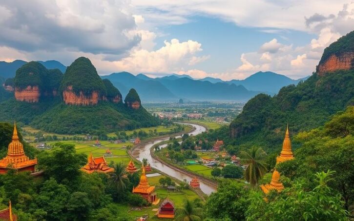
Between majestic mountains and lush valleys, the landscapes of Laos offer a breathtaking spectacle where tranquil rivers and verdant forests blend together.
Dominated by the Mekong River, which flows through the country from north to south and shapes its unique ecosystem, Laos stands out for its exceptional biodiversity and commitment to preserving its natural environment.
Far from traditional tourist routes, this delightfully mysterious country, where various ethnic groups coexist, offers an authentic journey through one of the most pristine landscapes in the region.
Geographical Location of Laos
Laos occupies a central position in the heart of the Indochinese Peninsula in Southeast Asia. It is a landlocked country with no direct access to the sea, surrounded by five neighbors: China to the north, Myanmar (Burma) to the northwest, Thailand to the west, Cambodia to the southeast, and Vietnam to the east. This unique geographical situation has historically made Laos a buffer state and a crossroads of influences between its powerful neighbors.
| Bordering Country | Direction from Laos | Approximate Border Length |
|---|---|---|
| China | North | 200 km |
| Myanmar (Burma) | Northwest | 150 km |
| Thailand | West | 1,000 km |
| Vietnam | East | 2,130 km |
| Cambodia | Southeast | 150 km |
The Mekong, a major river in Southeast Asia, flows through Laos for nearly 1,900 kilometers from north to south and forms a large part of the natural border with Thailand. This river is an essential communication route for local populations despite obstacles like rapids and waterfalls (notably at Khong Phapheng), which limit its navigability downstream. The fertile valleys along the Mekong concentrate most of the arable land and over half of the population.
Relief
The relief of Laos is dominated by mountains and plateaus covering over 70% of the territory. Three major geographical regions can be distinguished:
- The North: rugged mountainous area (highest point: Phou Bia at 2,850 m), covered in dense forests.
- The Center: limestone or sandstone plateaus.
- The South: fertile Bolaven Plateau (renowned for its coffee); in the far south, the Mekong splits into multiple branches forming the “Four Thousand Islands.”
The narrow alluvial plains along the Mekong are the main agricultural areas.
Climate
The climate is tropical monsoon with two distinct seasons:
- Dry season: October to April
- Wet/rainy season: early May to late September
The average annual temperature is around 28°C, but can drop to 10°C during cold nights in some mountainous regions or plateaus.
Laos’s central location in Indochina gives it a historical geopolitical importance marked by its role as a buffer state between Chinese influences (to the north) and Indian/Thai cultural influences (to the west). This centrality also explains why it was a strategic ground during past regional conflicts.
In Summary
- Strategic location in mainland Southeast Asia
- Five neighboring countries with varied influences
- Landlocked country traversed by a major international river
- Predominantly mountainous relief with some fertile plains
- Tropical climate marked by two contrasting seasons
This unique combination makes Laos a natural crossroads with varied landscapes but also a space subject to complex political and economic dynamics linked to its central position in the Indochinese region.
Good to Know:
Laos, located in Southeast Asia, is landlocked between China, Vietnam, Cambodia, Thailand, and Myanmar, with the Mekong as its central waterway; its varied relief consists of mountains, plateaus, and fertile valleys influencing its climate. Due to its central position in Indochina, Laos experiences varied geopolitical influences, reinforced by the climatic diversity of its main geographical regions.
Main Regions of Laos
Laos is divided into 17 provinces (khoueng) and one prefecture, Vientiane, which is the capital and the only municipality under direct administration. These provinces are distributed across three major geographical and cultural regions: the North, the Center, and the South.
| Region | Main Provinces | Geographical Features | Cultural and Ethnic Diversity | Tourist and Economic Points of Interest |
|---|---|---|---|---|
| North | Phongsaly, Luang Namtha, Bokeo, Oudomxay, Luang Prabang, Houaphanh, Sainyabuli | Steep mountains, dense forests, rivers (Mekong, Nam Ou), cool climate at altitude | High ethnic diversity: Hmong, Khmu, Akha, Yao, Tai Lue | Luang Prabang (UNESCO), Pak Ou Caves, trekking in Muang Sing, Phongsaly tea plantations, Nam Ha Nature Reserve |
| Center | Xiengkhouang, Xaisomboun, Vientiane Province, Vientiane Capital, Bolikhamxai, Khammouane | Plateaus (Plain of Jars), karst mountains, rivers (Mekong, Nam Ngum), tropical climate | Lao majority (Lao Loum), Hmong and Tai Dam minorities | Plain of Jars, Kong Lor Cave, capital Vientiane, Nam Ngum Dam, national parks |
| South | Savannakhet, Salavan, Sekong, Champasak, Attapeu | Plateaus (Bolaven), tropical forests, waterfalls, rivers (Mekong, Xe Don), warmer climate | Mon-Khmer groups, Lao Theung, Brao, Alak minorities | Bolaven Plateau (coffee), Khone Phapheng Falls, Vat Phou temples (UNESCO), 4000 Islands (Si Phan Don), agricultural production |
Administrative Division
- First level: 17 provinces + 1 prefecture (Vientiane Capital)
- Second level: Districts
- Third level: Villages
Geographical Aspects
- Mountains: Predominant in the north and east (Phongsaly, Houaphanh, Xiengkhouang)
- Forests: Over 60% of the territory, tropical and subtropical forests, nature reserves (Nam Et-Phou Louey, Nam Ha)
- Rivers: The Mekong flows through the country from north to south, vital for agriculture, fishing, and transport
- Climate: Tropical monsoon, dry season (November-April), rainy season (May-October), variations by altitude
Cultural and Ethnic Diversity
- North: Most diverse region, many highland minorities, animist traditions, textile crafts
- Center: Predominance of the Lao Loum ethnic group, Buddhist influences, presence of Hmong minorities
- South: Strong Mon-Khmer communities, traditional villages, distinctive rituals and festivals
Economic and Tourist Points of Interest
- North: Cultural and adventure tourism, mountain agriculture (tea, rice), crafts, ecotourism
- Center: Administration, commerce, industrial zones (Vientiane, Savannakhet), hydroelectric dams
- South: Agriculture (rice, Bolaven Plateau coffee), nature tourism (waterfalls, islands), world heritage (Vat Phou), fishing
Summary of Main Provinces
| Province | Capital | Population (2023) | Area (km²) | Main Assets |
|---|---|---|---|---|
| Vientiane | Vientiane | 836,000 | 3,920 | Political and economic center |
| Luang Prabang | Luang Prabang | 444,000 | 16,875 | UNESCO heritage, tourism |
| Champasak | Pakse | 706,000 | 15,415 | Vat Phou, 4000 Islands |
| Savannakhet | Savannakhet | 1,004,000 | 21,774 | Industry, commerce, heritage |
| Xiengkhouang | Phonsavan | 254,000 | 15,880 | Plain of Jars |
The provinces of Laos reflect a mosaic of landscapes, cultures, and natural riches, offering a rare diversity in Southeast Asia.
Good to Know:
Northern Laos, famous for its mountainous landscapes, is home to diverse ethnic groups like the Hmong and attracts tourists with the Royal Palace of Luang Prabang and the Mekong River. In the south, Champassak province is marked by the Bolaven Plateau, known for its coffee plantations and spectacular waterfalls.
Main Cities and Urban Areas
Main Cities and Urban Areas of Laos
Vientiane, the capital of Laos, is the main political, economic, and cultural center of the country. Located on the banks of the Mekong, it stands out for its peaceful atmosphere, far from the hustle and bustle of other Asian capitals. Vientiane concentrates government institutions, large companies, embassies, as well as the majority of the country’s modern infrastructure. It plays a key role in economic development through its markets, international airport, and major road axes. Culturally, the city is home to iconic monuments like the golden Pha That Luang stupa, a national symbol, and the Patuxai monument. The cultural scene is dynamic, marked by lively night markets and a growing offering of cafes, restaurants, and artistic events.
Other Major Cities
| City | Approximate Population | Historical/Cultural/Economic Importance | Tourist Highlights |
|---|---|---|---|
| Luang Prabang | ~54,000 | Former royal capital of the Lan Xang kingdom, spiritual center of Buddhism, UNESCO World Heritage site | Temples, monasteries, colonial architecture, Buddhist rituals, mountainous environment |
| Savannakhet | ~120,000 | Second largest city in the country, commercial crossroads on Route 9, major industrial and logistics role | Colonial architecture, proximity to the Mekong, Laos-Thailand Friendship Bridge |
| Pakse | ~90,000 | Capital of the south, economic and transit hub to the Bolaven Plateau and the 4000 Islands | Starting point for southern excursions, lively markets, colonial heritage |
Urban Dynamics
- Population growth in cities remains moderate, with Laos being one of the least urbanized countries in the region.
- Vientiane is experiencing rapid expansion with the arrival of rural populations attracted by economic opportunities and access to services.
- Luang Prabang and Pakse are seeing their populations increase, notably due to the development of tourism and related activities.
- Major challenges include managing urbanization, access to clean water, pollution, heritage preservation, and rising socio-economic inequalities between urban centers and peripheries.
Urban Infrastructure and Development Projects
- Major cities benefit from an improving road network, limited public transport, and progressive access to urban services (electricity, sanitation, internet).
- Vientiane has an international airport (Wattay) and a road network connecting the capital to other major cities and neighboring countries.
- Recent projects include road modernization, construction of bridges over the Mekong, and the arrival of the high-speed train linking Vientiane to China via Boten.
- Luang Prabang and Pakse are investing in the renovation of historic districts, sustainable tourism management, and modernization of hotel infrastructure.
Urban vs. Rural Lifestyle
| Aspect | Urban (Vientiane, major cities) | Rural (villages, countryside) |
|---|---|---|
| Access to services | Broad access to healthcare, education, transport | Limited access, dependence on agriculture |
| Lifestyle | More modern lifestyle, foreign influences, commercial dynamism | Traditional life, strong community cohesion, slow pace |
| Economy | Growing tertiary and industrial sectors | Subsistence agriculture dominant |
| Regional influence | Urban centers polarize development, foster employment and innovation | Role as suppliers of agricultural products |
Urban areas stimulate the regional economy by providing markets for agricultural products, concentrating investments, and attracting tourist flows, which indirectly benefits rural areas.
Tourism and Attractiveness
- Luang Prabang is the main tourist hub of the country, renowned for its heritage, temples, unique atmosphere, and UNESCO listing, attracting international and domestic travelers.
- Vientiane, thanks to its airport and iconic sites, is often the gateway to Laos and an essential stop for tourists.
- Pakse is the ideal base for exploring the south of the country, notably the Bolaven Plateau and the 4000 Islands, while Savannakhet attracts visitors for its authenticity and colonial remnants.
- Tourism represents an important economic driver but imposes challenges in terms of cultural preservation, infrastructure, and sustainable resource management.
Key Takeaway:
The main cities of Laos, though modest in size, play a disproportionate role in the political, economic, cultural, and tourist life of the country, while having to meet the challenges of rapid urbanization and balanced development.
Good to Know:
Vientiane, the capital of Laos, is the political and economic center, while Luang Prabang is renowned for its cultural and historical heritage. Urban infrastructure is developing rapidly, but these cities face challenges such as population growth and the need to improve transport networks.

Cyril Jarnias is an independent expert in international wealth management with over 20 years of experience. As an expatriate himself, he is dedicated to helping individuals and business leaders build, protect, and pass on their wealth with complete peace of mind.
On his website, cyriljarnias.com, he shares his expertise on international real estate, offshore company formation, and expatriation.
Thanks to his expertise, he offers sound advice to optimize his clients' wealth management. Cyril Jarnias is also recognized for his appearances in many prestigious media outlets such as BFM Business, les Français de l’étranger, Le Figaro, Les Echos, and Mieux vivre votre argent, where he shares his knowledge and know-how in wealth management.





