
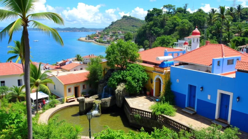
 Published on and written by Cyril Jarnias
An archipelago at the heart of the Caribbean yet a U.S. territory, Puerto Rico is a land of paradoxes: a unique tropical rainforest within the American system, UNESCO-listed fortifications, postcard-perfect beaches, giant caves, bays that glow at night, and vibrant colonial towns. Beyond the clichés of white sand and piña coladas, the island offers a concentrated dose of history, nature, and Boricua culture – a word derived from Borikén, the name the Taíno people gave to their “island of the brave and noble lord.”
This guide selects the must-see sites of Puerto Rico, from classics like Old San Juan to lesser-known spots, to help you understand the island’s uniqueness and create a logical, memorable travel itinerary without trying to see everything.
Old San Juan, Fortified Historic Heart
It’s hard to imagine a trip to Puerto Rico without visiting Old San Juan. This neighborhood perched on a small island connected to the rest of the capital is one of the oldest continuously inhabited European settlements in the Americas. Its cobblestone streets, pastel houses, shaded plazas, and ramparts create an almost theatrical setting, but it’s also a condensed history of five centuries of military, religious, and political life.
La Fortaleza and the UNESCO-Listed Fortified System
The island’s heritage jewel is officially inscribed on the World Heritage List as “La Fortaleza and San Juan National Historic Site”. This UNESCO designation, obtained in 1983, primarily covers the fortifications that secure the bay and protect the old city.
Year La Fortaleza in San Juan was built, the oldest executive mansion still in use in the Western Hemisphere.
Organized around it is the San Juan National Historic Site, managed by the U.S. National Park Service. It includes a series of military works that are among the most impressive defensive systems built by Spain in the New World.
| Element | Characteristics | Role in the Defensive System |
|---|---|---|
| Castillo San Felipe del Morro (El Morro) | 16th-century fortress, labyrinth of tunnels, casemates, and ramps, six levels | Protect the bay entrance from naval attacks |
| Castillo San Cristóbal | Largest Spanish fort in the Americas, built in the 17th–18th centuries | Defense against land assaults from the rest of the island |
| Fortín San Juan de la Cruz (El Cañuelo) | Small fort on the Isla de Cabras islet | Crossfire with El Morro at the channel entrance |
| San Juan City Walls | Ramparts built from the 16th to the 19th century | Protective enclosure of the colonial city |
| Puerta de San Juan | Last preserved access gate | Control of entrances from the sea |
These fortifications illustrate the evolution of European military architecture – from the Renaissance to the Baroque era – adapted to a tropical environment swept by sea spray. Walking the walls at sunset, one better understands the overall logic: El Morro locks down the channel, San Cristóbal covers land approaches, El Cañuelo provides crossfire, while the iconic *garitas* (sentry boxes) dot the panorama.
The forts El Morro and San Cristóbal in Puerto Rico are accessible with a single, economical combined admission ticket. They are open daily with extended hours. El Morro’s esplanade, in particular, is a popular gathering spot: this large lawn facing the sea is used by local families for picnics and flying kites, offering a seaside space for relaxation and recreation.
Cathedrals, Chapels, and Historic Houses
Old San Juan is not just about its walls. Its churches tell the religious and funerary dimension of Spanish colonization.
The San Juan Bautista cathedral houses the tomb of Juan Ponce de León, explorer and first governor, while the San José church, one of the oldest Spanish Gothic buildings in the Americas, offers a rare glimpse of 16th-century religious architecture, extensively restored. A small chapel, Capilla del Cristo, suspended above a cobblestone street, testifies to popular piety, born from a legend of a miraculously saved horseman.
In the alleys, several buildings have become museums that allow visitors to enter the intimacy of colonial families or learn about the island’s great figures. Casa Blanca, built for Ponce de León’s family in the early 16th century, recreates a period home with gardens, while the Cuartel de Ballajá – a 19th-century military barracks – now houses the Museo de las Américas, dedicated to the continent’s cultures, including that of the Taíno.
Plazas, Promenades, and Daily Life
Beyond monuments, Old San Juan charms with its plazas and promenades. The Plaza de Armas, a civic heart laid out in the 16th century, is framed by city hall and adorned with allegorical statues of the seasons. Plaza Colón, dominated by a statue of Christopher Columbus, is a good starting point to head towards the forts or walk up Calle Fortaleza, famous for its artistic installations suspended above the street.
The Paseo de la Princesa, a 19th-century promenade, runs along the city walls and leads to the Raíces Fountain, a sculpture celebrating Taíno, African, and Spanish roots. The path passes through the Puerta de San Juan, the last original gate, and offers views of the sea and the *garitas* (sentry boxes).
This density of sites explains why the San Juan National Historic Site welcomes over one million visitors a year. Yet, the neighborhood is not just a backdrop for cruise passengers: in the evening, tapas bars, small concert venues, and creative restaurants (from traditional cuisine to high gastronomy) give a very contemporary dimension to this historic center.
Great Beaches and Dream Islands
With nearly 300 miles of coastline and multiple satellite islands, Puerto Rico offers a rare diversity of beaches for such a compact territory. The “balnearios” – equipped public beaches – coexist with wild coves and deserted islets. All beaches are publicly accessible, even those lined with hotels.
Around San Juan and the North Coast
The San Juan metropolitan area concentrates some very popular but easily accessible beaches. Isla Verde, often described as the most beautiful urban ribbon of sand, lines up hotels and palm trees on a usually calm sea, practical for swimming or renting a paddleboard. Further west, Balneario del Escambrón, near Luis Muñoz Rivera Park, is appreciated for its reefs close to shore, ideal for a first snorkeling experience.
A few minutes from the airport, Balneario de Carolina regularly earns the international Blue Flag label, a guarantee of water quality and good environmental management. It features showers, play areas, a small water park for children, and even a microbrewery. This type of equipped public beach illustrates the island’s effort to reconcile beach access and basic services.
Heading up the north coast, Puerto Nuevo in Vega Baja and La Poza del Obispo in Arecibo offer spectacular landscapes where huge limestone rock formations break the Atlantic waves, creating calm natural pools. Puerto Nuevo Beach, a Blue Flag beach, is equipped with picnic tables and showers.
East Coast: Between El Yunque and the Fajardo Islands
On the eastern side, the big star is Luquillo, more precisely La Monserrate Beach. This crescent-shaped cove, sheltered from currents, also flies a Blue Flag. It combines shallow waters, lifeguards, a camping area, and a famous row of Luquillo’s *kioskos*: dozens of small restaurants serving the full repertoire of Puerto Rican cuisine, from *mofongo* to roadside fried snacks and seafood dishes.
A bit further north, Fajardo is the main departure point for the small uninhabited islands. Seven Seas Beach, integrated into the Cabezas de San Juan Natural Reserve, is a well-equipped family beach. A coastal trail leads to Playa Escondida, wilder, where mangroves and lagoons form a transition to the open sea. Boats to Cayo Icacos also depart from Fajardo marina, a white-sand islet surrounded by turquoise water with no infrastructure: you must bring your own food and water and, of course, take your trash with you.
Further offshore, Isla Palominos is linked to a large resort in Fajardo. It offers a postcard-perfect setting and mainly welcomes guests via private shuttles. Although the island belongs to a hotel establishment, the principle of public access to Puerto Rican shores theoretically still applies. In practice, it’s mostly resort guests who enjoy it, via the boats provided by the resort.
Culebra and Vieques: The Archipelago within the Archipelago
Within the archipelago, two autonomous islands crystallize travelers’ dreams: Culebra and Vieques. They offer a much more rural atmosphere, with relatively limited tourist development and beaches among the most renowned in the Caribbean.
In Culebra, Flamenco Beach regularly ranks among the world’s most beautiful beaches. Its wide crescent of white sand, crystal clear and shallow water, and green hills in the background create an almost unreal setting. A few food kiosks, restrooms, and camping areas structure the space without spoiling the landscape. On the sand, an old rusty military tank, a remnant of U.S. Navy target practice, reminds us that these islands’ history is not entirely idyllic.
Discover the diversity of Vieques’ beaches, from isolated coves to lively bays, each offering a unique experience.
A crescent-shaped beach lined with palm trees, known as one of the island’s most famous and easiest to access.
An intriguing beach with black sand, tinted by volcanic sediments, offering a unique landscape.
A beach sought after for snorkeling, with rich underwater life, located near the Vieques National Wildlife Refuge.
West Coast: Surfers’ Paradise and Family Coves
On the side of Rincón, Aguadilla, and Isabela, the sea is more energetic, attracting surfers and water sports enthusiasts. Domes Beach, Steps, and Maria’s have become famous spots, while Crash Boat Beach, near Aguadilla, also appeals to families. A former military port, this site is recognizable by its green-painted pier, from which teenagers jump into the water. Food trucks and small beachfront restaurants complete the festive atmosphere.
In Isabela, several beaches have been shaped by rocks to accommodate both young and old. Playa Montones forms a large shallow basin, ideal for young children, with a deeper area for snorkeling. Pozo de Teodoro, nicknamed La Pocita, and other small “pozitas” (natural pools) dot the coast, offering safer alternatives than the open Atlantic waves.
Further south, Cabo Rojo lines up a series of beaches with a classic Caribbean feel: Balneario de Boquerón, almost waveless and equipped with playgrounds; Playa Buyé with its clear water and fine sand; or La Playuela (often called Playa Sucia), an iconic beach bordered by limestone cliffs near Los Morrillos Lighthouse. This coastal area backs onto the Cabo Rojo National Wildlife Refuge, where pink salt flats – exploited for salt for over five centuries – constitute another unique landscape.
Comparison of Some Must-See Beaches
| Beach / Area | Major Assets | For Which Type of Visitor? |
|---|---|---|
| Isla Verde (San Juan) | Long ribbon of sand, urban vibe, often calm sea | Traveler without a car, hotel comfort lover |
| Balneario de Luquillo | Blue Flag, few waves, food kiosks | Families, foodies, combined with El Yunque |
| Flamenco Beach (Culebra) | Pristine white sand, translucent water, preserved setting | Postcard and easy snorkeling enthusiasts |
| Sun Bay (Vieques) | Large bay, relaxed atmosphere, natural shade | Traveler seeking tranquility, Vieques road trip |
| Crash Boat (Aguadilla) | Iconic pier, turquoise water, food trucks | Groups of friends, photo and adrenaline lovers |
| Playa Buyé (Cabo Rojo) | Clear Caribbean water, local vibe | Backpackers, couples, combined with salt flats and lighthouse |
El Yunque and Tropical Nature
Beyond the beaches, one of Puerto Rico’s greatest assets is its mosaic of natural environments. The island concentrates dry coastal forests, mangroves, karst landscapes riddled with caves, spectacular canyons, and especially an emblematic rainforest: El Yunque National Forest.
El Yunque, the Only Tropical Rainforest in the U.S. National Forest System
Located less than an hour east of San Juan, El Yunque is the only tropical rainforest in the U.S. National Forest System. This protected area of nearly 28,000 acres spans several municipalities (Río Grande, Luquillo, Fajardo, Naguabo, Ceiba, Las Piedras, Canóvanas) and receives about 100 billion gallons of rain annually, making it a vital water reservoir for the island.
The numbers give an idea of its richness: approximately 240 species of trees and plants have been recorded, including 26 endemic ones, as well as about fifty bird species. Among them, the local icon, the Puerto Rican parrot, is one of the world’s most endangered parrots. The forest is also a sanctuary for the coquí, a small tree frog whose nocturnal song has become an auditory signature of the island.
This site was sacred to the Taíno, who worshipped deities related to water and mountains here. Today, to reconcile tourism and conservation, access is regulated: a mandatory per-vehicle reservation via an online platform is required to limit crowds on PR-191 road and around the El Portal Visitor Center.
Waterfalls, Observation Towers, and Trails
El Yunque is designed for hiking and discovery. Right at the entrance, La Coca Falls offers a first spectacular stop: a waterfall of about 85 feet cascading over a large rock outcrop, visible from the roadside. Nearby, the Yokahú Tower and Mount Britton Tower allow you to gain height. The latter, accessible via a loop of about 1.6 miles, peaks at over 3,085 feet and, on clear days, offers views stretching from the Atlantic to the Caribbean Sea.
Several trails lead to natural pools and small waterfalls where you can swim, like the Angelito Trail to Las Damas Pond or the Juan Diego Creek area, with its succession of pools under the vegetation. Other paths, like Angelito or the El Toro Wilderness Trail, allow for deeper immersion into the canopy.
The El Portal visitor center, completely redesigned, offers interactive exhibits on ecosystems, cultural history, and conservation challenges. It’s also a convenient starting point for short walks accessible to a wide audience.
Canyons, Dry Forests, and Giant Caves
While El Yunque is the star, other natural sites are just as striking. In the central mountains, the Cañón San Cristóbal cuts through the terrain between Aibonito and Barranquitas. It’s the deepest canyon in the Antilles, with walls reaching about 750 feet in depth and waterfalls like El Juicio, about 250 feet high. Access to the most spectacular sections usually requires guided tours, via routes combining hiking, rappelling, and river crossings.
On the southwestern coast, the Guánica Dry Forest is a UNESCO Biosphere Reserve, offering an arid ecosystem with drought-adapted flora. Its marked trails lead to small isolated beaches, allowing a combination of hiking and swimming with sea views.
Puerto Rico’s underground is equally remarkable. The Río Camuy cave system, in the island’s west, is among the world’s largest cave networks and houses the planet’s third-largest underground river. The cave park offers a guided tour of about 45 minutes to Cueva Clara, a vast chamber with an impressive ceiling, and a viewpoint over a sinkhole where the river roars.
Further north, Cueva Ventana overlooks the Río Grande de Arecibo valley from a limestone cliff. As its name indicates, this ‘window cave’ opens through a natural arch framing a lush landscape, offering a spectacular viewpoint after a short hike. Nearby, Cueva del Indio, by the ocean, reveals Taíno petroglyphs carved into the rock just yards from cliffs sculpted by waves.
Bioluminescence: The Glowing Bays
Puerto Rico is one of the few places in the world with three permanent bioluminescent bays. In these lagoons, microorganisms – dinoflagellates – light up when agitated, producing blue-green trails around paddles, fish, or hands dipped in the water.
Mosquito Bay, on the island of Vieques, is considered the brightest according to the Guinness World Records. The bay’s configuration, exceptional dinoflagellate density, and relative isolation from artificial light sources contribute to this almost supernatural spectacle. Access is exclusively through guided kayak or boat tours, usually after nightfall, preferably on moonless or cloud-free nights.
On the main island, Laguna Grande in Fajardo combines the discovery of a mangrove tunnel – paddled up for about 3 miles round trip – and the observation of light in the water. La Parguera, in Lajas, offers a slightly different experience: it’s the island’s only bioluminescent bay where swimming is allowed, but access is only by motorboat, as kayaking is prohibited.
These environments remain fragile: guides and authorities emphasize good practices (using “reef-safe” sunscreen, prohibiting soap or chemicals in the water, limiting noise and trampling of mangroves).
Traces of the Taíno and Major Archaeological Sites
Before the arrival of Christopher Columbus in 1493, the island of Borikén was inhabited by the Taíno people, a society with complex social structures that left many traces. Some sites, now developed, allow direct engagement with this pre-Columbian heritage.
Ceremonial Parks and Petroglyphs
In Ponce, the Centro Ceremonial Indígena de Tibes is one of the oldest known Taíno ceremonial complexes in the Caribbean. Discovered after floods in 1975, the site revealed not only Taíno ritual structures but also evidence of earlier occupations. It features seven *bateyes* – these rectangular ceremonial plazas – and two other plazas, as well as a cemetery where 186 Taíno skeletons were exhumed. An on-site museum displays weapons, pottery, and representations of deities (*cemíes*).
Number of remarkably preserved petroglyphs carved on the stones delimiting the ten *bateyes* at the Caguana Taíno archaeological site.
In the mountainous region of Jayuya, La Piedra Escrita is a huge rock covered with pre-Columbian engravings, sitting in the middle of the Río Saliente. The rock creates a natural pool popular for swimming, accessible via a wooden walkway. Nearby, Cueva María de la Cruz, in Loíza, also features Taíno paintings and engravings, linking this Afro-Puerto Rican coast to a much older history.
These sites are part of a broader network of pre-Columbian clues – caves, engraved rocks, remains of ancient villages – that remind us that the Taíno legacy is not limited to a few vocabulary words or artisanal motifs.
Taíno Heritage
Dedicated Museums and Indigenous Memory
Several small museums complete this return to roots. In Jayuya, the Cemi Museum takes the stylized shape of a Taíno idol to present collections dedicated to indigenous cosmology. Institutions like the Museo del Oro in San Juan exhibit pre-Hispanic gold objects, testifying to regional exchanges before the European conquest.
For visitors, combining a visit to Caguana or Tibes with exploring the central mountains – coffee plantations, small villages, forests – helps understand how crucial the island’s interior was as a living and worship space long before coastal urbanization.
Ponce, Southern Capital and Open-Air Museum City
In the island’s south, Ponce offers a fascinating counterpoint to San Juan. Nicknamed “Pearl of the South,” it’s renowned for its strong cultural identity, eclectic architecture, and extremely dense historic center, with over a thousand remarkable buildings from the 19th and early 20th centuries.
Central Square, Firemen, and Bourgeois Houses
The heart of Ponce beats on Plaza Las Delicias, a large tree-lined square dominated by the Nuestra Señora de Guadalupe Cathedral and, especially, the Parque de Bombas. This former firehouse, built in 1882, sports a red-and-black striped facade that has made it one of the island’s most photographed symbols. Transformed into a museum, it pays homage to the firefighters who fought major urban and industrial fires.
Ponce’s downtown, especially around its main square, is characterized by many bourgeois mansions and public buildings dating from the region’s economic golden age, fueled by sugar and coffee industries. Notable examples of architecture with ornate facades, wrought-iron balconies, and sumptuous interiors include the Armstrong-Poventud Residence, Casa Wiechers-Villaronga, Casa Serrallés, and Ponce City Hall.
Art, Rum, and Seaside Promenade
El Castillo Serrallés, former residence of the family that built the Don Q rum empire, overlooks the city from a hill. This mansion, now a museum, allows exploration of both industrial history (sugar plantations and distillation) and the lifestyle of a Creole elite. Visitors can even participate in experiences focused on mixology and rum tasting.
La Guancha is an animated coastal boardwalk with a pier, stalls, and a cultural space, very busy on weekends for its concerts and bay views. On the heights, La Cruceta del Vigía is a large cross-viewpoint commemorating the old watchtowers that monitored ship arrivals.
Museums abound: the Museo de Arte de Ponce (famous for its collection of European and Puerto Rican art, including Frederic Leighton’s “Flaming June”), Museo de Historia de Ponce, Museo de la Música Puertorriqueña, Museo de la Masacre de Ponce… For those interested in Boricua culture and history, the city well deserves more than a short stopover.
Rincón, Cabo Rojo, and the Wild West Coast
At the other end of the island, the west coast offers a more laid-back vibe, almost Californian in some aspects, with its beach towns focused on surfing, snorkeling, and sunsets.
Rincón, Capital of Waves and Sunsets
Rincón has become an international reference for surfers, with spots like Domes, Maria’s, or Sandy Beach offering conditions from November to March. But the town doesn’t live only by the board. The Tres Palmas Marine Reserve, opposite Steps Beach, protects one of the largest elkhorn coral formations in the Caribbean, making it a hot spot for diving and snorkeling.
Perched on a cliff, the Punta Higüera Lighthouse is a popular spot to admire the sunset and, in season, watch whales offshore. The surrounding beach town offers various activities like yoga, diverse restaurants, beach bars, and art galleries, making it a pleasant base to explore the western region.
Cabo Rojo: White Cliffs and Pink Salt Flats
Further south, Cabo Rojo draws attention with the Los Morrillos Lighthouse, perched on the edge of high limestone cliffs. The contrast between the white rock, the deep blue sea, and the sandy coves below creates spectacular panoramas, especially around La Playuela.
Exploited for over 500 years, the Cabo Rojo salt flats offer a natural spectacle where the water turns pink, a color due to salt concentration and microscopic algae. This site is part of a national wildlife refuge crucial for migratory birds. Trails and lookouts are set up to observe the salt flats, lagoons, and surrounding mangroves.
This region is also where you can find accommodations committed to sustainable tourism, including small hotels certified by the “green” certification program established by the Puerto Rico Tourism Company.
Caves, Bridges, and Geological Curiosities
Another often underestimated facet of Puerto Rico lies in its geological formations and historical infrastructure: railway tunnels, historic bridges, sea arches…
The Río Camuy Caves and Cueva Ventana
We mentioned the Río Camuy Cave Park, but it deserves to be listed separately as a must-see site, as it contrasts so much with the image of a “simple beach island.” The scale of the chambers, the depth of the sinkholes, and the roar of the underground river give the feeling of entering a parallel world. The managed guided tours limit the impact on the ecosystem while making the place accessible to a fairly wide audience.
This cave offers an intimate experience and spectacular scenery. After a short underground passage, you discover an opening that frames the entire agricultural valley of the Río Grande de Arecibo, with the river winding below. This unique viewpoint has made it a must-see for travel photographers.
Guajataca Tunnel, Historic Bridges, and Curiosities
On the northwest coast, between Isabela and Quebradillas, the Guajataca tunnel – a remnant of the island’s railway past – goes through a cliff to emerge onto a wild beach. The contrast between industrial infrastructure and surrounding nature, plus the sea view, make it a popular stop on a road trip.
The island has several historic bridges, like the Blanco Bridge in Quebradillas, the Mavilla Bridge in Corozal, and the General Norzagaray Bridge in San Juan. These structures testify to the modernization of the road network in the early 20th century and add a heritage dimension to inland excursions, though they are not major attractions in themselves.
In the same vein, certain rock formations like La Cara del Indio in Isabela, carved into the cliff to represent a Taíno chief, or emblematic hills like Cerro Las Tetas between Cayey and Salinas, have become visual and identity landmarks.
Vieques, Mona, and the Wilder Islands
Beyond Culebra and Vieques, Puerto Rico has other islets that fuel the imagination of travelers seeking isolation.
Vieques: Free-Roaming Horses and Wildlife Refuge
Vieques, about a twenty-minute small plane flight from San Juan or accessible by ferry from Ceiba, combines spectacular beaches, bioluminescent bays, and vast areas protected by the Vieques National Wildlife Refuge. The former U.S. military presence paradoxally limited urbanization; today, large portions of the island are preserved, with beaches like Punta Arenas or Playa de los Almirantes earned at the end of sometimes rugged trails.
The territory is characterized by the presence of semi-wild Paso Fino horses, visible on beaches or along roads. For a stay entirely focused on nature, the offerings also include birdwatching, hiking in the mangrove, and snorkeling near reefs.
Mona: The Ultimate Frontier
Even more isolated, Isla de Mona lies between Puerto Rico and the Dominican Republic. Accessible only by boat or plane under strictly regulated conditions, it is often described as the “Galápagos of the Caribbean” for its biodiversity and almost pristine character. Only small groups of scientific expeditions or experienced hikers stay there, making it a goal rather reserved for enthusiasts, but highlighting how far the Puerto Rican archipelago extends beyond the main island.
Sustainable Tourism and Ecological Commitment
Puerto Rico doesn’t rely solely on the quantity of sites to visit; tourism authorities have developed a framework to encourage more sustainable practices, both from operators and visitors.
Certification Programs and Structured Ecotourism
The Puerto Rico Tourism Company, created in 1970, has developed several “green” certification programs covering accommodations, farm stays, and nature activities. The Green Lodging Program distinguishes, for example, hotels and *paradores* that reduce energy consumption, better manage water and waste, and source locally. Different levels – from “basic” to “exemplary” – allow for progress recognition.
In Puerto Rico, an agrotourism program encourages farms to open their doors to visitors while adopting environmentally friendly practices. Coffee haciendas, like San Pedro in Jayuya and Lealtad in Lares, and dairy farms like Vaca Negra in Hatillo, offer immersive experiences to the public. These visits can include tastings of local products (coffee, cheese, honey) or direct participation in production activities, illustrating a model of sustainable and educational agricultural tourism.
On the nature activities side, an ecotourism program certifies operators that combine environmental interpretation, benefits for local communities, and respect for ecosystems. Organizations like Para la Naturaleza, Casa Pueblo in Adjuntas, or community cooperatives around sites like the Cabachuelas caves (Morovis) are good examples.
The bioluminescent bays are a textbook case: their fragility has pushed the island to strictly regulate access, impose non-motorized vessels in some cases, limit the number of tours, and prohibit contact with certain sensitive areas. Visitors are encouraged to choose certified operators, avoid non-biodegradable sunscreens, and scrupulously follow guide instructions.
Tourism businesses and organizations engage in concrete actions to restore ecosystems and protect biodiversity.
Dive centers like Rincón Diving & Snorkeling, Pure Adventure (Ceiba), and Scuba Dogs (San Juan) integrate coral restoration efforts into their commercial activities.
Programs like safeguarding the Puerto Rican parrot in the Río Abajo forest, conducted through partnerships between government agencies and NGOs.
For travelers, this translates into a few simple actions: prioritize local and committed operators, reduce waste (trash cans are rare in natural sites, you must take your trash back), stay on marked trails, and choose sunscreen products without substances harmful to reefs.
How to Combine These Must-Sees in a Trip?
Faced with the abundance of sites – between beaches, forests, caves, colonial cities, and mountain villages – it can be difficult to prioritize. One way to structure a first trip is to think in “major regions” and “themes.”
A trip focused on historical and urban discovery could combine Old San Juan, Ponce, and a few small towns like San Germán (with its old quarter and Porta Coeli church) or Loíza for its Afro-Puerto Rican traditions. Another, nature-oriented, would rely on El Yunque, the Guánica Dry Forest, Cañón San Cristóbal, the Río Camuy caves, and a bioluminescent bay.
A stay in Puerto Rico can be structured around a maritime itinerary including beaches, boat trips to the islands (Cayo Icacos, Culebra, Vieques), snorkeling, and coastal exploration. The island being compact, it’s possible to combine different types of experiences or cross it in a few hours by car, offering great flexibility for longer stays.
In any case, renting a car greatly facilitates exploration beyond the capital, even though organized tours exist to most “must-sees” (El Yunque, bio-bays, islets, etc.). The ideal period depends on priorities: dry season to maximize beach and hiking days, new moon to best enjoy the bioluminescent bays, or swell season for surfers.
The must-see sites of Puerto Rico are not just photogenic. They are witnesses to Taíno, colonial, and industrial history, and laboratories of Caribbean biodiversity. Approaching them with curiosity and respect allows for an authentic immersion into the Boricua soul, between the ancestral heritage of Borikén and the contemporary American present.
Disclaimer: The information provided on this website is for informational purposes only and does not constitute financial, legal, or professional advice. We encourage you to consult qualified experts before making any investment, real estate, or expatriation decisions. Although we strive to maintain up-to-date and accurate information, we do not guarantee the completeness, accuracy, or timeliness of the proposed content. As investment and expatriation involve risks, we disclaim any liability for potential losses or damages arising from the use of this site. Your use of this site confirms your acceptance of these terms and your understanding of the associated risks.
Cyril Jarnias is an independent expert in international wealth management with over 20 years of experience. As an expatriate himself, he is dedicated to helping individuals and business leaders build, protect, and pass on their wealth with complete peace of mind.
On his website, cyriljarnias.com, he shares his expertise on international real estate, offshore company formation, and expatriation.
Thanks to his expertise, he offers sound advice to optimize his clients' wealth management. Cyril Jarnias is also recognized for his appearances in many prestigious media outlets such as BFM Business, les Français de l’étranger, Le Figaro, Les Echos, and Mieux vivre votre argent, where he shares his knowledge and know-how in wealth management.