
 Published on and written by Cyril Jarnias
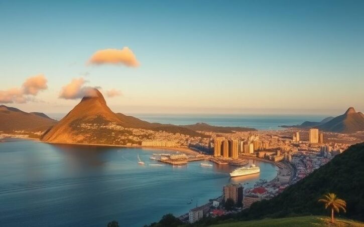
Nestled in the heart of the Caribbean, the Federation of St. Kitts and Nevis consists of two main islands with deliberately contrasting landscapes.
St. Kitts, with its impressive volcanic mountain range and lush tropical rainforests, offers a biodiversity-rich terrain that attracts adventurers and nature lovers.
In contrast, Nevis is distinguished by its pristine beaches and serene atmosphere, ideal for those seeking tranquility.
Despite their small size, these islands harbor a spectacular geographical diversity that influences not only their subtropical climate but also the lifestyle of their inhabitants.
Let’s explore this unique corner of the globe where the harmony between land and sea is omnipresent and where every landscape invites discovery.
Where is St. Kitts and Nevis located?
St. Kitts and Nevis is located in the eastern part of the Caribbean Sea, in the heart of the Lesser Antilles archipelago. The country consists of two main islands, St. Kitts to the northwest and Nevis to the southeast, separated by a narrow strait called The Narrows, about 3 km wide. The archipelago’s orientation is northwest/southeast, with St. Kitts slightly north of Nevis.
Position relative to other islands of the Lesser Antilles:
- North-northwest: Sint Eustatius, Saba, St. Barthélemy, St. Martin
- East and northeast: Antigua and Barbuda
- Southeast: Montserrat and Redonda
- Southwest: Guadeloupe
Distances and directions from mainland territories:
- St. Kitts and Nevis is located approximately 2,000 km southeast of Florida (USA), one of the closest North American mainland territories.
- The northern coast of South America (Venezuela) is located about 1,100 km to the south.
Distinctive geographical features:
- Both islands are of volcanic origin, giving them a mountainous terrain. The highest point is Mount Liamuiga (1,156 m) on St. Kitts.
- St. Kitts and Nevis are separated by a narrow stretch of sea, fostering a strong island identity and local maritime exchanges.
Features related to the island location:
- The islands are exposed to ocean currents from the Atlantic and the Antigua Channel, influencing water temperature and weather conditions, particularly the hurricane season (July to October).
- The climate is tropical, tempered by constant trade winds, with a rainy season from May to November and little marked seasonal variation.
- The exclusive economic zone (EEZ) extends up to 200 nautical miles, favoring access to diverse marine resources (fishing, nautical tourism).
Topographic features and natural environments:
| Feature | Detail |
|---|---|
| Relief | Mountainous, volcanic |
| Highest point | Mount Liamuiga (1,156 m, St. Kitts) |
| Coastal landscapes | Sandy beaches, cliffs, mangroves |
| Marine resources | Fishing, biodiverse waters |
| Soils | Fertile, suitable for agriculture |
| Natural sources | Hot springs (Nevis) |
The coastal landscapes alternate between sandy beaches, steep cliffs, and mangroves. Agriculture benefits from fertile volcanic soils. Natural environments include forests, hiking trails, and abundant marine life thanks to the richness of the surrounding waters.
Good to know:
St. Kitts and Nevis is located in the northern part of the Lesser Antilles, about 300 km east-southeast of Puerto Rico, influenced by ocean currents that bring a humid tropical climate. Away from the mainlands, its maritime wealth and beaches lined with coral reefs make it a precious refuge for biodiversity.
Key takeaway: St. Kitts and Nevis occupies a strategic position in the center of the Lesser Antilles, marked by volcanic relief and a strong maritime and climatic influence, which shapes its landscapes and natural resources.
The main regions of St. Kitts and Nevis
St. Kitts and Nevis form a federation composed of two main islands located in the Caribbean Sea. Each has its own geographical characteristics and identities, while sharing a common history and administrative organization.
| Island | Area | Dominant relief | Highest point | Main town |
|---|---|---|---|---|
| St. Kitts | 168-176 km² | Volcanic mountainous | Mount Liamuiga (1156 m) | Basseterre |
| Nevis | 93 km² | Volcanic mountainous | Nevis Peak (985 m) | Charlestown |
Distinctive geographical features:
St. Kitts is marked by a central mountain range dominated by Mount Liamuiga, an ancient volcano rising to 1156 meters. This range strongly influences the local climate, fostering dense tropical rainforests on the slopes and fertile arable land on the periphery.
Nevis, smaller and almost circular in shape, is structured around Nevis Peak (985 m), also volcanic. The island is renowned for its sulfur hot springs and fine sandy beaches.
Main regions and towns:
Basseterre (St. Kitts): The country’s capital, located on the southwest coast. It constitutes the economic, administrative, and cultural center, with a historical heritage linked to British and French colonization.
Charlestown (Nevis): The main town and capital of Nevis. It is distinguished by its well-preserved colonial architecture and historical role, notably as the birthplace of Alexander Hamilton. Charlestown is also a major cultural and tourist center.
Coastal areas, beaches, and nature reserves:
Both islands are bordered by renowned beaches, including South Friars Bay and Frigate Bay on St. Kitts, as well as Pinney’s Beach on Nevis.
The coastal areas alternate between volcanic cliffs, protected lagoons, and sandy bays.
Several nature reserves protect local biodiversity, including the tropical rainforest on the slopes of Mount Liamuiga and sea turtle nesting sites on the beaches.
Nevis is also known for its natural hot springs and hiking trails around Nevis Peak.
Administrative organization and regional divisions:
The federation is organized into two autonomous entities:
- St. Kitts is subdivided into 9 parishes.
- Nevis comprises 5 parishes and has a distinct local government with a degree of autonomy.
Each island has its own administrative institutions, although the federal government is based in Basseterre.
The management of natural resources and land use planning falls under both local and federal authorities.
Additional notable facts:
The climate is tropical, tempered by trade winds, with a rainy season from May to November.
The economy relies on agriculture (notably sugar cane, now in decline), tourism, and services.
The islands face natural hazards, primarily hurricanes.
St. Kitts is distinguished by its central mountain range and urban dynamism around Basseterre, while Nevis offers a more isolated volcanic relief, beaches, and a more peaceful atmosphere around Charlestown. The administrative organization reflects the duality of the federation, with each island retaining a strong identity and specific responsibilities.
Good to know:
St. Kitts is dominated by the central mountain range where Mount Liamuiga peaks, surrounded by beaches and nature reserves, while Nevis is distinguished by its dormant volcano, Mount Nevis, and its idyllic coastal landscapes. Basseterre, the administrative and cultural capital, is located on St. Kitts, whereas Charlestown, rich in history, is the main town of Nevis.
The major cities and the largest city of St. Kitts and Nevis
Basseterre is the largest city and the capital of St. Kitts and Nevis. It concentrates the majority of the country’s administrative, economic, and port activities. Its central role in governance and commerce makes it the main urban and economic engine of the territory.
List of main cities and towns
| City | Population (est. 2000) | Island | Geographical role | Economic & cultural importance |
|---|---|---|---|---|
| Basseterre | 12,500 | St. Kitts | Capital, main port | Administrative, commercial, and cultural center |
| Charlestown | 1,500 | Nevis | Main town | Administrative and historical center of Nevis |
| Sandy Point | ~3,000 | St. Kitts | West of the island | Second largest town, historic port |
| Cayon | ~2,500 | St. Kitts | Northeast | Agricultural center, local community |
| Saint Paul’s | ~1,800 | St. Kitts | Northwest | Residential town, near agricultural areas |
| Newcastle | ~1,000 | Nevis | Northeast Nevis | Small town, near the airport |
Historical and demographic details
- Basseterre: Founded in the 17th century, this city was an important colonial trading port. Today it houses the majority of national institutions and a strong tourist activity. Its urban expansion accelerated with the development of the financial sector and tourism.
- Charlestown: A town with a preserved colonial heritage, it retains historic buildings and plays a key role in the administration of Nevis. The local culture is strongly marked by island traditions and popular festivities.
- Sandy Point: A former important port, now more residential and agricultural, with a stable population and a strong community identity.
- Cayon and Saint Paul’s: Primarily residential and agricultural towns, characterized by lower population density and a slower pace of urban development.
- Newcastle: A small locality on Nevis, known for its proximity to the airport and peaceful environment.
Comparison of cities
| City | Population (2000) | Area (approximate) | Contribution to national GDP | Urban development/infrastructure |
|---|---|---|---|---|
| Basseterre | 12,500 | ~8 km² | High | Main roads, modern port, infrastructure |
| Charlestown | 1,500 | ~2 km² | Medium | Historic buildings, marina |
| Sandy Point | ~3,000 | ~3 km² | Low to medium | Secondary roads, agricultural infrastructure |
| Cayon | ~2,500 | ~2 km² | Low | Residential neighborhoods, schools, local markets |
Impact of urbanization
- Basseterre concentrates the majority of urban growth, with rapid infrastructure development, particularly in the tourism, commerce, and financial services sectors.
- Secondary towns experience slower urbanization, mainly linked to residential expansion and the modernization of basic infrastructure (roads, schools, markets).
- Urbanization has allowed for the improvement of public services but poses challenges in terms of heritage preservation and natural resource management.
Urban development and notable infrastructure
- Basseterre has a deep-water port, modern road infrastructure, and a bustling city center.
- Charlestown is distinguished by its historical monuments and administrative facilities.
- Other towns focus on essential infrastructure: schools, local markets, roads, and sometimes small tourist facilities.
Key points to remember
Basseterre is the economic and political heart of the country, while Charlestown remains the administrative and historical pillar of Nevis.
Other towns primarily play a local role, with a smaller contribution to GDP and more moderate urban development.
Urbanization is mainly concentrated around Basseterre, supported by the growth of tourism and services, while smaller towns preserve their residential and agricultural character.
Good to know:
Basseterre is the largest city and capital of St. Kitts and Nevis, serving as the economic and cultural center, while Charlestown, on the island of Nevis, is notable for its colonial heritage and more moderate development, with both cities offering quality tourist infrastructure.

Cyril Jarnias is an independent expert in international wealth management with over 20 years of experience. As an expatriate himself, he is dedicated to helping individuals and business leaders build, protect, and pass on their wealth with complete peace of mind.
On his website, cyriljarnias.com, he shares his expertise on international real estate, offshore company formation, and expatriation.
Thanks to his expertise, he offers sound advice to optimize his clients' wealth management. Cyril Jarnias is also recognized for his appearances in many prestigious media outlets such as BFM Business, les Français de l’étranger, Le Figaro, Les Echos, and Mieux vivre votre argent, where he shares his knowledge and know-how in wealth management.





