
 Published on and written by Cyril Jarnias
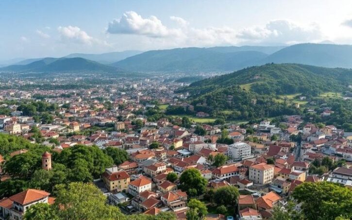
Between the Atlantic Ocean, forest-covered mountains, and plains dotted with fortified villages, Togo packs a variety of landscapes and cultures into a small territory that few West African countries can claim. Long off the beaten path, the country is now betting on a more structured yet still authentic tourism experience, where you can go from a nearly deserted beach to a UNESCO-listed village or a national park in just a few hours by road.
Good to know:
This article helps you organize your trip by combining must-see tourist sites, climate data, cultural aspects, and practical tips, for a structured experience tailored to your preferences.
Lomé and the Coast: Beaches, Markets, and Memory
The entry point for most travelers remains Lomé, an effervescent capital and the country’s main tourist hub. With its palm-lined boulevards, sprawling markets, and seafront, the city combines urban life with direct access to the Atlantic.
Lomé is also at the heart of the national tourism strategy: the government notably identifies the coastline as a major asset, even if shoreline development remains uneven and some stretches still suffer from a lack of infrastructure and sanitation issues.
Beaches of Lomé and the Coastline
The Togolese coast stretches east and west of the capital, with a succession of beaches offering very different atmospheres, from the most popular to the most secluded. Despite sometimes strong currents, these beaches are one of the great pleasures of a stay in Togo, especially during the dry season, which is more conducive to swimming and water activities.
Here is a comparative overview of some easily accessible beaches from Lomé:
| Beach / Site | Approximate Location | Atmosphere and Main Uses | Tourist Features |
|---|---|---|---|
| Plage de Lomé | In the heart of the capital | Urban beach, popular with locals, soccer, relaxation | 3 km of fine sand lined with palm trees, local bars |
| Baguida Beach | East of Lomé | Lively on weekends, quieter on weekdays | Snack bars, fried fish, families, music |
| Coco Beach | Outskirts of Lomé, hotel beach | More controlled atmosphere, access via hotel | Loungers, restaurant, private beach section |
| New Robinson Plage | Outside the center, accessible by shared taxi | Quiet retreat, ideal for a peaceful day | Hotel-restaurant facing the sea |
| Royal Beach Lomé | Slightly away from the city | Very peaceful, few facilities, intimate setting | Grilled fish restaurant, open view |
| Plage d’Aného | Further east, near the “Slave Route” | More historical atmosphere, small seaside town | Link to the former slave coast |
| Kpémé Beach | Kpémé area | Wilder coastline, turtle nesting area | Guided observation outings in season |
The coastal climate remains relatively mild, with temperatures generally ranging between 25°C and 30°C. However, the ocean is demanding: currents can be very strong, which explains the recurring advice to favor frequented areas or those linked to hotels, where swimming is at least better supervised. Water sports are slowly developing, with surfing, kitesurfing, kayaking, and jet skiing offered at some establishments like Novela Star and other beach hotels.
Notable Increase
Sea turtle nest counts have recently recorded an uptick.
Markets, Museums, and Memorial Sites in Lomé
Lomé is not just about its beaches. Much of the city’s soul is found in its markets and a few cultural institutions.
The Grand Marché covers several city blocks and ranks among the largest markets in West Africa. You’ll find fabrics, crafts, food, and electronics in an organized chaos. Photography enthusiasts and those seeking daily immersion often spend hours here, provided they keep an eye on their belongings in the crowd.
Attention:
This Voodoo market provides access to ritual ingredients, talismans, and esoteric objects, with advice from traditional priests, reflecting the coexistence of Christianity, Islam, and animist practices in Togo.
Meanwhile, the Palais de Lomé, the former governor’s residence turned into an art and culture center, illustrates the country’s desire to restore and enhance its heritage sites. Set in a park of about 11 hectares facing the ocean, the building combines colonial architecture with contemporary artistic interventions, showcasing African and diaspora creators. A few streets away, the Sacred Heart Cathedral and the Independence Monument complete this symbolic urban route.
Togoville, Lake Togo, and the Slave Route
A short distance from Lomé, Lake Togo offers a completely different setting. This large lagoon, separated from the ocean by a sandy strip, is a fishing area but also a leisure space where you can practice kayaking, boating, windsurfing, or water skiing depending on hotel facilities.
Example:
On the northern shore of the lake, Togoville is recognized as a founding site of the country’s modern history. It was here that a treaty was signed in the 19th century with German authorities, marking the beginning of the colonial period for ‘Togo-la-belle.’ Crossing the lake by pirogue or motorized boat to the village is part of the experience: the warm brown water, palm-fringed shores, and the silhouette of the village drawing closer provide a gentle introduction to the visit.
Togoville stands out for its singular mix of Catholicism—the Notre-Dame du Lac Cathedral, a Marian sanctuary built after an apparition on the lake—and very active Voodoo practices. Altars dedicated to deities like Legba coexist with Christian relics, and the local “fetish” market underscores the centrality of ancestor and spirit worship in daily life. The Royal House, turned into a small museum, preserves ritual objects, a throne, and photographs retracing the history of the local chieftaincy and the colonial treaty.
Further east, the coastal towns of Aného and Agbodrafo extend this narrative linked to the Atlantic slave trade. Agbodrafo is home to the famous Maison des Esclaves (Slave House), where you can visit the narrow rooms used to hide captives before their embarkation. In Aného, several sites and routes mark the “Slave Route,” now part of a UNESCO itinerary blending memory, culture, and ecotourism.
The Tamberma Country / Koutammakou: A Living UNESCO World Heritage Site
At the other end of the country, far from the sea spray, lies one of the most remarkable cultural landscapes in all of West Africa: Koutammakou, often called Tamberma country or Batammariba country. This territory, shared between northeastern Togo and northwestern Benin, was inscribed as a UNESCO World Heritage site for the exceptional harmony between a unique fortified habitat and a largely intact way of life.
A People of Builders and Farmers
The Batammariba—also called Tamberma, Somba, or Tammari depending on sources—define themselves first and foremost as builders. Their houses, the famous tata, are veritable miniature castles: cylindrical mud-brick structures topped with thatched roofs, connected by high clay walls and with only one entrance. This design is not merely aesthetic: it was conceived as a defensive system, inherited from a history marked by slave raids and tribal conflicts.
Tip:
Every ten years, a major renovation campaign mobilizes the family to reapply the néré fruit-based plaster and reinforce the wooden framework of the clay walls.
The interior layout reflects a particular worldview. The ground floor is largely reserved for livestock, the elderly, and cooking. An earthen staircase leads to an upper terrace where most daily life takes place: preparing and drying grains, evening gatherings, domestic chores. Around this terrace rise cylindrical towers, some used as granaries, others as bedrooms, each with a tiny opening that one must enter backwards, as much out of superstition as architectural necessity.
Cultural Landscape and Daily Life
Koutammakou is not a static museum. The villages are scattered over a vast territory of hills, fields, and sacred groves. Each family home is surrounded by its plots of millet, maize, cotton, or food crops. Large baobabs, mango trees, or gallery forests along watercourses complete this very “inhabited” picture, where nature and buildings respond to each other.
Good to know:
Every Wednesday, farmers, craftsmen, and traders arrive on foot or by bicycle from neighboring hamlets to sell foodstuffs, loose tobacco, second-hand clothing, and millet beer at various stages of fermentation. It’s a place of intense social interaction and a good observation point for visitors.
The spiritual dimension, very present, is embodied in the fetishes and altars that line the entrances of the tata. These objects regularly receive offerings—most often poultry sacrifices—intended to protect the household and maintain the link with ancestors. Major initiation ceremonies, marking the passage to adulthood, still take place in sacred groves and around the houses, with spectacular rituals such as whip fights (now performed with protection).
For the traveler, the appeal of Koutammakou lies as much in the aesthetics of the buildings as in the opportunity to observe a social and symbolic system that remains very coherent. Sleeping in a tata room, joining an evening on the terrace, or accompanying a local guide through the countryside offers a rare immersion in a way of life that globalization has, for now, only partially transformed.
Koutammakou
Access, Season, and Visit Organization
Most excursions to Tamberma country start from the towns of Kandé or Kara. A dirt road connects the main road to the various hamlets of Koutammakou, with Nadoba as an important hub thanks to its market and a few simple accommodations.
The region’s climate is divided between a dry season, roughly from November to March–April, and a rainy season that sometimes makes the tracks difficult. For village exploration, the dry season is more comfortable: moderate heat, low humidity, more passable roads, and the possibility of hiking in the hills without the risk of heavy downpours. In contrast, the wet season offers intensely green, very photogenic landscapes, but at the cost of more uncertain routes.
Local guides offer day trips, including walking, explanations of architecture, beliefs, and rites, and even overnight stays in a tata. The site’s UNESCO inscription has helped fund schools and generate tourism income, but infrastructure remains deliberately limited to preserve the character of the place. Strict respect for prohibitions (sacred spaces, photographing certain scenes, moving within houses) is therefore expected.
The Plateau Region: Kpalimé, Mountains, and Waterfalls
In the south-central part of the country, the Plateaux region forms the green lung of Togo. Around the town of Kpalimé, the hills are covered with forest, coffee and cocoa plantations, and are home to a multitude of waterfalls, making it one of the most attractive areas for travelers seeking coolness, hiking, and scenery.
Kpalimé: A Crossroads of Nature and Crafts
Kpalimé, about 120 km northwest of Lomé, has become the favorite base for hikers. The town combines a lively market, artisan workshops (wood, weaving, painting, pottery), and quick access to the surrounding mountains. Accommodation ranges from cheap small guesthouses to more comfortable hotels, often with the possibility of organizing any type of excursion through local guides recruited directly at the market or via agencies.
The optimal time to stay in Kpalimé generally falls between November and February, when rains are rare, trails are passable, and temperatures are milder. The rainy season, especially in July–August, brings exuberant vegetation, swollen waterfalls, and an impressive ballet of butterflies, but at the cost of slipperier paths.
Mount Agou and Mount Kloto: Hikes with a View
Mount Agou is the highest point in the country (986 m). Isolated above the surrounding hills, it appears as a large promontory covered with forest, coffee and cocoa plantations, and scattered hamlets. From Lomé, the road towards Kpalimé leads to a junction indicating the mountain; a post at Akumawa serves as an entry point, with agents present, an access fee to pay, and the possibility of finding a guide.
Good to know:
The uphill walk takes 2 to 3 hours (600 m elevation gain), with a path mostly through undergrowth and paved sections, with no water points along the way. A drivable road also allows reaching the summit, offering hybrid itineraries (uphill on foot and downhill by car, or the reverse).
The summit, occupied by communication installations and remains of German and French fortifications, offers views of the surrounding villages and, on clear days, as far as the Ghanaian border and Lake Volta. Local authorities have set up a ticket system, sometimes checked at a military post at the top, which requires presenting the entry receipt.
Nearby, Mount Kloto offers a shorter and easier hike, accessible from small villages like Kouma-Konda or the “CP Trailhead” near a bar-restaurant. A forest trail and a small road alternate over a fifteen-minute to one-hour walk depending on the starting point. The route, less demanding than Mount Agou, crosses woods, streams, and fields, and is suitable for a wide audience, including families.
Waterfalls: Womé, Kpimé, Yikpa, Aklowa, and Other Gems
The Plateaux region is literally dotted with waterfalls, some of which are becoming well known to travelers.
Around Kpalimé, the most frequented remain Womé and Kpimé waterfalls:
| Waterfall | Approximate Distance from Kpalimé | Access / Difficulty | Tourist Features |
|---|---|---|---|
| Womé Waterfall | About 12 km | Developed path, 336 steps with railings | Swimming pool, accessible to all |
| Kpimé Waterfall | On the Kpalimé–Adéta road | Forest path, moderate descent | Over 30 m drop, swimming pools, photo |
Womé Waterfall is often recommended for families and visitors unused to hiking: the paved steps, equipped with ramps and rest areas, make the descent and ascent safer. The cascade feeds a large pool of clear water, surrounded by lush vegetation and frequented by clouds of butterflies.
Kpimé Waterfall
Discover this roughly thirty-meter waterfall, nestled in a steep valley, offering a wilder experience than Womé with its pools suitable for swimming in the dry season.
About thirty meters high, it plunges into natural pools at the bottom of a steep valley.
Possibility to swim in the dry season when the current is weaker, in a wild and less structured setting.
Moving away from Kpalimé, several sites take on a more sporty dimension. The Yikpa waterfall (also associated with the Agumatsa Falls, which continue on the Ghanaian side as Wli Falls) requires a walk of about an hour and a half, crossing a steep pass. The path, sometimes muddy and slippery, leads to a narrow valley where water falls in several cascades into a deep basin, before continuing its plunge towards Ghana. The panorama over the three villages of Yikpa from the ridge already justifies the hike.
100
The Aklowa waterfall, one of the most spectacular in the country, reaches a height of 80 to 100 meters from a granite cliff.
More broadly, the region concentrates other lesser-known waterfalls—Kpélé Tsavié, Akakpotoé, Sidiki, Kamalo, Tsonja, Green Waterfall of Gbaledzé—which delight hikers willing to venture off the usual routes. The paths leading there cross protected forests like Missahohé, small farming villages perched on the plateau, and food crop fields. In practice, a local guide is almost essential to find some of these sites, as signage remains very limited.
When to Come to the Plateaux?
The region’s climate follows the same alternation as the rest of the country: dry season from November to around March, with moderate temperatures and rare rainfall, then a long wet season, whose peak is in July–August. For hiking and waterfalls, the compromise is subtle:
– In the dry season, trails are safer, roads more passable, and temperatures more pleasant. The falls remain fed—some like Womé maintain a good flow year-round—but flows may be lower on secondary sites;
– In the rainy season, the forest explodes with greenery, waterfalls reach their maximum power, and the abundance of butterflies and birds is spectacular, at the cost of slippery paths, possible leeches, and degraded roads.
December to February, already recommended for the whole country, offers an excellent balance for a stay in Kpalimé: clear skies, high probability of great views from the summits, and bearable heat for walking.
Fazao-Malfakassa: The Great National Park
For lovers of wildlife and grand landscapes, Fazao‑Malfakassa is the country’s main protected area. Located between the Central Region and the Kara Region, on the edge of the Ghanaian border, this park covers nearly 2,000 km², making it the largest national protected area.
A Patchwork of Natural Environments
Fazao-Malfakassa unfolds in the heart of the Togo/Atakora Mountains, in a transition zone between Sudanian savannas and denser forests. The relief alternates rounded hills, plateaus, steep valleys, and granite outcrops. Watercourses like the Kpaza or Koué rivers draw gallery forests, while wetlands like Mare-aux-Lions punctuate the mosaic.
Botanical studies list over 500 plant species distributed across nearly 100 families, with wooded savannas dominated by species like Afzelia africana or Isoberlinia doka, gallery forests rich in Dialium or Antiaris, and submontane forests on the higher slopes. Approximately 97% of the area is reportedly still covered by various forest formations, the rest shared between savannas and shrubby areas.
This diversity of environments explains the great faunal richness of the site.
Fauna: A Still Remarkable Biodiversity
Even if poaching and political crises of past decades have heavily affected certain populations, Fazao‑Malfakassa remains a refuge for varied fauna. Inventories report at least 19 species of large and medium mammals: forest and savanna elephants, buffalo, kob, roan antelope, hippotragus, hartebeest, various small antelopes (duikers, guibs, oribis), warthogs, varied primates (baboons, monkeys), felines (especially leopard), and more discreet carnivores.
a few dozen
The elephant population in the region collapsed after poaching in the 1990s, now numbering only a few dozen individuals.
For birdwatchers, the park is a true hotspot. Classified as an “Important Bird Area” (IBA) by BirdLife International, Fazao‑Malfakassa is home to at least 240 to nearly 300 bird species. Among them, emblematic or threatened West African species: grey parrot, casqued hornbills, critically endangered vultures, eagles (including martial), francolins, guineafowls, great turacos, herons, storks, etc. Recent surveys have highlighted the presence of many Guineo-Congolian forest species rarely observed this far north, reinforcing the park’s importance on a regional scale.
Safari Togolese Style: Real Conditions on the Ground
Unlike the great parks of East or Southern Africa, Fazao‑Malfakassa remains a rustic destination. Tourist infrastructure is limited: secondary roads sometimes difficult, almost total absence of upscale lodges inside the park, simple accommodations in nearby towns (Kara, Sokodé, peripheral villages). Travelers who venture here must accept a certain level of discomfort: camping with prior permit, self-supply of water and food, reliance on a 4×4 vehicle and local guides.
In return, the experience is often described as more “wild” and peaceful. Possible activities include:
Outdoor Activities
Discover a variety of immersive experiences in exceptional landscapes: safaris, hikes, and cultural encounters.
Drive through forest tracks and savannas to spot elephant signs, antelopes, or primates.
Explore certain areas accompanied, particularly at sunrise or sunset.
Enjoy panoramic viewpoints over the surrounding hills and valleys.
A rewarding experience near forest edges and water points.
Learn about agricultural practices and local cultures from neighboring communities.
When to Visit Fazao‑Malfakassa?
The park’s operation also follows the rhythm of the seasons. Generally, the dry season—from November to April—is preferred for wildlife observation: roads more accessible, grass shorter, animals more concentrated around water points. Many sources indicate that November to March constitutes the best window, with a peak in tourist traffic in February and March across the country.
The rainy season, from April to October, transforms the park into a green jewel. Forest birds are particularly active at the end of the dry season and the beginning of the wet season (March–May), making it an interesting period for birdwatchers, despite reduced visibility for large mammals and trickier tracks.
In any case, visiting the park requires preparation: advance booking with management authorities, transport planning (Lomé to park region about 5 to 7 hours by road), hiring guides, and preferably insurance covering possible medical evacuation, as the country’s health facilities remain limited.
Koutammakou, Koutammakou… and Everything in Between
One of the main appeals of Togo is the possibility, on a two-to-three-week trip, of combining extremely different worlds without having to cover endless distances. Road connections, though sometimes chaotic, allow you to chain together the following major areas:
| Region / Hub | Major Assets | Recommended Ideal Period |
|---|---|---|
| Coastline and Lomé | Beaches, markets, palace, Slave Route, Lake Togo, Togoville | November to March (dry and cooler climate) |
| Plateaux / Kpalimé | Mountains, waterfalls, forests, crafts, mountain villages | November to February, or rainy season for full-flow waterfalls |
| North / Koutammakou | Fortified villages, UNESCO cultural landscape, traditional markets | December to February for optimal weather |
| Fazao-Malfakassa | Wildlife, hiking, birdwatching, varied landscapes | Dry season (November–April), especially November–March |
This backbone can then be enriched with detours to other sites: Keran and Fosse aux Lions for other parks further north, interior towns for markets and daily life, the edge of the Mono River and lagoons for waterbird observation.
Climate, Seasons, and Choosing Your Time
Climate data collected for the country confirm a consensus: the main dry season, from November to March, offers the best conditions for most travelers. Temperatures remain relatively moderate, humidity drops, and rainfall becomes scarce. This window is particularly recommended for:
– exploring Lomé and the coastal towns, less oppressive in the heat;
– hiking the trails of Kpalimé, Mount Agou, and Mount Kloto without wading through mud;
– visiting Koutammakou and its rural tracks, more easily accessible;
– planning safaris in national parks, where roads remain open and wildlife is more visible.
Good to know:
December and January offer the most pleasant conditions, with daytime temperatures between 20°C and 30°C in the north (Koutammakou, Boukoumbé) and cool nights around 15°C.
For those who prioritize lush green landscapes, the wet season (June–October, with a peak in July–August) literally transforms the country: mountains draped in clouds, roaring waterfalls, fields in full growth. Nature photography or birdwatching enthusiasts may prefer these months, provided they accept difficult roads, weather surprises, and heavier heat, especially on the coast.
Infrastructure, Costs, and Practical Realities
Togo remains a relatively undeveloped tourist destination. The accommodation offer is still dominated by guesthouses and small hotels, with a few mid-range establishments and some beach resorts. Prices, however, remain attractive on a regional scale: $10 to $25 per night for simple accommodations, about $35 to $100 for mid-range hotels. Meals at local eateries or small restaurants often cost between $2 and $5, while tables more oriented towards international travelers charge around $8 to $12.
Tip:
Transport in Togo includes urban taxis with systematic price negotiation, motorcycle taxis (zémidjans) for short distances at low cost, and intercity minibuses for longer daytime journeys. For remote areas like Fazao-Malfakassa or certain mountain villages, it is recommended to rent a vehicle with a driver or use an agency or organizing guide.
To this picture, a few constraints should be added: secondary roads sometimes in poor condition, crossings becoming impassable in the rainy season, frequent power cuts, uncertain tap water quality, and a limited healthcare system outside major cities. Authorities and foreign embassies strongly recommend insurance covering medical evacuation and recall the requirement for yellow fever vaccination for entry into the country, as well as the need for preventive malaria treatment.
Towards a More Structured but Still Authentic Tourism
Togolese authorities see tourism as one of the potential drivers of economic development, with the stated ambition to increase its contribution to GDP and create thousands of jobs. Projects are underway: restoration of cultural sites, inventory of tourist establishments, projects for zones dedicated to ecotourism and beach tourism, gradual modernization of Lomé airport, development of booking platforms.
Good to know:
Togo is often included in circuits combining Ghana, Benin, and Burkina Faso rather than visited alone. This low exposure is an asset: fewer crowds, more spontaneity, direct interactions with locals, and preserved landscapes.
This situation imposes on the visitor a posture of responsibility: choosing locally involved guides and accommodations, respecting cultural codes (especially around sacred sites and rituals), limiting one’s impact on fragile natural environments—whether turtle nesting beaches or mountain forests.
Building Your Own “Must-See Togo”
Rather than mechanically listing a “top 10” of sites, it is more useful to imagine Togo as a set of complementary broad canvases:
– A coastline where beaches, the memory of the slave trade, markets, and urban palaces create a strong introduction to contemporary Togolese society;
– A mountainous heart made of waterfalls, forests, and artisan villages, ideal for walking and slow travel;
– A northern region of plains and hills, shared between millennia-old cultural landscapes (Koutammakou) and vast natural areas (Fazao‑Malfakassa, Keran, Fosse aux Lions) where wildlife still has its place.
Each traveler will build their itinerary according to their priorities—swimming and relaxation, hiking, wildlife observation, cultural immersion—but whatever the choices, the dominant impression at the end of a trip to Togo is often the same: that of having touched a still discreet country, at the crossroads of many influences, whose tourism potential is far greater than current visitor statistics suggest.
Togo’s “must-see sites” are not hyper-developed spectacular attractions, but rather places where nature, history, and daily life still respond to each other without excessive artifice. Perhaps that is where the true luxury of this small West African coastal country lies.
A heritage project or a question? Contact us now to speak with a wealth management expert.
Disclaimer: The information provided on this website is for informational purposes only and does not constitute financial, legal, or professional advice. We encourage you to consult qualified experts before making any investment, real estate, or expatriation decisions. Although we strive to maintain up-to-date and accurate information, we do not guarantee the completeness, accuracy, or timeliness of the proposed content. As investment and expatriation involve risks, we disclaim any liability for potential losses or damages arising from the use of this site. Your use of this site confirms your acceptance of these terms and your understanding of the associated risks.

Cyril Jarnias is an independent expert in international wealth management with over 20 years of experience. As an expatriate himself, he is dedicated to helping individuals and business leaders build, protect, and pass on their wealth with complete peace of mind.
On his website, cyriljarnias.com, he shares his expertise on international real estate, offshore company formation, and expatriation.
Thanks to his expertise, he offers sound advice to optimize his clients' wealth management. Cyril Jarnias is also recognized for his appearances in many prestigious media outlets such as BFM Business, les Français de l’étranger, Le Figaro, Les Echos, and Mieux vivre votre argent, where he shares his knowledge and know-how in wealth management.





