
 Published on and written by Cyril Jarnias
Lost in the vastness of the South Pacific, halfway between Fiji and Samoa, the country of Wallis and Futuna remains largely unknown. Yet, this small French overseas territory concentrates a surprisingly rich geography within just 142 km²: volcanic islands ringed by reefs, a turquoise lagoon, steep mountains, water-filled craters, endangered tropical forests, and fragile coastlines subject to rising sea levels. Understanding its geography is also key to understanding why its population is concentrated in certain areas, why agriculture remains limited, how isolation shapes transportation, and the ways in which climate change is already disrupting the balance of these islands.
A Polynesian Territory Between Fiji, Samoa, and Tonga
Wallis and Futuna is officially the “Territory of the Wallis and Futuna Islands“, a French overseas collectivity located in the southern Pacific Ocean, in the heart of Polynesia, but distinct from French Polynesia. Its geographic coordinates are around 13°18′ South and 176°12′ West, placing the territory about 360 km west of Samoa and 480 km northeast of Fiji. On a Pacific scale, it is roughly one-third of the way between New Zealand and Hawaii.
The archipelago is surrounded by neighboring islands: Tuvalu to the northwest, Fiji to the southwest, Tonga to the southeast, Samoa to the east, and Tokelau to the northeast. Although politically attached to France and associated with the European Union as an OCT (Overseas Country and Territory), it remains geographically and culturally integrated into Polynesia.
With a land area of approximately 142.42 km² and 129 km of coastline, Wallis and Futuna appears tiny on maps. But this figure says nothing about the dispersion of its lands: the archipelago is actually split into two island groups separated by about 260 km of ocean, complicating everything – from maritime links to development policies.
Two Archipelagos for One Territory
To the northeast, the Wallis Islands, or Uvea, form the most populated part of the territory. To the southwest, the Futuna Islands, or Horn Islands (Hoorn), include Futuna proper and Alofi, which is almost uninhabited. In total, there are three main tropical volcanic islands – Uvea (Wallis), Futuna, and Alofi – plus about twenty very small uninhabited islets, mostly around Wallis.
This dual structure – a northern group dominated by a low island surrounded by a lagoon, and a southern mountainous group without a lagoon – is at the heart of Wallis and Futuna’s geography. It largely explains the population distribution, the traditional organization into kingdoms, the nature of infrastructure, and even the environmental differences between the two poles.
Wallis (Uvea): A Low Island Ringed by a Lagoon
Uvea, better known as Wallis, is the most populous island in the territory. Covering an area of about 75–78 km² depending on sources, it is home to approximately 72.5% of the country’s inhabitants. Its capital, Mata Utu, is located on the east coast, in the Hahake district, and concentrates administrative and commercial functions.
Gentle Terrain, a Protective Reef
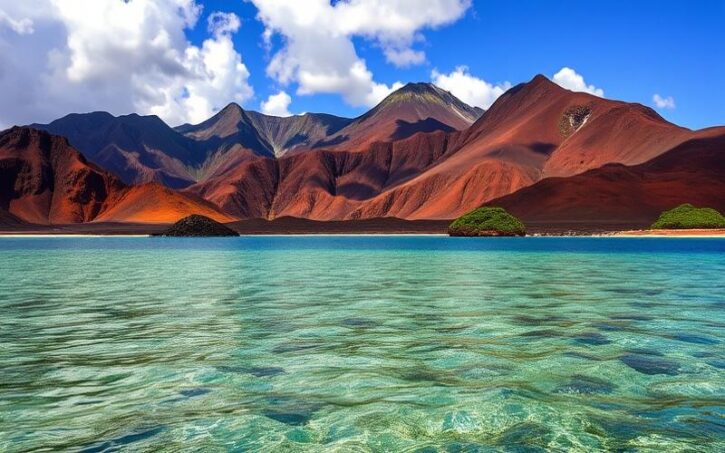
Unlike Futuna, with its rugged terrain, Wallis is described as a “low” island. The base is volcanic, but erosion has significantly softened the slopes. The island is entirely encircled by a barrier reef forming a vast lagoon. This lagoon contains between 13 and 20 small *motu*, uninhabited coral islets, which contribute to the characteristic lagoon landscape of tropical archipelagos.
Inland, volcanic activity from the Middle Pleistocene formed circular or elliptical crater lakes, visible today amid the tropical vegetation, illustrating the spectacular legacy of this geological period.
Among the most well-known are: the great artists, major works, and significant movements in art history.
| Crater Lake | Main Geographic Feature |
|---|---|
| Lalolalo | One of the largest crater lakes in the Pacific, about 450 m in diameter, 80 m deep |
| Lano | Crater lake surrounded by secondary forests |
| Lanutavake | Deep lake, difficult to access and heavily wooded |
| Lanutuli | Small crater lake in a forested area |
| Lanumaha | Small volcanic body of water |
| Kikila | Crater lake near inhabited areas |
| Alofivai | Crater lake adjacent to an ancient secondary crater |
These lakes, often nestled within steep walls, contribute to the uniqueness of Wallis’s geography: few tropical islands of this size boast such a string of water-filled craters.
The Lagoon, Epicenter of Maritime Life
The reef and lagoon of Wallis form a major ecosystem, both for biodiversity and daily life: coastal fishing, lagoon navigation, trips to the islets, and, more broadly, protection of the island from the energy of ocean waves.
Scientific surveys in Wallis have identified no fewer than 639 species of coastal fish.
The lagoon is also a considerable scenic asset, often described as one of the most beautiful in the world. It is no less fragile, however: the reefs have already been affected by natural events, notably a major earthquake in 1993, and remain sensitive to water warming, acidification, and cyclones.
Futuna and Alofi: Mountains, Forests, and Isolation
More than 250 km southwest of Wallis stand the islands of Futuna and Alofi, separated by a strait about 2 km wide, the Vasa. Here, the landscape changes radically: gone is the large low island with a lagoon, replaced by two more compact volcanic islands with tight, rugged terrain and often steep coasts.
Futuna, a Steep Island Turned Toward the Mountain
Futuna covers about 46 km². Its relief is distinctly more rugged than that of Wallis; the interior is traversed by ridges and steep valleys. It is on Futuna that Mount Puke (or Mount Singavi), the highest point in the territory, generally estimated at 524 m above sea level, rises.
The rugged topography limits usable agricultural land. The slopes, especially where the forest is degraded, are subject to severe erosion, with gullies carved by watercourses. Freshwater comes from springs, wells, and valleys.
The shores of Futuna are rocky for long stretches, with few continuous coastal plains. Villages are mostly distributed along the coasts, where the land is suitable for construction and subsistence farming. The main administrative center of the island is Leava, a port located in the kingdom of Sigave.
Alofi, the Almost Uninhabited Island Without Freshwater
Opposite the eastern part of Futuna, the island of Alofi extends over nearly 18 km². Physically, it resembles a condensed version of Futuna: mountainous terrain, forests, beautiful beaches. But one crucial geographic characteristic sets it apart: the absence of natural freshwater resources.
The island has no permanent population due to the lack of perennial streams and an accessible aquifer for a sustainable supply. Some sources mention occasional human presence, such as a resident and a few dogs, but this is not a permanent settlement.
This lack of continuous occupation has allowed primary forests to persist on part of the island. Alofi thus appears as a natural laboratory, precious for biodiversity, but particularly vulnerable to external pressures: invasive species, fires, climate change.
A Sea Without a Protective Lagoon
Unlike Wallis, which is surrounded by a vast lagoon, the islands of Futuna and Alofi do not benefit from a comparable lagoon. The reefs are mostly fringing, hugging the coasts, which exposes the coastline more to swells and complicates maritime operations. Port access, particularly at Leava, requires relatively mild weather conditions, especially for cargo ships.
A Territory Structured by Customary Kingdoms
The human geography of the country of Wallis and Futuna remains inseparable from its customary divisions. The territory consists of three traditional kingdoms – Uvea, Alo, and Sigave – which also correspond to the main geographic areas.
The kingdom of Uvea encompasses the entire island of Wallis. It is itself subdivided into three districts:
| Uvea District | Position on the Island | Main Center |
|---|---|---|
| Hihifo | West | Vaitupu |
| Hahake | East (includes the capital) | Mata Utu |
| Mu’a | South | Mala’efo’ou |
On Futuna, the kingdom of Sigave occupies the western part, while the kingdom of Alo rules the eastern part and includes the island of Alofi. The center of Sigave is Leava, Futuna’s main port, and that of Alo is Mala’e.
This customary organization largely matches the geography: borders follow ridges, valleys, and shoreline lines. It continues to structure land use, the distribution of family lands, resource management, and the location of infrastructure.
Tropical Warm Climate, Abundant Rainfall, and Cyclones
Like much of the South Pacific archipelagos, Wallis and Futuna has a tropical oceanic climate, often classified as “Af” in the Köppen system, meaning a tropical rainforest climate. Meteorological parameters confirm this classification: constant heat, high humidity, frequent rain, and no true dry season.
Two Seasons, But Rain Year-Round
Residents mainly distinguish two major periods:
The climate is divided into two main seasons. The warm and rainy season runs from November to April (austral summer), with temperatures between 28 and 32 °C, high humidity, and a maximum risk of tropical cyclones. The cooler and drier season runs from May to October, under the influence of the trade winds. Temperatures remain high but the atmosphere is more comfortable, especially from June to October, considered the most pleasant months.
Climate statistics highlight this permanent humidity: average annual rainfall varies between 2,500 and 3,000 mm depending on sources, and even exceeds 3,300 mm in Mata Utu. Rain falls on average at least 260 days a year. In other words, the sky is rarely completely dry.
In Mata Utu, the annual data show:
| Climate Indicator (Mata Utu) | Average Annual Value |
|---|---|
| Average Annual Temperature | ≈ 27.1 °C |
| Average Daily Maximum Temperature | ≈ 29.8 °C |
| Average Daily Minimum Temperature | ≈ 24.3 °C |
| Annual Rainfall | ≈ 3,322.6 mm |
| Rainy Days per Year | ≈ 201 |
| Average Relative Humidity | ≈ 80% |
Temperatures rarely drop below 24 °C, even at night during the so-called “cool” season. The feeling of heat is amplified by humidity, resulting in a climate considered “heavy” for much of the year.
Cyclones and Climate Hazards
Located in an active intertropical convergence zone, the archipelago lies on the potential path of many low-pressure systems. Cyclones, particularly between late December and early April, constitute the major hazard: violent winds, torrential rains, destructive swells, floods, and landslides.
Cyclone Ella, which occurred in 2017, is often cited as an example of a cyclone system occurring on the edge of the classic season. This event illustrates the trend of extreme phenomena becoming more frequent and occurring outside their usual time window. It directly questions the climatic future of Wallis and Futuna, where global warming could amplify storm intensity, increase coastal erosion, weaken coral reefs, and disrupt harvests.
Rich but Pressured Biodiversity
Beyond the landscapes, the geography of Wallis and Futuna can also be read through its fauna and flora. The islands belong to the Fiji tropical moist forests ecoregion, meaning they share a common ecological base with other Southwest Pacific archipelagos, while also hosting their own endemic species.
Between Ocean, Forests, and Watercourses
The marine environment is particularly remarkable around Wallis, with its 639 species of coastal fish recorded. In freshwater environments – rivers, streams, small lakes – researchers have identified four fish species and three crustacean species, including the goby Stiphodon rubromaculatus.
On land, the only native mammals are bats, as in many isolated Oceanian islands. Other mammals (pigs, dogs, etc.) were introduced by humans. A number of invertebrate species are of scientific interest, such as the spider Schizocosa vulpecula.
Five groups of endemic species are highlighted in the archipelago, including birds, mollusks, and flowering plants.
But this biodiversity is now in danger. A 2022 study on the endemic vascular plants of Wallis and Futuna showed that 15 of the 17 species studied were threatened with extinction. A strong warning signal for a territory where primary forests have almost disappeared.
Deforestation, Erosion, and Fragile Soils
Of the 142 km² of the country of Wallis and Futuna, only a small part is truly suitable for agriculture. According to sources, barely 5% of the land is classified as “arable”, meaning suitable for annual crops. Permanent crops (coconut palms, banana trees, etc.) cover about 20% of the area. The remaining forests represent around 40% of the territory according to some recent estimates, but these are largely secondary or degraded forests.
The use of wood as the main source of domestic energy is a major factor in deforestation. Repeated cutting has reduced forest cover, which, on the steep terrain of Futuna, has accelerated erosion. Tropical rains now wash down deforested slopes, carrying soil into the valleys and directly threatening inhabited areas and farmland.
The soils, of volcanic origin, can be fertile in theory, but their quality is highly variable and often limited by erosion, slope, or conversely by excess water. On both Uvea and Futuna, agricultural productivity remains modest considering the climate, which is otherwise favorable to vegetation. The territory thus remains dependent on imports for many food products.
Coastal Issues and Climate Change
The coastline concentrates most of the villages, infrastructure, and economic activities. However, this coastline is doubly threatened: by natural dynamics (swell, storms, subsidence) and by human pressures (sand extraction, construction in low-lying areas, destruction of mangroves and protective reefs).
Authorities and scientists have been warning for several years about coastal erosion. Sand extraction for construction, in particular, has accelerated the retreat of some beaches. To this is added the gradual rise in sea level linked to climate change, which is eating away at habitable space. In the long term, some coastal areas could become uninhabitable, forcing populations to move inland, onto land that is often already occupied or sometimes less favorable for agriculture.
A Concentrated and Declining Population
The human geography of the country of Wallis and Futuna is marked by a double characteristic: a strong concentration in small coastal areas and a rapid demographic decline, linked to massive emigration to other Pacific territories, particularly New Caledonia.
Island Distribution and Contrasting Densities
At the July 2023 census, the total population was 11,151 inhabitants, compared to nearly 15,000 in the early 2000s. In twenty years, the territory has thus lost more than a quarter of its inhabitants. Most of those who leave are young people, attracted by jobs, training, and services available in Nouméa or mainland France.
The distribution among the islands remains highly imbalanced:
| Main Island | Approximate Area | Population 2023 | Share of Total Population | Estimated Density |
|---|---|---|---|---|
| Wallis (Uvea) | ≈ 75–78 km² | 8,088 | ≈ 72.5% | > 100 inhabitants/km² |
| Futuna | ≈ 46 km² | 3,225 | ≈ 27.5% | ≈ 70 inhabitants/km² |
| Alofi | ≈ 18 km² | 0 (non-permanent) | — | — |
Most inhabitants live near the coasts, where the terrain is less restrictive and where roads provide access to schools, services, and the few salaried jobs. Over time, some interior villages have lost residents to better-served coastal areas.
An Archipelago with More People in Exile Than on Its Islands
The geographic dimension of this demography is not limited to the islands themselves. A significant proportion of Wallisians and Futunians now live elsewhere, mainly in New Caledonia. Estimates suggest over 20,000 people originally from Wallis and Futuna are settled in New Caledonia, more than the population remaining in the archipelago. Other communities exist in mainland France and neighboring French overseas departments.
Demographic decline leads to the desertification of space (abandoned houses, fallow fields) and a decrease in real estate pressure in some villages. However, remittances from expatriates provide vital economic support, contributing to the maintenance of local life.
A Transportation Network Constrained by Geography
In a territory split into two island groups 260 km apart and without a major naturalized port city, transport infrastructure is necessarily modest and sensitive to natural hazards. Geography directly shapes mobility possibilities here.
Roads, Ports, and Airports
The road network is concentrated mainly on Wallis, where there are about 100 km of roads, of which only 16 km are paved. These roads serve the villages, circle the island, and connect the capital to Hihifo airport in the north and the main points along the coast. Futuna, smaller and more mountainous, has only about 20 km of roads, all unpaved, which complicates travel after heavy rains.
Annual number of rotations for the cargo ship providing the maritime link between Wallis and Futuna and New Caledonia.
On the air side, the organization is simple: one airport per main island. On Wallis, Hihifo Airport has an asphalt runway about 2.1 km long, the only international gateway to the archipelago. It is served by Aircalin, the airline based in New Caledonia, via Nouméa and sometimes Nadi (Fiji). On Futuna, Pointe Vele Airport offers only a one-kilometer runway, suitable only for small aircraft like the Twin Otter. Flights between Wallis and Futuna constitute the only true domestic route, vital for the exchange of people and light goods.
Structural Isolation
The absence of a regular passenger boat service – no vessel has provided domestic passenger connections since the late 1990s – reinforces dependence on air travel. This situation is all the more pronounced as geography leaves few options: inter-island distances are too great for frequent service by small shuttles, and sea conditions, particularly around Futuna, do not allow safe year-round rotations.
Evolution of communication infrastructure to reduce the territory’s digital isolation
The territory long depended on satellite links, characterized by high cost and low speed.
This cable has significantly improved connectivity, marking a turning point in reducing digital isolation.
A local mobile network has been set up, although its geographic coverage remains uneven across the territory.
Resources, Agriculture, and a Subsistence Economy
The geography of Wallis and Futuna, made up of limited lands, fragile soils, and sometimes steep terrain, naturally directs the economy towards fishing, subsistence farming, and livestock, complemented by the public sector largely funded by France.
Few Arable Lands, but Diversified Agriculture
Land use statistics show that agricultural land covers only a restricted part of the territory. According to some estimates, about 5 to 7% of the area is arable, while permanent crops (coconut palms, banana trees, etc.) occupy 20 to 35% of the land. The rest consists of forests (primary or secondary) and various other surfaces (built-up areas, fallow land, soils too poor or steep).
Despite the constraints, subsistence agriculture is central, with the cultivation of taro, yams, sweet potatoes, cassava, bananas, breadfruit, and various vegetables. Coconut palms provide copra for oil and export. On Futuna, a specific adaptation to the terrain is illustrated by the cultivation on terraces of a particular variety of water taro, the “pakanuku” or “talo vusiga”.
The raising of pigs, which have important cultural and ceremonial roles, holds a central place, alongside a few cattle and poultry. Fishing complements this subsistence trinity, whether lagoon, coastal, or offshore fishing within the exclusive economic zone.
An Economy Largely Oriented Outward
The island geography strongly limits industrial development: activities remain modest – copra, handicrafts, wood, fish processing. Transport costs, the small size of the market, and territorial dispersion hinder any large-scale industrialization.
The territory’s financial resources depend mainly on public transfers from France, fishing licenses sold to foreign fleets (notably Japanese and South Korean), taxes on imports, and remittances from the diaspora.
This economic dependence cannot be understood without returning to geography: a small, isolated archipelago, without significant mineral resources, with limited lands, landlocked between several regional powers, can hardly rely on anything but the sea, subsistence farming, public services, and national solidarity.
Energy and Transition on Constrained Islands
Energy supply illustrates well the territory’s geographic difficulties. For a long time, electricity was produced almost exclusively from diesel or gasoline generators, fueled by imported fuels. A costly, low-resilience, and high CO₂-emitting situation.
The Solar Gamble in an Island Environment
Aware of these limitations, the country of Wallis and Futuna has begun a transition towards renewable energy. In 2023, four photovoltaic power plants were commissioned: three on Wallis (Lavegahau, Falaleu, Vaitupu) and one on Futuna (Mamati). These installations already power several hundred households and public buildings.
The territory aims to reduce its energy dependence, decarbonize its electricity production, and control public spending. The goal is to reach 50% renewable electricity by 2030. Given the abundant sunshine, sometimes strong winds, and complex terrain that makes networks difficult, solar appears as the most realistic short-term option, potentially complemented by small hydropower units or energy storage solutions.
But this transition remains technically and financially costly: transporting panels, batteries, spare parts, ensuring maintenance in isolated villages, training technicians on site. So many challenges to overcome on islands far from any major industrial center.
A Territory on the Front Line of Climate Change
Ultimately, the geography of the country of Wallis and Futuna paints the portrait of an archipelago that is both resilient and vulnerable. Resilient because it has, for centuries, adapted its ways of life to often ungenerous lands, an omnipresent ocean, and sometimes devastating cyclones. Vulnerable because the combination of rising sea levels, coastal erosion, deforestation, and soil impoverishment is now severely testing this balance.
The preservation of ecosystems (reefs, lagoons, forests), the fight against erosion, water management, and coastal planning raise crucial questions for the future: the safety of dwellings, the availability of agricultural land, and the reliability of inter-island links in the face of intensifying storms.
In this set of questions, geography is no longer just a description of terrain, climates, and maps. It becomes the key to understanding an island future that is already playing out daily, on the shores, in the valleys, and along the freshwater craters of Wallis and Futuna.
Disclaimer: The information provided on this website is for informational purposes only and does not constitute financial, legal, or professional advice. We encourage you to consult qualified experts before making any investment, real estate, or expatriation decisions. Although we strive to maintain up-to-date and accurate information, we do not guarantee the completeness, accuracy, or timeliness of the proposed content. As investment and expatriation involve risks, we disclaim any liability for potential losses or damages arising from the use of this site. Your use of this site confirms your acceptance of these terms and your understanding of the associated risks.

Cyril Jarnias is an independent expert in international wealth management with over 20 years of experience. As an expatriate himself, he is dedicated to helping individuals and business leaders build, protect, and pass on their wealth with complete peace of mind.
On his website, cyriljarnias.com, he shares his expertise on international real estate, offshore company formation, and expatriation.
Thanks to his expertise, he offers sound advice to optimize his clients' wealth management. Cyril Jarnias is also recognized for his appearances in many prestigious media outlets such as BFM Business, les Français de l’étranger, Le Figaro, Les Echos, and Mieux vivre votre argent, where he shares his knowledge and know-how in wealth management.





