
 Published on and written by Cyril Jarnias
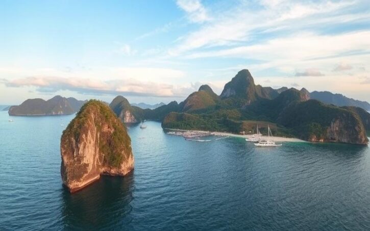
Located at the crossroads of Southeast Asia, the Philippine archipelago stretches across over 7,000 lush islands, forming a unique patchwork of landscapes. Bordered by the South China Sea to the west, the Pacific Ocean to the east, and the Philippine Sea, the country boasts a diverse geography ranging from pristine tropical beaches to rugged, volcanic mountains.
The Philippines, a land of contrasts, offers varied ecosystems, from vibrant coral reefs to lush jungles, home to exceptional biodiversity. In this naturally dynamic space, the meeting of tectonic plates gives the country an active seismic character, contributing to the continuous evolution of its landscape.
Geolocation of the Philippines and Its Borders
Geographic Coordinates of the Philippines:
- Latitude: between 4° 40′ and 21° 10′ N
- Longitude: between 116° 40′ and 126° 34′ E
- Often cited central point: 13° N, 122° E
The Philippines is a Southeast Asian archipelago located in the western Pacific Ocean. The country stretches approximately 1,850 km from north to south, forming an island chain that connects southern Taiwan to the northern tip of Borneo.
Seas and Oceans Surrounding the Philippines:
- To the west, the South China Sea
- To the east, the Philippine Sea
- To the south, the Celebes Sea
- To the southwest, the Sulu Sea
| Sea/Ocean | Position Relative to the Philippines |
|---|---|
| South China Sea | West |
| Philippine Sea | East |
| Celebes Sea | South |
| Sulu Sea | Southwest |
Neighboring Countries and Regional Borders:
The Philippines shares no land borders; it is separated:
- To the north by the Luzon Strait, separating it from southern Taiwan (approx. 360 km)
- To the west by the sea towards Vietnam
- To the south by maritime waters separating Mindanao from the northern coasts of Malaysia (Borneo) and Indonesia (Sulawesi)
Spatial Summary:
Concise list of geographic relationships:
- North: Taiwan, via the Luzon Strait
- West: Vietnam, across the sea
- South/Southwest: Borneo (Malaysia) & Sulawesi (Indonesia) via border seas
Main Islands and Archipelagos Comprising the Country:
The Philippine territory consists of approximately 7,641 islands, grouped into three main clusters:
- Luzon – largest island (~105,000 km²), capital region with Manila
- Visayas – central island group including Cebu, Panay, Leyte…
- Mindanao – second largest island (~95,000 km²), in the south
These three regions constitute nearly the entire national land area; only eleven islands account for approximately 94% of the emerged territory.
The strategic importance of the Philippines stems directly from:
- Its central position on major maritime routes linking East Asia to Southeast Asia.
- Its potential control over several straits essential for international trade.
- Its historical role as a cultural and commercial crossroads in this area of high economic activity.
The surrounding seas also provide major fishing wealth and increased military importance for any power wishing to influence or protect these vital sea lanes.
Good to Know:
Located between 4° and 21° north latitude and 116° and 127° east longitude, the Philippines forms a strategic archipelago in Southeast Asia, stretching between the South China Sea and the Philippine Sea, with Luzon and Mindanao as its main islands. The country’s position, at the crossroads of vital maritime routes, places it near Taiwan to the north, Vietnam to the west, and Malaysia and Indonesia to the south.
Main Regions of the Philippines
The Philippines is a Southeast Asian archipelago organized into three major island groups: Luzon, Visayas, and Mindanao, comprising 17 administrative regions. Each region has distinct geographic, cultural, economic, and climatic characteristics.
Administrative Division and Organization
- 17 administrative regions (rehiyon), grouping 80 provinces (lalawigan).
- Provinces are subdivided into cities, municipalities, and then barangays (smallest local unit).
- Metro Manila (National Capital Region, NCR) is not subdivided into provinces, but into 17 autonomous cities/municipalities.
- The Bangsamoro Autonomous Region has a special status.
| Island Group | Main Regions | Population (est. 2020) | Characteristics |
|---|---|---|---|
| Luzon | NCR, I, II, III, IV-A, IV-B, V | ~60 million | Political and economic center, mountains, rice terraces, beaches |
| Visayas | VI, VII, VIII | ~20 million | Central archipelago, Cebuano culture, beaches, volcanoes |
| Mindanao | IX, X, XI, XII, XIII, BARMM | ~25 million | Ethnic diversity, agriculture, forests, armed conflicts |
Luzon
- Geography: Largest island, mountains (Cordillera), fertile plains, rice terraces, volcanoes (Pinatubo, Mayon).
- Culture: Tagalog, Ilocano, Kapampangan mix; strong Spanish colonial influence.
- Economy: Industrial, technological, and financial center (especially Metro Manila). Rice, sugarcane, light industry.
- Climate: Tropical, marked monsoon, frequent storms.
- Attractions:
- Metro Manila: shopping malls, nightlife, colonial history.
- Banaue (rice terraces), Baguio (cool climate), Mayon Volcano, Palawan beaches.
Visayas
- Geography: Central archipelago, mountainous islands, indented coasts, numerous beaches.
- Culture: Cebuano, Hiligaynon, Waray languages; colorful festivals like Sinulog in Cebu.
- Economy: Fishing, agriculture (sugarcane, coconut), beach tourism.
- Climate: Tropical, frequent cyclones, abundant rainfall.
- Attractions:
- Cebu (cruises, history), Bohol (Chocolate Hills, tarsiers), Boracay (beaches), Iloilo (colonial architecture).
Mindanao
- Geography: Second largest island, mountains, dense forests, vast agricultural plains.
- Culture: Great ethnic diversity (Moro, Lumad, Visayans), Muslim traditions in Bangsamoro.
- Economy: Agriculture (banana, pineapple, cocoa), fishing, mining resources.
- Climate: Less affected by typhoons, abundant rainfall, cool mountainous areas.
- Attractions:
- Davao (Mount Apo, exotic fruits), Siargao (surfing), Zamboanga (Hispanic influence), Lake Sebu.
Metro Manila (NCR)
- Characteristics: Urban agglomeration of over 13 million inhabitants.
- Economy: Political and financial heart, center of services and technology.
- Attractions: Intramuros (Spanish fortifications), museums, giant shopping malls, urban parks.
Notable Differences Between Regions
- Languages: Tagalog predominates in Luzon, Cebuano in the Visayas, and a mosaic of languages in Mindanao.
- Religion: Majority Catholic in Luzon/Visayas; significant Muslim presence in Mindanao.
- Economy: Luzon is the most industrialized, Mindanao remains agricultural, Visayas is marked by tourism.
- Climate: Typhoons more frequent in the north (Luzon/Visayas), Mindanao is more spared.
Economic and Demographic Statistics (est. 2020)
- Total Population: Approximately 110 million inhabitants.
- GDP (2022): Approximately 400 billion USD.
- Growth Rate: Approximately 5-7% per year in recent years (excluding pandemic).
Main Tourist Attractions by Region
- Luzon: Banaue Rice Terraces, Mayon and Taal Volcanoes, Palawan beaches.
- Visayas: Boracay beaches, Bohol’s Chocolate Hills, historic churches of Cebu.
- Mindanao: Mount Apo, Siargao beaches, Mindanao lakes.
Map of the Philippines — Geographic Distribution of Regions

Summary of Differences Between Luzon, Visayas, and Mindanao
| Criterion | Luzon | Visayas | Mindanao |
|---|---|---|---|
| Area | Largest island | Central archipelago | 2nd largest island |
| Population | Densest | Less dense | Diverse |
| Language | Tagalog, Ilocano… | Cebuano, Hiligaynon… | Cebuano, Maranao, Tausug |
| Religion | Predominantly Catholic | Predominantly Catholic | Predominantly Christian and Muslim |
| Climate | Monsoon, typhoons | Tropical, cyclones | Tropical, fewer typhoons |
| Economy | Industrial, services | Tourism, agriculture | Agriculture, resources |
| Attractions | Rice terraces, volcanoes | Beaches, hills, festivals | Mountains, lakes, surfing |
Good to Know:
The Luzon region is not only the largest but also the most populous in the Philippines, housing the capital Metro Manila, while Visayas is renowned for its paradisiacal beaches and Mindanao is a fertile area conducive to agriculture. Due to their diversity, each region has a specific climate, with a mix of humid and dry tropical zones influencing the local economy, from tourist gems like the Chocolate Hills in Bohol to the Batad rice terraces.
Largest Cities in the Philippines
Major cities play a driving role in the economic and social development of the Philippines: they concentrate infrastructure, employment, educational and cultural institutions, while being at the heart of the country’s innovation and modernization. Urban dynamics support national growth, attract foreign investment, and foster social diversity.
Main Cities by Population, Area, and Location
| City | Estimated Population (2025) | Area (km²) | Geographic Location |
|---|---|---|---|
| Manila | 1,850,000 (city), >14 M* | 42 | Luzon Island (north-central metropolis) |
| Quezon City | 2,960,000 | 166 | Northeast Metro Manila |
| Davao | 1,860,000 | 2,443 | Southeast Mindanao Island |
| Cebu City | ~1,000,000 | ~315 | Central-East Cebu Island |
| Caloocan | ~1,660,000 | 53 | Northwest Metro Manila |
*The Greater Manila metropolis (“Metro Manila”) comprises over 14 million inhabitants, making it the country’s main urban hub.
Major Characteristics of Main Cities
Manila
- Political and economic capital, historic heart with Intramuros.
- Major financial hub (districts like Bonifacio Global City), high tertiary density.
- Cultural crossroads: national museums, prestigious universities.
- Notable fact: second most densely populated city in the world.
Quezon City
- Largest city by population; government center for several decades.
- Home to major university institutions like the University of the Philippines Diliman.
- Modern residential districts; important media/pharmaceutical hubs.
- Anecdote: houses the country’s tallest national memorial – Quezon Memorial Circle.
Davao
- Main city in the south; recognized for its increased safety in recent years.
- Strong logistical/industrial appeal due to its modernized port.
- Agro-industrial center renowned for its fruit exports (durian).
- Notable fact: nicknamed “the smoke-free city” for its strict anti-smoking policy.
Cebu City
- Economic capital of the Visayas; regional ICT/BPO hub with its modern IT Park.
- Rich Spanish colonial heritage, renowned cultural festivals (“Sinulog”).
- Recently modernized Port/International Airport enhancing its competitiveness.
- Anecdote: considered “the Queen City of the South”.
Caloocan
- Residential hub/rapidly expanding commercial dynamism in northern Metro Manila.
- Important history linked to the Philippine revolution against Spanish occupation.
- Administrative peculiarity: divided into two non-contiguous sectors.
Common Urban Challenges in Major Metropolises
- Overpopulation leading to pressure on essential services
- High air pollution due to dense traffic
- Recurring road congestion problems (traffic jams)
- Widespread informal housing in some peripheral areas
- Vulnerability to extreme climate risks
Recent Statistics / Global Rankings
- Metro Manila is among the most densely populated urban agglomerations in the world (>43,000 inhabitants/km²).
- Davao is cited among Asian cities that have experienced the fastest urban growth outside the capital region in the last ten years.
Interesting Facts/Additional Anecdotes
- Manila: The Intramuros district was completely rebuilt after being destroyed during World War II.
- Quezon City: Many national TV/radio studios are located here — it is nicknamed “City of Stars”.
- Davao: The nearby Mount Apo is the highest point in the Philippines.
- Cebu: First Christian site in East Asia — historic cross planted by Magellan in 1521.
Urban Development Outlook & Major Projects
Ambitious initiatives focus on:
- Accelerated modernization of public transport: new subways/LRT/MRT in Manila; highway extensions in Cebu/Davao
- Philippine Housing Roadmap aiming for affordable housing for all by 2040
- Tax incentives for green/mixed-use projects in all major urban centers
- Massive development of specialized economic hubs (BPO/ICT/logistics)
These transformations are accompanied by a stated commitment to reduce urban poverty and social inequalities through inclusive sustainable planning.
Good to Know:
Manila, the capital of the Philippines, is not only the most populous but also faces challenges like overpopulation and pollution, while Quezon City, larger in area, houses many cultural and scientific centers. Davao stands out for its exemplary environmental management and Cebu is renowned for its historical colonial heritage, while infrastructure developments in Caloocan aim to improve urban connectivity.
Disclaimer: The information provided on this website is for informational purposes only and does not constitute financial, legal, or professional advice. We encourage you to consult qualified experts before making any investment, real estate, or expatriation decisions. Although we strive to maintain up-to-date and accurate information, we do not guarantee the completeness, accuracy, or timeliness of the proposed content. As investment and expatriation involve risks, we disclaim any liability for potential losses or damages arising from the use of this site. Your use of this site confirms your acceptance of these terms and your understanding of the associated risks.

Cyril Jarnias is an independent expert in international wealth management with over 20 years of experience. As an expatriate himself, he is dedicated to helping individuals and business leaders build, protect, and pass on their wealth with complete peace of mind.
On his website, cyriljarnias.com, he shares his expertise on international real estate, offshore company formation, and expatriation.
Thanks to his expertise, he offers sound advice to optimize his clients' wealth management. Cyril Jarnias is also recognized for his appearances in many prestigious media outlets such as BFM Business, les Français de l’étranger, Le Figaro, Les Echos, and Mieux vivre votre argent, where he shares his knowledge and know-how in wealth management.





