
 Published on and written by Cyril Jarnias
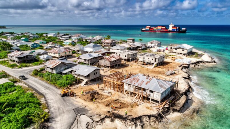
Tuvalu is often cited as the archetype of the “country that will disappear.” Yet behind the images of flooded atolls lies a much more complex story: that of a state that refuses forced exile and is reinventing its territory… by rebuilding it. At the heart of this strategy, internal relocation projects and land reclamation programs are already redrawing the country’s land map. And with them, the entire balance of the real estate market—broadly speaking, in a country where land remains first and foremost a customary asset, rather than a product to be sold.
The Tuvalu Coastal Adaptation Project (TCAP) and the Tuvalu Long‑term Adaptation Plan (L‑TAP, “Te Lafiga o Tuvalu”) are transforming the value, use, and governance of land in Tuvalu, in connection with new migration pathways such as the Falepili treaty with Australia.
A tiny territory, land under pressure
Tuvalu, nine inhabited islands scattered across about 900,000 km² of ocean, has only 26 km² of dry land. The average elevation is less than 2 meters, with the highest point at about 4.6 meters. In such a context, every square meter of soil is of strategic importance.
The capital Funafuti now concentrates nearly 60% of the population, roughly 6,500 residents out of a national total of about 11–12,000 people. Historically, the demographic balance leaned more toward the outer islands. In 1979, Funafuti had 2,120 inhabitants compared to 5,229 on the other islands. By 2012, the two groups were nearly equal, and then the capital took the lead.
There is no longer enough land to build houses or grow our food, which is why people are migrating.
Testimonies from Funafuti residents
The problem, therefore, is not just sea level rise: it is the structural tension between growing urban demographic pressure, limited land, and a property system based on custom.
In Tuvalu, land is not, in the first instance, a real estate asset to be bought or sold. It is above all a collective inheritance, governed by two central logics: customary ownership and the principle of kaitasi.
The *kaitasi*, or ‘eating from the same land,’ is a land tenure system in which all inhabitants of a plot have equal rights to its use. Decisions are made collectively, the land is not sold (it can be leased or exchanged in a very regulated manner), and the territory is often held by lineages with many rights holders on the same plot.
On Funafuti, another major distinction is added: the indigenous people of Funafuti are the customary owners of urban land. A large proportion of the capital’s residents are actually internal migrants from the outer islands who came for jobs or education. These people have no customary rights to urban land; they must rent their housing, often in precarious conditions.
Land law almost completely prohibits the sale of customary land to non-indigenous people; only the state can acquire it. The state uses long-term leases for public infrastructure (roads, airport, etc.).
Standard government-set rents provide an initial indication of the formal value of land:
| Type of land | Current government rent (per acre per year) |
|---|---|
| Commercial / urban | A$ 7,500 |
| Non‑commercial / urban | A$ 6,000 |
For families who own undervalued plots (scrub, marginal areas), a long-term lease with the state provides a stable cash income, often around A$ 3,000 per acre in some projects, without total loss of customary control.
Here we see an initial tension: the customary logic (land as a family common good) overlaps with a state logic of leasing (land as a financial resource), while the real estate market in the classic sense (private buying/selling) remains virtually non-existent.
Very high internal mobility… and reversible
Contrary to the image of islands condemned to exodus, the dominant mobility in Tuvalu remains for now internal. Funafuti has for decades attracted residents from the outer islands seeking wages, secondary education, or services. But this movement is not irreversible: there is a constant back and forth between the capital and the fenua, the home islands.
In March–April 2020, the government encouraged Funafuti residents to disperse to the rural islands within a few weeks to reduce the health risk related to COVID‑19.
– The outer islands saw their populations increase by an average of 35%.
– Funafuti lost about 25% of its inhabitants, who went to take refuge in their fenua or on small islets near the capital.
The operation did not use expropriation but customary ties. Most Tuvaluans have a right to use land on their home island, and large families can accommodate returns via the principle of *kaitasi*. The ‘crisis’ migration reactivated this ancient system: returning to the family land to share food, housing, and mutual aid.
For the indigenous people of Funafuti, these mechanisms even extend to the rural islets near the capital. In normal times, these small motu were either uninhabited or very sparsely occupied. During the pandemic, they became refuges again, accessible by private boat from the capital. Families built traditional houses there and installed water tanks, reconnecting with a more autonomous way of life.
Fale pili: solidarity that redefines access to land
One of the most revealing episodes for the future of real estate in Tuvalu occurred precisely during the pandemic: for the first time, the customary landowners of Funafuti opened some of their rural islets to non‑indigenous people.
The concept of *fale pili* extends mutual aid beyond the family, allowing families without land rights to temporarily settle on islets to live and cultivate.
Consider your neighbor’s problem as your own, treating him as a family member.
Faced with the health emergency, the customary chiefs of Funafuti broadened the obligation to share beyond blood ties.
Families without land rights in the capital were given permission to settle on these islets, build a house, and cultivate.
In real estate terms, this gesture is far from trivial. It opens a breach, albeit regulated, in the customary monopoly: the right of occupancy is extended to “non‑kin,” without transforming these lands into alienable private property. The land remains customary, but use is shared more flexibly, in a logic of environmental and health justice.
This experiment has several implications:
– It shows that land governance can adapt to crises by broadening access to land.
– It creates a precedent for future internal relocations based on solidarity rather than expropriation.
– It prefigures a “refuge real estate”: sparsely inhabited spaces near the capital where one can retreat in an emergency while maintaining connections to urban services.
The fale pili principle could eventually become one of the ethical pillars of land reconfiguration in Tuvalu, especially when relocations must intensify in the face of sea‑level rise.
When climate reshapes the ground: natural accretion and land reclamation
Morphological studies on Tuvalu’s islands add an important nuance to the narrative of “disappearance.” A team from the University of Auckland analyzed, using aerial photos and satellite imagery, the evolution of 101 islets across 9 atolls from 1971 to 2014. Result: overall, land area increased by about 73.5 hectares, a net increase of 2.9%. About 74% of the islets gained area, 27% lost.
Land gains on reefs result from sedimentary accretion, where sea‑level rise alters wave circulation, shifting sand masses. Some gravel or mixed islets expanded after strong cyclones, like Bebe in 1972. These phenomena show that reefs can dynamically adapt to disturbances.
But this “positive” dynamic does not automatically translate into more habitable land. Accretion often occurs in flood‑prone, unstable, or ecologically fragile areas. Former Prime Minister Enele Sopoaga noted in 2018: even if maps show an increase in area, this does not mean Tuvalu has more safe, buildable land.
Accretion does not compensate for the effects of sea‑level rise, particularly salinization of freshwater lenses, flooding during spring tides, erosion of exploited beaches, death of coconut and breadfruit trees due to salt intrusion, and the transformation of fertile land into low‑value salt flats.
Faced with this reality, the government chose not to wait for natural dynamics to do the work. It launched a succession of land reclamation and coastal protection projects that have a very concrete impact on local “real estate”: they create new usable land, elevated, with zoning planned from the start.
Funafuti, a laboratory for land‑making
Fongafale, the main island of Funafuti atoll, is already the demographic and administrative heart of Tuvalu. It is also the main experimental ground for land‑reclamation projects.
Starting in the 2010s, the project to fill the borrow pits – those former excavations left by military works – reclaimed about 365,000 m² of holes with sand dredged from the lagoon, increasing Fongafale’s actually usable surface by 8% and significantly improving living conditions in some neighborhoods.
A 7.3‑hectare platform was created on the lagoon front of Fongafale, designed to remain above projected sea‑level rise and storm surges beyond 2100.
– housing,
– public facilities,
– recreation spaces,
– a protected beach,
– port and airport improvements,
– rainwater drainage systems.
Financed largely by the Green Climate Fund as well as Australia and New Zealand, this operation is one of the first large‑scale examples of creating “climate‑resilient” land in Tuvalu.
The table below summarizes some key figures from the main recent reclamation projects in Funafuti:
| Project | Location | Area created or filled | Effect on usable land |
|---|---|---|---|
| Borrow Pit Reclamation (BPR) | Fongafale (Funafuti) | ≈ 365,000 m² | +8% usable area on Fongafale |
| TCAP Funafuti Reclamation | Lagoon front | ≈ 7.3 ha | Elevated platform for future housing |
| Recent “platform” project | Fongafale | ≈ 7 ha | +5% of island area |
These operations profoundly alter the map of the capital. Some previously flood‑prone areas become buildable; others, subject to stricter zoning, might be dedicated to coastal protection or recreational functions. In a country where land sales are virtually nonexistent, these new spaces become privileged supports for public policies: climate‑resilient social housing, collective facilities, and possibly economic activity zones.
L-TAP: 3.6 km² of “refuge” and a change of scale
If the current reclamation projects already seem ambitious on the scale of a small state, they are in reality only the first step of a much larger plan: the Tuvalu Long‑term Adaptation Plan (L‑TAP), or Te Lafiga o Tuvalu (“The Refuge of Tuvalu”).
L‑TAP proposes a radical vision: create 3.6 km² of elevated and protected land, mainly around Funafuti, to progressively relocate the entire national population and critical infrastructure, while maintaining ties to the home islands. In other words, it is not about moving the country abroad, but about rebuilding the habitable core of the territory at an altitude and with protections sufficient to remain livable beyond 2100.
The area of 3.6 km² represents more than 13% of Tuvalu’s current land area.
– creation of reclaimed land,
– elevation of existing land,
– planned relocation of housing and facilities,
– integration of more autonomous water, energy, and food systems,
– expansion of civic and commercial zones (government offices, schools, hospitals, shops).
The following table positions L‑TAP relative to projects already underway:
| Project | Area of elevated or created land | Primary objective |
|---|---|---|
| BPR (Fongafale) | ≈ 0.36 km² | Improve existing habitability |
| TCAP (new reclamation) | 0.073 km² (7.3 ha) | Coastal protection, first safe land |
| L‑TAP | 3.6 km² | Progressive relocation of housing and infrastructure |
In principle, L‑TAP marks a turning point for “real estate” in Tuvalu: for the first time, the state gives itself the physical means to massively reconfigure the national land map, and thus to redefine, in consultation with customary authorities, who will live where, in what type of housing, with what rights and obligations.
Progressive relocation rather than “climate exodus”
L‑TAP is not an evacuation plan. The government states clearly: relocation of the entire population outside the country is deemed unacceptable, both politically and socially. National policies affirm a triple course:
1. Priority on in‑situ adaptation: strengthen the islands to make them habitable as long as possible. 2. Desire for chosen immobility: reject the fatalistic narrative of inevitable, massive migration. 3. Complementarity with voluntary international migration: use labor migration and new mechanisms (like the Falepili treaty) to strengthen economic resilience, not to organize the country’s disappearance.
Concretely, L‑TAP provides for a phased relocation:
– in the short and medium term, move the most exposed infrastructure and housing (erosion zones, areas flooded during spring tides) to the new elevated platforms;
– in the longer term, densify these protected zones with planned neighborhoods, while maintaining strong ties to the home islands, which remain places of culture, subsistence, and secondary refuge.
The central question from a real estate perspective then becomes: who will have the right to occupy these new lands, under what conditions, and under what ownership or lease arrangements?
Between state leases and customary rights: who owns the new land?
Reclamation projects raise a delicate question: once created, to whom does this artificial land belong? Is it public property? Should it be attached to the lineages that hold customary rights to the lagoon waters and reefs from which the sand comes?
In Tuvalu, lagoons and reefs are governed by customary rights, which turns the creation of artificial islands into a reconfiguration of existing rights. Major projects consider co‑ownership models between funders (state, donors) and holders of customary rights, making these reclaimed lands hybrid assets, partly public and partly customary, managed through long‑term leases.
Several scenarios can be imagined:
Presentation of three land approaches for vulnerable maritime zones, combining social equity, customary recognition, and safe adaptation.
Leases awarded preferentially to the most exposed or poorest households.
Lineages receive a share of rent in exchange for ceding their marine rights.
A “survival” relocation policy prioritizing safety over revenue generation.
In practice, the government already has extensive experience with lease negotiation: a resettlement plan linked to the Funafuti water and sanitation project, for example, provides for leasing about 3,190 m² from five landowners, without moving houses, with compensation for any affected assets. This approach, combining compensation, official rents, and protection against dispossession, is expected to become general practice on the new reclaimed lands.
Effects on housing markets: from overcrowding to planned neighborhoods?
On the ground, the first effects of the reclamation and relocation projects on housing are already visible.
On one hand, spontaneous urbanization continues to “encroach” on green spaces on Fongafale: a study based on satellite imagery shows a notable decline in vegetation, especially in the northern and southern parts of the island, transformed into residential neighborhoods, sometimes at the expense of coastal protection. This urbanization often occurs without a strict regulatory framework, with houses built on low‑lying land vulnerable to flooding.
Build planned neighborhoods on recent reclaimed areas, incorporating floor heights, rainwater networks, sanitation, public spaces, and evacuation routes from the design stage, to replace informal, overcrowded housing with resilient subdivisions.
Several trends can be anticipated:
Summary of expected transformations in the residential and land market in the face of sea‑level rise and protective infrastructure.
Elevated, better‑protected land will become the most sought‑after. The issue will no longer be sale but obtaining a secure occupancy right.
Family land near reclaimed zones will gain in advantage, benefiting from networks and services without being in the risk zone itself.
The rent differential between low‑lying, exposed housing versus elevated, drained housing could widen, despite a customary brake on speculation.
However, the creation of new safe land does not mechanically guarantee a reduction in land pressure. In a context where the population continues to grow naturally and economic opportunities remain concentrated in Funafuti, demand will remain strong, especially if part of the existing land becomes progressively unfit for habitation.
The pandemic as a dress rehearsal for relocation
The temporary exodus of 2020, orchestrated for health reasons, served, despite itself, as a real‑life test for future relocation scenarios.
Under the national emergency plan (Talaaliki Plan), the idea was clear: in the event of a worst‑case scenario – the virus appearing in Tuvalu and a breakdown in food, fuel, and essential supplies – it had to be possible to quickly redistribute the population across the islands, turning the fenua into self‑sufficient strongholds. The government supported this movement by injecting significant resources:
A$ 500,000 was allocated to each outer island to strengthen health centers, install water tanks and shelters in case of housing shortages.
In land terms, this “stress test” highlighted two essential realities for Tuvalu’s future real estate:
Families who returned to the outer islands were able to reactivate their kaitasi rights to access land and housing, despite overcrowding. However, the influx strained subsistence systems, water, and housing, causing tensions over sharing land, food, and labor, especially with urban youth untrained in agricultural and fishing skills.
For the future, these lessons reinforce the idea that sustainable relocation cannot rely solely on traditional mechanisms but will require massive investments in infrastructure, housing, water and energy systems – exactly what L‑TAP aims for, but with a growing focus on Funafuti as a “secured hub.”
International migration and risk of depopulation: what impact on land?
Alongside internal relocations, two major dynamics of international mobility indirectly influence the real estate landscape in Tuvalu.
The first is long‑standing: economic migration to New Zealand, Australia, or other countries through mechanisms such as the Pacific Access Category (PAC), the Recognised Employer Scheme (RSE), or the Pacific Labour Mobility Scheme (PALM). These departures are often temporary or circular, with regular returns and above all the sending of remittances that support families remaining in the country and facilitate housing improvements (extensions, more robust materials, equipment).
About 4% of Tuvalu’s population can leave the country each year thanks to combined quotas from climate mobility programs with Australia and New Zealand.
For a country of only 11,000 inhabitants, this raises a concern shared by the government and some researchers: if these migrations become primarily permanent, Tuvalu risks progressive depopulation, leading to a labor shortage, a contraction of the social fabric, and a decline in available skills to implement precisely… L‑TAP and other adaptation projects.
From a land perspective, several scenarios emerge:
First scenario: if departures are offset by births and returns, land pressure remains high and the new elevated lands are quickly occupied. Second scenario: if the net migration balance becomes clearly negative, some rural areas empty while the reclaimed zones of Funafuti become showcases of a nation‑state managed remotely, including via the Tuvalu digital project. Third scenario: if migrants maintain strong ties with the country, remittances finance the construction of resilient housing on the new platforms, creating a diaspora real estate of houses for temporary stays, essential for land and symbolic anchoring.
The Falepili treaty, in this sense, is ambivalent for real estate in Tuvalu: it offers a demographic “safety valve” that can reduce immediate pressure on land, but at the risk of eroding the critical mass of population needed to inhabit and maintain both new and old lands.
Lands that are becoming more expensive to feed
Beyond the housing question, land transformation also affects food security. Tuvalu’s atoll soils are naturally poor: shallow, very porous, highly alkaline (pH up to 8.9), deficient in nitrogen, potassium, and key micronutrients like iron or zinc. Traditional crops – coconuts, pandanus, breadfruit, pulaka – depend on pits dug below the natural soil level to access sufficient moisture.
Sea‑level rise causes saltwater intrusion that destroys coconut trees, renders areas unproductive, transforms food‑producing land into useless vegetation, and abandoned *pulaka pits* become a hydrological liability.
Adaptation projects plan to reconvert some of these areas: replanting with more resistant species, or conversion to salt‑tolerant cash crops like Morinda citrifolia. But these transformations require rethinking land use: each plot will have to be allocated between residential, subsistence, ecological, and economic uses, in a context where L‑TAP’s elevated lands will be prioritized for housing and essential infrastructure.
A real estate market without a market, but not without value
Talking about a “real estate market” in Tuvalu may seem paradoxical, given that classic elements (agencies, listings, sales) are almost nonexistent. Yet all the facts described above show that land value – in its social, economic, and political sense – is being thoroughly recomposed.
Several key points emerge:
Land in Tuvalu is an ultra‑rare resource, managed by customary rules and state leases. Reclaimed platforms like TCAP and L‑TAP become land sanctuaries for housing and the economy. Customary law (kaitasi, fale pili) is evolving to accommodate outsiders, while total exile projects clash with sovereignty and the country’s land base.
In short, real estate in Tuvalu is not written in terms of square meters to sell, but in terms of square meters to save, create, share, and pass on.
Toward a refuge urbanism
Tuvalu stands at the crossroads of several trajectories: that of a state that wants to stay in place by building new land, that of a population split between rootedness and international mobility, that of a land law that must reconcile custom, state law, and international funding.
The internal relocation and reclamation projects, far from being simple civil engineering works, are in reality the first steps of a refuge urbanism. An urbanism that must:
Provide safe housing for families exposed to flooding and erosion, preserve ties to the fenua and customary practices of land sharing, integrate the most recent scientific knowledge on atoll evolution, secure financing without alienating national control over land, and above all allow a people to continue inhabiting their islands, rather than becoming a simple digital avatar.
For now, everything indicates that Tuvaluans have made their choice: they do not wish to become a “people without land.” Projects like TCAP and L‑TAP, the experiences of fale pili on the islets of Funafuti, the constitutional reaffirmation of sovereignty, the stated preference for voluntary and circular migration rather than organized exodus, all converge on the same idea: real estate in Tuvalu is not just another economic sector. It is the central tool of a political strategy: to stay, no matter what, on home soil.
In the decades to come, the success of this strategy will be measured less by the number of Falepili visas issued than by the ability of these new elevated lands to accommodate, with dignity, a population that has chosen to inhabit their islands rather than yield to the narrative of inevitable uninhabitability. And that is where the true effect of relocation projects on real estate in Tuvalu will ultimately play out: transforming a threatened archipelago into a recomposed archipelago, where every plot, natural or reclaimed, will continue to be lived as a piece of fenua to be shared.
Analysis on the future of Tuvalu
A heritage project or a question? Contact us now to speak with a wealth management expert.
Disclaimer: The information provided on this website is for informational purposes only and does not constitute financial, legal, or professional advice. We encourage you to consult qualified experts before making any investment, real estate, or expatriation decisions. Although we strive to maintain up-to-date and accurate information, we do not guarantee the completeness, accuracy, or timeliness of the proposed content. As investment and expatriation involve risks, we disclaim any liability for potential losses or damages arising from the use of this site. Your use of this site confirms your acceptance of these terms and your understanding of the associated risks.

Cyril Jarnias is an independent expert in international wealth management with over 20 years of experience. As an expatriate himself, he is dedicated to helping individuals and business leaders build, protect, and pass on their wealth with complete peace of mind.
On his website, cyriljarnias.com, he shares his expertise on international real estate, offshore company formation, and expatriation.
Thanks to his expertise, he offers sound advice to optimize his clients' wealth management. Cyril Jarnias is also recognized for his appearances in many prestigious media outlets such as BFM Business, les Français de l’étranger, Le Figaro, Les Echos, and Mieux vivre votre argent, where he shares his knowledge and know-how in wealth management.





