
 Published on and written by Cyril Jarnias
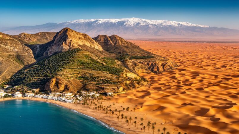
Discussing the geography of the country in Algeria means accepting the challenge of encompassing an immense, contrasting, and deeply unequal territory in terms of population distribution, resources, and administrative areas. As the largest state in Africa and the tenth largest in the world by area, Algeria spreads its 2.38 million km² between the Mediterranean and the Sahara, the humid Tell and the dry High Plains, the Atlas mountain ranges, and vast ergs of dunes. This highly marked physical geography has shaped human settlement, the architecture of the provinces (wilayas), and major contemporary challenges: coastal urbanization, desertification of the steppes, overexploitation of Saharan aquifers, and rapid coastal erosion.
A North African Giant, from the Tell to the Sahara
Algeria is a country of continental dimensions: 2,100 km from north to south, 2,400 km from east to west. More than 80% of this territory is desert, but over 90% of the population is concentrated on the narrow northern Mediterranean strip. This fundamental asymmetry is the thread running through the geography of the country in Algeria.
Over 60% of the Algerian population is concentrated in the Tellian belt, which represents only 12% of the territory.
South of the Tell, a second level emerges: that of the High Plains (Hauts Plateaux), vast undulating expanses with a semi-arid climate, ranging from 400 m in altitude in the east to over 1,100 m in the west. Covered with alluvium torn from the Atlas ranges by erosion, these steppe plains experience cold winters, scorching summers, and such low rainfall that some geographers do not hesitate to see them as an extension of the Sahara.
South of the Tell Atlas, the Sahara Atlas marks a clear transition to the Algerian Sahara, which covers more than 80% of the territory over 1,500 km to the borders of Niger and Mali. This desert includes the great dune ergs (Grand Erg Oriental and Occidental), stony plateaus (hamadas), the volcanic massifs of the Ahaggar, and the sandstone plateaus of the Tassili n’Ajjer.
Major Morphological Units
On this framework, several complementary geographical zones are often identified by researchers:
– the coastline and its coastal plains (Mitidja, plains of Oran and Annaba);
– the mountainous Tell (Dahra, Ouarsenis, Djurdjura, Bibans, Hodna, Aurès);
– the steppe High Plains, between the Tell Atlas and the Sahara Atlas;
– the Sahara Atlas, a true climatic fringe marking the start of the desert;
– the Sahara proper, structured by its ergs, plateaus, massifs, and oases.
This north–south organization results from a long tectonic history: collision between the African and Eurasian plates, uplift of the massifs, followed by alternating wet and dry phases that sculpted valleys, plateaus, and networks of salt chotts.
An Administrative Architecture Modeled on Territorial Contrasts
The geography of the country in Algeria is not limited to relief or climate: it is also visible in the organization of the provinces. The state has gradually adjusted the division of the wilayas to better align with regional realities, the constraints of Saharan distances, and demographic imbalances.
From 15 Wilayas in 1962 to 69 Provinces Today
At independence in 1962, Algeria inherited an administrative map inspired by the colonial organization: 15 wilayas, 1,578 communes, and 91 districts (dairas). Very quickly, the public authorities sought to rationalize this mesh, notably by reducing the number of communes (676 in 1963) to avoid unmanageable fragmentation in such a vast country.
In 1974, the wilayas increased from 15 to 31 with a coherent geographic redrawing; then in 1984, a law set the number at 48 wilayas and 1,541 communes, a stable organization for over 30 years.
From 2019, the map changed again, but this time with a logic heavily marked by Saharan geography. Ten new wilayas were created in the south (Bordj Badji Mokhtar, Timimoun, Djanet, In Salah, In Guezzam, Touggourt, El Menia, El M’Ghair, Ouled Djellal, Béni Abbès), in order to bring administration closer to the scattered populations, better manage the immense distances, and supervise the exploitation of hydrocarbon deposits and fossil aquifers.
In 2025, the total number of wilayas in Algeria increased to 69 following the announcement of 11 new provinces in the High Plains and interior Saharan margins.
Wilayas, Dairas, Communes: A Highly Centralized Hierarchy
The Algerian administrative system is based on three interlocking levels:
– the wilaya (province), a territorial entity with a degree of management autonomy, but headed by a wali appointed by the president;
– the daïra (district), headed by a district chief also appointed at the central level;
– the commune (baladiya), the basic level of local public action, with an elected assembly.
The following table illustrates, for a few key wilayas, the diversity of territorial configurations, between the dense north and the vast but sparsely populated south.
| Code | Wilaya | Number of Dairas | Number of Communes |
|---|---|---|---|
| 01 | Adrar | 11 | 28 |
| 05 | Batna | 22 | 61 |
| 15 | Tizi Ouzou | 21 | 67 |
| 16 | Algiers | 13 | 57 |
| 30 | Ouargla | 10 | 21 |
| 33 | Illizi | 3 | 6 |
| 37 | Tindouf | 1 | 2 |
One can immediately see how geography weighs on administrative architecture: Tizi Ouzou concentrates 67 communes in a densely populated mountainous area, while Tindouf covers an immense desert territory structured around only two communes. Similarly, Algiers – the only wilaya that is both a city and a province – condenses 57 communes within a coastal urban perimeter particularly vulnerable to natural hazards (earthquakes, tsunamis, coastal erosion).
Mediterranean North: Between Metropolization and Retreating Coastline
The Algerian coastline stretches for over 2,000 km along the Mediterranean, but this facade, an economic and tourist driver, is under strong pressure. Rapid urbanization, heavy industrialization, port infrastructure, and climate change converge to weaken beaches and ecosystems already under heavy demand.
An Overcrowded and Stressed Coast
Estimates converge: approximately 90% of Algerians now live in the northern part of the country, and more than 91% of the population resides on or near the Mediterranean coast, that is, on barely 12% of the national surface area. This concentration is compounded by very high urbanization: nearly three-quarters of inhabitants live in cities, and the trend shows no signs of weakening.
Around the Bay of Algiers, the pressure is emblematic. Urbanization there first followed the curve of bays and capes, before spilling over onto the surrounding slopes and passes, gradually eating away at agricultural land and natural areas. Despite the construction of dikes, retaining walls, and protective structures, the degradation of the coastline remains very visible, sometimes exacerbated by the developments themselves.
In Skikda, from 1985 to 2024, the share of built-up area went from about 14% to nearly 47% of the surface, to the detriment of beaches, wetlands, and green spaces essential for wave dissipation and biodiversity. Similar trends are observed in Mostaganem.
Coastal Erosion: A Widespread Phenomenon
Research conducted across the entire Mediterranean coast confirms a general retreat of shorelines, particularly on sandy beaches. In Algeria, analysis of the coastline between 1986 and 2024 reveals strong heterogeneity, but a clear trend: more than half of the coast (55.4%) is retreating, about 28% is gaining ground (accretion), and the rest is relatively stable.
The “net” dynamics over nearly forty years translate into:
| Indicator (Algerian coastline, 1986–2024) | Estimated Value |
|---|---|
| Share of coastline in erosion | 55.4% |
| Share in accretion | 27.96% |
| Stable share | 16.64% |
| Mean net shoreline movement (NSM) | -7.6 m |
| Mean erosion rate (EPR) | -0.201 m/yr |
| Rate by linear regression (LRR) | -0.218 m/yr |
These averages mask “hot spots” where retreat reaches several meters per year. Highly frequented beaches, such as those in the Sidi Madjedoub–Oureah area near Mostaganem, experienced local regressions up to 20 m/yr over the 2003‑2023 period, caused by both natural factors (storms, swell, currents) and anthropogenic ones (dredging and sand extraction, ports, urbanization, protective structures creating imbalances in sediment transport).
Coastal erosion destroys nearly 90 hectares of land and built assets in Algeria each year.
Tipasa, Bejaia, Algiers: Between Heritage and Risks
Several Algerian coastal sites of great heritage value – Tipasa, Bejaia, the Bay of Algiers – are today on the front line facing sea level rise and marine erosion. Studies published in international scientific journals show that Tipasa is among the very high vulnerability areas, exposed to submersion during storms and gradual water rise.
Studies covering the Algerian coast also highlight the contribution of dams to the weakening of beaches: by retaining millions of cubic meters of sediment upstream, these structures deprive coastlines of the sand that previously fed them. In Jijel, for example, the port of Djendjen trapped approximately 180,000 m³ of sediment between 1977 and 1997, to the detriment of about twenty kilometers of beaches downwind, now in significant retreat.
The Atlas Massifs and the High Plains: A Fragile Hinge
Between the Tellian coast and the desert, the Atlas ranges and the High Plains occupy a strategic as well as ecological position. It is here that a decisive part of the north–south climatic transition plays out, as well as the country’s food security.
Tell Atlas and Sahara Atlas: The Double Mountain Barrier
The Algerian Atlas mountains are divided into two major parallel ranges:
– the Tell Atlas, in the north, formed by multiple medium-altitude massifs such as the Dahra, Ouarsenis, Djurdjura, Bibans, and Aurès;
– the Sahara Atlas, in the south, higher and more continuous, with the Ksour, Ouled Naïl, Amour mountains, the Belezma and Hodna massifs, up to the chains that merge eastward with the mountains of Tébessa.
The Tellian Atlas mountains, resulting from the collision of the African and Eurasian plates, form a climatic boundary and a hotspot for seismic risks, especially near Algiers where the plate boundary lies offshore. The intramontane valleys, such as that of the Cheliff (the country’s longest river), concentrate agricultural land irrigated by a network of dams and canals.
The High Plains: A Desertification Front
The High Plains stretch for over 600 km from west to east, from the Moroccan border to the outskirts of Sétif and Tébessa. Seen from above, this steppe band appears as a vast slightly inclined table, dotted with depressions occupied by salt chotts and sebkhas.
The dry and semi-arid climate, with irregular and violent rains, leads to runoff, soil erosion, and reservoir siltation. Studies on the Hodna basin reveal high vulnerability to desertification, degraded soils, and a clearly declining vegetation cover.
In some steppe sub-regions, nearly half of the territory is classified as highly or very highly sensitive to desertification. Rangelands are shrinking, soils are becoming salinized in places, and the dynamics of cultivation (cereals, sometimes irrigated) are progressively encroaching on pastures. The former pastoral economy – seasonal transhumance between Sahara and Tell – is colliding with both agricultural pressure and climate change, which makes rainfall even more erratic.
The Algerian Sahara: Vastness, Resources, and Fragilities
South of the Sahara Atlas, the geography of the country in Algeria shifts into another universe. The Algerian Sahara, covering more than four-fifths of the territory, is far from being a uniform space. It is organized around several major landscape types that interact strongly with settlement patterns and the economy.
Ergs, Hamadas, and Massifs: A Desert Mosaic
Three major types of environments are classically distinguished:
– ergs, seas of sand dunes – the largest being the Grand Erg Oriental and the Grand Erg Occidental – covering about a quarter of the Saharan surface area;
– hamadas, vast rocky and stony plateaus (humud), generally very poor in vegetation;
– massifs and plateaus, among which the Ahaggar (Hoggar) and the Tassili n’Ajjer, which sometimes peak above 2,000 m.
Around these reliefs stretch sandstone plateaus cut by ancient river networks, now fossilized, and large closed basins (sebkhas). In the lowest areas, underground water tables surface, allowing oases to exist – veritable archipelagos of greenery in a mineral ocean.
Ahaggar and Tassili n’Ajjer: The Southern Highlands
The Hoggar mountains, in the south-central region, form a spectacular volcanic massif, known both for containing the country’s highest peak, Mount Tahat (approximately 2,900 m), and for the very ancient nature of its rocks. The surrounding plateaus are cut by gorges; some sectors still harbor sparse shrubby vegetation where aoudads and dorcas gazelles survive.
The Tassili n’Ajjer spans over 72,000 km², a vast sandstone plateau in southeastern Algeria.
The geology tells a long saga: marine sedimentation then fluvial sedimentation during the Ordovician and Devonian, slow uplift of the Tuareg shield, progressive incision by rivers, then wind erosion during the dry phases of the Quaternary. The sandstone layers of the Tassili and neighboring basins also constitute, further north, major reservoirs for the hydrocarbons of Illizi.
Oases, Aquifers, and Water Paradoxes
While the Sahara appears empty on a human scale (densities often below 1 inhab./km²), it is not devoid of resources. Besides very large hydrocarbon deposits, it harbors immense deep aquifers known as “fossil” aquifers, because they are very slowly renewed on a human timescale. This is notably the case of the Continental Intercalaire and the Terminal Complex, aquifers shared with neighboring countries.
Underground wealth gives the illusion of lasting abundance, but we are pumping a non-renewable capital. In regions like Biskra, Timimoun, Ouargla, or Oued Souf, studies show growing imbalances: overexploitation of aquifers for intensive irrigation, proliferation of poorly controlled motorized boreholes, and rapid decline in piezometric levels.
In Biskra, a hinge region between the Aurès and the Sahara, with a desert climate receiving only 150 to 200 mm of annual rainfall, studies show an average drawdown rate of about 5% per year for the aquifers, with a cumulative decline of nearly 300% over 44 years according to some indicators. This trend threatens the sustainability of irrigated agriculture, already very water-intensive, and drinking water supply.
In the Oued Souf valley, hyper-arid, intensive pumping of deep aquifers and lack of sanitation cause the water table to rise, salinizing soils and suffocating palm roots. About one-third of the ghouts are degraded or waterlogged.
Ancient Hydraulic Knowledge and Modern Pressures
The geography of the country in Algeria, in the Sahara, is also a geography of hydraulic know-how. In the Timimoun region, for example, foggaras – underground drainage galleries that capture water from aquifers and distribute it by gravity to plots – have for centuries ensured a collective and economical distribution of water. These “nature-based solutions” promote gentle aquifer recharge and limit evaporation.
But the massive drilling of motorized boreholes with high flow rates is disrupting this delicate system: the drop in water table levels dries up the foggaras, many of which are now abandoned. Community-based water management, patiently built, is being competed with by unregulated individual withdrawals.
Similar tensions appear in the M’zab, another emblematic valley of the Algerian Sahara, where managed recharge systems (structures slowing runoff to promote infiltration) have been patiently set up around Beni Isguen. Here too, the development of new, mechanized agriculture relying on individual pumping disrupts local hydrological balances.
Water, Climate, and Development: A Decisive Geographic Triptych
The question of water runs through all of Algerian geography. The country belongs to the global semi-arid zone and has been experiencing a sustained decline in precipitation for more than three decades, sometimes exceeding 30% in some basins. In the northwest and on the High Plains, the combination of repeated droughts, rising temperatures, and increasing demand makes hydraulic systems particularly fragile.
Strategic Plains Under Water Stress
The Mitidja, south of Algiers, is an emblematic example. A former malarial marsh transformed under colonization into an agricultural plain, it now constitutes a strategic reserve for the capital’s drinking water supply. Modeling studies indicate that the flows of the rivers feeding it should decrease by 26 to more than 70% depending on climate scenarios, while the recharge of the Quaternary aquifer depends mainly on increasingly irregular rainfall.
Recharge of the alluvial aquifer in the Upper Cheliff plain dropped by about 30% between 1970 and 2020.
From Flash Floods to Prolonged Droughts
Another striking feature of Algerian hydrological geography is the increase in extreme contrasts: long periods of drought, followed by episodes of intense rain that cause flash floods. In several major northern cities – Algiers, Oran, Béjaïa, Skikda – entire neighborhoods can be submerged within hours during violent storms. Yet, a few weeks later, drinking water restrictions come into effect due to lack of storage and integrated resource management.
On the High Plains, these sudden downpours result in powerful runoff that carries away the topsoil, fills up dams, and poorly recharges groundwater. Without a reorientation of agricultural practices and hillslope management, these plateaus risk becoming, according to researchers, mere runoff corridors between the mountains and the sea.
Researchers
Settlement Dynamics: From Saharan Nomadism to Metropolization
The geography of the country in Algeria is also embodied in settlement patterns. For a long time, a considerable part of the territory – steppes and Sahara – was traversed by nomadic or semi-nomadic groups, living from herding, caravan trade, and oasis agriculture.
Nomadism, Transhumance, and Recomposition of the Steppes
Before the generalization of closed borders and the rise of the modern state, the great pastoral tribes followed a very regular transhumance calendar: seven months in the Saharan zones, then a seasonal move northward to the Tell to exploit winter pastures, while trading in urban markets and paying taxes to authorities. This “vertical” movement, linking desert, High Plains, and Tell, was a structuring element of Algeria’s pre-colonial and colonial political economy.
Settling, agricultural expansion, droughts, and infrastructure have reduced the great rangelands. Nomadic pastoralism faces increased competition, loss of routes, and pressure on the steppes. The annual distance traveled by herds has decreased, favoring local mobility and semi-nomadism.
Accelerated Urbanization and Littoralization
In parallel, the Algerian population has experienced explosive growth: multiplied by more than four since 1950, it now exceeds 46–48 million inhabitants. The majority of this increase has been concentrated in the northern cities. Urbanization, rising from about 60% at the turn of the 2000s to nearly 75% today, is resulting in a rapid expansion of built-up areas, often faster than demographic growth itself.
In large coastal agglomerations (Algiers, Oran, Annaba, Skikda) and inland cities like Biskra or Médéa, urban sprawl systematically absorbs peri-urban agricultural land. In Médéa, a large part of cultivated land has been lost to urban growth and infrastructure expansion, while intensification of land use on the remaining areas increases.
New towns, such as Sidi Abdellah west of Algiers, illustrate another facet of this dynamic: in twenty years, impervious surfaces there have been multiplied by almost five, while agricultural land has virtually disappeared from the perimeter. Here again, geography – proximity to the capital, relatively favorable relief, presence of “virgin” land – strongly influences development trajectories.
Territorial Programming Areas: Recognizing the Major Sets
Aware of the diversity of its spaces, Algeria has also structured its territory into large “programming areas” grouping contiguous wilayas with similar development issues. Nine major sets are thus distinguished:
| Programming Area | Main Wilayas Included (Examples) |
|---|---|
| North-Central | Algiers, Blida, Bouira, Tizi Ouzou, Boumerdès, Tipasa, Chlef, Béjaïa |
| Northwest | Oran, Tlemcen, Mostaganem, Sidi Bel Abbès, Mascara, Aïn Témouchent |
| Northeast | Constantine, Annaba, Jijel, Skikda, Guelma, El Tarf, Souk Ahras, Mila |
| Central High Plains | Laghouat, Djelfa, M’sila |
| Western High Plains | Tiaret, Saïda, El Bayadh, Tissemsilt, Naâma |
| Eastern High Plains | Oum El Bouaghi, Batna, Tébessa, Sétif, Bordj Bou Arréridj, Khenchela |
| Southeast | Ouargla, Biskra, El Oued, Ghardaïa |
| Southwest | Béchar, Adrar, Tindouf |
| Hoggar–Tassili | Tamanrasset, Illizi |
This grid recognizes the specificity of the Saharan fronts (Southeast, Southwest, Hoggar–Tassili), the northern industrial and urban corridors (North-Central, Northwest, Northeast), and the transition zones in ecological crisis (High Plains). Above all, it reminds us that physical geography – climate, relief, hydrology – and human geography – densities, activities, urban networks – combine to give birth to distinct “problem regions.”
A Geography in Rapid Transformation
The geography of the country in Algeria is not static: it is being recomposed before our eyes, at the crossroads of climate change, accelerated urbanization, development policies, and the globalization of exchanges.
In the north, the coastline is densifying, sometimes verticalizing, while the sea gnaws away at certain beaches and natural hazards – earthquakes, tsunamis, floods – demand adaptation strategies that are still in their infancy. In the Tell mountains and on the High Plains, desertification advances, water becomes scarcer, and the old articulation between sedentary peasant society and mobile pastoralism is gradually unraveling.
In the Sahara, oases suffer from over-pumping of aquifers, soil salinization, urbanization around oil and gas towns, and abandonment of traditional hydraulic systems. The administrative division creates wilayas to bring decisions and populations closer, but the main challenge is to reconcile resource exploitation with environmental protection.
Ultimately, the geography of the country in Algeria is that of a space of extreme contrasts, where hyper-dense coastal metropolises, fragile mountains plagued by desertification, strategic plains under water stress, and Saharan immensities rich in resources but poor in renewable water coexist. Understanding this mosaic means grasping the challenges of the present and the room for maneuvering for the future: how to inhabit such a vast territory without exhausting its aquifers, without losing its beaches, and without letting its steppes become pure and simple desert.
A heritage project or a question? Contact us now to speak with a wealth management expert.
Disclaimer: The information provided on this website is for informational purposes only and does not constitute financial, legal, or professional advice. We encourage you to consult qualified experts before making any investment, real estate, or expatriation decisions. Although we strive to maintain up-to-date and accurate information, we do not guarantee the completeness, accuracy, or timeliness of the proposed content. As investment and expatriation involve risks, we disclaim any liability for potential losses or damages arising from the use of this site. Your use of this site confirms your acceptance of these terms and your understanding of the associated risks.

Cyril Jarnias is an independent expert in international wealth management with over 20 years of experience. As an expatriate himself, he is dedicated to helping individuals and business leaders build, protect, and pass on their wealth with complete peace of mind.
On his website, cyriljarnias.com, he shares his expertise on international real estate, offshore company formation, and expatriation.
Thanks to his expertise, he offers sound advice to optimize his clients' wealth management. Cyril Jarnias is also recognized for his appearances in many prestigious media outlets such as BFM Business, les Français de l’étranger, Le Figaro, Les Echos, and Mieux vivre votre argent, where he shares his knowledge and know-how in wealth management.





