
 Published on and written by Cyril Jarnias
Traveling in Micronesia means accepting that distances are measured not only in kilometers, but also in flight hours, days at sea… and degrees of patience. Between the lack of a structured bus network, rare flights, and irregular ferries, getting around requires a minimum of advance planning. This practical guide brings together essential information for understanding public transportation in Micronesia, with a particular focus on the Federated States of Micronesia (Yap, Chuuk, Pohnpei, Kosrae), while opening useful windows onto Guam, the Northern Mariana Islands, the Marshalls, and Palau.
Good to know:
To effectively plan your travels, it’s crucial to understand the practical operation, costs, as well as the comfort, reliability, and safety aspects of the different options. Good organization involves knowing how to intelligently combine taxis, boats, planes, and transfers offered by hotels.
Understanding Micronesia and its Transportation Constraints
Micronesia, in the broad sense, is an archipelago of islands scattered across a vast portion of the western Pacific. The Federated States of Micronesia (FSM) – Yap, Chuuk, Pohnpei, and Kosrae – bring together over 600 islands for a little more than 700 km² of land, spread across over 2.6 million km² of ocean. About half the population lives on the four main islands, the rest on often very isolated outer islands.
Warning:
The geographical fragmentation of the islands explains the weakness of land transport (buses, trains) and the reliance on air and sea connections. The infrastructure (roads, ports, airports), managed by four states with limited resources, results in services that are expensive, underdeveloped, and irregular.
In this context, “public” transportation takes on very diverse forms: shared taxis, school minibuses used by adults, collective pickup trucks, mixed cargo-passenger ferries, regional planes, but also hotel shuttles or dive boats that, in practice, play a role as public transport for visitors.
A Modest and Uneven Road Network
The Federated States of Micronesia have approximately 734 km of roads, divided into primary routes linking capitals, ports, airports, and hospitals; secondary roads to smaller localities; and tertiary routes, often simple dirt tracks.
Example:
A table summarizes some characteristics of the road network for each state, allowing for a quick comparison of transportation infrastructure.
| State | Approximate share of paved roads | Road Particularities |
|---|---|---|
| Pohnpei | ~50% | Main roads paved, many unpaved secondary tracks |
| Kosrae | ~48% | Coral/asphalt roads, very slippery in the rain |
| Yap | ~23% | Limited network, mainly around Colonia |
| Chuuk | ~10% | Many unpaved roads, network scattered across several islands |
Driving is on the right, with modest speed limits, generally around 20–25 mph (about 40 km/h) and less near schools. Narrow roads, potholes, animals (dogs, chickens, pigs), and the absence of sidewalks or lighting make nighttime driving inadvisable, especially outside small towns.
In such a setting, private cars remain rare, outside of a few centers. In some states, there are fewer than 200 vehicles per 1,000 inhabitants, and in Chuuk barely over twenty per 1,000 inhabitants, which reinforces the importance of taxis, organized hitchhiking, and shared vehicles.
Air Travel, the Backbone of Transportation in Micronesia
For connecting islands to each other and to the rest of the world, air travel is essential. The main player is United Airlines, which operates almost alone on regular commercial routes within the Federated States of Micronesia and to neighboring islands.
The “Island Hopper”: The Pacific’s Great Lifeline
The region’s iconic service is the “Island Hopper”, a United flight linking Honolulu (Hawaii) to Guam with stops at a series of isolated atolls in the FSM and the Marshalls. This route is not a simple tourist flight: for many islands, it is the only regular air service, for both passengers and cargo (food in coolers, mail, spare parts, medicine…).
From west to east, the “Island Hopper” serves the following airports:
| Airport Served | Code | Territory |
|---|---|---|
| Guam – Antonio B. Won Pat | GUM | U.S. Territory |
| Chuuk International (Weno) | TKK | Federated States of Micronesia |
| Pohnpei International | PNI | Federated States of Micronesia |
| Kosrae International (certain days) | KSA | Federated States of Micronesia |
| Bucholz Army Airfield (Kwajalein) | KWA | Marshall Islands, U.S. Military Base |
| Majuro International | MAJ | Marshall Islands |
| Honolulu – Daniel K. Inouye | HNL | Hawaii – United States |
The full journey, with stops, takes about 16 hours between Honolulu and Guam. Depending on the direction, flights are numbered 154 (Honolulu → Guam) and 155 (Guam → Honolulu). The service operates three times a week using specially configured Boeing 737‑800s for this very unique segment, which must contend with short runways, modest infrastructure, and specific local needs: transporting patients requiring stretchers, onboard mechanics, reinforced crew, and adapted procedures in case of a breakdown far from technical hubs.
Tip:
A few important practical points for travelers:
– Schedules are often at night or very early in the morning.
– Fares are high: a one-way Honolulu–Manila via this route can exceed $1,500 USD in economy, even though round-trip tickets are often more advantageous.
– Onboard service is basic: one real meal on a Honolulu–Guam segment and snacks on intermediate segments.
– The aircraft offers no Wi‑Fi, no power outlets on some current planes, and the entertainment system is old and reboots at each stop.
– On most islands, it is possible to disembark during the stop and sometimes get a transit stamp, with the notable exception of Kwajalein, a military base where passengers cannot leave the plane without prior authorization.
Good to know:
Starting in 2026, United will gradually replace its 737‑800s on this route with 737 MAX 8s. These new aircraft will be equipped with Starlink satellite Wi‑Fi and personal screens, significantly improving onboard comfort. However, the main constraint remains unchanged: these flights are rare and of vital importance to residents.
Other Useful Air Connections
Besides the “Island Hopper”, several regional connections structure the network:
– United Airlines connects Guam to Pohnpei, Chuuk, Yap, and Kosrae, often with few weekly frequencies.
– Caroline Islands Air and Pacific Missionary Aviation operate complementary domestic flights between some islands of the Federated States and to the Marshalls or Palau.
– Nauru Airlines offers connections to the central Pacific (Majuro, Tarawa, Nadi) from Brisbane or Fiji.
– Star Marianas Air connects Guam daily to the Northern Mariana Islands (Saipan, Tinian, Rota) with small planes.
The low frequency of flights requires precise planning. Many itineraries require going through Guam even to travel from one state to another, which can lengthen and significantly increase the cost of journeys.
Ferries and Boats: Rare but Essential Connections
Maritime transportation serves several roles in Micronesia: coastal supply, movement of outer island residents to state capitals, and occasional transport of foreign travelers.
Main Inter-Island Vessels in the Federated States of Micronesia
Two vessels play a central role in sea connections:
| Vessel | Main Role | Main Service Areas |
|---|---|---|
| FSM Caroline Voyager | Inter-state cargo/passenger and to outer islands | Pohnpei, Yap, Chuuk, Kosrae, neighboring archipelagos |
| Micro Glory / Micronesian Navigator | Mixed-use vessel, more regional connections | Circuits around Pohnpei, Yap, Chuuk, Mortlocks |
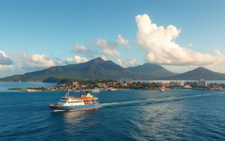
These boats serve government-approved itineraries, notably connecting the ports of Kolonia (Pohnpei), Colonia (Yap), Moen (Chuuk), and some remote islands. The rotation frequency is low and highly dependent on weather conditions, freight needs, and public budgets. Cabins are limited, and on long journeys, it’s not uncommon for passengers to sleep on deck.
30
Price in dollars for a cargo-passenger trip from Yap to outer islands, for a journey that can take up to two weeks.
Ferries in Neighboring Countries
In the rest of political Micronesia, the offerings are just as patchy:
Good to know:
A ferry connects Saipan to Tinian in the Northern Mariana Islands. In the Marshall Islands, public or chartered boats operated by Air Marshall Islands serve some outer atolls. However, between the main Pacific islands (Hawaii, Guam, Palau, Marshall Islands…), there is no regular fast ferry network due to difficult ocean conditions, high operating costs, and competition from air travel, which has led to the failure of several commercial attempts.
In summary, ferries are mainly useful for reaching rural islands from a state capital, not for organizing large-scale tourist “island-hopping”.
Ground Transportation in Each FSM State
Once on an island, the real question becomes: how to get around without a personal vehicle? The answer varies from state to state, with one constant: you must accept dealing with a mix of taxis, car rentals, and informal collective transport.
Pohnpei: Kingdom of Shared Taxis
Pohnpei, home to the national capital Palikir and the port town of Kolonia, is one of the states where mobility is simplest for a visitor, even though no formal bus network exists.
Circulation relies on a very flexible system of taxis and shared vehicles, which use the main road circling the island. In Kolonia, the fare is remarkably simple: one US dollar to go from one point to another in town. To go further out, prices increase with distance (about $2 USD to Palikir, $3 USD per person to reach some more remote hotels).
Taxis often wait near the market, hotels, or busy spots. It’s possible to hail one on the roadside, but many operate like “collectivos”: the driver picks up several passengers heading roughly in the same direction. Cash only, in small bills.
In the evening, service becomes scarce outside Kolonia. To go out to dinner far from the center, it’s better to ask the restaurant or hotel to arrange round-trip transportation.
Warning:
For more autonomy, car rental is available at the airport or through accommodations. On the mainly paved roads, great caution is required due to the presence of animals (dogs, pigs), children, sudden tropical rains, and unpaved segments leading to sites like waterfalls or Nan Madol.
In addition to the road, small boats are essential for exploring the lagoon, outer islets, or the Nan Madol site. Again, it’s often hotels, dive shops, or local guides who serve as de facto “public carriers”.
Chuuk: Irregular Buses, Taxis, and Lots of Boats
Chuuk is best known to divers for the World War II wrecks in the lagoon, but it’s also one of the states where transportation is the least structured.
A public bus system exists in theory for the local population, notably for students and workers, but it suffers from several handicaps: unpredictable schedules, partial coverage of localities, aging equipment. For a visitor, this mode of transport remains difficult to use as a reliable planning base.
Taxis and private vehicles supplement the offerings in the main town of Weno. As elsewhere, most do not have meters, which means negotiating the price before departure. Costs remain moderate, but road safety is not always exemplary.
Car Rental in Chuuk
Several options for renting a vehicle on the island, often combined with other tourist activities.
Specialized Rental Agencies
Several agencies like Chuuk Star, His & Hers, J & R, Kurassa, Moria U‑Drive, and Truk Stop Car Rental offer daily rentals.
Rental via Hotels
Many hotels, such as the Kurassa Hotel and Blue Lagoon Resort, also make vehicles available to their guests.
Popular Combination Packages
For foreign visitors, the combination of diving, car rental, and boat excursions is the norm.
Between the lagoon islands and peripheral atolls, ferries and freight boats play the role of “public transport” for residents. Departures are infrequent, often delayed or canceled in bad weather, and onboard accommodation is very basic. For those who accept this rustic experience, they nevertheless offer an economical way to explore the archipelago, even if the journey may be counted in days rather than hours.
Yap: A Budding Bus Network and Many Taxis
Yap is distinguished by a rare particularity in the FSM: a small public bus system, primarily geared towards residents and students who need to reach Colonia, the main urban center. This network, supplemented by a school bus service between the capital and villages, constitutes one of the few examples of “organized” land transport in the country.
Alongside buses, several taxi companies operate in and around Colonia (TNT Taxi, Corner Express, Twenty‑Four Seven Taxi). Fares are negotiated in advance; nighttime services exist but rely more on the availability of individual drivers than on a structured 24/7 coverage like in a big city.
Good to know:
Some local renters, like E.S.A Bay View Auto Rental, 7D Rental, and Yoruw Company, offer the possibility to combine self-driving with walking trips. This formula is ideal for exploring traditional villages and Yap’s famous stone money.
Kosrae: Well-Present Taxis, Slippery Roads
Kosrae presents a slightly different face, with a limited but relatively well-maintained road network, though largely composed of coral/asphalt paving that becomes very slippery in the rain. The standard speed limit is about 25 mph (40 km/h), and drivers must contend with ever-present fauna on the roadway (dogs, chickens, pedestrians, makeshift speed bumps).
Taxis operate across the island from 7 AM to 10 PM, with several identified companies (JT Taxi, LM Taxi, P&I Taxi). Some even provide 24/7 service on request, which is appreciated for late or early flights.
For those wishing to drive themselves, several local renters exist (Senny’s, Hairom, KNS, MGT/PMW). Foreign licenses are accepted, the legal driving age is 18. As elsewhere, payment is mostly in cash, with cards not widely accepted outside hotels.
The modest size of the island makes trips relatively short, but it’s still advisable to inform your hotel of your movements, both for safety reasons and to allow for assistance in case of breakdown or weather problems.
Taxis, “Colectivos,” and Informal Transport
On most Micronesian islands, the taxi and its informal variants serve as the true public transport. This model is found in both the FSM and the Marshalls, and even partially in Guam as a supplement to buses.
How Taxis Work in the Region
A few general principles apply to almost all islands:
– Taxis often don’t have meters.
– Fares are low in absolute terms but highly variable depending on distance and the driver’s estimate.
– Negotiating before getting in is the norm.
– Payment is almost always in cash, in US dollars, with no card or mobile app options.
– The same vehicle frequently serves multiple customers on a trip, like an improvised minibus.
0.75
The minimum fare in dollars for a taxi ride within the urban perimeter of Majuro, Marshall Islands.
The table below illustrates some price ranges in different parts of Micronesia:
| Location / Service | Type of Transport | Indicative Fare |
|---|---|---|
| Kolonia (Pohnpei), trip within town | Shared taxi | ~$1 USD per person |
| Kolonia → Palikir (Pohnpei) | Taxi | ~$2 USD |
| Majuro (Marshalls), trip within town | Shared taxi | ~$0.75–$1.50 USD |
| Majuro → Laura | Bus | ~$2 USD |
| Guam, public bus (GMTA) | Regular bus | $1 per trip / $3 day pass |
| Guam, Tumon tourist trolley | Trolley | Modest fare, varies by operator |
In the FSM, it’s often safer, especially in the evening, to ask your hotel to call a “known” or recommended taxi rather than hailing one randomly. Serious problems remain rare, but the modest infrastructure, limited law enforcement capacity, and the prevalence of alcohol in some areas call for basic vigilance.
Buses and Similar Systems: A Weak Link
Unlike other regions of the world, Micronesia has no national bus network or rail transport. A few exceptions exist:
Public Transportation in Micronesia
Overview of the different public transport systems available in the states and territories of the Micronesian region.
Yap
Small bus system, largely for schools, connecting Colonia to villages.
Chuuk and Pohnpei
Unstructured local minibuses, without schedules or route maps, used mainly by residents.
Guam
Strong local-scale GMTA bus network, with 15 lines, operating 6 days a week, and simple fares.
Northern Mariana Islands
Hotel shuttles and a public service (Transit CNMI) with a fixed route on Saipan and an on-demand accessible transport service (CARS/Paratransit).
In practice, in the FSM proper, a visitor will almost never be able to organize their stay around a bus network. These remain invisible to tourists, with no clear signage, and above all, very irregular. Therefore, taxis, car rentals, hotel shuttles, or chartered boats effectively serve as the collective transport.
Comparison with Neighbors: Guam, Marianas, Marshalls, Palau
To better understand the level of service in the FSM, it’s useful to briefly compare it to that of immediate neighbors, often used as air hubs.
Guam: Closest to an “Urban” System
Guam, a U.S. territory that is more populous and wealthier than the FSM, has the most comprehensive bus network in the region. The Guam Mass Transit Authority operates 15 lines, with 5 accessible to people with disabilities, at frequencies ranging from 30 minutes to 2 hours during the day, Monday through Saturday. A ticket costs $1 per trip or $3 for a daily pass, with discounts for seniors, students, and people with disabilities.
Good to know:
In Guam, it’s possible to get around without a car in tourist areas thanks to open-air tourist trolleys connecting the Tumon hotel district to shopping centers, as well as free shuttles offered by many hotels.
Northern Mariana Islands: Shuttles and Taxis
In Saipan, Tinian, and Rota, visitors mainly rely on taxis, rental cars, and hotel shuttles. A public system, Transit CNMI, exists on Saipan, with for example a Blue Line serving the main coastal road, and a Call‑A‑Ride (CARS) service accessible by reservation, compliant with U.S. (ADA) standards for people with reduced mobility. CARS fares are structured, with differentiated prices for the general public, students, and ADA passengers.
Good to know:
The islands are connected by plane via Star Marianas Air. Additionally, a ferry connection is specifically available between Saipan and Tinian.
Marshalls and Palau: Taxis and Rental
In the Marshalls, and particularly in Majuro, the lack of a structured collective network is again compensated for by an abundance of very cheap shared taxis, and a simple bus to Laura. Rental cars are available but more expensive than taxis for occasional trips.
In Palau, the paved roads of Koror and Babeldaob facilitate vehicle rental, often recommended for exploring natural and historical sites. However, there is no real public bus system for residents; mobility relies on cars, a few taxis, and boats for excursions to the Rock Islands.
Practical Tips for Using Public Transportation in Micronesia
Beyond describing the networks, a few concrete recommendations can make traveling in this part of the Pacific more serene.
Always Plan Ahead
Whether it’s booking a flight on the “Island Hopper”, a Caroline Voyager ferry, a rental car in Pohnpei, or a taxi for a very early departure, anticipation is key. Capacity is limited, frequencies are low, and a single weather cancellation can disrupt an entire island-hopping sequence.
It is particularly important to:
– book inter-island flights several weeks or even months in advance;
– check the rotation days of ferries and public boats;
– secure a rental car as soon as accommodation is confirmed;
– plan buffer time between segments (at least one night) to avoid a domino effect in case of delay.
Managing Cash and Transportation Costs
Almost all local transport – taxis, informal buses, small boats – is paid for in cash, in US dollars. ATMs are few outside state capitals and may be out of service. It is therefore prudent to always have small bills ($1, $5, $10) on hand to pay for trips.
The daily budget in dollars for internal transportation on an island like Chuuk or Pohnpei.
Safety, Health, and Behavior
The major risks come less from crime – generally low – than from limited infrastructure, tropical weather, and the distances to advanced medical services. A few simple reflexes are essential:
For a safe stay in the Northern Mariana Islands, it is recommended to avoid walking or cycling at night on poorly lit main roads. Always wear a seatbelt in cars and a helmet on two-wheelers, even if local laws are not strictly enforced. In often-crowded informal transport, keep an eye on your belongings and avoid displaying valuables. Prepare for your trip by checking in advance the contact numbers for state hospitals and police stations, which differ on each island. Finally, obtain travel insurance that explicitly includes medical evacuation to Guam or Hawaii, as local hospital facilities have limited capacity for serious cases.
Finally, mobility in Micronesia is also experienced as a moment of cultural encounter. Taking a shared taxi, a repurposed school bus, or a cargo boat to an outer island is often an opportunity to interact with residents for whom transport is not an “anonymous” service, but a deeply communal activity, subject to the famous “island time,” a more flexible approach to time than that of major metropolises.
Organizing an Itinerary: Combining Air, Sea, and Road
Building an itinerary in Micronesia involves assembling puzzle pieces of air, sea, and land. A common strategy is to:
To explore Pacific archipelagos like the Federated States of Micronesia, a typical itinerary can be organized as follows: use Guam as an air hub due to its many connections (Japan, Hong Kong, Manila, etc.). Then, take a segment of the “Island Hopper” flight to reach islands like Pohnpei, Chuuk, Kosrae, or Majuro. Complement, if possible, with a regional flight (Caroline Islands Air, Nauru Airlines, Air Marshall Islands) to a less-served island. On the ground, alternate between exploring the interior by taxi or rental car, and boat outings organized by hotels or dive shops. If time allows, add a long cargo or ferry trip to reach an outer island or another state capital, accepting minimal comfort.
The tables in this guide, the price ranges, and the information by state provide a basis for estimating the transport budget and logistical feasibility of each step. The rest depends largely on the traveler’s flexibility, tolerance for delays, and ability to enjoy the journey as much as the destination.
—
Micronesia does not have classic public transportation (subway, tram, regular buses). To get around, you must make do with a mix of solutions: long-haul and small domestic planes, cargo ships, shared taxis, hotel shuttles, and even improvised pickup trucks. This network allows you to explore the region independently and discover a Pacific still largely untouched by mass tourism.
Understanding these constraints and resources transforms an apparent difficulty – the transportation “hassle” – into an integral part of the Micronesian experience. With a little preparation, patience, and curiosity, getting around becomes the best way to grasp what it really means to live on these “small islands” in the middle of the planet’s largest ocean.

Cyril Jarnias is an independent expert in international wealth management with over 20 years of experience. As an expatriate himself, he is dedicated to helping individuals and business leaders build, protect, and pass on their wealth with complete peace of mind.
On his website, cyriljarnias.com, he shares his expertise on international real estate, offshore company formation, and expatriation.
Thanks to his expertise, he offers sound advice to optimize his clients' wealth management. Cyril Jarnias is also recognized for his appearances in many prestigious media outlets such as BFM Business, les Français de l’étranger, Le Figaro, Les Echos, and Mieux vivre votre argent, where he shares his knowledge and know-how in wealth management.





