
 Published on and written by Cyril Jarnias
At the heart of the Eurasian continent, the geography of the country of Kazakhstan shapes nearly every aspect of life: a harsh climate, a very low population density, an economy based on natural resources, but also environmental issues of global scale. Yet, this vast state, the ninth largest in the world by area, remains largely unknown. Behind the image of a vast, uniform plateau lies an extremely contrasting territory, ranging from the shores of the world’s largest closed lake to the glaciers of the Tian Shan, from desert depressions below sea level to summits approaching 7,000 meters.
A Landlocked Giant at the Heart of Eurasia
Kazakhstan is officially the Republic of Kazakhstan and is located primarily in Central Asia, with a small part in Europe, west of the Ural River. The country’s coordinates extend approximately between 40° and 56° north latitude and 46° to 88° east longitude. Its area reaches about 2.7 million km², comparable to all of Western Europe, making it the largest landlocked country on the planet.
Without direct access to the ocean, it nonetheless remains a littoral state thanks to its coastline on the Caspian Sea, a large closed sea located to the west. Its territory stretches from the Caspian Sea and the Caspian Depression in the west to the Altai and Tian Shan mountains in the east, and from the plains of Western Siberia in the north to the deserts and oases of Central Asia in the south.
The country shares 13,364 km of land borders with five neighbors: Russia to the north and west, China to the east, Kyrgyzstan to the southeast, Uzbekistan to the south, and Turkmenistan to the southwest. The border with Russia is the longest continuous land border in the world, at about 7,600 km. To this is added nearly 1,900 km of coastline on the Caspian Sea, giving the country a strategic role in exchanges between Europe and Asia.
Size and Position: A Pivot State
The position of Kazakhstan, firmly anchored in the axis of the “Eurasian corridor,” largely explains its current role as a hub for new trade routes between China, Russia, the Middle East, and Europe. Its territory stretches nearly 2,930 km from east to west and about 1,500 km from north to south, resulting in considerable climatic and landscape contrasts from one region to another.
Kazakhstan has a population density of less than 6 people per square kilometer, one of the lowest in the world.
A Mosaic of Landscapes: Steppes, Deserts, Plateaus, and Mountains
The image of a uniformly flat country is misleading. Kazakhstan features varied topography, where vast plains, high plateaus, hills, mountain ranges, depressions, and spectacular canyons coexist. Most of the territory lies between 200 and 300 meters above sea level, but about 10% of the surface consists of high mountainous terrain.
In terms of landform distribution, it can be roughly summarized as follows:
| Landform Type | Approximate Share of Territory |
|---|---|
| Lowlands (low plains) | ~ 1/3 |
| Plateaus and rolling plains | ~ 1/2 |
| Mountainous areas | ~ 1/5 |
This diversity is reflected in a few major regions.
The Great Kazakh Steppe, the Country’s Backbone
The Kazakh Steppe, also called the Great Steppe or Great Dala, covers about one-third of the territory, or more than 800,000 km², making it the largest dry steppe on the planet. It occupies mainly the north and center of the country, from the Caspian Depression and the fringes of the Aral Sea to the foothills of the Altai in the east.
It is a world of short grasslands and fertile black soils (chernozems) in the north, gradually degrading into saltier and poorer soils toward the south. Characteristic grasses are found here, such as feather grass (Stipa), various sagebrushes (Artemisia), and fescues. Despite the apparent monotony of the landscape, the mosaic of soil and moisture conditions creates a great diversity of plant communities.
This vast steppe, historically dedicated to pastoral nomadism, now constitutes a crucial ecological habitat. It is home to nearly the entire global population of the saiga, an emblematic antelope of the region.
Deserts and Semi-deserts: The Arid Dominance
The further one moves toward the center and south, the more the landscape shifts toward aridity. Approximately 44% of the country’s surface is covered by deserts and 14% by semi-deserts. In total, nearly 84% of Kazakhstan consists of drylands (deserts, semi-deserts, and steppes).
Several major deserts structure the space:
| Desert / Desert Plateau | Approximate Area |
|---|---|
| Kyzylkum | 298,000 km² |
| Ustyurt (plateau) | 200,000 km² |
| Betpak-Dala | 75,000 km² |
| Moiynkum | 37,500 km² |
| Aral Karakum | 40,000 km² |
| Ryn | 40,000 km² |
| Taukum | 10,000 km² |
These sandy or stony regions are characterized by sparse vegetation, adapted to drought and saline soils: sagebrush, tamarisk, twisted-trunk saxaoul (Haloxylon), calligonum, halophytic plants. It is also in these deserts that one finds the Karagiye Depression, located on the Mangyshlak Peninsula, at 132 meters below sea level, one of the lowest points on the planet.
The Ustyurt Plateau, a vast desert tableland stretching between the Caspian and Aral Seas, illustrates this geography of mineral vastness, carved with spectacular canyons and white cliffs.
Saryarka and the Central Highlands
In the center of the country, the steppe gives way to a region of plateaus and small mountains: the Kazakh Uplands, also called Saryarka, “the Yellow Steppe.” This undulating peneplain zone, about 1,200 km long, modestly peaks at altitudes between 700 and 1,000 meters, with a few isolated higher summits like Aksoran (1,565 m) in the Kyzylarai massif.
The region nicknamed “little Switzerland” for its hilly landscapes, granite rocks, lakes, and groves, is home to several national parks like Karkaraly, Bayanaul, Kokshetau, and Burabay. These protected areas mix pine forests, hills, and bodies of water. It also features mountainous massifs such as Kokshetau, Karkaraly, Kent, Bayanaul, and the historic Ulytau range, an emblematic site for the Kazakh people.
The Great Mountain Ranges: Tian Shan, Altai, and Dzungar
The most spectacular terrain is concentrated in the south and east. Two major systems dominate:
– The Tian Shan (“Celestial Mountains”), in the south and southeast, along the Kyrgyz and Chinese borders.
– The Altai Mountains, in the northeast, at the junction with Russia and China.
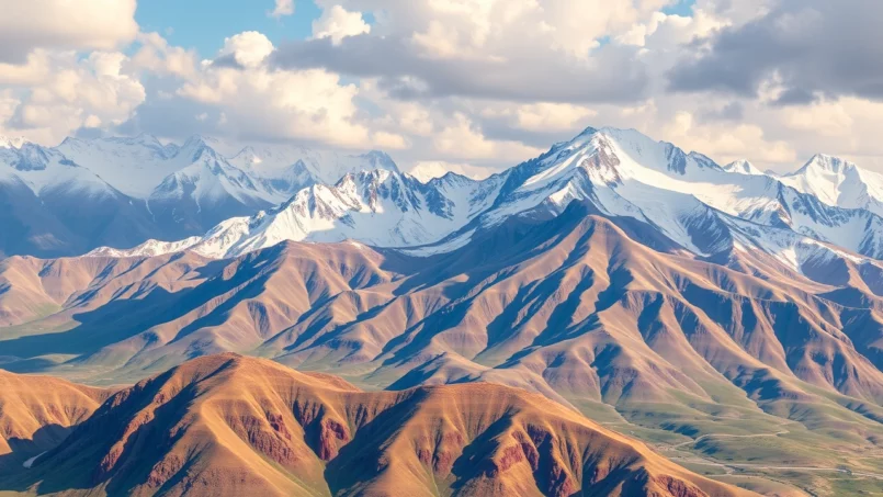
In the Kazakh part of the Tian Shan, the highest peak is Khan Tengri Peak, reaching 6,995 m (about 7,010 m including its glacial mantle). This pyramidal colossus marks the border between Kazakhstan, Kyrgyzstan, and China. Further west, other ranges like the Zailiyskiy Alatau dominate the Almaty region, with Talgar Peak (4,979 m) and numerous glaciers, including the Korjenevski, the country’s largest.
Kazakhstan features a complete mountainous arc with the Dzhungar Alatau massif in the southeast and the Tarbagatay Mountains in the east. Near the Caspian Sea, the Mangystau Mountains form lower but highly dissected terrain.
In the northeast, the Kazakh part of the Altai constitutes the southwestern extension of this great mountainous system. The highest peak of the Altai, Mount Belukha (4,506 m), lies on the Russian-Kazakh border and is considered a sacred mountain. This region of forested mountains, lakes, and glacial valleys is among the wildest landscapes in the country.
Canyons, Craters, and Depressions: Geological Curiosities
Beyond the major landforms, the geography of Kazakhstan holds many curiosities:
– The Charyn Canyon, about 80 km long, with red sandstone walls 150 to 300 m high, located some 200 km east of Almaty in the Tian Shan, sometimes nicknamed the “little Grand Canyon.”
– The Bigach crater, resulting from an asteroid impact, 8 km wide and millions of years old, nestled in the Eastern Highlands.
– The Karagiye Depression, already mentioned, but also the great Caspian Depression in the west, parts of which lie below sea level.
– Spectacular gorges like those of Turgen, nicknamed the “land of waterfalls,” or the strange rock formations of the Boszhira tract on the Ustyurt.
All these elements make the country a true open-air laboratory for the geology, geomorphology, and climatology of arid and mountainous environments.
Extreme Climate: A Land of Thermal Contrasts
The geography of the country of Kazakhstan results in a climate marked by high continentality. Distant from any ocean, traversed by steppes and deserts open to all winds, the territory experiences impressive temperature ranges, both seasonally and from one end of the country to the other.
A Continental, Semi-Arid Climate with Very Cold Winters
Overall, the climate is classified as continental to markedly continental, with zones of semi-arid steppe (Bsk in the Köppen classification) and cold desert (Bwk). Winters are long and cold, summers hot to very hot, and precipitation rather low, often concentrated in spring and early summer on the plains, and more regular in the mountains.
Average January temperatures vary greatly:
– In the north and center, averages are around –19 °C.
– In the south, averages reach about –5 °C.
In July, the contrast reverses:
– Around 20 °C average in the north,
– Over 30 °C in some southern regions, like Turkestan.
Extreme temperatures in Kazakhstan can reach 45°C in summer and drop to -45°C in winter.
The capital Astana is regularly cited among the coldest capitals in the world, with winters where temperatures frequently drop below –30 °C, a frigid wind, and a long snowy period.
Contrasting Precipitation Regimes
Annual precipitation is generally modest and typically decreases from north to south and from west toward the arid interior regions, then increases again on the mountainous terrain of the southeast.
Across the country, one observes:
| Zone / Region Type | Approximate Annual Precipitation |
|---|---|
| Forest-steppe of the north | 320–360 mm |
| Steppes of the north and center | 230–340 mm |
| Semi-desert zones | 134–330 mm |
| Vicinity of the Aral Sea | sometimes ~100 mm |
| Mountains of the southeast (Almaty region) | ~675 mm in Almaty, locally more |
Snowfall is frequent in winter but generally not heavy on the plains. The number of days with snow decreases from the north (up to a hundred days in Petropavl) to the south (about 20 days). In spring, the melting of this snow, combined with sometimes heavy rains, causes significant floods in the northern and central regions, with recurring inundation of river valleys.
Strong Winds, Dust Storms, and Microclimates
Another notable characteristic is the wind. The country is subject to powerful atmospheric flows, with violent winds in spring, dust storms in desert regions, and blizzards in winter in the steppe zones. The Dzungarian Gate region, for example, is known for its southern and southeastern winds that can reach hurricane-like speeds.
The coasts of the Caspian Sea, the Aral Sea, and large lakes like Balkhash are subject to local breezes. In the valleys and foothills of the Tian Shan and Altai mountains, warm, dry foehn-type mountain winds regularly descend from the highlands.
The diversity of altitudes and exposures creates a mosaic of microclimates: thus, Almaty, located at about 800 m at the foot of the mountains, enjoys a milder and wetter climate than the neighboring plains, while desert cities like Aktau, on the Caspian coast, experience much less severe winters but scorching and very dry summers.
Inland Waters: Closed Seas, Large Lakes, and Endorheic Systems
Despite its landlocked nature, the geography of the country of Kazakhstan is deeply structured by water, or rather by its scarcity. Almost all Kazakh rivers do not flow to the ocean but into closed basins—the Caspian Sea, the Aral Sea, interior lakes—or are lost in the steppes and deserts.
Major Rivers and Hydrological Basins
There are approximately 8,500 watercourses and nearly 48,000 lakes, large and small. But only a handful of rivers exceed 1,000 km, among them:
Kazakhstan is traversed by several major rivers, playing a crucial role for energy, agriculture, and ecosystems.
The longest flowing through the country (4,248 km from China to Russia). Considerable annual flow. Feeds three major Kazakh hydroelectric dams.
Join the Ob system and thus the Arctic Ocean, but from within Russia.
Flows into the Caspian Sea and serves as the traditional boundary between Europe and Asia.
Historic Central Asian river, heading towards the Aral Sea.
Main water source for Lake Balkhash.
Shorter but locally important rivers, like the Chu, Emba, or Nura.
Many of these rivers have a highly seasonal regime, with spring floods linked to snowmelt and severe low water levels in late summer. Many of them lose a significant portion of their flow in arid zones, where evaporation and withdrawals for irrigation are substantial.
Lakes and Inland Seas: Balkhash, Caspian, Aral…
Kazakh lakes are countless, but a few major bodies dominate:
Kazakhstan is home to several large inland water bodies, playing crucial ecological and economic roles.
The world’s largest closed body of water. About a quarter of its surface and over 2000 km of coastline belong to Kazakhstan. Reservoir of biodiversity (sturgeons, seals) and a strategic zone for the oil industry.
Vast basin of nearly 17,000 km², unique for its dual nature: fresh water in the west and salty water in the east, separated by a strait. It is mainly fed by the waters of the Ili River.
Former lake of tectonic origin, now connected to the large Bukhtarma reservoir on the Irtysh River.
Located in the east of the country, this lake system is an important area for waterbird nesting.
Salt lakes in the north of the country, constituting major wetlands on bird migration routes.
Finally, the Aral Sea constitutes one of the most famous ecological tragedies of the 20th century. Historically fed by the Syr Darya and Amu Darya, it saw its surface area and volume collapse after the massive water diversions for irrigated crops during the Soviet era. On the Kazakh part, a “Small Aral” (Northern Aral Sea) remains thanks to hydraulic engineering, but the former main basin is largely transformed into a salt desert.
Water Resources: A Scarce and Highly Stressed Good
Total renewable water resources are estimated at about 107–110 km³ per year, of which a significant portion comes from neighboring countries via major transboundary rivers. Annual freshwater needs are above 30 km³, with a very strong dominance of the agricultural sector (nearly two-thirds of withdrawals), ahead of industry and domestic use.
The expansion of irrigation, industrial development, and climate change increase pressure on these resources, even as many small lakes have already disappeared, and water quality is sometimes compromised by industrial pollution, agricultural runoff (pesticides, fertilizers), or radioactivity inherited from nuclear tests.
Soils, Vegetation, and Wildlife: A Fragile Natural Heritage
The structure of soils and vegetation cover closely reflects the major gradients of climate and terrain. From north to south, one thus moves from forest-steppe to grassy steppe, then to semi-deserts and deserts. Mountain enclaves, wetter and forested, break this continuity.
Land Mostly Agricultural but Sparsely Forested
Approximately 77% of the country’s surface is considered agricultural land, of which barely 9% is arable land, but nearly 70% is permanent pasture. The footprint of agriculture is therefore strong, particularly in the steppe plains which were massively cultivated during the “Virgin Lands” campaign launched by the USSR in the 1950s.
Forest cover in Kazakhstan declined by about 3.3% between 1990 and 2010.
This scarcity of forests does not prevent the country from achieving, in 2019, a high score on the Forest Landscape Integrity Index, a sign that the remaining woodlands are still relatively well preserved in some regions.
Ecological Zones: From Forest-Steppe to Salt Deserts
The main types of landscapes can be summarized as follows:
| Type of Environment | Approximate Share of Surface |
|---|---|
| Deserts | ~ 44% |
| Semi-deserts | ~ 14% |
| Steppes | ~ 26% |
| Forests (all forms) | 1.2–5.5% |
In the north, the forest-steppe appears as an alternation of meadows and small forests of white birch, aspen, and Scots pine. Further south, the steppe proper dominates, rich in grasses (fescues, feather grasses) and various herbaceous plants, often very flowery in spring. The fertile soils of these steppes have been largely converted to fields of wheat, barley, or sunflower.
Descending further toward warmer latitudes, vegetation thins, drought-resistant shrubs appear, soils become saline: this is the zone of semi-deserts, then true deserts, dominated by bushy sagebrush, saxaoul, and highly specialized halophytic flora.
In the southern and eastern mountains, the increase in precipitation and diversity of exposures create rich ecosystems. One finds coniferous forests, groves of wild apples (Malus sieversii, ancestor of the cultivated apple), walnuts, wild grapes, and alpine meadows with abundant flora. These meadows are home to spectacular wild tulips, like the Greig’s tulip or Kaufmann’s tulip.
Remarkable Wildlife, Between Steppe and High Mountain
Kazakhstan’s fauna matches this diversity of environments. It includes about 180 species of mammals, more than 500 species of birds, about fifty reptiles, and twelve amphibian species. The steppes and semi-deserts host emblematic species such as:
– The saiga, the antelope with a bulbous nose, whose great migrations long characterized the Eurasian steppe.
– The argali, the world’s largest wild sheep.
– The corsac fox, wolf, Eurasian lynx, bobak marmot, steppe pika, or badger.
– Various endemic rodents, like the Kazakhstan blind mole-rat.
The mountains harbor vulnerable species like the snow leopard, Tian Shan bear, lynx, and Altai ibex. The forests and wetlands of the north, meanwhile, constitute the southern limit of the range for the moose (elk) and brown bear.
Wetlands – lakes, marshes, deltas – play a crucial role on migration routes: three major bird migration flyways cross the country. More than 300 bird species are observed here, including several globally threatened ones like the Siberian crane, sociable lapwing, steppe eagle, saker falcon, or white-headed duck. Some lakes, like Tengiz, host colonies of flamingos that can reach tens of thousands of individuals.
Facing these challenges, a network of protected areas has gradually developed: the country counts about a dozen major strict nature reserves, thirteen national parks, and more than 10% of its territory is classified as “Specially Protected Natural Territory.” Sites like Saryarka – steppe and lakes of northern Kazakhstan, or the Naurzum and Korgalzhyn reserves, are listed as UNESCO World Heritage Sites.
Human Geography: A Vast, Sparsely Populated Country in Urban Transition
The distribution of Kazakhstan’s population largely reflects physical and climatic constraints. The northern steppe and certain river valleys concentrate most of the grain agriculture and thus human settlement, while the central and western deserts remain largely empty. In parallel, the mountainous zones in the south and east have favored the development of major urban centers thanks to a more favorable climate and the presence of mineral resources.
An Extensive Administrative Organization
The country is divided into 17 regions (oblystar) and 4 cities with special status (so-called “of republican significance”): Astana, Almaty, Shymkent, and Baikonur. These major cities do not depend on any region. The regions are themselves subdivided into nearly 180 districts, then into rural communes grouping thousands of villages and hamlets.
Percentage of the population still living in rural areas, often far from major centers.
Astana, Capital of the Cold Steppes
The capital, Astana, illustrates well the link between geography and politics. Long the capital in Almaty, situated at the foot of the Tian Shan, the country decided in the 1990s to move its political center to the heart of the northern steppe, on the banks of the Ishim, nearly 1,000 km from Almaty.
Astana is located at about 347 m above sea level, on a windy plain in the center of the country. Its climate is humid continental, with very cold winters (January average below -15°C) and moderately warm summers. Its central location responds to geostrategic, economic, and demographic objectives, aiming to develop the north of the country and strengthen the state’s presence in a historically sparsely populated region.
Almaty and the Southeastern Mountains
In contrast, Almaty, former capital and the country’s largest metropolis, nestles at about 800 m altitude, on the foothills of the Zailiyskiy Alatau (Tian Shan), near the Kyrgyz border. Its milder and wetter climate, with an average of 675 mm of annual precipitation, makes it an “urban garden,” rich in parks, gardens, orchards, and peri-urban forests. It is also the main access point to several ski resorts (Shymbulak, Ak-Bulak, etc.) and natural sites like Big Almaty Lake, Charyn Canyon, or the Kolsay Lakes.
The other major cities – Shymkent, Karaganda, Aktobe, Pavlodar, Öskemen, Atyrau, etc. – are also situated in specific geographic contexts: a crossroads of historic caravan routes in the south, the mining heart of the central uplands, oil platforms on the Caspian, industrial cities in the mountainous east, etc.
An Exceptional Subsoil: The Geography of Resources
One of the major characteristics of the geography of the country of Kazakhstan lies in the richness of its subsoil. Almost all major families of mineral resources are represented here: metals, fossil fuels, uranium, phosphorites. Estimates indicate that 99 of the 110 elements of the periodic table are present, with more than 8,000 recorded deposits.
Hydrocarbons: A Western Oil Triangle
The main oil and gas fields are concentrated in the west and west-central regions, notably in the Atyrau, Mangystau, and Aktobe regions, as well as in the Caspian sector. Proven hydrocarbon reserves are estimated at more than 2.7 billion tonnes, with some scenarios putting this potential at over 6 billion tonnes if certain offshore zones of the Caspian are included.
The giant fields of Kashagan, Tengiz, and Karachaganak are emblematic of Kazakh oil production. Oil is exported via pipelines to Russia, the Black Sea, and China. In parallel, the refineries in Atyrau, Pavlodar, and Shymkent process part of the production to supply the domestic market with fuels.
Uranium, Metals, and Coal: A Mining Map Across the Country
The map of metal resources follows that of the major geological regions: the east and center of the country, rich in ancient rocks, contain significant deposits of copper (Karaganda and eastern regions), iron (Kostanay, Karaganda, Akmola), manganese, lead, zinc, gold, and silver. Large-scale phosphorite deposits are found in the Karatau Range and the Chilisai basin.
Kazakhstan is one of the world’s leading uranium producers, extracted mainly in the south (Kyzylorda and southern regions), but also in the west (Mangystau) and north. The country also has significant coal basins, notably around Ekibastuz and Karaganda, which provide abundant coal still fueling the majority of the national power plants.
This concentration of resources in areas often remote from major urban centers has shaped a network of infrastructure (railways, oil pipelines, gas pipelines, roads) that outlines, at the scale of the territory, a veritable industrial and logistical geography parallel to the great natural structures.
Environmental Challenges Intimately Linked to Geography
The geography of Kazakhstan, combined with the legacy of Soviet policies and the rapid development of recent decades, has generated serious environmental challenges.
Aral, Caspian, Desertification: Water in Crisis
The tragedy of the Aral Sea, already mentioned, is emblematic. The drying of this basin caused the disappearance of fishing, the appearance of polluted salt dust storms, and heavy health impacts for local populations. In contrast, the Caspian Sea has experienced a rising sea level trend since the late 1970s, threatening to submerge low-lying coastal areas, notably around the city of Atyrau, and endangering some coastal oil installations.
Overexploitation of water, unsuitable irrigation, and intensive agriculture have caused soil salinization, the disappearance of many lakes, and widespread desertification, especially affecting pastures. By the 1990s, about 60% of rangelands were already degraded.
Industrial Pollution and Nuclear Legacy
The major industrial zones, notably those dedicated to metallurgy, chemicals, or mining, have left behind a heavy burden of atmospheric, soil, and groundwater pollution. The massive use of pesticides and mineral fertilizers on agricultural land has also contributed to the contamination of some water resources.
Even more serious, Kazakhstan bears the lasting imprint of Soviet nuclear tests conducted near Semey (formerly Semipalatinsk). Nearly 500 nuclear explosions were carried out there, leaving soils and waters durably contaminated over hundreds of square kilometers. This past sparked a major citizen movement, “Nevada-Semipalatinsk,” a precursor in the protest against nuclear testing.
Facing ecological challenges, authorities have created a Ministry of Ecology and Biological Resources, and institutions like the World Bank, IMF, and the U.S. EPA have supported remediation programs. However, the scale of the problem remains considerable.
Steppe Conservation and Ecological Restoration
In this context, major conservation and restoration projects are emerging. The “Altyn Dala” (“Golden Steppe”) initiative, which aims to protect and restore 75 million hectares of steppe and wetlands, is an emblematic example. It has allowed, among other things, to increase the saiga population from about 20,000 individuals in the early 2000s to over a million two decades later, thanks to the creation of protected areas, wildlife corridors, and strengthened anti-poaching efforts.
This approach, supported by international NGOs and Kazakh authorities, is part of a broader reflection on the role of steppes in carbon storage, hydrological regulation, and biodiversity conservation on a planetary scale.
A Geography Structuring the Present and Future
The geography of the country of Kazakhstan, with its unique combination of endless steppes, arid deserts, imposing mountains, and endorheic basins, is not merely a backdrop. It conditions the organization of space, the distribution of the population, the type of possible agriculture, the location of infrastructure, energy and mining potential, but also vulnerabilities to climate change, water shortages, and environmental disasters.
Kazakhstan is banking on its position as a land bridge between Europe and Asia, developing strategic transport corridors. However, this geography presents major challenges: immense distances, vast sparsely populated areas, extreme climates, and fragile ecosystems that are difficult to restore.
Understanding the geography of Kazakhstan therefore means reading both its past – that of the Silk Roads, nomadism, Soviet industrialization – and glimpsing its possible futures: an agricultural power of the steppes, a mining and energy giant, a pivot of Eurasian exchanges, but also a central actor in the conservation of one of the planet’s largest grassland ecosystems.
Disclaimer: The information provided on this website is for informational purposes only and does not constitute financial, legal, or professional advice. We encourage you to consult qualified experts before making any investment, real estate, or expatriation decisions. Although we strive to maintain up-to-date and accurate information, we do not guarantee the completeness, accuracy, or timeliness of the proposed content. As investment and expatriation involve risks, we disclaim any liability for potential losses or damages arising from the use of this site. Your use of this site confirms your acceptance of these terms and your understanding of the associated risks.

Cyril Jarnias is an independent expert in international wealth management with over 20 years of experience. As an expatriate himself, he is dedicated to helping individuals and business leaders build, protect, and pass on their wealth with complete peace of mind.
On his website, cyriljarnias.com, he shares his expertise on international real estate, offshore company formation, and expatriation.
Thanks to his expertise, he offers sound advice to optimize his clients' wealth management. Cyril Jarnias is also recognized for his appearances in many prestigious media outlets such as BFM Business, les Français de l’étranger, Le Figaro, Les Echos, and Mieux vivre votre argent, where he shares his knowledge and know-how in wealth management.





