
 Published on and written by Cyril Jarnias
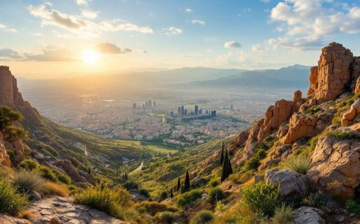
A long ribbon of land wedged between sea and mountains, Lebanon condenses on barely 10,452 km² a rare geographic diversity: Mediterranean coastline, ranges rising beyond 3,000 meters, interior plateaus, fertile valleys, and semi-arid slopes. This mosaic of reliefs shapes the climate, soils, crops, and increasingly, the country’s environmental vulnerabilities.
Lebanon’s geography is a complex system where several distinct bands of terrain intersect, each with its own characteristics. From the coastal Sahel to the snow-capped peaks of Qurnat as Sawda’, passing through the agricultural corridor of the Bekaa plain and the dry slopes of the Anti-Lebanon, these zones present specific constraints and opportunities related to agriculture, water, forests, urbanization, and ecological risks.
A small territory with a strategic position
Lebanon occupies the eastern shore of the Mediterranean, in the Levant, between latitudes 33° and 35° North and longitudes 35° and 37° East. Its roughly rectangular shape narrows toward the far north and south. The country is one of the smallest in mainland Asia, but its location at the interface of the Mediterranean basin and the Arabian Peninsula makes it a historic crossroads of trade routes and, still today, a geopolitical node.
This is the length in kilometers of Lebanon’s land border with Syria to the north and east.
The narrowness of the territory becomes clear when examining its dimensions: the maximum distance from west to east does not exceed 88 km, and can locally shrink to about 30 kilometers. In length, from north to south, the Lebanese strip stretches approximately 170 km. This particular geometry explains the parallel arrangement of the major relief units: coastal plain, Mount Lebanon range, Bekaa plain, Anti-Lebanon.
Four major bands of Lebanese relief
The physical framework of Lebanon’s geography rests on four longitudinal regions that succeed each other from west to east. Each has its own topographic profile, local climate, and land use.
The coastal plain: a narrow fertile ribbon
The Lebanese Sahel is a strip of lowlands backed against the sea. This ribbon is neither continuous nor wide: near Tripoli, it reaches barely 6.5 km, and in places, near Jounieh, it narrows to about 1.5 km before the foothills of Mount Lebanon rise abruptly.
Despite this narrowness, this plain accumulates marine and alluvial sediments that make it one of the most fertile soils in the country. It is particularly used for vegetable crops, citrus fruits, and further south, bananas under mild, humid climates. The coast remains relatively regular, without large gulfs or deep estuaries, which has limited the emergence of natural ports and concentrated port facilities on a few points like Beirut or Tripoli.
Located in the north of the country, the Akkar plain widens to form a large coastal plain. It is one of the few coastal areas where field crops, especially cereals, potatoes, and vegetables, can be grown on significant acreages.
Mount Lebanon: a mountain barrier overlooking the sea
Parallel to the coast, the Mount Lebanon massif forms a true backbone. Stretching 160 to nearly 200 km in length, this range of limestone and sandstone culminates at Qurnat as Sawda’, over 3,080 m in altitude, the highest point in the country and the Levant. The altitude frequently exceeds 2,000 m, with other iconic peaks like Sannine (2,695 m).
The range is widest in the north, where it reaches more than 50 km in width, then narrows toward the south. Its western slopes, carved with deep gorges and steep valleys, catch the humid winds coming from the sea. Result: abundant precipitation, including thick snow several months a year, feeding 13 of the country’s 16 permanent rivers that then flow down to the Mediterranean.
The mountain slopes, although forming iconic landscapes with their cultivated terraces, perched villages, and forest reserves, have rugged topography. This configuration limits the size of agricultural plots and leads to extreme land fragmentation. This natural constraint makes them more suitable for fruit tree cultivation (orchards) and livestock farming rather than large-scale cereal crops that require vast flat areas.
The Bekaa plain: an agricultural corridor at the heart of the country
Squeezed between Mount Lebanon and the Anti-Lebanon, the Bekaa plain is a high plateau about 170 km long and 10 to 25 km wide. Its average altitude is around 750 m, with high points near Baalbek. Geologically, it extends northward the great depression of the Levantine Rift system, giving it rich alluvial soils from the two ranges that flank it.
Nearly half of the country’s arable land is concentrated in the Bekaa depression. This region, which represents about 42% of the national cultivated area, is the main basin for cereals (57% of acreage), industrial crops like sugar beet or tobacco (62% of land), as well as potatoes, fruits, and vegetables.
This is also where the two major interior rivers originate: the Litani, which then flows south before cutting through Mount Lebanon to reach the sea, and the Orontes (Nahr al-Asi), which instead flows north toward Syria and Turkey.
The Anti-Lebanon: arid slopes and eastern border
East of the Bekaa, a second range extends the mountain system: the Anti-Lebanon. Drier and less populated than Mount Lebanon, this massif shares its peaks with Syria. Its highest point, Mount Hermon (Jabal al-Shaykh), exceeds 2,800 m. This relief, distant from the sea and in a rain shadow position, receives lower precipitation, with landscapes tending toward semi-arid, particularly in the north and the upper Bekaa.
These slopes host some orchards (especially cherry trees) and olive groves on their western slopes, but the dominant land use remains extensive grazing of small ruminants, adapted to poor soils and rangeland vegetation.
Climate: a Mediterranean climate contrasted by relief
While Lebanon is classically described as having a Mediterranean climate, the on-the-ground reality is more nuanced. The combination of north-south relief, proximity to the sea, and interior plateaus creates a series of microclimates that directly condition the geography of agriculture.
The seasonal rule, however, remains the same for the whole country: hot, dry summers, cool to cold, humid winters, with rainfall concentrated between October and April. From June to September, rain becomes rare.
On the coast, summers are very hot (>35°C) and humid, while winters are mild (13-14°C) but rainy, with annual precipitation varying from 600 mm in the south to over 800 mm in the north. In the mountains, the temperature drops by about 3°C per 500 m of altitude and precipitation increases, potentially exceeding 2000 mm on the western slopes, with a significant portion as snow.
The Bekaa, sheltered by the Mount Lebanon barrier, is significantly drier, with annual rainfall totals of 200 to 450 mm and marked temperature ranges. Summers are scorching, winters harsh, requiring substantial irrigation to secure crops.
The Lebanese climate is marked by hot, dry winds (khamsin) in spring and autumn, causing sudden temperature rises and dust episodes. Additionally, the region is warming faster than the global average, with a projected 20 to 40% decrease in winter precipitation by the end of the century if emissions remain high. This could shift temperate zones toward a semi-arid climate, particularly in the northern Bekaa.
A geography shaped by water: rivers, aquifers, and dams
For a small country, Lebanon has a dense hydrographic network: 16 perennial rivers, almost all originating in Mount Lebanon. These waterways, short and fast-flowing, are the direct product of the combination “high relief + heavy winter rainfall.” Yet, due to slopes and insufficient storage infrastructure, more than three-quarters of these resources flow to the sea without being utilized.
The Litani basin covers over 2,100 km², about 20% of Lebanon’s area.
Other rivers, such as the Orontes (Asi), the Hasbani, or the Nahr al-Kabir, cross borders and belong to transboundary systems (toward Syria, Turkey, Israel, or Jordan). This situation of a “regional water tower,” where Lebanon feeds several neighboring basins, heightens the stakes for coordinated management.
The country’s karstic limestone subsoil forms a vast groundwater reservoir feeding thousands of springs. However, the presence of about 60,000 illegal wells disrupts this balance, leading to declining water levels, saline intrusion on the coasts, and the disappearance of resurgences.
A very agricultural land… under pressure
Despite the small size of the territory and the omnipresent mountains, agriculture occupies a considerable place in Lebanon’s geography. According to FAO and World Bank series, about two-thirds of the area is classified as agricultural land, including arable land, permanent crops, and permanent pastures. This represents between 6,500 and nearly 6,800 km² depending on the year, placing Lebanon among the countries with the highest proportion of agricultural land relative to total area, and first in the Middle East region.
This high proportion results from terraced relief, extensive use of mountain pastures, and the integration of permanent crops (olives, orchards) into the landscape. It does not mean, however, that all this land is easily farmable: steep slopes, thin soils, plot fragmentation, and water access remain major constraints.
Regional distribution of cultivated land
Lebanese agricultural geography reflects the major relief units. The main productive areas are:
Overview of the main agricultural production areas in Lebanon and their specialties.
Dominant crops: citrus, bananas, vegetables, and greenhouse crops.
Specialized in cereals, potatoes, vegetables, and vines.
Heart of large-scale crops (cereals, potatoes, vegetables, industrial crops) and dairy cattle farming.
Characterized by orchards and mountain vegetable farming.
Mainly grapevines, olives, and cherry trees.
Dominant crops: olives, tobacco, almonds, and some cereals.
A table of the distribution of major crops by mohafaza (governorate) from the late 1990s illustrates these contrasts well.
An example of crop distribution by governorate
The table below, expressed in thousands of square meters, shows the distribution of the five major crop groups (cereals, fruit trees excluding olives, olive trees, industrial crops, vegetables) across the main administrative regions.
| Governorate | Cereals | Fruit trees | Olive trees | Industrial crops | Vegetables |
|---|---|---|---|---|---|
| Mount Lebanon | 3,140 | 97,820 | 77,678 | 1,613 | 31,100 |
| North | 120,380 | 135,685 | 209,628 | 37,769 | 128,584 |
| Bekaa | 297,737 | 217,570 | 31,443 | 153,232 | 259,743 |
| South | 37,638 | 123,304 | 89,340 | 14,625 | 20,753 |
| Nabatiyeh | 59,525 | 20,768 | 116,124 | 40,026 | 12,141 |
This table highlights several structural features: the dominance of the Bekaa for cereals and industrial crops, the importance of the North and South for olive growing, and the significance of vegetables across all regions, especially in the Bekaa and the North.
Land tenure structures and irrigation
An agricultural census carried out with FAO support provides a finer understanding of land use. The country has about 170,000 farms, for a utilized agricultural area of approximately 231,000 hectares, nearly half of which is irrigated. This irrigation is concentrated more than half in the Bekaa/Baalbek-Hermel pair, followed by Akkar. Mount Lebanon, due to its relief, represents only 9% of cultivated land and less than 9% of irrigated areas.
A second table summarizes these data.
| Mohafaza | Number of farms | UAA (ha) | Irrigated UAA (ha) |
|---|---|---|---|
| Mount Lebanon | 31,178 | 20,588 | 9,396 |
| North | 27,636 | 24,065 | 9,200 |
| Akkar | 28,120 | 35,352 | 15,649 |
| Bekaa | 12,516 | 41,649 | 29,866 |
| Baalbek-Hermel | 21,569 | 57,625 | 31,703 |
| South | 22,111 | 25,621 | 12,203 |
| Nabatiyeh | 26,382 | 26,095 | 4,939 |
| Total Lebanon | 169,512 | 230,995 | 112,956 |
It can be seen that, even if the center of the country around Beirut is highly urbanized, the northern, eastern, and southern margins remain largely rural and structured by agricultural practices, with thousands of small, often family-run farms.
Crop specialization and diversity of agricultural landscapes
The Lebanese cultivated landscape is divided into broad categories: temporary crops (cereals, vegetables, fodder), permanent crops (fruit trees, vines, olives), and permanent pastures. About 54% of the cultivated area is occupied by perennial crops, 44% by temporary crops, and a small fraction by greenhouses.
This is the share, in percentage, of agricultural land occupied by olive trees, the dominant perennial crop in Tunisia.
The ten main crops by area (olives, wheat, potatoes, barley, apples, grapes, tobacco, almonds, cherries, oranges) alone account for nearly three-quarters of harvested land. To this base are added about forty other cultivated species, from lentils to chickpeas, garlic to hazelnuts, reflecting a moderate but real agricultural diversity.
From relief to livestock: herds and mountain pastures
The mountainous dimension of the territory is also reflected in the geography of livestock farming. Rocky slopes, high plateaus, and shallow-soil areas are more suited to grazing small ruminants than intensive crops. Thus, in many sectors of Mount Lebanon, the Anti-Lebanon, and especially the arid areas around Baalbek-Hermel, sheep and goat farming is the dominant land use.
The goat herd has been stable for decades, while sheep flocks have increased sharply, driven by demand for meat and dairy products. Dairy cattle farming is becoming structured in the Bekaa and the North, with the emergence of medium to large farms, supported by credit programs and international aid.
This evolution translates geographically into less dependence on wild grazing: the use of feed supplements and fodder blocks helps reduce pressure on natural rangelands, even though overgrazing remains a localized problem in some massifs.
Forests, cedars, and biodiversity issues
Beyond fields and pastures, Lebanon’s geography is distinguished by its forest massifs, although these have been greatly reduced over the centuries by human exploitation. Forests and other wooded areas now cover barely more than 13% of the territory, with about 137,000 hectares of natural forests recorded.
The cedar of Lebanon, a national emblem, mainly survives in the highlands of Mount Lebanon in reserves such as Chouf, Tannourine, or Horsh Ehden. These high-altitude forests are crucial for hydrological regulation, soil stabilization, and biodiversity conservation. They belong to two major ecoregions: the Eastern Mediterranean coniferous and sclerophyllous forests, and the Southern Anatolian mixed montane forests.
Forest cover fragmentation, illegal logging, fires, and urban expansion threaten these ecosystems. In response, a national reforestation plan aims to plant tens of millions of trees, with support from local NGOs and international partners, to eventually restore a more significant proportion of tree cover, especially in mountain areas.
Urbanization concentrated on the coast
The human dimension of Lebanon’s geography is first read in its population map. Nearly 90% of the population now lives in urban areas, and most major agglomerations are spread along the coast or in low valleys.
Lebanon’s population is heavily concentrated in the Beirut agglomeration, which brings together more than two million inhabitants on a coastal peninsula. The urban network then extends along the coast, with the port cities of Tripoli to the north, and Sidon and Tyre to the south, connected by the coastal road. Inland, in the Bekaa valley, Zahle and Baalbek in the northeast are the main urban centers.
This urban concentration on the coastal fringe has a direct consequence on agricultural land: the coastal plain is under constant land pressure, with conversion of fertile soils into built-up areas, especially around Beirut, Jounieh, and in the southern plains. The phenomenon extends into the more accessible sectors of the Bekaa, where urbanization nibbles at the edges of urban centers and road axes.
Environmental pressures on land and water
The combination of population density, erosion-sensitive relief, and insufficient resource management generates a series of environmental problems closely linked to geography.
On agricultural lands, soil erosion is accentuated by slopes, deforestation, and certain farming practices. In several regions, particularly on the slopes of Mount Lebanon, terraces have been built to reduce this risk, but they require regular maintenance. Desertification threatens some sectors of the northern Bekaa and the south of the country, where rainfall patterns are changing and soils are drying out faster.
The Litani River, polluted by untreated domestic wastewater, industrial effluents, and agricultural residues, has concentrations of contaminants exceeding standards. This has a serious health impact on local populations and affects the quality of irrigated agricultural products.
This situation is not isolated: many coastal waterways are also contaminated, and groundwater aquifers near landfills or dumpsites show signs of degradation. It is estimated that about 30% of agricultural land is affected by solid or liquid pollution, contributing to declining yields and soil quality degradation.
Land management policies and hydraulic projects
Faced with these challenges, the state and its partners have attempted, over the decades, to structure a geographically targeted response. Large irrigation and water storage projects, in particular, aim to leverage the topography to better distribute the resource.
This is the number of additional hectares of irrigated land targeted by recent programs in the Litani basin, in order to reduce pressure on groundwater tables.
At the same time, water mobilization projects at the national level set aside space for landlocked rural areas, particularly in Baalbek-Hermel, Akkar, or the South, where hill reservoirs and small dams are being multiplied. Thousands of hectares of abandoned land have been reclaimed, often at the cost of major earthworks to stabilize slopes.
But these efforts face several obstacles: insufficient funding, weak maintenance, institutional fragmentation, slow dissemination of water- and soil-saving techniques (drip irrigation, mulching, conservation agriculture). The share of irrigation systems actually designed to conserve resources remains a minority, even as the country’s climatic vulnerability increases.
Agriculture and economy: a disproportionate geographic weight
On a macroeconomic level, agriculture accounts for only a modest fraction of the gross domestic product – between 3 and 6% depending on the series and recent years – and officially employs a limited share of the total workforce (around 6 to 8%). But this national picture masks the geographic reality: outside Greater Beirut, nearly 60% of the population depends directly or indirectly on this sector, whether through farming, agro-processing, or related services.
In the regions of Akkar, Baalbek-Hermel, South, and Nabatiyeh, agriculture is fundamental. It forms the pillar of local economies, influences land use planning (village layout, infrastructure, crop choices), and creates a close link with natural environments. The landscapes there typically consist of a mix of fields, orchards, pastures, and areas of natural vegetation.
The integration of this agriculture into regional markets is, however, fragile. On one hand, geographic diversity allows for the production of both temperate crops (apples, grapes, cereals) and subtropical ones (citrus, bananas). On the other hand, small plot sizes, production costs, dependence on poorly protected foreign labor, and international competition limit the ability to export on a large scale.
Temporal evolution: an agricultural space being reshaped
Area data show that, since the 1960s, the country’s agricultural area has fluctuated but tends overall to increase slightly in absolute terms, while spatially recomposing. It goes from about 5,600 km² of agricultural land in the early 1960s to nearly 6,800 km² in the early 2020s. However, this net gain masks several realities: urbanization of some coastal plains, bringing new areas into cultivation at higher altitudes or in the Bekaa, conversion of grasslands to permanent crops or vice versa.
The country lost on average 2 km² of agricultural land per year between 2008 and 2018.
A territory at the crossroads of climatic and human risks
Lebanon’s geography, long seen as an asset – variety of environments, relative abundance of water, climate favorable to a wide range of crops – now lies at the center of several fault lines.
Global warming and the decline in winter precipitation could shift isohyets westward, reducing the area with a humid Mediterranean climate and drying out the interior. The Bekaa, already poorly watered, could see its semi-arid conditions expand, threatening the availability of irrigation water and the entire agricultural system.
On the environmental front, pressure on forests, soils, and waterways is weakening the ecosystem services provided by the mountains: water infiltration into aquifers, landslide mitigation, natural water filtration. Fires, whether natural, accidental, or linked to armed conflicts, denude entire slopes, paving the way for erosion and loss of biodiversity.
Finally, on the socio-spatial front, the concentration of populations and economic activities on the coastal fringe, combined with the influx of refugees and displaced populations, makes certain coastal and valley sectors extremely vulnerable to pollution, infrastructure congestion, and risks of flooding or submersion.
Toward a new reading of Lebanese geography
Putting relief, climate, agriculture, and environment into perspective allows a better understanding of the country’s current and future challenges. The coastal plain is not just a narrow urbanized ribbon; it is also a reservoir of fertile land threatened by artificialization. Mount Lebanon is not just a topographic barrier; it is a water tower, a forest reservoir, and a space for pastoralism that conditions river regimes. The Bekaa is not simply a “breadbasket”; it is a fragile corridor where the most water-demanding crops, intensive livestock farming, and major hydraulic infrastructure are concentrated.
Despite its small territory, Lebanon’s geography concentrates disproportionate challenges for its population and the region. Its physical and agricultural maps reveal risk zones and opportunities, indicating where it is crucial to restore forests, modernize irrigation, protect groundwater tables, limit urbanization, and develop more resilient agriculture.
In this perspective, the major challenge of the coming decades will be to reconcile the potential offered by this mosaic of landscapes – sea, mountain, valley, plateau – with the ecological limits that climate change and human pressures make increasingly visible. Lebanon has rare geographic assets; their future will depend on the capacity to use them more sparingly, more coordinately, and with greater attention to the fragility of its reliefs, soils, and waters.
Disclaimer: The information provided on this website is for informational purposes only and does not constitute financial, legal, or professional advice. We encourage you to consult qualified experts before making any investment, real estate, or expatriation decisions. Although we strive to maintain up-to-date and accurate information, we do not guarantee the completeness, accuracy, or timeliness of the proposed content. As investment and expatriation involve risks, we disclaim any liability for potential losses or damages arising from the use of this site. Your use of this site confirms your acceptance of these terms and your understanding of the associated risks.

Cyril Jarnias is an independent expert in international wealth management with over 20 years of experience. As an expatriate himself, he is dedicated to helping individuals and business leaders build, protect, and pass on their wealth with complete peace of mind.
On his website, cyriljarnias.com, he shares his expertise on international real estate, offshore company formation, and expatriation.
Thanks to his expertise, he offers sound advice to optimize his clients' wealth management. Cyril Jarnias is also recognized for his appearances in many prestigious media outlets such as BFM Business, les Français de l’étranger, Le Figaro, Les Echos, and Mieux vivre votre argent, where he shares his knowledge and know-how in wealth management.





