
 Published on and written by Cyril Jarnias
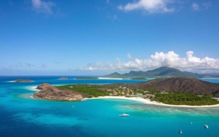
With around forty coral islands, a nearly 300-mile-long barrier reef, and some of the most beautiful beaches on the planet, the Turks and Caicos Islands offer a concentrated dose of the most spectacular the Caribbean has to offer. But beyond the postcard images of white sand and turquoise water lies a mosaic of natural, marine, and historical sites that would be a shame to miss.
This article lists the major sites of the destination, including national parks, protected lagoons, caves, iconic beaches, uninhabited islets, notable dive spots, and humpback whale watching sites, based on the most recent data.
Understanding the Geography of the Turks and Caicos Islands
Before exploring the sites one by one, it helps to set the scene. The archipelago consists of two main groups separated by the deep Turks Island Passage: the Turks group and the Caicos group. In total, about forty islands and cays, only a few of which are inhabited.
Providenciales, often nicknamed “Provo,” concentrates the majority of tourist infrastructure, luxury resorts, and international air links. Grand Turk, the administrative capital, is home to the territory’s only cruise port. Around them, a constellation of wilder or more exclusive islands – North Caicos, Middle Caicos, South Caicos, Salt Cay, Pine Cay, Parrot Cay, West Caicos, French Cay – form a vast playground for nature lovers.
Off the coast of Mayotte, ‘the Wall’ is a steep underwater drop-off that descends from shallow depths to over 2000 meters. This unique topography creates nutrient-rich currents, explaining the exceptional biodiversity of the seabed, the quality of the dive sites, and the remarkable passage of humpback whales in the area.
A Few Practical Points of Reference
Even though the temptation is great to unpack your bags on a single beach, understanding the archipelago’s structure helps organize your visits. The table below summarizes the tourist role of a few key islands.
| Island / Area | Main Role for Visitors | Major Assets |
|---|---|---|
| Providenciales (Provo) | Tourist and air hub, base for stays | Picture-perfect beaches, large beach resorts, water sports |
| Grand Turk | Capital, cruise ship port of call | Historic center, museums, Lighthouse, major dive sites |
| Middle & North Caicos | More rural islands, nature and culture | Caves, Mudjin Harbour cliffs, wild beaches |
| Salt Cay | Tranquil micro-island, prime whale location | Humpback whale watching, diving, timeless atmosphere |
| Pine Cay, Parrot Cay | High-end private islands | Ultra-exclusive resorts, pristine beaches |
| West Caicos, French Cay | Uninhabited, accessible by boat | Advanced diving, coral walls, pelagic wildlife |
Throughout the territory, driving is on the left, the official language is English, and the US dollar is the currency in circulation. The archipelago is known to be safe, but also expensive, which encourages careful selection of must-see sites.
Grace Bay Beach and Princess Alexandra National Park
It’s hard to talk about must-see sites without starting with Grace Bay Beach, on the northeast coast of Providenciales. This more than 3-mile-long beach, with waters of an almost unreal turquoise, is regularly ranked among the world’s most beautiful, and has repeatedly won “World’s Best Beach” titles in major international awards.
The beach is part of Princess Alexandra National Park, a vast marine park that also includes Bight Beach, Smith’s Reef, Bight Reef (Coral Gardens), Leeward Beach, Little Water Cay, Half Moon Bay, and Mangrove Cay. One mile offshore, a barrier reef protects the coast from Atlantic swells, explaining the sea’s near-constant calm.
Why Grace Bay Became an Icon
What sets Grace Bay apart from other Caribbean beaches is not just the water color, but also the consistency of quality: ultra-fine sand, few or no rocks, no pollution, very little sargassum thanks to favorable prevailing winds. The beach continues seamlessly to Leeward Beach to the east and Bight Beach to the west, offering nearly 7 miles of walkable shoreline, except for a few breaks by marinas and small cliffs.
The island’s coastline features a variety of hotel options, from large international resorts to more intimate establishments.
Stay at legendary establishments like Club Med Turkoise or renowned 5-star hotels.
Discover absolute luxury at prestigious addresses such as Seven Stars Resort & Spa, The Palms, Grace Bay Club, or The Ritz-Carlton.
Choose a more personal atmosphere at establishments like Sibonné Beach Hotel or Royal West Indies Resort.
Activities and Life Around the Beach
Grace Bay is more than a strip of sand: it’s a true “corridor of experiences.” Water sports are omnipresent: catamaran trips, snorkeling cruises to the barrier reef, kayaking, paddleboarding, Hobie Cat sailing, parasailing, scuba diving, wakeboarding, even kitesurfing towards Long Bay.
For snorkeling accessible from shore, Bight Reef (Coral Gardens) and Smith’s Reef, both included in the national park, remain reliable spots. Turtles, southern stingrays, parrotfish, lobsters, and moray eels can be seen just meters from the beach, making them ideal for beginners and children equipped with a float.
The Regent Village and Salt Mills Plaza complexes, set back from the beach, house shops, restaurants, and galleries. They are also home to the local Turks and Caicos National Trust headquarters, where you can purchase tickets and get information to visit several protected sites, like Little Water Cay.
In the evening, the beach transforms subtly: beach bars, restaurant terraces like Bay Bistro, Hemingway’s on the Beach, or Infiniti Restaurant & Raw Bar take over, while some hotels organize sunset yoga sessions or “sunset” cruises.
Access, Safety, and Environment
Many public access points with parking lots allow you to reach Grace Bay, although most umbrellas and lounge chairs belong to the hotels. Respecting the national park rules is essential: speed limits for boats, no fishing, no collecting corals, shells, or conch, and encouragement to use “reef-safe” sunscreens without oxybenzone or octinoxate.
Authorities consider that the main danger for swimmers comes less from sharks and more from motorboats and towed activities like banana boats or inner tubes, sometimes operated recklessly. Vigilance is therefore required near nautical channels.
Chalk Sound National Park and the Lagoons of Southern Providenciales
In contrast to Grace Bay, on the southwestern tip of Providenciales, Chalk Sound National Park offers a radically different setting. Here, there are no long beaches but a vast enclosed lagoon about 3 miles long, dotted with hundreds of small rocky islets. The water, shallow (3 to 4 feet on average), displays an almost fluorescent milky turquoise, due to the refraction of sunlight on a fine white limestone bottom.
A Protected Lagoon, Without Mass Infrastructure
Classified as a national park, Chalk Sound has neither developed viewpoints, nor proper public beaches, nor a common launch area. The only real organized access point is the Las Brisas restaurant, part of the Neptune Villas complex on the southeastern shore. From its small beach and wooden dock, you can rent kayaks, paddleboards, even clear kayaks, or board pontoons for mini-cruises of 2 to 2.5 hours.
Depth in feet of an impressive ‘Blue Hole’ observable on guided kayak tours.
Wildlife, Flora, and Atmosphere
The atmosphere at Chalk Sound is radically more contemplative than at Grace Bay. No beach clubs, little noise, a feeling of isolation accentuated by the contrast between the still lagoon and the rocky “ironshore” coastline, a limestone carved by waves. On some of the lagoon’s larger islets, you can spot the local iguana species, seabirds, or even, more rarely, rays and small lemon sharks in the channels.
The hardy vegetation mixes mangroves, prickly pear cacti, sisals, and a toxic tree, the “poisonwood” (coral sumac), whose mere contact can cause severe skin reactions. Needless to say, it’s better to stay on the trails when landing on an islet.
This public and free park is very popular with families and photographers for its color contrasts, especially midday. Be aware that drone use is potentially regulated and requires prior verification.
Sapodilla Bay and Taylor Bay, the Neighboring Gems
Just minutes from Chalk Sound, two small bays are star attractions: Sapodilla Bay Beach and Taylor Bay Beach. These are not park beaches, but they belong to the same geographical area and perfectly complement a visit to the lagoon.
Sapodilla Bay, with its white sand and very shallow warm water, is often cited among the most beautiful beaches of Providenciales. Very popular with families, it is lined with luxury villas and a few vendors offering drinks, snacks, and water sports (jet skis, boat trips). Taylor Bay, wilder and devoid of services, offers a shallow body of water that extends far offshore, ideal for walking knee-deep in the water for dozens of meters.
Little Water Cay (Iguana Island): The Iguana Sanctuary
Still within the Princess Alexandra National Park, but on the northeastern side of Providenciales, Little Water Cay – better known by the nickname Iguana Island – is another must-see, especially for nature lovers.
Located less than 550 yards from the Leeward coast, this small cay of about 116 acres is a sanctuary for the Turks and Caicos rock iguana (Cyclura carinata), the largest native land animal still living on the archipelago.
An Emblematic Species on the Rebound
Once present on most of the country’s islands, this species saw its population collapse due to the introduction of predators (cats, dogs, rats) and habitat destruction. Conservation efforts led by the Turks and Caicos National Trust have helped it recover: the overall population is now estimated at around 50,000 individuals, with about 3,000 on Little Water Cay.
The iguanas, whose color ranges from green to grayish-brown, are typically between 16 and 24 inches long, with some males exceeding 31 inches. Their diet is primarily vegetarian (leaves, flowers, fruits), but they can also eat small lizards and crabs. On Little Water Cay, they dig burrows in soft soil or lodge in cracks in the limestone.
A Structured Eco-Touristic Visit
The island is managed as a strict reserve. A small welcome center and two loops of wooden walkways – north and south – allow observation of the iguanas without damaging their habitat. It is mandatory to stay on these structures and follow a strict “iguana etiquette”: no feeding, no contact, no shouting, no litter, no pets, no cigarettes, and no restroom facilities on site.
These are the indicative amounts, in dollars per person, for entry fees to visit the island and fund its conservation.
How to Get There and What to Combine
Little Water Cay is only accessible by sea. From the Blue Haven or Leeward marinas, the boat trip takes only about ten minutes. Several operators – Caicos Dream Tours, Caribbean Cruisin’, Big Blue Collective, Turks Wave Tours, among others – offer half-day or full-day excursions combining snorkeling on the barrier reef, a visit to Half Moon Bay, a stop on Pine Cay or Mangrove Cay, a picnic, or even a beach barbecue.
It is also possible to go by kayak or stand-up paddleboard, renting equipment in Leeward. But you must respect the sometimes noticeable currents in the channel, even though the area is heavily frequented and rarely completely isolated.
The following table summarizes the place of a few cays in the tourist offerings of Princess Alexandra Park.
| Cay / Site | Main Feature | Most Common Type of Visit |
|---|---|---|
| Little Water Cay | Sanctuary for endemic iguanas | Guided tour with wooden walkways |
| Half Moon Bay | Very photogenic sandbar / lagoon | Swimming and relaxation stop by boat |
| Pine Cay | Private island, Pine Cay Wall for diving | Boat excursions / stays in private resort |
| Mangrove Cay | Mangrove channels rich in juveniles (turtles, etc.) | Eco-guided kayak / paddle tours |
Conch Bar Caves: A Dive into Underground History
Leaving the beaches for the interior, Middle Caicos is home to one of the archipelago’s most fascinating sites: the Conch Bar Caves. Located near the village of Conch Bar on the north coast, this karst network is considered the largest system of dry caves in the entire Bahamas–Turks & Caicos region, and one of the most significant in the Caribbean.
A Living Labyrinth Under the Rock
Formed over millions of years by the action of slightly acidic water on limestone, these caves constitute a “living system”: stalactites, stalagmites, and columns continue to grow. The galleries, mainly on a single level, stretch for about 1.5 miles according to standard measurements, although some higher figures circulate in the literature.
Visitors discover a succession of rooms – Christmas Room, Skylight Chamber, Bat City – punctuated by pits, light holes, small lakes whose levels fluctuate with the tide, and even “blue holes” interconnected with the sea.
Archaeological Heritage and Human Traces
The caves were first exploited in the 1880s for guano (bat droppings) exported as fertilizer. At that time, animal remains and artifacts of the Lucayan Indians (associated with the Taínos) were discovered there, but few were preserved. Today, archaeological research around Indian Cave and other nearby sites has uncovered skeletons of extinct animals (giant iguana, endemic turtle, birds), confirming Middle Caicos’ importance as a pre-Columbian settlement center.
This is the estimated number of Lucayans who lived on the island at their peak, using some caves as burial and ritual sites.
A Supervised and Somewhat Sporty Visit
Designated both as a national park and national heritage site, the Conch Bar Caves are strictly managed by the Turks and Caicos National Trust. Access is locked by a gate, and any visit must be with a licensed guide. There are no cemented paths, stairs, or fixed lighting: you progress with a flashlight on sometimes slippery or uneven ground. Sturdy closed-toe shoes are essential.
Tours generally last between 45 minutes and just over an hour. The ticket, around $20 to $30 depending on the source, necessarily includes the guide. It is recommended to book in advance via the National Trust, especially since the site accommodates only a small number of visitors and there is no guaranteed permanent presence.
For conservation reasons, it is prohibited to touch the formations, write on the walls, disturb the bat colonies, or leave any litter. Penalties for vandalism can be severe.
Access from Providenciales
To reach Middle Caicos, visitors first arrive on Providenciales, then take a domestic flight or ferry to North Caicos. A road causeway of about one mile, built in 2007, connects North and Middle Caicos. A car is then essential to reach Conch Bar.
Several agencies, like Big Blue Collective or Caribbean Cruisin’, offer excursions including transport, the cave visit, and other iconic sites like Mudjin Harbour, with its limestone cliffs plunging into the sea.
Grand Turk: Between Colonial History and Legendary Diving
Head to Grand Turk, the political capital and living memory of the archipelago. The island, about 7 miles long and barely 1 to 1.5 miles wide, concentrates a historic waterfront, calm beaches, a very lively cruise port, and spectacular underwater sites along the famous Grand Turk Wall.
Cockburn Town and the Built Heritage
The small capital, Cockburn Town, stretches along Front Street and Duke Street, with British-Bermudian style colonial houses, churches, and administrative buildings. The Turks and Caicos National Museum, housed in the 19th-century Guinep House, notably displays artifacts from the Molasses Reef Wreck, considered one of the oldest excavated European shipwrecks in the Americas, as well as collections on the salt industry and the 1962 Mercury space mission.
The former colonial prison H.M. Prison, used until the 1990s, is now open for self-guided visits. Nearby, old salt pans, like Hawkes Nest Salina, recall the era when sea salt production was the island’s main wealth.
The Lighthouse and the North Coast
At the northern tip, the Grand Turk Lighthouse, the country’s only lighthouse, overlooks the cliffs. While the interior of the structure is closed to the public, the surroundings offer remarkable views of the coastline and ocean. The site is also a good starting point for walking along coastal trails and watching waves break on the rocks.
Bars and small restaurants like Cliff Hanger or Lazy Donkey complement the outing, often punctuated by encounters with the wild donkeys that roam freely on the island.
The Grand Turk Cruise Center and Adjacent Beaches
On the southern point, the Grand Turk Cruise Center, owned by Carnival Corporation, is the entry point for tens of thousands of cruise passengers each year. The infrastructure, covering over a dozen acres, includes duty-free shops, restaurants – including a massive Margaritaville with a lagoon pool and submerged bar, a surf simulator, and direct access to the beach known as Cruise Center Beach or SunRay Beach.
Less than a mile north, Governor’s Beach is often considered the island’s most beautiful for its quality sand and clear waters. For more tranquility and good snorkeling opportunities, the beaches of Cockburn Town Beach, Pillory Beach, and English Point offer excellent alternatives.
The Grand Turk Wall and Gibbs Cay
Beneath the surface, Grand Turk is most famous for its spectacular drop-off, where the shallow shelf plunges almost vertically into the depths. The diving here is world-renowned: hard and soft corals, sea fans, barrel sponges, schools of jacks, turtles, eagle rays, reef sharks… The feeling of “the bottom disappearing” is particularly striking.
To the east, Gibbs Cay, a small uninhabited cay accessible by boat, has earned the local nickname “Stingray City“: southern stingrays regularly come into the shallow waters, accustomed to the presence of visitors. Many excursions from the cruise port combine snorkeling on the reef and a stop at Gibbs Cay.
Salt Cay: The Humpback Whale “Headquarters”
Modest in appearance, Salt Cay is nonetheless one of the most unique sites in the Turks and Caicos Islands. This tiny island, a relic of an era when salt ponds structured the economy, has become a sanctuary for humpback whale watching, particularly between January and early April.
A Corridor for Thousands of Whales
The Turks Island Passage, a channel about 6,000 feet deep separating the Turks from the Caicos, serves as a migration route for humpback whales leaving their cold northern feeding grounds (Greenland, Iceland, Canada, etc.) to breed and give birth on the warmer banks of Silver Bank, Mouchoir Bank, or Gentry Bank. It is estimated that 3,000 to 5,000 individuals transit through the region each season.
Salt Cay, located in the heart of the humpback whale migration corridor, is an ideal starting point for whale watching trips. Excursions are conducted on small boats, similar to those used for diving or fishing, allowing for flexible and respectful approaches while adhering to the regulatory distances imposed for animal protection.
Observation from the Boat… and Sometimes in the Water
Excursions departing from Salt Cay or Grand Turk generally last 2.5 to 3 hours. The chances of seeing whales resting, breaching, blowing, or swimming in groups are high during the peak season, although no serious operator will ever guarantee an encounter.
In the Turks and Caicos Islands, supervised snorkeling encounters with humpback whales are sometimes permitted in temperate water. Under certain conditions (sea state, animal behavior, distance from calves), guides may allow a quiet entry into the water at a distance. Participants must float calmly on the surface, avoid any diving or intrusive approach, and let the whales decide the level of proximity. These experiences, lasting anywhere from a few minutes to over an hour, typically create unforgettable memories.
A Timeless Island
Beyond whale trips, Salt Cay offers an almost frozen-in-time atmosphere: small houses, a few guest houses like Tradewinds Guest Suites, beachfront cottages, a few restaurants and grocery stores, as well as excellent diving spots on the nearby shelf and drop-off. Getting around is often by bicycle or golf cart.
Access to Salt Cay, however, requires some planning: limited flights from Providenciales (generally two days a week) and ferry links from Grand Turk only on certain days. As a result, those who make the effort to stay there enjoy an almost intimate experience.
The table below allows for a quick comparison of the two main whale watching hubs.
| Site | Main Advantage | Level of Tourist Infrastructure |
|---|---|---|
| Grand Turk | Combine whales, diving, beaches, and museums | Capital, cruise port, many services |
| Salt Cay | Maximum proximity to the migration route | Very low development, village atmosphere |
Providenciales’ Wild Side: Northwest Point, Malcolm’s Road, Long Bay, and the Southwest Coast
While Grace Bay concentrates the majority of visitors, Providenciales holds other sites worth the detour.
Northwest Point and the Marine Parks
At the northwestern tip of the island, Northwest Point Marine National Park protects a rougher, wave-battered coast and spectacular underwater walls. Divers frequent sites like Shark Hotel, known for its Caribbean reef sharks – or even, occasionally, lemon or tiger sharks – or The Hole In The Wall, which features a spectacular passage under rock opening at 100 feet depth.
These dives, intended for experienced divers due to currents and depth, are organized by operators like Aqua TCI. Small-group trips (max. 8 divers per guide) to sites like Northwest Point or French Cay typically offer two dives per outing, with Nitrox as an option to optimize bottom time.
Malcolm’s Road Beach and “the Wall”
On the west coast of Providenciales, Malcolm’s Road Beach is an increasingly poorly kept secret. Access is via a sometimes bumpy track where a 4×4 is recommended, but the reward is worth it: a wilder beach, a feeling of being at the end of the world, and especially the immediate proximity to “the Wall,” the great barrier reef drop-off.
Artificial reef balls have been placed to enrich marine life near the beach, and divers embarking from this area quickly reach vertiginous depths with remarkable visibility. Again, this site is more for experienced divers.
Long Bay Beach and the Southeast Coast
On the southeast coast, Long Bay Beach stretches for about 3 miles of sand facing the trade winds. This orientation, combined with a relatively shallow and flat bottom, has made it a prime spot for kitesurfing. More sheltered from crowds than Grace Bay, the beach retains a relaxed atmosphere, even though more villas and small hotels are appearing.
The wreck of the La Famille Express, grounded on a shoal offshore, now serves as a visual landmark for navigators and is a tourist curiosity during some boat trips.
The Coves and Points of the Southwest Coast
Finally, the entire southwestern area of Providenciales, around Pirate’s Cove, Split Rock, Bonefish Point, or Bonefish Beach, is worth a detour for those seeking more rugged landscapes: rocky coasts, small caves, vast sandbars exposed at low tide. These places are harder to access, sometimes requiring a suitable vehicle and good self-sufficiency, but offer rarely crowded panoramas.
Sapodilla Bay Hill Rock Carvings: Sailors’ Etched Memory
Just above Sapodilla Bay Beach, a small hill about 160 feet high houses a little-known historical site: the Sapodilla Bay Hill Rock Carvings. Designated a protected area, this rocky promontory contains inscriptions left between the mid-18th and 19th centuries by sailors, captains, travelers, and crew members awaiting at the nearby port of South Dock, formerly Gussy Cove.
An 18th-Century Graffiti Book
On the limestone slabs, one can still distinguish – despite theft and vandalism that have reduced the number of visible pieces – names, dates, sometimes silhouettes of ships or buildings. Some original blocks have been removed for preservation, and the Turks and Caicos National Museum has undertaken systematically molding the engraved stones for study and display, notably in the international area of Providenciales Airport.
Historians have been able to confirm the passage, sometimes tragic, of certain ships in the region by cross-referencing the engraved ship names with British, European, or American archives.
A Short Ascent for a Panoramic View
The ascent from the small parking lot at the end of an unpaved track takes only five minutes, but the path is rocky, narrow in places, and unshaded. Good shoes are essential. Once at the top, you enjoy a 360-degree view over Chalk Sound, Sapodilla Bay, the coastal villas, and South Dock port. Many choose to climb up at the end of the day to watch the sun set into the sea and, with a bit of luck, try to spot the famous “Green Flash.”
Access to the site is free, but it is prohibited to damage the rocks, place graffiti, remove stones, or build cairns. These actions, which alter the geological record, are subject to prosecution.
This hill regularly features on guided tours of Providenciales, alongside Grace Bay, Taylor Bay, The Hole, or Cheshire Hall Plantation.
Combining Must-Sees: Ideas for Site Combinations
Given the diversity of places, it can be useful to think in “duos” or “trios” of nearby sites to combine on the same day or half-day. For example:
To optimize your stay, here are daily itinerary suggestions by island: On Providenciales, combine a morning of water sports at Chalk Sound (kayaking or paddleboarding from Las Brisas) with an afternoon of relaxation at Sapodilla Bay or Taylor Bay, then finish with the climb up Sapodilla Hill to admire the sunset. East of Provo, combine a boat trip from Leeward with snorkeling on the barrier reef, a landing at Little Water Cay to see the iguanes, a stop at Half Moon Bay, and possibly a detour to Pine Cay Wall for divers. On Middle Caicos, follow the visit to Conch Bar Caves in the morning with lunch in Conch Bar or Bambarra, then a walk at Mudjin Harbour to discover its cliffs and beach. On Grand Turk, devote a full day to a mix of historic sightseeing in Cockburn Town (museum, prison, streets), relaxation on the beaches (Governor’s Beach, Pillory Beach), and snorkeling or diving on the wall; reserve Gibbs Cay for a second day. On Salt Cay, alternate between whale watching days (in season), diving, and relaxing on the nearly deserted beaches.
The table below summarizes some typical combinations around the highlight sites.
| Stay Base | Nearby “Must-See” Site Combo | Target Traveler Profile |
|---|---|---|
| Grace Bay (Provo) | Grace Bay Beach + Bight Reef + Smith’s Reef + evening dining/shopping | First-time visitors, families, couples |
| Chalk Sound (Provo) | Chalk Sound + Sapodilla Bay + Sapodilla Hill | Photographer, families with young kids |
| Leeward / Blue Haven | Little Water Cay + Half Moon Bay + Mangrove Cay | Nature lovers, eco-tourists |
| Middle Caicos | Conch Bar Caves + Mudjin Harbour + Conch Bar and Bambarra beaches | History buffs, light hikers |
| Grand Turk | Cockburn Town + National Museum + Governor’s Beach + Grand Turk Wall | Cruise passengers, divers, culture lovers |
| Salt Cay | Whale watching + diving + beaches and salt ponds | Marine wildlife enthusiasts, slow travelers |
Cross-Cutting Tips to Enjoy the Sites Without Damaging Them
All these sites share a common fragility. A few basic rules help preserve them while making the experience more enjoyable:
To preserve marine and terrestrial biodiversity, use biodegradable, coral-friendly sunscreen and wear UPF-rated clothing. Avoid all physical contact with coral reefs and wildlife (corals, turtles, rays, sharks). Do not take any natural souvenirs like shells or coral fragments. Strictly follow local guidelines: use designated walkways, do not disturb bats in caves, and use a guide if required. Finally, be vigilant of boat traffic, the main source of danger in the water, by staying visible and swimming in designated areas.
Conclusion: A Constellation of “Must-Sees” Beyond the Postcard
The Turks and Caicos Islands are often summed up by a few images of pristine sand and turquoise waters. The reality, far richer, is revealed in the juxtaposition of very different sites: a world-awarded beach like Grace Bay, a surreal lagoon like Chalk Sound, an endemic iguana reserve on Little Water Cay, a network of ancient caves on Middle Caicos, a vertiginous drop-off off Grand Turk, or a forgotten small island turned humpback whale “HQ” on Salt Cay.
Exploring these places allows you to discover the territory’s deep history: the Lucayan caves, the sailors’ carvings at Sapodilla Hill, the heritage of salt production on Grand Turk and Salt Cay, and the delicate coral reef ecosystems, world-renowned for diving.
In an archipelago where the cost of living encourages planning your days, carefully choosing these emblematic places – and taking the time to understand them – can transform a simple beach vacation into a true voyage of exploration.
Disclaimer: The information provided on this website is for informational purposes only and does not constitute financial, legal, or professional advice. We encourage you to consult qualified experts before making any investment, real estate, or expatriation decisions. Although we strive to maintain up-to-date and accurate information, we do not guarantee the completeness, accuracy, or timeliness of the proposed content. As investment and expatriation involve risks, we disclaim any liability for potential losses or damages arising from the use of this site. Your use of this site confirms your acceptance of these terms and your understanding of the associated risks.

Cyril Jarnias is an independent expert in international wealth management with over 20 years of experience. As an expatriate himself, he is dedicated to helping individuals and business leaders build, protect, and pass on their wealth with complete peace of mind.
On his website, cyriljarnias.com, he shares his expertise on international real estate, offshore company formation, and expatriation.
Thanks to his expertise, he offers sound advice to optimize his clients' wealth management. Cyril Jarnias is also recognized for his appearances in many prestigious media outlets such as BFM Business, les Français de l’étranger, Le Figaro, Les Echos, and Mieux vivre votre argent, where he shares his knowledge and know-how in wealth management.





