
 Published on and written by Cyril Jarnias
A tropical archipelago lost in Micronesia, Palau racks up every superlative: electric blue lagoons, deep forests, some of the planet’s richest reefs, stalactite-filled caves, World War II relics, and traditional villages. Long known mainly to divers, the country is increasingly opening up to travelers curious about nature and culture. To visit Palau is to accept spending your days on the water, your evenings listening to the stories of the elders, and your nights dreaming of sharks, mantas, and limestone islets.
This guide presents the essential sites to visit, detailing what you’ll find, access procedures, associated costs, and their central role in the country’s exemplary conservation strategy.
Koror, the Gateway and Ideal Base Camp
Before the lagoons and reefs, there’s Koror. The former capital and commercial heart of the country, it’s home to the majority of the archipelago’s 18 to 20,000 inhabitants. This is where you’ll find the international airport, most hotels, dive shops, museums, and marine tour operators. Not a bustling metropolis, Koror offers everything a traveler needs between days at sea: restaurants, shops, markets, museums, and a real glimpse of contemporary Palauan life.
The main streets stretch along the coast. Within minutes by taxi or rental car, you can reach the docks where boats depart for the Rock Islands. Numerous companies like Sam’s Tours, Fish ’n Fins, Palau Dive Adventures, and kayak operators organize daily trips; departures are usually scheduled between 8:30 and 9 a.m., returning around 4–5 p.m., with lunch included on a sandy islet or by a deserted beach.
Museums and Aquarium: Understanding the Archipelago Before Exploring It
To grasp the cultural depth of Palau, a visit to Koror’s museums is a must. The Belau National Museum, founded in 1955, is considered the oldest museum in Micronesia. Its halls display traditional objects, artifacts from the colonial periods (German, Japanese, American), and a rich collection on recent political history. You’ll discover, for example, the workings of the Palauan matrilineal system, the role of women’s councils in land management, and the symbolic role of meeting houses, the “bai.”
In the museum garden, a full-size replica of a bai (a type of traditional Chinese building) is on display. It’s decorated with paintings depicting myths and battles, offering a concrete visualization of this iconic architecture. Furthermore, the museum provides a library with several thousand volumes for visitors wishing to deepen their knowledge on the subject.
Nearby, the Etpison Museum, established in the late 1990s, complements the visit. It features ancient maps, archival photographs, archaeological objects, and entire sections dedicated to Palauan biodiversity, from mangroves to large pelagic species. It’s an excellent primer for planning your time on the water.
Attached to the marine research center, the aquarium recreates reef habitats and informs visitors about threats to corals and protection measures like the shark sanctuary and the ban on toxic sunscreens.
Practical Information: Hotels and Base Budget in Koror
Koror offers a range of accommodations to suit all budgets, from small family hotels to beachfront resorts. You’ll find places like Palau Central Hotel or West Plaza Downtown on the budget/mid-range side, up to the Palau Royal Resort for a more upscale approach, with a private beach and full services. On the neighboring island of Malakal, connected by a bridge, the Palau Pacific Resort or the Sea Passion Hotel often serve as bases for divers.
For getting around, taxis, rental cars, and scooters are available, with local rental companies like IA Rental. The island is modest in size, but a car or scooter is very useful if you plan to explore Babeldaob or have multiple early morning outings.
Rock Islands Southern Lagoon: The Turquoise Heart of Palau
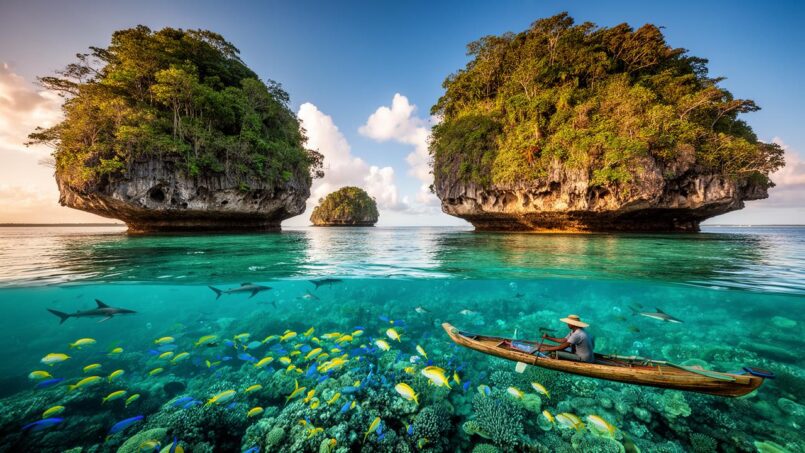
Almost as soon as the boat leaves Koror, the scenery shifts into another dimension. Ahead of the bow emerges a labyrinth of more than 250 to 300 limestone islets, covered in vegetation with their bases eroded by waves, giving them their characteristic “mushroom” look. This complex, known as the Rock Islands Southern Lagoon, covers over 100,000 hectares, 94% of which is marine waters, and is a UNESCO World Heritage site for its exceptional natural and cultural value.
Between karst cliffs, caves, arches, tunnels, and 52 marine lakes, the area boasts an incredible density of landscapes and habitats: reefs, seagrass beds, mangroves, secret beaches. More than 1,500 species of fish and nearly 400 species of hard corals are recorded here, a level of diversity unmatched in the North Pacific.
Access to the Rock Islands is exclusively by boat, typically via organized tours departing from Koror. Before boarding, it is mandatory to obtain a Rock Islands permit, issued by the State of Koror, as it is required to enter this protected area.
Permits and Access Fees: What You Need to Know
Palau has chosen to fund part of its lagoon protection through entrance fees. These permits are checked by rangers at the most popular sites, and a portion of the revenue directly funds conservation programs.
Below is a summary, for reference, of the main fees associated with the iconic sites of the Rock Islands and surrounding areas (amounts based on recent available data, subject to change):
| Site / Permit | Approximate Amount (USD) | Approximate Validity | Key Remarks |
|---|---|---|---|
| Rock Islands Permit (without lake) | 50 | 5 to 10 days | General access to Rock Islands (excluding Jellyfish Lake) |
| Jellyfish Lake / Rock Islands Permit | 100 | 5 to 10 days | Includes Jellyfish Lake and associated areas |
| Iconic Waterfall (Ngardmau…) | 10 | – | Trail and waterfall entrance fee |
| WWII Sites of Peleliu (land permit) | 15 | – | Land permit for war relics |
| Kayangel – tourist fee | 8 | – | Atoll visitation fee |
| Kayangel – conservation area | 15 (+ 8 snorkeling) | – | Protected area access + snorkeling fee |
Additionally, there are departure taxes (green fee and departure tax), and an environmental fee integrated into the airfare. In practice, most tour operators include permits in their packages or handle obtaining them, but they often appear as a separate line item on the invoice.
Milky Way Lagoon: A Limestone Mud Bath in the Middle of the Lagoon
Among the most common stops on Rock Islands tours is Milky Way, a small cove with strangely milky blue water. Here, the bottom is covered in a fine white limestone mud, which guides scoop to the surface to slather visitors from head to toe. You cover your body, let it dry for a few minutes (photos included), then dive back in to rinse off this improvised mask.
Beyond its fun aspect, Milky Way reveals the limestone substrate that forms the base of the Rock Islands. This substrate is essential as it nourishes coral reefs of great richness.
Secret Lakes, Bays, and Caves: The Kingdom of Kayaking
In coves like Nikko Bay, Risong Bay, or Long Lake, limestone walls rise straight from the water, sometimes pierced by tunnels leading to interior “lakes” like Disney Lake or Jurassic Lake. The best way to explore this maze on the surface is by sea kayak.
Specialized companies like Paddling Palau or adventure travel agencies offer trips combining kayaking, snorkeling, and short hikes. You glide under stone arches, traverse tunnels to emerge in hidden pools, observe mangrove roots, shallow corals, and juvenile fish. On some routes, after nightfall, guides take visitors to observe bioluminescent plankton, those tiny organisms that light up when the water is stirred.
Jellyfish Lake: Swimming Among Nearly Harmless Jellyfish
This is perhaps the most famous image of Palau: a swimmer moving amidst thousands of golden jellyfish. Jellyfish Lake, or Ongeim’l Tketau in the local language, is nestled on Eil Malk island, in the heart of the Rock Islands Southern Lagoon. This marine lake, completely isolated from the ocean by limestone terrain, is a unique ecosystem.
Over time, two species of jellyfish – the golden jellyfish (Mastigias papua etpisoni) and a moon jellyfish (Aurelia) – have evolved there in the near absence of predators. As a result, their stinging capacity has greatly diminished. For humans, contact feels like a gelatinous water balloon, without pain.
A Fragile Ecosystem, Protected by Strict Rules
The lake is about 30 meters (100 feet) deep, but only the upper layer (down to 10–15 meters / 33–50 feet) supports life. Below that, the water column becomes anoxic (without oxygen) and rich in hydrogen sulfide, toxic to organisms and dangerous for humans. Scuba diving is therefore prohibited, as is deep freediving: visitors float at the surface with mask and snorkel, life jackets mandatory.
The El Niño event that year caused the collapse of the golden jellyfish population, from several million to almost nothing.
This vulnerability explains the strict protocol for visitors. Before entering the water, you must rinse your gear and body with fresh water to avoid introducing parasites or foreign microorganisms. Standard sunscreen is prohibited; only “reef-safe” protection is allowed, applied well before arriving at the site so it doesn’t immediately wash off into the lake water. Touching or handling the jellyfish is forbidden, as they are easily injured by pressure from fingers or fins.
Visiting Conditions and Logistics
Access to the lake is exclusively through licensed operators. From Koror, the speedboat ride takes about three-quarters of an hour, followed by a short walk (up and down a hill, with stairs and a handrail) between the landing point and the dock.
The visit consists of an immersion of about 30 minutes (sometimes more) among the jellyfish. The experience is spectacular when jellyfish density is high, offering an unreal vision of thousands of animals. However, during periods of low density, some operators offer the site as an optional add-on, focusing more on the other treasures of the Rock Islands.
In addition to the excursion price (generally $100 to $250 per person, excluding permits), you must pay a specific fee, the Jellyfish Lake Permit, issued by the State of Koror and integrated into a special Rock Islands Permit.
Blue Corner, German Channel, and Ulong Channel: The Divers’ Golden Triangle
While the Rock Islands attract kayakers and swimmers, Palau remains above all a diver’s Mecca. And three sites alone summarize the spectacular nature of local dives: Blue Corner, German Channel, and Ulong Channel. They are all located in or on the edge of the Rock Islands Southern Lagoon, and most dive shops organize trips that combine these spots depending on currents and tides.
Blue Corner: The Balcony Over the Big Blue
Blue Corner, on the outer reef edge, is often ranked among the world’s best dive sites. It’s a reef promontory, forming a kind of underwater peninsula at about 15 meters (50 feet) deep, overlooking a dizzying drop-off plunging into the blue open ocean. Three major ocean currents meet in this area, bringing colossal amounts of nutrients that attract pelagic species and massive schools of fish.
Dive currents on site can be powerful, shifting, with cold upwellings or reversals. To observe safely, using a reef hook (a hook attached to the reef via a tether) is common to stabilize yourself without using your hands, as gloves are prohibited.
On a single dive, you might encounter several species of reef sharks, schools of barracuda, jacks, snappers, bumphead parrotfish, eagle rays, turtles, not to mention the abundance of colorful reef fish on the plateau itself. The ledges also host “cleaning stations” where sharks and rays get rid of their parasites by small wrasses and shrimp.
The dive requires good drift diving experience and precise buoyancy control. Dive shops typically bring divers already comfortable with current, grouping them by level.
German Channel: Rendezvous with Mantas
A short distance away, German Channel offers a completely different spectacle. This channel was dredged during the German colonial period to allow ships to access the inner lagoon. Today, it’s a sandy corridor flanked by reefs, traversed by a plankton-rich current, making it one of the best manta ray cleaning stations in the world.
Divers often position themselves kneeling on the sand, in an arc around a submerged structure (a pinnacle or reef ledge), to await the arrival of manta rays. The best sightings occur between January and April, during incoming tide and in plankton-rich waters. Under these conditions, several individuals, sometimes ten or more, glide slowly above the divers and get cleaned by specialized fish.
All around, schools of fusiliers, surgeonfish, snappers, reef sharks, and eagle rays complete the picture. The visibility, very often excellent (up to 30–40 meters / 100–130 feet), and the average shallow depth make German Channel a particularly photogenic site.
Ulong Channel: Drifting Over the Corals
Further north, Ulong Channel offers one of the Pacific’s most famous drift dives. It’s a shallow channel paved with white sand, bordered by prolific coral slopes. When the current rushes in, divers let themselves be carried, soaring over vast coral gardens, including a very photogenic bed of lettuce coral, sometimes called the “Ulong Carpet”.
The site hosts about thirty coral species, gorgonians, sponges, and fish colonies (butterflyfish, damselfish, triggerfish). The currents attract pelagic species like gray reef sharks, barracuda, jacks, rays, and turtles. Between April and July, around full and new moons, you can observe aggregations of groupers during spawning season.
Again, the logistics of the dive shops are well-oiled: choosing the direction of the drift according to the tide, detailed briefings on behavior, grouping divers of the same level…
When to Go to Make the Most of the Diving?
Palau is diveable year-round thanks to a stable tropical climate, with air temperatures hovering around 28°C (82°F) and water temperature a pleasant 28–30°C (82–86°F). Visibility is unevenly distributed, better in the dry season, more variable during the monsoon.
The table below summarizes the general trends:
| Approximate Period | General Conditions | Highlights for Key Sites | Possible Drawbacks |
|---|---|---|---|
| December – April (dry season) | Drier weather, calmer seas, max visibility. | Peak manta activity (German Channel), sharks very active (Blue Corner), highly predictable dives | High visitor numbers, higher prices |
| April – July (shoulder season) | Increasing humidity, some showers | Spawning of certain species (groupers, bumphead parrotfish), fewer crowds | Seas rougher some days |
| May/June – October (wet season) | Frequent rain, seas sometimes rough | Very green landscapes, softer prices, good macro subjects | Reduced visibility in spots, typhoon risks |
The golden rule is flexibility: operators adapt the sites daily based on currents, moon phase, and observations from the previous day. In Palau, there isn’t a single “diving season,” but rather moods of the ocean you must accept to follow.
Caves, Hidden Lakes, and Reefs from Babeldaob to Peleliu
While the Rock Islands monopolize the imagination, other islands in the archipelago hold their own treasures, from spectacular geology and waterfalls to historical sites.
Chandelier Cave: A Labyrinth of Stalactites Under the Sea
A few minutes by boat from Koror, Chandelier Cave offers a unique experience: entering via dive into a partially flooded cave, composed of several “rooms” connected by underwater passages. You enter through a shallow opening, then periodically surface into air pockets, making the site accessible to divers of moderate skill provided they are comfortable in an “overhead” environment.
The ceilings are adorned with stalactites and concretions; the play of light created by dive lights and small openings to the outside gives the impression of floating in a mineral cathedral. Colonies of bats sometimes occupy the emerged sections.
Ngardmau Waterfall and the Interior of Babeldaob
Babeldaob, the largest island in Palau, is often passed through quickly, yet it constitutes the country’s “terrestrial heart”. Inland, forest-covered hills hide waterfalls, archaeological sites, and traditional villages.
Ngardmau Waterfall, the island’s most famous, is about 30 meters (100 feet) high. A marked trail from the main road leads to a natural pool at the base of the falls, ideal for cooling off after the hike. A small entrance fee is required to contribute to site maintenance.
Further north, the site of Badrulchau and its basalt monoliths standing in the grass is a remarkable stop for those interested in archaeology. These standing stones, dated to around 150 AD, testify to ancient structures whose exact function is still unknown.
Peleliu: Peaceful Beaches and Wartime Memory
At the southern tip of the archipelago, Peleliu presents two faces. On one side, fine sandy beaches still relatively uncrowded, a calm island atmosphere, a few family-run guesthouses focused on fishing, diving, or simple relaxation. On the other, a major historical battlefield of World War II.
The island preserves many relics from one of the fiercest battles of the Pacific front: bunkers, cannons, tank hulls, tunnel networks (including the “Thousand Man Cave”), a museum, and the landing beaches. A specific permit is required to access some sites, which is best visited with a local guide for a deeper understanding.
Underwater, the reefs of Peleliu – Peleliu Wall, Peleliu Cut, Peleliu Corner – are for experienced divers. The currents are known to be strong, with the possibility of spectacular encounters: hammerhead sharks, bull sharks, even passing whale sharks or marlin, in addition to reef sharks and dense schools of fish.
Kayangel, Ulong, and the Postcard Islands
To the north and south, several islands combine all the elements of the “tropical paradise” as imagined.
Kayangel is the northernmost atoll, composed of white sand motus and surrounded by intact coral reefs. It’s home to fewer than 150 inhabitants, offering an end-of-the-world atmosphere. Access is restricted, often requiring specific permits and more complex logistics than for the Rock Islands. In return, visitors discover deserted beaches, traditional fishing, and exceptional snorkeling in preserved coral gardens.
Ulong Island, in the heart of the Rock Islands, mixes sandy beaches, interior lakes (like Jurassic Lake), and reefs very accessible for snorkeling. Some tours thus combine kayaking in Ulong Channel, swimming at the beach, visiting caves with rock paintings, and snorkeling on the outer reef.
Living Culture: Traditional Villages, Bai, and Festivals
Reducing Palau to a giant aquarium would be a mistake. Palauan society is structured by values and practices that also influence how the country manages its tourism.
Bais, Monoliths, and Villages of Babeldaob
On Babeldaob, several villages preserve or have reconstructed bais, these men’s meeting houses that once played a central role in political and social life. Airai Bai, in Airai, is often cited as the oldest still standing, with its elongated silhouette, 12-meter (39-foot) high roof, and narrative paintings under the eaves. Aimeliik Bai, Bai Melekeok, and other similar structures, sometimes reconstructed, now serve as ceremonial sites, demonstration areas, or cultural interpretation centers.
Trails near villages lead to archaeological remains (stone paths, terraces, house platforms) testifying to ancient communities of the Rock Islands. Tours like Experience Airai, Melekeok tours, or the Ngaraard expedition offer guided visits including legends, demonstrations of traditional skirt weaving, introduction to taro cultivation, and community meals.
Museums, Crafts, and Cuisine
In Koror’s museums, but also in workshops like Tebang Woodcarving Shop, you’ll find the tradition of “itabori”, these carved wooden panels telling mythological or historical episodes. Weaving plant fibers (hibiscus bark, pandanus leaves) produces skirts, baskets, mats, with coded patterns.
Palauan cuisine favors local products from the sea (fish, crustaceans from regulated fisheries) and land (taro, cassava, coconut milk, tropical fruits). It’s influenced by Japanese and Filipino cuisines. Experiences like market visits, cooking classes, or dinner shows in villages allow you to discover it while directly supporting local producers and cooks.
Regular night markets in Koror (like the 680 Night Market) bring together food stalls, artisans, musicians, offering a snapshot of Palauan urban life in a friendly atmosphere.
Tourism and Conservation: An Original Model
The must-see tourist sites of Palau are not simply “products” to consume; they are at the center of a unique environmental and social policy, which visitors encounter upon arrival.
Palau Pledge and Ban on Harmful Sunscreens
In every traveler’s passport, a special stamp is placed: the Palau Pledge. It is an oath every visitor must sign, promising to respect Palau’s nature and culture. Drafted with input from the country’s children, this text asks, for example, not to touch corals, not to feed fish or sharks, not to take natural souvenirs, to use reef-friendly products, and to choose local guides.
Palau has banned the import and sale of sunscreens containing substances harmful to corals. Local alternatives, like a brand produced on-site, are promoted. Rangers and guides enforce these rules at tourist sites.
Marine Sanctuaries and Tourism Flow Management
The country has also distinguished itself by creating the world’s first shark sanctuary, banning all targeted fishing of these predators in a maritime area comparable in size to France. More recently, the Palau National Marine Sanctuary has protected 80% of the country’s exclusive economic zone, banning industrial fishing and mining to make these waters a refuge for tuna, sharks, mantas, turtles, and other species.
The flip side is tourist pressure on a limited territory and population. Before the health crisis, annual arrivals neared or exceeded 90,000 visitors, five to seven times the local population. Waves of low-cost groups, less inclined to spend locally, highlighted the risks of mass tourism disconnected from the quality of experiences and the carrying capacity of sites.
The Palau government has established a “responsible tourism” framework to promote longer, more respectful stays. This strategy includes gradually increasing certain permit fees, limiting access to sensitive sites like Jellyfish Lake during ecological stress, and promoting tours based in villages on Babeldaob or Peleliu, aiming to create higher added value for the local community.
Towards Carbon-Neutral Tourism
The latest, ambitious goal: the stated aim to become the first “carbon-neutral” tourist destination. Authorities, in partnership with specialized NGOs and international programs, have begun assessing the carbon footprint of the entire tourism chain, from international flights to boat excursions and food sourcing.
The idea is twofold: to encourage more local consumption (reducing imports, supporting local farmers and fishers) and to allow visitors to estimate and then voluntarily offset the impact of their trip via a dedicated digital platform. The funds collected are to be reinvested in coral restoration, plastic management, or reforestation projects. The tourist sites visited, from the Rock Islands to Peleliu, thus become both showcases and direct beneficiaries of these efforts.
Practical Tips for Enjoying the Must-See Sites
To get the most out of Palau’s iconic sites, a few simple principles make the trip much easier.
The period from December to April offers the best marine conditions (calm seas, excellent visibility) and very active marine life (sharks, mantas), but it’s the most expensive and crowded season, requiring bookings well in advance. The shoulder seasons and the rainy season offer the advantage of greener landscapes, lower prices, and less crowded sites, while accepting some days of heavy rain and sometimes reduced visibility near the coasts.
Essential gear varies little by season: light, breathable clothing, physical sun protection (UV-protective shirt, wide-brimmed hat), light rain jacket or poncho for frequent showers, dry bag to protect cameras and documents during boat trips. For water activities, mask, snorkel, and fins can be rented on-site, but avid divers often prefer to bring their own gear for comfort.
At natural sites, it is crucial to respect local guidelines, which are not mere suggestions but essential protection measures. These rules, such as not touching coral, not taking natural elements, limiting flash near wildlife, keeping your distance from animals, and staying on marked trails, preserve the ecosystems. Their observance by each visitor makes a big difference on a large scale.
Finally, regarding budgets, it’s important to remember that Palau bets on quality tourism rather than mass tourism. Access permits, day trips, accommodations, and dining may seem more expensive than in other Asian destinations; but this is also the price to pay for enjoying sites that remain largely intact, where the density of fish on a reef like Blue Corner or Ulong Channel often leaves divers in disbelief.
An Archipelago to Discover Without Rush
The must-see tourist sites in Palau are not reduced to a list of Instagram spots or a diving checklist. Behind every marine lake, every decorated bai, every limestone islet, lies a story spanning several millennia, made of Austronesian migrations, inter-village wars, successive colonizations, and, more recently, strong political choices in conservation.
To explore the archipelago is to agree to slow down, to devote an entire day to a single bay or a group of islands, to listen to local legends on a trail to a waterfall, to let guides decide on the best site based on the moon and current. It is also, by signing a simple stamp in your passport, to acknowledge that these landscapes do not belong to us, and that our responsibility is to leave with as few traces as possible.
Archipelago Guide
Between Koror and Kayangel, between Jellyfish Lake and the monoliths of Badrulchau, between Blue Corner and the ruins of Peleliu, Palau offers a mosaic of places that reconcile adventure, contemplation, and reflection on our relationship with the ocean. To discover them is already, in a way, to take a stand for their future.
Disclaimer: The information provided on this website is for informational purposes only and does not constitute financial, legal, or professional advice. We encourage you to consult qualified experts before making any investment, real estate, or expatriation decisions. Although we strive to maintain up-to-date and accurate information, we do not guarantee the completeness, accuracy, or timeliness of the proposed content. As investment and expatriation involve risks, we disclaim any liability for potential losses or damages arising from the use of this site. Your use of this site confirms your acceptance of these terms and your understanding of the associated risks.

Cyril Jarnias is an independent expert in international wealth management with over 20 years of experience. As an expatriate himself, he is dedicated to helping individuals and business leaders build, protect, and pass on their wealth with complete peace of mind.
On his website, cyriljarnias.com, he shares his expertise on international real estate, offshore company formation, and expatriation.
Thanks to his expertise, he offers sound advice to optimize his clients' wealth management. Cyril Jarnias is also recognized for his appearances in many prestigious media outlets such as BFM Business, les Français de l’étranger, Le Figaro, Les Echos, and Mieux vivre votre argent, where he shares his knowledge and know-how in wealth management.





