
 Published on and written by Cyril Jarnias
Sandwiched between sea and desert, mountains and mangroves, the country now known as the United Arab Emirates offers a landscape far more varied than is often imagined. Behind the image of glass skyscrapers and golden dunes lies a complex territory—at once arid, coastal, mountainous, and profoundly shaped by water scarcity. Understanding the geography of the country in the United Arab Emirates also means understanding why its cities cluster along the coast, why its oases have become World Heritage sites, and why climate change is an existential challenge here.
A Country of Seven Emirates at a Geographic Crossroads
The country is located in West Asia, at the eastern end of the Arabian Peninsula, between approximately 22°30′ and 26°10′ north latitude and 51° to 56°25′ east longitude. It occupies a strategic position along the approaches to the Strait of Hormuz, a vital passage for a large portion of the world’s oil. This location makes it a natural crossroads between the Gulf, the Indian subcontinent, East Africa, and the rest of the Middle East.
The United Arab Emirates is a federation of seven emirates: Abu Dhabi, Dubai, Sharjah, Ajman, Umm Al Quwain, Ras Al Khaimah, and Fujairah. Abu Dhabi, which is the capital, is by far the largest, while Ajman is the smallest. Most of their internal borders were established during the British protectorate era with the aim of limiting rivalries among the sheikhdoms.
The country shares land borders with only two neighbors, but this apparent simplicity masks a far more labyrinthine reality of enclaves and border disputes.
Borders, Enclaves, and Territorial Disputes
To the south and west, the country borders Saudi Arabia; to the east and northeast, it meets the Sultanate of Oman. The exact length of the borders varies by source, reflecting long-uncertain demarcations. However, a rough figure can be given: approximately 1,000 kilometers of land borders in total.
The border between Oman and the United Arab Emirates exhibits remarkable territorial complexity with the presence of enclaves. Oman has two exclaves within Emirati territory: the Musandam Peninsula, strategic for control of the Strait of Hormuz, and the Madha region, surrounded by the emirate of Sharjah. Moreover, within this Omani enclave of Madha lies the counter-enclave of Nahwa, which belongs to Sharjah. This interlocking arrangement illustrates how regional geopolitics has been shaped by historical agreements, tribal rivalries, and the legacy of colonial arbitration.
At sea, the picture becomes even more complicated. The country shares maritime borders with Oman, Qatar, and Iran, primarily in the Persian Gulf. Several islands are subject to disputes, particularly Abu Musa and the islands of Greater and Lesser Tunb, controlled by Iran since 1971 but claimed by the federation on behalf of the emirate of Ras Al Khaimah. Even the question of a true land border with Qatar in the Khor Al Adaid area remains contested.
Beyond political boundaries, it is relief and environment that structure the country’s vast spaces.
A Territory Dominated by Desert, Rhythmed by Mountains
Over approximately 83,600 km², most of the territory consists of desert plains, covered with aeolian sands or gravel. Desert occupies nearly 80% of the country’s area. But this dominance does not mean uniformity: giant dunes of the Rub’ al Khali, gravel plains, saline sabkhas, and rocky massifs form a patchwork of contrasting arid environments.
Three Major Physical Zones: Coast, Desert, Mountains
Geographers often divide the national space into three main physical units.
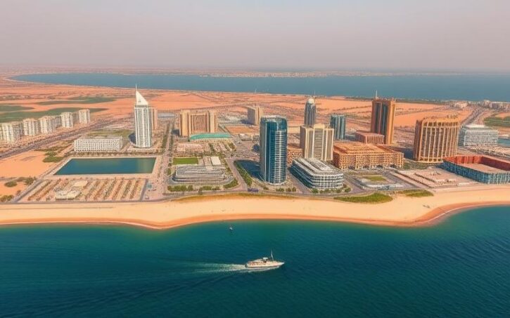
The first is the coastal plain, flat, low-lying, and largely sandy or sabkha, bordering the Persian Gulf to the north and the Gulf of Oman to the east. This is where the main cities and ports are located, from Dubai to Abu Dhabi, as well as Sharjah and Fujairah. The Persian Gulf coast is mostly low, with shallow waters, shifting sandbars, and coral reefs that complicate navigation. The eastern facade, along the Gulf of Oman, is rockier and steeper, with mountains sometimes dropping directly into the sea.
The desert interior of Abu Dhabi, characterized by high dunes, merges into the Rub’ al Khali, the largest continuous sand expanse on Earth. This ‘Empty Quarter,’ shared with Saudi Arabia and other countries, is almost uninhabited except for a few oases like Liwa and oil and gas installations.
The third is the mountainous zone of the east and northeast, dominated by the Hajar range. These mountains, sometimes called the “Arabian Rockies,” form an arc that extends far into Omani territory. They separate the coastal plain of the Persian Gulf from the Gulf of Oman shoreline and the interior plateau. Elevations exceed 1,000 meters in many areas and peak at nearly 2,000 meters.
Major Relief Features: Jebel Jais, Hajar Massifs, and Sabkhas
In the emirate of Ras Al Khaimah, Jebel Jais is considered the country’s highest point, with a summit reaching 1,934 meters on the border with Oman. The precise point on the Emirati side lies slightly lower, around 1,900 meters depending on the source. Other important peaks dot the chain: Jabal ar Rahrah, Jabal Yibir in the emirate of Fujairah, and Jebel Hafeet, which overlooks the oasis city of Al Ain.
The relief of the United Arab Emirates is primarily marked by the northern coastal plain, occupied by sabkhas. These salt flats, which appeared about 4,000 years ago, are regularly flooded and are especially visible around Abu Dhabi and Dubai. These flat, salt-laden surfaces are an iconic feature of the coastal landscape and testify to an ongoing geomorphological dynamic.
The transition between these plains and the sand masses occurs through fields of increasingly imposing dunes as one moves south. The great dunes of Liwa and those of the Manadir region are thought to have originated from wetter episodes during the last glacial period, as confirmed by fossil deposits found in the area.
Oases and Landscapes Shaped by Scarce Water
In a country with no permanent rivers, oases serve as true pillars of the inhabited landscape. They are found mainly in the emirate of Abu Dhabi, particularly in Liwa and the Al Ain–Al Buraimi oasis complex on the Omani border.
The Al Ain oasis, the largest, is home to more than 147,000 date palms, producing around a hundred varieties of dates.
These green islands would not exist without groundwater stored in alluvial or rocky aquifers in the foothills of the Hajar and the great sandy plain. Wadis—seasonal riverbeds that flow only during intense rains—drain water from the mountains to these areas, where it infiltrates and recharges the water tables.
Two Coastlines, a Global Strategic Role
The coastal geography largely contributes to the country’s regional and global role. The main coastline stretches over 650 kilometers along the southern shore of the Persian Gulf, while about 90 kilometers of coast overlooks the Gulf of Oman.
The Persian Gulf Coast: Sabkhas, Islands, and Giant Ports
The Persian Gulf coast is relatively low and sandy. Vast sabkhas extend up to 8 to 10 kilometers inland, particularly near Abu Dhabi and Dubai. These saline areas alternate with beaches, lagoons, coastal mangroves, and strings of low-lying islands.
This coast is dotted with major ports: the historic natural harbor of Dubai, linked to the interior by the extensively dredged Dubai Creek, and large modern terminals such as Jebel Ali, one of the world’s largest container ports. Abu Dhabi and Sharjah have also multiplied port developments to compensate for the lack of large natural shelters.
The coastline is dotted with islands, some natural like Dalma, Sir Bani Yas, or Saadiyat, which hold historical importance or are dedicated to ecotourism and culture. Others, artificial like the Palm Jumeirah, Palm Jebel Ali, and The World archipelagos, reflect the conquest of new maritime spaces, with a significant impact on coastal and marine ecosystems.
The sea, relatively shallow—the seabed is often visible at 6 to 9 meters depth—and the presence of shifting sandbars and coral reefs create significant navigation hazards. Powerful tides and occasional storms further complicate maritime traffic.
The Gulf of Oman Coast: Steep Relief and Oceanic Frontage
The second coastline, shorter, extends along the Gulf of Oman for about 70 to 90 kilometers. It is dominated by the foothills of the Hajar, often coming very close to the sea. The relief is more spectacular, with rocky cliffs, enclosed bays, and occasional coastal plains, such as near Fujairah.
The east coast of the United Arab Emirates, on the Sea of Oman, has small natural ports such as Dibba Al-Hisn, Khor Fakkan, and Kalba. This coastline is a strategic axis for bypassing the Strait of Hormuz. The emirate of Fujairah, the only one entirely on this coast, has developed a major oil hub and a deep-water port, enabling hydrocarbon exports without passing through the strait.
Oceanic conditions differ clearly from those of the Persian Gulf. The sea here is generally slightly cooler in summer, more dynamic in terms of currents, and the influence of the open ocean fosters a sometimes distinct biodiversity, even if most marine species remain of Indo-Pacific origin.
Population Distribution: A Coastal Country
This dual maritime opening partly explains the current distribution of the population. About 85% of inhabitants now live in coastal areas, mainly in the major urban centers of Dubai, Abu Dhabi, and Sharjah. More than two-thirds of residents are concentrated in the emirates of Abu Dhabi and Dubai alone, reflecting an urbanism heavily oriented toward the sea and global trade.
A Desert Climate Under Pressure
The country is classified as having a hot desert climate (BWh in the Köppen-Geiger classification). In practice, this translates to extremely long, torrid, and sunny summers, and short, mild to warm winters. The intermediate seasons of spring and autumn primarily mark a very rapid rise or fall in temperatures.
Extreme Temperatures and Regional Variations
On the coast, average maximum temperatures in July and August regularly exceed 45 °C. In some situations, thermometers can climb above 48 °C, even reaching 49 to 50 °C in the desert interior. Conversely, winters remain mild, with average minimums of 10 to 14 °C in January and February.
The Hajar mountains offer a much cooler climate than the plains. In winter, peaks like Jebel Jais, Jabal Yibir, or Jebel Hafeet can approach 0 °C, with rare snowfall observed on Jebel Jais. In summer, these high-altitude areas provide temperate refuges from the extreme heat of the lowlands.
A difference is also observed between the coast and the interior. The dunes of the Rub’ al Khali, far from the sea, experience drier heat, while coastal cities endure a combination of high temperatures and high humidity, making the heat particularly oppressive.
Rare Rainfall, Sudden Storms
Annual precipitation is low, often below 100 to 120 millimeters on the coast. It is concentrated mainly between November and April, with a typical peak around February-March. Across the country, rain takes the form of short but sometimes violent showers, capable of causing flash floods in the wadis.
In the eastern mountains, annual totals can reach 200 to 350 millimeters. This is where thunderstorms are most frequent, especially in spring and summer. The topography favors cloud development and orographic precipitation, sometimes including hail or torrential downpours.
Data from Abu Dhabi illustrates the erratic nature of precipitation in the region, with, for example, a marked drop in average rainfall between 2011 and 2012. This high interannual variability, where dry years are not uncommon, considerably complicates the management of already very limited water resources.
Winds, Dust, and Occasional Cyclones
Winds also play a major role in the climatic geography. The country experiences several regional wind regimes, including the shamal, a northwesterly wind often responsible for sand and dust storms that severely reduce visibility. Other winds, like the sharqi, blowing from the southeast, bring stifling heat and humidity in late summer along the coast.
The country enjoys more than 3,500 hours of sunshine per year.
Climate Change: Extreme Heat and Sea Level Rise
Climate data indicate an increase in the average annual temperature over the past century, from about 27.8 °C in the early 1900s to over 29 °C recently. Projections based on CMIP6 climate models foresee a continuation of this trend, with more days where maximums exceed 35 °C—a occurrence already very common in summer.
This evolution, combined with the expected rise in sea level, poses considerable risks for a country where most of the population and infrastructure are concentrated in coastal zones. The ND-GAIN index ranks the federation among the most vulnerable countries, but also among the most “ready” to respond, due to its investment capacity and planning.
The main identified risks concern extreme heat waves, coastal inundation, and increased pressure on already overexploited water resources.
Water: The Pivot of Human Geography
In this desert territory, water is the key to almost everything: population distribution, agriculture, city siting, industrial choices. The country is one of the poorest in the world in terms of natural freshwater resources, with renewable supplies estimated at only 150 million cubic meters per year, for a demand far exceeding that.
A Fragile Hydrological Foundation: Aquifers, Wadis, and Falaj
The main natural freshwater resources come from groundwater aquifers. There are shallow aquifers, recharged by rainfall in the piedmont areas—particularly the Bajada region in the east—and much deeper, non-renewable aquifers, like those of the Dammam and Umm er-Radhuma formations. These latter behave like fossilized capital, built up during wetter climatic periods and now being gradually exhausted.
Wadis, dry valleys active during rains, drain water from the mountains to the plains and oases, thereby recharging aquifers. To optimize this recharge, dams have been built on several wadis (such as Al Beeh, Ghalfa, Wareaa, or Basira) to slow the flow of floods.
For centuries, ingenious irrigation systems like the aflaj—gravity-fed underground tunnels and channels—have captured this water for redistribution to fields, notably in the oases of Al Ain or at Masafi on the borders of Fujairah. These techniques, thousands of years old, testify to how hydrological geography has shaped human settlements.
The Rise of “Non-Conventional” Water
Faced with demographic and urban growth, traditional resources proved insufficient. The country is now extremely dependent on desalinated water: about 99% of domestic drinking water comes from seawater desalination. Nearly 70 large desalination plants, mainly using multi-stage flash evaporation (MSF), multiple-effect distillation (MED), and, to a lesser extent, reverse osmosis, provide these vast volumes.
Volume of treated wastewater reused for irrigation and industry in 2013, in millions of cubic meters
The federation is also experimenting with complementary techniques like cloud seeding, primarily over the eastern massifs, to temporarily enhance precipitation. While the actual impact on water balances remains debated, these operations show how far the country is willing to go to counter water constraints.
Water Security Strategies
Aware of the structural vulnerability represented by this dependence, the federation has developed several national strategies, including the Water Security Strategy 2036 and a National Program for Water and Energy Demand Management. The goal is to reduce consumption through efficiency gains of around 40% in key sectors, diversify sources, and secure supply even in the event of an external shock.
Beyond its territory, the country positions itself as an actor in the fight against water scarcity on a global scale, through initiatives such as Suqia – UAE Water Aid or the Mohamed bin Zayed Water Initiative.
Ecosystems, Biodiversity, and Protected Areas
Behind the image of a barren desert, the country harbors a surprising biological richness. Four main ecosystem types share the space: desert, mountain, coastal/marine, and wetlands. Each hosts species adapted to extreme conditions, often rare or threatened.
Deserts, Mountains, and Oases: A Mosaic of Life
The interior lands are dominated by xeric vegetation, consisting of sparse grasses, thorny bushes, and resilient trees like the ghaf and certain acacias. The oases, irrigated, host rows of date palms, as well as citrus, mango, or fig trees, which benefit from the shade of the date palms—a typical case of multi-story agriculture.
In the Hajar mountains, altitude and a slightly more humid microclimate allow for a much more diverse flora. At mid-elevations, one finds shrub thickets and open woodland formations, mixing wild olives, figs, pistachios, or monotheca. Higher up, above 2,000 meters in the highest sectors of the Hajar (mainly in Oman but in ecological continuity with the federation’s territory), juniper stands dominate, relics of a once cooler climate.
The mountains host specific fauna such as the Arabian tahr, ibex, mountain gazelle, fox, hyena, caracal, and, more rarely, the Arabian leopard in the wildest areas. The desert plains are home to the Arabian oryx, various gazelles, small carnivores, rodents adapted to aridity, and numerous reptiles (geckos, lizards, snakes).
Oases and wetlands form essential stopovers for migratory birds. More than 300 bird species pass through the country each year, using mangroves, lagoons, inland wetlands, and artificial water bodies as resting and feeding sites.
Mangroves, Seagrass Beds, and Coral Reefs: The Blue Treasure
Coastal and marine ecosystems are equally rich. Mangroves, called qurms in Arabic, extend in groves along certain stretches of the Persian Gulf coast, particularly around Abu Dhabi. These coastal forests, composed of halophytic trees, play a crucial role: fish nurseries, bird shelters, shoreline protection against erosion, and powerful carbon sinks.
Seagrass beds, meanwhile, cover several thousand square kilometers of shallow seabeds. They feed notably dugongs—one of the largest populations in the world, estimated at around 3,500 individuals in Abu Dhabi waters—and certain species of green turtles.
Coral reefs, although subjected to high thermal and saline stress in the Gulf, host a great diversity of fish and invertebrates and contribute to the fishery productivity of the region. Marine turtles, including the green turtle and hawksbill turtle, come to nest on certain island shores and coastal segments, while dolphins and whales range in offshore waters.
Protected Areas and Conservation Policies
Aware of the fragility of these environments, the federation has established a national network of protected areas covering nearly one-fifth of its terrestrial territory and a growing share of its coastal waters. Adding Ramsar sites, marine reserves, and other categories yields a network of several dozen sites.
The table below gathers some key figures on these protected areas.
| Type of protection | Approximate value |
|---|---|
| Total number of protected areas (land/sea) | 49 |
| Share of terrestrial territory protected | 18% |
| Share of marine surface protected | 12% |
| Ramsar sites (wetlands of international importance) | 10 sites (39,166 hectares) |
| Protected mangroves (blue carbon) | ~183 km² |
| Protected seagrass beds | ~2,956 km² |
These figures are accompanied by targeted programs: mangrove restoration (over 3,600 hectares restored in Abu Dhabi alone), reintroduction of emblematic species like the Arabian oryx, and monitoring of dugong, sea turtle, and waterbird populations.
Concurrently, scientific initiatives like the Abu Dhabi Urban Biodiversity Index allow measuring, at the city level, the effectiveness of preservation policies in a highly urbanized environment.
Cities on the Sand: The Relationship Between Geography and Urbanization
Urbanization in recent decades has literally transformed the face of the country. However, certain geographic constants remain evident: priority given to the coastline, strategic placement along maritime trade routes, and valorization of the rare water points of the interior.
Abu Dhabi: Desert Giant and Coastal Capital
Abu Dhabi is both an emirate and a city. The emirate covers nearly 87% of the country’s total area, encompassing vast sandy expanses to the south and west, large sabkha zones, and a highly indented coastline on the Persian Gulf. The capital city itself extends over a coastal island connected to the mainland by bridges, surrounded by mangroves and sea arms.
Inland, the space is punctuated by a few major hubs: the oases of Al Ain, the Liwa region, and industrial localities in Al Dhafra. But human density there remains low, contrasting with the extreme concentration on the coast.
Dubai: Desert Metropolis Between Sea and Dunes
Dubai spectacularly illustrates the interaction between geography and urban planning. Established on a sandy coastal plain with no rivers or natural oases, the city built its identity around its old natural creek, Dubai Creek, and its proximity to the major shipping routes of the Persian Gulf.
The desert hinterland is characterized by fine sand derived from crushed shells and corals. Its dunes, less imposing than those of the Rub’ al Khali, are suited to safaris and 4×4 circuits. To the east, the sabkha areas give way to north-south oriented dunes, then to the first reliefs of the Hajar near Hatta, a mountainous enclave of the emirate.
The city’s expansion has relied on massive land reclamation and creation of artificial islands, profoundly altering the coastline and marine currents. It also illustrates the urban heat island phenomenon, where central districts remain warmer at night than the periphery in winter, and sometimes slightly cooler than the suburbs on summer days thanks to widespread air conditioning and dense building fabric.
The Other Emirates: Particular Interfaces with the Environment
Sharjah is distinguished by a dual maritime opening: on the Persian Gulf to the west, and on the Gulf of Oman to the east (Khor Fakkan, Kalba). Ras Al Khaimah combines a Persian Gulf coastline with a mountainous hinterland, dominated by Jebel Jais and numerous spectacular wadis. Fujairah, for its part, is entirely turned toward the Gulf of Oman, with a rocky coastline and beaches nestled between the Hajar foothills.
Ajman and Umm Al Quwain are the smallest emirates. They occupy portions of the coastal plain north of Dubai, characterized by the presence of lagoons, mangroves, and sandy islands. Traditionally dedicated to fishing and livestock, these environments are now gradually being integrated into a continuous urban fabric that connects Dubai to Sharjah, Ajman, and beyond.
Land Use and Environmental Constraints
Agricultural land remains very limited, barely 1% of the territory for arable land and permanent crops, often concentrated in oases or modern irrigated perimeters. Permanent pastures account for around 3 to 4% of the area, while forested areas—partly from plantations—cover less than 5%. The remainder, over 90%, consists of bare deserts, sabkhas, rocky surfaces, or urbanized land.
This distribution directly reflects natural conditions: poor soils, high salinity, lack of freshwater, and extreme heat. It also explains the scale of investments made to green certain urban areas or to promote greenhouse agriculture.
A Geographic Space Under Environmental Stress
Rapid economic growth, first based on hydrocarbons then on services, trade, and tourism, has intensified already strong pressures on a fragile environment.
Desertification, Pollution, and Resource Pressure
Desertification, understood as the degradation of drylands, is fueled by overgrazing, urbanization, salinization of agricultural soils, and intensive groundwater extraction. In several oasis areas, the decline in water table levels and saltwater intrusion threaten the long-term viability of traditional farming systems.
Air quality in cities is degraded by dust storms, traffic, industry, and construction. Coasts are threatened by hydrocarbon pollution from oil traffic and by urban or industrial discharges into the water.
Marine and coastal ecosystems, already subjected to extreme temperature and salinity, also suffer from land reclamation, dredging, and artificial island construction, which alter currents, increase turbidity, and fragment habitats.
Institutional Response and Energy Transition
Faced with these challenges, the federation has joined a large number of international conventions on biodiversity, climate, desertification, wetland protection, and marine pollution limitation. Domestically, each emirate has launched its own sustainable development plans: the Environmental Vision for Abu Dhabi, the energy efficiency and renewable energy strategy for Ras Al Khaimah, and master plans for Dubai and Fujairah that integrate climate resilience.
Geography determines development strategies: coastal areas are protected against sea level rise, mountains are used for cloud seeding and recreation, and deserts host large solar parks thanks to their space and sunshine.
Geography at the Heart of Identity and Future Choices
The geography of the United Arab Emirates is not merely a matter of picture-postcard dunes or the silhouettes of glass towers. It is a set of constraints and opportunities shaped by an immutable triangle: desert, sea, and mountains, with water as the guiding thread.
The geostrategic position of the territory, marked by complex borders and a dual maritime frontage near the Strait of Hormuz, makes it a geopolitical pivot. Its relief, composed of deserts, sabkhas, wadis, and the Hajar mountains, has historically determined human settlement and ecosystems. Faced with an extreme desert climate that is intensifying, the country must today reinvent its spatial occupation, secure its water supply, and protect natural environments of global ecological importance.
In this context, geography is not just a backdrop; it remains the matrix of political, economic, and environmental decisions. It is by reading this space finely—its reliefs, its coastlines, its aquifers, its winds—that the country now seeks to reconcile development and resilience, urban modernity and the preservation of a unique natural heritage, anchored in the desert and turned toward the sea.
Disclaimer: The information provided on this website is for informational purposes only and does not constitute financial, legal, or professional advice. We encourage you to consult qualified experts before making any investment, real estate, or expatriation decisions. Although we strive to maintain up-to-date and accurate information, we do not guarantee the completeness, accuracy, or timeliness of the proposed content. As investment and expatriation involve risks, we disclaim any liability for potential losses or damages arising from the use of this site. Your use of this site confirms your acceptance of these terms and your understanding of the associated risks.

Cyril Jarnias is an independent expert in international wealth management with over 20 years of experience. As an expatriate himself, he is dedicated to helping individuals and business leaders build, protect, and pass on their wealth with complete peace of mind.
On his website, cyriljarnias.com, he shares his expertise on international real estate, offshore company formation, and expatriation.
Thanks to his expertise, he offers sound advice to optimize his clients' wealth management. Cyril Jarnias is also recognized for his appearances in many prestigious media outlets such as BFM Business, les Français de l’étranger, Le Figaro, Les Echos, and Mieux vivre votre argent, where he shares his knowledge and know-how in wealth management.





