
 Published on and written by Cyril Jarnias
Sandwiched between the Caspian Sea and the vast deserts of Central Asia, Turkmenistan is one of those countries that is seldom discussed, yet its geography conditions almost everything: the economy, the location of cities, agriculture, trade routes, and even diplomacy. Here, sand covers most of the territory, water is scarce, temperatures regularly flirt with extremes, and yet lush oases, a strategic maritime frontage, and mountain ranges rich in biodiversity create a landscape far more complex than it initially appears.
The predominantly desert territory of Turkmenistan has become a crucial energy crossroads and a strategic transit point between Europe and Asia. It also serves as an important study area for major contemporary environmental issues.
A Desert Country between the Caspian Sea and the Amu Darya
Turkmenistan is located in the western part of Central Asia. Its territory stretches approximately 1,100 kilometers from west to east and nearly 650 kilometers from north to south, covering an area of around 488,000 to 491,000 km²—slightly smaller than Spain but larger than Cameroon. It is therefore neither a giant nor a geographic dwarf, but it still ranks 52nd in the world by size and fourth among the former Soviet republics.
Turkmenistan is often described as a ‘landlocked’ country, but this description requires clarification. Although it has no direct access to the world ocean, it possesses a long coastline of approximately 1,700 to 1,760 km on the Caspian Sea, a closed basin. This coast forms its western border. The country is surrounded by continental neighbors: Kazakhstan to the north and northwest, Uzbekistan to the north and east, Afghanistan to the southeast, and Iran to the south and southwest. This geographic position represents both a constraint for global maritime trade and a strategic opportunity via the Caspian.
Coordinates that Already Tell the Climate Story
The country’s geographic coordinates, approximately between 35°08′ and 42°48′ north latitude and 52°27′ and 66°41′ east longitude, clearly place Turkmenistan in the zone of continental desert and steppe climates. Similar in latitude to southern Spain but far from any moderating oceanic influence, the country experiences marked temperature variations, both seasonally and from day to night, particularly in its desert areas.
A Deceptively Simple Mosaic: Desert, Mountains, Oases
The country’s geography rests on a triad of landscapes: desert, mountains, oases. Nearly 80% of the territory is covered by the Karakum Desert, the southern extension of the great Turan Plain. This desert of sand and loess, one of the largest on the planet at about 350,000 km², dominates the entire center and west of the country.
This is the altitude in meters of Mount Aýrybaba, the highest point in Turkmenistan, located in the Köýtendag massif.
Relief: Depressions, Plateaus, and Active Ranges
In terms of elevation, Turkmenistan is a relatively low-lying country. The average altitude ranges between 100 and 220 meters, reflecting the dominance of the Turan Plain. But this apparent flatness hides a subtle geography of deep depressions, dissected plateaus, and massifs still undergoing tectonic evolution.
The Karakum and the Turan Depression
Nearly four-fifths of the country lies within the Turan Depression. The Karakum – literally “black sand” in Turkic languages, referring to the dark, shale-rich sands – covers about 70 to 80% of the national territory. It extends nearly 800 km west to east and 450 to 500 km north to south. It can be divided into three main zones: the Trans-Unguz (or Zaunguz) Karakum in the north, more elevated; the Central Karakum, lower; and the Southeastern Karakum, bordering the foothills and high plateaus of Karabil and Badkhyz.
The dunes, 2 to 20 meters high, are reshaped by winds from the north, northeast, and west. Nearly 80% of Turkmenistan has no permanent surface water flow, with most of the country lacking perennial rivers, except on its eastern and southern margins.
Salt Depressions and Low Points
While the peaks of the Köýtendag rise above 3,100 meters, the country also plunges below sea level. The Akjagaýa depression, linked to the Sarykamysh Lake basin, reaches about –100 meters. Further northwest, the Garashor (or Karashor) depression forms a vast closed basin of some 1,500 km², chosen to host a pharaonic project: the artificial “Altyn Asyr” lake (or Turkmen Lake), intended to collect agricultural drainage water.
Geological formations like the Unguz system, located between the Central and Northern Karakum, illustrate the complex interaction between erosion, sedimentation, and wind dynamics. These landscapes, shaped over a very long period, were once occupied by inland seas.
Active Ranges and Seismic Risks
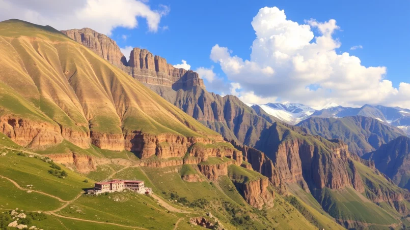
In the south, the east-west oriented Kopet-Dag range reaches about 2,912 m at Mount Şahşah on the Turkmen side. It is a young massif in geological terms, part of the vast Alpine system, still uplifting and therefore seismically very active. The region has experienced several strong earthquakes, notably the one in 1948 that almost completely destroyed Ashgabat.
Further east, the Köýtendag range extends the ramifications of the Pamir-Alay into the country. Mount Aýrybaba is its highest point. To the west, the Greater and Lesser Balkan massifs form more modest reliefs (1,880 m at Mount Arlan) but are strategically important, bordering the Caspian and hosting some hydrocarbon deposits.
In the northwest, the plateaus of Krasnovodsk and Ustyurt overlook the Caspian Sea and the plain. They mark the transition between the Turkmen desert and the Kazakh steppes.
The Caspian Sea: Inland Frontage and Major Stake
Even though Turkmenistan does not face an ocean, its long coast on the Caspian Sea makes it a de facto maritime country. The Caspian is the world’s largest inland body of water, a closed basin of about 371,000 km² whose level is roughly thirty meters below that of the oceans and whose depth exceeds 1,000 meters in its southern part.
A Long, Indented, and Fragile Coast
The Turkmen coast is generally estimated at between 1,700 and 1,770 km, making it the country’s longest border. It is largely rocky, composed of limestone plateaus and cliffs eroded by the sea. Peninsulas like those of Türkmenbaşy and Cheleken form protruding capes. Between these points, long sandy beaches and coastal spits bear witness to the work of waves and wind on the sands of the Karakum.
The salt concentration in the Garabogazköl lagoon can reach 350 grams per liter, making it one of the saltiest bodies of water in the world.
Ports, Industrial Zones, and Protected Areas
Several major hubs are concentrated on this coast. The city of Türkmenbaşy (formerly Krasnovodsk) is home to the country’s main port, modernized and expanded to become a transit platform handling over 25 million tons per year, with ferries to Baku, container terminals, and shipyards. Further south, the national tourist zone of Avaza lines up hotels and seaside infrastructure.
The Turkmen coast hosts major industrial sites for extraction (oil, gas, salts) and chemical production, notably at Hazar and Garabogaz. Within these transformed zones, the Hazar State Reserve protects crucial coastal ecosystems: lagoons, islets, and wetlands. These sanctuaries serve as vital stopovers for millions of migratory birds and as refuges for threatened species like the Caspian seal and certain sturgeon.
The Caspian frontage thus contributes to both the country’s economic power – via hydrocarbons and transit – and its ecological heritage, but it also concentrates significant pollution risks.
Climate: A Cold Desert with Marked Extremes
The country’s geography in Turkmenistan is inseparable from its climate. Officially, the country has a cold desert continental climate, with long, very hot, dry summers, and generally dry winters, cold to very cold in the north.
Temperatures: From –30 °C to over 50 °C
The averages speak for themselves. In January, average temperatures hover around –4 °C in the north and +3 to +4 °C in the south. In summer, July averages approach 26–28 °C in the northern Karakum and 30–34 °C further south. But these smoothed values hide extreme peaks: in the desert, the mercury regularly climbs to 45 °C, and records around 50–51 °C have been recorded, notably at the Repetek Reserve or in the Kerki region.
In winter, in the north without mountain barriers, Siberian air masses can plunge temperatures to -15°C, even below -30°C during exceptional cold waves. Further south and towards the Caspian, winters are milder, but the contrast with summer remains sharp. In desert areas, daily temperature swings can reach 30°C, with cool nights despite intense daytime heat.
Precipitation: Structural Scarcity
Regarding rainfall, the verdict is clear: it is one of the driest countries in the world. Almost everywhere, annual totals remain below 250 mm, and over nearly two-thirds of the territory, less than 150 mm falls per year. In some sectors of the Karakum, averages even drop to around 12 mm. In Ashgabat, the annual average is around 225 mm, mainly from autumn to spring.
The mountainous regions of the Kopet-Dag (or Köýtendag) are a relative exception with annual precipitation of 300 to 400 mm, in the form of rain and snow. These highlands are essential because they feed the rivers that flow down to the foothill oases. In contrast, summer, from June to September, is almost completely dry, with most regions receiving practically no precipitation during this period.
This combination of intense heat, high sunshine (over 230 sunny days per year), and negligible rainfall explains why agriculture is entirely dependent on irrigation and why water management is at the heart of the country’s human geography.
Rivers, Canals, and Lakes: The Fragile Architecture of Water
In a country dominated by desert, every river counts, and every canal profoundly alters the map. The main watercourses are all peripheral: no major river originates or terminates within Turkmenistan, which reinforces its vulnerability vis-à-vis its neighbors and the climate.
The Great Rivers of Central Asia to the Rescue of the Oases
The hydrological giant of the region is the Amu Darya, approximately 2,540 km long, which partly forms the country’s eastern border before flowing towards the Aral basin. Its average flow, close to 1,940 m³/s, supplies a significant portion of Turkmen irrigation systems, notably via the Karakum Canal.
Further south, three more modest rivers play a key role: the Murgab (about 850 km), the Tejen (about 1,120 km), and the Etrek (660 km). All originate in the Hindu Kush ranges or their Afghan and Iranian foothills, then disappear into the sands, intercepted by irrigation canals or evaporated in closed depressions. The Etrek, which should flow into the Caspian, no longer always reaches the sea due to water withdrawals.
Number of watercourses recorded in the country, the majority of which are seasonal streams less than 10 km long.
The Karakum Canal: An Artificial Backbone
It is impossible to discuss the country’s geography in Turkmenistan without mentioning the Karakum Canal (or Garagum). This titanic structure, built in stages starting in the 1950s, diverts part of the Amu Darya’s waters to the arid heart of the country. Over about 1,350 to 1,375 km, it crosses the desert from east to west, from the Lebap region to the vicinity of Bereket and, beyond, supplies via pipelines several Caspian cities like Balkanabat, Hazar, or Türkmenbaşy.
This canal irrigates hundreds of thousands of hectares – estimates speak of about 3,800 square miles of land irrigated directly – and supplies Ashgabat and many oases with drinking and agricultural water. Its current capacity is on the order of several hundred m³/s, with plans for expansion, even though a considerable portion of the transported water is lost to infiltration into the sands or evaporation, feeding saline ponds and marshes that pose serious salinization problems.
Natural and Artificial Lakes in the Midst of the Desert
Besides the Caspian, the main bodies of water are closed lakes, often saline, occupying depressions in the relief.
Lake Sarykamysh, fed by drainage waters, is located in a basin 12 meters below sea level.
More recent, the “Altyn Asyr” lake project in the Karashor depression aims to create a huge artificial reservoir of about 2,000 km² with a capacity of 130 km³, fed by a network of collectors over 2,600 km long draining irrigation water. This project, presented as a solution to rising water tables and secondary salinization, also raises questions about environmental impacts, particularly regarding water quality, massive evaporation, and salt concentration.
Water Balance: A Country in Deficit
The numbers summarize the system’s fragility: renewable water resources are estimated at about 24.77 km³ per year, while total withdrawals exceed 27 km³, with about 94% for agriculture. Water withdrawal per capita is among the highest in the world, around 5,700 m³ per year, reflecting the combination of arid climate, agricultural choices (extensive irrigated cotton and wheat), and limited efficiency of irrigation networks.
This dependence on the Amu Darya and transboundary rivers, combined with climate change and the accelerated melting of glaciers upstream, places water at the heart of the country’s geographic and political concerns.
Soils, Vegetation, and Land Use
Seen from afar, Turkmenistan’s map appears entirely ochre. Yet, soils and vegetation present great diversity, with direct consequences for land use.
A Wide Range of Desert and Saline Soils
In terms of soil classification, Turkmen territory includes:
| Soil Type | Estimated Area (ha) |
|---|---|
| Gray-brown soils (desertic) | 6.1 million |
| Takyr-type soils (bare, cracked clay) | 2.6 million |
| Sandy desert soils | 10.0 million |
| Dark sierozems (steppe brown soils) | 430,000 |
| Cinnamon mountain soils | 300,000 |
| Steppe pasture soils (sierozems) | 120,000 |
| Saline soils (solonchaks) | 2.3 million |
| Shifting or weakly fixed sands | 3.7 million |
To this are added smaller areas of meadow soils, marshy soils, and cliffs or escarpments. It is immediately clear that truly fertile, non-saline soils represent a minority fraction of the surface area.
Arable land covers only about 4% of the territory, while permanent pastures occupy nearly 68%. Forests represent less than 9% of the national area, and even these are mostly open formations or protective plantations.
Desert Forests, Mountain Forests, and Riverine Gallery Forests
Contrary to the image of a totally bare desert, Turkmenistan possesses several types of forest formations.
Actual forested area out of the 5 million hectares of potential forest zone in the mountains of Turkmenistan.
On the plains, “desert forests” extend over more than 14 million hectares: these are mainly stands of white and black saxaul, shrubs like kandym or cherkez, adapted to poor sandy soils and deep water tables. These formations play a crucial role in stabilizing dunes, providing firewood, and serving as pasture.
The total extent of gallery forests (tugai) along rivers like the Amu Darya, which harbor remarkable fauna and stabilize riverbanks.
Finally, the country develops windbreaks and protective plantations (shelterbelts) along canals and around irrigated lands, in an effort to combat erosion and desertification.
Distribution of Land Uses
Looking at the overall structure of land cover provides a fairly clear picture of the country’s priorities and constraints:
| Type of Land Use (approx. 2018) | Share of National Territory |
|---|---|
| Agricultural land & livestock | 72% |
| – of which arable land | 4.1% |
| – of which permanent crops | 0.1% |
| – of which permanent pastures | 67.8% |
| Forests | 8.8% |
| Other uses (built-up, wasteland, etc.) | 19.2% |
The numbers underscore the overwhelming weight of extensive livestock grazing on natural pasture, traditionally centered on Karakul sheep, goats, and camels, and the extremely concentrated nature of irrigated agriculture, confined to thin ribbons along rivers, canals, and oases.
Oases, Agriculture, and Human Geography
The distribution of the population in Turkmenistan is almost entirely dictated by the presence of water. The major cities and highest densities are found in the oases, at the foot of mountains, or along major rivers.
The Main Chains of Oases
One can generally distinguish five major oasis complexes:
Turkmenistan is structured around several major oases, each playing a distinct economic, historical, and demographic role.
The political-administrative and industrial heart of the country, dominated by the capital Ashgabat and a string of settlements in the foothills.
Centered on Mary, combines irrigated agriculture (cotton, cereals, fruits) and historical heritage with ancient Merv, a Silk Road crossroads.
More modest, structured around the city of Tejen and benefiting from waters captured upstream.
Around Türkmenabat, the country’s second-largest urban area, relies on diversions from the Amu Darya.
In the ancient delta, extends irrigation systems southwards and notably touches the Daşoguz region.
It is in these oases and along the Karakum Canal that most of the five to seven million inhabitants are concentrated, with recent estimates placing the population around 7 million, with a low average density (about 16 inhabitants/km²) masking stark contrasts between nearly empty desert and densely populated oases.
Irrigated Crops and Agricultural Specialization
Turkmen agriculture remains largely shaped by the Soviet legacy: large areas are devoted to cotton, a very water-intensive crop, and wheat, whose area increased sharply after independence to ensure better food self-sufficiency.
In 2019, the total cultivated area reached about 1.49 million hectares.
| Type of Crop (2019) | Area (thousands of ha) |
|---|---|
| Wheat (primarily) | 761.3 |
| Cotton | 551.1 |
| Fruits and berries | 23.8 |
Cotton is cultivated on more than half of the arable land, mainly in the Murgab, Amu Darya, and Tejen oases. Diversification crops – vegetables, potatoes, melons, fruits (apricots, apples, pears, pomegranates, figs, pistachios, walnuts) – occupy specific niches, often linked to favorable microclimates (subtropical valleys of the Etrek and Sumbar, Kopet-Dag foothills, lower Amu Darya valleys).
Livestock farming, for its part, utilizes the vast pastures of the Karakum and steppe zones, at the cost of increasing pressure on desert ecosystems.
Natural Resources, Energy, and Economic Geography
Beneath the sand, another geography emerges, composed of pockets of gas, oil, salts, sulfur, and metals, which deeply structure the economy and the industrial map of Turkmenistan.
A Gas Giant in the Heart of the Desert
The country is credited with the fourth or fifth largest natural gas reserves in the world, with colossal fields like Galkynysh, sometimes presented as the world’s second-largest gas field. Numerous other fields – Achak, Shatlyk, Nayip, Derweze, and many others – dot the territory, particularly in the western lowlands and offshore in the Caspian.
Oil is mainly extracted in the Transcaspian plain (regions of Türkmenbaşy, Cheleken, Hazar) and offshore. Infrastructure (pipelines, stations, refineries like the one in Türkmenbaşy) follows land transport axes and the coast, structuring the national economy around export corridors to China, Iran, and via the Caspian to Azerbaijan.
Salt, Iodine, Potash, and Other Mineral Mines
Beyond hydrocarbons, Turkmenistan has vast salt deposits, notably in the Garabogazköl Bay and the Karakum depressions. It is also one of the world’s major producers of iodine and bromine, extracted from brines and oilfield wastewater, particularly in the Balkan region.
The potash deposits in the east of the country are estimated to total nearly 2.8 billion tons of resources.
The distribution of these resources reinforces the strategic importance of certain regions: Lebap and Köýtendag for potash and cement, Balkan for hydrocarbons, Garabogaz for salts, etc.
Environmental Issues: Geography Under Pressure
The country’s geography in Turkmenistan is not fixed: it is profoundly disrupted by human activities, notably through massive irrigation, resource exploitation, and climate change. The main threats cluster around three phenomena: desertification, salinization, and water crisis.
Accelerated Desertification and Erosion
Turkmenistan is at the heart of a zone where it is estimated that 8,000 to 10,000 km² of new desert appear each year across Central Asia, a rate exceeded only by some regions in Africa. The causes are multiple: overgrazing that removes vegetation cover, inappropriate use of irrigation water, mechanical destruction of vegetation, climate change, strong winds generating dust and sand storms.
A national study mentioned in the early 2000s a degradation of vegetation on about 77% of Turkmen territory. Between 2015 and 2020, more than 565,000 ha of irrigated land and an additional 3.38 million hectares of pasture are estimated to have been degraded.
Salinization and Saline Marshes
Gravity-fed irrigation in poorly drained soils under a high-evaporation climate mechanically leads to the rise of dissolved salts. It is estimated that in Turkmenistan more than 60% of agricultural land suffers from salinization, and that regional agricultural productivity may have fallen by 20 to 25% due to these combined phenomena.
In some sectors, extreme salinization has created ‘takyr’ or salt marshes, surfaces of bare, cracked clay unfit for any cultivation. By the late 1980s, these surfaces already covered about one million hectares. This situation is aggravated by the inefficiency of the drainage network, water leaks from canals like the Karakum Canal, and the massive use of fertilizers and pesticides.
Aral Crisis and Local Impacts
Even though the main drama of the Aral Sea plays out further north, Turkmenistan directly suffers its consequences, notably in the Daşoguz region. The drastic reduction in the Aral’s level (a surface area reduction of about 59,000 km² by the mid-1990s) has exposed former seabeds covered with salts and toxic substances. Winds disperse these particles over long distances, affecting soils, crops, and human health.
In some regions, the bacteriological quality of drinking water exceeds sanitary standards by up to ten times. This pollution is associated with high rates of disease and infant mortality. The situation illustrates the direct link between the management of water resources, like the diversion of the Amu Darya for irrigation, and its consequences for population health.
Methane, Climate, and Vulnerability
The country, heavily dependent on hydrocarbons, also finds itself at the forefront of climate issues. Its greenhouse gas emissions per capita, estimated at around 17.5 tons of CO₂ equivalent, exceed the average of many industrialized nations, largely due to methane leaks from gas installations. For 2019/2020, the market value of lost methane was estimated at $6 billion, and in 2022, over 4 million tons of methane may have been released, one of the highest figures in the world.
At the same time, the climate is warming faster than the global average: the average temperature is estimated to have increased by about 1.4 °C in 55 years, compared to 0.8 °C globally. The country already experiences a multiplication of heat waves, droughts, and extreme events (flash floods, mudflows in the mountains). Projections indicate a further contraction of water resources, notably through a decrease in Amu Darya flows linked to accelerated glacial melt upstream.
Protected Areas and Biological Wealth
Beyond the apparent desert, the country’s geography in Turkmenistan conceals an astonishingly rich biodiversity. More than 2,500 species of flowering plants have been recorded, with significant endemism in the Kopet-Dag and Köýtendag massifs.
Nature Reserves and Restricted Zones
The network of protected areas includes seven nature reserves and about a dozen restricted territories where the protection of flora and fauna is prioritized. In total, these spaces cover around 1.08 million hectares, or about 2.2% of the country’s area.
Among the emblematic sites:
Turkmenistan is home to several nature reserves crucial for the conservation of biodiversity, desert landscapes, and migratory corridors.
Located in the western Kopet-Dag, it protects a remarkable collection of wild relatives of cultivated plants (grapes, apple trees, pear trees, pistachio trees…) and marks the eastern limit of the distribution range of the wild grape (*Vitis sylvestris*).
A natural desert laboratory in the eastern Karakum, famous for heat records recorded in the former USSR era.
In the northwest of the country, this reserve protects varied landscapes of plateaus, steppes, and deserts.
The protected areas (Hazar Reserve and sanctuaries) form an essential link in bird migration routes between Eurasia and Africa.
A Precious Genetic Heritage
The steep valleys of the western Kopet-Dag harbor an astonishing collection of wild fruit trees: myrobalan plums, pear trees, apple trees, cherry trees, pomegranates, fig trees, jujubes, hawthorns, almond trees, pistachio trees, Persian walnuts, grapevines, etc. This ensemble of genetic diversity is of particular interest to agronomists and biologists, as it offers a potential reservoir of genes for resistance to drought, diseases, or extreme temperatures, valuable in a context of climate change.
The “Red Book” of Turkmenistan lists various endangered plant species, including fruit-bearing, fodder, ornamental, and medicinal plants. Their preservation urgently requires the protection of their natural habitats.
Transport, Corridors, and the Geography of Trade
Finally, the country’s geography in Turkmenistan can only be fully understood by placing it in the great game of continental routes. Situated between the Caspian and the Amu Darya, at the crossroads of ancient caravan routes, the country now asserts itself as a key piece in the new Eurasian transport corridors.
A Transport Architecture Structured Around the East-West Axis
The main framework remains the east-west corridor linking the port of Türkmenbaşy to the Uzbek border at Farap, passing through Ashgabat, Mary, and Türkmenabat. This corridor combines the M37 highway, the main railway line (legacy of the Transcaspian), and the Karakum Canal. It is the link between the Caspian, the interior deserts, and the Amu Darya valley.
A second, north-south axis links Ashgabat to Daşoguz by rail (the Trans-Karakum line) and road, then extends towards Kazakhstan to the north and towards Iran to the south via various border points (Serakhs, Gaudan). New highway sections are under construction, like the major toll road Ashgabat–Türkmenabat, intended to smooth trade flows across the Karakum.
The Caspian as a Multimodal Pivot
The port of Türkmenbaşy, modernized at a cost approaching $1.5 billion, plays the role of maritime gateway for goods flows between Central Asia and the Caucasus, and even beyond to Europe via Georgia and Turkey. Ferries, container ships, and train ferries connect road, rail, and maritime transport there. Specialized terminals (hydrocarbons, fertilizers, containers) also dot other points along the coast (Hazar, Kiyanly, Garabogaz).
Thanks to its infrastructure, Turkmenistan integrates into several international corridors: a north-south axis linking Russia to Iran, the “Lapis Lazuli” route to Turkey via Afghanistan and the Caucasus, and transit agreements with countries like India, Iran, Oman, Kazakhstan, and Uzbekistan.
Networks Shaped by Natural Geography
The transport map follows that of physical constraints: following the oases and foothills avoids the most unstable dunes, skirting the Karakum allows water supply to infrastructure and cities, and following the Caspian coast offers port support. Roads and rails instinctively avoid the most inhospitable zones of the central Karakum, crossing the desert only where the relief is favorable and water supplies are assured.
Thus, even in the realm of international trade, it is indeed the physical geography – position between a closed sea and a great river, dominance of the desert, presence of border massifs – that dictates the possible routes and strategic choices.
A Geography that Conditions the Future
At the end of this journey, one constant stands out: the geography of the country in Turkmenistan is both an asset and a permanent source of challenges. The Karakum Desert offers vast pastures and conceals energy treasures beneath its sand, but it also isolates populations, complicates transport, and exacerbates vulnerability to drought. The Caspian Sea opens maritime and energy prospects, while locking the country into a basin with no direct access to the oceans. The mountains provide vital water to the oases, but expose the country to earthquakes and mudflows.
Crucial challenges for the coming decades include preserving arable land from salinization, saving water in irrigation, reconciling hydrocarbon exploitation with reducing methane leaks, protecting ecosystems (forests, tugai, steppes), and adapting infrastructure to growing climate extremes.
For a state that has built part of its foreign policy on neutrality and on the role of a bridge between continents, mastering its territory – from its deserts to its Caspian coasts – will remain a cardinal challenge. In many ways, Turkmenistan’s future will be determined by its ability to tame, or at least to work with, the geography that has shaped it.
Disclaimer: The information provided on this website is for informational purposes only and does not constitute financial, legal, or professional advice. We encourage you to consult qualified experts before making any investment, real estate, or expatriation decisions. Although we strive to maintain up-to-date and accurate information, we do not guarantee the completeness, accuracy, or timeliness of the proposed content. As investment and expatriation involve risks, we disclaim any liability for potential losses or damages arising from the use of this site. Your use of this site confirms your acceptance of these terms and your understanding of the associated risks.

Cyril Jarnias is an independent expert in international wealth management with over 20 years of experience. As an expatriate himself, he is dedicated to helping individuals and business leaders build, protect, and pass on their wealth with complete peace of mind.
On his website, cyriljarnias.com, he shares his expertise on international real estate, offshore company formation, and expatriation.
Thanks to his expertise, he offers sound advice to optimize his clients' wealth management. Cyril Jarnias is also recognized for his appearances in many prestigious media outlets such as BFM Business, les Français de l’étranger, Le Figaro, Les Echos, and Mieux vivre votre argent, where he shares his knowledge and know-how in wealth management.





