
 Published on and written by Cyril Jarnias
Sandwiched between the Caspian Sea, the Karakum Desert, and the mountainous foothills of Iran, Turkmenistan remains one of the world’s most mysterious countries. Its political isolation, strict visa regime, and still-nascent tourist development make it a rare destination. Yet, those who cross these barriers discover a fascinating country, where Silk Road ruins, multi-colored canyons, underground lakes, and white marble cities compose an almost unreal setting.
Beyond its futuristic capital, Turkmenistan offers three key experiences: the ancient caravan cities (Merv, Nisa, Köneürgench), extreme desert landscapes (Darvaza crater, Karakum Desert), and spectacular natural sites (Yangykala Canyon, Kow-Ata underground lake, Kopet Dag and Köýtendag mountains). The country also includes modern projects like the Awaza resort and impressive religious monuments such as the Turkmenbashi Ruhy Mosque.
This overview provides a tour of must-see tourist sites in Turkmenistan, based on available data and the practical realities of a country that is still difficult to access.
Ashgabat, Capital of White Marble and Symbols
Ashgabat, squeezed between the Karakum Desert and the Kopet Dag range, sets the tone. With over a million inhabitants and state-driven urbanization, the capital has been profoundly reshaped since independence. Pharaonic projects, financed by gas revenues, have covered the center in white marble, domes inspired by Persian architecture, and Greco-Roman style colonnades.
A Record-Holding City, Between Surrealism and Power Staging
The city holds a Guinness World Record for the highest concentration of buildings clad in white marble: over 500 new buildings, covering more than 4.5 million m² of facades. Other sources cite nearly 4.5 million m², or about 48.6 million square feet, a figure that gives a sense of the scale of this monumental undertaking.
To better grasp the scale of the phenomenon, we can summarize some milestones of this urban transformation:
| Element | Detail |
|---|---|
| Population (2022 census) | 1,030,063 inhabitants |
| Marble record | > 543 white marble buildings |
| Marble surface area | ~4.5 million m² of facades |
| Announced public spending | 8 billion USD in international investments + 4,000 billion manat |
| Urban extension (2013) | +37,654 hectares annexed |
| Extreme climates | Max 47.2°C, min -24.1°C |
Major construction projects were largely entrusted to foreign companies, notably Bouygues (France) and Turkish groups like Polimeks or Gap İnşaat. The result is a showcase city, saturated with symbols: eight-pointed stars of Oguz Han, statues of the first president, faceted wedding palace, ministry buildings shaped like objects (globe, caduceus, molar, coin), international airport shaped like a falcon, and a hippodrome dominated by a giant Akhal-Teke horse head.
Among the most iconic constructions are:
| Major Site in Ashgabat | Tourist Feature |
|---|---|
| Arch of Neutrality | Iconic monument of the country’s permanent neutrality, relocated to the south of the city |
| Turkmenistan Tower (TV tower) | 211 m, the country’s tallest structure, with a giant Oguz Han star at its summit |
| Wedding Palace (Bagt Köşgi) | Futuristic-design wedding palace with panoramic city views |
| International Airport | Falcon-shaped terminal, capacity of 14 million passengers/year |
| Olympic Complex | 157 ha, 45,000-seat indoor stadium, 600-ton horse head on the roof |
| Alem Center | Cultural center with the world’s largest indoor Ferris wheel |
| Magtymguly & Alabay Monuments | Giant statues dedicated to the national poet and the Alabay dog |
This accumulation of marble, gilding, and monumental sculptures gives the city an almost unreal character, described by many travelers as “surreal” or “straight out of a movie set.” For a visitor, simply exploring the grand boulevards, the meticulously manicured parks like Ylham Park or National Independence Park, and riding the cable car up to the Kopet Dag hills allows one to gauge the scale of this urban staging.
Museums, Culture, and Silk Road Heritage
Behind the marble facades, Ashgabat also harbors premier museum institutions. The city developed on the ruins of Konjikala, an ancient Silk Road city, explaining the archaeological richness of its museums.
Discover a selection of must-see sites to experience the essence and diversity of the region.
The historic and lively heart of the city, lined with cafes and monuments, witness to maritime trade for centuries.
A spectacular landscaped park centered around a waterfall, offering tranquility, botanical trails, and panoramic views.
An imposing fortress perched on the heights, housing a history museum and offering a unique viewpoint over the entire region.
A colorful covered market where local creators exhibit and sell their works: pottery, textiles, gastronomy…
– The National Museum of History of Turkmenistan displays collections from major sites like Nisa, Merv, or Köneürgench.
– The National Museum of Fine Arts blends Turkmen and international artworks.
– The Turkmen Carpet Museum highlights the traditional carpet motif “göül,” a national identity emblem.
– The Halk Hakydasy Memorial Complex commemorates the victims of World War II and the deadly 1948 earthquake.
Ashgabat is also the logical starting point for many excursions to must-see sites, whether historical (Nisa, Merv) or natural (Kow-Ata, Kopet Dag).
Ancient Merv, Mythical Silk Road Oasis
East of Ashgabat, the Merv oasis, near the modern town of Baýramaly in Mary province, is home to one of Central Asia’s most important archaeological sites: the State Historical and Cultural Park “Ancient Merv.” A UNESCO World Heritage site, it is presented as the oldest and best-preserved oasis-city of the Silk Road.
A City with 4,000 Years of History
Human remains at the site span nearly 4,000 years. The region belongs to the Bronze Age Bactria–Margiana Archaeological Complex and is mentioned in the Zoroastrian texts of the Zend-Avesta as “Mouru,” one of the sixteen perfect lands created by Ahura Mazda. During the Achaemenid period, the region was known as Margu, center of the Margiana satrapy.
Merv was rebuilt, renamed, and expanded by successive empires. Under the Seleucid king Antiochus I, it became Antiochia Margiana. It later came under Parthian, Sassanian, Arab, Ghaznavid, Seljuk, Khwarezmian, and Timurid rule. It served successively as the capital of Margiana, the capital of the Abbasid Caliphate for a time in the 9th century, and then the center of the vast Great Seljuk Empire in the 11th–12th centuries.
In 1150, Merv was the world’s largest city, with around 200,000 inhabitants.
This prosperity was brutally interrupted in 1221, when the Mongol armies of Tolui, son of Genghis Khan, destroyed the city. Medieval chroniclers cite staggering death tolls, from 700,000 to over 1.3 million people massacred.
A Nested Ensemble of Cities
The “Ancient Merv” park covers 353 hectares, with a buffer zone of 883 hectares. Its uniqueness lies in its structure: instead of a single city rebuilt upon itself, Merv consists of several adjacent fortified cities, built successively and sometimes relocated over the centuries.
The main complexes are:
| Urban Complex | Dominant Period | Characteristics |
|---|---|---|
| Erk Kala | From the 7th century BC | Achaemenid citadel, later Hellenistic and Islamic acropolis |
| Gyaur Kala | Hellenistic and Sassanian periods | Square city, 2 km per side, religious plurality (Buddhism, Zoroastrianism, Christianity) |
| Sultan Kala (Marv al-Shahijan) | Islamic Middle Ages, mainly Seljuk | Large fortified medieval city, 12 km of ramparts |
| Abdullah Khan Kala | 15th century | Post-medieval Timurid city |
Erk Kala, the first urban core, is a polygonal fortress of about 20 hectares with rammed earth walls still nearly 30 meters high. It served as the acropolis for the Hellenistic city and later as a citadel in the Islamic era.
The quadrangular Gyaur Kala site contains major remains such as the Beni Makhan Mosque (one of the city’s earliest) with its cistern, as well as a stupa and Buddhist monastery attesting to Buddhism’s extreme westward expansion. A mysterious “oval building” on a platform, with rooms around a courtyard, still puzzles archaeologists.
Sultan Kala, the great medieval city, is encircled by 12 km of impressive ramparts. At its heart stands the Shahriyar Ark, an 11th–13th century citadel containing a palace, administrative buildings, and dwellings. The walls feature towers, posterns, staircases, and galleries.
Mausoleums and “Corrugated” Fortresses
In this landscape of ochre ruins, certain monuments stand out. The Mausoleum of Sultan Sanjar, built in the 12th century, is arguably the most spectacular. It is the largest known Seljuk mausoleum and the first dated mosque-mausoleum complex. The building, a cube about 27 meters per side, is topped by a huge dome originally covered in turquoise ceramic, said to have been visible from a day’s walk away.
Another architectural singularity of the oasis: the “köshks,” large fortified buildings with fluted walls, unique in Central Asia. The most famous, the Greater Kyz Kala, located west of Sultan Kala, is a vast Abbasid structure of 17 rooms organized around a central courtyard. The neighboring Lesser Kyz Kala is distinguished by the extraordinary thickness and corrugated appearance of its walls, often compared by travelers to a “corrugated cardboard” fortress.
Nearby is the 12th-century Mausoleum of Muhammad ibn Zayd, characterized by a domed burial space adorned with Kufic inscriptions. Later, the Askhab complex, with its two large Timurid-style iwans, is richly decorated with turquoise and blue faience and pays homage to two Companions of the Prophet. Other monuments, like the mausoleums of Kiz Bibi, Talkhattan Baba, Imam Bakr, Imam Shafi, as well as a Timurid pavilion, complete this architectural ensemble.
Visiting Ancient Merv Today
Despite its relative isolation, the site tops lists of things to see in the Merv region on travel platforms, with an average rating of 4.5/5 (based on just over a hundred reviews). Its size, however, requires adapted logistics: it is almost essential to have a vehicle with a driver or to book a guided tour to cover the different complexes, which are distant from each other.
Some practical benchmarks from traveler accounts:
| Aspect | Recurring Information |
|---|---|
| Minimum visit duration | 1.5 to 3 hours, a full day recommended for thorough exploration |
| Approximate entrance fee | ~21 manat for the ticket |
| Camera fee | ~10.5–11 manat extra |
| Best seasons | Spring and autumn, in the morning or late afternoon |
| On-site conditions | Uneven terrain, very little shade, extreme heat in summer |
| Advice | Comfortable shoes, water supply, beware of snakes |
The Turkmen state created the State Historical and Cultural Park “Ancient Merv” in 1987, managed by the national department in charge of monument protection. International projects, like the “Ancient Merv Project” led with the Institute of Archaeology of University College London, have worked since the 1990s to document and preserve this heritage threatened by erosion, salinization, rising groundwater, and, more recently, urban and tourist development.
For archaeology enthusiasts, a visit to Merv can be combined with older Bronze Age sites of the Murghab Delta, like Gonur Tepe, a huge palatial and religious center interpreted as a possible “fire temple.”
Nisa and Köpetdag: Parthian Antiquity and Mountains at the Capital’s Doorstep
A few kilometers from Ashgabat, the UNESCO-listed site of Nisa offers an almost ideal complement to Merv. This ancient Parthian capital reveals fortresses, reception halls, and warehouses, helping to grasp the importance of these dynasts in the region. Excavations have uncovered rich material, partly displayed in Ashgabat’s museums.
The Kopet Dag Mountains, a Playground for Hikers
As a backdrop to the capital stretches the Kopet Dag range, a natural border with Iran. Largely unknown outside the region, this mountainous area offers great landscape diversity: deep gorges, green valleys, rocky ridges overlooking the desert expanses of the Karakum.
The Turkmen side of the Kopet Dag is dotted with sub-ranges and ridges, whose names – Kurendag, Karadag, Akdag, Ilanly, or Kaptalchesme – evoke a complex geography. The highest peaks, like Mount Chapan (2,889.2 m) or Shah-Shah (2,863.7 m), are accessible to experienced hikers. Rich flora (over 2,500 species) and varied fauna (Persian leopard, ibex, mouflon, raptors) also make it a biodiversity hotspot.
For travelers, several gorges and valleys near Ashgabat, like Firyuzinsky or Archabil, have become hiking classics, with routes of varying difficulty. The absence of permanent snow and glaciers makes hiking possible much of the year, though the ideal period is between May and September, preferably early morning to avoid the heat.
Kow-Ata, the Sulfurous Underground Lake
About sixty kilometers west of Ashgabat, at the foot of the Kopet Dag, lies a natural site that consistently appears on “must-see” lists: the Kow-Ata underground lake, also called Kov-Ata, Koy-Ata, or Bakharden Cave.
A “Father of Lakes” Hidden Beneath the Mountain
The Turkmen name “Kow-Ata” translates as “father of lakes” or “father of caves”. It designates a vast natural cavity housing a warm-water lake. The cave, known for over two millennia according to archaeological data, has spawned many local legends: one tells that mortally wounded slaves under Parthian rule regained their health by bathing there.
Access is via a long metal staircase plunging into darkness. Texts mention “several hundred steps,” between 200 and 350 according to sources, with a particularly steep first section. At a depth of about 50 to 60 meters below the entrance, the temperature becomes stable, warm, and humid, and one emerges onto the lake shore.
Measurements vary slightly between studies, but give the following approximate scale:
| Characteristic | Approximate Value |
|---|---|
| Vertical depth from entrance | 52–65 m |
| Cave length (main chamber) | ~230–250 m |
| Ceiling height | 15–26 m depending on area |
| Lake length | ~72 m |
| Lake width | ~30 m |
| Water surface area | ~1,000 m² |
| Water depth | 8–14 m |
| Water temperature | 33–38°C year-round |
The water, blue-green and slightly cloudy, is saturated with hydrogen sulfide, giving it a strong rotten egg smell. The air at the bottom of the cave is hot, humid, and heavy, especially in summer.
A Natural Thermal Bath with Complex Chemistry
Analyses indicate highly mineralized water containing at least several dozen chemical elements. Those explicitly mentioned include iodine, magnesium, iron, bromine, potassium, sodium, sulfate, chlorine, but also aluminum or antimony. This composition has fueled the site’s therapeutic reputation, considered the country’s most famous natural “thermal spa.”
Local tradition attributes therapeutic virtues to the lake for joints, skin, respiratory tract, circulation, and the nervous system. However, it is recommended to limit bathing to 15-20 minutes due to gas concentration and the cave’s specific conditions.
The site is also home to the largest known bat colony in Central Asia, earning it protected natural monument status.
Access and Visiting Conditions
Kow-Ata is located in the Bakharden district, accessible via the M37 highway between Ashgabat and Türkmenbaşy, via an asphalted 7 km spur road to the site. Several Turkmen agencies, such as “Amul Gala” or “Nomads Life”, offer excursions from the capital including transport and visit.
The cave is equipped with a ticket office (entrance ~50 manat), basic changing rooms, toilets, and information panels in Russian and English. Small shops and cafes are located nearby. Opening hours are generally from 9 a.m. to 6 p.m. during the day.
Some recommendations are essential:
– wear non-slip shoes, as the steps are wet and slippery;
– bring a flashlight or headlamp for comfort, even though the staircase is dimly lit;
– bring your own towel and a waterproof bag for belongings;
– limit bathing time and avoid intense physical exertion at the bottom of the cave.
Online reviews mention an overall rating of about 4.6/5 based on around sixty reviews, highlighting the “unreal” character of the place, but also the dense air and sometimes hard-to-bear smell.
Darvaza, the “Door to Hell” in the Heart of the Karakum
If there were only one image to represent Turkmenistan in the collective imagination, it would probably be that of the flaming Darvaza crater in the Karakum Desert. This gigantic burning hole, officially named “Shining of the Karakum” (Garagum ýalkymy in Turkmen), has become, despite government reluctance, the country’s most famous attraction.
A Geological Experience Turned Sci-Fi Spectacle
The crater is located about 260 kilometers north of Ashgabat, near the village of Darvaza, along the M37 highway linking the capital to Daşoguz. Its coordinates are around 40°15′ N, 58°26′ E. There is no marked official road for the last kilometers: access is via sandy tracks, requiring a 4×4 and good knowledge of the terrain.
The engineers then decided to ignite the gas to avoid toxic dispersion, thinking the fire would burn out in a few weeks. It has been burning for over half a century.
Soviet geologists
Other, less widespread accounts suggest a collapse in the 1960s and ignition in the 1980s. Regardless, today the crater measures about 60 to 70 meters in diameter and 30 meters deep. Orange walls, pockets of fire bursting from the wall, dancing flames at the bottom – the scene, especially at night, evokes a post-apocalyptic movie set.
Between Pride, Concern, and a Desire to Extinguish
Aware of the site’s symbolic and ecological impact, the Turkmen government has shifted its stance. In 2010, the president mentioned the need to limit the crater’s influence on other gas fields. In 2013, the area was nonetheless designated a “nature reserve.” In January 2022, a new announcement struck minds: authorities declared their intention to extinguish the crater, appointing a commission to find a technical solution.
Wells are being drilled to capture methane and reduce flames by a factor of three by 2025. However, by late 2025, new fires appeared outside the site, indicating the subsurface remains crisscrossed with active gas pockets.
Darvaza has nonetheless established itself as the “number one site” for foreign travelers, who see it as a unique opportunity to camp beside a fire volcano… in the middle of the steppe.
Organizing a Visit: Logistics, Safety, and Ground Realities
The crater is in one of the country’s most arid regions, on a desert plateau with significant temperature swings. Advice from guides and agencies converges:
– the best period is spring (April-May) and autumn (September-October), when days are bearable and nights not yet freezing;
– in summer, temperatures can exceed 45–50°C in the Karakum; in winter, nights drop well below zero, sometimes to -20°C;
– the nighttime visit is by far the most impressive, with the glow visible from far away across the desert.
On-site facilities are very basic: accommodation in yurts, rudimentary toilets, and no shops nearby. It is imperative to bring in advance all necessary water, food, fuel, and camping gear, as the first shops are in Erbent, about 90 km away.
Safety is not trivial: there is no stable barrier around the crater nor an official monitoring system. The ground, unstable, can be cracked and crumbly near the edge. Minimum recommendations are:
– maintain a reasonable distance from the rim;
– avoid running or walking too fast near the hole, especially at night;
– do not expose yourself to the gases for long, particularly if the wind blows smoke toward visitors.
The site’s isolation, the lack of reliable network coverage, and the vagaries of movement rules mean most travelers go through a local agency. It handles permits, transport, camping, and the presence of a guide.
The crater has also sparked scientific and media expeditions. In 2013, explorer George Kourounis became the first man to descend to the bottom of the pit, as part of a program supported by National Geographic. Equipped with a Kevlar harness, Technora ropes, and an aluminized suit with breathing apparatus, he collected samples for the “Extreme Microbiome Project,” searching for extremophile microorganisms capable of surviving in these conditions.
Seas and Beaches: Awaza, the Caspian’s Resort Showcase
In the west of the country, on the eastern shore of the Caspian Sea, Turkmenistan launched a project in the mid-2000s at the crossroads of a seaside resort and a giant amusement park: the Awaza National Tourist Zone, administratively attached to the city of Türkmenbaşy.
A Little-Known “Mini-Dubai” on the Caspian
Presented by authorities as a “second Dubai” or even a sort of “Turkmen Las Vegas”, Awaza illustrates the ambition to open a tourist maritime front. Originally a simple hamlet, the area was proclaimed a “national tourist zone” in 2007, then established as a borough in 2013. It covers nearly 9,660 hectares, 5,000 of which are for the tourist zone alone. The international airport of Türkmenbaşy and a small residential quarter are also part of the perimeter.
That’s the number of years it took to radically transform Awaza’s landscape into a luxurious seaside resort.
| Infrastructure Type | Approximate Number | Capacity / Notes |
|---|---|---|
| Hotels | 18 | From Serdar (2001) to Merdana, Hazar, Gämi, etc. |
| Recreation & Health Centers | 8 | Some for children, ~1,380 children’s beds |
| Cottage Complexes | 9 | Vacation bungalows (Aşgabat, Şapak, Ýüpek ýoly, etc.) |
| Total simultaneous capacity | > 10,000 visitors | Cumulative accommodation |
| Landscaped Parks | 4 | 83,600 m² total, rides, games, amphitheater |
| Restaurants and Cafés along the river | 28 | On both banks |
The complex hosts about 150,000 visitors per year, mostly Turkmen on summer vacation. Foreign media sometimes describe the place as one of the world’s strangest and least-known resorts: a succession of monumental, often under-occupied hotels amidst a desert coastline.
The seafront relies on long sandy beaches, relatively clear waters for the Caspian, a warm and dry climate, and a managed leisure offer: a 30-hectare water park opened in 2018 with slides, artificial lakes, waterfalls, commercial spaces, and an open-air theater; a fountain complex with 24-meter-high jets, 20-meter holographic projections, lights synchronized to music; 34-meter observation platforms offering panoramic views of the sea and fountain shows.
Easier Access but Tourism Still Largely Domestic
To reach Awaza, the main gateway is the international airport of Türkmenbaşy, connected daily to Ashgabat by Turkmenistan Airlines. In high season, frequency can rise to six flights per day. International connections exist, for example to Minsk.
A 22 km, six-lane road axis, inaugurated in 2010, directly links the airport to the tourist zone. This highway has a 5-meter-wide central median, modern signage, designated parking lots, and several viaducts. Buses and taxis complement the transport offer, providing connections to the center of Türkmenbaşy and to the capital.
For foreign travelers, Awaza can be a surprising stop after discovering the desert and historical cities: swimming, boat rides on the Awaza river (7 km long, 50 to 70 m wide, 4 m deep), walks in the parks, nighttime fountain shows. But the highly controlled nature of tourism and still-modest attendance sometimes give the impression of a slightly oversized setting relative to visitor numbers.
The Turkmenbashi Ruhy Mosque, a Religious and Political Monument
About ten kilometers west of Ashgabat, in the birthplace of former president Saparmurat Niyazov, stands one of the country’s most impressive religious buildings: the Turkmenbashi Ruhy Mosque, also nicknamed the Gypjak Mosque.
Monumental Architecture and Ideological Syncretism
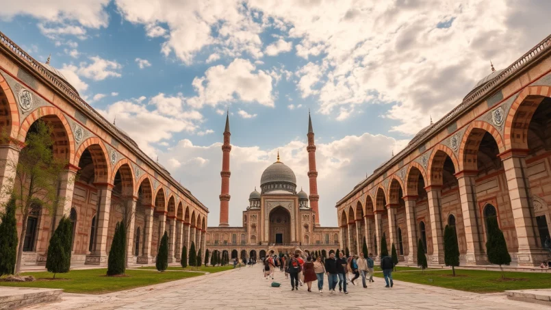
Built between 2002 and 2004 by the Bouygues group at a cost exceeding 100 million dollars, the mosque combines elements of Ottoman architecture (large central dome, slender minarets) and Turkmen motifs. Entirely clad in white marble and gilding, it is surrounded by fountains and pools giving the impression the building is “floating.”
The main announced characteristics are:
| Element | Description |
|---|---|
| Central Dome | Diameter ~50 m, interior painted sky blue |
| Minarets | 4 minarets 91 m high (referencing the year 1991 of independence) |
| Total height | Approx. 55 m |
| Complex area | ~18,000 m² |
| Prayer hall capacity | Up to 10,000 worshippers |
| Interior decor | Marble columns, gilding, huge eight-pointed star-shaped carpet, 1,200 kg Austrian crystal chandelier |
The complex also includes a mausoleum where Niyazov, who died in 2006, rests, along with family graves (his mother and brothers). An on-site museum is dedicated to him, as well as a madrasa. A 25-hectare garden, with imported trees, flowers, fountains, and reflecting pools, surrounds the whole. The parking lot can accommodate about 100 buses and 400 cars.
A Controversial but Unmissable Mosque
The Turkmenbashi Ruhy Mosque has not drawn only praise. Inside, some walls and the dome bear not only verses from the Quran but also quotations from the Ruhnama, a spiritual and political work written by Niyazov himself. This near-equal footing of religious words and excerpts from a presidential text has been deemed blasphemous by some believers. Accounts describe it as sometimes sparsely attended for prayer due to this political connotation.
Despite some criticism, this site is essential for understanding post-Soviet monumental architecture, the personality cult, and the complex relationship between religion and power. A major modernization completed in 2024 refreshed the marbles and facilities.
Access from Ashgabat is simple: by taxi (10–15 minutes), by bus (lines 18 or 20, 15–20 minutes from the main bus station, then a short walk), or by private car via the city’s western axis. Visitors are asked to respect a strict dress code (shoulders and legs covered, headscarf for women inside), remove shoes, and avoid inappropriate photography during prayer.
Yangykala, Köýtendag, Karakum: Raw Nature
Beyond Darvaza, Turkmenistan offers other extreme landscapes. The Yangykala Canyon, in the west of the country, spreads its cliffs striped in red, pink, and white in a region almost devoid of inhabitants. Farther east, the Köýtendag Nature Reserve and its “Dinosaur Plateau” harbor impressive fossil tracks. The mountains are suitable for hiking, while the Karakum Desert allows for bivouacs, camel or 4×4 routes far from any artificial light.
Favor spring (March to May) and autumn (September to November) for moderate temperatures and little rain, making even deserts passable. Summer can see extreme heat exceeding 45°C, with large diurnal temperature swings. Winter is very cold, with temperatures potentially dropping below -20°C, especially in the north.
Merv, Nisa, Köneürgench: The UNESCO Triptych
For those interested in the Silk Road, three names constantly recur: Ancient Merv, Nisa, and Köneürgench, all three inscribed on the UNESCO World Heritage List.
Turkmenistan is home to several major archaeological sites illustrating its rich past. Ancient Merv is the archetype of the large fortified caravan oasis. The site of Nisa, near Ashgabat, reveals the power of the Parthian Empire. Finally, Köneürgench, in the north in the Daşoguz region, is recognized as the former capital of Khwarezm in the 12th century; its medieval mausoleums and minarets testify to the region’s cultural wealth.
These three sites, combined with the marble capital, the Darvaza crater, the Kow-Ata underground lake, and the seaside front of Awaza, form the backbone of a first comprehensive trip to Turkmenistan.
Practical Realities: Visas, Access, and Constraints of Controlled Tourism
If these sites are so little visited, it’s also because the country remains one of the most closed in the world. Tourism remains marginal, with figures oscillating around a few thousand to a few tens of thousands of foreign visitors per year depending on the period, far from the 300,000 tourists recorded in 1998, before the tightening of isolationist policies.
A Deterrent Visa Policy, Moving Toward Partial Relaxation
The general rule is that almost all foreigners need a visa, itself conditional, for tourist stays, on a “Letter of Invitation” (LOI) issued by an accredited Turkmen travel agency and validated by the State Migration Service. This LOI is then used to obtain the visa at an embassy, or sometimes upon arrival at Ashgabat airport or certain land border crossings (Farab, Shavat, Khojeyli, Gaudan, Bekdash).
The visa acquisition process typically takes between three and four weeks, requiring advance planning.
A notable evolution, however, was announced in April 2025: a presidential decree plans to implement e-visas and remove the letter of invitation requirement for some business travelers and tourists, with the stated goal of reviving tourist activity and facilitating exchanges. Concrete modalities (visa types, duration, conditions) remain to be defined, but this announcement marks a possible turning point.
Strict Control of Movement and Logistical Constraints
Even with a visa, a tourist is not entirely free to move. Certain sectors – notably border zones, some Caspian ports, or towns like Hazar, Kerki, Dashoguz, Serhetabat – require special permits from the Ministry of Foreign Affairs, often obtained via the travel agency. Non-compliance with residence registration rules, lack of identity papers on one’s person, or failure to register with the Migration Service can lead to fines, detention, or even expulsion and a ban on return.
As the local economy operates mainly on cash, with low acceptance of bank cards and unreliable ATMs, travelers are advised to bring recent US dollars in cash. These should be exchanged at the official rate in banks, avoiding informal transactions.
Road and medical infrastructures remain uneven outside major cities. Roads can be poorly maintained, poorly lit, lacking signage; taxis are often unregulated. Health services are concentrated in urban centers, and shortages of common medicines are frequent.
Nevertheless, those who accept these constraints discover a country surprisingly safe in terms of common crime, where hospitality remains a strong trait of Turkmen culture. Respect for local codes – modest dress, political discretion, caution in photography use (never of government buildings, military sites, or people in uniform), and respect for religious practices in mosques – generally allows for smooth travel.
A Difficult Country, but Exceptional Sites
The must-see tourist sites in Turkmenistan form a contrasting mosaic: millennial ruins of Merv emerging from the sand, the flaming Darvaza crater in the night, the turquoise dome of Sultan Sanjar dominating the steppe, crossroads of worlds at Nisa, the sulfurous underground lake of Kow-Ata in the mountain’s belly, the multicolored cliffs of Yangykala, the Awaza seafront looking like an empty amusement park, the Turkmenbashi Ruhy Mosque blending religious fervor and political cult, and finally the white marble capital exhibiting records and architectural extravagance.
Turkmenistan offers a unique experience blending extreme landscapes and historical heritage, but access is regulated. Visa procedures are complex, movements are controlled, and information is filtered. Using a local agency to organize your trip is highly recommended, as it helps overcome these constraints and access exceptional sites, often deserted, like ancient cities or the Darvaza crater.
For those seeking discovery tourism rather than consumption tourism, the must-see tourist sites in Turkmenistan have what it takes to justify the effort. Between caravan past, outsized projects, and infinite deserts, they tell a singular story, both ancient and still being written.
Disclaimer: The information provided on this website is for informational purposes only and does not constitute financial, legal, or professional advice. We encourage you to consult qualified experts before making any investment, real estate, or expatriation decisions. Although we strive to maintain up-to-date and accurate information, we do not guarantee the completeness, accuracy, or timeliness of the proposed content. As investment and expatriation involve risks, we disclaim any liability for potential losses or damages arising from the use of this site. Your use of this site confirms your acceptance of these terms and your understanding of the associated risks.

Cyril Jarnias is an independent expert in international wealth management with over 20 years of experience. As an expatriate himself, he is dedicated to helping individuals and business leaders build, protect, and pass on their wealth with complete peace of mind.
On his website, cyriljarnias.com, he shares his expertise on international real estate, offshore company formation, and expatriation.
Thanks to his expertise, he offers sound advice to optimize his clients' wealth management. Cyril Jarnias is also recognized for his appearances in many prestigious media outlets such as BFM Business, les Français de l’étranger, Le Figaro, Les Echos, and Mieux vivre votre argent, where he shares his knowledge and know-how in wealth management.





