
 Published on and written by Cyril Jarnias
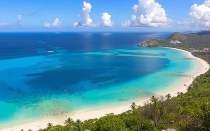
Nestled between the Atlantic and the Caribbean Sea, the Geography of Antigua and Barbuda is a small archipelago with an astonishingly dense geographical richness. Behind the postcard image – white-sand beaches, turquoise lagoons, coral reefs – lies a complex territory. Here, the shape of the coastlines, the nature of the rocks, the scarcity of fresh water, and exposure to hurricanes all shape land use, the economy, and environmental challenges.
A Small Archipelagic State at the Heart of the Lesser Antilles
The geography of Antigua and Barbuda belongs to the chain of the Leeward Islands, in the eastern arc of the Lesser Antilles. The archipelago lies at the boundary between the Caribbean Sea and the Atlantic Ocean, around 17°03′ north latitude and 61°48′ west longitude. Antigua is located about 650 kilometers southeast of Puerto Rico, while Barbuda stretches 48 kilometers to the north, and Redonda rises from the waves 56 kilometers southwest of Antigua.
The Exclusive Economic Zone of Antigua and Barbuda extends over more than 110,000 km², far larger than its land area of about 440 km².
An Archipelago of Multiple Islands
The state consists of two main inhabited islands, Antigua and Barbuda, and a string of islets, of which Redonda, an uninhabited volcanic rock, is the most iconic dependency. Around Antigua orbit islands such as Great Bird Island, Long Island (Jumby Bay), Green Island, Guiana Island, Maiden Island, Prickly Pear Island, and a constellation of small islets with evocative names like Hells Gate Island, The Sisters, or Sandy Island. Barbuda also has its satellites, including Goat Island, Kid Island, Man of War Island, and Rabbit Island.
This constellation largely rests on a submarine platform, the Barbuda Bank, with an area of about 3,500 km². This submerged continental structure shapes the seabed, reefs, and seagrass beds, and partly explains the country’s rich fishery resources.
Modest Relief, Between Limestone and Volcanoes
The first impression given by the topography of Antigua and Barbuda is one of gentleness: few peaks, rounded hills, broad plains, islands often described as “low-lying.” Yet, beneath this apparent uniformity lies a geological mosaic with very concrete effects on landscapes, soils, and water resources.
Antigua: A Clearly Marked Geological Triptych
Antigua – approximately 280 to 281 km² – presents three major, distinctly different physical zones.
In the southwest are volcanic uplands, with the Shekerley Mountains forming a ridge of dark hills. The country’s highest point, Boggy Peak (named Mount Obama from 2008 to 2016), reaches 402 meters. This is the remnant of an ancient volcanic crater within a massif where slopes mostly range between 10° and 20°, with some areas occasionally exceeding 30°. This zone receives the most abundant rainfall, as the relief forces moisture-laden air masses to rise.
The Central Plain is a broad clay plateau in the center of the island, separating the volcanic hills of the south from the limestone areas of the north and east. Composed of marls and clays over a volcanic base, it contains the most fertile agricultural lands, enriched by ancient ash deposits. It is also home to the rare semi-permanent watercourses, such as Bendals and Ayre Creeks.
Finally, the north and east of Antigua are dominated by limestone and coral rock. Altitudes remain modest here, often between 15 and 30 meters, though there are a few conical hills reaching just over 120 meters. This highly dissected limestone relief gives rise to a fragmented coast of bays, headlands, and lagoons, dotted with natural curiosities like Devil’s Bridge, a limestone arch carved by waves.
Barbuda: The Almost Horizontal Coral Island
Barbuda, with its 160 to 161 km², offers a radically different face. The island, of coral origin, is almost flat: most of the land lies only about 3 meters above sea level. The highest point – a plateau east of Codrington – barely reaches more than 40 to 45 meters in altitude. Limestone formations and sands dominate, creating a low-lying island vulnerable to storm surges and sea level rise.
The Codrington Lagoon is a large saltwater lagoon nearly 12 km long and 4 km wide, isolated from the open sea by a long sandy spit. This vast inland water body, fringed by mangroves and mudflats, is a crucial refuge for biodiversity, a traditional fishing area for local communities, and represents a zone highly vulnerable to the impacts of hurricanes.
The island is also indented with caves in its limestone cliffs and hosts submarine dunes, salt marshes, and long, straight beaches, notably around Coco Point or Palmetto Point.
Redonda: An Isolated Volcanic Pinnacle
Redonda, though tiny (between 1 and 2.6 km² depending on sources), completes the geological picture. It is a steep, entirely volcanic islet rising to 246 meters almost sheer from the ocean, with no significant flat terrain. Uninhabited, battered by wind and waves, Redonda is primarily known as a geographical curiosity and a potential conservation area, rather than as an inhabited territory.
Topography that Shapes Hydrology
The modest relief and the limestone nature of much of the soil partly explain the absence of perennial rivers. On both Antigua and Barbuda, watercourses are rare and runoff is often seasonal. Rainwater quickly infiltrates the porous rocks or flows to the sea without forming significant river networks. This characteristic heavily impacts the vital issue of access to fresh water.
Coasts, Reefs, and Lagoons: An Extremely Indented Coastline
The coastline of Antigua and Barbuda, about 153 kilometers long, is disproportionate to the country’s small land area. This high “coastline ratio” structures both tourism, fishing, and vulnerability to climate hazards.
Antigua, the Island of Bays and Natural Harbors
Antigua is famous for its countless coves – often called “365 beaches” – and its many bays that deeply cut into the shoreline. In the northwest, the capital Saint John’s backs onto a deep-water natural harbor, St. John’s Harbour, equipped with a wharf for cruise ships and cargo traffic. To the west, Five Islands Harbour, Jolly Harbour, or Deep Bay host anchorages, marinas, and sheltered beaches, facing the relatively calm Caribbean Sea.
The south coast of Antigua features bays like Old Road and Carlisle Bay. The English Harbour and Falmouth Harbour area forms an exceptional double natural harbor. English Harbour is renowned as one of the best hurricane shelters in the Eastern Caribbean. It is home to the historic Nelson’s Dockyard, a UNESCO World Heritage site, as well as major nautical infrastructure.
To the east and northeast, the Atlantic-facing coast is more rugged, exposed to easterly swells. Nonsuch Bay, Willoughby Bay, or Half Moon Bay serve as transitions between the calmer waters to the west and the open sea. This coast is bordered by reefs and islets like Green Island, which partly protect the beaches from the strongest swells but make navigation more delicate.
Barbuda: Long Beaches and an Inland Lagoon
Barbuda presents a simpler but equally remarkable coastal physiognomy: very long beaches of light sand stretch along the west, south, and east coasts. The west coast is dominated by Codrington Lagoon, separated from the ocean by a sand and dune barrier. To the north and south, headlands like Goat Point, Cedar Tree Point, Coco Point, Palmetto Point, or Spanish Point mark the ends of large sandy arcs or reefal sectors.
Barbuda’s coast, characterized by a succession of beaches, lagoons, reefs, and salt marshes, is an essential study site for the management of low-lying coral coasts. This unique geographical configuration exposes the territory to a dual risk: marine inundation and coastal erosion, making it a natural laboratory for developing and testing protection and adaptation strategies.
Reefs, Seagrass Beds, and Mangroves: A Very Active Coastal Fringe
The entire archipelago is fringed by coral reefs and shoals that form natural barriers, fishing grounds, and tourist sites. Estimates of reef area vary but are around 20 to 25 km². These reefs are associated with extensive seagrass beds, for example in Nonsuch Bay, Falmouth Harbour, Willoughby Bay, and in Codrington Lagoon, where the seagrass provides shelter and food for many species, including threatened sea turtles.
Mangroves are another key link in the coastal ecosystems. Historically, it is estimated that Antigua and Barbuda had nearly 4,900 hectares of mangroves and salt marshes, and, in the early 2000s, they represented about 3% of Antigua’s area and 22% of Barbuda’s. The main species are Rhizophora mangle, Avicennia germinans, Laguncularia racemosa, and Conocarpus erectus. They perform essential functions: fish nurseries, coastal protection against waves and storms, carbon storage, and natural filtration.
A Tropical Maritime Climate Under the Influence of Trade Winds
The climate of Antigua and Barbuda is typically tropical maritime, shaped by the almost constant presence of the northeast trade winds. It is characterized by high but relatively stable temperatures year-round and a marked alternation between dry and wet seasons.
Temperatures: A Permanently Warm Mildness
Average temperatures hover around 77 to 81°F (26 to 27°C) throughout the year. In the boreal winter, between December and February – the “coolest” period – values rarely drop below 73 to 75°F (23 to 24°C). In summer and early autumn, from June to September, daily averages rise towards 84 to 86°F (29 to 30°C). In Saint John’s, the thermometer generally oscillates from 77°F (25°C) in January-February to 82°F (28°C) in midsummer. The recorded heat record is 94.8°F (34.9°C) in Saint John’s, evidence that extremes remain, for now, relatively moderate compared to other tropical regions.
This relative stability is due to the oceanic influence and the trade winds, which frequently blow between 18 and 31 mph (30 and 50 km/h). This easterly or northeasterly flow limits heat peaks but also contributes to increasing evaporation, and thus potential drought when rains become scarce.
Rare and Irregular Rains
With approximately 39 to 43 inches (990 to 1,100 mm) of annual rainfall, the islands are not among the wettest in the tropics. Moreover, the distribution of rainfall is very uneven in space and time. The southwestern part of Antigua, around the volcanic massif and Boggy Peak, receives up to 49 to 51 inches (1,250 to 1,300 mm), while the flatter, limestone east may get only about 24 inches (600 mm) in some years. On Barbuda, in Codrington, annual totals hover around 45 inches (1,150 mm), but with high variability.
Overview of the main seasons and characteristic climate periods.
Generally spans from September to November, with a peak in precipitation around October.
The February-March period is often the driest. A long dry quarter extends from January to mid-April.
A hotter, humid, and unstable period sets in from mid-June to mid-November.
Between the two main phases, modulated by the passage of tropical waves and depressionary systems.
The country experiences recurrent droughts, to the point that the SPI (Standardized Precipitation Index) tends to become significantly negative in future climate projections. Statistical analyses indicate there is almost a one in two chance (45.1%) each year of experiencing at least a moderate drought, and about a one in seven probability (15.1%) of suffering a severe drought.
Hurricanes and Extreme Hazards
Located in the North Atlantic tropical cyclone corridor, Antigua and Barbuda is exposed to tropical storms and hurricanes, especially between July and October, with a peak risk from mid-August to mid-September. The probability that at least one hurricane passes within 120 nautical miles (about 190 km) of the archipelago in any given year is estimated at one-third, which corresponds, statistically, to a significant passage every three years.
Percentage of structures damaged or destroyed on the island of Barbuda by Hurricane Irma in 2017.
Extreme droughts constitute the other major climate hazard. Between 2014 and 2016, Antigua and Barbuda experienced an exceptionally dry episode, which saw the reserves of Antigua’s main dam, Potworks Dam, fall to 10% of capacity by the end of 2014, and the use of desalinated water rise to over 90% of total consumption by the end of 2015, compared to about 60% normally. Agriculture, domestic supply, and local food production were severely affected.
A Hotter and Drier Future
Climate models compiled within international programs (CMIP5, CMIP6) converge towards significant warming. Under a high emissions scenario (RCP8.5), the annual average temperature could increase by about 5°F (2.8°C) by 2071-2100 compared to the 1981-2010 period. Even under a more virtuous scenario (RCP2.6), the rise could reach nearly 1.6°F (0.9°C).
Average projected decrease in annual precipitation in the pessimistic scenario by the end of the century.
Regarding cyclones, studies suggest a possible decrease in the total number of systems, but an intensification of those that do form, with more powerful winds (increase of 2 to 11% in some scenarios) and more concentrated rainfall around storm centers (up to +10% per degree of warming). Category 4 and 5 hurricanes could become more frequent.
Finally, sea level rise constitutes an insidious but major threat. In the Caribbean Sea, the observed rise between 1993 and 2010 is about 0.07 inches (1.7 mm) per year, and projections indicate an increase of 1.3 to 1.6 feet (0.4 to 0.5 m) by the end of the century. For a country where vast areas of Barbuda and many coastal zones of Antigua lie only a few meters above sea level, the challenge is considerable.
Fresh Water, a Scarce and Strategic Resource
In this constraining climate context, the geography of fresh water is at the heart of geography itself. The archipelago has very limited internal resources: the total renewable resources are estimated at only 0.05 km³ per year, with withdrawals of about 0.01 km³. Groundwater aquifers are limited, weakened by over-exploitation, saltwater intrusion, and various forms of pollution.
Multiple but Limited Water Sources
The country depends on a mix of surface water catchments, seawater desalination, wells, and rainwater harvesting. On Antigua, a few reservoirs, like Potworks Dam, long formed the backbone of the supply, but their filling is highly erratic and subject to droughts. Reverse osmosis desalination plants – at Crabbs, Ffryes Beach, or the Ivan Rodrigues plant – now guarantee a substantial part of production, at the cost of high energy consumption.
A significant portion of households is connected to the public network managed by the Antigua Public Utilities Authority (APUA). However, a non-negligible proportion of the population supplements its water supply through private cisterns and wells. Furthermore, rainwater harvesting is encouraged, even mandated by regulation for new constructions.
In practice, total water demand was around 3 to 4 million gallons per day in the late 1980s, with distribution capacities close to these figures, but marred by massive losses due to leaks in the network. Earlier projections anticipated needs of 5.1 million gallons per day by 2000 and 8 million by 2020. Population growth, tourism expansion, and increased industrial, domestic, and agricultural uses intensify pressure on this resource.
Cruise ships can take on up to 750,000 gallons of locally pumped water each month.
A Priority Sector for Climate Adaptation
Official reports classify the water sector as one of the absolute priorities for climate change adaptation. The increasing risks of drought, irregular rainfall, and aquifer salinization necessitate rethinking watershed management: reforestation, erosion control, reducing slash-and-burn and overgrazing, developing new reservoirs, modernizing networks, diversifying sources (desalination, rainwater harvesting, reuse of treated wastewater).
The state has committed, in its Nationally Determined Contributions (NDCs), to protect all watercourses and bodies of water by 2030, in order to reduce flood risks and preserve human health. But implementation faces constraints of funding, technical expertise, and governance.
Land Use, Forests, and Agro-Ecosystems
In a country where land is scarce, but land pressures are strong – urbanization, tourism, agriculture, livestock – land use is a structuring issue of its geography.
Distribution of Major Land Use Types
Land use data shows a mosaic of allocations, where agricultural and forest lands coexist with a large category of “other uses” covering built-up areas, infrastructure, fallow land, and unclassified natural spaces.
A table allows us to visualize this balance at the national level:
| Land Use Category (approx. 2011–2018) | Share of Total Area | Additional Numerical Details |
|---|---|---|
| Agricultural Land (total) | ≈ 20.5% | ≈ 90 km² in 2021 |
| – Arable Land | ≈ 9% | About 30% of territory is theoretically arable, but only 18% is cultivated |
| – Permanent Crops | ≈ 2.3% | |
| – Permanent Pasture | ≈ 9 to 9.1% | |
| Forest | ≈ 18 to 22.3% | ≈ 8,120 ha in 2020 (vs. 10,110 ha in 1990) |
| Other Uses (built-up, roads, bare land…) | ≈ 57 to 61% | Includes tourist areas, fallow land, mangroves not accounted for elsewhere |
Other more detailed inventories describe the following distribution (indicative figures): 34% woodland, 3% mangroves, 33% scrub and extensive pasture, 4% improved pasture, 8% cropland, 11% settlement areas, 3% tourism-dedicated spaces, 3% airfields, and 1% reservoirs. These estimates illustrate a territory where semi-natural environments (woodland, scrub, mangroves) still occupy an important place, but where urbanization and infrastructure are rapidly progressing.
A History of Deforestation and Partial Reforestation
Since colonization in the 17th century, the islands have experienced massive deforestation linked to sugar cane and cotton plantations, and later to the expansion of pasture and built-up areas. By the end of the colonial period, only a small fraction of the original forests remained outside mangroves, with estimates suggesting a loss of 95 to 99% of primary forest cover.
Over 1,100 species of vascular plants are recorded in the island’s 54 types of plant communities.
This vegetation has strong ecological value, but its integrity is relatively low: the Forest Landscape Integrity Index was assessed at 4.72/10 in 2018, ranking the country around 117th globally. Pressures are multiple: bush fires, uncontrolled grazing, urban expansion, cutting for charcoal, hillside agriculture.
A Rural Space in Transition
Agriculture, which still represented about 40% of the economy in 1960, now accounts for only a few percent of GDP (around 2 to 4% depending on the year) and employs less than 5% of the workforce. The former plantation economy, based on sugar cane – which dominated Antigua from the 17th century – was gradually dismantled from the 1960s onwards in favor of tourism. The large sugar estates were bought by the state in 1969 and reoriented towards other uses.
This transition has left a visible landscape legacy: fragmented large estates, abandoned pastures colonized by scrub and acacias, ruined sugar infrastructure, but also the emergence of small mixed crop-livestock farms oriented towards local markets. However, a significant portion of livestock farmers remain landless, practicing extensive herding with stray animals that degrade slopes and crops through trampling and overgrazing.
To try to reconcile agricultural production and conservation, agroforestry projects have been tested, combining orchards, woodlands, and food crops in several communities. NGOs like the Environmental Awareness Group or the Pan American Development Foundation have thus supported the creation of small orchards and wood-fuel plots. The government, for its part, promotes innovative home gardening programs, like the “National Backyard Gardening Programme,” which mobilizes thousands of households to produce basic fruits and vegetables (tomatoes, okra, salad greens, herbs) to reduce dependence on imports.
Exceptional and Fragile Island Biodiversity
The position of Antigua and Barbuda at the crossroads of Atlantic migratory routes and the diversity of its habitats – reefs, seagrass beds, mangroves, dry forests, salt marshes, limestone caves – make it a biodiversity hotspot on a regional scale.
Remarkable Flora and Fauna
The recorded flora includes over 1,150 species of vascular plants, distributed among 149 families, of which nearly 200 require specific conservation measures. Faunistically, at least 209 species of amphibians, birds, mammals, and reptiles have been reported, with an endemism rate close to 3%. Birds are particularly well represented: about 182 species, two-thirds of which are migratory. The archipelago lies on the transatlantic axis linking North and South America, making it a crucial stopover for many species.
Native land mammals on islands like Antigua are mainly limited to bats (7 species). The majority of other mammals (bovids, equines, suids, rodents) were introduced by humans. The reptile fauna, with about twenty species, includes remarkable endemics like the Antiguan racer, one of the world’s rarest snakes, and the Griswold’s ameiva lizard.
Sandy lagoons and beaches also host significant populations of sea turtles – hawksbill, green, and leatherback turtles – which come to nest between June and October. Below the surface, seagrass beds and reefs harbor rich biodiversity, but it is increasingly threatened by warming waters, acidification, pollution, and overfishing.
Protected Sites and Natural Area Management
Several sites benefit from a protected status. Codrington Lagoon, on Barbuda, has been designated a national park; it hosts one of the world’s largest colonies of magnificent frigatebirds, attracting ornithologists and tourists. On Antigua, the North Sound islands, as well as reef and seagrass sectors, are also protected.
The country created the MEPA fund in 2015 to finance marine protected area management and habitat restoration. However, only a small portion of the waters is strictly protected, and ecosystems remain under strong pressure: coastal tourism development, dredging, sewage discharge, plastic pollution, and sargassum proliferation.
Spatial Organization and Human Geography
The geography of settlement in Antigua and Barbuda reflects the historical concentration of activities around fertile plains and natural harbors, but also the rise of tourism and services.
Population Distribution and Major Agglomerations
Approximately 97% of the population lives on the island of Antigua, leaving Barbuda among the least densely populated islands in the Caribbean. The national average density is around 210 inhabitants per km², but with strong contrasts: the parish of Saint John, which encompasses the capital, exceeds 770 inhabitants/km², while Barbuda barely has a dozen.
The population is predominantly rural or semi-urban: barely a quarter of inhabitants live in what statistics classify as an urban area. The most populous corridor stretches from the port of Saint John’s southeast to English Harbour, in the Central Plain, where subdivisions, agricultural villages, commercial zones, and tourism infrastructure succeed one another.
The following table summarizes the size, population, and density of the main parishes and dependencies:
| Parish / Dependency | Capital | Area (km²) | Population 2011 | Density (inhabitants/km²) |
|---|---|---|---|---|
| Saint John | St. John’s | 66.96 | 51,737 | ≈ 773 |
| Saint George | Fitches Creek | 24.41 | 8,055 | ≈ 330 |
| Saint Mary | Old Road | 63.55 | 7,341 | ≈ 115 |
| Saint Paul | Falmouth | 45.27 | 8,128 | ≈ 180 |
| Saint Peter | Parham | 32.37 | 5,325 | ≈ 165 |
| Saint Philip | St. Philip’s | 40.67 | 3,347 | ≈ 82 |
| Barbuda | Codrington | 160.58 | 1,634 | ≈ 10 |
| Redonda | – | 1.50 | 0 | 0 |
St. John’s, the country’s only true city, concentrates the main administrative, commercial, and port functions, with a compact urban center around the deep-water harbor. Other major localities – All Saints, Bolans, Liberta, Piggotts, Swetes, Codrington – remain modest in size, oscillating between 1,500 and 3,500 inhabitants, and retain the character of an extended rural village rather than a distinctly urban one.
Mobility and Infrastructure
The road network of Antigua roughly forms a star on the island, with Saint John’s as the central node. To the north, a road follows the coast towards Cedar Grove, Dickenson Bay, and Hodges Bay. To the west and southwest, an axis runs along the coast through Five Islands, Jolly Harbour, Bolans, and Old Road. To the south and southeast, a road connects All Saints to Liberta, Falmouth, and English Harbour, while another, to the east, connects All Saints to Bethesda, Seatons, Willikies, and Half Moon Bay. To the northeast, a road corridor links the capital to V. C. Bird International Airport, located near Coolidge, in the heart of Saint George parish.
Barbuda has a central road backbone connecting Codrington to the beaches and the airstrip. Exchanges with Antigua occur via a small airport – Codrington Airport – and a ferry service, the Barbuda Express, between the port of Saint John’s and Codrington.
Urbanization and Land Pressure
In a context where land is physically limited, the demand for housing, infrastructure, and tourism complexes creates a permanent tension. A significant portion of Antigua’s land is state-owned (about 42 to 60% of the land, according to estimates), while about one-third is held by private owners. Older surveys have revealed that nearly a quarter of the territory remained without clearly established land title, complicating planning.
Land concentration has direct social and geographical repercussions: precariousness for small livestock farmers and agricultural tenants, difficulty accessing credit, and strong pressure for non-agricultural land use (housing, tourism, commerce). This accelerates diffuse urbanization, notably along road axes and on Antigua’s tourist-oriented west coast, rapidly transforming landscapes.
Sea, Tourism, and Vulnerability: An Economy Shaped by Geography
The physical configuration of Antigua and Barbuda – pleasant climate, warm sea, accessible reefs, numerous protected anchorages – has directly shaped its economic model since the 1980s. Tourism now represents the backbone of GDP, with estimates varying from 60 to 80% of the wealth produced, and about 70% of employment. Yachting, cruising, beach stays, and nature tourism rely on the country’s geographical assets but also increase its dependence on these same assets.
The vast Exclusive Economic Zone of Antigua and Barbuda, essential for its fishery resources.
But this maritime prosperity rests on fragile ecosystems. Tourism exacerbates pressures on beaches, reefs, and mangroves – coastal construction, dredging for marinas, sewage discharge, intensive recreational use of the coastline. Fishing, if not regulated, can lead to overexploitation of certain species. Climate change and hurricanes, by damaging reefs, seagrass beds, and tourism infrastructure, highlight the vulnerability of an economy heavily concentrated on the coastal strip.
The authorities emphasize that protecting the terrestrial and marine environment is crucial, as it is directly linked to the sustainability of the tourism sector and food security.
A Geography Under Constraint: Risks, Adaptation, and Governance
Ultimately, the Geography of Antigua and Barbuda can be read as a permanent play of balances and imbalances between a tiny but interface-rich territory – land/sea, limestone/volcanic, dry/wet – and multiple pressures: coastal densification, climate change, water scarcity, ecosystem degradation.
The territory is exposed to climate risks (droughts, hurricanes, sea level rise) which compound structural vulnerabilities like tourism dependence, a biocapacity deficit, and limited water resources. The response involves rigorous land use planning, watershed restoration, protection of mangroves and reefs, improvement of water networks, and the systematic integration of climate risk into spatial planning.
In this country where 97% of the inhabitants live on an already densely occupied island, where almost all activities are concentrated along a few dozen kilometers of coastline, and where trade winds, tides, and waves dictate daily life, geography is not just a backdrop. It is the fabric upon which the compromise between development, resilience, and preservation of environments is woven, day after day. Understanding the Geography of Antigua and Barbuda thus means measuring to what extent the future of this small island state will depend on the ability to live sustainably with its modest relief, its indented coasts, its vulnerable reefs, and its increasingly extreme climate.
Disclaimer: The information provided on this website is for informational purposes only and does not constitute financial, legal, or professional advice. We encourage you to consult qualified experts before making any investment, real estate, or expatriation decisions. Although we strive to maintain up-to-date and accurate information, we do not guarantee the completeness, accuracy, or timeliness of the proposed content. As investment and expatriation involve risks, we disclaim any liability for potential losses or damages arising from the use of this site. Your use of this site confirms your acceptance of these terms and your understanding of the associated risks.

Cyril Jarnias is an independent expert in international wealth management with over 20 years of experience. As an expatriate himself, he is dedicated to helping individuals and business leaders build, protect, and pass on their wealth with complete peace of mind.
On his website, cyriljarnias.com, he shares his expertise on international real estate, offshore company formation, and expatriation.
Thanks to his expertise, he offers sound advice to optimize his clients' wealth management. Cyril Jarnias is also recognized for his appearances in many prestigious media outlets such as BFM Business, les Français de l’étranger, Le Figaro, Les Echos, and Mieux vivre votre argent, where he shares his knowledge and know-how in wealth management.





