
 Published on and written by Cyril Jarnias
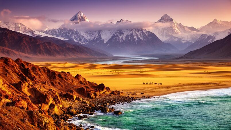
The geography of Pakistan is an immense patchwork of landscapes, climates, and peoples. Between the peaks over 8,000 meters of the Karakoram, the fertile plains of the Indus, and the arid deserts of the south, the country alone concentrates a large portion of Asia’s great landscapes. Its physical mosaic is matched by an impressive human diversity, structured by vast and unequal provinces, a network of vital rivers, and cities growing at a spectacular rate.
To properly understand Pakistan’s geography, it is necessary to approach it through several interconnected maps: physical, administrative, demographic, and linguistic. These different dimensions are intimately linked and offer a complete reading of the country.
A hinge country, at the crossroads of plates and regions
Situated between 24° and 37° north latitude and 61° and 77°50 east longitude, Pakistan occupies a pivotal position between South Asia, Central Asia, and the Middle East. The country stretches about 1,300 to 1,500 kilometers from north to south, from the confines of the Pamirs to the shores of the Arabian Sea, covering an area close to 796,000 to 882,000 km² depending on the source, ranking it around 33rd in the world.
Pakistan’s geography is primarily determined by the collision of three tectonic plates: the Indian Plate, the Eurasian Plate, and the Arabian Plate. Sindh and Punjab rest on the northwestern corner of the Indian Plate, while Khyber Pakhtunkhwa, Balochistan, and Gilgit‑Baltistan lie on the Eurasian Plate. This collision gave rise to the mountain arcs of the Himalayas, the Karakoram, and the Hindu Kush, and is responsible for significant seismic activity, as evidenced by the violent earthquakes that have repeatedly struck the Quetta region in the 20th century.
To the north, the country touches China; to the east, it is bordered by India; to the west, by Afghanistan and Iran. Along the Afghan border runs the famous Durand Line, and a narrow strip of Afghan territory, the Wakhan Corridor, separates it from Tajikistan. To the south, the coastline extends about 1,046 km along the Arabian Sea, with an exclusive economic zone of about 290,000 km².
Three major physical regions: mountains, Indus plains, and the Balochistan plateau
The geography of Pakistan can first be read through three major physical regions: the northern highlands, the Indus plain, and the Balochistan plateau, with the addition of desert and coastal areas.
The northern highlands: the “roof of the world”
In the north, Gilgit‑Baltistan and the mountainous regions of Khyber Pakhtunkhwa and Azad Jammu and Kashmir form one of the most spectacular landscapes on the planet. It is here that the Himalayas, Karakoram, and Hindu Kush ranges meet. More than fifty peaks exceed 6,500 meters, including several “giants” over 8,000 meters: K2 (8,611 m), the world’s second highest peak, Nanga Parbat (8,126 m), Gasherbrum I (8,080 m), and Broad Peak (8,051 m).
These mountains harbor vast glaciers, so much so that the area is sometimes called the “third pole.” Among the most famous are the Siachen Glacier, Baltoro Glacier (about 63 km), Biafo (67 km), and Batura (57 km). They feed the country’s major rivers through snow and glacial melt, making this region the water tower of the Indus plain.
The highly rugged terrain of Gilgit-Baltistan makes travel difficult, despite state efforts to develop mountain tourism and trekking. The region has a mountainous to subarctic climate (Köppen-Geiger type Dfc), with harsh winters and short summers. Settlement is concentrated in isolated, multilingual valleys such as Hunza, Neelum, and Astore, as well as in the districts of Skardu, Gilgit, Ghanche, and Diamer.
The Indus plain: agricultural and demographic heart
In the center of the country, the geography of Pakistan is dominated by the alluvial plain of the Indus and its tributaries, which covers most of Punjab and Sindh. The very name “Punjab” means “land of five waters,” referring to five major rivers—Jhelum, Chenab, Ravi, Sutlej, and Indus—that converge near Panjnad before joining the main trunk of the Indus.
This immense alluvial fan, watered by one of the world’s largest irrigation systems (the Indus Basin Irrigation System, with three major reservoirs, 19 barrages, 12 link canals, and over 120,000 secondary canals), constitutes the most fertile and densely populated area of the country. It has been inhabited by agricultural societies for at least five millennia, as evidenced by the sites of the Indus Valley Civilization.
This is the percentage of agricultural land irrigated by the Indus in the basin.
This hydraulic centrality has major economic and environmental consequences: the geography of Pakistan is literally constrained by the Indus regime. A treaty signed in 1960 with India, the Indus Waters Treaty, grants India almost exclusive use of the eastern rivers (Ravi, Sutlej, Beas) upstream, and Pakistan the waters of the western rivers (Indus, Jhelum, Chenab). To compensate for the loss of eastern waters, Pakistan built two major dams (Tarbela on the Indus, Mangla on the Jhelum) and a system of link canals.
The Balochistan plateau: the vast arid hinterland
To the west and southwest, Balochistan, with its 347,190 km², represents nearly 48% of the country’s area, but remains the least populated province. It is a vast rugged plateau, between 600 and 3,010 meters in altitude, carved by mountain ranges (Sulaiman, Kirthar) and interior basins. Its climate is largely arid to semi-desert, marked by strong continentality, large temperature variations, and low rainfall.
The Pakistani province of Balochistan is characterized by diverse geography, including the coastal sub-region of Makran in the south, the central Kalat region, and the vast Kharan Desert in the northeast. Although poor in surface water, it is rich in strategic mineral resources such as copper, coal, and natural gas (notably via the key Sui gas field). The Chagai district also hosts the important Reko Diq copper-gold deposits.
Population densities are very low, sometimes below 10 inhabitants per km² in divisions like Rakhshan, in stark contrast to the hundreds or even thousands of inhabitants per km² in the Indus plains.
Deserts and coastal areas: Thar, Cholistan, Makran
The geography of Pakistan also includes several major deserts. The Thar, an extension of the Indian desert of the same name, covers part of Sindh and the southeast of the country. Further west, the Cholistan Desert (“Rohi”) extends over about 16,000 km², while the Kharan develops in Balochistan, and the Thal occupies a semi-arid corridor between the Indus and the Jhelum.
To the south, the coastline of Sindh and Balochistan borders the Arabian Sea. The Makran coast, relatively dry (sometimes around 100 mm of rain per year), hosts the deep-water port of Gwadar, destined to become a hub for regional trade under the China–Pakistan Economic Corridor (CPEC). Further east, Karachi, backed by a group of small islands like Manora, concentrates the main port and the largest urban agglomeration in the country.
A multi-layered administrative organization
The geography of Pakistan is not limited to its reliefs and rivers: it also involves a complex administrative division, resulting from the colonial heritage and post-independence political reorganizations.
Provinces, territories, and contested areas
Administratively, Pakistan is organized into four major provinces, one federal territory, and two territories whose status remains contested. The provinces are Punjab, Sindh, Khyber Pakhtunkhwa, and Balochistan. The federal territory is the Islamabad Capital Territory (ICT), which encompasses the national capital. The two administered but disputed entities are Azad Jammu and Kashmir and Gilgit‑Baltistan. The country also claims the Indian-administered regions of Jammu and Kashmir and Ladakh, an inheritance from the first Kashmir conflict in the late 1940s, as well as a historical claim on Junagadh, without ever having exercised effective authority there.
Each province presents a very contrasting geographic and demographic profile, as shown in the table below.
Area, population, and capitals of first-level units
| Administrative Unit | Area (km²) | Most Recent Population | Capital |
|---|---|---|---|
| Balochistan | 347,190 | 14,894,402 (2023) | Quetta |
| Khyber Pakhtunkhwa | 101,741 | 40,856,097 (2023) | Peshawar |
| Punjab | 205,345 | 127,688,922 (2023) | Lahore |
| Sindh | 140,914 | 55,696,147 (2023) | Karachi |
| Islamabad Capital Territory | 906 | 2,363,863 (2023) | Islamabad |
| Azad Jammu and Kashmir | 13,297 | 4,045,366 (2017) | Muzaffarabad |
| Gilgit‑Baltistan | 72,496 | 1,492,924 (2017) | Gilgit |
We immediately see the imbalance between Balochistan, which accounts for nearly half the area but a small share of the population, and Punjab, which concentrates more than half of the inhabitants on about a quarter of the territory. The geography of Pakistan is therefore deeply unbalanced in terms of human occupation.
Administrative structure of the country upon its creation in 1947, before subsequent territorial reorganizations.
Capital: Dhaka. Became independent in 1971 as Bangladesh.
Capital: Lahore. Major province of present-day Pakistan.
Capital: Hyderabad. Historical region of the southeast.
Capital: Peshawar. Today the province of Khyber Pakhtunkhwa.
Capital: Quetta. The largest province by area.
The former Federally Administered Tribal Areas (FATA), located along the Afghan border, were integrated in 2018 into Khyber Pakhtunkhwa, reshaping the administrative map of this mountainous province.
Divisions, districts, tehsils, and union councils
Below the provincial level, the geography of Pakistan is structured by a hierarchical network: divisions, districts, tehsils, and then union councils. Divisions, headed by a divisional commissioner appointed by the federal government, group several districts. They were abolished in 2000 before being reinstated in 2008. There are now 37 divisions, including 31 in the four provinces and 6 in the two mountain territories.
The provinces respectively have 10 divisions in Punjab, 6 in Sindh, 7 in Khyber Pakhtunkhwa, and 8 in Balochistan. Azad Jammu and Kashmir has 3 divisions, as does Gilgit‑Baltistan. The Islamabad Capital Territory, however, is not part of any division.
Divisions are themselves subdivided into 145 districts in total, considered the key level of local administration. Districts are broken down into tehsils, and then into union councils, the smallest units of governance.
The diversity of these divisions illustrates the geography of Pakistan, both in terms of areas, densities, and levels of urbanization or education. A few examples suffice to grasp the extent of these disparities.
Territorial contrasts: examples of divisions
In Balochistan, the Kalat division covers over 91,000 km² for barely 2.7 million inhabitants, a density below 30 inhabitants/km². Rakhshan goes even further in low density, with about 940,000 inhabitants over nearly 100,000 km², barely ten inhabitants per km². Conversely, the Quetta division concentrates over 4.2 million inhabitants on just over 14,500 km², with a density of nearly 300 inhabitants/km², reflecting regional urbanization in and around the provincial capital.
The spectacular density of over 1,460 inhabitants/km² in the Mardan division reflects a high concentration of people in the Kabul Valley.
Punjab offers the sharpest contrast between rural divisions and major urban centers. Lahore, with nearly 22.8 million inhabitants over 11,727 km², has a density close to 1,942 inhabitants/km². Gujranwala and Gujrat also exceed 900 and 670 inhabitants/km², with literacy rates near or above 75%, making them some of the most educated regions in the country. In contrast, a division like Bahawalpur, encompassing part of the Cholistan Desert, is much larger (45,588 km²) and less dense (about 294 inhabitants/km²), while still being more populous than most Baloch divisions.
In Sindh, the Karachi division is an extreme case: less than 3,600 km² for over 20.3 million inhabitants, a density approaching 5,800 inhabitants per km². This is the most striking illustration of the rapid urbanization that marks the geography of Pakistan. At the other end of the spectrum, Mirpur Khas or Hyderabad, although larger (up to nearly 50,000 km² for the latter), remain less dense.
As we see, the very notion of “Pakistani space” covers very different realities, ranging from near-human deserts to overcrowded conurbations.
A human geography marked by strong imbalances
The geography of Pakistan cannot be understood without considering a major fact: over 241 million inhabitants counted in 2023 in the four provinces and the ICT, making the country the fifth most populous in the world. But this human mass is very unevenly distributed.
Densities and population distribution
In 1998, the average density was 166 inhabitants/km². It now exceeds 320 inhabitants/km² according to 2023 estimates, but this average masks extreme disparities. Balochistan had only about twenty inhabitants per km² at the end of the 1990s; Punjab then had over 350, and districts like Lahore or Sialkot now exceed 500 inhabitants/km², or more.
In 1998, nearly 56% of the population lived in Punjab, which represents only about a quarter of the country’s area, compared to only 5% in Balochistan, which covers almost half the territory. This disproportion illustrates the structuring role of the Indus plain and alluvial soils in the geography of Pakistan: populations are massively concentrated in fertile and irrigated areas, along major rivers and canals.
Urbanization: the rise of cities along the Indus
For a long time, Pakistan remained largely rural: still in 1998, about two-thirds of the population lived in the countryside. In 2017, nearly 65% of inhabitants still resided in rural areas. But the trend is clear: the share of urban population rose from about 17.7% in 1951 to nearly 40% in 2023, with an urban growth rate still higher than that of rural areas (2.5 to 3% per year vs. less than 2%). Between 1998 and 2017, the urban population nearly doubled, from 43 to 75 million people.
Number of inhabitants living in urban areas in Pakistan in 2023, of which more than half are concentrated in a few major cities.
The geography of Pakistan has therefore become, in a few decades, increasingly polarized around a chain of metropolises arranged along the Indus and its tributaries, from Karachi on the coast to Peshawar in the northwest, passing through Lahore, Faisalabad, Multan, or Rawalpindi.
In 2023, Sindh was the most urbanized province in Pakistan, with about 54% of its population living in cities.
Population growth and pressure on space
The country’s population has multiplied by more than seven between 1951 (about 34 million inhabitants) and 2023 (over 241 million for the provinces and ICT alone). Some provinces have experienced staggering growth: Balochistan nearly doubled its population between 1998 and 2017 (+87.9%), and the Islamabad Capital Territory saw its population soar by nearly 149%. Overall, the country recorded growth of around 56.5% over this period.
This dynamic translates into rapid densification of already populated areas, haphazard urban sprawl, and increased pressure on agricultural land, especially in the alluvial plains. The result is a geography of Pakistan increasingly marked by “rurbanization”: large peri-urban spaces where the city spreads without benefiting from structured urban services.
The ethnic and linguistic fabric: a mosaic inscribed in space
The geography of Pakistan is not just about relief and density: it also covers a mosaic of ethnic groups and languages that are fairly clearly inscribed in space, even if migrations have complicated this picture.
Correspondence between provinces and major ethnolinguistic groups
The major provinces roughly correspond to majority ethnolinguistic groups. Punjab is dominated by Punjabis, by far the largest group in the country. Sindh is the historical home of Sindhis. Khyber Pakhtunkhwa, along with large pockets in western Pakistan and southern Balochistan, are predominantly Pashtun. Balochistan is the territorial base of the Baloch, overlain by Brahui populations speaking a Dravidian language.
Several linguistic groups occupy specific regions of the country: Saraikis in southern Punjab and border areas with Sindh and Balochistan (the Derajat region); Hindkowans or Hazarewals in the former Hazara region in northeastern Khyber Pakhtunkhwa; Shina, Balti, Burusho, Kho, or Wakhis in the valleys of Gilgit-Baltistan; Indus Kohistanis and Torwalis in the remote valleys of Kohistan and upper Swat; and Khetrans in the Barkhan region of Balochistan.
The great migrations following the Partition of 1947 added another spatial configuration: the Muhajirs, Muslims from India during the creation of Pakistan, settled en masse in the cities of Sindh, particularly Karachi, but also Hyderabad, Mirpur Khas, and Sukkur, as well as in some major Punjab centers like Lahore or Multan. They now constitute an important urban group without their own rural territorial base.
The following table summarizes, approximately, the geographic distribution of some main groups.
| Ethnolinguistic Group | Primary Region |
|---|---|
| Punjabis | Punjab (northeast, central and eastern part of the country) |
| Pashtuns | Khyber Pakhtunkhwa, western Pakistan, southern Balochistan |
| Sindhis | Sindh (southeast), lower Indus Valley |
| Saraikis | Southern Punjab, contact zones with Sindh and Balochistan |
| Baloch | Balochistan, neighboring areas of Sindh and southern Punjab |
| Brahui | Central Balochistan, often culturally assimilated to Baloch |
| Muhajirs | Major cities of Sindh, especially Karachi, but also other cities |
| Shina, Balti, Burusho… | Valleys of Gilgit‑Baltistan |
| Hindkowans/Hazarewals | Hazara region (northern Khyber Pakhtunkhwa) |
Linguistic diversity and roles of languages
The geography of Pakistan is also one of over 60 to 80 languages spoken, according to estimates. Institutionally, Urdu is the national language, shared as a lingua franca by about 80% of the population, but is the mother tongue of only a small minority (around 8%). English, inherited from the colonial period, remains the official language of the elite, higher administration, and the business world.
About half of Pakistan’s population primarily speaks Punjabi, the main regional language of the country.
The linguistic areas largely follow the geography of the major physical regions and provinces. Punjabi, for example, dominates in the central plain, but remained largely oral in contemporary Pakistan for a long time, despite recent efforts to develop its written form in Urdu script. Sindhi is rooted in the lower Indus Valley and its delta, with a strong Sufi character visible in local cultures. Pashto, a language with a rich oral tradition, accompanies the valleys and high plateaus of the northwest down to the margins of Balochistan. Balochi and Brahui organize the linguistic landscape of the Baloch plateau.
The linguistic question has regularly intersected with territorial tensions: the Bengali movement for recognition of Bengali in then East Pakistan, linguistic riots in Sindh in the early 1970s fearing marginalization of Sindhi by Urdu, mobilizations in favor of minority languages perceived as “mere dialects.” The geography of Pakistan is thus traversed by these symbolic as much as physical fault lines.
Rivers: hydrological and spatial backbone
It is impossible to talk about the geography of Pakistan without returning in more detail to its river system. The great rivers structure not only the relief, but also the cities, cultivated lands, and population distribution.
The Indus, nearly 3,180 km long, is a major river of Asia.
This network forms the backbone of the Indus Basin Irrigation System which, by watering over 170,000 km² of irrigable land, has enabled the rise of cash crops like cotton, rice, and sugarcane, as well as significant cereal production (the country is a very large wheat producer and a major exporter of rice, especially basmati). But this hydrological dependence also makes the country vulnerable: overexploitation of groundwater aquifers, silting and sedimentation of canals, agricultural and urban pollution, and glacial retreat due to climate change are weakening the system.
The majority of major Pakistani cities are located along the main hydrological axis, forming an urban river corridor. Karachi and Hyderabad are on the lower Indus, Sukkur near strategic barrages, Multan and Bahawalpur in southern Punjab. Further upstream, Faisalabad and Lahore line the canal network, while Rawalpindi and Islamabad overlook the Soan and Jhelum basins, and Peshawar is located in the Kabul Valley.
Climate and natural hazards: from snowy mountains to scorching plains
From a climatic perspective, the geography of Pakistan is marked by great diversity. The country, located just north of the Tropic of Cancer, primarily experiences continental climates, with little maritime influence except along the coastal strip.
The high valleys of Gilgit‑Baltistan have a subarctic climate: very harsh winters, cool summers, precipitation often in the form of snow. Azad Jammu and Kashmir and the mountainous regions of Khyber Pakhtunkhwa have humid subtropical climates (type Cfa) with summer monsoon and cold winters. Punjab and the Indus Valley have a hot subtropical climate, with scorching summers (maxima close to 47 to over 50 °C are common in the plains and deserts) and cooler but dry winters. Cities like Jacobabad or Turbat regularly rank among the hottest in the world, with Turbat recording nearly 53.7 °C in 2017.
These regions are mostly desert or semi-desert, with annual precipitation often below 200 mm, concentrated over a few months, and high evaporation. Only the coast, especially around Karachi, benefits from moderation by sea breezes, despite oppressive summer heat and humidity.
Monsoon, drought, and floods
The seasonal dynamic is based on four main phases: a cool, dry winter (December–February), a hot, dry spring (March–May), the summer monsoon (June–September), and a drier autumn (October–November). Two systems modulate these seasons: the southwest monsoon, which brings sometimes torrential rains from the Bay of Bengal and the Arabian Sea to the northern subcontinent, and western disturbances, which bring rain and snow to the mountains in winter.
The northern mountains can receive more than 200 mm of rain per month in summer, while the Baloch coast remains almost dry. Islamabad receives nearly 1,250 mm of rain annually, with about half concentrated in July–August, while Karachi barely gets more than 200 mm per year.
Number of millions of people affected by the devastating floods in Pakistan in 2022.
Cities, in the midst of expansion, are particularly vulnerable to these phenomena, whether through river flooding (fluvial flooding) or urban runoff (pluvial flooding) amplified by soil impermeability. Lahore, for example, has large built-up areas exposed to both types of risk.
Responses and limits
Faced with these challenges, the geography of Pakistan is also being redrawn through infrastructure projects (such as the Diamer‑Bhasha Dam on the upper Indus, which aims to store over 6 MAF of water), integrated management plans for the Indus Basin, reforestation programs (Billion Tree Tsunami, notable increase in mangroves since the 1990s), and land conservation policies to limit degradation and desertification. But these responses must contend with strong budgetary constraints, complex governance, and “disorderly” urbanization that often exceeds the capacity of public authorities to plan.
Toward new maps? Debates on territorial reorganization
The scale of demographic, economic, and geographic imbalances has fueled proposals for administrative redrawing for several years. New provinces are regularly mentioned: Bahawalpur province, “South Punjab,” “South Balochistan,” a possible Karachi province (sometimes called Jinnahpur), Hazara province in northern Khyber Pakhtunkhwa, or the transformation of Gilgit‑Baltistan into a full-fledged provincial entity.
Some researchers suggest going much further. One article proposed increasing the country to around twenty provinces or administrative units, either by dividing the current large provinces or by elevating most existing divisions into autonomous provinces. The main argument: bring governance closer to citizens, mitigate the overwhelming demographic weight of Punjab (which would group around 100 million people), and better adapt public policies to very different local realities.
Dr. Mehtab S. Karim, researcher
However, the strong population disparity between divisions poses a problem: in Punjab, divisions range from about 6 to 24 million inhabitants; in Sindh, from 4 to 20 million; in Khyber Pakhtunkhwa, from 3 to 10 million; in Balochistan, from less than one million to 4 million. A breakup of provinces into many entities of very unequal size would complicate the distribution of national resources, especially allocations from the National Finance Commission, which determines the sharing of federal revenues.
Some scenarios for territorial reorganization envision the creation of 18 provinces, resulting from the grouping of districts, distributed across existing regions. A central political point remains the definition of the future status of the current federal territories, particularly Gilgit-Baltistan and the Islamabad Capital Territory.
The geography of Pakistan is thus likely to recompose in the medium term, according to political compromises and demographic constraints.
An economic and environmental geography under pressure
Finally, the geography of Pakistan overlaps with a contrasting economic and environmental geography. Most wealth is produced in major cities and the most densely populated regions of the Indus plain. Services now dominate the economy, accounting for nearly 58% of GDP, while agriculture, once hegemonic (more than half of GDP in 1947), now only accounts for just over a fifth of created wealth, even though it remains vital in terms of employment and foreign exchange.
Rural mountain or plateau regions, such as the interior of Balochistan, northern Khyber Pakhtunkhwa, or some valleys of Gilgit‑Baltistan, often have limited access to infrastructure and low industrialization. However, they possess significant natural resources, including mines, water resources, hydropower potential, and landscapes suitable for tourism.
Environmentally, over 80% of the territory is classified as arid or semi-arid; nearly half of the land suffers from some form of degradation (deforestation, overgrazing, salinization, unplanned urbanization). Forest cover remains modest (around 4% of the area), although spectacular progress has been observed in some components, such as a more than threefold increase in mangroves since the 1990s.
Pakistan’s geography is characterized by balances and imbalances between mountains and plains, water and desert, density and emptiness. It also presents linguistic contrasts and a gap between metropolises and hinterlands. This landscape, subject to climate change and demographic shifts, will continue to transform according to development policies, settlement dynamics, and climatic hazards.
Understanding the geography of Pakistan is thus grasping this intimate interweaving of territory, population, language, water, and power, and measuring how each decision—a dam, a highway, an administrative redrawing—can reshape, sometimes profoundly, the lived map of the country.
Disclaimer: The information provided on this website is for informational purposes only and does not constitute financial, legal, or professional advice. We encourage you to consult qualified experts before making any investment, real estate, or expatriation decisions. Although we strive to maintain up-to-date and accurate information, we do not guarantee the completeness, accuracy, or timeliness of the proposed content. As investment and expatriation involve risks, we disclaim any liability for potential losses or damages arising from the use of this site. Your use of this site confirms your acceptance of these terms and your understanding of the associated risks.

Cyril Jarnias is an independent expert in international wealth management with over 20 years of experience. As an expatriate himself, he is dedicated to helping individuals and business leaders build, protect, and pass on their wealth with complete peace of mind.
On his website, cyriljarnias.com, he shares his expertise on international real estate, offshore company formation, and expatriation.
Thanks to his expertise, he offers sound advice to optimize his clients' wealth management. Cyril Jarnias is also recognized for his appearances in many prestigious media outlets such as BFM Business, les Français de l’étranger, Le Figaro, Les Echos, and Mieux vivre votre argent, where he shares his knowledge and know-how in wealth management.