
 Published on and written by Cyril Jarnias
Nestled in the heart of the South American continent, landlocked yet open to a mosaic of terrains and climates, Bolivia’s geography is one of the most complex in the tropical world. Between the high Andes mountains, the high-altitude plateau, temperate valleys, and Amazonian lowlands, the territory forms a patchwork of landscapes that shapes the climate, population distribution, economy, and even politics.
Bolivia features extreme topography, with altitudes ranging from less than 100 m to over 6,500 m over short distances. This vertical geography explains the diversity of cities, agricultural crops, and ecosystems. It also makes water both a precious resource and a risk, and contributes to exceptional biodiversity.
A Landlocked Country in the Center of South America
The territory extends over just over 1.09 million square kilometers, making it the fifth largest country in South America, after Brazil, Argentina, Peru, and Colombia, and the largest landlocked country in the Southern Hemisphere. It lies entirely within the tropical zone of the Southern Hemisphere, but the massive presence of the Andes mountain range completely disrupts the expected climatic logic for a “tropical” country.
This is the total length, in kilometers, of the land borders the country shares with its five neighbors.
A major fact marks the political and economic geography: the loss of access to the Pacific Ocean at the end of the 19th century, following the War of the Pacific against Chile. Since then, access to the sea has depended on two major river systems: the Paraguay-Paraná network in the southeast and the Amazon system in the north, via inland ports connected to the Atlantic.
A Territorial Organization Linked to Major Physical Regions
Administratively, the state is organized into nine departments, whose boundaries largely overlap with the major physical regions: the Andean highlands and valleys in the west and center, and the Amazonian and Chaqueñan lowlands in the east and southeast. The example of the department of Santa Cruz, immense and mostly flat, contrasts with that of La Paz, which is mountainous and Andean.
It is very clear that the highland departments concentrate mining and political history, while the lowland departments, especially Santa Cruz and Beni, drive the new agricultural, energy, and forestry frontier.
Three Major Geographical Tiers: Andes, Transition Zones, and Plains
Bolivia’s geography is generally described in three major blocks, which also correspond to dominant climatic zones: the Andean region in the west, the intermediate sub-Andean zone of valleys and Yungas, and the vast plains of the Oriente in the east and north.
The Andean Region: Extreme Heights and the Plateau of the World
The western part of the territory is occupied by the Bolivian portion of the Andes, which itself subdivides into several mountain ranges and a vast high-altitude plateau, the Altiplano. This region covers about 28% of the national area but has long concentrated a significant share of the population and historic cities.
Two great mountain ranges frame the plateau: the Cordillera Occidental, arid, volcanic, and very high, along the border with Chile and Peru; and the Cordillera Oriental (or Cordillera Central/Real depending on the segment), more humid, incised with fertile valleys, and topped with glacial peaks.
The Altiplano, located between two ridgelines, is the world’s second-largest high-altitude plateau after Tibet. Its average altitude is about 3,700 meters, with a surface generally between 3,600 and 4,000 meters. It is home to some of the highest cities on the planet, such as El Alto (around 4,150 m) and Potosí (around 4,090 m).
On this plateau, the terrain is less rugged than in the neighboring ranges, but is still punctuated by closed basins, salt flats, and lakes. It is also on the Altiplano that the main north-south communication axis developed during the colonial period unfolds, linking La Paz, Oruro, Potosí, and, further south, the Andean borderlands.
The Sub-Andean Zones: Temperate Valleys and Humid Yungas
To the east of the high ridges, the mountains gradually slope down toward the plains. This transition zone, known as sub-Andean, covers about 13% of the territory. It is composed of inter-Andean valleys (the Valles) and very rugged eastern slopes, covered in cloud forests: the Yungas.
The valleys, situated between 2,000 and 3,000 meters in altitude, enjoy a mild climate, often described as “eternal spring.” The alluvial soils are rich, and agriculture has long been developed there. Major cities like Cochabamba, Sucre, or Tarija are located in these temperate basins.
The Yungas are steep valleys between the Andes and the Amazon, characterized by a very humid subtropical climate and lush vegetation. These cloud forests harbor exceptional biodiversity, including the spectacled bear, the Andean cock-of-the-rock, and orchids. They also constitute an important agricultural zone for coffee, citrus fruits, and coca cultivation.
The Plains of the Oriente: Amazon, Chiquitanía, and Gran Chaco
To the east and north of the Andes begins the domain of the lowlands, often referred to as the Llanos. This immense zone covers about 59% of the national territory but remains much less densely populated than the highlands, with the notable exception of the Santa Cruz metropolitan area.
The plains are generally located below 400 meters in altitude. They extend northward into the Amazon basin, eastward into the Pantanal shared with Brazil, and southeastward into the semi-arid Gran Chaco region, which connects with Paraguay and Argentina. Tropical rainforests, seasonally flooded savannas, wooded pampas, and marshlands form a highly contrasted landscape.
It is precisely in these plains that most of the major oil and gas reserves are found, as well as the new agricultural frontiers (notably for soybeans) around Santa Cruz.
Topography: Mountains, Plateau, Salt Flats, and Lowlands
Bolivia’s geography is first read in vertical sections. Between the highest Andean peaks and the lowest point, on the banks of the Paraguay River (about 90 meters altitude), the elevation difference exceeds 6,400 meters.
The Great Andean Mountain Ranges
The Cordillera Occidental, a natural border with Chile and partly with Peru, is a succession of volcanoes and eruptive cones, some still active or geothermally hot. The country’s highest point, Nevado Sajama, rises to 6,542 meters. Further north, other volcanoes like Parinacota or Pomerape mark the border, while the southwest, contiguous with the Atacama Desert, is one of the driest sectors on the continent.
This western range is sparsely populated: the climate is harsh, rainfall is negligible, and vegetation is often reduced to sparse steppes or near-desert expanses, especially in its southern part.
East of the Andean plateau, the Cordillera Oriental, including the segments of the Cordillera Real and Apolobamba, is characterized by high mountain features: glacial peaks, steep walls, residual glaciers, and deep valleys. It is home to iconic summits like Illimani (6,438 m), visible from La Paz, and the massifs of Illampu and Ancohuma, all exceeding 6,000 meters. Its eastern slopes, more humid, feed the valleys and forests of the Yungas.
The Altiplano: An Endorheic High Plateau
Between these two ranges, the Altiplano forms a vast endorheic basin, meaning its waters do not flow to the sea but are lost in lakes and salt flats. This configuration gives rise to a unique hydrological system, historically centered on the Titicaca–Desaguadero–Poopó–Coipasa complex.
The northern part of the plateau is occupied by Lake Titicaca, shared with Peru and located at about 3,812 meters altitude. It is often presented as the world’s highest large navigable lake. Further south, waters flow via the Río Desaguadero to the basin of the former Lake Poopó, now largely dried up due to droughts and water withdrawals, and then to the Salar de Coipasa.
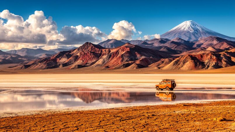
The Salar de Uyuni, the world’s largest salt flat, extends over more than 10,000 km².
Lowlands: Forests, Savannas, and Marshes
As one descends the eastern slopes, the terrain fragments into hills and sierras, then gives way to vast plains. In the north, in the departments of Beni and Pando, the relief is almost imperceptible: sheets of seasonally flooded savannas, dense forests, countless river branches, lakes, and lagoons.
A particular feature strongly structures these landscapes: an impermeable clay subsoil that prevents rapid water infiltration. During the rainy season, vast areas turn into marshes or temporary lakes, before becoming grasslands again in the dry season.
Further southeast, toward Santa Cruz and the Paraguayan border, the hills of the Chiquitanía alternate with drier plains. Finally, in the far southeast, the Gran Chaco forms a transitional space toward the Chaqueñan plains shared with Paraguay and Argentina: torrid climate, long periods with almost no rain, and vegetation of thorny scrubland.
Water: Three Major Basins and Iconic Lakes
Despite being landlocked, Bolivia’s geography is profoundly shaped by water. Rivers form three major drainage systems: the Amazon basin in the north and east, the Río de la Plata system in the southeast, and the closed basin of the Altiplano.
Three Main Hydrographic Systems
The territory is classically divided into three basins:
– The Amazon basin (or north), covering nearly two-thirds of the country and draining waters toward the Atlantic via the Amazon River;
– The Río de la Plata basin (or south), channeling waters from the southeast to the Atlantic Ocean via the Paraguay and Paraná Rivers;
– The central or lacustrine basin of the Altiplano, endorheic, centered on the Titicaca–Poopó–salt flats complex.
On average, the country receives over 1,100 mm of precipitation per year, representing more than 600 km³ of renewable water resources. But this abundance is very unevenly distributed: excess in the Amazonian plains, relative scarcity on the high plateaus.
The Amazon Network: Mamoré, Beni, Madeira
In the north, the great plains are crisscrossed by three major rivers: the Mamoré, the Beni, and the Madre de Dios, which converge to form, with other tributaries, the Madeira, one of the main tributaries of the Amazon.
Presentation of the main Bolivian rivers, key elements of the Amazon basin.
Approximately 2,000 km long, it is Bolivia’s main tributary to the Amazon.
Descends from the Andes for over 1,100 km and is considered the country’s second most important river.
The network includes rivers like the Guaporé/Iténez or Abunã, which mark the border with Brazil.
These rivers, slow and wide in the lowlands, feature large meanders that create numerous lakes and lagoons, and a good portion of their stretches are navigable, offering transport routes where roads are scarce.
The Paraguay-Paraná System and the Pantanal Marshes
In the southeast, waters head toward the Río de la Plata basin. The Paraguay River runs along the eastern border for several hundred kilometers, serving as a strategic fluvial outlet to the Atlantic. Further west, the Pilcomayo crosses the Chaco before reaching Argentina and Paraguay.
The border region with Brazil hosts part of the Pantanal, the world’s largest tropical wetland. This wetland area includes numerous shallow lakes, such as Mandioré, Uberaba, or Gaiba. These bodies of water play a major ecological role as fish nurseries and in flood regulation. They also hold significant economic importance, notably for fishing and tourism.
High-Altitude Lakes and Salt Flats: Titicaca, Poopó, Uyuni
On the Altiplano, the iconic feature is Lake Titicaca, with about 45% of its surface area on the Bolivian side. At over 3,800 meters altitude, this lake remains navigable for sizable boats. Its waters, fed by dozens of rivers and rain, constitute a vital resource for the lakeside populations and harbor endemic species.
Further south, Lake Poopó and Lake Uru Uru, both shallow and very saline, have undergone dramatic drying in recent years, revealing the fragility of the endorheic system in the face of climatic variations and human withdrawals. Their decline has caused significant economic and ecological losses.
The salt flats, particularly that of Uyuni, are remnants of ancient prehistoric lakes. Beyond their tourist appeal, they concentrate strategic mineral resources, notably lithium, whose exploitation must, however, respect the fragile balance of these salt deserts.
Climate: From Humid Tropical to Near-Polar
The immense altitudinal variety explains why Bolivia’s geography comes with an unusual climatic palette for a tropical country. Within a few hundred kilometers, one can go from a hot and humid equatorial forest climate to cold, dry conditions akin to high-mountain tundra.
Broadly, three zones are distinguished: the Andean highlands with a cold, dry climate, the valleys and Yungas with a temperate or subtropical climate, and the eastern plains with a hot and humid climate. Seasonality is marked by a rainy season/dry season alternation rather than a summer/winter opposition in the temperate sense.
The Andean Highlands: Cold, Dry, and High Radiation
On the Altiplano and Andean highlands, the average annual temperature remains low, often between 5 and 15°C. Precipitation is moderate to low, rarely more than 500 mm per year, concentrated during the Austral summer months (roughly December to March).
Days are sunny and temperate, but nights are cold with frequent frosts. Solar radiation is very high due to scarce cloud cover and low air density. In the southern Altiplano, near the Chilean border, the climate resembles a high-altitude desert.
Temperate Valleys and Yungas: Between Mild Spring and Cloud Forest
In the Valles, mildness prevails: average temperatures between 15 and 25°C, annual rainfall generally between 500 and 1,000 mm. These conditions allow for diverse agriculture, often with two harvests per year, unlike the Altiplano where only one growing season is possible.
The Yungas, more humid and warmer, receive moisture-laden air masses from the Amazon. Precipitation is abundant there, with a marked rainy regime, and the atmosphere is often saturated with mist. It is a climate conducive to perennial crops like coffee, citrus fruits, and coca.
Tropical Plains: Heat, Heavy Rains, and Southern Winds
In the lowlands, the climate becomes decidedly tropical. Average annual temperatures generally range between 25 and 30°C, with much higher maximums in the hot season. Precipitation is abundant, easily exceeding 2,000 mm annually in many areas, with some rainforest sectors reaching 4,000 mm.
The spatial distribution of rainfall is not uniform, however. The regions of the Llanos, the Chiquitanía, and the Selva (dense Amazon) each have their nuances:
Bolivia presents three major types of regional climates: the Llanos experience a hot and humid climate with a marked rainy season and a dry season with drier winds; the Chiquitanía remains tropical but with more moderate total rainfall and a short dry season; the true Selva (notably in Pando) is very humid, with abundant rains almost all year.
A local climatic phenomenon, the surazos – cold winds from the south – can temporarily drop temperatures in the plains, bringing unusual coolness for a few days.
Climate Vulnerabilities: Floods, Droughts, Retreating Glaciers
This diversity does not immunize the country against hazards. Events linked to El Niño and La Niña accentuate precipitation variations, leading either to major floods in the lowlands or severe droughts on the Altiplano and in the valleys.
Major floods of rivers like the Beni, Mamoré, or in the Trinidad region have, in recent years, inundated hundreds of thousands of hectares, damaged roads and bridges, destroyed crops, and affected several hundred thousand people.
Simultaneously, the Andean glaciers that feed part of the hydrographic network are in sharp retreat. Iconic glaciers like that of Chacaltaya have disappeared, threatening the drinking water supply of high-altitude cities like La Paz and El Alto, where a significant portion of the population still depends on seasonal glacial melt for part of its needs.
Major Physical and Ecological Regions
Bolivia’s geography cannot be summed up as a simple mountains/plains opposition. Geographers and ecologists distinguish several intermediate ensembles corresponding to different land uses, strong regional identities, and specific ecological systems.
Altiplano: Historic and Mining Heartland
The Altiplano is both a physical and cultural space. It is home to predominantly Aymara and Quechua indigenous populations, who practice the herding of llamas and alpacas, and the cultivation of tubers (potato, oca, etc.) and hardy cereals like quinoa or barley.
The region has borne, since colonial times, the bulk of mining production (silver, tin, zinc, etc.), notably around Potosí and the Cordillera Central. Today, numerous mines, legal or artisanal, still dot the landscape of the plateau and surrounding mountains.
Valles and High Valleys: The Country’s Temperate Gardens
The Valles located on the eastern slopes of the Andes, between 2,000 and 3,000 meters, are often described as the country’s “gardens.” They concentrate a significant share of subsistence and commercial agricultural production: corn, vegetables, temperate fruits, vineyards (notably in Tarija), etc.
Soils in the mid-mountains are deeper and more fertile than at higher altitudes, but also more susceptible to erosion if vegetation disappears. To remedy this, terracing agriculture, inspired by pre-Columbian techniques, is used in some areas to reduce gullying.
Yungas: Humid Corridors Between Mountain and Forest
The Yungas form a narrow but strategically important strip. They connect the Andean world to the Amazon rainforest via spectacular roads, often carved into steep slopes. Abundant humidity supports cash crops like coffee or cocoa, but also coca, whose expansion has sometimes led to rapid deforestation and environmental problems.
From an ecological point of view, these cloud forests constitute a crucial biodiversity corridor, ensuring a smooth transition between the Andean high grasslands (puna) and the dense forests of the Amazon.
Bolivian Amazon: Flooded Savannas and Dense Forests
In the north (Beni, Pando, north of La Paz and Cochabamba), the Bolivian Amazon combines several types of landscapes: terra firme forests, seasonally flooded forests, seasonally submerged savannas, marshes, and oxbow lakes. The soils are often hydromorphic, very rich in organic matter on the surface but delicate to exploit intensively.
This region is simultaneously a zone of agricultural pioneer frontier, a major hydrocarbon reservoir, and the heart of rich biodiversity. It is therefore at the center of many issues, both environmental and economic.
Chiquitanía and Gran Chaco: Dry Forests and Thorny Scrubland
East of Santa Cruz, the Chiquitanía offers a landscape of tropical dry forests interspersed with savannas, with a warm climate but somewhat less rainfall than the central Amazon. To the southeast, the transition to the Gran Chaco occurs gradually, as the dry season lengthens and vegetation becomes stunted into thickets and thorny scrub.
The Bolivian Gran Chaco is characterized by a hydrological paradox: almost no rain for long months, then subject to sudden floods during the rainy season. This extreme alternation limits conventional agricultural uses but favors extensive cattle ranching in some areas.
Population Distribution and Major Urban Axes
The geography of Bolivia profoundly conditions the distribution of people. Human concentrations follow the relief, temperate climates, and historic communication axes.
A Double Backbone: Andes and Oriente
Historically, the majority of the population settled on the Altiplano and the Andean valleys, along a north-south axis linking La Paz, Oruro, Potosí, and the mining regions. This is where the oldest colonial cities, main administrative centers, and traditional highland farmlands are located.
Since the second half of the 20th century, a significant internal migration has shifted Bolivia’s demographic and economic center of gravity toward the eastern plains. Santa Cruz de la Sierra, located in this region, is now the most populous city and the main economic hub of the country, especially for industrial agriculture, hydrocarbons, and electricity sectors.
Thus, one can speak today of a structuring east-west axis connecting Santa Cruz to Cochabamba and then to La Paz, which concentrates a large part of the population, roads, investments, and economic flows.
Contrasted Densities Between Departments
Differences between departments clearly illustrate the role of geography. The table below compares, for a few major departments, the area, estimated population, and density.
| Department | Area (km²) | Population 2024 (est.) | Density (inhab./km²) | Dominant Geographical Profile |
|---|---|---|---|---|
| Santa Cruz | 370,621 | 3,115,386 | 8.41 | Large plains, hills, Chiquitanía |
| La Paz | 133,985 | 3,022,566 | 22.56 | Altiplano, Cordillera, Yungas |
| Cochabamba | 55,631 | 2,005,373 | 36.05 | Temperate valleys, sub-Andean foothills |
| Beni | 213,564 | 477,441 | 2.24 | Amazonian plains and flooded savannas |
| Pando | 63,827 | 130,761 | 2.05 | Dense Amazon rainforest |
| Tarija | 37,623 | 534,348 | 14.2 | Valleys and Chaqueñan foothills |
It can be seen that the highest densities concern valley regions (Cochabamba) or densely urbanized Altiplano (La Paz), while the forested lowlands (Beni, Pando) remain very sparsely populated despite their immense area. Santa Cruz, though still of low average density, is rapidly attracting population and investment.
Andean Urbanization and the Rise of Santa Cruz
The presence of high plateaus favored the emergence of large cities at unusual altitudes. La Paz, the de facto capital, is located in a canyon cutting into the Altiplano, allowing it to benefit from more temperate microclimates than the neighboring high plain. El Alto spreads above, directly on the plateau, at over 4,000 meters.
Cochabamba benefits from a much-appreciated climate in its sheltered valley, reinforcing its importance as a regional center. Sucre, the country’s constitutional capital, is also located in a basin with a temperate climate.
In contrast, Santa Cruz de la Sierra, in the eastern plains, has established itself as the great tropical metropolis, benefiting from vast lands for mechanized agriculture, hydrocarbon resources, and a strategic position for trade with Brazil and the Atlantic.
Natural Resources, Agriculture, and Physical Constraints
The geography of Bolivia conditions not only settlement patterns but also underpins all productive activities. Topography, climate, and soils determine the location of mining and energy resources, as well as agricultural systems.
Mineral and Energy Resources: Mountains and Sedimentary Basins
On the mining side, the Andes – particularly the Cordillera Central and the Altiplano – contain deposits of metals like tin, zinc, silver, lead, or tungsten. This wealth stems from the geological history of the range, linked to the subduction of the Nazca Plate under the South American Plate, which favored magmatic intrusions and hydrothermal flows concentrating metals.
Hydrocarbon resources, on the other hand, are concentrated in the ancient sedimentary basins of the foothills and sub-Andean plains, notably in the departments of Santa Cruz, Chuquisaca, and Tarija. The Chaco, at the edge of the Andes and the plains, has seen new gas and oil fields attracting settlers and investments.
The salt flats of the Altiplano, like that of Uyuni, contain significant lithium reserves, crucial for the global energy transition. However, their exploitation faces a major challenge: extraction requires large quantities of water, increasing pressure on water resources in these already arid and fragile environments.
A Difficult Territory for Intensive Agriculture
On a national scale, only a small fraction of the territory is truly arable. Topography, altitude, aridity in some sectors, and water saturation in others complicate cultivation. Adverse weather linked to climatic phenomena, floods, and droughts add another layer of uncertainty.
The Altiplano, despite its low temperatures and short growing season, supports resilient traditional agriculture, based on potatoes (over 200 local varieties), barley, quinoa, and camelid herding. In the valleys, milder conditions allow for two annual harvests and strong diversification.
The eastern plains of Bolivia, notably around Santa Cruz, have undergone rapid transformation into vast zones of mechanized monoculture (soybeans, corn, sugarcane, sunflower). This expansion is accompanied by major environmental and social consequences: accelerated deforestation, soil erosion, and conflicts related to water use.
The major agricultural systems can be summarized according to physical zones:
| Geographical Zone | Typical Altitude | Dominant Climate | Main Agricultural Products |
|---|---|---|---|
| Altiplano | 3,600 – 4,000 m | Cold, semi-arid | Potato, quinoa, barley, llama herding |
| Inter-Andean Valleys | 2,000 – 3,000 m | Temperate, relatively dry | Corn, fruits, vegetables, vine, various cereals |
| Yungas | 400 – 3,500 m | Humid, subtropical | Coffee, cocoa, citrus fruits, coca |
| Amazonian Plains | < 400 m | Tropical humid | Cattle, rice, cassava, tropical fruits, cocoa |
| Santa Cruz Plains | 200 – 500 m | Tropical with dry season | Soybeans, corn, sugarcane, oilseeds, cattle |
| Gran Chaco & Chiquitanía | 200 – 800 m | Semi-arid seasonal | Extensive cattle ranching, drought-adapted crops |
Water, Irrigation, and Hydrological Risks
Agriculture is by far the main user of freshwater in the country, siphoning off most withdrawals. Yet, a large part of potentially cultivable land still lacks irrigation infrastructure, particularly in the highlands and valleys.
The plain zones, though generally rainier, also experience tensions, especially in sectors of recent clearing where bare soil and lack of hedges favor runoff and floods.
The contrast is striking between, on one side, regions like Beni, where rains periodically turn the plain into an inland sea, and on the other, Andean zones where rural communities must ration increasingly uncertain glacial meltwater. Geography thus accentuates inequalities in water access depending on altitude and basin.
Biodiversity and Protected Areas: A Living Laboratory
The altitudinal gradient, variety of climates, and juxtaposition of very different biomes – humid tropical forests, savannas, dry forests, high-altitude puna, marshes – explain why Bolivia’s geography is accompanied by exceptional biodiversity.
Several dozen terrestrial ecoregions are recorded there, from the humid forests of the southwest Amazon to the shrubby steppes of high mountains, including seasonally flooded savannas, Chaqueñan dry forests, and Yungas cloud forests.
Bolivia protects its varied ecosystems through vast national parks and reserves. In the northwest, Madidi National Park concentrates exceptional diversity, ranging from lowland tropical rainforest to snow-capped peaks. In the east, Noel Kempff Mercado and Kaa-Iya del Gran Chaco parks preserve the forest and savannas of the Gran Chaco respectively. Near Cochabamba, Tunari National Park overlooks the region. Finally, in the southwestern Altiplano, Eduardo Avaroa National Park features spectacular landscapes like vividly colored lagoons, salt flats (salt deserts), and colonies of Andean flamingos.
In the Amazon, seasonally flooded forests of the várzea type – regularly enriched by sediments carried by rivers from the Andes – contrast with igapó forests, poorer, flooded by black or clear waters from crystalline rocks. This interplay of waters and soils results in a mosaic of ecological niches for fauna and flora.
On the Altiplano, emblematic species like the vicuña, alpaca, or Andean flamingo have adapted to high thermal amplitudes, intense radiation, and low oxygen content in the air.
Contemporary Challenges Related to Geography
Far from being mere scenery, the geography of Bolivia is at the heart of strategic challenges: access to the sea, climate vulnerability, uneven development between highlands and plains, conflicts over resource use.
Landlockedness, inherited from successive territorial losses, forces dependence on neighboring countries for port access, which increases foreign trade costs and makes maintaining stable diplomatic relations crucial.
The eastern lowlands, once peripheral, are now the main engine of economic growth, driven by mechanized agriculture and hydrocarbons. In parallel, the Andean regions, the historic heartland, see their traditional resources like glaciers and lakes become more fragile.
Rapid deforestation in the Amazon basin and Gran Chaco, linked to the advance of the agricultural frontier and timber exploitation, threatens biodiversity, alters the water cycle, and could ultimately even affect rainfall patterns across the rest of the continent.
The combination of complex topography, highly populated high-altitude cities, flood-prone lowlands, and sometimes insufficient infrastructure makes risk management (floods, landslides, droughts) a priority for land use planning.
—
Ultimately, the geography of Bolivia appears as a highly integrated system: mountains, plateaus, valleys, and plains are not separate worlds but closely linked tiers connected by flows of water, materials, species, and populations. The country’s ability to reconcile economic development, territorial justice, and environmental protection will largely depend on how this physical complexity is taken into account in public policies, urban planning, agriculture, and natural resource management.
Disclaimer: The information provided on this website is for informational purposes only and does not constitute financial, legal, or professional advice. We encourage you to consult qualified experts before making any investment, real estate, or expatriation decisions. Although we strive to maintain up-to-date and accurate information, we do not guarantee the completeness, accuracy, or timeliness of the proposed content. As investment and expatriation involve risks, we disclaim any liability for potential losses or damages arising from the use of this site. Your use of this site confirms your acceptance of these terms and your understanding of the associated risks.

Cyril Jarnias is an independent expert in international wealth management with over 20 years of experience. As an expatriate himself, he is dedicated to helping individuals and business leaders build, protect, and pass on their wealth with complete peace of mind.
On his website, cyriljarnias.com, he shares his expertise on international real estate, offshore company formation, and expatriation.
Thanks to his expertise, he offers sound advice to optimize his clients' wealth management. Cyril Jarnias is also recognized for his appearances in many prestigious media outlets such as BFM Business, les Français de l’étranger, Le Figaro, Les Echos, and Mieux vivre votre argent, where he shares his knowledge and know-how in wealth management.





