
 Published on and written by Cyril Jarnias
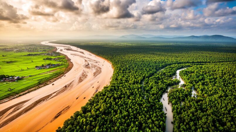
Sandwiched between the Himalayas and the Bay of Bengal, Bangladesh is a country where geography dictates nearly everything: the climate, the economy, spatial organization, as well as the risks to which the population is exposed. A giant delta, a land of floodplains, a mosaic of rice paddies and villages, it is often summed up by a simple yet accurate phrase: “land of rivers.” Behind this image, however, lies a much more complex reality, in which agriculture, demographic pressure, urbanization, and climate change are intertwined.
The article addresses the geography of Bangladesh beyond a simple cartographic description. It analyzes the structure of the territory, the organization of agricultural land, major hydrological and climatic systems, and their direct consequences on employment, land use planning, and public policies. The objective is to understand how the country lives and adapts to an environment that is both constraining and generous.
A Deltaic Plain Country at the Heart of South Asia
Bangladesh occupies a pivotal position between the Indian subcontinent and Southeast Asia. Located approximately between 20°34’ and 26°38’ north latitude and 88°01’ to 92°41’ east longitude, it lies entirely in the northern and eastern hemispheres. Its area is around 147,000 to 148,000 km² depending on the source, roughly the size of Greece or the U.S. state of Iowa.
Nearly 79% of the territory consists of recent alluvial plains, most at less than 10 meters above sea level. This extremely low elevation, within the delta of the Ganges, Brahmaputra, and Meghna rivers, makes the country highly vulnerable to floods, cyclones, and rising sea levels.
The rare exceptions to this horizontal flatness are found in the northwest (Barind Tract), north-central region near Dhaka (Madhupur Tract), and especially in the southeast, with the Chittagong Hill Tracts, the country’s only truly pronounced hill system. The highest point, Saka Haphong, reaches just over 1,060 meters near the border with Myanmar.
The maritime front opens onto the Bay of Bengal, with a coastline of approximately 580 km, which is highly indented and unstable, made of mudflats, alluvial islands, and estuaries. In the southwest, this coastline is protected by the immense mangrove forest of the Sundarbans, a UNESCO World Heritage Site.
One of the Highest Population Densities in the World
The country’s geography cannot be understood without integrating the human factor. With more than 170 million inhabitants in about 148,000 km², the country ranks in the global top 10 both for its total population and its density, which exceeds 1,200 inhabitants per km². In some areas, particularly Dhaka, the urban density climbs to over 47,000 inhabitants per km².
This demographic pressure directly weighs on land use. The land/person ratio is extremely low, around 0.12 hectares per person, and the agricultural land per capita has decreased from 0.11 to 0.06 hectares in a few decades. In other words, each cultivable plot must feed more and more people, even as urbanization, infrastructure, and soil erosion chip away at the available land.
Administrative Organization and Spatial Structuring
The territory is divided into eight major divisions: Barisal, Chittagong, Dhaka, Khulna, Mymensingh, Rajshahi, Rangpur, and Sylhet. These divisions are themselves subdivided into 64 districts, then into 495 upazilas (sub-districts), and over 4,500 union councils. This dense administrative grid accompanies a very fine-grained land occupation, with no large empty spaces.
Several functional regions stand out in Bangladesh. “Central Bengal” groups Dhaka and Mymensingh, the political and economic heart of the country. “Southern Bengal” links Barisal, Khulna, and the future division of Faridpur, an area heavily marked by coastal and deltaic characteristics. In the far north, Rangpur and Rajshahi form large cereal plains. Finally, Sylhet and the mountainous southeast (including Chittagong and its hills) present more hilly landscapes, with tea plantations, forests, and wetlands.
A Monsoon Climate Structuring the Agricultural Calendar
The country is subject to a tropical monsoon climate, one of the wettest on the planet. Three main seasons dominate the year: a cool, dry winter from November to February, a hot pre-monsoon period from March to May, and then the rainy monsoon from June to October. In the Bengali tradition, six seasons are distinguished, but it is these three major climatic periods that regulate the crops.
The regions of Sylhet and southeastern coastal Bangladesh receive more than 4,000 mm of rain per year.
Between 70 and 80% of annual rainfall occurs during the monsoon. This water is both a blessing for rice paddies and a major threat, as the floodplains are submerged each year. An average of 20 to 22% of the territory is flooded between June and October, with extreme episodes covering much larger areas in some years.
A Territory Shaped by Rivers
The geography of Bangladesh is primarily read through its extraordinary river network. There are about 700 rivers and canals, connected to three major systems: the Ganges-Padma, the Brahmaputra-Jamuna, and the Meghna, joined by the Surma-Meghna system from the northeast. Together, these basins drain an area of more than 1.7 million km², far beyond national borders.
The great rivers transport nearly 1 billion tons of sediment per year, depositing over 2 billion tons in the delta and the Bengal submarine fan. This flow nourishes soil fertility but also causes high morphological instability: migration of meanders, formation of ephemeral alluvial islands (chars), bank collapse, and shifting of river mouths.
This dynamic is not only natural: it determines the location of villages and crops, as well as the risks. Millions of people live on land that can disappear within a few years due to riverbank erosion. A significant portion of internal migrants – often called “climate refugees” – come from these fragile riverside zones.
Agricultural Land: An Ultra-Cultivated and Pressured Territory
One of the most striking features of the country’s geography is the considerable share of land devoted to agriculture. In 2022, agricultural land represented about 72% of the country’s area, nearly double the global average, estimated at 38.5%. In this densely populated country, almost every accessible plot of plain is cultivated.
Land Distribution and Cropping Intensity
Of the approximately 14.84 million hectares of land, 3.74 million are not cultivable: cities, industrial zones, roads, rural buildings. The total cultivable area is estimated at 8.8 million hectares. The net area actually cultivated is around 8 million hectares, but the harvested area is almost twice as large due to successive multiple cropping on the same plot.
The table below provides a synthetic picture of agricultural land use.
| Land Category | Area (million ha) |
|---|---|
| Total cultivable area | 8.8 |
| Net cultivated area | 8.025 |
| Single-cropped area (monoculture) | 2.043 |
| Double-cropped area | 4.103 |
| Triple-cropped area | 1.858 |
| Quadruple-cropped area | 0.019 |
| Cultivable fallow | 0.296 |
| Temporary fallow | 0.481 |
| Non-cultivable land | 3.382 |
| Forests | 2.575 |
| Total cropped area (all harvests) | 15.899 |
The comparison between net area and total cropped area shows how intensively the land is used. Cropping intensity – that is, the average number of harvests per plot – has increased significantly, from about 143% in the early 1970s to nearly 198% in 2022-2023. Projections even estimate it will exceed 211% by 2030.
Evolution of cultivated areas and factors of pressure on agricultural land in France.
The net cultivated area decreased from about 8.85 million hectares in 1985 to less than 8 million in 2011, despite population growth.
Urbanization, infrastructure, and industrialization contribute to an estimated loss of 80,000 hectares of fertile land per year.
The intensification of agricultural practices partially compensates for this gradual reduction in available land.
Agriculture, an Economic Pillar Despite a Declining Relative Weight
The national economy remains profoundly rural. Agriculture remains the primary source of employment: in 2023, more than a third of the labor force (about 35%) still worked in this sector. In rural areas, 87% of households have agriculture as their main source of income. Historically, around 26% of the workforce was employed there in the early 2010s, a proportion that remains very high for a country undergoing rapid industrialization.
In value terms, agriculture’s contribution to GDP is slowly declining, a sign of the growing importance of industry and services. In 2017, the sector still represented 14.2% of GDP; in 2020, about 13%; in 2024, a little over 11%. Including livestock, the total share approached 19%, with 13% for crops alone. In absolute value, agricultural value added reached over 50 billion dollars in 2024.
This importance is directly reflected in major national objectives: poverty reduction, food security, job creation, human capital development. Any climatic or economic shock affecting agriculture has an immediate impact on the entire society.
Agrarian Structure and Practices
The country’s geography is also social: about 80% of farmers cultivate less than one hectare. It is therefore a country dominated by very small farms, intensively cultivated, often with still traditional methods. Animal traction and manual tools remain widespread, even though light mechanization is progressing, particularly through power tillers and two-wheel tractors.
This land tenure structure explains the massive reliance on multiple cropping, as well as a gradual diversification towards cash crops (jute, sugarcane, vegetables, fruits, tea) whenever access to water and markets allows. Technical support is provided by the Ministry of Agriculture and its extension services, but also by a set of research institutes like the Bangladesh Rice Research Institute (BRRI) for rice or the Bangladesh Agricultural Research Institute (BARI) for non-cereal crops.
Major Crops: An Agricultural Map Dominated by Rice
The agricultural landscape is largely structured by cereals, which occupy nearly 78% of cultivated land. Among them, rice is by far the leading crop. About 75% of arable land is dedicated to it, a world record for a country of this size.
Rice, the Backbone of the Cultivated Territory
Rice is not only the staple food of the population, it is also the principal crop in terms of area, production, and value. The country ranks among the world’s top producers: second in 2019, third since then, with production reaching about 39.1 million tons in 2023. Average yields are around 5 tons per hectare, allowing the country to be largely self-sufficient.
Rice cultivation varies by season and zone. The three main seasons are: boro (irrigated winter/early spring rice), aman (monsoon rice), and aus (pre-monsoon rice, less widespread). Cropping systems can be single, double (e.g., boro followed by aman), or even triple in areas with secure irrigation.
The distribution of cropping patterns highlights the centrality of rice. The rice-rice model alone covers about 27% of the agricultural area and reaches up to 60% in the north of the country. Nearly 90% of farmers cultivate modern high-yielding varieties, from BRRI research programs, adapted to different water regimes (submergence, salinity, relative drought).
Weight of Other Crops
Even overshadowed by the dominance of rice, the crop map shows some diversification. The table below summarizes the approximate share of major crop categories in the cultivated area.
| Crop Type | Share of Cultivated Area (%) |
|---|---|
| Cereals (rice, wheat, maize, etc.) | 77.55 |
| Pulses | 2.22 |
| Oilseeds | 3.43 |
| Spices and condiments | 2.29 |
| Sugar crops (sugarcane, etc.) | 0.61 |
| Fiber crops (jute, etc.) | 4.64 |
| Winter vegetables | 1.93 |
| Summer vegetables | 0.96 |
Secondary cereals like wheat and maize occupy an increasingly strategic place. Wheat reached its peak in the 1990s-2000s, with nearly 1.9 million tons produced around 1999, but its expansion is now hindered by competition from maize, which is better adapted to current irrigation and demand for animal feed. Maize also benefits from the expansion of irrigation networks and proximity to livestock and aquaculture supply chains, particularly in the north.
Potato production in Bangladesh exceeded 10 million tons in 2023.
Pulses, Oilseeds, and Cash Crops
In a country where the consumption of animal protein remains limited by income, pulses play an important role in plant-based protein intake. They cover just over 2% of the cultivated area, with lentils strongly dominant, occupying nearly 38% of the pulse area, followed by mung beans and black gram.
Oilseeds occupy about 3.4% of agricultural land. Among them, rapeseed and mustard are ultra-dominant, representing nearly 70% of the oilseed area. Their importance is reinforced by their good fit into cropping sequences, particularly with rice, as in the mustard-rice-rice association, making them key elements of the agricultural mosaic.
In terms of industrial crops, jute and sugarcane are historically emblematic. The country is one of the world’s top jute producers, with this fiber occupying more than 98% of the area for fiber crops. Sugarcane provides over 7 million tons per year, mainly processed into raw sugar of the gur type.
To this framework are added tea, concentrated in the hills of the northeast (Sylhet) and southeast, cashew nut plantations recently developed in hilly regions and plains, as well as numerous horticultural crops. With 166 tea plantations on nearly 280,000 acres, Bangladesh ranks among the world’s top ten tea producers, with around 2% of global production.
Water, a Strategic Resource for Agriculture
In a monsoon country, water is omnipresent, but it is not always available at the right time or in the right quality. The country’s geography in terms of irrigation is marked by massive appropriation of groundwater and delicate management of surface resources.
Rapid Expansion of Irrigation
The agricultural boom of recent decades is largely based on the growing mastery of water. The proportion of irrigated land in the gross agricultural area increased from about 11% in 1973 to over 37% in 2006. This movement enabled the development of the highly productive boro rice cultivation during the dry season.
These years illustrate the dependence on irrigation through their figures.
– approximately 4.58 million hectares of boro rice were irrigated, representing 95% of the area in that season;
– for aman monsoon rice, only 0.69 million hectares were irrigated (12% of the area), the rest being rainfed;
– for wheat, 0.33 million hectares were irrigated, or over 90% of the acreage.
In total, groundwater is mobilized to irrigate more than 5.3 million hectares in the dry season, feeding boro rice and winter maize crops. More than 19 million farmers depend on this massive pumping.
Tensions Over Water Resources
This strategy has a downside: in several regions, especially in the north, water tables are dropping. Farmers are thus reducing boro rice plantings in favor of maize, which is less water-intensive. To this are added salinization phenomena in coastal areas, where seawater intrusion is advancing due to rising sea levels and freshwater extraction.
The current challenge goes beyond simply expanding irrigation. It is about making it more efficient and sustainable through precise management of volumes, rehabilitation of existing systems, and adaptation of crops (tolerant varieties, adjustment of sowing calendars).
Intensive and Complex Cropping Systems
The combination of natural constraints (floods, seasonal drought, variable soils) and land pressure has led to the establishment of highly varied cropping systems. The country’s agricultural geography reads like a mosaic of sophisticated crop combinations.
Among the most frequent combinations are:
– rice-rice (often boro-aman);
– rice-wheat;
– rice-maize;
– potato-rice-rice;
– wheat-rice-rice;
– mustard-rice-rice;
– rice-rice-rice (triple rice cultivation in the best-irrigated sites).
The areas under rice-rice and rice-wheat are declining in favor of rice-maize patterns, which are more profitable for farms combining livestock or fish farming. In the north, intercrops of maize with vegetables are also seen, evidence of both horizontal and vertical intensification.
The increase in cropping intensity since the late 1940s (from 128% to over 175% in 2005, then to almost 200% today) reflects this growing sophistication. The country, in a sense, cultivates time as much as space, maximizing the use of the available window between two floods or two heat peaks.
Soils and Inputs: Fertility Under Pressure
While the alluvial soils of Bangladesh are among the most fertile in the world, their condition is deteriorating under the combined effects of intensification and poor input management. More than 65% of agricultural land shows signs of declining fertility, and 85% of soils have an organic matter content below the desirable minimum.
Fertilizer consumption reached nearly 392 kg of nutrients per hectare of arable land in 2023.
The use of pesticides has exploded, rising from three thousand tons of active ingredients in the late 1970s to nearly 17,000 tons in the early 2000s. The rise of resistance, health pressure on ecosystems, and risks to human health now pose serious sustainability questions.
Regional Diversity: From Sylhet Tea to Coastal Shrimp
The country’s geography is not limited to a vast, homogeneous rice field. Marked regional specificities structure varied landscapes and local economies.
In the north and northwest (Rajshahi, Rangpur), the relatively dry plains are intensively cultivated with cereals, maize, potatoes, and pulses. It is a major cereal-producing region, with very gentle relief but lower rainfall.
The Sylhet region in the northeast is characterized by its tea hills, rice paddies, and wetland depressions (haors). The latter fill into lakes during the monsoon and are then cultivated with boro rice in the dry season. However, this geographic configuration makes it highly exposed to flash floods, which can wipe out crops just before harvest.
The southwest (Khulna, Bagerhat, Satkhira) is marked by the proximity of the Sundarbans and high soil and water salinity. Mixed rice-farming systems with shrimp and fish cultivation are found there, but these intensive practices sometimes promote land degradation.
The hills of the southeast (Chittagong Hill Tracts) offer potential for agroforestry and high-value-added crops but remain marginal in area. Tea, fruits, spices, and bamboo dominate more than staple food crops.
Cities, Another Face of the Country’s Geography
If agriculture still occupies most of the land, the territorial reality is increasingly urban. Urban centers cover about 7% of the territory but already concentrate more than 40% of the population, with a strong trend towards metropolitanization.
Dhaka is a megacity whose wider metropolitan area has over 20 million inhabitants.
This rapid urbanization modifies the functional geography: roads, railways, and rivers become corridors connecting agricultural production basins to processing and consumption centers. Infrastructure – bridges like the Padma Bridge or the Jamuna Bridge, highways, ports – are gradually reshaping flows and, indirectly, rural land use.
Environment and Risks: A Geography Under Strain
One of the salient features of the country’s geography is the overlap of extreme assets and vulnerabilities. The same factors that explain soil fertility and water wealth – the delta, monsoon, abundance of rivers – are also those that expose the country to recurrent disasters.
Each year, the country experiences floods of varying extent, tropical cyclones, episodes of salinization or local drought. Cyclones born in the Bay of Bengal are funneled towards the coast by the bay’s shape. Storm surges then crash onto an extremely low coastline, submerging land and destroying crops, houses, and infrastructure.
Climate projections forecast an increase in extreme events (heat, monsoon rains, floods) and a sea-level rise of several tens of centimeters by 2100. With 62% of its coastal land less than 3 meters above sea level, the country risks massive soil salinization, the disappearance of arable land, and population displacement.
Salinity, erosion, inundation, water pollution, loss of biodiversity: all these factors converge towards increasing pressure on agriculture. It is already estimated that more than one-tenth of the monsoon rice-growing land – which provides a significant share of national rice production – could be threatened by floods and rising sea levels.
Public Policies: Adapting Agricultural Space to a Changing Environment
Faced with these challenges, agricultural and territorial policies are being repositioned. The Ministry of Agriculture, in coordination with other public agencies, is assigned a key mission: to ensure food security while preparing agriculture and ecosystems for climate change.
Several axes are emerging. First, continuously increasing productivity per hectare through improved varieties, better water and input management, and reducing post-harvest losses. Second, crop diversification, encouraged since the Fifth Five-Year Plan (late 1990s) to reduce dependence on rice alone and improve nutrition (fruits, vegetables, pulses, animal products).
Major programs like the Bangladesh Delta Plan 2100 aim to transform territory management in the face of climate risks. The goal is to move from disaster reaction to resilient organization, including the construction of embankments, restoration of wetlands, development of climate-resilient infrastructure, and adaptation of agricultural systems and human settlements.
The reality on the ground, however, remains that of a country where loss of agricultural land continues, where soil quality is eroding, and where land pressure is not easing. It is in this context that research initiatives (BRRI, BARI, international collaborations like CIMMYT for wheat and maize) and growing private sector engagement in supplying seeds, fertilizers, or mechanized services intervene.
A Geography in Motion
The geography of Bangladesh is not fixed. The great rivers shift their beds, islands are born and disappear in the estuaries, coasts recede or advance due to sediment deposits and marine erosion. Cities encroach on the countryside, rice paddies sometimes give way to shrimp ponds or industrial complexes, and new road and rail infrastructure recomposes distances.
In this country where there are only 0.06 hectares of agricultural land per capita, every planning decision – a bridge, a port, a dike, an industrial zone – has a direct impact on cultivated spaces. The central question then remains the same: how to continue feeding a large, growing population on a territory as constrained and exposed as this, while preserving the very ecosystems upon which this food security depends?
Challenge of Spatial Planning and Food Security
It is this permanent tension, between abundance and fragility, that makes Bangladesh a unique case in the world. A land where geography is not just a backdrop, but an active force shaping the country’s economy, society, and future every day.
Disclaimer: The information provided on this website is for informational purposes only and does not constitute financial, legal, or professional advice. We encourage you to consult qualified experts before making any investment, real estate, or expatriation decisions. Although we strive to maintain up-to-date and accurate information, we do not guarantee the completeness, accuracy, or timeliness of the proposed content. As investment and expatriation involve risks, we disclaim any liability for potential losses or damages arising from the use of this site. Your use of this site confirms your acceptance of these terms and your understanding of the associated risks.

Cyril Jarnias is an independent expert in international wealth management with over 20 years of experience. As an expatriate himself, he is dedicated to helping individuals and business leaders build, protect, and pass on their wealth with complete peace of mind.
On his website, cyriljarnias.com, he shares his expertise on international real estate, offshore company formation, and expatriation.
Thanks to his expertise, he offers sound advice to optimize his clients' wealth management. Cyril Jarnias is also recognized for his appearances in many prestigious media outlets such as BFM Business, les Français de l’étranger, Le Figaro, Les Echos, and Mieux vivre votre argent, where he shares his knowledge and know-how in wealth management.





