
 Published on and written by Cyril Jarnias
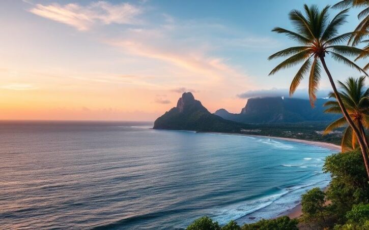
Nestled between the Caribbean Sea and the Pacific Ocean, Costa Rica is a true gem of Central America, renowned for its exceptional biodiversity and breathtaking landscapes.
In this country where nearly 26% of the territory consists of national parks and nature reserves, geographical contrasts offer stunning panoramas, ranging from paradisiacal beaches to lush tropical forests, and imposing mountain ranges.
Costa Rica’s tropical climate, divided between a dry season and a rainy season, enriches the diversity of its fauna and flora, attracting millions of visitors each year in search of adventure and discovery.
Discover how this land of volcanoes, traversed by the spectacular Cordillera de Talamanca, successfully manages the bold challenge of combining nature conservation and economic development, making Costa Rica one of the most progressive nations in environmental matters.
General Geography of Costa Rica
Geographical Location:
Costa Rica is located in the heart of the Central American isthmus, between the 8th and 11th degrees north latitude, bordered by Nicaragua to the north, Panama to the southeast, the Caribbean Sea to the east (212 km of coastline) and the Pacific Ocean to the west (1,016 km of coastline). Its capital is San José.
Total Area:
| Area | Including Water |
| 51,100 km² | of which approximately 40 km² is water |
Main Physical Characteristics:
- A country marked by high topographical diversity.
- Crossed by several mountain ranges forming an axis from northwest to southeast.
- Presence of narrow coastal plains and vast tropical forests.
Main Geographical Regions:
Mountain Ranges (Cordilleras):
- Central Cordillera
- Talamanca Cordillera
- Several major volcanoes: Cerro Chirripó (highest point at 3,819 m), Irazú, Poás, Arenal.
These landforms strongly influence regional microclimates.
Coastal Plains:
- Caribbean Plain: hot and humid year-round, favoring dense tropical forests.
- Pacific Plain: drier in its northwestern part (Guanacaste) with wooded savannas; more humid towards the south (Puntarenas).
Tropical Forests and Wetlands:
- Humid tropical forest on the Caribbean coast
- Cloud forest at high altitude (Monteverde)
- Mangroves on the coastlines
Main Rivers and Bodies of Water:
| River/Lake | Characteristic/Climate Impact |
| San Juan | Border with Nicaragua |
| Tempisque | Long river of Guanacaste |
| Reventazón | Important for hydroelectricity |
| Térraba | Longest entirely national river |
| Lake Arenal | Largest lake in the country |
The numerous waterways contribute to local climate regulation (hydric buffer effect), support aquatic biodiversity, and enable abundant hydroelectricity. Areas near rivers sometimes experience seasonal flooding or flash floods.
Protected Areas & National Parks:
Approximately 25% of the territory has protected status. Among the main areas:
- Tortuguero National Park
- Corcovado National Park
- Manuel Antonio National Park
- Monteverde Biological Reserve
These areas protect mangroves, primary/tropical dry or humid forests, active/inactive volcanoes, and marine habitats rich in biodiversity.
Costa Rica’s exceptional biodiversity stems directly from its location between two major biological continents (North/South America) combined with its significant altitudinal variations. This ecological mosaic is home to nearly 5% of the world’s known species while the country represents only a tiny fraction of the Earth’s landmass.
The Main Regions of Costa Rica
| Region | Historical and Geographical Introduction | Capital or Main Cities | Economic Characteristics | Cultural Characteristics | Environmental Characteristics | Natural or Tourist Attractions | Recent Statistics |
| Central Valley | Historical region, heart of settlement, crossed by the central cordillera. Hosts over half the population and the capital San José. Average altitude, temperate climate. | San José, Alajuela, Heredia, Cartago | Administrative, economic, financial, and industrial center of the country. | Blend of rural and urban cultures. Strong Spanish influence, colonial heritage in Cartago. | Fertile region, cloud forests, volcanoes (Irazú, Poás). | Irazú and Poás volcanoes, La Paz Waterfall Gardens, historic towns. | San José metropolitan area: approx. 2 million inhabitants. |
| North Pacific (Guanacaste) | Former province of the Captaincy General of Guatemala, annexed to Costa Rica in 1824. Flat terrain, drier climate. | Liberia, Nicoya, Santa Cruz | Livestock, agriculture (sugar cane, melon), beach tourism. | Guanacasteco heritage, traditions of music, dance, and Creole cuisine. | Dry savanna, beaches, national parks (Rincón de la Vieja). | Tamarindo beaches, Playa Flamingo, Santa Rosa National Park. | Guanacaste Province: ~400,000 inhabitants. |
| Central Pacific | Transition zone between the dry north and humid south, rugged terrain, high biodiversity. | Puntarenas, Quepos, Jaco | Fishing, tourism (beach resorts), agriculture. | Blend of coastal cultures and mestizo influences. | Tropical forests, mangroves, abundant wildlife. | Manuel Antonio National Park, Jaco beaches, Carara Reserve. | City of Puntarenas: ~35,000 inhabitants. |
| South Pacific | More isolated region, mountainous terrain (Talamanca cordillera), strong indigenous presence. | Golfito, Puerto Jiménez | Agriculture (banana, oil palm), ecotourism. | Bribri and Cabécar indigenous communities, living traditions. | Primary forests, exceptional biodiversity, wetlands. | Corcovado National Park, Osa Peninsula, Piedras Blancas Park. | Dispersed population, low density (~5% of national population). |
| Caribbean (Limón) | Region historically marked by Afro-Caribbean immigration, humid tropical climate, vast coastal plain. | Limón, Puerto Viejo, Cahuita | Commercial port, banana, cocoa, tourism. | Afro-Caribbean culture (calypso music, carnival, English Creole). | Humid forests, coral reefs, marine biodiversity. | Tortuguero National Park, Cahuita beaches, Gandoca-Manzanillo Reserve. | Limón Province: ~450,000 inhabitants. |
Key Points to Remember
- Geographical Diversity: mountains, volcanoes, plains, coastlines, two maritime fronts (Pacific and Caribbean).
- Economy: tourism, agriculture, fishing, and services dominate depending on the region.
- Culture: Spanish, indigenous, and Afro-Caribbean heritages coexist.
- Environment: over 25% of territory protected, 6% of world’s biodiversity.
- Climate: dry season (Dec.-Apr.), rainy season (May-Nov.), precipitation varies greatly by region (from 1,867 mm/year in San José to over 3,500 mm/year in Limón).
Main National Parks and Reserves:
- Manuel Antonio (wildlife, beaches)
- Corcovado (biodiversity, jaguar, tapir)
- Tortuguero (sea turtles)
- Santa Rosa (history, savannas)
- Rincón de la Vieja (volcanoes, hot springs)
Complementary Statistics
- Total country area: 51,100 km²
- National population: ~5.2 million (2024)
- GDP per capita: ~13,000 USD (2023)
The richness and diversity of Costa Rica’s regions make it a sought-after destination for discovering nature, culture, and biodiversity.
Good to Know:
Unlike other regions, Guanacaste is known for its prolonged dry season, ideal for discovering its renowned beaches like Playa Conchal, while the Central Valley is home to the capital San José, the economic and cultural epicenter of the country.
Major Cities and the Largest City
San José, the capital and largest city of Costa Rica, holds a central place in the country’s life, economically, culturally, and politically. It concentrates the main government institutions, numerous headquarters of national and international companies, and a vibrant cultural offering: museums, major theaters like the Teatro Nacional, art galleries, and festivals punctuate the life of this modern metropolis. Its history began in the 18th century as a colonial village; it became the capital in 1823 after national independence. Since then, San José has experienced rapid urban development that accelerated in the late 19th century with the coffee boom and later banana exports. Today, the city remains at the forefront of economic innovation (especially in technology and services), while affirming its status as a national artistic center.
Recent Data on Urban Population:
| City | Approximate Urban Population | Main Role |
|---|---|---|
| San José | Approximately 1,400,000 (urban area) | Political, economic, and cultural center |
| Alajuela | ~300,000 | Industrial/agro-industrial & logistics hub |
| Cartago | ~160,000 | Historical/religious city & light industry |
| Heredia | ~130,000 | University/technological center |
San José concentrates about 7% of the national population within its direct administrative limits but nearly one-third if considering its entire metropolitan area.
Distinct Roles of the Main Cities:
- Alajuela
Close to the Juan Santamaría International Airport (the main air access to the country), it is a major logistics hub for domestic/foreign trade. The city also benefits economically from tourism due to its proximity to Poás Volcano National Park. - Cartago
The former colonial capital until 1823, it retains strong historical significance for Costa Ricans. It hosts thousands of pilgrims each year who visit the Basilica of Our Lady of the Angels. - Heredia
Nicknamed “the city of flowers,” Heredia combines colonial architectural heritage and academic dynamism thanks to its renowned campuses; it is also a growing technological hub located near industrial free zones.
Urban Growth & Environmental/Infrastructure Impact:
The rapid growth around San José has led to extensive urbanization towards Alajuela-Heredia-Cartago, forming a vast interconnected conurbation linked by highways that are often congested during rush hours.
Major challenges include:
- Increased pressure on existing road networks
- Local air pollution due to traffic
- Ecological fragmentation linked to urban sprawl
Local policies now encourage sustainable development: improvement of public transport (suburban rail networks), multiplication of urban green spaces, and incentives for green building.
In summary:
- San José dominates with its cultural/culinary diversity and its role as the engine of the national economy.
- Alajuela stands out for its international logistics/nature tourism.
- Cartago distinguishes itself as a major historical/spiritual center.
- Heredia shines through its innovative universities/emerging technological hubs.
Together, these cities shape a modern Costa Rica facing classic challenges related to rapid urbanization while affirming their own identity within the national territory.
Good to Know:
San José, with its growing population, is the economic and cultural heart of Costa Rica, while Alajuela, Cartago, and Heredia play important historical and economic roles; this rapid urbanization poses major environmental challenges.
Borders and Neighboring Countries
Costa Rica is located in the heart of the Central American isthmus, between latitudes 8° and 11° north and longitudes 82° and 86° west. It occupies a strategic position, bordered to the west-southwest by the Pacific Ocean and to the east-northeast by the Caribbean Sea (Atlantic), giving it direct access to both major ocean basins.
| Oceans Bordering Costa Rica | Side of the Country | Approximate Coastline Length |
|---|---|---|
| Pacific Ocean | Southwest | ~1,078 km |
| Caribbean Sea (Atlantic) | East-northeast | ~212 km |
This dual maritime frontage strongly influences the climate:
- The Caribbean regions receive abundant rainfall year-round, favoring lush vegetation.
- The Pacific slope experiences a more marked dry/wet season alternation.
The climatic diversity combined with mountainous terrain (central and Talamanca cordilleras) explains the exceptional richness of Costa Rican biodiversity: tropical forests, mangroves, varied beaches, and numerous unique ecosystems.
Costa Rica shares its land borders with two countries:
- To the north-northwest: Nicaragua, for approximately 309 km
- To the southeast: Panama, for approximately 339 km
| Border Country | Geographical Position | Land Border Length |
|---|---|---|
| Nicaragua | North-northwest | ~309 km |
| Panama | Southeast | ~339 km |
These borders are crucial for:
- Regional Trade: road transit, agricultural and industrial exchanges
- Culture: historical migratory flows, linguistic sharing (Spanish), common culinary traditions
- Diplomatic Relations: bilateral agreements for border security, shared environmental management
The legal framework of the borders is based on bilateral treaties ratified after several minor historical disputes, mainly with Nicaragua concerning the course of the San Juan River. These disputes have generally been settled through international arbitration or direct negotiations.
Cross-border Cooperation Efforts:
- Joint surveillance against illicit trafficking
- Common environmental projects in border protected areas
- Trade facilitation through customs modernization
Recapitulative list:
- Central location in Central America
- Opening onto two oceans influencing remarkable climate and biodiversity
- Land borders: Nicaragua (~309 km) to the north/northwest; Panama (~339 km) to the south/southeast
- Increased commercial, cultural & diplomatic importance thanks to these regional interfaces
Ongoing cooperation efforts make Costa Rica a stable actor in the region despite some past disputes resolved peacefully.
Good to Know:
Located in Central America, Costa Rica is bordered to the west by the Pacific Ocean and to the east by the Caribbean Sea, sharing borders of 309 km with Nicaragua to the north and 339 km with Panama to the southeast, which profoundly influences its tropical climate and rich biodiversity. Although often peaceful, these borders have been at the heart of minor historical disputes, but they are now essential for trade, culture, and diplomatic exchanges, with ongoing efforts to strengthen cross-border cooperation.
Disclaimer: The information provided on this website is for informational purposes only and does not constitute financial, legal, or professional advice. We encourage you to consult qualified experts before making any investment, real estate, or expatriation decisions. Although we strive to maintain up-to-date and accurate information, we do not guarantee the completeness, accuracy, or timeliness of the proposed content. As investment and expatriation involve risks, we disclaim any liability for potential losses or damages arising from the use of this site. Your use of this site confirms your acceptance of these terms and your understanding of the associated risks.

Cyril Jarnias is an independent expert in international wealth management with over 20 years of experience. As an expatriate himself, he is dedicated to helping individuals and business leaders build, protect, and pass on their wealth with complete peace of mind.
On his website, cyriljarnias.com, he shares his expertise on international real estate, offshore company formation, and expatriation.
Thanks to his expertise, he offers sound advice to optimize his clients' wealth management. Cyril Jarnias is also recognized for his appearances in many prestigious media outlets such as BFM Business, les Français de l’étranger, Le Figaro, Les Echos, and Mieux vivre votre argent, where he shares his knowledge and know-how in wealth management.





