
 Published on and written by Cyril Jarnias
Situated in the heart of Southern Africa, Botswana presents a geographical face that is deceptively simple and complex at once. From afar, the country appears as a vast, nearly flat tableland, perched at about 1,000 meters above sea level and dominated by the sands of the Kalahari. But upon closer inspection, this landlocked territory reveals itself as a puzzle of semi-arid deserts, flooded deltas, salt pans, wooded savannas, and rare river valleys that structure human settlement, the economy, and the landscapes.
Botswana is an arid territory where water scarcity and the dry climate have shaped settlement and development. The population is small and concentrated in the east of the country, where the main cities are also located. This particular geography makes it both a regional crossroads and a major destination for nature tourism, thanks to its vast protected areas. Urbanization is rapid, making the country a case study of the interaction between a challenging environment and growth.
A landlocked country at the center of Southern Africa
Botswana, officially the Republic of Botswana, covers approximately 581,730 km², an area comparable to that of France. The country is entirely landlocked: it has no coastline, but a network of borders totaling over 4,000 km with four neighbors — South Africa to the south and southeast, Namibia to the west and north, Zimbabwe to the northeast, and a very brief contact with Zambia to the north.
Length in meters of the border segment between Zambia and Botswana near Kazungula, one of the shortest in the world.
The western borders are largely drawn with a ruler, along meridians and parallels that cross the Kalahari Basin. In the east and south, some sections follow watercourses or old wagon trails. The country, sometimes described as “land-linked” rather than simply landlocked, plays a pivotal role in road trade between South Africa, Namibia, Zambia, and Zimbabwe, thanks in particular to its road network and infrastructure like the Kazungula Bridge.
A nearly uniform sandy plateau, but with symbolic relief
In terms of relief, Botswana shows great uniformity. Almost the entire territory rests on a vast African plateau at about 1,000 meters above sea level. The typical landscape is one of gently rolling plains, carpeted with sands of varying depth, with an often clear horizon.
Botswana’s highest point is Monalanong Hill, in the southeast, at 1,495 meters. Other notable relief features include Otse Hill and the Tsodilo Hills in the northwest, the latter being a UNESCO World Heritage Site for its rock paintings. The lowest point is at the confluence of the Limpopo and Shashe rivers, in the east, with an altitude varying between 500 and 660 meters.
The entire country lies within the great Kalahari Basin. Underfoot, an ancient basin is filled with aeolian sands several tens of meters thick. Much of the most “visible” landforms result less from tectonics than from ancient hydrological phenomena: ancient lake beds, fossil deltas, faults that still guide rivers today.
Three major physical units: hardveld, sandveld, and ancient lakes
Geographers distinguish three major natural units, which summarize the internal geography of Botswana well.
In the east, the hardveld constitutes a band of rockier terrain, with hills, granite outcrops, and less sandy soils. This is where the majority of the population, agriculture, and infrastructure are concentrated. The hills of the hardveld support a denser wooded savanna, especially with mopane, croton, and combretum on slopes and ridges.
In the center and west, the sandveld forms the heart of the Kalahari. It is characterized by deep orange or whitish sands, highly draining, which support savannas of acacias, thorny bushes, and xerophytic grasses. Watercourses are rare and often temporary, making villages largely dependent on groundwater for their water supply.
Finally, in the north, there are vast basins of ancient continental lakes</strong, of which today only river deltas and salt pans remain: the Okavango Delta, the Makgadikgadi Pans, and various swamps fed by the Chobe, Linyanti, or Kwando. These spaces, both flat and hydromorphic, covered with silt and salts, structure habitats very different from the rest of the country.
Kalahari, Okavango, and Pans: the major geographical triptych
To say that Botswana is “the country of the Kalahari” is no exaggeration: over 70% of its area is covered by this sandy expanse. But this Kalahari is more of a semi-arid savanna than a barren desert. Vegetation alternates between grasses, thorny shrubs, and a few scattered trees, and the rains, although low and irregular, are enough to support remarkable wildlife.
In contrast, the northwest is home to one of the world’s largest inland deltas: the Okavango Delta. Here, a river coming from the Angolan highlands — the Okavango, called Kubango in Angola and Kavango in Namibia — fans out into the sand instead of reaching the ocean. The result: a labyrinthine network of channels, islands, swamps, and floodplains covering 15,000 to over 20,000 km² depending on the season.
The Okavango Delta
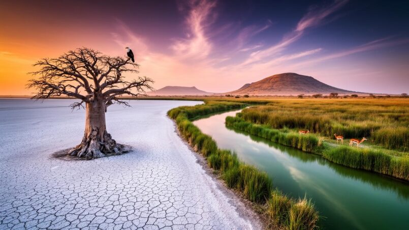
Further east, the Makgadikgadi Pans form one of the largest salt pan complexes on the planet. These white basins, covered with salt layers up to five meters thick, are the remnants of a giant ancient inland lake, now completely evaporated. The main pans — Nwetwe, Sua, Nxai — are surrounded by grassy plains and scattered thickets.
These three units — Kalahari, Okavango, Makgadikgadi — concentrate most of the large protected areas: Central Kalahari Game Reserve, Kgalagadi Transfrontier Park, Chobe National Park, Moremi, Makgadikgadi and Nxai Pan National Parks. Their physical configuration determines wildlife presence, the hydrological regime, and also the very sparse human settlement in the west and north.
Semi-arid climate and distinct seasons
Botswana has a climate generally described as semi-arid and subtropical. Two parameters dominate: the subtropical latitude and especially the altitude of the plateau, around 1,000 meters, which partially moderates extreme heat.
Two main seasons are clearly distinguished. The Southern Hemisphere summer, from October to April, is hot to very hot and constitutes the rainy season. Average monthly temperatures then often oscillate between 29.5°C and 32°C (85°F and 90°F), with afternoons frequently climbing to 35°C (95°F) and, during heat waves, up to 38–44°C (100–111°F). The northern part generally experiences its peak heat between September and November; further south, the maximum shifts to December–January, with late October often considered the hottest period nationwide.
The Southern Hemisphere winter, from April to September, is characterized by dry, sunny weather. Days are pleasant with temperatures often between 20 and 25°C (68–77°F). However, nights can be very cool, with frequent frosts in the southwest and on the high ground, where the mercury can approach or dip slightly below freezing. June and July are the coolest months. The thermal contrast between day and night is particularly marked during this dry season, especially in the most arid areas.
Air humidity generally remains low: around 20–40% in winter, slightly higher in summer, where it can reach 60–80% in the morning before falling again in the afternoon. This combination of strong sunlight, dry air, and seasonal winds explains evaporation rates that far exceed annual rainfall over a large part of the territory.
Unpredictable rains, decreasing towards the southwest
Rainfall follows a very seasonal pattern: most precipitation falls between October–November and March–April, with a peak generally in December–January–February. The dry season then stretches from April–May to September–October, with months like June to August almost completely devoid of rain.
Spatial distribution is very uneven. The gradient is clear from northeast to southwest:
| Region / zone | Approximate average annual rainfall |
|---|---|
| Northeast (Chobe, plateau) | > 650 mm, sometimes > 700 mm |
| North (Okavango, Maun) | ~ 450 mm |
| Southeast (Gaborone) | 450–500 mm |
| Extreme east (Limpopo) | < 400 mm |
| Southwest (Kalahari) | < 250 mm, sometimes ~ 127 mm |
Rain rarely falls in long sequences. It most often takes the form of brief, intense, and highly localized thunderstorm showers in the late afternoon or evening. Consecutive rainy days are rare, and much of the water received is quickly lost through runoff, deep infiltration, evaporation, and plant transpiration.
Characteristics of precipitation and extreme events in the region
Overall low rainfall in the south and west, leading to high interannual variability, particularly marked in the driest areas.
Frequent drought episodes, which can last several consecutive seasons.
Some years see flash floods and inundations, mainly in the eastern region.
Wind, dust, and large-scale climatic influences
Between the end of winter and the beginning of summer, from August to October, a “time of winds and dust” often sets in. Westerly winds lift the sand of the Kalahari, reducing visibility and covering installations with fine particles.
Botswana’s climate results from a complex interplay between the altitude of the plateau and the country’s position at the crossroads of oceanic air masses. Flows of warm, humid air from the Indian Ocean clash with the cooler, drier influences from the South Atlantic. The southward oscillation of the Intertropical Convergence Zone (ITCZ) during the austral summer largely drives the arrival of rains in the north of the country.
Added to this dynamic is the influence of the ENSO (El Niño–Southern Oscillation) phenomenon. El Niño episodes tend to increase the risk of drought, while La Niña increases the probability of heavy rains, and even floods and inundations, particularly in the northern and eastern basins. To these “internal” risks are sometimes added the remnants of tropical cyclones born in the Mozambique Channel or off the Indian Ocean, which can penetrate the territory as depressions bringing torrential rains, as shown, for example, by episodes like Dineo or Japhet cited in the sources.
Climate change: a country warming fast
Observations over several decades show that Botswana is not immune to global warming. Since the early 1960s, the average temperature is estimated to have increased by about 2°C (3.6°F), with particularly marked warming during the dry season. Records indicate an increase in the number of hot days and nights, at the expense of cool days and cold nights.
Projected temperature increase in degrees Celsius by the end of the century compared to pre-industrial levels.
Projections also suggest a lengthening of heat periods: “heat waves” could extend by 62 to 80 additional days per year. Dry periods would also lengthen: about five more days in a world at +1°C, and up to 15–19 more days in a world at +2°C. Average annual rainfall could decrease by 2 to 7% for +1°C and by 5 to 12% for +2°C. Paradoxically, indices of extreme rainfall would increase, reflecting more intense but rarer episodes.
On the ground, these trends accentuate already strong vulnerabilities: more frequent or severe droughts, degradation of rangelands, increased strain on water resources, but also greater risk of flash floods during violent thunderstorm showers.
From shrub savanna to mopane forests
Botswana’s vegetation cover is expressed almost exclusively on the register of savanna. It is not a uniform savanna: formations vary according to soils, rainfall, and altitude.
In the dry southwest, the framework consists of a shrub savanna of acacias, often low, punctuated by thorny bushes and drought-resistant grasses. Moving north and east, the savanna gains height: shrubs turn into small trees, then into denser wooded parks, up to open forests.
The eastern hardveld presents rocky slopes with a wooded savanna dominated by the Croton and Combretum genera. Over a large part of the north and east of the country, outside the floodplains of the Okavango and around the pans, extends a vast mopane savanna. This tree, sometimes called “African ironwood,” forms dense woodlands that are highly favored by herbivores like the elephant.
Around the Okavango and Makgadikgadi Pans, the scenery changes again: wide grassy plains extend to the immediate vicinity of the flood zones, offering a marked contrast with the Kalahari bush. These seasonally flooded grasslands attract spectacular herbivore migrations during the rains, notably zebras and wildebeest, which travel several hundred kilometers between Chobe and Nxai Pan.
The share, in percentage, of the territory covered by forests or wooded formations.
A country shaped by scarce water and major watersheds
Despite the spectacle of the Okavango or flooded pans in the rainy season, Botswana is a country where surface water remains globally very scarce and often temporary.
The territory can be read through four major drainage systems. In the north, the Chobe belongs to the Zambezi basin, the second great river of Southern Africa flowing into the Indian Ocean. The Chobe, which changes names along its course (Cuando, Kwando, Linyanti), runs along the Namibian border before joining the Zambezi at Kazungula. Its banks attract some of the largest concentrations of elephants in the world.
The Okavango River, about 1,600 km long, originates in Angola, crosses Namibia, and forms a vast delta in Botswana. This system is endorheic, meaning its water does not reach the sea: it infiltrates into the ground or evaporates. Its overflows feed the Boteti River, thus contributing to the periodic flooding of the Makgadikgadi Pans.
In the east, a third unit is controlled by the Limpopo River, which runs about 1,750 km before reaching the Indian Ocean in Mozambique. Within Botswana, the Limpopo collects a string of tributaries like the Notwane, Bonwapitse, Mahalapye, Lotsane, Motloutse, and Shashe. The Notwane is particularly strategic as it supplies, via the Gaborone Dam, the capital and its region.
The last certain confluences of the Molopo and Nossob rivers with the Orange River date back to the 19th century.
In most cases, Botswana’s rivers are seasonal: apart from a few more perennial stretches of the Chobe, Okavango, Boteti, and Limpopo, they flow only for a few weeks or months after the rains, in the form of sometimes brutal floods. The numerous pans dotting the savanna — natural basins that fill with water — rarely retain water beyond the core of the rainy season.
This contrast between a relatively better-watered north, rich in permanent wetlands, and a southwest almost devoid of surface water largely explains human distribution, the location of protected areas, and water management challenges. Nearly three-quarters of the population and livestock depend on groundwater, pumped via boreholes and wells.
Protected areas among the largest in the world
The geography of Botswana is also read through its map of national parks, game reserves, and wildlife management areas. According to sources and years, between 29 and nearly 40% of the territory is allocated to the conservation of biodiversity in one way or another, placing the country among the world champions in terms of the proportion of protected areas.
Chobe National Park is home to the highest concentration of African elephants, with an estimated population of over 100,000 in northern Botswana.
In the southwest, the Kgalagadi Transfrontier Park perfectly illustrates the sandy topography of the Kalahari, with its red dunes, fossil riverbeds (Auob, Nossob), and its camelthorn thickets. Approximately 75% of this binational park lies on the Botswana side.
The Central Kalahari Game Reserve, with its 52,800 km², is among the largest nature reserves in the world. Situated in the heart of the sandy plateau, it preserves an almost intact dry savanna landscape, a refuge for both wildlife and San (Bushmen) communities historically linked to these spaces.
The Okavango Delta, a Ramsar site and World Heritage Site, is partially protected by the Moremi Game Reserve. The latter was the first reserve created at the initiative of a local Tswana community. Together, they cover tens of thousands of square kilometers, including wetlands, riverine forests, plains, and wooded islands.
The scale of these protected areas, combined with rich wildlife (lions, leopards, cheetahs, African wild dogs, numerous antelopes, buffalo, giraffes, hippos, crocodiles, over 400 to 450 bird species depending on the site) shapes not only the ecological geography but also an essential part of the economy via tourism based on the principle of “low volume, high yield.”
A sparse population, concentrated in the east
Despite its size, Botswana is one of the least densely populated countries in the world. In 2022, the average density was around 4 inhabitants/km²; recent estimates hover around 4.4 to 5 inhabitants/km². This average masks deep regional contrasts.
Census data clearly show a concentration of the population in the eastern fringe, in a corridor running from the northeast (Zimbabwe border) to the southeast (Gaborone region), near the South African border. This eastern band precisely corresponds to the better-watered hardveld zone, where soils are more favorable and where cities, mines, infrastructure, and arable land have developed.
Some regions of Botswana, like the Central Kalahari Game Reserve, have a population density of less than one inhabitant per square kilometer.
The table below, based on different statistical sources, illustrates this contrast between eastern and western districts:
| District / City | Area (km²) | Population (≈ 2022) | Density (inh./km²) |
|---|---|---|---|
| Gaborone (city) | ~196 | ~246,000 | > 1,250 |
| Orapa (mining town) | 79–159 (depending on source) | 8,600–8,700 | ~1,050 |
| Central District | ~142,000–148,000 | ~585,000–652,000 | 4–4.5 |
| South East District | 1,780 | ~85,000–111,000 (excluding Gaborone) | 47–63 |
| Kweneng District | 31,100 | ~304,000–388,000 | 10–12.5 |
| North West District | 109,130 | ~152,000–198,000 | 1.4–1.8 |
| Ghanzi District | 117,910 | 43,000–56,000 | < 0.5 |
| Kgalagadi District | 105,200 | 50,000–59,000 | ~0.5–0.6 |
Gaborone, the capital, alone concentrates over 10% of the national population on a limited territory, explaining its very high density compared to the rest of the country. Francistown, the country’s second city, also has a density well above the national average, while remaining significantly less dense than the capital.
An administrative grid following human geography
To organize this vast and heterogeneous territory, Botswana relies on a relatively simple but constantly evolving administrative division. The country has ten large rural districts, two urban districts (Gaborone and Francistown), and four towns or towns with urban council status (Lobatse, Selebi-Phikwe, Jwaneng, Sowa). Depending on the approach, some documents mention nine “main” districts, with Chobe and Ngamiland having merged or separated several times over the course of reforms.
The large districts cover contrasting geographical and demographic realities. The Central District, the largest in area and population, extends from the northeast towards the center of the country. It includes the Limpopo Basin, part of the Makgadikgadi Pans, and semi-arid savanna areas. The North West district (formerly Ngamiland) encompasses the Okavango Delta, associated wetlands, and much of the safari tourism land. Ghanzi and Kgalagadi, to the west and southwest, mainly cover the Kalahari, with very low densities.
The structure into sub-districts allows for more refined management, especially in vast districts like Central or North West. The local level is ensured by district and city councils, which are responsible for many services — health, education, planning — and thus have a strong influence on spatial organization.
In practice, the administrative map closely follows the physical geography: boundaries often follow rivers (Shashe, Limpopo, Chobe), watershed lines, or pans, which facilitates the planning of water resources and infrastructure.
Cities and roads: a geography of an eastern corridor
Urbanization, still limited in the 1970s, accelerated with the discovery of mines and economic growth. Gaborone, created as a planned capital in the 1960s for 20,000 inhabitants, now exceeds 200,000 inhabitants and is the main administrative, economic, and university hub. Its development occurred in the southeast, near the South African border, benefiting from a slightly wetter climate and good road accessibility.
Francistown, located in the east near Zimbabwe, is a major structuring hub, serving as a railway and road crossroads towards Zambia, Zimbabwe, and the Democratic Republic of Congo. Other large localities like Serowe, Mahalapye, Palapye, Molepolole, Maun, and Kasane line this eastern corridor, often along important road axes such as the A1 (north-south axis) and the A3 (west-east transversal axis).
This road “backbone” broadly follows the hardveld fringe, more suitable for the establishment of villages and towns. To the west, the Trans-Kalahari Highway gave new impetus to towns like Ghanzi, connecting them more directly to Namibia and the Atlantic Ocean.
The road map of Namibia illustrates a strong concentration of infrastructure in the east. Out of a total network of over 32,000 km, the majority of paved roads are located in the eastern districts, meeting the most important transport needs. In contrast, the western part of the country is mainly served by dirt roads, gravel roads, or simple sandy tracks. This contrast between a well-connected east and a more isolated west stems directly from geographical realities: a wetter climate, more favorable soils, better access to surface water, and proximity to the major economic borders of South Africa and Zimbabwe.
A climate shaping agriculture, livestock, and environmental risks
The physical and climatic geography of Botswana is also reflected in land use. Over 70% of the territory is used for communal grazing, mainly in the form of extensive ranching. Cattle farming largely dominates a fragile rain-fed agriculture, hit hard by low and irregular rainfall.
Less than 5% of agricultural land can be cultivated solely with rain; the rest depends on heavy inputs like irrigation or is limited to subsistence production (maize, sorghum, millet, beans, peanuts). In the wetter areas of the northeast, crop production is more sustained but remains vulnerable to cyclical droughts.
Overgrazing and pressure on land near water points accentuate soil degradation and desertification, particularly in the Kgalagadi, Kweneng, and Boteti districts. Projects to replant indigenous species are being implemented to restore ecosystems and curb this degradation.
Natural hazards are also directly linked to geography and climate. Recurrent droughts and heat waves primarily strike the Kalahari, while flash floods concern the east more, along the tributaries of the Limpopo and poorly drained urban areas. In the north, fluctuations in the level of the Okavango and the Linyanti swamps create a complex hydrological regime, where years of exceptional floods and years of low overflow alternate.
Tourism and seasons: when geography dictates the calendar
For visitors as for inhabitants, geography and climate impose a real calendar. The winter dry season (April to October) is generally considered the best time for wildlife viewing. Permanent water points — main channels of the Chobe, Okavango channels, residual pools of the Boteti — then become magnets for animals, in landscapes cleared by the fall of grasses.
In Botswana, the rainy season transforms the landscape: vegetation turns green, temporary rivers flow, and vast areas of the pans and delta are flooded. This is the birthing season for many herbivores and the arrival of migratory birds, attracted by the abundance of food in the wetlands.
This alternation of dry/wet seasons, so clear in its manifestations, is in fact modulated by regional geography. The north, wetter and dependent on floods from Angola for the Okavango, experiences a lag between local rains and the arrival of floodwaters. Thus, the plains of the delta are often at their highest in the very heart of the Botswana dry season, around June–July, when the floods from Angolan rains reach the basin. This dissociation between local rains and floods explains the very particular calendar of the delta’s fauna and flora.
A geography at the heart of development challenges
Ultimately, the geography of Botswana is not just a postcard backdrop, between red dunes, sparkling pans, and lush marshes. It intimately structures the economy, population distribution, infrastructure choices, climate risks, and conservation strategies.
The arid Kalahari plateau necessitates activities adapted to low density and water scarcity (safari, extensive ranching, controlled mining). The wetter eastern corridor concentrates human activities but faces rapid urbanization, pressure on water resources, and soil degradation.
The mosaic of northern wetlands — Okavango, Chobe, Linyanti, pans — gives the country global ecological importance, but also a heavy responsibility: managing delicate transboundary hydrological systems, in a context of climate change and population growth, both local and regional.
Between desert and delta, savanna and salt pans, the geography of Botswana therefore remains a central element for understanding not only its landscapes but also its societal choices, its tensions, and its assets in contemporary Southern Africa.
Disclaimer: The information provided on this website is for informational purposes only and does not constitute financial, legal, or professional advice. We encourage you to consult qualified experts before making any investment, real estate, or expatriation decisions. Although we strive to maintain up-to-date and accurate information, we do not guarantee the completeness, accuracy, or timeliness of the proposed content. As investment and expatriation involve risks, we disclaim any liability for potential losses or damages arising from the use of this site. Your use of this site confirms your acceptance of these terms and your understanding of the associated risks.

Cyril Jarnias is an independent expert in international wealth management with over 20 years of experience. As an expatriate himself, he is dedicated to helping individuals and business leaders build, protect, and pass on their wealth with complete peace of mind.
On his website, cyriljarnias.com, he shares his expertise on international real estate, offshore company formation, and expatriation.
Thanks to his expertise, he offers sound advice to optimize his clients' wealth management. Cyril Jarnias is also recognized for his appearances in many prestigious media outlets such as BFM Business, les Français de l’étranger, Le Figaro, Les Echos, and Mieux vivre votre argent, where he shares his knowledge and know-how in wealth management.





