
 Published on and written by Cyril Jarnias
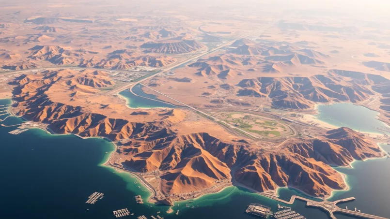
Located at the junction of Africa, Asia, and the Middle East, the Sultanate of Oman occupies the southeastern tip of the Arabian Peninsula. Covering nearly 309,500 to 315,000 km², it is one of the largest states in the region, and also one of the most geographically diverse. Mountains exceeding 3,000 meters, vast deserts, fertile coastal plains, spectacular fjords, and monsoon-swept coastlines form a natural puzzle where each region possesses its own identity.
Oman’s geography, stretching from the Strait of Hormuz to the Dhofar Mountains through wadis and central deserts, is a mosaic of rare ecosystems. It is fundamental to understanding the country’s history, its modern administrative organization, and its environmental challenges.
A strategic location at the crossroads of seas and continents
The country lies between latitudes 16° and 28° North and longitudes 52° and 60° East, straddling the Tropic of Cancer. Its coastline stretches over 2,000 to 3,100 kilometers, depending on sources, bordered by the Gulf of Oman to the northeast and the Arabian Sea to the southeast. A portion of its exclusive economic zone even extends to the vicinity of the Yemeni archipelago of Socotra, towards the Guardafui Channel and the Somali Sea.
The country shares land borders totaling 1,374 km with Saudi Arabia, the United Arab Emirates, and Yemen.
Territorial waters extend 12 nautical miles, the contiguous zone 24 nautical miles, and the exclusive economic zone (EEZ) 200 nautical miles, approximately 533,180 km². This vast EEZ reinforces the country’s importance on regional maritime routes, particularly at the Strait of Hormuz where a significant portion of the world’s oil transits.
Exclaves and enclaves: a unique political geography
The country’s geography in Oman is not limited to its main territorial block. Two exclaves, entirely surrounded by the UAE, give a very particular shape to its borders.
The Musandam Peninsula, in the north, overlooks the Strait of Hormuz. It is separated from the rest of Oman by the United Arab Emirates and features rugged terrain and fjords. The second enclave, Madha, about 75 km², is located within the UAE. It itself contains the micro-enclave of Nahwa, belonging to Sharjah. This intertwining illustrates the complexity of the historical negotiations that shaped regional geopolitics.
A landscape dominated by mountains and deserts
In overview, the physical map of the country’s geography in Oman reads like a triptych: a long coastal strip, a mountainous arc in the north and south, and a vast central desert plateau. The figures give an idea of this balance: approximately 82% of the territory is occupied by valleys and deserts, 15% by mountain ranges, and only 3% by coastal plains.
The Hajar Mountains, the backbone of the north
In the north, a powerful range, the Hajar Mountains, forms an arc of over 700 km from the Musandam Peninsula to Ras al-Hadd, at the eastern tip of the country. This range, which separates the Gulf of Oman coast from the desert interior, is the highest chain in the eastern Arabian Peninsula.
The highest peak, Jabal Shams, and the plateaus of Jabal Akhdar form a highland region with cooler temperatures and significant annual rainfall (up to 400-900 mm). These conditions foster unique ecosystems, hosting endemic species like the Arabian tahr, and have led to the creation of protected areas.
The Hajar range is subdivided into two main massifs separated by Wadi Samail, a broad valley that acts as a natural corridor between the coast and the interior. To the west, the Western Hajar (Al-Hajar Al-Gharbī) dominates the Al Batinah plain. To the east, the Eastern Hajar (Al-Hajar Ash-Sharqī) overlooks the Ash Sharqiyah plains and the dune deserts.
Dhofar, from lush mountains in the south
In the far south, the Dhofar region presents a radically different landscape. A mountain arc, sometimes called the Dhofar Mountains or Qara Mountains, runs along the coast for about 400 km between Ras ash-Sharbatat and the Yemeni border. The peaks reach nearly 2,000 to 2,500 meters at Jabal Samhan.
Under the influence of the summer monsoon, the slopes exposed to the humid winds of Dhofar become covered with dense vegetation, creating a green enclave within a predominantly desert environment. It is in this zone, on the slopes and plateaus watered by the fogs and drizzles of the khareef, that the famous groves of frankincense trees thrive.
The vast central desert plateau
Between the northern and southern mountains, the largest part of the territory is occupied by a desert plateau and gravel plains (seih). To the west, this zone merges into the Rub’ al Khali, the “Empty Quarter,” considered the world’s largest continuous sand desert, which spills over from Saudi Arabia into the country.
In the center and east, other deserts shape the country’s geography in Oman. The Wahiba Sands, or Sharqiyah Sands, form a spectacular sea of dunes, oriented north to south, bordering the plains of the Ash Sharqiyah region. Further northwest, the large salt depression of Umm As Samim, near the Emirati border, is an immense salt flat almost devoid of vegetation.
This desert heart also harbors geological peculiarities: numerous meteorites are found here, outcrops of the Semail ophiolite – a rare sequence of oceanic crust exposed on land – as well as marine fossils found far from the current coast, testifying to ancient seabeds now emerged.
Coasts, fjords, and islands: a multifaceted maritime facade
Over 3,000 kilometers, the coastlines outline highly varied landscapes, between fertile plains, austere cliffs, lagoons, kwars, and archipelagos. This maritime dimension is essential to understanding the country’s geography in Oman, as well as its historical role as a naval and trading power.
The Al Batinah coastal plain
In the north, the Al Batinah plain stretches along the Gulf of Oman, from the Emirati border to the vicinity of the town of As-Sib. This coastal strip, generally between 15 and 80 km wide, is one of the few truly fertile areas of the country. Runoff waters from the Hajar Mountains converge here through a multitude of wadis, irrigating a string of oases fed by wells and by the aflaj systems, those underground channels inherited from ancient hydraulic engineering.
Many important cities have developed on this plain: Sohar, a major industrial port and historic trading city; Rustaq, a former political center; and the agglomerations of the Muscat metropolis further east. Population density and concentration of irrigated land are among the highest in the country here.
The coast from Muscat to Ras al-Hadd
Between As-Sib and Ras al-Hadd, the coast takes on a very different character. Dominated by rocky cliffs, it offers little arable land and few natural shelters for ships. The best natural ports are at Muscat and Matrah, whose protected coves fostered the rise of the political and commercial capital.
The eastern peninsula of Oman, the meeting point between the Gulf of Oman and the Arabian Sea, famous for its beaches and marine wildlife.
The Ras al-Hadd peninsula marks the geographical boundary between the Gulf of Oman and the Arabian Sea.
The beaches of Ras al-Hadd and Ras al Jinz are among the most important sea turtle nesting sites in the region.
The eastern coast and Masirah Island
South of Ras al-Hadd, the coastline runs along the Arabian Sea towards Masirah and Duqm. A large portion of this coast is particularly arid and sparsely populated, with sandy expanses, sebkhas (salt flats), and lagoons, like those of the Barr al-Hikman peninsula, rich in mudflats and wetlands.
Located about fifteen kilometers offshore, this large island approximately 70 km long, windswept and relatively austere, occupies a strategic position at the entrance to the Gulf of Oman and has previously hosted foreign military installations. Ecologically, it is a major nesting site for loggerhead turtles, one of the world’s largest populations of this species.
Masirah Island
The Dhofar coastline
Continuing southwest, the coastline gradually becomes greener approaching Dhofar. The coast, irrigated by the monsoon fogs, harbors coconut groves, small perennial river valleys, and localized mangroves. It is in this region that the city of Salalah is located, the country’s second largest urban area and the capital of Dhofar.
Offshore, the Al Hallaniyat Islands (or Khuriyyā Muriyyā), of which the largest is Al-Ḥallāniyyah, complete the island mosaic. They host coral reefs, seabirds, and contribute to the fishery wealth of the south of the country.
Musandam, the “Arabian Norway”
At the northern extreme, the Musandam Peninsula is perhaps the most spectacular coastal landscape of the country’s geography in Oman. Its mountains plunge directly into the sea, carved by deep sea inlets, like the Khawr ash-Shamm (often nicknamed “Elphinstone’s fjord”) about fifteen kilometers long, bordered by cliffs sometimes exceeding 1,000 meters. This morphology earns it the nickname “Norway of Arabia.”
These fjords, combined with Musandam’s position on the Strait of Hormuz, give this region a singular strategic and touristic importance.
Climate: between scorching desert and verdant monsoon
The country’s geography in Oman is matched by an equally contrasting climatic range. Overall, the territory falls under a hot desert climate (Köppen classification BWh): scorching summers, low and irregular rainfall, strong aridity. But the influence of the mountains and the khareef in the south creates unexpected microclimates.
A predominantly arid country
Over most of the territory, summer temperatures regularly exceed 95 to 104 °F (35 to 40 °C), and in the desert interior, maximums can approach or even exceed 122 °F (50 °C). The northern coast, particularly the Al Batinah coast and the Muscat region, combines heat and high humidity, resulting in a particularly trying feel. An impressive record illustrates this thermal excess: in the coastal village of Qurayyat, a minimum temperature of 108.7 °F (42.6 °C) was recorded in the early morning, meaning it did not drop below this threshold overnight.
In winter, from December to February, temperatures become much more temperate, generally ranging between 63 and 79 °F (17 to 26 °C) depending on the region. In the mountains, nights can be cold, sometimes near 32 °F (0 °C) at high altitude, with risks of frost in the highest sectors of Jabal Shams or Jabal Akhdar.
Annual precipitation on the coastal plains and interior plateaus remains modest, between 20 and 100 mm, with an average around 100 mm in Muscat. It is also highly irregular, with some areas near Masirah possibly experiencing an almost rainless year. In contrast, the mountains capture more clouds: the Hajar Mountains, and particularly Jabal Akhdar, can receive over 400 mm, even up to 900 mm per year according to some estimates.
The khareef of Dhofar, a unique monsoon in the region
In Dhofar, the climate changes radically in summer. From June to September, the southwest monsoon, called khareef, brings fogs, drizzles, and humid winds from the Indian Ocean. Maximum temperatures then remain significantly lower than in the rest of the country, often around 81-82 °F (27–28 °C) in Salalah during July-August.
Under the effect of this persistent humidity, the mountain slopes become covered in grasslands, small streams, and seasonal waterfalls, while the coast becomes a green ribbon of coconut groves and crops. This contrast attracts many regional visitors seeking to escape the extreme heat of other Gulf countries.
Cyclones, winds, and fogs
Beyond the heat and aridity, the country’s geography in Oman also exposes the territory to several climatic hazards. The Arabian Sea is an area of tropical cyclone formation. Some reach the sultanate’s coasts, bringing torrential rains and violent winds. Episodes like Gonu (2007), Phet (2010), Keila (2011), Mekunu (2018), or Shaheen (2021) left their mark with sudden wadi floods, landslides, and coastal damage.
In summer, a hot wind from the interior, the gharbī, can abruptly raise temperatures on the Gulf of Oman coast by several degrees in a short time. Furthermore, sand and dust storms sometimes accompany air flows from desert areas.
Certain portions of the coast, notably on the east and in Dhofar, are regularly shrouded in fog, especially during the monsoon season. This thick mist reduces visibility but nourishes original ecosystems, classified among the “coastal fog deserts” of the Arabian Peninsula.
Wadis, scarce water, and hydraulic ingenuity
The absence of permanent rivers is another major characteristic of the country’s geography in Oman. The hydrographic network is composed of wadis, dry valleys most of the year but capable of turning into violent torrents during rainy episodes.
A network of spectacular wadis
Among the most well-known, Wadi Samail crosses the Hajar Mountains, creating a natural passage between the coast and the interior. Wadi Nakhr cuts deeply into the massif at the foot of Jabal Shams, forming what is often called the country’s “Grand Canyon.” Others, like Wadi Shab, Wadi Tiwi, Wadi Bani Khalid, Wadi Dayqah, Wadi Bani Awf, or Wadi Darbat in Dhofar, have become iconic sites for hiking and nature tourism, combining water pools, palm groves, and rock walls.
In the absence of perennial rivers, water supply relies on three main methods: exploitation of groundwater, collection of runoff via dams, and the use of traditional irrigation systems.
Aflaj and dams: a hydrological heritage
The aflaj, channels and galleries draining aquifers or springs to cultivated areas, constitute a fundamental legacy of the human geography of the country in Oman. These gravity systems, sometimes underground, distribute water among farms according to precise community rules. Some networks are inscribed as World Heritage for their historical and technical value.
The country’s renewable water resources are limited to about 1.4 km³ per year, placing it among the states most exposed to water stress.
Administrative organization and regional geography
The country’s geography in Oman is also reflected in the architecture of its administrative divisions. The territory is structured into 11 governorates (muhafazah), themselves subdivided into 63 wilayat (provinces or districts). Each governorate has a capital which serves as the main urban and administrative center.
The 11 governorates: a mosaic of regions
The table below summarizes the main geographical elements of each governorate, based on available data (2020 for mentioned populations):
| Governorate | Capital | Approx. Area (km²) | Approx. Population | Dominant Geographical Profile |
|---|---|---|---|---|
| Muscat | Muscat | ~3,500 | ~1,302,000 | Northern coast, Hajar Mountains, major port |
| North Al Batinah | Sohar | ~9,000 | ~1,250,000 | Fertile coastal plain, between sea and Hajar |
| South Al Batinah | Rustaq | ~3,500 | ~465,000 | Coastal plain, numerous wadis, ancient political centers |
| Ad Dakhiliyah | Nizwa | ~31,900 | ~478,000 | Mountainous interior, Jabal Akhdar and Jabal Shams |
| Ad Dhahirah | Ibri | ~37,000 | ~213,000 | Semi-desert interior, transition to the Rub’ al Khali |
| Al Buraimi | Al Buraimi | ~7,460 | ~122,000 | Border region, oases and historical forts |
| North Ash Sharqiyah | Ibra | ~24,361 | ~272,000 | Interior slopes of the Eastern Hajar, edge of the dunes |
| South Ash Sharqiyah | Sur | ~12,039 | ~315,000 | Arabian Sea coast, Wahiba Sands, turtle sites |
| Al Wusta | Haima | ~79,700 | ~52,000 | Central deserts, sparsely populated coast, hydrocarbon zone |
| Dhofar | Salalah | ~99,300 | ~416,000 | Monsooned mountains, fertile coastal plain, frankincense |
| Musandam | Khasab | ~1,800 | ~49,000 | Mountainous exclave, fjords and Strait of Hormuz |
The political, economic, and cultural capital, Muscat, is located on the northern coast, wedged between the Hajar Mountains and the sea. Over half the population lives in the greater metropolitan area encompassing Muscat and the neighboring towns of Seeb and Bawshar, on the coastal plain.
Some major regional groupings
Beyond administrative divisions, several major geographical regions structure the territory.
In northern Oman, the Al Batinah coastal plain concentrates population, irrigated agriculture, and major industrial and port infrastructure, such as Sohar. In contrast, the interior regions of Ad Dakhiliyah and Ad Dhahirah are home to historical cities like Nizwa, former capital of the Imamate, and Ibri, which serves as a gateway to the western desert.
In the east, North and South Ash Sharqiyah encompass the coast of Sur, famous for its shipbuilding heritage, the dune deserts of the Wahiba Sands, spectacular wadis, and the sea turtle nesting sites of Ras al Hadd and Ras al Jinz.
In the center, Al Wusta acts as a connecting link between north and south, encompassing parts of the Rub’ al Khali, a long, still underdeveloped coast, and hydrocarbon production zones. The port of Duqm, under development, occupies an increasingly important place here.
Finally, in the south, Dhofar stands out for its monsooned mountain relief, its frankincense tree forests, its verdant valleys, and its coasts lined with mangroves and lagoons.
Biodiversity: an unexpected hotspot of the Arabian Peninsula
Despite a largely desert environment, the country’s geography in Oman hosts one of the richest biodiversities on the Arabian Peninsula. This biological heritage relies on the diversity of habitats: deserts, mountains, wetlands, islands, coral reefs, mangroves, and fog forests.
Iconic species and varied ecosystems
Available surveys mention over 1,200 species of terrestrial plants, including at least 78 endemic, more than 500 species of marine flora, nearly 1,000 fish species, about a hundred reptiles, two amphibians, more than 500 bird species, and over 90 mammal species.
Among the iconic mammals are the Arabian leopard, whose national population is estimated to be below 200 individuals, with a core in the Jabal Samhan reserve; the Arabian oryx, reintroduced after becoming extinct in the wild in the 1970s; the Arabian tahr, a caprid confined to the rocky slopes of the Hajar Mountains; mountain and sand gazelles; the Arabian wolf; the striped hyena; and foxes and hares adapted to the desert.
The country’s islands and beaches are major nesting sites for sea turtles. Five species frequent its waters, four of which regularly nest there. The beaches of Ras al Jinz, Ras al Hadd, and Masirah host some of the world’s largest nesting colonies, particularly for green and loggerhead turtles.
Offshore, the country has become an important location for whale watching. A dense population of Indian Ocean humpback whales is encountered here, considered genetically distinct, as well as sperm whales and small pygmy blue whales. In the fjords of Musandam lives the Indo-Pacific humpback dolphin, a threatened species.
The mountains, for their part, harbor relict forests of juniper, wild olive, and fig trees, as well as orchards of pomegranates and Damask roses on the terraces of Jabal Akhdar. The mangroves, concentrated mainly near Muscat, in Batinah, and around Salalah, cover about 1,000 hectares and offer nurseries for fish and waterbirds.
Protected areas and environmental challenges
Nearly 4% of the territory is classified as protected areas: terrestrial reserves for the oryx, leopard, or tahr; marine reserves like the Dimaniyat Islands off Muscat, where coral reefs and seabirds benefit from protected status. The Qurm site, in the capital, is a Ramsar-listed mangrove.
Oman’s geography is under strong pressure: overgrazing in the mountains (notably in Dhofar) causes erosion and degradation of vegetation. Coastal developments, oil activities, oil spills, and a vast zone of oxygen-poor waters in the Gulf of Oman threaten marine habitats. Coral reefs are also affected by overfishing, physical destruction, and pollution.
Water resources, already very limited, are overexploited in several basins, leading to coastal soil salinization, seawater intrusion into aquifers, and falling water table levels. Climate change, with an expected temperature rise of 2 to 4 °C by mid-century, risks exacerbating these water tensions and altering monsoon and cyclone patterns.
Cities, population, and human geography
With a total population estimated between 4.6 and 5.5 million inhabitants depending on sources and years, the density remains low, around 17 to 18 inhabitants per km². But this average masks a strong concentration along the coasts, particularly around the capital and on the Al Batinah plain, while the desert interior remains very sparsely populated.
Over 80 to 90% of the Omani population today lives in urban areas.
This demographic imbalance is closely linked to the country’s geography in Oman: water scarcity, limited arable land (0.1% of the surface for temporary crops, 0.12% for permanent crops), difficult-to-access terrain in some mountains or deserts. Urbanized areas therefore developed where water, soil, and maritime routes allowed.
Geography at the heart of strategic and economic issues
Finally, the country’s geography in Oman is inseparable from contemporary geopolitical and economic issues. Its control of the Musandam Peninsula and its proximity to the Strait of Hormuz give it a key role in securing global oil traffic. Its coasts offer 25 fishing ports and significant potential for aquaculture, diving, sailing, and water sports.
The country’s landscape, characterized by vast deserts, sun-drenched plateaus, and windy areas, offers notable potential for renewable energy. Large-scale solar projects (like in Ibri) and wind farms (notably in Dhofar) are under development, exploiting high solar irradiation and regular wind patterns.
Natural resources – oil, gas, copper, chromium, gypsum, marble, limestone, frankincense – have also been strongly conditioned by geology and relief. Hydrocarbon deposits are partly concentrated in the sedimentary basins of the center and south, while metallic minerals are linked to major tectonic units like the Semail ophiolite.
Conclusion: a territory of contrasts and transitions
From the “Arabian Norway” of Musandam to the green mists of Dhofar, from the canyons of the Hajar Mountains to the temporary lakes of the wadis, the country’s geography in Oman offers a condensed version of the Arabian Peninsula at its most extreme and surprising. Far from being a simple homogeneous desert, the territory juxtaposes hyper-arid environments, temperate mountains, fertile coastlines, and fragile island ecosystems.
Oman’s geographical diversity directly influences population distribution, cultures, urban networks, maritime routes, and development strategies. It also imposes major constraints on water management, climate risks, and biodiversity. A thorough understanding of this geography is therefore essential to anticipate future transformations (climatic, economic, demographic) and preserve the sultanate’s unique balances.
Disclaimer: The information provided on this website is for informational purposes only and does not constitute financial, legal, or professional advice. We encourage you to consult qualified experts before making any investment, real estate, or expatriation decisions. Although we strive to maintain up-to-date and accurate information, we do not guarantee the completeness, accuracy, or timeliness of the proposed content. As investment and expatriation involve risks, we disclaim any liability for potential losses or damages arising from the use of this site. Your use of this site confirms your acceptance of these terms and your understanding of the associated risks.

Cyril Jarnias is an independent expert in international wealth management with over 20 years of experience. As an expatriate himself, he is dedicated to helping individuals and business leaders build, protect, and pass on their wealth with complete peace of mind.
On his website, cyriljarnias.com, he shares his expertise on international real estate, offshore company formation, and expatriation.
Thanks to his expertise, he offers sound advice to optimize his clients' wealth management. Cyril Jarnias is also recognized for his appearances in many prestigious media outlets such as BFM Business, les Français de l’étranger, Le Figaro, Les Echos, and Mieux vivre votre argent, where he shares his knowledge and know-how in wealth management.





