
 Published on and written by Cyril Jarnias
Lost archipelago in the heart of the Pacific, the Marshall Islands only receive a handful of visitors each year, about 6,000 in total. Yet this country, spread across 29 atolls and over a thousand islets, concentrates some of the most spectacular lagoon landscapes in the world, as well as a unique cultural and historical heritage, marked by traditional navigation, World War II, and the nuclear era.
To discover the must-see sites of the Marshall Islands, you need to venture off the beaten path. The country is entirely shaped by the ocean, which influences the way of life, economy, and myths. Its geography consists of two chains of atolls: Ralik to the west and Ratak to the east, stretching over 600 nautical miles along a northwest/southeast axis.
In this fragile landscape, where the elevation rarely exceeds two meters, several places clearly stand out for a traveler: Majuro and its lagoon, Eneko and the neighboring islets, Arno, Mili, Jaluit, Likiep, the mythical atolls of Bikini and Kwajalein, and a few key institutions like the Alele Museum or the Waan Aelon in Majol center. Each tells, in its own way, a facet of the archipelago.
Majuro, Gateway and Showcase of the Marshall Islands
Majuro Atoll is the capital, the main aerial gateway to the country via Amata Kabua International Airport, and the largest population center. Nearly all Marshallese, about 97%, live along this long crescent of coral sand bordering a lagoon nearly 30 miles long.
Majuro is hardly a metropolis and tourist infrastructure remains limited, but this is where most cultural visits, lagoon excursion departures, and modern daily life in the country are concentrated. The atoll is often presented as unspectacular at first glance, yet it hides a series of must-see sites.
Laura Village and Laura Beach, the End of the World on the West Side
At the western tip of Majuro, Laura Village offers a glimpse of the more traditional life of the archipelago. The drive, about an hour from central Majuro, follows the thin strip of road laid on the reef, with the ocean on one side and the turquoise lagoon on the other.
Upon arrival, Laura Beach Park opens onto a powdery white sand beach, with shallow, crystal-clear waters ideal for swimming, picnicking, and lazing around. The site sits about 30 feet above sea level, making it the highest point on the atoll, a surprising detail in a country threatened by rising sea levels.
A small symbolic entrance fee is requested for access, intended for site maintenance. Nearby, two monuments serve as reminders that this picture-postcard setting has also experienced climatic and wartime tragedies.
Monuments of Memory: the 1918 Typhoon and Peace Park
On the coastal road near Laura Beach, a massive sandstone monument commemorates a violent typhoon that struck in 1918, killing more than 200 people on Majuro. The structure pays tribute to the dead, but also to the aid that came from Japan: the emperor contributed from his private funds to the reconstruction. This gesture, carved in stone, illustrates the long history of successive dominations – German, Japanese, then American – that the Marshall Islands experienced before their independence.
A little further west, past the airport, stands the Peace Park Memorial, a peace park funded by the Japanese government to honor soldiers who fell in the Pacific during World War II. A stele recalls the memory of more than 19,000 military personnel who died in the Marshall Islands, including over 8,000 on Kwajalein Atoll alone.
These two sites, close to an idyllic beach, powerfully remind us that the archipelago is not just a tropical refuge, but also a territory marked by storms and conflicts.
Majuro Lagoon and its Islets: Enemanit, Eneko, Arno…
In the capital, everything eventually leads to the lagoon. This vast turquoise mirror is not just a backdrop: it’s a playground for snorkeling, diving, kayaking, sport fishing, or outings in traditional canoes. Several islets are prime destinations, accessible in a few minutes or a few tens of minutes by boat.
Travel times and main features give a good idea of the lagoon’s scale.
| Majuro Lagoon Destination | From Majuro (city/port) | Approximate Travel Time | Main Highlights |
|---|---|---|---|
| Enemanit Island | 10 minutes by boat | 10 minutes | Small recreational islet, bar / traditional shelter, snorkeling |
| Eneko Island | Uliga Dock | 20 to 40 minutes | White sand beach, camping, snorkeling, weekend getaway |
| Arno Atoll | Majuro Pier | 45 to 60 minutes | Neighboring atoll, virgin beaches, preserved reefs |
| Ejit Island | Within Majuro Lagoon | Accessible at high tide | Bird sanctuary, 17 nesting species |
Enemanit, the Express Getaway
Across from Majuro, a ten-minute boat ride away, Enemanit Island is the quintessential “afternoon outing” option. Local companies and operators like PII organize trips with a traditional shelter, space for group events, swimming, and snorkeling. People come for a few hours to picnic, cool off, and dive from the beach.
Eneko Island, the Private Postcard
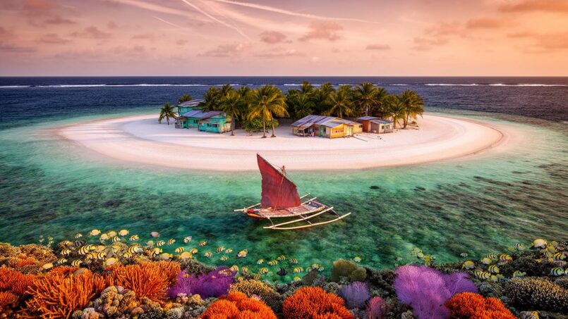
Eneko Island, a small private island north of Majuro, is probably one of the best-known names among visitors. A boat departs from Uliga dock, next to the Robert Reimers Hotel, and takes between twenty and forty minutes depending on the sea. The journey itself, amidst coconut-fringed islets and translucent waters, is part of the experience.
Upon arrival, the boat drops you directly onto a brilliant white sand spit. Behind it, a thin strip of trees, a nearby coral reef for snorkeling, blue lagoon water where tropical fish, small juvenile reef sharks, and starfish mingle. The island has no shops or restaurants, no vehicles, no permanent village; just a few simple bungalows, camping areas, a rustic communal kitchen, basic showers, and a restroom block.
Visitors must bring all their food and fresh water, as the tap water is salty. You can book rooms (two beds and a fan, shared bathroom) or a beachfront cottage with a kitchenette and private bathroom. For smaller budgets, camping is possible anywhere on the island, for a per-person fee.
Even though the facilities are rudimentary and sometimes poorly maintained, Eneko remains an extremely popular escape, both for Majuro residents on weekends and for travelers seeking a castaway experience. In the evening, sunsets turn bright pink and deep purple, and at night, crabs and bioluminescent creatures stir on the beach.
Arno Atoll, the Wild Neighbor
About forty minutes to an hour east by boat, Arno Atoll offers a rawer version of Marshallese life. Famous for its still nearly deserted beaches, its “Blue Pools” – natural electric-blue pools – and its colorful reefs, Arno remains very little visited. A few beach accommodations exist, served by a ferry with irregular schedules, especially disrupted in the wet season when cancellations can exceed 40% between August and October.
Arno Atoll allows visits to traditional villages, active fishing sites, and remnants of the Japanese occupation during World War II. It is also renowned for the quality of its basketry and weaving crafts.
Diving and Boating in Majuro Lagoon
Majuro is home to a few renowned dive spots, notably Kalalin Pass, known for its strong currents, sharks, rays, and schools of fish. Local dive clubs prioritize environmentally responsible outings, with a strong emphasis on reef protection.
Water sports follow the rhythm of the seasons. The dry season, from December to April, offers the best visibility (80 to 100 feet) for snorkeling and diving, with calmer seas and less rain. The wet season, from May to November, retains a more dramatic tropical charm, but underwater visibility can drop to around 40 to 60 feet, and winds pick up, especially between July and mid-November, the cyclone period.
Cultural Institutions: Alele Museum and Waan Aelon in Majol
Beyond the beaches and islets, Majuro is home to two major institutions for understanding Marshallese culture: the Alele Museum, Public Library and National Archives, and the Waan Aelon in Majol (WAM) center.
Alele Museum, Living Memory of the Marshalls
Located in the Delap-Uliga-Djarrit area, right next to the court (RMI Court House) in Uliga, the Alele Museum is both the national museum, national archives, and the country’s only public library. The name “Alele” refers to a traditional basket or bag used to store a family’s precious objects – a very apt metaphor for a place that preserves the tangible and intangible treasures of the archipelago.
The museum occupies the ground floor of the building, spread over three exhibition rooms, while the library, which notably includes a bright children’s room and a specialized collection on Pacific islands, is upstairs. A small shop offers maps, books, and cultural souvenirs. Admission is free, donations are encouraged, and hours are generally 8 a.m. to 5 p.m. on weekdays.
The collections consist exclusively of objects originating from the Marshalls. You’ll find canoes and canoe models, “stick charts” (rod maps translating swell systems), fishing tools, tattooing instruments, weapons, drums, household items, jewelry, and traditional textiles, including the famous women’s fabrics called nieded. Due to space constraints, the largest textile pieces cannot all be displayed.
The labels are in English and Marshallese, allowing visitors to delve into the world of the ri-metos, those navigators who read waves and currents, into the history of traditional social structures, or into local medical practices, the subject of a research project conducted by the museum in 2004.
Alele also preserves historical photographs from the time of German colonization, notably of chiefs and chieftainesses, and a strong section on the nuclear tests at Bikini and Enewetak, with striking images. The whole constitutes an almost mandatory stop for anyone wanting to understand the archipelago beyond tropical clichés.
Number of glass plates in the Joachim DeBrum collection, documenting life in the Marshall Islands between 1880 and 1930.
Beyond the exhibition, the museum runs a dense cultural program: organizing Manit Day celebrations and Lutok Kobban Alele week, with basket weaving contests, coconut husking, school performances, regular radio broadcasts reaching the outer islands since the 1980s, former television programs, educational workshops, and guided tours. So many proofs that the museum acts as a true crossroads of memory and transmission.
For a visitor, half an hour to forty-five minutes is enough to go through the rooms, but the richness of the information is well worth spending more time there.
Waan Aelon in Majol, the Renaissance of Canoe Culture
Another essential stop: the Waan Aelon in Majol center (often abbreviated WAM), literally “Canoes of the Marshalls.” Located near the Marshall Islands Resort, this program combines vocational training and cultural revival centered on the canoe.
The Marshallese are among the great navigators of the Pacific. For nearly 3,000 years, communities scattered across these atolls cultivated and fished, developing sophisticated nautical knowledge. Navigators, called ri-metos, read waves, swells, and currents, recognized swell signatures created by the presence of atolls, and conceptualized their voyages using rod maps – the famous stick charts – before memorizing all the information.
For a long time, the scientific community doubted the robustness of these “wave-piloting” techniques, until recent studies showed they actually align with modern understanding of oceanic phenomena.
WAM is part of a revival of this knowledge. In its large “canoe house,” open on weekdays, visitors can see outrigger canoes under construction, chat with carpenters who still build vessels without nails or screws, using only coconut fiber lashings (sennit), and understand the role of the canoe in society: transport, inter-atoll exchange, fishing, but also identity and sporting competitions.
The center organizes canoe outings, youth workshops, and even programs for inmates at Majuro prison, blending vocational learning, cultural reconnection, and social support. A visit here gives a living face to what you learn at the Alele Museum about stick charts and wave navigation.
Bikini Atoll, a Wartime Lagoon Turned Underwater Museum
If one place embodies the historical dimension of must-see tourist sites in the Marshall Islands, it is Bikini Atoll. Located in the Ralik chain, this atoll of 23 islands surrounding a lagoon of about 1,700 km² was the site of 23 US nuclear tests between 1946 and 1958.
American sailors already knew it as Escholtz Atoll. But it is above all for having ushered in the nuclear age that it entered history, with a combined yield of about 77 megatons, nearly 7,000 times the Hiroshima bomb.
From the Evacuation of Inhabitants to the Nuclear Era
In 1946, after the American conquest of the Pacific, the United States chose Bikini as a test site to study the effects of atomic bombs on a fleet of warships. Its isolated position, far from major air and sea routes and under American control, made it an ideal site in the eyes of Cold War strategists.
In February 1946, the American military governor, Commodore Ben H. Wyatt, asked the atoll’s 167 inhabitants, led by King Juda, to leave “temporarily” their land “for the good of humanity and to end all wars.” The community agreed, not imagining the exile would be permanent.
After the nuclear tests, the Bikinians were successively relocated to inhospitable atolls (Rongerik, Kwajalein, Kili) and experienced famine. Attempts to return in the 1960s were halted in 1978 due to persistent radioactivity in the soil and water. To this day, they cannot permanently resettle on their home atoll and depend on food aid and financial compensation.
Major Test Campaigns and Their Traces
The tests began with Operation Crossroads, in July 1946, which saw two bombs of 23 kilotons each explode: Able, an aerial detonation at 518 feet altitude, and Baker, an underwater explosion at 90 feet depth, considered the first “nuclear disaster” due to the concentrated radioactive cloud it projected onto target ships and the environment.
Then followed Castle, Redwing, Hardtack… The most famous, Castle Bravo, on March 1, 1954, reached 15 megatons, far more than expected. Winds dispersed radioactive fallout beyond the estimated zone, contaminating other atolls and a Japanese fishing boat, the Daigo Fukuryū Maru. In total, 67 nuclear tests were conducted across the Marshall Islands, including 23 at Bikini, on the surface, in the air, in the lagoon, and on the reef.
The explosions carved huge craters in the lagoon floor and blasted billions of fragments of irradiated coral. A large part of the target fleet – nearly a hundred decommissioned ships – ended up sunk. Some wrecks, like the German cruiser Prinz Eugen, were towed and eventually scuttled at Kwajalein.
Despite partially restored coral biodiversity (65% of species reobserved), the atoll’s soils remain contaminated with cesium-137, making local crops dangerous to eat. Decontamination efforts since the late 1960s have not been sufficient, and Bikini remains unsuitable for large-scale resettlement of the population.
A UNESCO World Heritage Site, Between Memory and Extreme Diving
In 2010, Bikini Atoll was inscribed on the UNESCO World Heritage List, the first inscription for the Marshall Islands. The organization emphasizes that it is a tangible testimony to the advent of the nuclear age, with its war wrecks, gigantic craters, and altered ecological landscape.
This international recognition coexists with a very specific tourist activity: diving on the “nuclear ghost fleet”. The local Bikini council authorized the controlled opening of the atoll to technical divers as early as 1996, hoping to generate income for the exiled inhabitants. A dive center and small hotel operated in the early 2000s, generating up to $500,000 in revenue in a single season. But high logistical costs led to the closure of the facility in 2008, followed by a temporary suspension of operations.
The annual number of divers allowed to explore Bikini Atoll is fewer than 80.
On site, visibility often exceeds 100 feet, with water around 86 °F. Wrecks are typically around 165 feet deep, or more, requiring advanced certifications (trimix, rebreather, confined environment for penetrations). The nearest decompression chamber is one to two days away, adding to the expeditionary feel.
Among the vessels, the USS Saratoga (CV‑3) – one of only three aircraft carriers accessible to divers worldwide –, the Japanese battleship Nagato, other American destroyers and transports, and submarines like Apogon or Pilotfish. The whole is often described as an “underwater museum” of mid-20th-century naval power, frozen by nuclear fire.
For a non-diving traveler, the interest lies mainly in the symbolic weight of the place and in the detailed briefings on the history of the tests, recounting the displacements of the Bikinian communities, environmental damage, and geopolitical stakes of the Cold War.
Kwajalein Atoll, the Silent Giant
Kwajalein, in the Ralik chain, is one of the largest coral atolls in the world in terms of lagoon area. According to sources, it covers between 655 and over 1,000 square miles, with a total length of about 66 to 78 miles and about twenty navigable passes.
The whole comprises nearly a hundred islands and islets covering barely over 6 square miles of land, with a maximum elevation of about 6 feet above sea level. The south of the atoll is dominated by Kwajalein Island, the main island, while the north is marked by Roi-Namur, connected by a causeway, and Ebeye, a densely populated islet.
A Battlefield Turned Missile Base
Kwajalein also carries a heavy history. A German possession from 1885, it came under Japanese control after World War I, under a League of Nations mandate. In the 1930s, Japan progressively strengthened its military presence, building airfields and naval bases.
During World War II, Kwajalein Atoll was transformed into a veritable Japanese fortress. Roi-Namur islet was equipped with a major airfield, while Ebeye islet served as a seaplane base. The entire atoll was dotted with numerous defensive installations, including bunkers, pillboxes, and coastal artillery batteries.
The United States launched their assault in January 1944. On the 31st, amphibious landings occurred, followed by a barrage of unprecedented intensity in the Pacific: on Kwajalein Island alone, about 36,000 shells were fired on February 1, 1944. Of the over 8,700 Japanese present (military, navy, laborers, and forced workers), nearly 7,900 were killed. About 200 Marshallese also died in the fighting.
After the war, Kwajalein served as a logistics base for the nuclear tests at Bikini and Enewetak, then became a linchpin of American anti-missile programs: Nike Zeus in the 1950s‑60s, then elements of the Strategic Defense Initiative (“Star Wars”) in the 1980s. Even today, the atoll hosts the Reagan Test Site, a testing ground for missiles and strategic radars.
The militarization of the Marshall Islands led to the forced relocation of local populations to other islands, such as Ebeye. The latter concentrates a large Marshallese population living in difficult conditions, without direct logistical support from the nearby military base.
A Lagoon Full of Wrecks, but Hardly Accessible to Tourists
The Kwajalein lagoon harbors a large number of wrecks: Japanese merchant ships, barges, downed aircraft, remnants of platforms and port structures. Among the most famous, the German cruiser Prinz Eugen, damaged at Bikini then towed here before sinking, or cargo ships like Akibasan Maru, Tyoko Maru, Ikuta Maru, not to mention fighter or bomber planes lying on the bottom.
On land, a few vestiges – eroded blockhouses, American 75 mm guns – still bear witness to the 1944 battle. Diving conditions could be exceptional: 100-foot visibility on the ocean side, water at 81 °F on average. But the status of a highly strategic military base makes access extremely restricted.
Tourism is practically non-existent: most visitors who tread these sites are members of the military or scientific community stationed there. For the average traveler, it’s best to consider Kwajalein as a name heavy with history, glimpsed briefly on a stopover on the “United Island Hopper” rather than as a destination.
Mili Atoll, the Scars of War in a Picture-Perfect Setting
At the far south of the eastern Ralik chain, Mili Atoll offers a striking contrast. On one hand, a classic Pacific atoll: 92 islets surrounding a deep lagoon, transparent waters, pristine beaches, relentlessly tropical and humid climate with an average near 84 °F. On the other, a veritable open-air museum of the Pacific War, riddled with craters, wrecks, and bunkers.
An Atoll at the Crossroads of Histories
Initial human settlement likely dates back to the middle of the first millennium BCE. By the time Europeans arrived, the population exceeded 500 inhabitants. Contacts with the neighboring Gilbert Islands (Kiribati) were frequent, evidence of extensive navigation networks.
In the 19th century, notable episodes mark local history: the stopover of the whaler Globe and the tragedy of some mutineers killed by islanders, or the presence of the infamous trader Bully Hayes, who owned Tokowa islet and used it as a base. The German Empire claimed the atoll in 1885, before ceding it de facto to Japan after World War I.
One hypothesis, often cited but poorly substantiated, suggests that Amelia Earhart and Fred Noonan may have landed there in 1937. Lacking solid evidence, this scenario mainly fuels local folklore and the interest of mystery hunters, rather than that of historians.
Local folklore and mystery hunters
A Japanese Fortress Harassed from the Sky
Starting in 1935, Japan installed a small weather and radio observation station on Mili, then massively reinforced the military presence at the beginning of World War II. In 1942, a seaplane base was established, quickly followed by a vast airfield. Three runways were built (about 4,400 to 4,750 feet long), with two hangars, a service area, a radar station, barracks, a power plant, a fuel depot, and hundreds of buildings.
To build this infrastructure, between 800 and 1,000 Korean laborers were brought to the atoll, along with forced Marshallese workers. The garrison comprised over 2,000 Imperial Japanese Navy sailors and over 2,200 army soldiers. Coastal guns, anti-aircraft batteries, and other artillery pieces then encircled the atoll.
Over 4.5 million pounds of bombs were dropped on Mili Atoll between mid-1943 and August 1945.
A Playground for Military History and Diving Enthusiasts
Today, Mili is known for its fine sandy beaches, its spectacular sunsets, its lagoons ideal for snorkeling, kayaking, and fishing. But what makes it a major tourist site, especially for history buffs, are the thousands of World War II relics still scattered on land and underwater.
You can find:
– vast bunker and tunnel complexes
– remains of runways, hangars, fuel depots
– coastal and anti-aircraft artillery pieces
– remains of railways, power plants, electrical stations
– wrecks of Japanese and American aircraft and boats.
Inventories conducted over more than twenty years by archaeologists and divers list a dozen sites to explore in the Pacific. These sites include American torpedoes, shipwrecks like the *Nankai Maru*, as well as debris from Japanese aircraft (Mitsubishi A6M ‘Zero’ fighters, Nakajima B5N torpedo bomber, G4M ‘Betty’ bomber) and American ones (A‑24 fighter-bomber, B‑25 bomber, P‑38 fighters).
On land, a particularly impressive site is the coastal defense battery on the north of Mili’s main island, with its dual-purpose 127 mm guns, command bunker, searchlight bases, and associated power plant.
The following table provides a synthetic overview of some types of sites that can be found on Mili.
| Site Type on Mili Atoll | Examples Mentioned | Visitor Interest |
|---|---|---|
| Bunkers and fortifications | Large galleries, firing positions | Land exploration, photography |
| Aircraft wrecks | Zeros, Betty, B‑25, P‑38, A‑24 | Diving, snorkeling, military history |
| Shipwrecks | Nankai Maru, patrol boats, cargo ships | Diving on artificial reefs |
| Ground military installations | Runways, hangars, power plant, fuel depot | Guided historical tour |
| Caves and shelters | “Japanese Cave”, natural grottos | Hiking, supervised exploration |
Caution: Marshallese law prohibits removing World War II relics from the atoll, whether on land or underwater. Additionally, many unexploded ordnance remain, despite clearance campaigns conducted since the 1960s. It is therefore essential not to touch anything and to be accompanied by experienced guides.
For travelers willing to endure the heat and humidity, Mili is a prime destination, combining swimming, fishing, diving, cave exploration, and dives into history – both literally and figuratively.
Eneko, Enemanit, Jaluit, Likiep: Other Gems Not to Miss
Beyond Majuro, Bikini, Kwajalein, and Mili, several other sites complete the picture of must-see places.
Eneko and Enemanit, Majuro’s Satellites
As we’ve seen, Eneko and Enemanit represent the natural leisure outlets for capital residents. They are close recreational islands, perfect for camping, beach volleyball, a barbecue, or a few hours of snorkeling. The floating docks, shaded shelters, and swimming spots make them privileged places to experience the simplicity of Marshallese weekends.
Staying on Eneko allows you to experience isolated life on an islet, with accommodation in tents or beachfront bungalows, no roads or cars. This entails rigorous water management, total dependence on the boat for supplies, and very dark nights offering an exceptionally starry sky.
Jaluit, Biosphere Reserve and Colonial Memory
Further south, Jaluit Atoll has received UNESCO Biosphere Reserve status. The atoll was also the seat of German and later Japanese administration in the 19th and 20th centuries, still retaining colonial buildings and military infrastructure. For travelers motivated enough to face the logistical challenges of a remote atoll, Jaluit combines biodiversity observation, diving, visits to colonial ruins, and immersion in local communities still largely living from fishing and cultivation.
Likiep, a Postcard with Colonial Houses
Likiep Atoll, in the Ratak chain, offers another facet of colonial history: its well-preserved German buildings, copra plantations, and charmingly old-fashioned village. With its white sand beaches and calm lagoon, Likiep appeals as much to lovers of “postcard” photography as to those interested in the evolution of terrestrial economy (copra, coconut palms) in a country where the sea dominates everything.
Ailinglaplap, Arno, and Other Traditional Atolls
Ailinglaplap Atoll is often cited for the preservation of Marshallese culture. Several villages there perpetuate traditional practices, and the atoll is renowned for the fineness of its pandanus weaving.
Arno shares the characteristics mentioned earlier for other atolls. Its main advantage is its geographical proximity to Majuro, making it a more easily accessible excursion for visitors.
The table below summarizes some notable atolls and islands for an itinerary focused on must-see tourist sites in the Marshall Islands.
| Site / Atoll | Main Highlights | Dominant Experience Type |
|---|---|---|
| Majuro (Laura, lagoon) | Capital, Laura Beach, museums, markets | Culture + Lagoon |
| Eneko / Enemanit | Private/recreational islets, snorkeling, camping | Beach + Relaxation |
| Arno Atoll | Virgin beaches, Blue Pools, reefs | Nature + Local culture |
| Mili Atoll | WWII, wrecks, bunkers + beaches | History + Lagoon |
| Bikini Atoll | Nuclear tests, technical wreck diving | Memory + Technical diving |
| Kwajalein Atoll | Military base, major battle, many wrecks | History (restricted access) |
| Jaluit Atoll | Biosphere reserve, colonial vestiges | Nature + History |
| Likiep Atoll | Colonial houses, beaches, copra | Heritage + Beach |
| Ailinglaplap | Traditional villages, crafts | Culture |
Must-see sites in the Marshall Islands are not limited to geographical locations: they also include cultural spaces where know-how, memory, and identity revival are expressed.
The Art of Weaving, a Feminine Heritage
The Marshallese practiced craftsmanship long before the Japanese occupation of the 20th century. Weaving – monakjen in Marshallese – holds a central place, often passed from mother to daughter. The Japanese had even introduced the term amimono to designate these handmade objects.
Raw materials come almost entirely from the environment: membranes of young coconut shoots (kimej), pandanus leaves, palm ribbing (mālwe), inner bark fibers of hibiscus (law), shells. With these elements, women create sleeping mats (jaki), work baskets (iep), hats, fans, decorative canoe models, and more ceremonial pieces like wall ornaments ubon.
Traditional crafts have diversified into contemporary products like sophisticated handbags (including the famous “kili bags” from Bikini), jewelry, and fashion accessories. The finely woven large mats, called *jaki-ed* or *nided*, represent the pinnacle of this art and are the subject of a revival project led by the College of the Marshall Islands and its resident weaver, Susan Jieta.
Certain islands specialize: Wotje for hair ornaments nicknamed “the rose of Wotje“, Utrok and Majuro for full adornments, Bikini for “kili” bags, Ailinglaplap for particularly refined pandanus pieces. Craftsmanship is a crucial source of income for many families, especially in rural areas and outer islands.
Visitors can discover this richness at various markets and shops in Majuro: Delap Market, MISCO Market, MALGOV Market, MIMRA Fish Market, as well as specialized boutiques like Leipajid, Happy Hands, Misco Handicraft Shop, Tourist Trap, Wut Konare, or Busy Hands Club.
Discover the main craft products and souvenirs, often available at the airport or for export.
Pandanus bags and baskets, testimony to unique artisanal skill.
Stick charts (rebbelib) and mini-canoes, cultural and historical representations.
Elegant and natural creations made from local shells.
Coconut soaps and oils, for natural and beneficial skincare.
Historical images of Bikini or World War II, collectible pieces.
Stick charts are another strong symbol of Marshallese culture. These assemblies of palm sticks, pandanus roots, and shells, also called Stabkarten in German, were not nautical charts used on board but pedagogical and mnemonic tools.
Navigators represented on them the dominant swell systems, their inflections around atolls, the swell convergence zones creating confused seas, sometimes currents or approximate directions of islands. Shells symbolized the position of atolls. The student learned to read these patterns on land, memorized the information, then set sail without graphic aids.
Traditional Marshall Islands charts fall into three main categories. The *mattang* is an abstract, didactic model used to teach the principles of wave diffraction and refraction around a single atoll. The *meddo* focuses on a small group of islands and incorporates more practical hydrographic details for navigation. Finally, the *rebbelib* is a larger-scale chart covering a vast archipelago or a wide geographic area.
Today, many Marshallese still know how to make stick charts, but very few are able to interpret them in their original depth. Two masters, Isao Eknilang and Thomas Bokin, are often cited as the rare complete holders of this knowledge. A younger navigator, Korent Joel, nicknamed Captain Korent, played a key role in reconstructing this tradition by cross-referencing the teachings of different navigation “schools.”
Collaborations between ethnologists and oceanographers have even made it possible to verify, via satellite data, that certain swell signatures represented on stick charts did correspond to real, measurable phenomena.
For the visitor, the best way to approach this knowledge is to combine a visit to the Alele Museum – where several historical stick charts are displayed – with a meeting at WAM or participation in cultural activities like Manit Day, during which workshops and demonstrations are sometimes organized.
When to Go and How to Get Organized to Make the Most of the Sites
Even though this article focuses on places rather than logistics, a few benchmarks help plan a trip to explore these must-see sites in the Marshall Islands.
The climate is typically tropical, with stable annual temperatures between 79 and 86 °F (about 81 °F average), a more marked dry season from December to March/April, and a wet season from May to November. October is generally the wettest month, with over 12 inches of rain on Majuro. January is both the windiest and least humid month, while July has the highest humidity.
For lagoon activities (diving, snorkeling, bioluminescence observation), the months of February, March, and August are the most favorable. Peak tourist season runs from December to March, with high hotel demand (occupancy rates up to 78%). It is therefore essential to book accommodation several months in advance, as options are limited and expensive.
In the wet season, visitor numbers drop by about 40%, and hotel rates can decrease by 25 to 30%. On the other hand, ferries to outer atolls face more cancellations, making visits to places like Arno, Mili, or Jaluit more complicated.
Internationally, the country is linked to Guam and Honolulu via the famous “Island Hopper” route operated by United Airlines, which also serves Chuuk, Pohnpei, and Kwajalein. This allows long-haul divers to combine a stay at Bikini or Mili with a stop at Chuuk Lagoon, another world-class wreck diving destination.
An Archipelago of Sites, Between Fragile Beauty and Heavy Memory
Exploring the must-see tourist sites of the Marshall Islands means accepting sometimes brutal contrasts: going from a nap in a hammock on Eneko to a dive over the irradiated wrecks of Bikini; from a mat-weaving workshop in Majuro to the shell-pitted bunkers of Mili; from a colorful market overflowing with taro, pandanus, and breadfruit to the stark scars of a nuclear crater.
The Marshall Islands, a little-visited country, offer a journey where the beauty of the lagoons rubs shoulders with the stigmas of history. Marshallese culture, visible through the WAM canoes, the stick navigation charts at the Alele Museum, and pandanus crafts, draws on its traditions to confront major contemporary issues such as the legacy of nuclear testing, economic dependence, and rising sea levels.
For the traveler willing to venture off the beaten path, the Marshall Islands thus offer an itinerary of rare intensity, where the dream beach is never far from a site of memory, and where every islet visited tells a story larger than its fringe of sand.
Disclaimer: The information provided on this website is for informational purposes only and does not constitute financial, legal, or professional advice. We encourage you to consult qualified experts before making any investment, real estate, or expatriation decisions. Although we strive to maintain up-to-date and accurate information, we do not guarantee the completeness, accuracy, or timeliness of the proposed content. As investment and expatriation involve risks, we disclaim any liability for potential losses or damages arising from the use of this site. Your use of this site confirms your acceptance of these terms and your understanding of the associated risks.

Cyril Jarnias is an independent expert in international wealth management with over 20 years of experience. As an expatriate himself, he is dedicated to helping individuals and business leaders build, protect, and pass on their wealth with complete peace of mind.
On his website, cyriljarnias.com, he shares his expertise on international real estate, offshore company formation, and expatriation.
Thanks to his expertise, he offers sound advice to optimize his clients' wealth management. Cyril Jarnias is also recognized for his appearances in many prestigious media outlets such as BFM Business, les Français de l’étranger, Le Figaro, Les Echos, and Mieux vivre votre argent, where he shares his knowledge and know-how in wealth management.





