
 Published on and written by Cyril Jarnias
Wedged between the Atlantic Ocean and the regional giants of Senegal and Guinea, Guinea-Bissau is a small country in size but a concentrated dose of spectacular geography. Gently undulating relief, endless mangroves, labyrinthine archipelagos, rivers that behave like arms of the sea, a torrential rainy season and a dry season dominated by the harmattan: together, they form a territory that is both fragile and extraordinarily rich ecologically.
With an area of 36,125 km², Guinea-Bissau is slightly larger than Belgium and comparable to the U.S. state of Maryland. Located in West Africa between latitudes 11°–13° north and longitudes 11°–15° west, the country boasts remarkable geographic diversity, including a fossil delta, plateaus, savannas, dense forests, and one of the world’s largest mangrove networks.
Location, borders, and territorial organization
Situated on the West African coast, Guinea-Bissau is bordered by Senegal to the north, Guinea to the east and south, and the Atlantic Ocean to the west. Its 350 km coastline is deeply indented by estuaries, bays, and channels, giving the country an exceptionally high coast-to-area ratio for Africa.
The layout of Guinea-Bissau’s land borders stems from late 19th-century Franco-Portuguese colonial agreements, materialized on the ground by joint commissions and numbered markers. The border with Senegal begins at Cape Roxo, runs northeast across the Geba River and ends at the tripoint with Guinea. The boundary with Guinea, meanwhile, follows several watercourses (Feline, Senta, Ouale, Corubal) before reaching the same tripoint.
Administratively, the territory is divided into eight regions – Bafatá, Biombo, Bolama/Bijagós, Cacheu, Gabú, Oio, Quinara, and Tombali – plus one autonomous sector, Bissau, for the capital. These regions are subdivided into 37 sectors, then into sections, villages, and towns. Gabú region in the east is the largest, covering over 9,000 km², encompassing much of the interior plateaus and savannas.
A tiny country on a continental scale, but complex
On an African scale, Guinea-Bissau is among the smallest states on the continent. Yet this small area concentrates a remarkable variety of environments, linked to a simple structure: a wide, very low coastal plain that gently rises eastward, transitioning into a forest-savanna mosaic. This configuration, combined with a highly contrasting tropical climate between dry and rainy seasons, shapes the hydrography, soils, vegetation types, and human activities.
Guinea-Bissau has about 2.3 million inhabitants, with an average density exceeding 80 people per km².
Relief and major landscape units
Guinea-Bissau is often described as a “flat” country. The reality is somewhat more nuanced, but the overall perception remains one of very modest topography. The average altitude is around 34 m, and the highest point, depending on sources, ranges from 262 m (Monte Torin) to 277 m (Dongol Ronde) and an unnamed peak approaching 300 m in the east or southeast of the country. Nothing resembling a mountain range, then, but enough relief to shape a few plateaus and hills.
A vast coastal plain shaped by tides
Nearly all of the territory belongs to a very gently sloping coastal plain. This extreme flatness allows ocean tides to penetrate far inland, up to a hundred kilometers inland via estuaries and drowned river valleys called rias. The result: many “rivers” marked on maps are actually saline channels where marine influence dominates for much of the year.
This plain is strongly modeled by:
The coastal region features funnel-shaped estuaries (Geba, Cacheu, Mansôa, Cacine, Rio Grande de Buba), salt marshes, immense mangroves, as well as dynamic tidal flats and sandbars, whose appearance changes with the tides, which can reach a tidal range of about 7 meters.
Marshes and mangroves occupy the lowest areas, while small natural levees, ancient coastal ridges, and micro-plateaus support villages, mangrove rice fields (bolanhas), or cashew orchards where the original vegetation has been cleared.
Interior plateaus: Bafatá, Boé, and Fouta Djallon
Heading east and southeast, the plain gradually rises into plateaus and hills that connect to the foothills of the Fouta Djallon massif, the veritable “water tower” of West Africa. In the Guinean part of the massif, altitudes far exceed those of Guinea-Bissau, but on the Bissau-Guinean side, the relief translates into:
Main geographical regions of the country
Overlooks the valleys of the Geba and Corubal rivers
Western extension of the Fouta Djallon slopes
More open region, but slightly elevated
Altitudes there range around 150 to 300 m, still modest, but enough to differentiate slopes, interfluves, and lowlands that structure the landscape and vegetation distribution: grassy savannas, wooded savannas, and dry forests punctuating the better-watered areas or deeper soils.
A deeply “scarred” coast
The coastline of Guinea-Bissau has a singularly “jagged” morphology. Geological studies have advanced the hypothesis that an asteroid impact about 66 million years ago, 400 km offshore, may have contributed to the formation of a complex underwater relief and this hyper-indented shoreline. The Nadir crater, 9 km wide, would have generated a tsunami wave nearly a kilometer high and a major earthquake at the time.
Today, this “scarred” coast translates into a multitude of coves, sea arms, islets, and insular arches, the most spectacular example being the Bijagós archipelago.
Hydrography: a land of rivers, estuaries, and bolanhas
Seen from space, Guinea-Bissau looks like lacework of water, mudflats, and mangroves. All its rivers end up in the Atlantic, but they follow varied paths, often heavily reworked by the tide.
The major rivers: Geba, Corubal, Cacheu, Mansôa, Cacine…
Among the multitude of watercourses recorded – one dataset counts over a thousand longer than a kilometer – a few systems dominate the hydrographic network.
The Geba River is the country’s central axis. Over 450 km long, it drains the Bafatá Plateau and the Gabú Plain before flowing into the Atlantic opposite the capital. Its estuary is so wide and deep that oceangoing vessels can travel up to 80 km inland. The city of Bissau sits on its northern bank, where the estuary begins to narrow.
The Corubal, sometimes called Koliba, carries waters from Fouta Djallon and joins the Geba downstream. Along its course are the Saltinho Falls, a remarkable site where the river crosses a rocky bar, creating rapids and a natural sill.
The country’s main watercourses, such as the Cacheu in the north, the Mansôa and Cacine further south, and the Rio Grande de Buba, follow a common hydrographic pattern. After long continental stretches, their lower sections are strongly estuarine. This terminal part is subject to tidal influence over a long distance, resulting in noticeable salinity in deeper waters. Many other shorter rivers exhibit the same characteristics.
Rias, tides, and mangrove rice
One of the major features of Bissau-Guinea’s hydrography is the very far inland penetration of salt or brackish water masses. On the Cacheu, for example, tidal influence is felt up to 150 km upstream. In many estuaries, river valleys are “drowned”: these are called rias, meaning widened river valleys flooded by the sea following a rise in sea level.
This situation has enabled the development of a truly unique agricultural system: mangrove rice paddies, or *bolanhas salgada*. In these landscapes where the boundary between land and sea is blurred, farmers have learned to domesticate tidal water by building earth dikes, dams, canals, and terraces. The principle involves letting brackish water in in a controlled manner, holding it, gradually desalinating it, and thus creating cultivable plots, often below sea level at high tide.
Balanta and Diola farmers
This peasant engineering has made Guinea-Bissau the main area for mangrove rice in West Africa, with a potential estimated at 22,000 hectares. In practice, this system requires significant labor and highly specialized knowledge in small-scale hydraulics, making it vulnerable to social and economic changes (rise of cashew, rural exodus) and climate disruptions (sea level rise, irregular rainfall, more intense storms).
Wetlands and lagoons: Cufada leading the way
Water landscapes are not limited to estuaries. Between the Corubal and Fulaconda rivers, the Cufada Lagoon is the largest freshwater reserve in the country. Classified as a nature park and Ramsar site, it is surrounded by forests, swamps, and floodable savannas that host a great diversity of wildlife, including chimpanzees in the Cufada Lakes Nature Park.
The interior plains lie within the major regional river basins: the southern edge of the Senegal basin, the upper parts of the Gambia River system, directly linking the country’s hydrology to the climatic and hydrographic dynamics of all West Africa.
The power of mangroves: a global heritage
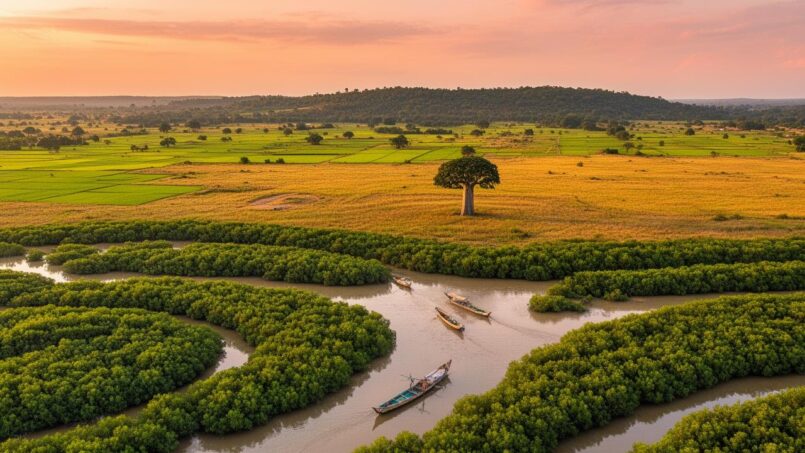
If there is one image that sums up the geography of Guinea-Bissau, it’s that of the mangroves. These amphibious forests, with their stilt roots, colonize the tidal flats of estuaries, line the channels, sometimes climb upriver 40 km inland, and literally envelop a large part of the coastline.
The figures are staggering: about 326,000 hectares of mangroves, or between 8 and 9% of the national area. In proportion to its territory, Guinea-Bissau is the most “mangrove” country in the world and ranks second in Africa and in the global top 15 in absolute mangrove area.
Ecological and economic functions
The mangrove plays a crucial ecological role. Its roots trap sediments and stabilize shorelines, limiting coastal erosion. Tides bring in considerable volumes of organic matter that these ecosystems transform into nutrients, fueling complex food chains. Mangrove channels serve as nurseries for many fish species, refuges for invertebrates, and a major migratory stopover for waterbirds.
The mangroves belong to the ecoregion known as “Guinean mangroves”, stretching from Senegal to Sierra Leone. Guinea-Bissau hosts one of the largest populations of West African manatees. Other emblematic species find refuge there: Nile crocodile, dwarf crocodile, Nile monitor, colobus monkeys (Temminck’s, black-and-white colobus), mona monkeys, water chevrotains, amphibious fish like the mudskipper. Sea turtles – green turtle, olive ridley, loggerhead – use the beaches and mudflats as feeding and nesting sites.
For human populations, these forests provide firewood, timber, poles, fishery products, honey, oysters, salt, and rice-growing areas after clearing. But this dependence also has a downside: pressure on wood, coupled with expanding agriculture and charcoal production, has led to an estimated decline of about 32% in mangrove area over the past 80 years.
Restoring rather than planting at all costs
Faced with this erosion, several restoration projects have been implemented. An NGO like Wetlands International, along with national bodies such as IBAP (Institute for Biodiversity and Protected Areas), promotes “assisted natural regeneration” approaches rather than massive campaigns of planting mangroves on poorly chosen sites.
This is the number of hectares of mangroves that were restored between 2015 and 2024 through correction of hydrological dysfunctions.
To monitor these operations, modern tools – GPS, mobile apps like ArcGIS Survey123 – are used to collect data on salinity, water circulation, biodiversity, or disturbances. A specific law for mangrove protection is also being prepared, a sign that the state is gradually grasping the strategic importance of these ecosystems in the context of climate change.
The Bijagós Archipelago: a world apart
Off the coast, about 48 km from the mainland, stretches an archipelago of rare geographic and ecological originality: the Bijagós Islands. Depending on sources, there are 88 islands and islets or about twenty large islands surrounded by a myriad of smaller ones. This ensemble, inscribed since 1996 in the UNESCO Biosphere Reserve network and now recognized as a World Natural Heritage site, forms the marine and insular heart of Guinea-Bissau.
Physical geography and organization
The Bijagós are the product of the ancient delta of the Geba and Rio Grande de Buba. The tides, among the strongest in Africa, constantly sculpt the landscape: sandbanks, winding channels, intertidal mudflats, reefs, platforms. At low tide, square kilometers of mud and sand emerge, offering a feast for shorebirds coming from Europe and Asia.
The islands are covered with dense forests, palm groves, coastal savannas, and mangroves. Sandy beaches often line the inside of the islands, while the backshores contain ponds, lowlands, and in places, freshwater marshes.
The Bijagós archipelago is divided into four administrative sectors: Bolama (administrative capital), Bubaque, Caravela, and Uno (created in 2004). Bubaque is the most populous island, Bolama the administrative center, and Orango the largest island. Orango is also a major conservation hub, hosting the country’s first national park.
Among the islands inhabited year-round, we can mention: La Corse, Madeira, Hawaii, the Canaries, Iceland.
| Island / Locality | Estimated Population (inhabitants) |
|---|---|
| Bubaque | 6,429 |
| Bolama | 6,024 |
| Uno | 3,324 |
| Canhabaque (Roxa) | 2,478 |
| Formosa | 1,873 |
| Galinhas | 1,633 |
| Orango | 1,250 |
| Uracane | 1,181 |
| Soga | 842 |
| Caravela | 907 |
| Orangozinho | 706 |
Other islands like Rubane, Maio, Canogo, Unhocomo, Unhocomozinho have a few hundred inhabitants, while a small archipelago around João Vieira, Cavalos, Ilhéu do Meio, and Poilão, covering about ten km², is left without a permanent population to better protect the nesting sites of sea turtles.
The entire archipelago is estimated to have had about 30,000 inhabitants in 2006, mostly from the Bijagó people, whose social organization, agropastoral practices, and rituals are closely intertwined with the ecological cycles of the islands.
A tropical biodiversity hotspot
The Bijagós bring together, in a relatively compact space, an astonishing variety of ecosystems: mangroves, mudflats, lagoons, dry forests, semi-deciduous forests, savannas, palm groves, dunes, and marine habitats (seagrass beds, sandy bottoms, upwelling zones rich in nutrients). This patchwork explains the biological importance of the archipelago.
Classified as an IBA by BirdLife International, this site hosts tens of thousands of wintering waterbirds each year (sandpipers, godwits, tattlers, flamingos, pink-backed pelicans, terns, gulls). The intertidal mudflats, rich in mollusks, crustaceans, and worms, provide abundant food resources for these Palearctic migrants.
The shallow, well-oxygenated waters also constitute a breeding and feeding area for many fish and marine mammal species. The West African manatee finds choice seagrass meadows there. The islands of Poilão and João Vieira are known to host one of the largest green turtle colonies in the Atlantic, where thousands of females come to lay eggs each year.
Among the remarkable inhabitants of the islands are also the Nile crocodile, the hippopotamus (which digs veritable “paths” in the vegetation heading to the sea), the bottlenose dolphin, and many monkey species. This concentration of wildlife justified the creation of the Bolama‑Bijagós Biosphere Reserve, which encompasses both the islands and a portion of the surrounding sea.
Climate: a tropical two-beat
Guinea-Bissau lies entirely under a tropical climate, with a strong influence of the West African monsoon. The country is characterized by a well-marked alternation between an extremely wet rainy season and a dry season dominated by the harmattan.
Rainy season and dry season
Depending on sources and regions, the rainy season extends from May‑June to October‑November. The first showers can begin as early as mid‑May, but it is often in July and August that rains become almost daily and very intense. The core of the rainy season – July, August, September – concentrates the bulk of annual precipitation. In Bissau, August alone can receive nearly 680 mm of rain.
Average annual precipitation in millimeters received by the entire country, with significant regional variations.
The dry season roughly runs from November to May. From December to April, rains are almost nonexistent: some months like January or March sometimes record 0 mm in the interior (Bafatá, Gabú). Watercourses, heavily dependent on rainfall, see their flows decrease, but estuaries remain fed by the tide.
Temperatures, humidity, and winds
Temperatures remain high year-round, with an annual average around 26–27 °C. Seasonal differences depend mainly on the position of the Intertropical Convergence Zone (ITCZ) and the relative influence of the ocean and continent.
Maximum temperature frequently reached in April in interior towns of Guinea-Bissau, such as Gabú or Bafatá.
During the rainy season, the air remains hot but the significant cloud cover and constant evaporation moderate daytime temperatures somewhat. In Bissau, average maximum temperatures in July hover around 29–30 °C, but the feeling of discomfort is amplified by very high humidity, often above 85%.
In the dry season, it is the harmattan wind, coming from the Sahara, that marks the climate. It blows from the north or northeast between mid-December and mid-April, bringing very dry air laden with fine dust. The sky often takes on a whitish hue, visibility decreases, and nights can become relatively cool inland, with occasional lows around 13–14 °C. On the coast, the ocean’s presence mitigates these effects, but Saharan dust is still felt.
Sunshine, sunlight, and climate risks
Sunshine is generous during the dry season, with sometimes 9 hours of sun per day in March or April, and an extremely high UV index (often above 11). In contrast, cloud cover is persistent during the peak rainy season: August sometimes offers only 3 hours of sun per day in Bissau.
Torrential rains from July to September regularly cause flooding in coastal plains and lowlands, due to fragile dikes, bridges, and drainage infrastructure. The combination of saturated soils, high tides, and river floods, aggravated by sea level rise and concentration of rains over short periods, makes the country one of the most exposed in Africa to this risk.
Finally, while the country is not a major cyclone corridor, it can be affected at the end of the rainy season (August‑September) by low-pressure systems from the tropical Atlantic, capable of bringing strong winds and exceptional rainfall.
Ecology, forests, and savannas: an internal mosaic
Beyond the mangroves, Guinea-Bissau is broadly divided among three main ecological units: the estuary and marsh zone, the forested interior plain, and the eastern savannas.
Immediately near the coast, floodable soils host not only mangroves but also freshwater or brackish marshes that develop behind ridges and dikes. These environments serve as habitat for many waterbirds, amphibians, and reptiles, and constitute seasonal grazing areas.
Cantanhez National Park, located in southern Guinea-Bissau, illustrates the wooded forest belt that separates the humid coastal strip from the eastern savannas. In these well-watered and less degraded areas, classified as dense humid tropical forest, remarkable forest formations persist. They provide habitat for rich biodiversity, including chimpanzees, arboreal primates, and forest birds, as well as varied flora with species such as kapok, bamboo, mango, and oil palm.
Further inland, towards Gabú and the far east, vegetation shifts clearly towards savanna. This is the ecoregion known as the “Guinean forest-savanna mosaic,” where grassy savannas, isolated groves, forest galleries along watercourses, and remnant forests on deeper soils or moist slopes coexist. This landscape hosts antelopes, buffalo, monkeys, and various reptiles, against a backdrop of increasing pressures from burning, overgrazing, and expanding agriculture.
Loss of tree cover in hectares in Guinea-Bissau between 2001 and 2024, representing more than 20% of the initial stock.
Bissau and the cities: a coastal urban geography
The capital, Bissau, is the nodal point of the country’s human geography. Situated on the northern bank of the Geba estuary, at about latitude 11°51’N, it occupies a low island or peninsula, bordered to the south by the wide estuary, to the north by the Mansôa River, and to the east by the Impernal channel.
The city, built on low, floodable ground with shallow water tables, has undergone rapid and unplanned urban expansion. Its extent grew from 34 km² in 2010 to about 60 km² in 2018, mainly in the form of spontaneous neighborhoods that now house nearly 90% of the population, forming an urban continuum along the Geba channel.
This rapid expansion, combined with insufficient drainage networks and inherent vulnerability to tides and floods, makes the capital particularly exposed to flooding, coastal erosion, and soil salinization.
Other important towns – Gabú, Bafatá, Cacheu, Bolama, Bubaque – structure the urban network, often directly linked to a river, estuary, or port function. Cacheu, for example, lies near the Senegalese border on the namesake river, at the entrance to the Cacheu Mangroves Nature Park, while Bolama and Bubaque are at the heart of the Bijagós island geography.
A geography under pressure: environment and climate change
The combination of very flat relief, an extremely indented coast, heavy dependence on natural resources, and fragile governance puts Guinea-Bissau on the front line of environmental challenges.
Sea level rise increases risks of submersion and coastal erosion, threatens mangrove rice paddies, and can lead to extreme soil salinization and acidification. This creates sterile zones, neither agricultural nor ecologically restored, when rice paddies are abandoned without breaking the dikes.
Changes in rainfall patterns – shorter rainy seasons, more irregular precipitation, more frequent extreme events – jeopardize both rain-fed crops in the interior and lowland and mangrove rice paddies alike, increasing risks of crop failure and land-use conflicts.
Nearly 65% of the country’s population directly depends on coastal resources for food and employment.
Finally, demographic pressure, still moderate in absolute terms, translates into the expansion of farmland, often at the expense of forests. However, the agriculture-forestry-land use sector is a central contributor to the country’s greenhouse gas emissions. Guinea-Bissau has committed, through its Nationally Determined Contribution, to reduce these emissions by about 30% by 2030, which requires better forest protection, more sustainable agricultural land management, and systematic consideration of geographic vulnerability in public policies.
A singular geography at the heart of tomorrow’s debates
Guinea-Bissau is an interesting case of a coastal state where the sea penetrates deep inland, where most of the population, infrastructure, and economic activities are concentrated within a few dozen kilometers along a low, fragile coast, and where coastal ecosystems – mangroves, estuaries, archipelagos – play a structuring role far beyond mere ecology.
The geography of Guinea-Bissau is constantly evolving, shaped by tides, rains, winds, human decisions (such as building or abandoning dikes), agricultural choices, migrations, and conservation projects. This case illustrates, on a small but exemplary scale, the contemporary challenge of reconciling food security, development, social justice, and preservation of coastal ecosystems, which constitute a first line of defense against climate change.
Understanding this geography – the discreet plateaus of the east, the floodplains of the west, the jungle of mangroves and channels intertwining in the Bijagós, the Sahelian winds meeting the marine monsoon – is to grasp why Guinea-Bissau, despite its modest size, holds a disproportionate place on the map of environmental and human challenges in West Africa.
Disclaimer: The information provided on this website is for informational purposes only and does not constitute financial, legal, or professional advice. We encourage you to consult qualified experts before making any investment, real estate, or expatriation decisions. Although we strive to maintain up-to-date and accurate information, we do not guarantee the completeness, accuracy, or timeliness of the proposed content. As investment and expatriation involve risks, we disclaim any liability for potential losses or damages arising from the use of this site. Your use of this site confirms your acceptance of these terms and your understanding of the associated risks.

Cyril Jarnias is an independent expert in international wealth management with over 20 years of experience. As an expatriate himself, he is dedicated to helping individuals and business leaders build, protect, and pass on their wealth with complete peace of mind.
On his website, cyriljarnias.com, he shares his expertise on international real estate, offshore company formation, and expatriation.
Thanks to his expertise, he offers sound advice to optimize his clients' wealth management. Cyril Jarnias is also recognized for his appearances in many prestigious media outlets such as BFM Business, les Français de l’étranger, Le Figaro, Les Echos, and Mieux vivre votre argent, where he shares his knowledge and know-how in wealth management.





