
 Published on and written by Cyril Jarnias
A tiny speck on the map of the Antilles, but a giant in reputation, Saint Barthélemy packs an astonishing wealth of geography into just a few square miles. Volcanic terrain, underwater plateaus, coral reefs, a semi-arid tropical climate, a shortage of fresh water, nature reserves, intense tourist pressure: here, everything is read through space. Understanding Saint Barthélemy means first understanding its territory.
A French Island Anchored on the Lesser Antilles Arc
Saint Barthélemy is a French overseas collectivity located in the Caribbean Sea, within the Lesser Antilles archipelago, in the Leeward Islands group. The island lies about 30 kilometers southeast of Saint Martin and Anguilla, some 250 kilometers east of Puerto Rico and the Virgin Islands, and approximately 200 kilometers north of Guadeloupe. Its geographic coordinates are roughly 17°54′ north latitude and 62°50′ west longitude.
Saint Barthélemy sits on the vast underwater plateau of the Anguilla Bank (approximately 4,600 km², average depth 40 m). Along with Saint Martin, Anguilla, and Tintamarre, it is the emerged part of this bank. 18,000 years ago, when the sea level was about 100 meters lower, these islands formed a single landmass.
Politically, Saint Barthélemy is the Territorial Collectivity of Saint Barthélemy, separate from Guadeloupe since 2007. It is part of the French West Indies but is no longer part of the European Union as an outermost region: it has the status of an overseas country and territory (OCT) while remaining under French sovereignty.
A Tiny but Dense Territory
Sources vary slightly, but the area of Saint Barthélemy ranges between 21 and 25 km². It measures approximately 17.5 kilometers long and a maximum of 4 kilometers wide. Suffice it to say that everything is close by, but nothing is truly flat.
No specific figure was provided in the content to highlight.
| Indicator | Approximate Value |
|---|---|
| Land area | 21–25 km² |
| Maximum length of island | ~17.5 km |
| Maximum width | ~4 km |
| Population (2017 census) | 9,961 inhabitants |
| Recent estimate (2021–2022) | around 10,700–11,000 inhabitants |
| Average density | ~400 inhabitants/km² |
| Number of neighborhoods (quartiers) | 40 |
| Number of administrative parishes | 2 (Sous le Vent, Au Vent) |
The inhabitants, the Saint Barths, are legally French citizens. Insularity and the small size of the territory require extremely fine-tuned management of space, urbanization, and resources.
A Volcanic Island Sculpted by Time
Saint Barthélemy is a volcanic island, but now completely extinct. Its geological history began tens of millions of years ago, when the subduction of the Atlantic plate under the Caribbean plate shaped the volcanic arc of the Lesser Antilles.
From Volcano to Arid Island
The island’s basement consists mainly of andesitic tuffs and volcanic breccias dating from the middle to late Eocene. These volcanic deposits were later pierced by more recent intrusions of basalts, quartz diorites, and andesites. The volcanoes that built the relief of Saint Barthélemy were active for about four million years, approximately between 39 and 43 million years ago. At least three distinct cones are believed to have ejected their materials into neighboring lagoons, forming volcano-sedimentary rocks.
Ancient volcanic tuffs underwent deformation (tilting, fracturing) and erosion. Later, during the Oligocene and Miocene, limestone and marl sediments were deposited on top in shallow seas. These carbonate layers, sometimes affected by karst, contain red paleosols (terra rossa) rich in fossils, including mammals and birds.
This stratification explains the island’s current appearance: an alternation of dark volcanic rocks and lighter limestone banks, on a rugged topography. No active volcano exists today, but it remains a remarkable relic of the ancient magmatic arc, extensively studied by geologists to understand the birth and migration of Caribbean volcanic arcs.
Relief: A Mosaic of Hills, Valleys, and Ponds
For such a small island, the relief is surprisingly pronounced. Saint Barthélemy presents itself as a collection of steep hills (mornes), deeply incised valleys, and deeply indented bays.
The highest point is Morne de Vitet at 286 meters. The landscape is structured by other hills (Rouge, Criquet, Grand Fond, Dépoudré, Lurin). The center of the island mainly consists of hills and combes, with very few large plains.
The island has no mountains in the Alpine sense, no permanent rivers, and no dense tropical rainforest. The soils are mostly poor, rocky, and shallow, explaining a spontaneous vegetation dominated by cacti, xerophytic shrubs, and a few tropical species adapted to drought.
The only notable inland water surfaces are ponds and marshes:
| Main Water Body | Type | Geographic Particularity |
|---|---|---|
| Étang de Saint-Jean | Coastal pond / lagoon | Wetland with mangrove included in reserve |
| Grande Saline | Salt pond / salt marsh | Back-beach, marshy area |
| Grand Étang | Inland water body | Small freshwater or brackish basin |
| Petit Étang | Smaller pond | Associated with coastal wetlands |
These ponds, often linked to salt flats or coastal marshes, play a key role in the island’s ecology, particularly for avifauna, but do not constitute significant freshwater reserves usable on a large scale.
An Indented Coastline, Ringed by Reefs and Islets
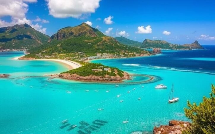
It is impossible to discuss the geography of Saint Barthélemy without mentioning its coasts. The island is almost entirely surrounded by coral reefs and shallow lagoons, which partially protect the shoreline and give the sea that turquoise transparency that has become its signature.
Reefs, Lagoons, and Coral Plateau
On the north and east coasts, the reefs are clearly visible from land, a white fringe where waves break before reaching the shore. These reefs develop in shallow waters, on the edge of the Anguilla Bank, composed of sand, shell debris, and coral.
Offshore to the east, the edge of the bank lies about twenty kilometers away. Beyond this limit, the depth suddenly increases, marking the break between the continental shelf and the deep ocean. This unique environment creates a sea rich in marine biodiversity but also makes it vulnerable to phenomena like coastal erosion, storms, and the pressure of overtourism.
A Constellation of Uninhabited Islets
Around the main mass of Saint Barthélemy gravitate several islets, all uninhabited, extending the underwater relief and enriching the diversity of coastal landscapes. Among the most significant:
| Islet / Group of Islets | Approximate Location | Notable Feature |
|---|---|---|
| Île Fourchue | Northwest | Steep relief, surrounded by fish-rich waters |
| Île Coco | Off the north coast | Small rocky islet |
| Île Chevreau (Bonhomme) | Near the north coast | Reefs and underwater drop-offs |
| Île Frégate | Northeastern sector | Integral part of the nature reserve |
| Île Toc Vers | Northeast | Surrounded by protected areas |
| Île Tortue | Off the coast | Name linked to its turtle-like shape |
| Roche Plate (Table à Diable) | Offshore | Rocky shoal |
| Mancel or la Poule et les Poussins | Surrounding sector | Group of islets and emergent rocks |
To this is added a myriad of smaller rocks and islets such as Pain de Sucre, Les Gros Islets, La Baleine des Gros Islets, Les Baleines du Pain de Sucre, Les Grenadins, which dot the horizon and constitute privileged habitats for seabirds.
Deep Bays, Coves, and Lagoons
The coast of Saint Barthélemy is deeply indented, carved into a succession of bays, coves, and lagoons. Each cove has its own morphology, exposure to wind, sand type, and uses.
Discover the different beaches of the island, classified according to their wind exposure and safety for swimming.
Beaches where the sea is generally calmer, providing ideal conditions for a peaceful swim.
Beaches more exposed to the elements, often sheltered by hills and reefs, offering wilder landscapes.
The island boasts up to 22 public beaches accessible to everyone for enjoying the coastline.
About 15 of these beaches are particularly suitable and safe for swimming.
A few emblematic examples illustrate this diversity:
| Beach / Bay | Coast Type and Exposure | Main Geographic Characteristics |
|---|---|---|
| St. Jean Beach | Open bay, shallow lagoon | Fringing reef with pass, suitable for water sports |
| Flamands Cove | Large sandy bay, leeward | Wide fine-sand beach, back dune |
| Gouverneur Cove | Leeward cove | Framed by hills, direct road access |
| Colombier Cove | Isolated leeward bay | Accessible only on foot or by boat, anchorages |
| Grand Galet Cove (Shell Beach) | Small cove near Gustavia | Beach of pebbles and shells, subject to erosion |
| Grande Saline Cove | Leeward cove | Dune and salt pond inland, marshy area |
| Grand Cul-de-Sac | Northern lagoon, windward side | Large barrier reef, seagrass beds, calm waters |
| Lorient Cove | Relatively open bay | Long beach, vegetated, swell suitable for light surfing |
| Toiny Cove | Highly exposed windward coast | Strong currents, coarse sand and pebble beach |
| Marigot & Grand Cul-de-Sac Cove | Northern lagoons | Mangroves, grassy bottoms, shallow waters |
| Petit Anse | Small inlet north of Flamands | Calm waters, suitable for children |
The northern facade, around Marigot and Grand Cul-de-Sac, is characterized by protected lagoons, bordered by mangroves and underwater meadows. Conversely, coves like Toiny or Anse des Cayes take the full force of the easterly or northeasterly swell that shapes coastal dynamics.
A Tropical, Dry, and Windy Climate
The climate of Saint Barthélemy is tropical maritime, with two main seasons rather than a marked alternation of hot and cold. Here, temperatures remain high year-round, but it is the distribution of rainfall and the trade wind regime that dictate the rhythm of the seasons.
Two Seasons, Little Thermal Variation
Locally, a distinction is made between “carême” or “le Carême” for the dry season, and “hivernage” or wet season for the hot and rainy period.
– Dry season: roughly December to April. Northeast trade winds bring drier air, precipitation is relatively low, skies are often clear. This is the peak tourist season.
– Wet season: May to November. Temperatures rise slightly, the air becomes heavier, tropical showers or thunderstorms occur, often at the end of the day, but generally remain brief.
Climate statistics confirm this thermal stability:
| Climate Parameter | Indicative Value |
|---|---|
| Average annual temperature | ~25–27 °C |
| Average annual maximum | ~28–30 °C |
| Average annual minimum | ~22–26 °C |
| Heat record (Gustavia) | ~35.5 °C |
| Cold record (Gustavia) | ~18–18.5 °C (isolated extreme lower at 13 °C recorded elsewhere) |
| Sea temperature | ~26 °C in winter to ~29 °C in late summer |
| Annual sunshine | ~3,000 h (average ~250 h/month) |
The temperature difference between the “coolest” day of the year and the hottest remains modest. September is often considered the hottest month, while March may appear slightly “cooler” in some data series.
Rain, Sun, and Cyclones
Saint Barthélemy is a generally dry island by tropical standards. Annual rainfall ranges around 900 to 1,000 millimeters, with local disparities: the east generally receives more precipitation than the west.
The rainiest months are September, October, and November, with October often being the wettest. The dry period extends from January to April, with a frequent minimum in February. Rainy episodes are generally intense but brief: heavy showers followed by a quick return of the sun, rather than a full day of rain.
The island lies right in the Atlantic hurricane belt. The hurricane season officially runs from June to November, with the highest risk between August and October, and a statistical peak around mid-September. In practice, severe hurricanes rarely affect Saint Barthélemy more than once or twice per decade, but when they do strike, the impact on infrastructure, coastline, and ecosystems can be major.
Water, a Major Geographic Question
Paradoxically, surrounded by water on all sides, Saint Barthélemy suffers from a severe shortage of fresh water. The absence of rivers, abundant aquifers, and sufficiently high relief to generate significant orographic rainfall has shaped a geography of water resources that is entirely artificial.
A Territory with No Natural Freshwater Resources
The volcanic substrate, fractured but unfavorable to large aquifers, and the small size of the island prevent the formation of rivers. The only wetlands are ponds, pools, marshy areas behind beaches, and a few temporary bodies of water after rain showers.
Drinking water therefore comes massively from the sea, via desalination, supplemented by rainwater harvesting and treated wastewater reuse. The geography of water here is a geography of plants, hilltop reservoirs, and buried networks, rather than rivers and dams.
Desalination, Upland Storage, and Reuse
The first desalination plant was commissioned in the early 1970s. Since then, capacity has increased steadily. Today, daily production is around 4,300 m³, with a maximum capacity boosted to approximately 4,700 m³/day through additional membrane modules. Average daily consumption is around 3,000 m³, but can spike sharply during tourist season, reaching peaks of nearly 300 m³ per hour—rates that are close to and sometimes exceed hourly production capacity.
Drinking water is produced by desalinating seawater through thermal evaporation or reverse osmosis. After remineralization, it is stored in elevated reservoirs, such as Colombier, for gravity distribution through the network. This process is efficient but consumes a lot of energy.
In parallel, many buildings have rainwater harvesting cisterns, an old tradition reinforced by current constraints. Treatment plants allow for the reuse of a portion of wastewater for irrigation and non-potable uses.
A quick summary of the key elements of this “artificial cycle”:
| Key Step | Geographic or Technical Particularity |
|---|---|
| Seawater intake | Coastal capture, sensitive to heavy swells and sand |
| Desalination | SIDEM plant: evaporation + reverse osmosis/nanofiltration |
| Production capacity | ~4,300 m³/day (up to ~4,700 m³/day with new modules) |
| Storage | Large elevated reservoirs (e.g., Colombier) |
| Distribution | Gravity network from reservoirs |
| Supplements | Private cisterns, treated wastewater for irrigation |
This total dependence on coastal infrastructure makes the system vulnerable to swells. A recent episode of strong westerly seas clogged the intakes of the desalination plant with sand, drastically reducing production. The collectivity had to set up free water distribution points, limit certain uses (pools, car washing, irrigation), and move rock blocks to protect the structure, at the cost of a temporary closure of the access road to Gustavia via Public.
A Major Spatial Constraint
The steady increase in population, the upscaling of tourism, the proliferation of villas with pools and tropical gardens—all this translates into growing pressure on the resource. Geographically, this leads to densifying networks in expanding areas, such as Lurin, where new pipeline sections are being laid to secure supply.
Water, in Saint Barthélemy, is therefore not just a technical issue: it is a structuring element of land use, urban planning, choices of vegetation, and trade-offs between residents, hotels, and leisure activities.
Analysis of water management in Saint Barthélemy
Natural Spaces, Vegetation, and Fauna: Biodiversity Under Pressure
The picture-postcard image of Saint Barthélemy—turquoise sea, white sand, palm trees—masks a more subtle ecological reality: that of a dry island with poor soils, where natural vegetation has adapted to water stress and wind, and where coastal ecosystems play a vital role.
Vegetation: Between Drought and Controlled Lushness
The spontaneous vegetation of Saint Barthélemy is typical of dry tropical environments. On the hills, one finds mainly cacti, agaves, woody euphorbias, thorny bushes, and succulents. During the wet season, these brownish hills are covered with a patchy green mantle, but overall it remains far from the dense tropical rainforest of wetter islands.
Coastal areas host halophytic plants adapted to salt and spray, such as seaside grape, beach scrub, and mangroves around the ponds. Inland features emblematic species like flamboyant trees, frangipani, hibiscus, bougainvillea, jasmine, latan palms, and various palm species, including the coconut palm introduced from the Pacific.
A botanical inventory from the 1990s already recorded several hundred native species, to which are added naturalized species in irrigated gardens: aloe, ornamental climbers like coral vine, Mexican cacti, etc.
Terrestrial Fauna and Avifauna
Isolated on the Anguilla Bank, the island shares with Saint Martin and Anguilla a small fauna of endemic reptiles: anoles, terrestrial lizards like the “Améiva de Plé,” Lesser Antilles iguanas, non-venomous colubrid snakes. A few introduced land tortoises, such as the red-footed tortoise, complete the picture.
For birds, Saint Barthélemy is an important site for seabirds and shorebirds. Rocky islets and certain cliffs host terns, noddies, brown boobies, gulls, while ponds and salt marshes serve as stopovers and breeding sites for herons, egrets, sandpipers, and other waders. Winter sees an influx of Neotropical migrants escaping the North American cold season.
This is the number of zones recognized by BirdLife International within the reserve, highlighting their crucial importance for conservation.
A Sea Rich in Corals, Turtles, and Fish
Underwater, biodiversity is even more spectacular. The coral reefs of Saint Barthélemy are among the richest in the French West Indies: about fifty species of corals have been recorded here, from hard reef-building corals to colorful gorgonians and sponges. Seagrass beds—carpets of marine phanerogams like turtle grass—play a major role as nursery grounds for many fish and constitute the dietary base for green turtles.
Marine fauna includes between 165 and nearly 200 species of fish: groupers, parrotfish, surgeonfish, damselfish, jacks, as well as seahorses, eagle rays, moray eels, etc. Three species of sea turtles are frequently observed: hawksbill, green turtle, and more occasionally the leatherback turtle, the largest of all. Dolphins and humpback whales pass offshore during migration season, from winter to spring.
This biological richness, combined with the limited extent of the plateau, explains the creation of a vast nature reserve.
The National Nature Reserve: A Geographic Tool for Protection
To protect these fragile environments, most of the reef perimeter of Saint Barthélemy is designated as a national nature reserve. The Saint Barthélemy Nature Reserve, sometimes called the Nicole Aussedat National Nature Reserve, covers approximately 1,200 hectares of marine and coastal habitats.
A Zoning That Maps the Geography of Sea Use
The reserve is organized into several distinct sectors around the island, notably:
Discover the main natural sites and marine protected areas of the island, essential for preserving its biodiversity.
The vicinity of Gros Îlets and Pain de Sucre, at the entrance to Gustavia Bay.
The waters surrounding the islets of Fourchue, Frégate, and Toc Vers.
A large part of this bay, a renowned anchorage and hiking site.
Includes Grand Cul-de-Sac Bay, Petit Cul-de-Sac, Marigot, Petite Anse, and several salt flats.
Area including the pond and its mangrove, a rich and fragile ecosystem.
These sectors are themselves subdivided into simple protection zones (where diving, swimming, navigation are allowed under conditions) and high-protection zones, where all human activity is heavily restricted, even prohibited except for scientific monitoring.
This zoning, shown on nautical charts, redraws the geography of uses: certain anchorages are equipped with buoys to prevent destructive anchoring on seagrass beds and corals, entire areas are closed to fishing or spearfishing, and the movement of jet skis is prohibited.
Stakes: Between Tourism and Conservation
With nearly 10,000 dives per year on reserve sites, plus snorkeling, the tourist pressure on the marine environment is intense. Protection therefore involves active surveillance (patrols, anchoring controls, anti-poaching efforts), but also education: school programs, nature outings, information panels, awareness campaigns about turtles and reefs.
This reserve acts as an ecological infrastructure: it dampens waves, reduces coastal erosion, serves as a biodiversity reservoir and fish spawning ground. It also constitutes a major asset for nature tourism, the main local economic resource.
An Island Highly Fragmented Administratively and Socially
In such a small space, Saint Barthélemy is nevertheless finely subdivided. Forty neighborhoods (quartiers), divided into two main parishes—Sous le Vent (south and west) and Au Vent (north and east)—cover the entire island. Each neighborhood corresponds to a valley, a slope, a cove, sometimes a hill.
The parish of Sous le Vent notably includes:
The island of Saint Barthélemy is structured around several agglomerations. Gustavia, the capital, is the main port, set in a U-shaped cove. St. Jean is the second urban hub, organized around its beach and the airport. There are also historic villages like Corossol, a former fishing village, as well as various coastal neighborhoods such as Flamands, Anse des Cayes, Public, and Lurin.
The parish of Au Vent includes:
– The bays and neighborhoods of Lorient, Grand Fond, Toiny, Vitet, Marigot, Grand Cul-de-Sac, Petit Cul-de-Sac, among others.
– Fast-growing residential sectors such as Pointe Milou, Mont Jean.
This micro-administrative geography largely follows the topography: each valley opening onto the sea forms a micro-living basin, with its main road, houses, sometimes shops. The result is a highly fragmented urbanization, made of built-up islets scattered around the island’s perimeter, connected by a narrow road network that hugs the contours.
Gustavia: Geographic, Historical, and Port Heart
At the center of this territorial puzzle, Gustavia serves as a pivot. Nestled at the back of a horseshoe-shaped bay on the west side, the city concentrates administrative, port, commercial, and cultural functions.
A City Shaped by Its Port
The site of Gustavia is first and foremost an excellent natural shelter. The old name “Carénage” (careening) recalls the era when ships were hauled ashore for repairs. When the island came under Swedish rule in the 18th century, the town was renamed Gustavia, in honor of King Gustav III, and established as a free port. The status of a neutral port, in the heart of a Caribbean region troubled by wars of the time, fostered its development as a trading hub, including for contraband trade.
The current urban layout retains a grid plan around the port, with streets parallel and perpendicular to the shore. The architecture blends Northern European influences with local materials. The topography of the rocky peninsula and steep hills has imposed narrow streets and terraced buildings.
Forts, Lighthouse, and Heritage
Three historic forts (Fort Oscar, Fort Karl, Fort Gustav) once dominated the entrances to the port. Today, their remains—sometimes integrated into contemporary infrastructure like the gendarmerie—recall the strategic importance of the site. On the heights, the Gustavia lighthouse, a white 9-meter tower perched 64 meters above sea level, signals the island to navigators.
The city of Gustavia, on the island of Saint Barthélemy, illustrates the overlay of colonial legacies through its urban fabric. One finds buildings testifying to the French and Swedish eras, such as churches, presbyteries, stone and wooden houses, as well as museums like the Wall House. At the same time, Gustavia constitutes the main commercial hub of the island, with a waterfront organized around a marina and lined with luxury boutiques, restaurants, and various services.
A Sea That Is Both Resource and Border
Geographically, Saint Barthélemy is not just a piece of land, but also a vast maritime area under French jurisdiction. The island has its territorial sea (12 nautical miles), a contiguous zone (24 miles), and is part of a larger exclusive economic zone (EEZ), statistically shared with Saint Martin, totaling approximately 5,200 km².
This is the length in nautical miles of the maritime boundary delimited by treaty between Saint Martin and Antigua and Barbuda in 2017.
This legal geography of the sea governs the management of fishery resources, the laying of submarine cables, potential seabed exploration, and everything related to navigation safety.
A Coastline Under Pressure: Erosion, Urbanization, and Beach Nourishment
The coastal strip concentrates the majority of urbanization, roads, businesses, and tourist facilities. Yet this coastal ribbon faces increasing erosion. The beaches, major assets of the local economy, tend to recede, shrink, or transform under the combined effects of swells, sea level rise, storms, and human development.
The Role of Natural Dynamics
The dominant swells come from the east, with episodes of northeast or west swells during severe storms or hurricanes. These waves constantly redistribute sediments around the island: sand eroded from one beach may replenish another part of the shoreline. Pocket beaches, framed by rocky headlands, are particularly sensitive to these variations.
Long-term climate changes, such as sea level rise, possible changes in storm patterns, and the weakening of natural protections (reefs, seagrass beds, mangroves), amplify the risks of coastal erosion and submersion.
The Impact of Coastal Development
Urbanization of low-lying areas—already very dense in several bays—has often led to flattening or reducing dunes, removing sand-stabilizing vegetation, and building retaining walls that reflect waves instead of dissipating them. Every jetty, every riprap, every pontoon modifies local currents and how sand moves.
The degradation of reefs and seagrass beds, due to pollution, anchoring, overuse, or overfishing, also accelerates erosion by reducing the production of calcareous sediments and the dissipation of wave energy.
Artificial Nourishment: A Changing Geography of Beaches
To counter these retreats, the collectivity regularly resorts to beach nourishment. This involves transferring sand from an area deemed to have a surplus (often offshore, on shoals) to a beach in deficit. Depending on volumes, transport is done by trucks or stationary hydraulic dredging.
In Saint Barthélemy, beach nourishment operations have been carried out at several sites, such as Colombier, Corossol, or Gouverneur. A notable example is Shell Beach (Anse de Grand Galet), whose sand was heavily eroded by the swell of Hurricane Lenny in 1999. To remedy this, the beach was replenished with sand in 2000.
Each nourishment redraws the shoreline for a few years, sometimes at the cost of ecological impacts on the borrow areas. The question for the future is to what extent this type of intervention will remain viable over the long term, against a backdrop of rising sea levels and constant tourist pressures.
An Insular Space Shaped by Tourism
If you look at a map of Saint Barthélemy, it quickly becomes apparent that the human geography follows the physical geography: houses are clustered at the back of bays, on less steep slopes, near beaches. The economy, largely oriented toward luxury tourism, reinforces this coastal logic.
High-End Beach Tourism
The beaches, sheltered bays, lagoons, and hilltop panoramas are at the heart of the island’s appeal. Accommodation mainly consists of private villas, often perched on slopes with sea views, and small hotels—rarely more than a few dozen rooms. This dispersion of accommodation accentuates the spread of urbanization, the road network, and infrastructure (water, electricity, sanitation) across all the coastal valleys.
The island is a major hub for nautical tourism, with pleasure yachts anchoring in the bays of Gustavia, Colombier, and the south. It is also well connected by regular ferry services to Saint Martin and by flights from St. Jean Airport to major regional hubs in the Caribbean and the American continent.
Pressures and Trade-offs
This economy, essential to local prosperity, nonetheless exerts strong pressure on natural spaces and resources. The sprawl of construction on slopes increases runoff, silting of ponds and reefs. The proliferation of pools and irrigated gardens increases water demand. Car traffic on narrow roads exacerbates noise and local pollution problems.
In Gustavia, the height of buildings is limited to 6 meters to regulate urbanization.
Conclusion: A Geography Under High Tension
The geography of the land in Saint Barthélemy is that of a small island territory accumulating constraints and privileges: rugged volcanic relief, hot dry climate, lack of fresh water, exposure to hurricanes, but also teeming coral reefs, transparent lagoons, deep bays, a protective underwater plateau, and a strategic position on the Lesser Antilles arc.
On 25 km², the island concentrates phenomena that elsewhere span tens or hundreds of kilometers: rainfall gradients between east and west, a mosaic of micro-landscapes from arid hills to lush lagoons, juxtaposition of urbanized neighborhoods, ponds, salt flats, and wild areas, embedding of environmental protection zones and densely built areas.
The territory must reconcile the preservation of its fragile ecosystems (reefs, beaches, ponds, slopes) with its high-end tourism economy, ensure its water and energy security despite the lack of natural resources, and adapt to the already visible effects of climate change, all within a very constrained geographic space.
In Saint Barthélemy, the geographic challenge is not abstract: it is visible in the shape of the beaches, the level of the reservoirs, the health of the corals, the color of the hills, the layout of roads and neighborhoods. On this island, more than anywhere else, geography is destiny… but also a field of action.
Disclaimer: The information provided on this website is for informational purposes only and does not constitute financial, legal, or professional advice. We encourage you to consult qualified experts before making any investment, real estate, or expatriation decisions. Although we strive to maintain up-to-date and accurate information, we do not guarantee the completeness, accuracy, or timeliness of the proposed content. As investment and expatriation involve risks, we disclaim any liability for potential losses or damages arising from the use of this site. Your use of this site confirms your acceptance of these terms and your understanding of the associated risks.

Cyril Jarnias is an independent expert in international wealth management with over 20 years of experience. As an expatriate himself, he is dedicated to helping individuals and business leaders build, protect, and pass on their wealth with complete peace of mind.
On his website, cyriljarnias.com, he shares his expertise on international real estate, offshore company formation, and expatriation.
Thanks to his expertise, he offers sound advice to optimize his clients' wealth management. Cyril Jarnias is also recognized for his appearances in many prestigious media outlets such as BFM Business, les Français de l’étranger, Le Figaro, Les Echos, and Mieux vivre votre argent, where he shares his knowledge and know-how in wealth management.





