
 Published on and written by Cyril Jarnias
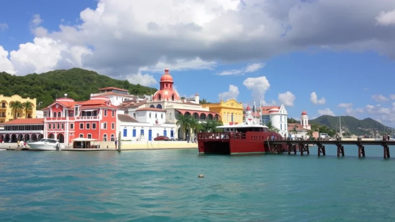
With its picture-perfect beaches, tropical rainforests, Taíno remnants, and colonial towns, Puerto Rico packs an impressive density of must-see sites into a relatively compact territory. From Old San Juan to the islands of Culebra and Vieques, via the mysterious El Yunque and the bays that glow at night, the archipelago more than earns its nickname of “Isla del Encanto.”
This article provides a selection of essential destinations based on concrete data: geographical location, access methods, cultural or natural interest, travel time, entrance costs, and specific environmental guidelines to follow on-site.
San Juan and the Magic of Old Town
A lively capital, major cruise port, and the island’s historic heart, San Juan is often travelers’ first contact with Puerto Rico. Spending at least two or three days here allows you to discover a unique concentration of history, architecture, and cultural life.
Over five centuries old, Old San Juan sits on an islet connected to the mainland by three bridges. This piece of city surrounded by fortification walls, battered by the Atlantic and open to San Juan Bay, is one of the best-preserved historic centers in the Americas. Its blue-cobblestone streets, pastel facades, and shaded plazas earned it a UNESCO World Heritage designation in 1983.
The Fortresses Guarding the Bay
The most spectacular element of the urban landscape remains the Spanish fortification system, developed between the 16th and 19th centuries to protect one of the Caribbean’s strategic ports.
Castillo San Felipe del Morro, or El Morro, is a fortress built from the 16th century onward to protect the entrance to San Juan Bay in Puerto Rico. Evolving over more than 250 years, it became a six-level citadel with a network of tunnels, casemates, and artillery ramps. Never taken by an enemy, it served as an American military base during both World Wars before being transferred to the National Park Service in 1961. Today, it’s a major tourist site where visitors explore the galleries, admire ocean views, and fly kites on its lawns.
Castillo San Cristóbal completes this defensive network. Built starting in 1634, this immense 27-acre fortress was designed to protect San Juan from land attacks, at a time when incursions from the island’s interior became a growing risk. Tunnels, troop quarters, a chapel, observation posts: the whole complex formed a veritable military town, connected to the walls that completely encircled the old city.
This ensemble of fortifications, which also includes the small fort of El Cañuelo (Fortín San Juan de la Cruz) and the fort of San Gerónimo del Boquerón, now forms the San Juan National Historic Site, a UNESCO-listed site. El Cañuelo can be viewed from Isla de Cabras Park across from the old city, while San Gerónimo, built around 1600, still guards the entrance to the islet on the side of the modern Condado district.
The table below summarizes the main characteristics of these major fortifications.
| Site | Main Historical Role | Area / Structure | Current Features |
|---|---|---|---|
| Castillo San Felipe del Morro | Defense of the bay from the sea | 6-level citadel | Panoramic views, kite-flying lawn, museum |
| Castillo San Cristóbal | Protection against land attacks | Approx. 27 acres | Tunnel network, observation posts |
| Fortín San Juan de la Cruz (El Cañuelo) | Support for El Morro at the bay entrance | Small fort on Isla de Cabras | Currently closed, visible from shore |
| Fortín San Gerónimo | First line of defense against pirates | Small coastal fort | Located next to the Caribe Hilton |
| San Juan City Walls | Defensive enclosure surrounding the colonial city | Up to 42 ft high and 45 ft wide | Scenic walks, remarkable integrity |
A City of Palaces, Plazas, and Alleyways
Beyond the walls, Old San Juan is a dense fabric of remarkable sites. The Palacio de Santa Catalina, better known as La Fortaleza, embodies political power since the 16th century. Built between 1533 and 1540, first as a fort, it is now the oldest continuous-use executive mansion in the Americas and has hosted over 170 governors. This UNESCO-listed building offers free weekday tours, subject to opening hours.
A few streets away, the Catedral de San Juan Bautista is among the oldest cathedrals in the Americas. Built from 1540 onward, it houses the tomb of Juan Ponce de León, a key figure of the Spanish conquest in the region. Not far from there, the small Capilla del Cristo, perched atop the walls at the end of Calle del Cristo, speaks to another facet of local religiosity: according to legend, it was built after a young horseman miraculously survived a spectacular fall on this very street.
Catedral de San Juan Bautista and Capilla del Cristo
Plazas play a central role in urban life. Plaza de Armas, the old administrative heart of the city, is bordered by City Hall and several historic buildings. A fountain adorned with allegorical statues of the four seasons stands at its center. Downhill from the walls, the Paseo de la Princesa, a 19th-century promenade lined with trees, gardens, and statues, leads to the famous Raíces Fountain. This bronze work depicts figures representing Puerto Rico’s three great heritages: Taíno, African, and Spanish.
The combination of historical elements and lively shopping streets, like Calle Fortaleza with its shops and overhead art installations, makes Old San Juan a living museum entirely accessible on foot.
Museums, Culture, and Nightlife
Museum enthusiasts have a varied choice in San Juan. In the former Cuartel de Ballajá, a vast 19th-century barracks, the Museo de las Américas traces both pre-Columbian history and the colonial period through contemporary changes. Other institutions—the Museo de Arte de Puerto Rico in Santurce, the Museo de la Música Puertorriqueña, Casa Blanca (the former residence of Ponce de León turned museum)—complete this panorama.
In terms of vibe, San Juan isn’t just about history. The city is renowned for its cuisine—from traditional cafés in the old town to more contemporary establishments in Condado or Santurce—and for its vibrant nightlife. Music is central here, between salsa bars, more modern clubs, and iconic spots like La Factoria, a San Sebastián bar ranked among the best in the Caribbean.
Finally, it’s impossible to talk about San Juan without mentioning the piña colada, the iconic cocktail made of rum, pineapple, and coconut. Two establishments, Barrachina in the old town and the Caribe Hilton seaside, claim its invention, incidentally highlighting the importance of rum culture to local identity.
The Island’s Beaches and Maritime Facade
Puerto Rico has roughly 270 to 300 miles of coastline and nearly 300 beaches. On such a small territory, the diversity is surprising: calm bays for families, wild coves, powerful surf spots, festive urban zones. All beaches are public and free, even when hotels border them. Some, managed by the state, are classified as balnearios (public beaches) and have facilities (restrooms, lifeguards, guarded parking).
Around San Juan: From Urban Beaches to Protected Coves
Just minutes from the historic center, Balneario El Escambrón is a Blue Flag-certified beach, a sign of environmental quality. Located in Tercer Milenio Park, it benefits from a reef that calms the swell and creates a body of water ideal for swimming and snorkeling. The ruins of an 18th-century artillery battery and the proximity of Castillo San Cristóbal add a heritage dimension to this site, very popular with capital residents.
A bit further east, Condado Beach and Isla Verde Beach embody the urban beach par excellence. Lined with hotels and restaurants, they combine sunbathing, water sports (parasailing, jet ski), and nightlife. In the more protected Condado lagoon, you can spot manatees, sea turtles, and tropical fish, especially by kayak or snorkeling.
For a family-friendly vibe and calm waters, ideal for kids and beginner snorkelers, opt for the small, sheltered Playita del Condado. For a livelier, more diverse atmosphere, mixing residents and tourists along a long beach bordered by apartment buildings and small hotels, prefer Ocean Park Beach.
The following table gives an overview of some iconic beaches near San Juan and their main characteristics.
| Beach / Area | Type of Vibe | Highlights | Precautions / Particularities |
|---|---|---|---|
| Balneario El Escambrón | Family-friendly, urban, Blue Flag | Protective reef, snorkeling, historical ruins | Respect marked swimming areas |
| Condado Beach | Urban, festive | Hotels, restaurants, proximity to lagoon | Currents sometimes present |
| Playita del Condado | Very family-friendly | Very calm waters, ideal for beginners | More limited space |
| Isla Verde Beach | Resort-style | Water sports, wide sandy beach | Very crowded in high season |
| Ocean Park Beach | Mixed, local | Long beach, relaxed ambiance | Direct exposure to wind and waves |
North, South, East, West: Contrasting Coastlines
The island’s north, open to the Atlantic, mixes long beaches and coves framed by rocks. Playa Mar Chiquita, in Manatí, is a good example of these spectacular landscapes: a crescent-shaped basin protected by rocky cliffs, where the sea rushes in through an opening. Swimming conditions can become dangerous in winter when the swell strengthens. Nearby, La Esperanza Beach, part of the Manatí nature reserve, illustrates, in contrast, a more preserved and regulated coastline, with specific opening hours.
Further west, the areas around Vega Alta and Vega Baja host beaches like Cerro Gordo and Playa Puerto Nuevo, characterized by calmer waters, ideal for swimming and relaxing, with occasional natural lookout points for seasonal whale watching.
Discover the tranquil bays of the Caribbean Sea, protected by mangrove cays, offering a variety of water activities and spectacular natural landscapes.
A labyrinth of islets and channels ideal for snorkeling, diving, fishing, and excursions to the bioluminescent bay.
Family beaches (Playa Santa), secret coves for snorkeling (Playa Buyé), and lively sandy arcs like Combate Beach.
Site of spectacular landscapes like Playa Sucia (La Playuela), near the historic Los Morrillos Lighthouse.
On the west coast, finally, the terrain and exposure to swell make it a haven for surfers. The Rincón area, often called Puerto Rico’s “surfing capital”, combines legendary wave spots (Playa Domes, Playa María, Surfer’s Beach) and calmer zones like Playa Corcega. Further north, Aguadilla and Isabela concentrate beaches with multiple purposes: Crash Boat Beach, with its old pier turned into a jumping platform and artificial reef, attracts swimmers, divers, and photographers, while Jobos Beach is a famous surf spot, but known for its strong currents. Montones Beach, in Isabela, is a kind of natural swimming pool protected by a rocky barrier, very popular with families.
Just compare three major zones to gauge the diversity of the coasts.
| Coast / Region | Dominant Sea | General Beach Profile | Key Activities |
|---|---|---|---|
| North (Atlantic) | Atlantic Ocean | Rocky coves, long beaches, stronger swell | Vista points, local surfing, careful swimming |
| South (Caribbean) | Caribbean Sea | Calm bays, mangroves, drier ambiance in places | Snorkeling, family swimming, bioluminescence |
| West | Atlantic / Channels | Major surf spots, snorkeling areas, sunsets | Surfing, diving, whale watching |
| East | Vieques Channel / Atlantic | Large beaches, access to islands (Vieques, Culebra, Icacos) | Boat excursions, bioluminescent bays |
Marine Life, Fragile Reefs, and Safety
Puerto Rico’s waters are home to up to 800 species of fish, including more than 500 tropical types, as well as different species of sea turtles and rays. Coral gardens, especially of Acropora (like the vast elkhorn coral formations in the Tres Palmas Marine Reserve in Rincón), offer essential refuges for this biodiversity.
But some of these reefs are now damaged, weakened by rising temperatures, pollution, and mismanaged tourism. The use of coral-unfriendly sunscreens or trampling on formations are among the avoidable threats. Local operators and authorities therefore emphasize using “reef-safe” sun protection and respecting sensitive areas.
At the same time, some beaches, especially those exposed to the Atlantic, are prone to rip currents and strong winter swells. Sites like Jobos Beach, Mar Chiquita, or Playa Escondida are known for their dangerous currents: swimming here requires great caution and should sometimes be avoided depending on conditions. Generally, authorities recommend never swimming alone, checking current conditions, and staying alert around motorized vehicles (boats, jet-skis) when snorkeling.
El Yunque, an Iconic Tropical Rainforest
When you leave the coast and head inland to the east, another world awaits travelers: El Yunque National Forest, the only tropical rainforest included in the United States National Forest System. Located on the slopes of the Sierra de Luquillo, about thirty minutes to an hour’s drive from San Juan depending on traffic, this massif of approximately 28,000 to 29,000 acres forms a strategic reservoir of biodiversity and freshwater for the island.
The forest receives between 120 and 200 inches of rain per year, feeding a mosaic of rivers, waterfalls, and wetlands. Four major forest types have been identified here, including the tabonuco forest, the palo colorado forest, the Sierra Palm forest, and the dwarf cloud forest, characterized by stunted trees at higher elevations.
The El Yunque forest provides about 20% of the island of Puerto Rico’s drinking water.
A Natural and Cultural Heritage
Considered a sacred place by the Taíno people, the mountain was long at the heart of mythical tales, surrounding a deity called Yúcahu or a term “Yuke” meaning “white land,” in reference to the clouds that frequently cloak the peaks. Under Spanish colonization, the area was used for timber exploitation, gold, and coffee plantations, before gradually being protected as a Crown reserve, then as a national forest, first under the name Caribbean National Forest, officially renamed El Yunque National Forest in 2006.
Today, the main access is via Highway PR‑191, which winds through the different vegetation zones. Entry to the recreational area is free, but a daily vehicle cap is enforced: no reservations are required since 2023, but an early start is still advised, especially in high season.
The El Portal Visitor Center, on PR‑191 in Río Grande, is an excellent introduction. This approximately 39,800 sq ft building, rebuilt after damage from Hurricane Maria thanks to an investment of around $20 million, offers interactive exhibits, a theater, a restaurant, and an accessible trail. Entry here is paid, but other forest areas are then free.
Waterfalls, Observation Towers, and Trails
Going up PR‑191, La Coca Falls appears quickly, tumbling from a rocky cliff about 85 feet high right by the roadside. A bit further, Yokahú Tower, a 69-foot observation tower built in the 1960s, offers panoramic views of the canopy, the Atlantic coast, and on some days, as far as the Virgin Islands, after climbing 96 steps.
El Yunque National Forest offers several trails suited to different fitness levels. The Mount Britton Trail (about 0.8 miles) leads to a historic tower offering spectacular views of the Atlantic and Caribbean Sea. For more experienced hikers, the El Yunque Trail presents a significant elevation gain and muddy sections toward the peaks. More accessible options like the Caimitillo Trail or Angelito Trail allow easy access to the natural pools of the Mameyes River.
The Juan Diego falls, accessible by a very short trail from the road, illustrate the abundance of water in this massif. A first pool invites swimming, while a steeper path leads to higher waterfalls, to be approached with caution, especially after rain.
The table below synthesizes some of El Yunque’s iconic trails and their major characteristics.
| Trail / Site | Difficulty (relative) | Approximate Distance | Main Points of Interest |
|---|---|---|---|
| El Portal Trail | Easy | ~0.3 miles | Accessible loop around the visitor center |
| Angelito Trail | Easy | 0.2 to 0.5 miles | Natural swimming hole on the Río Mameyes |
| Caimitillo Trail | Easy | ~0.4 miles | Short forest loop, suitable for families |
| Mount Britton Trail | Moderate | ~0.8 miles | Panoramic tower, north and south coast views |
| El Yunque Trail | Difficult | ~2.6 miles | Ascent to the heights, cloud forest |
| Juan Diego Trail | Easy | ~0.12 miles | Waterfalls and natural pools |
| La Coca Trail | Very Difficult | ~1.8 miles | Steep, muddy descent to the Río Mameyes |
The unpredictable weather requires staying cautious: sudden showers, fog, slippery trails. It is advisable to wear proper hiking shoes, bring a light rain layer, carry enough water, and download an offline map, as mobile coverage is very limited.
Vieques, Culebra, and the Satellite Islands: Another Face of Puerto Rico
While the main island already concentrates a multitude of landscapes, the neighboring small territories of Vieques and Culebra, off the east coast, constitute a world apart. They are accessed by ferry from Ceiba or by plane from Luis Muñoz Marín International Airport or Isla Grande Airport in San Juan.
Culebra and Its Exceptional Beaches
Culebra is a small arid island with turquoise waters, surrounded by coral reefs. It is particularly famous for Flamenco Beach. This crescent-shaped beach, with white sand and shallow water, is regularly cited among the world’s most beautiful. One of its curiosities is the presence of graffiti-covered Sherman tanks, remnants of military exercises conducted by the U.S. Navy in the 20th century. It is also the only beach on Culebra where camping is legally permitted.
Playa Carlos Rosario offers a deep, fish-rich reef after a 20-minute walk from Flamenco. Playa Tamarindo, protected by Cayo Luis Peña, features calm waters for turtle watching and kayaking. Other sites like Melones Beach or Punta Soldado allow easy exploration from shore with excellent visibility.
The surrounding islets add a “Robinson Crusoe” dimension to the experience. Cayo Luis Peña, a deserted island off Culebra’s west coast, and Culebrita, further east, are accessible via chartered boats. On Culebrita, Tortuga beach is known for the regular presence of sea turtles coming to feed.
Vieques: Wild Horses and a Glowing Bay
Larger and greener than Culebra, Vieques combines wild beaches, traces of recent military history, and a spectacular natural phenomenon. Long used as a training area by the U.S. Navy, the island still retains bunkers and military infrastructure, notably along some interior roads.
The beaches of the Vieques National Wildlife Refuge, like Playa Caracas (Red Beach) and Playa La Chiva (Blue Beach), are renowned for their light sand and seclusion. Sun Bay Beach, a Blue Flag beach, is more equipped with basic services. Semi-wild horses roam freely in several areas, adding to the sense of escape.
But the most famous attraction in Vieques remains Mosquito Bay, considered one of the brightest bioluminescent bays in the world. Listed in the Guinness World Records, its luminosity comes from an exceptional concentration of dinoflagellates of the species Pyrodinium bahamense, sometimes estimated at up to 700,000 organisms per gallon of water. Protected from light pollution and surrounded by mangroves, the bay reacts to every movement in the water with blue-green flashes: paddles, hands, or fish outlines all seem to transform into living neon lights.
Access is exclusively by kayak, via guided tours departing from the village of Esperanza. For preservation reasons, swimming is prohibited, and using chemicals on the skin (sunscreen, conventional insect repellent, lotions) is strongly discouraged before the tour.
The following table quickly compares the two main islands off the eastern coast.
| Aspect | Culebra | Vieques |
|---|---|---|
| General Vibe | Small arid island, very tranquil | Larger island, alternating nature and villages |
| Iconic Beach | Flamenco Beach | Sun Bay, Caracas, La Chiva |
| Major Attraction | World-class snorkeling and beaches | Mosquito Bay bioluminescent bay |
| Access | Ferry from Ceiba (~45–90 min), short flights | Ferry from Ceiba (~40–45 min), short flights |
| Particularities | Military tanks on the beach, camping allowed at Flamenco | Wild horses, visible military heritage |
Bioluminescent Bays: The Unique Nighttime Experience
Fewer than twenty bays that glow at night are documented worldwide, and Puerto Rico is home to three: Mosquito Bay on Vieques, Laguna Grande in Fajardo, and La Parguera Bay in Lajas. These very rare ecosystems harbor extraordinary concentrations of dinoflagellates, single-celled microorganisms halfway between animal and plant, capable of emitting light when agitated.
How Does Bioluminescence Work?
Dinoflagellates like Pyrodinium bahamense contain chlorophyll and produce some of their food through photosynthesis. They possess a chemical mechanism that, in the presence of oxygen and specific enzymes, generates a bluish light flash when they experience mechanical disturbance (impact, turbulence, movement from a swimmer or fish). It is thought this glow serves as a defense, startling predators or making them more visible to larger enemies.
This natural phenomenon requires a specific combination of factors: mangrove-rich organic matter, a narrow entrance limiting water renewal, low light pollution, stable water temperature, and the presence of nutrients. These conditions allow dinoflagellates to proliferate in exceptional density, creating a light show at the slightest nighttime agitation.
Mosquito Bay (Vieques)
Mosquito Bay, on Vieques’ south coast, is considered the brightest of these bays. Surrounded by a nature reserve and mangroves, with little exposure to artificial light, it regained its intensity after temporarily dimming following Hurricane Maria. Access is only with a guide, by kayak, usually in small groups. Some operators use clear-bottom kayaks, allowing better observation of this liquid “rain of stars.”
Due to the fragility of the ecosystem, swimming is strictly prohibited. Authorities have established precise rules to limit human impact: reducing evening departures when natural light (moon, clouds) or water quality (rain, pollution) don’t allow for a satisfactory experience, and requiring use of a licensed provider.
Laguna Grande (Fajardo)
Closer to San Juan, an hour or a bit more by car, Laguna Grande in Fajardo is the most accessible bioluminescent bay from the capital. Technically, it’s a lagoon connected to the sea by a long, winding channel lined with mangroves. The classic excursion involves paddling through this vegetal tunnel plunged into darkness to emerge onto a vast expanse of water where, again, every paddle stroke paints luminous trails on the surface.
The area is located within the Las Cabezas de San Juan Nature Reserve, which protects several ecosystems (mangroves, forests, wetlands, coastlines) and is home to Puerto Rico’s second-oldest lighthouse. As on Vieques, swimming is prohibited. Visits are by kayak, sometimes with transparent bottoms. A typical excursion lasts about two hours on the water, for a total time of three hours including the safety briefing.
La Parguera (Lajas)
On the opposite side of the island, on the southwestern coast, La Parguera distinguishes itself from the other two bioluminescent sites on several points. It is the only bay where motorboats are allowed, and the only one where swimming is permitted. Visitors can thus jump directly from the boat into this dark water where every movement leaves a bluish trail behind, an experience often described as mesmerizing.
Although the concentration of dinoflagellates here is on average lower than in Vieques or Fajardo, the La Parguera site offers a very lively overall context. This former fishing village, transformed into a nautical base, offers nightlife, floating bars, and many activities (fishing, diving, excursions to the cays). It’s an ideal choice for combining bioluminescence observation with other sea-based leisure.
When and How to Best Enjoy the Bio-bays?
Several elements influence the visibility of the bioluminescence. The lunar phase plays a key role: a clear sky and a full moon strongly diminish the glowing effect, while a new moon night, without clouds and light pollution, multiplies the phenomenon’s intensity. The season also matters: the so-called dry season, from December to April, tends to offer more stable conditions, while the rainy and hurricane season, from June to November, can durably disrupt the bays (massive freshwater input, turbidity, damage to mangroves).
Reputable operators regularly assess the “brightness” of the bay and sometimes cancel tours if it falls below a deemed insufficient threshold (for example, around 30% visibility). It is therefore recommended to contact them a few days before the excursion to know the current state and to avoid applying skin products harmful to marine organisms: conventional sunscreens, non-ecological insect repellents, perfumes, deodorants. An eco-friendlier insect repellent, quick-dry clothing, and a change of clothes are often advised.
The table below synthesizes the main characteristics of the three bioluminescent bays.
| Bay / Location | Main Access from San Juan | On-site Transport | Swimming Allowed | Major Particularities |
|---|---|---|---|---|
| Mosquito Bay (Vieques) | Ferry or flight to Vieques | Kayak only | No | Brightest glow, highly protected environment |
| Laguna Grande (Fajardo) | Road (PR‑3, ~1h–1h15 drive) | Kayak (often clear-bottom) | No | Most visited bio-bay from San Juan |
| La Parguera Bay (Lajas) | Road (~2h–2h15, or 1h from Rincón) | Motorboat or kayak | Yes | Only bay where swimming is allowed, lively fishing village vibe |
Historic Towns and Taíno Heritage: Stepping Back in Time
Puerto Rico is not just beaches and tropical forest. The island also offers a network of colonial towns and Taíno archaeological sites that allow tracing a history much older than Christopher Columbus’s arrival in 1493.
Ponce, the “Pearl of the South”
The island’s second-largest city, Ponce sprawls along the south coast and has earned the nickname “Perla del Sur” (Pearl of the South). Its historic center, organized around Plaza Las Delicias, boasts an impressive ensemble of 19th and early 20th-century buildings.
At the heart of the plaza, the Parque de Bombas immediately catches the eye. This former firehouse painted in red and black stripes, built in 1882, has become a city symbol. Converted into a museum, it pays tribute to firefighters, especially those who fought a major fire in 1899. Right next door, the Catedral de Nuestra Señora de Guadalupe completes this architectural tableau.
Height in feet of the Cruceta del Vigía, offering a spectacular viewpoint over Ponce and the Caribbean Sea.
Ponce is also home to one of the most important art museums in the Caribbean, the Museo de Arte de Ponce, designed by architect Edward Durell Stone. Its collection of over 4,500 works mixes European masters and Puerto Rican artists, notably the famous painting “Flaming June” by Frederic Leighton. Although the building was damaged by the 2020 earthquakes, its role remains central in the island’s artistic landscape.
San Germán, Jayuya, and Taíno Memory
San Germán, in the island’s western interior, is the second oldest town founded by the Spanish in Puerto Rico. Its historic center preserves several remarkable edifices, including the Porta Coeli church, built in the 17th century by Dominicans. Considered one of the oldest churches in all the Americas, it now functions as a museum of sacred art, highlighting 17th-century religious works.
The Caguana Indigenous Ceremonial Park in Utuado is a major Taíno site. Visitors see ceremonial plazas (bateyes) with petroglyphs and a museum presenting artifacts from the 14th and 15th centuries. The site is open daily and the modest entry fee includes access to the park and interpretive center.
In Ponce, the Tibes Indigenous Ceremonial Center tells another facet of this history. Discovered after floods in the 1970s, this archaeological complex revealed seven bateyes, two large plazas, and hundreds of skeletons and artifacts. Here too, a museum displays weapons, pottery, and representations of deities (cemíes), while bilingual guided tours of about an hour help understand the social and spiritual organization of the Taíno people.
Other more modest sites complete this network: La Piedra Escrita, in Jayuya, is a massive rock covered in petroglyphs in the middle of the Saliente River, accessible via a wooden walkway. Cueva Ventana, in Arecibo, overlooks an impressive valley while housing Taíno remnants. Cueva María de la Cruz features ancient rock art. Together, these places remind us that the island’s very name, Borikén—from which the term boricua derives—finds its origin in Taíno civilization.
Practical Tips for Exploring the Essentials
Puerto Rico’s relatively modest size and the existence of fast highways like the Luis A. Ferré Expressway (PR‑52) make a very dense itinerary possible in just a few days. You can drive around the island’s perimeter in under eight hours of continuous driving, and many sites mentioned above are less than six hours from San Juan.
Renting a car is recommended for touring the island. A U.S. driver’s license is sufficient. Main roads are well-marked, but mountain roads can be winding and have potholes. It’s advisable to book in advance with local or international agencies (like Charlie Car Rental or Hertz) to get attractive rates.
San Juan remains an excellent base camp, especially for travelers who like combining cultural visits, urban beaches, restaurants, and nightlife. From there, it’s relatively simple to organize day trips to El Yunque, Luquillo, and Fajardo, or even plan a night or two in Rincón, Ponce, or on the islands of Vieques and Culebra.
For the most fragile sites—forests, bioluminescent bays, coral reefs—using guides or organized tours offers a double value: facilitating logistics (transport, reservations, equipment) and enhancing the educational and environmental dimension of the visit. In the case of the bio-bays, most access is anyway regulated and conditional upon professional guidance.
To preserve site accessibility for the future, it is essential to respect safety guidelines (currents, mountain weather, caves) and environmental protection rules (don’t touch coral, limit chemicals, stay on marked trails).
—
From the cobblestone alleys of Old San Juan to the phosphorescent nights of La Parguera, from the Taíno petroglyphs of Caguana to the waves of Rincón, Puerto Rico offers a concentrated version of the Caribbean where long history, spectacular landscapes, and intertwined cultures meet. Understanding this patchwork and exploring it with curiosity, preparation, and respect is ultimately the best way to discover the island’s true “must-see” sites: those that, beyond clichés, tell its deep identity.
Disclaimer: The information provided on this website is for informational purposes only and does not constitute financial, legal, or professional advice. We encourage you to consult qualified experts before making any investment, real estate, or expatriation decisions. Although we strive to maintain up-to-date and accurate information, we do not guarantee the completeness, accuracy, or timeliness of the proposed content. As investment and expatriation involve risks, we disclaim any liability for potential losses or damages arising from the use of this site. Your use of this site confirms your acceptance of these terms and your understanding of the associated risks.

Cyril Jarnias is an independent expert in international wealth management with over 20 years of experience. As an expatriate himself, he is dedicated to helping individuals and business leaders build, protect, and pass on their wealth with complete peace of mind.
On his website, cyriljarnias.com, he shares his expertise on international real estate, offshore company formation, and expatriation.
Thanks to his expertise, he offers sound advice to optimize his clients' wealth management. Cyril Jarnias is also recognized for his appearances in many prestigious media outlets such as BFM Business, les Français de l’étranger, Le Figaro, Les Echos, and Mieux vivre votre argent, where he shares his knowledge and know-how in wealth management.





