
 Published on and written by Cyril Jarnias
Lost in the middle of the South Pacific but at the center of Polynesia, the Kingdom of Tonga offers a geography that is both simple to grasp on a map and extraordinarily complex when you delve into the details. This small island state, with no land borders, stretches nearly 800 kilometers from north to south, lining up more than 170 islands and islets, of which only a few dozen are permanently inhabited. Between active volcanoes, raised coral plateaus, barrier reefs, lagoons, and low-lying coastal plains, the scenery is magnificent… and heavily exposed to the wrath of the ocean and tectonics.
Understanding the geography of Tonga requires integrating several dimensions: cartography, geology, climate, demography, and natural hazards. The central element is the sea, which deeply structures the kingdom’s economy, housing, transportation, resources, and even political issues.
A Polynesian Archipelago in the Middle of the Pacific
The Kingdom of Tonga is located in Oceania, in the South Pacific, within the vast Polynesian cultural area. Situated just south of Samoa, about two-thirds of the way between Hawaii and New Zealand, the archipelago occupies a strategic position on the edge of the famous “Polynesian Triangle.” Its central coordinates are around 20°S and 175°W, in the Southern and Western Hemispheres, just west of the International Date Line.
The country spans a vast maritime area of about 700,000 km², contrasting with its modest land surface.
Regional Position and Neighbors
The Tongan islands fit within a clear regional environment:
Tonga is surrounded by several archipelagos and island nations: to the north and northeast by Samoa and American Samoa; to the west and northwest by Fiji, Wallis and Futuna, Vanuatu, and New Caledonia; to the east by Niue; and to the south and southwest by the Kermadec Islands and New Zealand, the latter being about 1,800 to 2,000 kilometers away (North Island).
This position makes Tonga a kind of “hub” within regional shipping routes, but distance remains considerable: about 690 km from Suva (Fiji), roughly 800 km from Samoa, and nearly 1,770 km from Auckland. Geographic isolation is thus real, heavily impacting the cost of transportation, imports, and access to markets.
A Mosaic of Islands: Tongatapu, Ha’apai, Vava’u, and the Niuas
To understand the geography of the country in Tonga, it is useful to start with the main groups that structure the archipelago. The islands are traditionally grouped into three main clusters – Tongatapu, Ha’apai, Vava’u – to which are added the Niuas in the north and the island of ‘Eua, often considered separately.
Distribution and General Characteristics
Figures vary by source, but the overall structure remains the same:
| Indicator | Approximate Value |
|---|---|
| Total number of islands | 169 to 177 |
| Inhabited islands | 36 to 52 |
| Total land area | 747–750 km² |
| North–south length of archipelago | ≈ 800 km |
| Maximum east–west length | ≈ 200 km |
| Coastline length | ≈ 419 km |
These islands are divided into major administrative and geographic groups:
– Tongatapu and ‘Eua in the south
– Ha’apai in the center
– Vava’u in the north
– The Niuas (Niuafo’ou, Niuatoputapu, Tafahi) far to the north of the archipelago
– A few isolated islands like ‘Ata, at the far south
Tongatapu, Demographic and Political Heart
Tongatapu is the largest island in the country (nearly 257 to 260.5 km²) and the main population center. It is home to about 70 to 75% of the national population, and even more than 70% according to some recent estimates. This is where Nuku’alofa, the political, economic, and administrative capital, is located.
Tongatapu is a raised atoll, low and flat, composed of a limestone platform capped with fertile volcanic soils. The majority of the population lives on the north and northeast coasts, only 1 meter above sea level, making it very vulnerable to sea-level rise. The south coast features limestone cliffs exposed to the swell, while the north is characterized by lagoons, reefs, and beaches.
‘Eua, the Old Foundation of the Kingdom
Less than 20 km southeast of Tongatapu lies ‘Eua, often presented as the oldest island in Tonga. It is a raised limestone island, but high enough for Eocene volcanic rocks to outcrop. It peaks at about 329 m and has more pronounced relief, with ridges, valleys, and streams. Its natural forests contain a great diversity of species, making the island a refuge for terrestrial biodiversity.
Ha’apai, Low and Fragile Archipelago
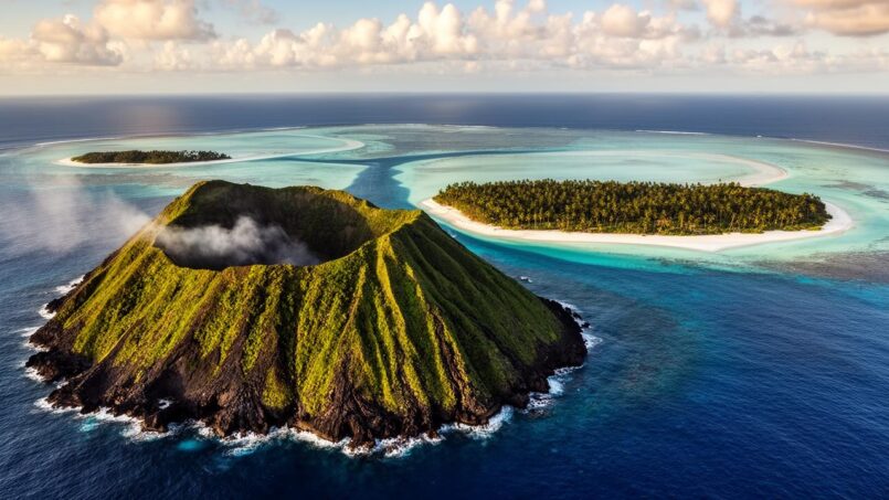
In the center of the archipelago, Ha’apai gathers about fifty islands, islets, reefs, and sandbanks, of which only about twenty are inhabited. The total land area is around 110 km². Ha’apai combines two types of relief: low coral islands, often ring-shaped or sand strips, and a few emerged volcanoes.
The Tongan archipelago has contrasting geography. The highest point, Kao, is between 1,033 and 1,046 meters above sea level. The volcanic island of Tofua contains the kingdom’s largest lake, a crater lake about 500 meters deep. Conversely, the low coral islands of Ha’apai, such as Lifuka or Uoleva, are highly exposed to sea-level rise and storm risks.
Vava’u, Rugged Relief and Natural Harbor
Further north, the Vava’u group offers a contrasting face, with raised limestone islands carved by deep bays, cliffs, caves, and channels sometimes reminiscent of a tropical fjord landscape. The main island, often called ‘Utu Vava’u‘, is the second largest in the country (about 97 km²). The entire group covers nearly 119 km².
Tongan archipelago characterized by rolling hills and an exceptional sheltered harbor.
Rolling hills with altitudes between 150 and 300 m. Its highest point is Mount Talau, at 204 m.
Protected by a semi-circular reef, providing a natural barrier.
Remarkable natural harbor welcoming yachts and pleasure craft.
Neiafu, the main town of Vava’u, is the second urban center of the Kingdom of Tonga.
The Niuas, the Northern Reaches
Further north, about 300 km from Vava’u, lie the Niuas – Niuafo’ou, Niuatoputapu, and Tafahi. These volcanic islands, ringed by reefs, represent the Tongan end of the world. Isolated, less developed than the other groups, they are also among the hottest in the kingdom. Niuafo’ou, a volcano island with a large flooded crater, experienced destructive eruptions in the 20th century that led to evacuations.
A Geology Dominated by Subduction and Volcanoes
Behind the turquoise lagoons and coral beaches, the geography of the country in Tonga is primarily shaped by a formidable geological mechanism: the subduction of the Pacific Plate beneath the Indo-Australian Plate. Tonga lies on the front of the gigantic Tonga-Kermadec volcanic arc, part of the Pacific “Ring of Fire.”
Two Parallel Chains: Volcanic Arc and Coral Ridge
The archipelago consists of two parallel chains of islands, each of different origin:
– To the west, the Tongan Volcanic Arc, made up of “high” volcanic islands (Kao, Tofua, Late, Fonualei, Tafahi, Niuafo’ou, etc.), directly resulting from the partial melting of the Pacific Plate at depth. Several of these volcanoes remain active, some barely emerging above sea level, others entirely submarine.
– To the east, the Tonga Ridge, a mainly coral crest, where the islands are raised limestone plateaus or low atolls, such as Tongatapu, Vava’u, or Lifuka. These islands are built on an older volcanic foundation, but their current morphology is essentially coral.
The lowest point of the Tonga Trench, Horizon Deep, reaches about 10,800 meters below sea level.
Highly Fertile Volcanic Soils
Most of the soils of the eastern islands of Tonga come from fine andesitic volcanic ash, deposited by eruptions of the western arc over millennia. These deposits can reach up to ten meters in thickness and have weathered to produce very fertile soils. This allows intensive agriculture on Tongatapu or Vava’u, where root crops (yams, taro, cassava, sweet potato), tropical fruits (coconut palms, banana trees, papaya, citrus, etc.), and cash crops (squash, vanilla, kava) are grown.
On ‘Eua, Kao, Tofua, Late, or Vava’u, these well-drained soils still support natural forests, refuges for many species, including endemic birds like the Tongan megapode or the Tongan whistler. Along the coast, vegetation adapted to spray and wind – mangroves, shrubs with thick waxy leaves – protects the shores from erosion.
Islands of ‘Eua, Kao, Tofua, Late, and Vava’u
Hunga Tonga–Hunga Ha’apai, Symbol of Volcanic Hazards
Among the most publicized volcanoes is Hunga Tonga–Hunga Ha’apai, a submarine edifice of which two small islands, Hunga Tonga and Hunga Ha’apai, only timidly emerged before recent eruptive episodes. In 2009, then between 2014 and 2015, Surtseyan-type eruptions caused new land to emerge and merge, forming an island about 2 km by 1 km, about a hundred meters high.
In January 2022, an exceptionally powerful eruption blasted a plume more than 20 km high, generated a trans-Pacific tsunami and devastated the western coasts of Tongatapu, ‘Eua, and Ha’apai. Waves reached 12 to 15 meters on some beaches, penetrating up to 500 meters inland on low islands like Mango. The new lands of Hunga Tonga–Hunga Ha’apai were largely torn away, leaving only small remnants of island subject to erosion.
This eruption spectacularly illustrates how the geography of the country in Tonga remains in constant motion, between emergence and destruction of land, uplift and subsidence, volcanic push and oceanic erosion.
A Tropical Climate, Rhythmed by the Sea and Trade Winds
The kingdom’s climate is typically tropical maritime, moderated by the southeast trade winds and the immense ocean mass surrounding it. Generally warm year-round, it is structured into two main seasons: a hot, humid season and a cooler, drier season.
Seasons, Temperatures, and Rainfall
We distinguish:
– a wet season, from November to April, corresponding to the austral summer and cyclone season;
– a cooler and drier season, from May to October, equivalent to winter.
Annual average temperatures in Tonga range from 23 to 28 °C, higher in the north and cooler in the south.
Rainfall is largely controlled by the South Pacific Convergence Zone (SPCZ), a quasi-permanent band of clouds and precipitation linked to the meeting of warm, humid air masses. This zone strengthens and moves over Tonga during the rainy season. About 60 to 70% of annual precipitation falls between November and April. Annual averages vary significantly from north to south: about 2,500 mm per year on the northern islands, compared to about 1,700 mm on the southern islands; Ha’apai constitutes a relative rainfall “dip.”
The Role of El Niño and Cyclones
The El Niño–Southern Oscillation (ENSO) phenomenon strongly modulates this regime. During El Niño episodes, the SPCZ tends to move away from Tonga, leading to drier conditions and sometimes marked droughts, especially on Tongatapu and Ha’apai. Conversely, La Niña years often see the SPCZ approach, with increased rainfall, sometimes leading to floods. These variations of a few months, however, rarely extend beyond a season.
Average number of cyclones crossing Tonga’s Exclusive Economic Zone per decade, with increasing intensity.
An Omnipresent Sea: EEZ, Reefs, and Resources
If land is scarce, the sea is everywhere. Tonga’s Exclusive Economic Zone (EEZ) far exceeds 650,000 km² – some sources mention nearly 700,000 km² – almost a thousand times the archipelago’s land area. This maritime vastness represents both a colossal resource and a management challenge.
Maritime Zones and Sovereign Rights
Like most coastal states, Tonga has defined its maritime zones in accordance with the United Nations Convention on the Law of the Sea (UNCLOS). The country declares itself an archipelagic state and claims:
– a territorial sea of 12 nautical miles from the baselines;
– a contiguous zone up to 24 nautical miles;
– an EEZ of 200 nautical miles, within which it exercises sovereign rights over biological and mineral resources, as well as energy production from water, currents, and wind;
– a continental shelf that may extend beyond 200 miles where the continental margin permits.
Historically, a “Tongan Box” had been defined as early as the late 19th century, encompassing all islands, reefs, and waters between 15° and 23.5°S and 173° to 177°W. This historical claim partly overlaps with the EEZs of neighbors such as Fiji, Niue, Samoa, American Samoa, and New Zealand, and still fuels discussions on exact boundaries, particularly around the Minerva Reefs (Teleki Tokelau and Teleki Tonga).
Reefs, Lagoons, and Marine Biodiversity
Geographically, Tonga is bordered by a mosaic of fringing reefs, barriers, lagoons, and submerged coral structures. Ha’apai concentrates one of the largest reef areas in the South Pacific, on the raised edge of the Indo-Australian Plate. The southern coasts of Tongatapu and ‘Eua also feature a unique coralline algal fringing reef, directly exposed to ocean swell.
Reefs protect coasts from erosion and contribute to beach sand supply. They provide essential habitat for rich biodiversity, including fish, mollusks, crustaceans, corals, seagrass beds, and mangroves. The surrounding waters serve as a major breeding ground for humpback whales and also host dolphins, sea turtles, and a great diversity of pelagic fish, such as various tuna species.
This marine wealth has a decisive weight in human geography: a large majority of the population lives within 5 km of the shore, and a substantial share of households participate in reef or lagoon fishing. Offshore fisheries targeting tuna and deep-sea fish, as well as aquaculture (mabé pearls, giant clams), take advantage of the vast EEZ, even though the country does not yet have a large-scale purse seiner fleet.
A Population Concentrated on Coastal Plains
The geography of the country in Tonga is intimately linked to a very coastal population distribution. Out of about 100,000 inhabitants, more than 80% live within 5 km of the sea, and nearly three-quarters are settled on the single island of Tongatapu. The capital Nuku’alofa, on the north coast of this island, alone accounts for about a third of the inhabitants.
Limited but Growing Urbanization
The country remains largely rural: about 21% of the population is recorded as urban, the rest living in villages, often traditional, scattered along the coasts. The development of Nuku’alofa and its agglomeration, however, tends to increase urban concentration. The city and its outskirts are estimated to approach 45,000 inhabitants by 2030, or nearly 40% of the projected total population.
Average altitude in meters of the city of Nuku’alofa, making it very vulnerable to coastal hazards.
Regional Imbalances and Migration
Outside of Tongatapu, the other groups – Ha’apai, Vava’u, the Niuas, ‘Eua – host smaller populations, often organized around a main town (Neiafu in Vava’u, Pangai in Ha’apai, for example). Ha’apai barely has over 5,000 inhabitants, Vava’u around 14,000, and the Niuas remain very sparsely populated.
Inequalities in access to services and opportunities push the population to migrate, mainly to the capital Nuku’alofa and abroad (New Zealand, Australia, United States). This emigration reduces local population growth but generates remittances from the diaspora, which constitute a significant part of the national GDP.
Infrastructure Shaped by Insularity
Island geography profoundly determines how Tonga equips itself with transport and communication infrastructure. The sea, ever-present, imposes planes and boats as the main means of connection between islands, while road networks are concentrated on the few large islands.
Roads, Ports, and Airports
The national road network totals about 680 km, with barely 184 km paved. Most roads are earth or coral material, sensitive to weather, especially during the rainy and cyclone seasons. Main axes are on Tongatapu and to a lesser extent on Vava’u and Ha’apai. The lack of marked relief on Tongatapu facilitates road layout, but low altitude exposes them to flooding and submersion risks.
On the maritime side, three ports dominate:
| Main Port | Location | Geographic Role |
|---|---|---|
| Nuku’alofa | Tongatapu Island | Main international port, 95% of containerized freight |
| Neiafu | Vava’u Island | Second port, complementary container traffic |
| Pangai | Ha’apai Group | Regional port and export of agricultural products |
The port of Nuku’alofa, with the Queen Sālote International Wharf, concentrates most imports and exports, as 98% of goods arrive by sea. A cruise terminal at Vuna Wharf reinforces the capital’s importance as a tourist gateway. Small ports or wharves serve the secondary islands, often with limited capacity and highly dependent on weather conditions.
The archipelago has six airports, but only Fua’amotu on Tongatapu has a hard-surface runway suitable for regular international flights. The other airports (Vava’u, Ha’apai, ‘Eua, Niuatoputapu, etc.) have shorter and often unpaved runways, reserved for domestic connections and sensitive to weather conditions.
Geographic Constraints and Vulnerability
This transport geography has two sides. On one hand, it guarantees a minimum of connectivity between the main island groups, necessary for trade, passenger transport, medical evacuations, and national cohesion. On the other hand, it heavily exposes the country to the slightest disruptions: cyclones, swells, coastal flooding, eruptions, and tsunamis can damage runways, wharves, coastal roads, and bridges, suddenly isolating entire communities.
Recent investments, often supported by international donors, aim to “climate-proof” these infrastructures: raised roads, improved drainage systems, reinforced wharves, airport modernization. But geography – low islands, reefs, sandy coasts – limits room for maneuver and increases the cost of every project.
Natural Hazards at the Heart of Geography
The Kingdom of Tonga is among the most exposed countries in the world to climatic and geophysical hazards, a situation directly linked to its geography: low-lying islands, anchoring on a hyperactive subduction zone, full exposure to South Pacific cyclones, and dependence on the sea for resources and habitation.
Cyclones, Floods, and Droughts
Tropical cyclones are the most regular threat. Statistics over several decades show that on average 1 to 2 systems affect Tonga per season, with marked variations year to year. Since the late 20th century, several major cyclones – Ron, Waka, Heta, then Gita, Harold – have struck the kingdom, destroying homes, power grids, crops, roads, bridges, port and airport infrastructure.
The low-lying coastal plains of Tongatapu, Ha’apai, and ‘Eua are highly exposed to flooding (storm surge, heavy rainfall). Conversely, El Niño episodes can cause prolonged droughts, threatening water resources, agriculture, and public health.
Earthquakes, Subsidence, and Coastal Erosion
Seismic activity, though less publicized than cyclones, remains a factor in landscape transformation. The case of Lifuka, in Ha’apai, is emblematic: a major earthquake in 2006 (magnitude near 7.9) caused the island to subside by about 23 cm. Over four decades, the west coast of Lifuka has retreated by 2 to 43 meters depending on the sector, under the combined effect of tectonic subsidence, marine erosion, and sea-level rise.
This dynamic illustrates how Tonga’s coastal geography is plastic, shifting: sections of coast disappear, sand spits reform elsewhere, mangroves retreat or advance depending on swell and current action. For villages built at water’s edge, a few tens of centimeters of subsidence can spell the permanent disappearance of agricultural land or inhabited sites.
Sea-Level Rise and Flooding Scenarios
Satellite observations indicate that sea level near Tonga is rising at a rate exceeding 6 mm per year since the early 1990s, about twice the global average. If this trend continues, projections suggest a rise of about 30 cm by 2050, then 40 to 87 cm by the end of the century (high-emissions scenario), with extreme scenarios reaching up to one meter of average rise, or even more beyond 2100.
On an island like Tongatapu, where large areas lie between 0 and 2 meters in elevation, these figures translate into very concrete terms:
| Sea-Level Scenario on Tongatapu | Estimated Effects |
|---|---|
| +0.3 m | 14% of the population and nearly 4% of land submerged during high tides |
| +0.5 m | About 6% of land permanently lost |
| +1.0 m | Up to 25% of land potentially permanently submerged |
By combining mean sea-level rise and extreme events (spring tide, storm, cyclone), these percentages explode. One study suggests that with +0.5 m and a storm event, up to 42% of Tongatapu’s population – more than 30,000 people – could be exposed to floods of 20 cm or more. In some areas, long-term flood protection would inevitably require strategies of planned retreat, relocation, and reconstruction further back from the coastline.
Adaptation and Spatial Recomposition
Faced with these prospects, the geography of the country in Tonga is not just a backdrop to endure: it becomes the object of a huge adaptation project, where coastal engineering, land-use planning, reforestation, reef protection, and habitat reorganization intersect.
Protection Works, Nature, and Coastal Management
On Tongatapu, Ha’apai, or Lifuka, pilot projects have experimented with different types of coastal protection: rock revetments, rubble-mound breakwaters, offshore breakwaters, beach nourishment, ban on sand extraction, replanting of mangroves and coastal species. The east coast protection project on Tongatapu, or the structures on Lifuka, illustrate this mixed approach between hard structures and nature-based solutions.
On very low islands, physical protections against sea-level rise have technical and financial limits. “Managed retreat” scenarios are therefore considered, including mandatory setback zones, raising buildings, or relocating villages inland or to higher islands, to anticipate the inevitable conquest of land by the sea.
Terrestrial and Marine Reserves
On land, the national strategy aims to dedicate at least 30% of land to agroforestry or forest by the mid-2020s, supported by massive planting campaigns – one million trees, mainly coastal species like mangroves. At sea, the country aims to place 30% of its EEZ under marine protected area or special management zone status, in order to preserve reefs, seagrass beds, mangroves, and breeding habitats essential to fisheries.
Natural elements like forests, reefs, mangroves, and relief are now considered fully-fledged protective infrastructure, on par with artificial dikes and breakwaters. They play a functional role in defense against waves, storm surges, and erosion, going beyond their simple status as landscape.
Geography at the Center of Development Choices
Ultimately, the geography of the country in Tonga imposes a number of constants: island dispersion, low-lying coasts, dependence on the ocean, extreme exposure to natural hazards. These realities permeate all development choices: where to build roads, ports, and airports; where to locate villages and towns; how to exploit scarce agricultural land and marine resources; how to protect, adapt, and sometimes retreat.
The moderate relief, fertile volcanic soils, diversity of reefs, and rich fisheries are major assets. However, these assets are exposed to growing risks from sea-level rise, intensification of severe cyclones, and consequences of subduction (earthquakes, tsunamis, volcanism), which are gradually reshaping the territory.
In this context, geography is neither fixed nor merely suffered: it is at the heart of national strategies – whether strengthening coastal defenses, restructuring land-use patterns, negotiating maritime boundaries, expanding natural reserves, or directing investments toward more resilient infrastructure. The Kingdom of Tonga thus illustrates, in a particularly visible way, what it means today to inhabit an archipelago that is both magnificent, vulnerable, and rapidly transforming on the edge of the deepest trench on the planet.
A heritage project or a question? Contact us now to speak with a wealth management expert.
Disclaimer: The information provided on this website is for informational purposes only and does not constitute financial, legal, or professional advice. We encourage you to consult qualified experts before making any investment, real estate, or expatriation decisions. Although we strive to maintain up-to-date and accurate information, we do not guarantee the completeness, accuracy, or timeliness of the proposed content. As investment and expatriation involve risks, we disclaim any liability for potential losses or damages arising from the use of this site. Your use of this site confirms your acceptance of these terms and your understanding of the associated risks.

Cyril Jarnias is an independent expert in international wealth management with over 20 years of experience. As an expatriate himself, he is dedicated to helping individuals and business leaders build, protect, and pass on their wealth with complete peace of mind.
On his website, cyriljarnias.com, he shares his expertise on international real estate, offshore company formation, and expatriation.
Thanks to his expertise, he offers sound advice to optimize his clients' wealth management. Cyril Jarnias is also recognized for his appearances in many prestigious media outlets such as BFM Business, les Français de l’étranger, Le Figaro, Les Echos, and Mieux vivre votre argent, where he shares his knowledge and know-how in wealth management.





