
 Published on and written by Cyril Jarnias
Immense plateau wedged between Siberia and the Chinese desert, Mongolia is often summed up as a picture of endless steppes. The reality is far more complex. From the glacial mountains of the west to the dunes of the Gobi Desert, from the deep northern lakes to the dry interior valleys, the country’s geography in Mongolia shapes everything: climate, resources, ways of life, environmental vulnerabilities, and even administrative organization. Diving into this geography means understanding why this territory is both one of the most preserved and one of the most fragile on the planet.
A Landlocked Giant in the Heart of Asia
Mongolia occupies a pivotal position on the Central Asian plateau, on the edge of East Asia. Without access to the sea, it is completely encircled by two giants: Russia to the north, China to the south, east, and west. Its coordinates are around 46° north latitude and 105° east longitude, placing it roughly between 41°N and 52°N, and between 87°E and 120°E.
Mongolia, with an area of about 1.56 million km², is the second-largest landlocked country in the world.
This vastness contrasts with a tiny population on a global scale, just over 3.5 million inhabitants. The average density is around 2.2 inhabitants per km², making the country, excluding disputed territories, the most sparsely populated sovereign state in the world. Half of all Mongolians are concentrated in Ulaanbaatar, the capital located at 1,350 meters above sea level in the Tuul River valley, while the rest of the territory seems almost empty.
Relief, Altitudes, and Major Natural Regions
The country’s geography in Mongolia is first and foremost a story of altitude. Approximately 80% of the territory lies above 1,000 meters, with an average altitude of nearly 1,580 meters. This high relief largely explains the harsh climate, isolation, and physiognomy of the landscapes.
The highest point is Khüiten Peak (4,374 m), nestled in the Tavan Bogd massif in the far west of the Altai Mountains. At the other extreme, the lowest point is at Lake Hoh Nuur, about 560 meters. Between these two extremes, the country forms a vast, undulating plateau, tilted from northwest to southeast, incised by internal depressions, glacial valleys, and lake basins.
Mongolia can be roughly divided into four latitudinal bands, from north to south: mountain-forest-steppe zone, mountain-steppe, semi-desert, then desert. Added to this are the major mountain ranges that structure the space.
The Major Mountain Ranges
Three main complexes dominate the relief, with a fourth distinct block sometimes added.
Occupying the western quarter of the country, the Altai Mountains form the highest and most glacial region, with many peaks exceeding 4,000 meters (e.g., Mönkhkhairkhan at 4,204 m). These mountains with their eternally snow-covered peaks and glaciers feed numerous rivers and lakes, creating an unexpected alpine landscape. To the east, the chain extends into the Gobi-Altai Mountains, which form a barrier against moist air masses as they end in the desert.
Further east, in the center, lies the Khangai Massif. Older and more eroded than the Altai, it presents a gentler face: rounded summits, wide high-altitude pastures, a mosaic of forests, rivers, and lakes. The Khangai stretches for about 800 kilometers. Its highest point, Otgontenger (about 4,031 m), is a sacred mountain. It is one of the country’s major water towers, giving rise to the Orkhon, Ider, Zavkhan, and many tributaries of the Selenge. Its foothills shelter the Orkhon Valley, a UNESCO World Heritage site as the historical heartland of nomadic civilizations.
Located northeast of Ulaanbaatar, the Khentii Mountains stretch for about 400 km. Although modest in altitude (the highest point, Asralt Khairkhan, reaches about 2,800 m), this massif plays a crucial geographical role as the watershed divide between the Arctic and Pacific basins. Several major Mongolian rivers originate here, such as the Onon, Kherlen, Tuul, and Menza. Covered in coniferous and birch forests, it also contains Mount Burkhan Khaldun, a sacred mountain associated with Genghis Khan.
Finally, to the north, the Khovsgol Mountains overlook the great lake of the same name. Less well-known than the Altai or Khangai, they nonetheless form a rugged assemblage marked by glacial relief and deep forests.
Steppes, Semi-Deserts, and the Gobi
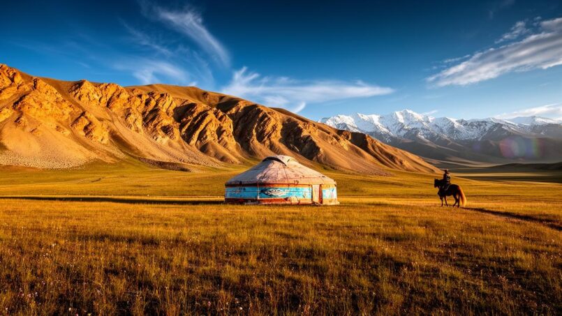
Between and at the foot of these mountain ranges stretch vast steppe plains. Mongolia is home to one of the largest expanses of intact temperate grasslands in the world, particularly in the eastern part of the country, within the Mongolian-Manchurian steppe and Eastern Mongolian steppe. These grassy landscapes, undulating as far as the eye can see, are the matrix of nomadic herding and the heart of the pastoral territory.
Heading south, the steppe dries out to form the Gobi Desert, which covers about a third of Mongolia. Contrary to popular belief, only 5% of its surface consists of sand dunes. Most of the desert is composed of gravel plains, rocky plateaus, regs, arid hills, and dry steppes.
The entire Mongolian Gobi steppes and surrounding steppes form the largest continuous steppe system on the planet. In the south, the Mongolian Gobi naturally extends into China, creating a considerable transboundary ecological entity, at the heart of which are sites like the Great Gobi National Park, recognized by UNESCO as a biosphere reserve.
Climate: Extreme Continental
The country’s geography in Mongolia, through its altitude and landlocked nature, generates one of the most continental climates in the world. Far from any oceanic influence, dominated in winter by the Siberian anticyclone, Mongolia combines endless winters and short but sometimes scorching summers, with dizzying temperature differences.
The temperature range between the January and July averages can exceed 44 °C in Mongolia.
Despite this cold, the country is nicknamed the “Land of Blue Sky”: depending on the region, there are between 220 and over 250 sunny days per year. The sky is often clear, cloud cover low, which intensifies both solar radiation in summer and nighttime cooling in winter.
Average annual precipitation in Mongolia, ranging from less than 100 mm in the Gobi to over 250 mm in the northern mountains.
This climate itself is undergoing rapid change. Since the mid-20th century, the average temperature has risen by at least 1.8 °C, and over the past 80 years studies indicate a warming close to 2.5 °C, one of the most pronounced in the world. This warming accelerates the melting of mountain glaciers, the degradation of permafrost which still covers more than half the territory, and dries out the steppes, increasing the frequency of droughts and natural disasters.
Hydrographic Network: Three Seas, a Landlocked Country
Paradoxically, Mongolia, despite having no coastline, sends its waters to three major basins: the Arctic Ocean, the Pacific Ocean, and a vast internal basin with no outlet to the sea.
The territory is thus divided into three major hydrographic basins: the Arctic basin, the Pacific basin, the endorheic basin of Central Asia. The Khentii Mountains play a fundamental role, serving as the watershed divide between the Arctic and Pacific.
Major River Systems
There are over 4,000 rivers in the territory, representing about 65,000 km of permanent waterways. Among them, the Selenge–Orkhon system occupies a dominant place. The Selenge, combined with its tributaries, drains a large part of northern Mongolia before flowing into Lake Baikal in Russia, then into the Angara River and finally the Yenisei, which reaches the Arctic Ocean.
Born on the slopes of the Khangai, winds through the historic Orkhon Valley before joining the Selenge. Its basin accumulates a large part of the country’s history, archaeology, and settlement.
The Orkhon, the longest river in Mongolia
To the east, the Kherlen originates in the Khentii Mountains and flows for more than 1,000 km in Mongolia before crossing the Chinese border to empty into Lake Dalai (Hulun), itself connected to the Amur River system, and thus to the Pacific. The Onon, another major river originating in the Khentii, follows a similar path by joining the Shilka in Russia, then the Amur.
In the center, the Tuul River plays a vital role, less for its length than for its function: it flows through Ulaanbaatar and supplies water to half the country’s population via the alluvial aquifers of its valley. Further west, the Khovd or Zavkhan flow into the endorheic lakes of the “Great Lakes Depression,” a vast internal basin typical of Central Asia.
Over 120 million m³ of wastewater is discharged annually without treatment in Mongolia.
Lakes: Inland Seas and Freshwater Pearls
The country has about 3,000 lakes, most of which have no outlet to the sea. They play a crucial ecological and climatic role: water reservoir, refuge for biodiversity, local thermal regulator, resource for fishing and livestock.
Several major systems stand out.
Lake Uvs, located in the west, is the largest lake by surface area, with about 3,350 km². It sits at an altitude of 759 meters. Its particularity is being highly saline, up to five times saltier than seawater. The lake is endorheic, meaning without an outlet, and is fed by about thirty rivers, including the Tes. Its entire basin is a UNESCO World Heritage site, a transboundary site shared with Russia.
Further north, Lake Khövsgöl, nicknamed the “Blue Pearl of Mongolia,” is the country’s largest freshwater reservoir. Of tectonic origin, it covers 2,620 km² with a maximum depth of over 250 meters. Its waters of exceptional clarity flow into the Selenge and Lake Baikal, thus strengthening the ecological connection between Mongolia and Siberia.
In the arid west, the “Great Lakes Depression” groups several major lakes such as Khar-Us, Khar, Dörgön, Khyargas, Achit, and Boon Tsagaan. Some are shallow freshwater, others highly saline, often linked in a chain by rivers and channels. They form a necklace of wetlands at the foot of the Altai, essential for migratory birds and local populations.
Some Major Lakes in Numbers
| Lake | Type | Area (km²) | Max. Depth (m) | Key Features |
|---|---|---|---|---|
| Uvs Nuur | Saline | ~3,350 | 10–20 | Endorheic basin, UNESCO site, very salty |
| Khövsgöl Nuur | Freshwater | 2,620 | ~262 | “Blue Pearl,” ultra-clear waters, tourism |
| Khar-Us Nuur | Freshwater | 1,852 | 4.5 | Great Lakes Depression, many islands |
| Khyargas Nuur | Saline | – | – | Large endorheic basin in the west |
| Buir Nuur | Freshwater | 615 | 6–10 | Largest lake in the east, rich in fish |
| Dörgön Nuur | Saline | 305 | 27 | Deep, no islands, connected to Khar Nuur |
These water bodies, though modest on a national scale, represent 83.7% of surface water resources. Hence the crucial importance of their protection in a generally dry nation.
The Gobi Desert: A Mineral Giant Under High Tension
In the country’s geography in Mongolia, the Gobi holds a special place. This immense desert entity, located in the south of the territory and extending well into China, is both an iconic space, a reservoir of resources, and a front line of environmental change.
Maximum height that the great singing dunes of Khongor can reach in the Gobi Desert.
Despite its aridity, the Gobi harbors unexpected life: saxaul bushes, tamarisks, halophytic plants, or xerophytic grasses cling to the salty soils, while Bactrian camels, gazelles, Gobi bears, snow leopards and a host of reptiles survive there. Scientifically, the desert is famous for its fossils of dinosaurs and Cenozoic mammals, which testify to ancient river environments now vanished.
The Gobi Desert is advancing northward at a rate of 6 to 7 km per year, encroaching on the steppes.
Natural Resources: A Strategic Subsoil, a Fragile Surface
Beneath its steppes and deserts, Mongolia hides a veritable mineral treasure chest. Over 10,000 occurrences and 2,500 deposits of more than 80 types of minerals have been cataloged, of which about 1,170 are officially registered. Proven reserves place the country in the global top tier for several resources: over 37 billion tons of coal, 57 million tons of copper, 2,500 tons of gold, over 48 million tons of fluorspar, not to mention iron, zinc, uranium, or rare earths.
The mining sector accounts for nearly a quarter of GDP, constitutes the vast majority of exports, and attracts most foreign investment. However, these activities take place in an extremely sensitive environment.
Mongolia’s land surface is mostly covered in pastures: about three-quarters of the territory. These grasslands feed tens of millions of livestock and form the foundation of pastoral culture. But studies converge: nearly 70 to 77% of land is now considered degraded, and over 70% of pastures are in a state of severe degradation. Desertification is gaining ground in the south, where any poorly managed disturbance can turn into permanent sandy desert.
Desertification, Degradation, and Policy Response
The numbers show the scale of the phenomenon. The proportion of desertified land rose from about 72% to nearly 77% between 2006 and 2020. Vegetation growth on rangelands has decreased fivefold. Forests, concentrated in the north, lost 10% of their cover between 1980 and 2000, and then nearly 384,000 hectares between 2007 and 2010. Overall, 77% of land is considered degraded, due to the combined effects of overgrazing, climate change, unsustainable pastoral practices, deforestation, mining expansion, and a network of unpaved tracks.
Forest clearing and natural disturbances strip the soil. This intensifies runoff, causing flooding and erosion, while lowering water tables. Weakened vegetation becomes more vulnerable to climatic hazards, with a risk of near-irreversible tipping into desert, especially in the south.
Aware of this spiral, Mongolia joined the United Nations Convention to Combat Desertification as early as the 1990s, established a National Committee and a dedicated National Center, and funded a series of anti-desertification projects. More recently, the country launched the “Billion Trees” campaign, aiming to plant one billion trees by 2030. To date, over 50 million trees have reportedly been planted, with international support, notably from China. This initiative, often cited as a model of reforestation and agroforestry, adds to forestry policies that require reinvesting most timber revenues into forest protection and restoration.
Scarce Water, Water Under Pressure
In a dry country, water management is a matter of geography as much as survival. Mongolia has limited renewable resources, a large fraction of which is already mobilized. In theory, only 1.5% of renewable resources are withdrawn each year, but this figure masks strong spatial disparities. While the mountainous northeast is well-watered, the center and especially the south — particularly the Gobi region — suffer from a chronic deficit. Where mining industries concentrate, water demand increases faster than supply, intensifying pressure on aquifers.
Over 120 million m³ of wastewater is discharged annually without treatment in Mongolia, coming from cities and industries.
Facing these challenges, the state has structured water management around 29 river basins, each with a specific organization responsible for implementing integrated management. Major reservoir and diversion projects — such as the Orkhon–Ongi or Khentii–Toono systems — are planned to supply water to the mining areas of the Gobi, while exploration campaigns target groundwater aquifers on about 17% of the territory. The stakes are both economic and human: over 40% of deaths related to natural disasters are caused by water-related hazards, whether floods, landslides, or ice jams.
Biodiversity and Protected Areas: An Expanding Network
The country’s geography in Mongolia is not limited to its constraints: it also hosts a unique natural heritage. The intact steppes, boreal forests, lakes, and deserts form a landscape mosaic where some of the last wild populations of threatened large mammals still survive: Przewalski’s horses (takhi), wild camels, Mongolian saiga, Gobi bears, snow leopards, argali sheep, gray wolves, saker falcons, to name only the most iconic.
Percentage of wildlife collapse in Mongolia, mainly due to poaching and habitat loss.
The official goal is to reach 30% of protected land. To achieve this, the “Eternal Mongolia” initiative plans to add nearly 14.4 million hectares to the existing network and strengthen the management of 47 million hectares already classified, while promoting sustainable practices on an additional 34 million hectares. This program, valued at nearly $198 million, involves a vast partnership between the government and several major international NGOs, and notably relies on nomadic herders: about 200,000 pastoral families are involved in establishing sustainable pastures on nearly 34 million hectares.
Protected areas cover about half of the world’s freshwater sources and river flows.
Population, Territory, and Administrative Organization
The way the population fits into the country’s geography in Mongolia is equally revealing. With a density of about 2.2 inhabitants per km², one might think of an empty space. In reality, the population is heavily concentrated in a few urban centers and valley oases, leaving vast expanses largely dedicated to extensive pastoralism.
Ulaanbaatar concentrates nearly half of Mongolia’s population. Its location in a narrow valley prevents the dispersion of pollutants, making the air particularly unbreathable in winter due to coal heating. The rest of the population is spread across medium-sized cities like Darkhan, Erdenet, Choibalsan, Mörön, and Bayankhongor, located along major transport routes.
The administrative space is divided into 21 provinces (aimags) and one municipality with equivalent status, that of Ulaanbaatar. Each aimag is subdivided into several soums (rural districts), themselves broken down into bags (hamlets or local units). The capital, for its part, is fragmented into nine urban districts (düüreg), each subdivided into khoroos, the equivalent of neighborhoods. These divisions reflect geographical realities: an aimag like Ömnögovi, in the heart of the Gobi, covers over 165,000 km² with fewer than 70,000 inhabitants, while the small province of Orkhon concentrates a dense population around the Erdenet mining combine.
Life in the steppes and semi-deserts is traditionally organized around pastoral nomadism, where families move their herds according to seasons and pasture availability. This mobility, essential for adapting to an unpredictable environment, now faces major challenges: increasing sedentarization, infrastructure development, and fragmentation of rangelands due to mining activities.
A Country Shaped by Climate Risks
In this geographical context, climate change acts as a risk multiplier. Rising temperatures increase evaporation, weaken soils, degrade pastures, and heighten precipitation variability. Extreme events are multiplying: spring dust storms, severe droughts, flash floods after concentrated storms, more violent blizzards.
Several dzud episodes in recent years have wiped out nearly 9% of Mongolia’s national livestock herd.
Authorities are trying to respond with finer tools: development of a national climate risk index, early warning systems for pasture management, emission reduction strategies, notably through a nationally determined contribution aiming for a reduction of nearly 23% of expected emissions by 2030 in the energy and non-energy sectors.
Transport and Development: The Effect of Distances
The country’s geography in Mongolia is also one of distances and infrastructure scarcity. On such a vast territory, the transport network conditions regional accessibility, the structure of exchanges, and how natural resources are exploited.
The Trans-Mongolian Railway, a north-south axis linking Russia to China via Ulaanbaatar, forms the backbone of the network. It is now complemented by several lines dedicated to transporting minerals (coal, copper, metal concentrates) from the major southern deposits (Tavan Tolgoi, Zuunbayan, Gashuunsukhait, Khangi, Shiveekhüren) to Chinese border crossings. These railways, hundreds of kilometers long, are transforming the geography of flows, replacing former herding and caravan routes with massive raw material transport.
On the road, the network remains uneven. While links between the capital, major cities, and some border crossings are paved, most secondary routes are still dirt tracks. Projects for east-west and north-south corridors, integrated into regional initiatives (China–Mongolia–Russia corridor, Asian Highway network), aim to transform landlockedness into a transit advantage. But each new infrastructure, in a fragile environment, raises the question of its impact on steppes, wildlife habitats, and pastoral dynamics.
A Geography in Constant Change
Over the decades, the country’s geography in Mongolia is transformed under the combined effect of climate, economic activities, and policy choices. Glaciers are retreating in the Altai and Khangai; permafrost is thinning; steppes are drying out; the Gobi’s boundaries advance and retreat with droughts and pastoral use; river valleys are densifying while the most remote areas are gradually emptying.
Mongolia attempts to reconcile the exploitation of its mineral resources with the preservation of its fragile ecosystems, through protected areas, reforestation, and water management. However, the heavy economic dependence on the mining sector and climatic vulnerability leave little margin for error in this delicate balance.
Understanding the country’s geography in Mongolia thus means grasping a system in permanent tension between vastness and scarcity, pastoral tradition and industrial extraction, drought and floods, desertification and reforestation. It also means recognizing that this territory, far from being a mere “blank” on the map, is one of the most advanced laboratories for the major environmental challenges of the 21st century.
Disclaimer: The information provided on this website is for informational purposes only and does not constitute financial, legal, or professional advice. We encourage you to consult qualified experts before making any investment, real estate, or expatriation decisions. Although we strive to maintain up-to-date and accurate information, we do not guarantee the completeness, accuracy, or timeliness of the proposed content. As investment and expatriation involve risks, we disclaim any liability for potential losses or damages arising from the use of this site. Your use of this site confirms your acceptance of these terms and your understanding of the associated risks.

Cyril Jarnias is an independent expert in international wealth management with over 20 years of experience. As an expatriate himself, he is dedicated to helping individuals and business leaders build, protect, and pass on their wealth with complete peace of mind.
On his website, cyriljarnias.com, he shares his expertise on international real estate, offshore company formation, and expatriation.
Thanks to his expertise, he offers sound advice to optimize his clients' wealth management. Cyril Jarnias is also recognized for his appearances in many prestigious media outlets such as BFM Business, les Français de l’étranger, Le Figaro, Les Echos, and Mieux vivre votre argent, where he shares his knowledge and know-how in wealth management.





