
 Published on and written by Cyril Jarnias
Sandwiched between the Red Sea and the Indian Ocean, at the junction of three tectonic plates, the country of Djibouti packs an astonishing variety of landscapes, climates, and geostrategic stakes into a tiny territory. Barely larger than the U.S. state of New Jersey, yet a key access point to the Suez Canal, global trade, and major digital flows, it is both one of the most arid territories on the planet and one of the most coveted.
Djibouti’s territory consists of volcanic plateaus, cool mountains, salt plains, hyper-saline lakes, and coral coasts. This complex geography explains its extreme climate, environmental vulnerability, role as a logistics hub, and the organization of its population of over one million within a constrained space.
A Tiny State at the Heart of the Horn of Africa
Located in the Horn of Africa, the country of Djibouti stretches over approximately 23,200 km². It shares borders with Eritrea to the north, Ethiopia to the west and southwest, and Somalia to the south and southeast. To the east, its coastline of over 300 km is washed by the Red Sea and the Gulf of Aden, at the Bab-el-Mandeb strait.
The Bab-el-Mandeb strait is located only 30 kilometers from the Yemeni coast, linking the Red Sea to the Indian Ocean.
A Compact Yet Highly Contrasted Territory
On the map, the country of Djibouti resembles an irregular triangle, framed by three major natural regions: the northern mountains, the central plateaus and plains, and the southern highlands. The authorities distinguish three main physiographic units: the Northern Mountains, the Grand Bara plain, and the Southern Mountains. Behind this typology lies a rugged relief that varies by more than 2,000 meters between the highest and lowest points.
With approximately 575 km of land borders, the longest stretch of which is with Ethiopia, Djibouti plays a crucial role for its landlocked neighbor. Ethiopia depends almost entirely on Djibouti’s ports, such as the one in Djibouti City, for its foreign trade. This interdependence is primarily geographical, as Djiboutian territory offers the most direct access between the Ethiopian highlands and the sea.
A Coastal Capital on a Coral Reef
The demographic and economic heart is concentrated in Djibouti City, the capital built on coral reefs at the head of the Gulf of Tadjoura. Positioned around 11°35’ north latitude and 43°09’ east longitude, the city stretches along an arcing coast, just a few meters above sea level.
The urban area concentrates approximately 70 to 75% of the national population, making it by far the main urban center. The administrative region of Djibouti, the smallest in area (about 200 km²), is also by far the most populous. It concentrates political functions, the port base, rail infrastructure, airport and telecom facilities, but also a large share of vulnerabilities related to climate and sea-level rise.
Relief: Between Cool Mountains, Basaltic Plateaus, and Salt Depressions
The country of Djibouti is often described as an “open-air geology laboratory.” This reputation stems from its location at the meeting point of three major rift systems: the East African Rift Valley, the Red Sea rift, and the Gulf of Aden rift. The result: a mosaic of massifs, tectonic depressions, volcanic plateaus, and salt lakes that give the landscape a unique physiognomy.
A Mountainous Arc Surrounding the Territory
The relief is dominated by a vast mountainous arc that encircles the north and center of the country: the Moussa Ali, Goda, Mabla, Arrei, Dalha, Garbi, Boura, and Dagouein massifs form a sort of rocky crown above the plateaus.
The main peaks can be summarized as follows:
| Range / Massif | Approximate Altitude | Main Location |
|---|---|---|
| Moussa Ali | ~2,020 – 2,060 m | Ethiopia–Eritrea–Djibouti border |
| Mount Goda (Goda) | ~1,780 m | Northwest of the Gulf of Tadjoura |
| Mount Mabla | ~1,780 m | Obock region |
| Mount Garbi | ~1,680 m | West of Tadjoura |
| Mount Arrei | ~1,300 m | Ali Sabieh region |
| Mount Dagouein | ~1,120 m | Southern interior |
| Mount Hemed | ~1,100 m | Arta region |
| Boura Mountains | ~1,000 m | Southwest |
The official highest point is Mount Moussa Ali, a volcano that slightly exceeds 2,000 meters at the northern tip of the country, where the Ethiopian, Eritrean, and Djiboutian borders meet. At the other end of the spectrum, Lake Assal, a saline basin located approximately 155 meters below sea level, is the lowest point in Africa and one of the lowest on the globe.
Volcanic Plateaus and Desert Depressions
Inland, the relief is dominated by vast basaltic plateaus cut by ravines and canyons. Much of the country is covered with ancient solidified lava fields, dark basalt flows, and stony plains. Earthquakes are frequent – more than 600 micro-tremors are recorded each year – and the scars of past eruptive episodes are visible everywhere.
Among the most spectacular depressions are:
– The Grand Bara, an immense desert plain with sandy-clay soil, covering parts of the Arta, Ali Sabieh, and Dikhil regions. The altitude there remains below 500–520 meters, with flat expanses crisscrossed by cracks. This backdrop serves as a venue for races and sometimes for wheeled land sailing experiments.
– The plains and depressions of Petit Bara, Hanlé, Gobaad, as well as other basins like Alol, which structure the center and south of the country.
– The Djiboutian Danakil, the western part of a vast depressed area that extends mainly into Ethiopia, and includes the Lake Assal area, volcanic and scorching.
In these desert plains, the water from salt lakes and sebkhas (chotts) evaporates quickly as soon as it appears, leaving behind thick crusts of salt.
Hyper-Saline Lakes: Assal and Abbé
Two large closed lakes dominate the hydrography of Djibouti, in the absence of permanent rivers.
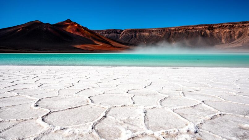
Lake Assal, located west of the Gulf of Tadjoura in a tectonic basin, is a hypersaline lake situated about 155 meters below sea level. Its water is up to ten times saltier than ocean water, placing it among the saltiest bodies of water on the planet. Its shores are covered with thick white salt crusts, surrounded by dark volcanic hills, creating a striking contrast. The surrounding area hosts significant salt deposits exploited industrially.
Located on the Ethiopian border, Lake Abbé is a salt lake famous for its hundreds of limestone and tufa chimneys, which can reach 50 meters, forming a ‘mineral forest’ in the middle of the desert. The area also includes hot springs, marshes, and significant birdlife, including flamingos, making it a remarkable ecological site.
These lakes are the endpoint of numerous temporary wadis: networks of dry valleys that turn into muddy torrents at the slightest significant downpour.
Active Volcanoes and Tectonic Triple Junction
The country of Djibouti lies where three rifts meet: the Red Sea rift, the Gulf of Aden rift, and the East African Rift. This configuration, called the “Afar triple junction,” results in intense tectonic and geothermal activity.
The Ardoukoba volcano, located between Lake Assal and the Gulf of Tadjoura, illustrates this dynamism: during its eruption in the late 1970s, spectacular lava flows covered the area, and the separation between the African and Arabian plates reportedly widened by about one meter. Since then, the site has been monitored and symbolizes this process of slow tearing of the Earth’s crust.
This geology offers considerable potential for geothermal energy. National estimates suggest a capacity of about 1,000 MW, potentially sufficient to cover all of the country’s electricity needs in the long term and significantly reduce the cost of electricity production. Several exploratory projects are targeting active volcanic areas, particularly around Lake Assal.
Climate: A Hot Desert, Between Coastal Furnace and Highland Coolness
While the relief is contrasting, the climate is largely dominated by aridity. The country of Djibouti is among the driest nations in the world. It exhibits a combination of a hot desert climate and, in some mid-altitude areas, semi-desert or arid steppe.
A Country That Is Generally Scorching and Dry
Nationally, annual rainfall typically ranges between 100 and 200 millimeters, with strong regional variations. On the coast and in low-lying plains, it rarely exceeds 130 mm per year, while some highlands can receive up to 380–400 mm. Not only is rain scarce, but it is also extremely erratic from year to year, with drought sequences that can last several years.
Average temperatures indicate a country permanently under heat. Daily highs often range between 32°C and over 40°C, with nights rarely cool in the lowlands. In Djibouti City, the average annual temperature is around 30°C, making it one of the hottest and driest cities in the world.
There are two main seasons:
Oman’s climate is divided into two main seasons. A “cool” season from October to April, with more bearable temperatures around 25–30°C during the day by the sea, and more rain, especially in winter and early spring. A torrid season from May to September, when the thermometer often exceeds 40°C on the coast, with nights frequently remaining above 30°C. In the most exposed areas, heat peaks can exceed 45–50°C.
In addition, a scorching desert wind, the khamsin, can blow in summer, bringing dust, sand and a suffocating feeling of heat.
Microclimates: Contrast Between Coast and Mountains
Altitude plays a decisive role in mitigating the heat. In mid-mountain towns like Arta, Randa, or the Day area, mornings can be pleasantly cool, with temperatures sometimes close to 10°C during the coolest season. These temperate enclaves, particularly the Day Forest in the Goda massif, constitute veritable climatic and ecological refuges.
The differences between coastal zones and inland areas can be summarized as follows:
| Zone | Typical Temperatures | Annual Rainfall | Characteristics |
|---|---|---|---|
| Coast (Djibouti) | 29–42°C (day), nights > 25°C | ≈ 130–165 mm | Very hot, humid, sea breeze, rare violent rains |
| Inland Plain (Grand Bara, Hanlé) | 30–45°C | ≈ 100–200 mm | Very dry, sand winds, large day/night temperature range |
| Mountains (Goda, Mabla, Arrei) | 10–30°C depending on season | 200–400 mm | More temperate, denser vegetation, possible fog |
In the capital, detailed climate data highlight near-permanent heat. The hottest month is July, with an average high close to 38°C and an average low above 31°C. January is the “coolest” with highs around 26–27°C and lows around 22°C. Humidity is highest in late winter (February–March) and lowest in the peak hot season (July), but the combination of heat and humidity makes September particularly oppressive.
Rare but Sometimes Devastating Rains
If we speak of a desert, it is not only because rain is scarce, but also because its distribution is very erratic. Long periods of drought can be abruptly interrupted by intense rainfall events concentrated over a few hours.
In the capital, some flash flood events have seen more than the usual annual rainfall fall in a single day.
This dual reality – prolonged droughts and violent rains – makes Djibouti one of the most vulnerable countries in Africa to climate change. Climate projections indicate a temperature rise of 0.6 to 2.4°C by 2050, increased droughts, and even more erratic precipitation.
Warm Sea and Weakened Tropical Cyclones
The sea bordering Djibouti is warm year-round, with surface temperatures ranging around 26–27°C in winter and 29–31°C in summer. These waters support a rich coral life and attract diving enthusiasts, who come especially to observe whale sharks.
The warm waters of the region favor the formation of tropical cyclones over the Arabian Sea. Although these systems generally weaken as they approach the Arabian Peninsula or the Gulf of Aden, Djibouti is often affected by their remnants. These primarily bring torrential rains rather than extreme winds, but can be enough to cause major flooding, exacerbating the vulnerability of a territory ill-prepared for intense precipitation.
Scarce Water, Meager Soils: A Country Under Physical Constraint
Water and soil are the two major physical limits that structure the human geography of Djibouti. The assessment is harsh: 89% of the territory is classified as desert, less than 1% is covered by forests, and the fraction of truly arable land is minuscule.
One of the World’s Most Water-Poor Countries
Renewable water resources are estimated at about 0.3 km³, barely 300 million m³ per year. Per capita, these resources drop to approximately 185 m³ per year, a level that places Djibouti among the nations most in water stress on the planet.
Most water comes from groundwater aquifers that are often overexploited, salinized in coastal areas, or contaminated by fossil salts inland. Irrigated areas are very limited. In the capital, access to running water is unequal: many residents of informal settlements depend on communal water points or tanker trucks.
The irregularity of rainfall makes planning even more difficult. Long drought periods, such as the one that stretched from the late 2000s to the early 2010s, had major economic impacts: a sharp drop in pastoral production, massive livestock losses, a halving of agricultural GDP, and a contraction of national GDP. The exceptional drought of the early 2020s affected nearly a fifth of the population.
Soils Largely Unsuitable for Agriculture
Land use figures give the measure of the challenge:
| Land Category | Share of Territory (approx.) |
|---|---|
| Desert / Bare soil | ~89% |
| Permanent pastures | ~73% |
| Arable land | ≈ 0.1% |
| Forests | ≈ 0.2% |
| Other (urban areas, rocks, etc.) | ≈ 26% |
This apparent “abundance” of pastures is deceptive: it mainly consists of very poor rangelands typical of arid regions, over which herders lead their herds of dromedaries, goats, and cattle in search of sparse vegetation cover.
Percentage of food supplies imported by Djibouti, making its food system one of the most dependent on international trade.
Desertification and Biodiversity Under Pressure
Under the combined effect of overgrazing, fuelwood cutting, uncontrolled urbanization, and climate variability, soils are eroding and vegetation is becoming scarcer. Desertification is progressing, further reducing the small pockets of biodiversity that remain.
The Goda and Mabla massifs, particularly in the Day Forest National Park, harbor relics of mountain forests with species such as juniper, fig, wild olive, and jujube, surrounded by a shrub layer dominated by acacias, euphorbias, boswellias (frankincense producers), and doum palms. These ecosystems are threatened by the expansion of pastures and wood collection.
Terrestrial fauna has also declined significantly: iconic large mammals such as elephants, giraffes, zebras, and lions survive only as relicts or have disappeared. What remains includes gazelles, dik-diks, some carnivores like hyenas, monkeys, jackals, scavenging birds, and waterfowl around lakes and wetlands.
In contrast, the coastline and coral reefs constitute first-rate reservoirs of marine biodiversity. Djibouti lies on an important migratory corridor for birds of prey along the Red Sea. Seagrass beds, mangroves, and reefs shelter rich fauna – pelagic fish, turtles, sharks, notably whale sharks – making the territory a sought-after destination for some divers. But these environments are in turn threatened by warming waters and acidification: studies predict that more than half, or even nearly all, of East African coastal reefs could suffer severe degradation under a global temperature rise of 2°C.
A Strategic Coastline: Ports, Military Bases, and Submarine Cables
Djibouti is not just a strip of arid land set beside a warm sea. Its coastline, stretching 314 to 370 km depending on the calculation method, coincides with one of the busiest maritime corridors in the world. It is this interface between physical geography and political geography that explains the geostrategic importance of this very small state.
The Bab-el-Mandeb Chokepoint
Positioned on the African shore of the Bab-el-Mandeb Strait, the country of Djibouti controls, along with Yemen opposite, the southern access to the Red Sea. Through this bottleneck transit tens of thousands of ships each year, carrying a significant share of global trade and oil and gas flows from the Gulf to Europe.
The national coastline includes several key maritime features:
– The Gulf of Tadjoura, a large bay that deeply indents the east coast.
– The Ghoubbet-el-Kharab, a small enclosed basin connected to the gulf by a narrow, deep passage, bordered by volcanic cliffs.
– Archipelagos and islets such as Moucha, Maskali, or the Seven Brothers group, which dot the entrance to the gulf.
The exclusive economic zone extends up to 200 nautical miles from the coast, conferring rights over fishery and submarine resources.
Transit Port for a Landlocked Giant
The interior configuration of the continent further adds to the importance of this coastline. Ethiopia, a country of over 100 million people, has no direct access to the sea and relies heavily on Djibouti’s port facilities. In practice, 90 to 95% of Ethiopian foreign trade transits through the terminals of Djibouti and Doraleh.
Djibouti’s ports serve simultaneously as the maritime terminus for the road and rail corridor to Addis Ababa, a regional transshipment hub to other Red Sea ports, and a refueling point for ships. This role as a logistics pivot at the scale of the Horn of Africa makes it an indispensable player for regional supply chains.
Military Bases and “Security Insurance”
Alongside its commercial function, Djibouti’s coastline hosts an exceptional foreign military presence in terms of density. The United States, France, China, Japan, Italy, and other countries maintain bases or detachments there. These installations serve to monitor maritime routes, for anti-piracy operations, counter-terrorism in the region, and more broadly, for power projection.
The presence of foreign military bases in Djibouti generates substantial rents, constituting a significant source of public revenue. This situation also acts as a form of “security insurance,” contributing to the country’s relative stability in an unstable regional environment, an asset directly linked to its strategic position.
A Digital Hub
Maritime geography concerns not only ships but also data. Djibouti has established itself as a major node for submarine cables linking Europe, the Middle East, Asia, and Africa. Major infrastructures such as the SEA-ME-WE or 2Africa systems land there, transforming the territory into a veritable digital crossroads.
This digital gateway role is reinforced by data centers located near the landing stations and by terrestrial fiber-optic links to Ethiopia and beyond to other countries in the region. Once again, geography – this time underwater – largely explains the choice of this small country as a continent-wide connectivity hub.
Administrative Organization and Settlement: A Coastal and Urban Country
The distribution of the population faithfully reflects these constraints and geographical assets. More than three-quarters of the inhabitants live in cities, a high proportion by African standards. The majority is concentrated on a narrow coastal strip, often exposed to the risks of sea-level rise and flooding.
Six Regions, One Overcrowded Center
Djibouti is divided into six administrative regions: Djibouti, Arta, Ali Sabieh, Dikhil, Tadjourah, and Obock. Their distribution in area and population highlights the primacy of the capital.
| Region | Area (km²) | Population (2024 census, approx.) | Capital |
|---|---|---|---|
| Djibouti | ~173–200 | ≈ 777,000 | Djibouti City |
| Dikhil | ~6,800–7,200 | ≈ 66,000 | Dikhil |
| Tadjourah | ~6,300–7,100 | ≈ 61,000 | Tadjourah |
| Obock | ~4,500–4,700 | ≈ 38,000 | Obock |
| Ali Sabieh | ~1,900–2,200 | ≈ 76,000 | Ali Sabieh |
| Arta | ~1,800 | ≈ 49,000 | Arta |
The region of Djibouti alone concentrates more than two-thirds of the national population on less than 1% of the area, while regions like Dikhil or Tadjourah, much larger, count only a few tens of thousands of inhabitants each, mostly grouped in towns and small cities.
The territory contains nearly a thousand localities, in addition to its six regional cities. These hamlets and villages, often very small with sometimes fewer than a few hundred inhabitants, are scattered along the rare roads, near water points, in pastoral plains, or on the isolated shores of the Red Sea.
Coastal Urbanization and Pastoral Margins
Statistics show that approximately 70 to 78% of the population lives in urban areas, mainly along the coast. In Djibouti City, rapid urbanization has resulted in the expansion of informal neighborhoods, particularly in the Balbala area, west of the historic center. A significant proportion of residents live there in precarious conditions, often in areas exposed to flooding and without regular access to drinking water.
The countryside is mainly organized around semi-nomadic pastoralism, practiced by the Afar and Somali communities. These populations move according to the seasons, depending on the availability of water and vegetation cover, following ancestral routes across desert plains and mountain foothills. This mobility is an essential strategy for exploiting sparse resources in a generally hostile environment.
In the rare more clement pockets – the Goda mountains, the Day basin, certain high plateaus – experiments with agro-pastoral perimeters, retention dams or irrigated perimeters have been set up to secure access to water and diversify livelihoods. But on a national scale, these initiatives remain isolated in the face of the scale of natural constraints.
Natural Hazards: Drought, Flooding, and Maritime Threat
The geography of Djibouti does not simply shape landscapes and lifestyles; it also conditions a high exposure to natural hazards. On this small territory converge earthquakes, volcanism, long droughts, torrential rains, sea-level rise, and coastal erosion.
Chronic Drought and Food Insecurity
The combination of an arid climate, extreme rainfall variability, and dependence on imported goods makes the country particularly vulnerable to climate shocks. Repeated droughts affect first the pastoralists, whose herds suffer from a lack of water and fodder, then the entire population through food prices and resource tensions.
When droughts extend over several years, the effects ripple through the overall economy: available studies indicate that a prolonged episode has already caused a loss of about 4% of national GDP, with a collapse of nearly half of agricultural value added. These figures, relative to an already fragile economy, give the measure of the stake.
Flash Floods, Urban Flooding
At the other extreme, the country’s hydrography – made of dry wadis in normal seasons – amplifies the violence of rare intense rains. In piedmont areas or drainage corridors, even a sustained downpour transforms sandy beds into raging torrents, carrying mud, stones, and debris toward the lowlands.
The main cities, built at the outlets of the wadis, are regularly partially submerged. Recent major floods affect hundreds of thousands of people, cause thousands of temporary displacements, and inflict significant damage on road infrastructure, sewer networks, and informal neighborhoods. Dyke and protection works projects are underway in the Tadjourah and Dikhil regions to counter this torrential geography.
Earthquakes and Volcanism
Djibouti’s position at the intersection of three tectonic rifts explains the frequency of moderate-magnitude earthquakes (often between 4 and 5 on the Richter scale). Most remain without major consequences, but they remind us of the fragility of infrastructure in a seismogenic environment.
The Ardoukoba eruption and current manifestations (recent lava fields, vents, fumaroles, hot springs) prove that volcanic activity is still ongoing. These phenomena represent both an opportunity for geothermal energy and a risk, although the area is sparsely populated. They highlight the need to take seismic and volcanic risks into account in land-use planning.
Sea-Level Rise and Coastal Vulnerability
The concentration of population and strategic infrastructure along the coast adds an extra layer of vulnerability. The gradual rise in sea level increases the risk of erosion, marine submersion, and salinization of coastal aquifers. The capital, at very low altitude, is particularly exposed. Ports, free zones, power plants, roads, and densely populated neighborhoods lie in low-lying areas susceptible to combinations of tides, swell, and extreme events.
Climate scenarios envision significant land loss on certain portions of the northern and eastern coastline, as well as an increase in the frequency of coastal flooding. For a country whose economy relies heavily on port facilities and logistics corridors, this prospect reinforces the urgency of integrating the geographical and climatic dimension into all development choices.
A Geography That Shapes the Economy and Development Choices
Ultimately, the geography of Djibouti acts as a prism through which most features of its economy can be read: concentration of population in cities, near-absence of agriculture, dependence on food imports, specialization in port and logistics services, valorization of maritime and digital assets, and a race to develop geothermal energy to compensate for the lack of conventional natural resources.
From Aridity to the Choice of the Port Model
Water poverty, scarcity of arable land, and harsh climate made any development strategy based on intensive agriculture or forestry (almost non-existent) illusory. The only truly abundant natural resource is, in fact… the position of the country on the map: a “geographical resource” that oriented the economy toward transit, logistics, warehousing, distribution, and associated services.
The port of Djibouti handles about 90% of Ethiopia’s maritime traffic, its landlocked neighbor.
Corridors, Roads, and Rail: Extending the Sea Inland
To transform this coastal advantage into sustained revenue, Djibouti has invested in multimodal corridors that extend maritime access to the interior markets of East Africa. National Road 1, along which hundreds of trucks travel daily between the capital and the Ethiopian border, is the historic axis. More recently, the modern electric railway linking Djibouti to Addis Ababa has reduced goods transit time by several days.
The transport network faces significant maintenance challenges due to environmental conditions. The hot, dry climate, erosive rains, sand winds, and ground movements related to local geology constantly weaken roads and railways. Authorities must therefore manage this geography which, while allowing the construction of these infrastructures, also puts them under severe strain.
Energy: From Dependence to Interconnection to Geothermal
On the energy front, the absence of perennial rivers, waterfalls, and exploitable fossil resources left the country almost devoid of conventional options. To meet the growing needs of an urban economy and light industrial platforms, the country first relied on thermal power plants running on imported petroleum products, then on importing “green” electricity from neighboring Ethiopia via a cross-border high-voltage line.
The local geothermal potential, directly linked to the tectonic and volcanic context, appears as the great promise for the future. If the deep heat resources – particularly in the Lake Assal area – are fully developed, they could allow the country to achieve an ambitious goal of full coverage of its needs with renewable energy in the medium term.
Conclusion: A Minuscule Territory at the Center of Major Stakes
Reading its physical, climatic, human, and economic maps, Djibouti appears as a territory of geographical paradoxes. Tiny but strategic, arid but an exporter of services, almost empty inland but overcrowded on a narrow coastal fringe, poor in conventional resources but rich in a hot subsurface and a cardinal position on maritime and digital routes.
Cool and lush mountains of the Day Forest, cracked plains of the Grand Bara, sparkling salt basins of Lake Assal, forests of mineral chimneys at Lake Abbé, coral reefs of the Gulf of Tadjoura, sprawling free zones of the capital, military bases facing the sea, submarine cables buried in the sand: all these realities, however different, make sense once connected by a common thread—that of geography.
Geography of Djibouti
In a context of accelerated climate change and geopolitical restructuring in the Horn of Africa, this geography will more than ever act as the arbiter. It will set the limits of what can be cultivated, inhabited, protected, and exploited, but it will also offer, if understood and respected, unique opportunities for adapted development, centered on what this small country does better than many others: serving as a bridge between continents, between land and sea, between the physical world and the immaterial flows of the 21st century.
Disclaimer: The information provided on this website is for informational purposes only and does not constitute financial, legal, or professional advice. We encourage you to consult qualified experts before making any investment, real estate, or expatriation decisions. Although we strive to maintain up-to-date and accurate information, we do not guarantee the completeness, accuracy, or timeliness of the proposed content. As investment and expatriation involve risks, we disclaim any liability for potential losses or damages arising from the use of this site. Your use of this site confirms your acceptance of these terms and your understanding of the associated risks.

Cyril Jarnias is an independent expert in international wealth management with over 20 years of experience. As an expatriate himself, he is dedicated to helping individuals and business leaders build, protect, and pass on their wealth with complete peace of mind.
On his website, cyriljarnias.com, he shares his expertise on international real estate, offshore company formation, and expatriation.
Thanks to his expertise, he offers sound advice to optimize his clients' wealth management. Cyril Jarnias is also recognized for his appearances in many prestigious media outlets such as BFM Business, les Français de l’étranger, Le Figaro, Les Echos, and Mieux vivre votre argent, where he shares his knowledge and know-how in wealth management.





