
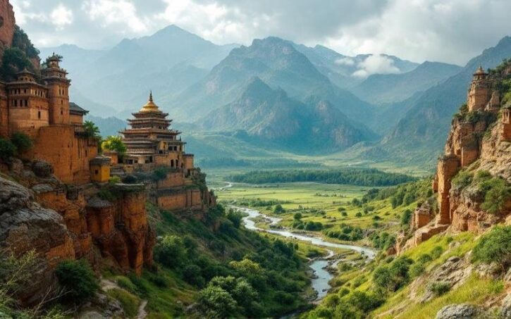
 Published on and written by Cyril Jarnias
Located at the crossroads of India, China, and the Indochinese Peninsula, Burma occupies a singular place on the map of Southeast Asia. The largest state on the Southeast Asian mainland, at nearly 676,600 km², the country forms a vast rhombus stretched from north to south, bordered by the Bay of Bengal and the Andaman Sea and surrounded by five terrestrial neighbors – Bangladesh, India, China, Laos, and Thailand. This strategic position, near major Indian Ocean shipping lanes and at the heart of the Greater Mekong region, partly explains why Burma’s geography is as much a political and economic issue as a simple natural backdrop.
Burma is not just about its pagodas and rice paddies. Its complex geography – with its horseshoe-shaped mountains, large rivers, arid central plains, waterlogged deltas, monsoon‑exposed coasts, and sparsely inhabited islands – directly structures its economy, shapes ways of life, dictates local climates, and influences both conflicts and biodiversity conservation.
A general framework: a “kite” of mountains and plains
Seen from above, Burma resembles a kite with a long tail trailing down the Malay Peninsula. The country extends between approximately 9° and 29° north latitude and 92° to 102° east longitude, over nearly 2,050 kilometers from north to south. The maximum width, at the latitude of Mandalay, is about 930 kilometers from east to west.
Nearly half of the territory is occupied by reliefs: mountain ranges, plateaus, hills, which form a kind of horseshoe surrounding central plains dominated by the Ayeyarwady (Irrawaddy) basin. This arrangement, born from the collision of the Indian and Eurasian plates, explains almost everything: the north‑south orientation of the mountains, the course of the great rivers, the contrasts in rainfall between drenched coasts and the central dry zone, and the distribution of populations.
We generally distinguish five major morphological regions.
The northern mountains: the extension of the Himalayas
In the north, Burma backs onto the Himalayan foothills. There rise complex massifs culminating with Mount Hkakabo Razi, at 5,881 meters altitude, the highest point in the country and all of Southeast Asia. This area, located in Kachin State, also marks the meeting point between the Indian plate, the Burmese microplate, and the Eurasian plate, making it a region of high seismicity.
This mountain range features snow‑capped peaks several months a year due to cold air masses from Central Asia. Its deep valleys shelter the sources of several major rivers, such as the tributaries of the Ayeyarwady and the Salween. A difficult‑to‑access territory, it serves both as a refuge for highland communities and as a biodiversity reservoir for temperate and alpine ecosystems.
The western ranges: a barrier facing the ocean
Along the entire western flank of the country stretches the long wall of the Rakhine (Arakan) Mountains, extended to the north by the Naga and Chin Hills, and to the south by the Rakhine Peninsula which continues underwater toward the Andaman and Nicobar Islands. These medium‑altitude reliefs – often around 1,800 to 3,000 meters – consist of old, heavily folded rocks.
On the maritime slope of the range, annual precipitation far exceeds 4,000 mm, creating a spectacular contrast with the interior dry zone.
The Shan Plateau and the eastern reliefs
To the east, the Shan Plateau forms a vast, gently sloping table, perched on average around 900 to 1,000 meters. It is an older structure than the western ranges, formed during the Mesozoic, later carved by deep valleys. This plateau extends to the Chinese, Laotian, and Thai borders and continues southward through the Dawna Range and the Tenasserim Hills.
These reliefs constitute the natural border with Thailand. They shelter the Kayah–Karen mountain forests, classified among the world’s highest‑priority ecoregions by the WWF. The cooler slopes host tea, coffee, corn, and temperate fruit cultivation, and are home to numerous ethnic minority communities.
The central basin: agricultural and demographic heart
Between these two mountainous ensembles opens the great central basin, drained by the Ayeyarwady and its main tributary, the Chindwin, as well as the Sittaung further east. The plains consist of alluvium, with vast deltas approaching the sea. But not all of the region is uniformly humid: a large part of the central area lies in the rain shadow of the Rakhine Mountains, making it a semi‑arid “dry zone.”
The Ayeyarwady basin, the historical, economic, and cultural heart of the country, is home to nearly 40 million people, concentrating the bulk of the population around major cities like Mandalay and Naypyidaw.
Coastal plains and archipelagos
Around the periphery, narrow coastal plains slip between the western and southern mountains and the sea: the Rakhine coast in the northwest, then further south the long Tenasserim strip descending to the Malaysian border. The coastline, rocky and often fringed with islands, stretches over more than 1,900 to 2,200 kilometers depending on the source, representing about a quarter of the country’s total perimeter.
Off the southern peninsula is scattered a string of islands: the Mergui (Myeik) Archipelago, over 800 islands, most uninhabited, surrounded by coral reefs. This is one of the last relatively preserved coastal areas in Asia, though increasingly coveted by industrial fishing and tourism projects.
Borders, maritime frontage, and geostrategic role
Burma’s location gives it a strategic importance disproportionate to its current economic weight. The country, sometimes described as a “land bridge” between the Indian Ocean and southern China, borders demographic and economic giants while controlling a long stretch of coastline on crucial shipping lanes.
Complex land borders
The land borders total more than 6,500 km. They are shared with:
This is the length in kilometers of the border between Burma and Thailand, the longest of its land borders.
These borders wind through often remote mountainous areas, inhabited by numerous minorities and crossed by routes of smuggling, cross‑border trade, and frequently, political tensions. Some sections are vague or disputed, particularly at the tripoints with China and India in the context of Sino‑Indian disputes.
A vast maritime zone and an exposed coastline
On the maritime side, Burma opens wide onto the Bay of Bengal and the Andaman Sea, with an exclusive economic zone of about 533,000 km². The continental shelf extends up to 200 nautical miles offshore, and the coastline, very indented, offers about ten major seaports, including Yangon and Sittwe, as well as a multitude of natural anchorages.
This maritime frontage has two faces. It is a tremendous opportunity for trade: the country is integrated into several regional economic corridors, and deep‑water ports are planned or under development. But it is also a major line of vulnerability to tropical cyclones and sea‑level rise, as the devastating passage of Cyclone Nargis over the Ayeyarwady delta reminded us.
Geostrategic analysis
A country of rivers: the Ayeyarwady, “backbone” of the territory
It is difficult to discuss the country’s geography without giving central place to its river networks. Burma is literally woven by rivers: more than 60,000 miles of waterways snake through mountains, plains, and deltas. They provide irrigation, transport, water supply, fisheries, energy, while structuring human habitats.
The Ayeyarwady, vital artery
The Ayeyarwady is the longest and most important river in the country. Over about 2,170 km, it crosses Burma from north to south, from the confluence of the N’mai and Mali rivers in Kachin State to a vast nine‑branched delta that empties into the Andaman Sea. Its basin, covering more than 60% of the national area, concentrates most of the population and economic activity.
The sediments deposited by the river advance the delta front by about 50 meters per year.
Hydrologically, the Ayeyarwady is a monsoon river: its flow varies greatly between the dry season and the rainy season. Nearly 95% of annual precipitation falls between May and October, fueling spectacular floods but also devastating inundations. At Mandalay or Pyay, the water level difference between low and high can reach ten meters.
The Ayeyarwady delta is one of the country’s rice bowls: nearly 60% of national rice production is said to come from these plains. The polders are crisscrossed with canals, dikes, and endless rice paddies. But it is also a zone highly vulnerable to cyclones, storm surges, and saltwater intrusion.
Major tributaries: Chindwin, Mu, Sittaung
Among the main tributaries of the Ayeyarwady, the Chindwin plays a special role. Born in the isolated Hukawng Valley, it travels about 1,200 km before joining the main river downstream of Mandalay. Its middle and lower valley, with rich alluvial soils, is an important agricultural area, but also a transport corridor for forest and mineral resources.
The Mu, though modest, has for centuries fed sophisticated irrigation systems in the Sagaing region. The Sittaung, shorter (about 420 km), is used for floating teak and other goods, despite navigation difficulties caused by its mouth bar and strong tidal bores.
The Salween, the Mekong, and coastal rivers
To the east, the Salween (Thanlwin) offers a striking contrast with the Ayeyarwady. Rising on the Tibetan Plateau, it follows a long, deeply entrenched course through mountains, often in deep gorges. On the Burmese portion, it forms part of the border with Thailand. It is one of the world’s last major rivers still largely free of dams, but several large‑scale hydroelectric projects threaten it, sparking intense debate.
The Mekong, for its part, only brushes Burma’s geography: it serves as the border with Laos for just over 200 km, in the “Golden Triangle” area. Nevertheless, it remains a major player in the region, for cross‑border trade as well as for its role in the hydrological dynamics of the Mekong basin.
In the south, finally, a series of shorter rivers – Ye, Dawei, Tanintharyi, Lenya – cascade down the slopes of the Tenasserim Hills into the Andaman Sea. They irrigate narrow coastal valleys, favorable to tropical crops and fishing.
The regime of all these waterways is intimately linked to the monsoon climate. Abundant summer rains swell flows, fill natural reservoirs – lakes, wetlands, aquifers – but also cause flooding, mudflows, and landslides on deforested slopes. Conversely, in the dry season, some rivers shrink, complicating access to water for irrigation or domestic use, especially in the central dry zone.
Climate scenarios for the country predict both a rise in temperatures, an intensification of extreme rainfall events in the wet season, and more frequent droughts. These trends are expected to alter hydrological regimes, worsening both flood risks and periods of water deficit, with direct repercussions on agriculture, hydropower, and aquatic ecosystems.
A monsoon climate with many faces
Globally classified as tropical or subtropical, Burma does not, however, offer a uniform climate. The north‑south orientation of the ranges, distance from the sea, and altitude create a mosaic of local conditions, ranging from the stifling heat of the dry plains to near‑alpine temperatures in the north.
Three seasons, one dynamic
The annual rhythm is structured around three main seasons:
– a “cool” and relatively dry season, under the influence of northeast winds, from late October to mid‑February;
– a hot, dry period, from mid‑February to mid‑May, when temperatures peak before the arrival of rain;
– the rainy season, from mid‑May to late October, dominated by the southwest monsoon bringing moisture‑laden air masses from the Indian Ocean.
From March to April, temperatures regularly exceed 40°C in central cities like Mandalay and Bagan, and humidity is stifling on the coasts. Starting in May, the monsoon arrives gradually, bringing sometimes daily showers, strong winds, and a risk of tropical storms on exposed coastlines.
From the drenched coast to the dry zone
The differences in rainfall from one region to another are impressive. On the Rakhine coast or in Tanintharyi Region, annual rains often exceed 5,000 mm, making these areas among the wettest in Southeast Asia. The mountains overlooking these coasts also receive torrential precipitation during the rainy season.
At the other extreme, the central dry zone – around Magway, Mandalay, or Chauk – receives only between 500 and 1,000 mm per year. The barrier of the Rakhine Mountains largely blocks the monsoon, which loses its vigor by the time it reaches these interior plains. Natural vegetation is sparser, soils more prone to erosion, and agriculture heavily dependent on irrigation systems.
This is the average amount of rain, in millimeters per year, received by intermediate regions like the Shan Plateau.
Thermal variations and altitude effects
Generally, the country experiences high annual temperatures: the national average is around 27 to 28 °C. But altitude and distance from the sea strongly modulate this picture.
On the coasts and in the delta, maxima hover around 32 °C, with limited daily temperature range but very high humidity. In the center, day‑night variations are more pronounced, especially in Mandalay, where differences exceed 10 °C between morning and afternoon.
In the mountains, above 2,500 to 3,000 meters, the climate becomes subtropical temperate, then decidedly cool, with a snow cover in winter on the highest peaks. Above 3,500 meters, alpine and then tundra conditions dominate, nearly arctic near Hkakabo Razi.
Administrative and geographic organization of the territory
On this physical foundation is superimposed a complex administrative geography. Burma is officially divided into regions, states, and one union territory. This structuring reflects both geographic realities – coastal plains, plateaus, high reliefs – and the ethnic mosaic of the country.
States, regions, and union territory
The regions, located mostly in the central lowlands and deltas, are predominantly populated by Bamar, the dominant ethnic group. The states, on the other hand, largely correspond to settlement areas of minorities (Kachin, Shan, Karen, Rakhine, Chin, etc.), often in mountainous or peripheral areas.
The Union Territory, centered on Naypyidaw, hosts the administrative capital of the country.
Here is a synthetic overview of the main entities, with some orders of magnitude.
Main administrative entities
| Entity | Status | Capital | Area (km²) | Population 2014 (approx.) |
|---|---|---|---|---|
| Ayeyarwady | Region | Pathein | 35,032 | 6,184,829 |
| Yangon | Region | Yangon | 10,277 | 7,360,703 |
| Mandalay | Region | Mandalay | 30,888 | 6,165,723 |
| Sagaing | Region | Sagaing | 93,702 | 5,325,347 |
| Bago | Region | Bago | 39,404 | 4,867,373 |
| Magway | Region | Magway | 44,821 | 3,917,055 |
| Tanintharyi | Region | Dawei | 43,345 | 1,408,401 |
| Kachin | State | Myitkyina | 89,042 | 1,689,441 |
| Shan | State | Taunggyi | 155,801 | 5,824,432 |
| Rakhine | State | Sittwe | 36,778 | 3,188,807 |
| Mon | State | Mawlamyine | 12,297 | 2,054,393 |
| Kayin | State | Hpa‑An | 30,383 | 1,574,079 |
| Chin | State | Hakha | 36,019 | 478,801 |
| Kayah | State | Loikaw | 11,732 | 286,627 |
| Naypyidaw | Territory | Naypyidaw | 7,057 | 1,160,242 |
The differences in area are striking: Shan, for example, covers nearly a quarter of the country by itself, while Yangon Region, much smaller in surface area, concentrates the largest urban agglomeration.
Urbanization polarized around major rivers and the coastline
While over 70% of the population still lives in rural areas, urbanization is progressing rapidly. Major cities line up along river and coastal axes.
Yangon, with over 5 million inhabitants, is the economic metropolis and main seaport. Mandalay, heir to former royal capitals, is the hub of the center and north toward China. Naypyidaw, a planned administrative capital, is strategically located halfway between Yangon and Mandalay.
Other regional capitals – Mawlamyine, Pathein, Sittwe, Myitkyina, Taunggyi – also embrace riverside or coastal sites, confirming the decisive importance of physical geography in the choice of urban settlements.
Soils, forests, agriculture: a productive geography under pressure
Now looking at land use, Burma appears as a country still largely covered by forests, but where agricultural clearing and natural resource exploitation are advancing rapidly.
Land distribution: forests, crops, fallow
Out of a total of nearly 67.7 million hectares, it is estimated that less than 20% is currently cultivated. Forests still cover around 44 to 49% of the territory, though this proportion was much higher in the mid‑20th century. The remainder consists of savannas, wastelands, wetlands, bare mountains, or artificial surfaces.
A recent breakdown of land cover categories provides a glimpse of this structure.
Approximate distribution of land categories
| Land category | Share of national area (order of magnitude) |
|---|---|
| Forests (all types) | ~44% |
| Arable land / net area sown | ~18% |
| Other woodlands | ~21% |
| Reserved forests | ~29% of classified land (possible overlap) |
| Fallow arable land | ~10% |
| Current fallow | <1% |
| Protected areas (PAs) | ~6 to 10% (target 10%) |
| Other land (urban, mountains…) | ~22% |
These figures vary by source and year, but they confirm a dual reality: a still remarkable forest base on a regional scale, but rapid deforestation; significant agricultural potential, especially through the development of fallow and marginal lands, but with the risk of encroaching on precious natural habitats.
Agriculture structured by major geographic zones
Agriculture remains the pillar of the economy, employing the majority of the labor force and still accounting for a significant share of GDP. It is based on agro‑ecological systems highly dependent on local relief, soil, and climate characteristics.
The territory is characterized by three major distinct agro‑ecological zones, each with specific conditions and potentials for agriculture and the environment.
A region characterized by an arid climate, requiring drought‑adapted agricultural practices and rigorous water resource management.
Fertile and often humid zones, benefiting from alluvial deposits and favorable to diversified agriculture, but sensitive to coastal phenomena.
Spaces with varied relief, presenting a diversity of microclimates and often associated with terrace farming or livestock raising.
– In the central dry zone (Magway, Mandalay, part of Sagaing), crops must contend with chronic water deficit. One finds many legumes (chickpeas, beans, lentils), oilseeds (sesame, peanuts, sunflower), and irrigated food crops, with rice more a subsistence crop than an export one.
– In the deltas and coastal plains (Ayeyarwady, Bago, Yangon, Mon, Tanintharyi), water control is key. Flooded rice paddies dominate the landscape, sometimes with double annual cropping in the delta. Along the southern coast, rubber and oil palm plantations are expanding, along with tropical horticulture.
– In the hill and mountain areas (Shan, Chin, Kachin, Kayah, Kayin), the mosaic is even more varied: terraced rice paddies, coffee bushes, tea plants, corn, temperate fruits, tuber and vegetable crops, often associated with shifting slash‑and‑burn cultivation systems.
This is the percentage of farmers who grow rice, occupying more than half of the cultivated area.
Agricultural seasons, irrigation, and fallow
The agricultural cycle closely follows the climate calendar, with three main growing seasons: the rainy season (rice and corn plantings), the cool, dry season (legumes, vegetables), and the hot season (some off‑season crops, often irrigated).
Despite significant water potential, only a small fraction of cultivated land is actually irrigated by artificial systems – around 16% of cultivated area, the rest relying directly on rainfall. This vulnerability to precipitation variability weighs on yields and food security.
Paradoxically, analyses of satellite imagery show a large proportion of arable land left fallow for a good part of the year, especially in the dry and hot seasons. Judiciously exploiting these fallows – for example with short‑duration legume crops – would represent considerable income potential, while enriching soils with nitrogen.
Natural resources, biodiversity, and environmental pressures
Burmese geography is not only spectacular; it is also exceptionally rich in natural resources. Forests, minerals, hydrocarbons, fresh water, marine resources: everything combines to make Burma a “rich country of poor people,” where natural abundance contrasts with low average income.
A biodiversity hotspot
Almost the entire territory lies within the Indo‑Burma biodiversity hotspot, one of the most threatened in the world. It hosts more than 16,000 plant species, over 300 mammal species, more than 1,100 bird species, nearly 300 reptile species, and over 100 amphibian species. Sixty‑four types of terrestrial ecosystems have been identified, from lowland tropical forests to alpine grasslands, via mangroves and freshwater marshes.
This richness is linked to the diversity of reliefs and climates: Himalayan mountains in the north, Shan Plateau, alluvial plains, dry zones, coasts, archipelagos. Large expanses of natural forests, sometimes still intact, remain in regions like Kachin, northern Sagaing, or parts of Tanintharyi.
Nearly half of the ecosystems and over 230 species are threatened, mainly due to deforestation, conversion of natural habitats, hunting, poaching, water pollution, and climate change.
Forests and mangroves in decline
Historically, forests covered about three‑quarters of the country. Recent estimates suggest only 44 to 49% remain, with one of the highest deforestation rates in the world over recent decades: some studies mention annual losses on the order of 1.2 to 2% of forest area. Between 1990 and 2015, this would represent about 10 million hectares lost.
Deforestation fronts are located both in lowland areas – conversion to agricultural land, especially for rice or oil palm plantations, rubber, sugarcane – and in seemingly remote regions, where mining, road or dam construction, and logging open up the forest.
Mangroves, essential for coastal protection, marine biodiversity, and carbon storage, are disappearing at an accelerated rate. Burma, which possesses the second‑largest area in the region, suffers destruction rates sometimes exceeding 3% per year, mainly in Rakhine State and the Ayeyarwady delta due to conversion to rice paddies and shrimp farming ponds.
Mining and energy pressures
Burma’s reliefs contain significant mineral resources: jade, rubies, sapphires, gold, copper, lead, zinc, tin, tungsten, antimony, rare earths… The main mining districts are located in Kachin and Shan States, and in Sagaing, Mandalay, Bago, and Tanintharyi regions. Large concessions are also dedicated to oil and gas, especially offshore (Gulf of Martaban, off Rakhine State).
This geographic distribution, often in mountainous areas inhabited by minorities, makes natural resources a central geopolitical issue, sometimes fueling local conflicts. In some border regions, mining activities – formal and informal – are linked to cross‑border networks, particularly with neighboring China.
Mining activities, especially gold panning and rare earth extraction, cause considerable environmental damage. They lead to clearing, soil erosion, habitat fragmentation, and increased river turbidity. Additionally, they generate heavy metal pollution (mercury, arsenic, cyanide). In rare earth areas, extraction by chemical leaching has caused severe contamination of surface and groundwater.
Conservation challenges in a climate‑vulnerable country
Burma regularly ranks among the countries hardest hit by extreme weather events. Cyclone Nargis dramatically highlighted the vulnerability of low‑lying deltaic lands to storms and storm surges, especially when protective mangroves have been largely destroyed.
In the central dry zone, rising temperatures and increasingly erratic rainfall heighten risks of drought and forest fires. In the northern mountains, the retreat of Himalayan glaciers and changing snow regimes threaten the seasonal regulation of meltwater.
Authorities have stated ambitions in conservation – expanding protected areas to 10% of the territory, strengthening the permanent forest estate, developing national climate policies – but implementation remains hampered by lack of resources, institutional complexity, and political fragility. Many parks are still “paper parks,” poorly staffed and funded.
A geography that shapes society and economy
Beyond the landscapes, the geography of the country in Burma profoundly conditions daily life, social structures, and development trajectories.
In the delta, inhabitants live to the rhythm of floods, dike works, rice planting and harvesting. In the dry zone, communities must optimize the use of every drop of water, rely on resilient crops, and fight erosion. On the plateaus and in the mountains, isolation, difficult topography, and ethnic diversity have fostered the emergence of societies with strong local identities, often far from power centers.
Major transport infrastructure (roads, railways, ports, bridges) aims to open up regions. They mainly follow the natural corridors offered by geography, such as river valleys, mountain passes, and deltaic plains. However, the state of the networks remains very unequal, leaving vast rural areas isolated for part of the year. This situation limits access to markets as well as to essential services like health and education.
Contrasting densities and demographic dynamics
Population densities likewise reflect these geographic constraints. The most densely populated areas are in the Ayeyarwady delta, around Yangon, and in the central valley. Conversely, the western mountains (Chin, Naga Hills), northern Kachin, or parts of the Shan Plateau have very low densities.
This is the average population density in inhabitants per square kilometer at the national level, though this average masks strong regional disparities.
Internal migration flows, largely oriented from rural areas to cities and toward dynamic border zones (for example, toward Thailand), are gradually reshaping this demographic map. Urbanization, advancing, poses new challenges in terms of planning, pollution, and land consumption.
A changing geography
The geography of the country in Burma should not be seen as a static backdrop. Under the combined effect of population growth, economic development, political choices, technical innovations, and climate change, landscapes are evolving rapidly.
Forests are retreating or transforming, deltas are changing shape under the effects of sediment supply and dams, urban expansion and sea‑level rise are reshaping coasts. In parallel, initiatives such as mangrove replanting in a delta or integrated watershed management are emerging, often supported by international organizations and local civil society, to conserve and restore ecosystems.
Understanding this shifting geography is essential for grasping the contemporary issues of the country: food security in the dry zone, protection of coastal populations from cyclones, management of transboundary rivers, sharing of mineral wealth in mountainous states, sustainable planning of plains and cities.
Burma, sometimes nicknamed the “Golden Land,” owes a good part of this reputation as much to the color of its pagodas as to that of its soils, forests, and rivers. It is at the intersection of these elements – reliefs, climates, waters, soils, peoples – that its future is being played out today.
Disclaimer: The information provided on this website is for informational purposes only and does not constitute financial, legal, or professional advice. We encourage you to consult qualified experts before making any investment, real estate, or expatriation decisions. Although we strive to maintain up-to-date and accurate information, we do not guarantee the completeness, accuracy, or timeliness of the proposed content. As investment and expatriation involve risks, we disclaim any liability for potential losses or damages arising from the use of this site. Your use of this site confirms your acceptance of these terms and your understanding of the associated risks.

Cyril Jarnias is an independent expert in international wealth management with over 20 years of experience. As an expatriate himself, he is dedicated to helping individuals and business leaders build, protect, and pass on their wealth with complete peace of mind.
On his website, cyriljarnias.com, he shares his expertise on international real estate, offshore company formation, and expatriation.
Thanks to his expertise, he offers sound advice to optimize his clients' wealth management. Cyril Jarnias is also recognized for his appearances in many prestigious media outlets such as BFM Business, les Français de l’étranger, Le Figaro, Les Echos, and Mieux vivre votre argent, where he shares his knowledge and know-how in wealth management.





